Royal Leamington Spa

Settlement in Warwickshire Warwick

England

Royal Leamington Spa

Anthony Eden Gent's Hairdresser A gent's hairdressers on Clarendon Street with a very famous name, that of a former British Prime Minister, Anthony Eden who was the town's MP from the 1920s until his resignation in 1957.  No, this isn't what he turned his hand to after his political career ended, but I understand the proprietor of this business was named after him.
Anthony Eden Gent's Hairdresser Credit: Philip Halling

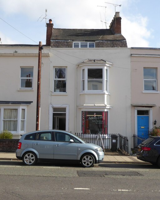
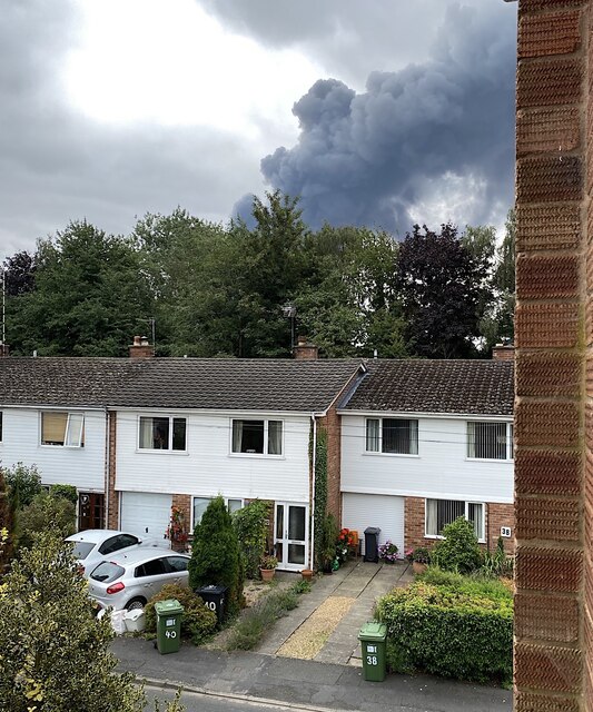
Royal Leamington Spa, located in Warwickshire, England, is a vibrant and historic town known for its elegant Regency architecture and natural mineral springs. With a population of around 50,000, it is situated on the banks of the River Leam, hence its name. The town has a rich cultural heritage and is often referred to as Leamington or simply "The Spa."

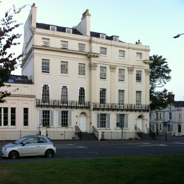
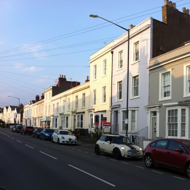
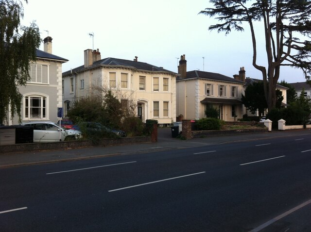
Leamington Spa gained popularity in the 19th century when its healing waters were discovered to have medicinal properties. As a result, it became a fashionable destination for the aristocracy and upper classes seeking relaxation and wellness. Today, the town's beautiful Georgian and Victorian buildings still reflect this affluent past.

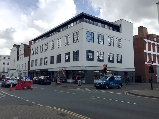
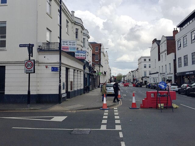
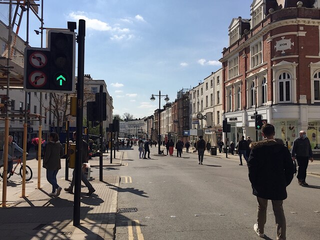
In addition to its architectural charm, Leamington Spa offers a range of cultural and recreational activities. The town center, known as the Parade, is lined with boutique shops, cafes, and restaurants, making it a popular destination for shoppers and food enthusiasts. Jephson Gardens, a stunning 19th-century park, provides a tranquil escape with its picturesque landscapes and floral displays.

Leamington Spa also boasts a thriving arts scene, with various art galleries and theaters hosting regular exhibitions and performances. The Royal Pump Rooms, a Grade II listed building, houses the town's museum and art gallery, showcasing local history and contemporary art.

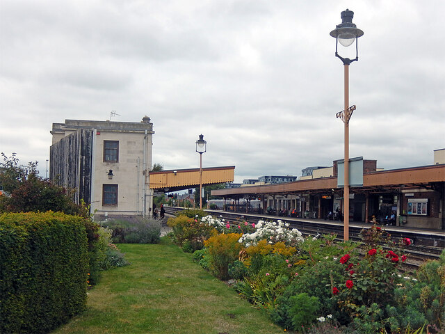
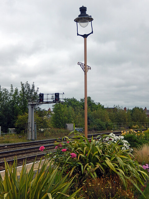
With its convenient location, Leamington Spa offers excellent transport links. The town's train station provides quick access to major cities like Birmingham, London, and Oxford. Moreover, its proximity to Warwick Castle, Stratford-upon-Avon, and the Cotswolds make it an ideal base for exploring the surrounding areas.

Overall, Royal Leamington Spa is a charming and picturesque town that seamlessly blends history, culture, and natural beauty, making it a popular destination for visitors and residents alike.

If you have any feedback on the listing, please let us know in the comments section below.

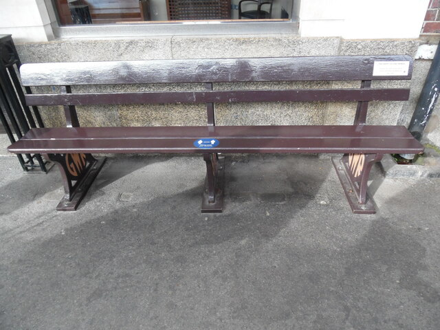
Royal Leamington Spa Images

Images are sourced within 2km of 52.28996/-1.521275 or Grid Reference SP3265. Thanks to Geograph Open Source API. All images are credited.

Anthony Eden Gent's Hairdresser A gent's hairdressers on Clarendon Street with a very famous name, that of a former British Prime Minister, Anthony Eden who was the town's MP from the 1920s until his resignation in 1957.  No, this isn't what he turned his hand to after his political career ended, but I understand the proprietor of this business was named after him.
Anthony Eden Gent's Hairdresser
A gent's hairdressers on Clarendon Street with a very famous name, that of a former British Prime Minister, Anthony Eden who was the town's MP from the 1920s until his resignation in 1957. No, this isn't what he turned his hand to after his political career ended, but I understand the proprietor of this business was named after him.
Former Co-op Home store occupied, Leamington Now three floors of flats above Esquires Coffee and Dodo Pizza. It's hard to believe that the town needs any more coffee shops and pizza outlets. Compare <a href="https://www.geograph.org.uk/photo/5263504">SP3166 : Former Co-op Home store, Warwick Street, Royal Leamington Spa</a>.
Former Co-op Home store occupied, Leamington
Now three floors of flats above Esquires Coffee and Dodo Pizza. It's hard to believe that the town needs any more coffee shops and pizza outlets. Compare SP3166 : Former Co-op Home store, Warwick Street, Royal Leamington Spa.
Station bench - Leamington Spa It may say 'Stratford on Avon' but this bench is to be found on platform 2 at Leamington just east of the main building. The little brass plaque explains what it is doing here: 'After nationalisation in 1948 British Rail owned all rail assets and moved items between stations. This bench has been at Leamington station for many years'. Presumably, then, at some point Stratford had a surplus of benches and Leamington a shortage. Note the differences in the two supports: one showing GWR and the other BR(W), indicating that the one on the left was replaced probably in the 1950s. It is certainly a curiosity but looks as though it could do with some renovation.
Station bench - Leamington Spa
It may say 'Stratford on Avon' but this bench is to be found on platform 2 at Leamington just east of the main building. The little brass plaque explains what it is doing here: 'After nationalisation in 1948 British Rail owned all rail assets and moved items between stations. This bench has been at Leamington station for many years'. Presumably, then, at some point Stratford had a surplus of benches and Leamington a shortage. Note the differences in the two supports: one showing GWR and the other BR(W), indicating that the one on the left was replaced probably in the 1950s. It is certainly a curiosity but looks as though it could do with some renovation.
Floral train - Leamington Station Floral trains are a tradition at Leamington and this one can be seen to the east of the main building on platform 2. The board states that it was 'crafted by Moreton Morrell College apprentices'.
Floral train - Leamington Station
Floral trains are a tradition at Leamington and this one can be seen to the east of the main building on platform 2. The board states that it was 'crafted by Moreton Morrell College apprentices'.
Smoke from a fire in south Leamington When I first noticed it mid-morning from street level I thought for a moment from the size of it that it was an unusual cloud formation. Photos appeared among NextDoor messages; the Warwick Courier website had a brief report; the BBC Coventry & Warwickshire news page reported that the fire service was dealing with a blaze and explosions at Leeson Polymers. <span class="nowrap"><a title="https://www.google.co.uk/maps/@52.2741694,-1.5379557,3a,68.9y,58.25h,85.2t/data=!3m6!1e1!3m4!1sHC-BbKQL4f496vdzgfuUYQ!2e0!7i13312!8i6656?hl=en" rel="nofollow ugc noopener" href="https://www.google.co.uk/maps/@52.2741694,-1.5379557,3a,68.9y,58.25h,85.2t/data=!3m6!1e1!3m4!1sHC-BbKQL4f496vdzgfuUYQ!2e0!7i13312!8i6656?hl=en">Link</a><img style="margin-left:2px;" alt="External link" title="External link - shift click to open in new window" src="https://s1.geograph.org.uk/img/external.png" width="10" height="10"/></span> The address given, Juno Drive, was perhaps where the fire service was working from. The company's website ("temporarily closed") gives its address as Hermes Close, a winding drive serving a number of medium-sized units on an industrial estate off Tachbrook Park Drive.
Smoke from a fire in south Leamington
When I first noticed it mid-morning from street level I thought for a moment from the size of it that it was an unusual cloud formation. Photos appeared among NextDoor messages; the Warwick Courier website had a brief report; the BBC Coventry & Warwickshire news page reported that the fire service was dealing with a blaze and explosions at Leeson Polymers. LinkExternal link The address given, Juno Drive, was perhaps where the fire service was working from. The company's website ("temporarily closed") gives its address as Hermes Close, a winding drive serving a number of medium-sized units on an industrial estate off Tachbrook Park Drive.
Leamington Spa Station Although this station dates from 1852, it was rebuilt by the Great Western Railway in the 1930s in a fashionable art deco style. It remains a busy place but an unusual - and very pleasing - feature is the large garden on platform 2. Work on this began in 2005 by the Friends of Leamington station and it now comprises a 164ft lawn, a herbaceous border and a yew topiary 'steam train' hedge.
Leamington Spa Station
Although this station dates from 1852, it was rebuilt by the Great Western Railway in the 1930s in a fashionable art deco style. It remains a busy place but an unusual - and very pleasing - feature is the large garden on platform 2. Work on this began in 2005 by the Friends of Leamington station and it now comprises a 164ft lawn, a herbaceous border and a yew topiary 'steam train' hedge.
Leamington Spa Station This is the eastern end of platform 2, looking towards Banbury and London. In the foreground is the station garden, one of the largest in the country.
Leamington Spa Station
This is the eastern end of platform 2, looking towards Banbury and London. In the foreground is the station garden, one of the largest in the country.
Inside the Boiler Room, Leamington Spa The Boiler Room describes itself as an 'independent ale, craft beer, wine and artisan gin bar...within a chic industrial themed interior'. A feature of the design is this stack of beer barrels.
Inside the Boiler Room, Leamington Spa
The Boiler Room describes itself as an 'independent ale, craft beer, wine and artisan gin bar...within a chic industrial themed interior'. A feature of the design is this stack of beer barrels.
2-4 Kenilworth Road, Leamington Spa This pair of Regency town houses was built c1822-34 and faces on Christchurch Gardens. Like many Leamington town houses they are built from brick faced with painted stucco and have cast iron railings and balconies. They were later enlarged to the left and to the rear and served as a hotel for many years, first as the Guys Hotel and more recently as a Berni Inn, painted strawberry-ice-cream pink. They have since been converted back to housing. Two-storey houses on Clarendon Avenue can be seen to the right. <span class="nowrap"><a title="https://historicengland.org.uk/images-books/photos/item/IOE01/14257/04" rel="nofollow ugc noopener" href="https://historicengland.org.uk/images-books/photos/item/IOE01/14257/04">Link</a><img style="margin-left:2px;" alt="External link" title="External link - shift click to open in new window" src="https://s1.geograph.org.uk/img/external.png" width="10" height="10"/></span>
2-4 Kenilworth Road, Leamington Spa
This pair of Regency town houses was built c1822-34 and faces on Christchurch Gardens. Like many Leamington town houses they are built from brick faced with painted stucco and have cast iron railings and balconies. They were later enlarged to the left and to the rear and served as a hotel for many years, first as the Guys Hotel and more recently as a Berni Inn, painted strawberry-ice-cream pink. They have since been converted back to housing. Two-storey houses on Clarendon Avenue can be seen to the right. LinkExternal link
Space Invader mosaic, Arlington Avenue, Leamington Spa This small mosaic, of 70 tiles, depicts an alien of the pixelated Space Invader type, familiar from the Japanese video game of that name from 1978. It is set into the white painted stucco of a wall outside a large Regency town house. One tile, near the top right, is translucent, suggesting a moon in the night sky. On Space Invaders, see Matt Alt, Pure Invention: How Japan's Pop Culture conquered the World, Constable, 2020.
Space Invader mosaic, Arlington Avenue, Leamington Spa
This small mosaic, of 70 tiles, depicts an alien of the pixelated Space Invader type, familiar from the Japanese video game of that name from 1978. It is set into the white painted stucco of a wall outside a large Regency town house. One tile, near the top right, is translucent, suggesting a moon in the night sky. On Space Invaders, see Matt Alt, Pure Invention: How Japan's Pop Culture conquered the World, Constable, 2020.
Town Houses, Clarendon Street, Leamington Spa A row of early-mid 19th century town houses in the Regency style, some two storey, some three, of brick faced with painted stucco and with sliding sash windows, all in a restrained classical style.
Town Houses, Clarendon Street, Leamington Spa
A row of early-mid 19th century town houses in the Regency style, some two storey, some three, of brick faced with painted stucco and with sliding sash windows, all in a restrained classical style.
Maisonettes on Lansdowne Street, Leamington Spa These maisonettes are part of the 1960s Kennedy Square development.
Maisonettes on Lansdowne Street, Leamington Spa
These maisonettes are part of the 1960s Kennedy Square development.
Victorian villas, Kenilworth Road, Leamington Spa Unusually for English houses, some of these have shutters which are not merely decorative but actually work; see the house on the left, which had all three upstairs windows facing the road shuttered (only the right hand one is visible).
Victorian villas, Kenilworth Road, Leamington Spa
Unusually for English houses, some of these have shutters which are not merely decorative but actually work; see the house on the left, which had all three upstairs windows facing the road shuttered (only the right hand one is visible).
Partial closure of Warwick Street, west side, Royal Leamington Spa During the pandemic the Parade (distant crossing) was made traffic-free to allow social distancing. The approaches of the Regent Street and Warwick Street crossings were closed, though some vehicle access was allowed for businesses. On the left the departed Yorkshire Bank suffers the indignity of being to let as a shop.
Partial closure of Warwick Street, west side, Royal Leamington Spa
During the pandemic the Parade (distant crossing) was made traffic-free to allow social distancing. The approaches of the Regent Street and Warwick Street crossings were closed, though some vehicle access was allowed for businesses. On the left the departed Yorkshire Bank suffers the indignity of being to let as a shop.
Leamington's Parade in Lockdown Leamington's busy Parade was closed to traffic to allow social distancing on footways. The stretches near the eight or so bus stops could be especially congested. Although re-opened to traffic in late summer 2021, a petition was launched to keep the Parade traffic-free.
Leamington's Parade in Lockdown
Leamington's busy Parade was closed to traffic to allow social distancing on footways. The stretches near the eight or so bus stops could be especially congested. Although re-opened to traffic in late summer 2021, a petition was launched to keep the Parade traffic-free.
Banks of the River Leam between two bridges, Royal Leamington Spa Vegetation has been removed though it's not clear why or by whom. Environment Agency has been known to remove trees overhanging a river; the land is probably Warwick District Council's. Network Rail, too, has been removing or cutting back trees on the embankment parallel to Princes Drive.
Banks of the River Leam between two bridges, Royal Leamington Spa
Vegetation has been removed though it's not clear why or by whom. Environment Agency has been known to remove trees overhanging a river; the land is probably Warwick District Council's. Network Rail, too, has been removing or cutting back trees on the embankment parallel to Princes Drive.
The Happy To Chat Bench at Leamington Spa Station This bench is on platform 3 and its inscription notice refers to it being The Happy To Chat Bench, <a title="https://www.geograph.org.uk/photo/6973345" href="https://www.geograph.org.uk/photo/6973345">Link</a> refers.
The Happy To Chat Bench at Leamington Spa Station
This bench is on platform 3 and its inscription notice refers to it being The Happy To Chat Bench, Link refers.
Inscription Notice on Bench at Leamington Spa Station This inscription notice on a bench at station platform 3 has the following wording:

           THE HAPPY TO CHAT BENCH

         Please sit here if you don't
          mind someone stopping to
                 say hello
Inscription Notice on Bench at Leamington Spa Station
This inscription notice on a bench at station platform 3 has the following wording: THE HAPPY TO CHAT BENCH Please sit here if you don't mind someone stopping to say hello
Show me another place!

Royal Leamington Spa is located at Grid Ref: SP3265 (Lat: 52.28996, Lng: -1.521275)

Administrative County: Warwickshire

District: Warwick

Police Authority: Warwickshire

What 3 Words

///nail.digits.minute. Near Royal Leamington Spa, Warwickshire

Nearby Locations

Royal Leamington Spa

Related Wikis

Newbold Comyn

Newbold Comyn is a park on the Eastern edge of Leamington Spa, Warwickshire, England. == History == The first mention of Newbold Comyn in history was in...

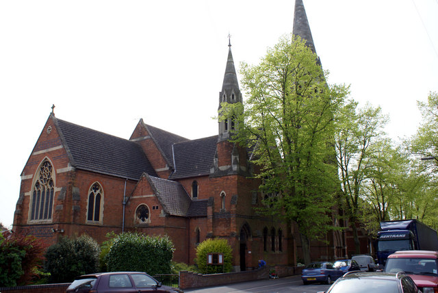
St Paul's Church, Leamington Spa

St. Paul's Church, Leamington Spa is a Grade II listed parish church in Leamington Spa, England. == History == St. Paul's Church was built between 1873...

Woodbine Street Recording Studios

Woodbine Street Recording Studios is a recording studio located in the town of Leamington Spa, England. There are two recording rooms, the first being...

St Mary's Church, Leamington Spa

St. Mary's Church, Leamington Spa is a Grade II listed parish church in Leamington Spa, England. == History == St. Mary's Church was built between 1838...

Nearby Amenities

Located within 500m of 52.28996,-1.521275
Crossing
Crossing: marked
Crossing Markings: zebra;dots
Crossing Ref: zebra
Flashing Lights: always
Kerb: lowered
Tactile Paving: yes
Traffic Calming: hump
Lat/Long: 52.286906/-1.5246988
Traffic Signals
Crossing Markings: no
Road Marking: GB:1001
Source: Warwicks CC Aerial Imagery 2013
Traffic Signals: signal
Traffic Signals Direction: forward
Lat/Long: 52.2899247/-1.5273469
Direction: both
Traffic Calming: hump
Lat/Long: 52.2938108/-1.5239045
Direction: both
Traffic Calming: hump
Lat/Long: 52.2932416/-1.5230995
Newbold Comyn Leisure Centre
Bench: no
Bin: no
Bus: yes
Covered: no
Naptan AtcoCode: 4200F035500
Naptan Bearing: E
Naptan CommonName: Newbold Comyn Leisure Centre
Naptan Indicator: Adj
Naptan NaptanCode: warapmpm
Naptan PlusbusZoneRef: LMNGTNS
Naptan Street: Newbold Terrace East
Passenger Information Display: no
Physically Present: no
Shelter: no
Source: naptan_import
Tactile Paving: no
Lat/Long: 52.2902185/-1.5182857
Bus Stop
Liberal Club
Bench: no
Bin: no
Bus: yes
Covered: no
Lit: yes
Naptan AtcoCode: 4200F036500
Naptan Bearing: E
Naptan CommonName: Liberal Club
Naptan Indicator: Adj
Naptan Landmark: Liberal Club
Naptan NaptanCode: wardamja
Naptan PlusbusZoneRef: LMNGTNS
Naptan Street: Upper Holly Walk
Passenger Information Display: no
Physically Present: yes
Public Transport: platform
Shelter: no
Source: naptan_import
Tactile Paving: no
Lat/Long: 52.2917199/-1.5269377
Bus Stop
Holly Street
Bench: no
Bin: no
Bus: yes
Covered: no
Lit: yes
Naptan AtcoCode: 4200F087300
Naptan Bearing: N
Naptan CommonName: Holly Street
Naptan Crossing: Holly Street
Naptan Indicator: Nr
Naptan NaptanCode: warapjtd
Naptan PlusbusZoneRef: LMNGTNS
Naptan Street: Campion Terrace
Passenger Information Display: no
Physically Present: yes
Public Transport: platform
Shelter: no
Source: naptan_import
Tactile Paving: no
Lat/Long: 52.292758/-1.5255837
Bus Stop
Holly Street
Bench: no
Bin: no
Bus: yes
Covered: no
Lit: yes
Naptan AtcoCode: 4200F087301
Naptan Bearing: S
Naptan BusStopType: CUS
Naptan CommonName: Holly Street
Naptan Crossing: Holly Street
Naptan Indicator: Nr
Naptan NaptanCode: warapjtg
Naptan PlusbusZoneRef: LMNGTNS
Naptan Street: Campion Terrace
Passenger Information Display: no
Physically Present: yes
Public Transport: platform
Shelter: no
Source: naptan_import
Tactile Paving: no
Lat/Long: 52.2924907/-1.5254496
Bus Stop
Newbold Terrace
Bench: no
Bin: no
Bus: yes
Covered: no
Lit: yes
Naptan AtcoCode: 4200F126851
Naptan Bearing: NW
Naptan CommonName: Newbold Terrace
Naptan Indicator: Adj
Naptan NaptanCode: waratajd
Naptan PlusbusZoneRef: LMNGTNS
Naptan Street: Willes Road
Passenger Information Display: no
Physically Present: yes
Public Transport: platform
Route Ref: 63
Shelter: no
Source: naptan_import
Tactile Paving: no
Lat/Long: 52.2895788/-1.5272108
Bus Stop
Purcell Close
Bench: no
Bin: no
Bus: yes
Covered: no
Lit: yes
Naptan AtcoCode: 4200F150202
Naptan Bearing: E
Naptan CommonName: Purcell Close
Naptan Crossing: Purcell Close
Naptan Indicator: Adj
Naptan NaptanCode: waraptpd
Naptan PlusbusZoneRef: LMNGTNS
Naptan Street: Newbold Terrace East
Naptan Verified: no
Passenger Information Display: no
Physically Present: yes
Public Transport: platform
Shelter: no
Source: naptan_import
Tactile Paving: no
Lat/Long: 52.2904347/-1.5255991
Noexit: yes
Lat/Long: 52.2858144/-1.5194791
Noexit: yes
Lat/Long: 52.2864177/-1.5180508
Pub
The Holly Bush
Check Date Opening Hours: 2022-09-19
Opening Hours Signed: no
Operator: Punch Taverns
Wheelchair: no
Lat/Long: 52.292683/-1.526095
Pub
Somerville Arms
Addr City: Leamington Spa
Addr Housenumber: 4
Addr Postcode: CV32 4SX
Addr Street: Campion Terrace
Check Date Opening Hours: 2022-08-26
Fhrs Id: 241750
Opening Hours Signed: no
Wheelchair: yes
Lat/Long: 52.2935464/-1.5256843
Mini Roundabout
Direction: clockwise
Lat/Long: 52.2919196/-1.5253723
Hazard: children
Lat/Long: 52.2916847/-1.5223798
Noexit: yes
Lat/Long: 52.2931082/-1.5235093
Noexit: yes
Lat/Long: 52.2933045/-1.5244666
Noexit: yes
Lat/Long: 52.2933881/-1.5244606
Hazard: children
Lat/Long: 52.2930885/-1.5231105
Noexit: yes
Lat/Long: 52.2910896/-1.5243256
Direction: both
Traffic Calming: bump
Lat/Long: 52.2927917/-1.5215802
Direction: both
Traffic Calming: bump
Lat/Long: 52.2926732/-1.5209563
Traffic Calming: bump
Lat/Long: 52.2902992/-1.5189312
Barrier: height_restrictor
Source: survey
Lat/Long: 52.2903023/-1.5162806
Bicycle Parking
Bicycle Parking: stands
Capacity: 8
Covered: no
Fee: no
Lit: no
Operator: Warwick District Council
Source: survey
Surface: asphalt
Lat/Long: 52.2894929/-1.5144224
Access: yes
Leisure: playground
Source: survey
Lat/Long: 52.2890279/-1.5141043
Man Made: surveillance
Source: survey
Lat/Long: 52.2904025/-1.5173494
Give Way
Direction: backward
Road Marking: GB:1003A
Lat/Long: 52.286872/-1.5233687
Give Way
Direction: backward
Road Marking: GB:1003A
Lat/Long: 52.2866507/-1.5218179
Give Way
Direction: backward
Road Marking: GB:1003A
Lat/Long: 52.2876139/-1.5255527
Crossing
Crossing: unmarked
Crossing Island: no
Crossing Markings: no
Kerb: lowered
Tactile Paving: no
Lat/Long: 52.2876054/-1.5255802
Crossing
Crossing: unmarked
Crossing Island: no
Crossing Markings: no
Kerb: lowered
Tactile Paving: no
Lat/Long: 52.2862334/-1.5188236
Give Way
Direction: forward
Road Marking: GB:1003A
Lat/Long: 52.2862357/-1.5188027
Give Way
Direction: forward
Road Marking: GB:1003A
Lat/Long: 52.286822/-1.5190268
Direction: both
Traffic Calming: hump
Lat/Long: 52.2921815/-1.5231964
Traffic Signals
Crossing Markings: no
Road Marking: GB:1001
Source: Warwicks CC Aerial Imagery 2013
Traffic Signals: signal
Traffic Signals Direction: backward
Lat/Long: 52.2900322/-1.5278225
Direction: both
Traffic Calming: hump
Lat/Long: 52.2920984/-1.5242745
Give Way
Direction: backward
Lat/Long: 52.2918931/-1.5255006
Direction: both
Traffic Calming: hump
Lat/Long: 52.2915104/-1.5280476
Direction: both
Traffic Calming: hump
Lat/Long: 52.2916885/-1.5268652
Noexit: yes
Lat/Long: 52.2914551/-1.5229967
Noexit: yes
Lat/Long: 52.2914264/-1.5232
Direction: both
Traffic Calming: hump
Lat/Long: 52.2928335/-1.5237486
Direction: both
Traffic Calming: hump
Lat/Long: 52.2927087/-1.5226063
Direction: both
Traffic Calming: hump
Lat/Long: 52.2926677/-1.5252285
Direction: both
Traffic Calming: hump
Lat/Long: 52.2929985/-1.5254947
Direction: both
Traffic Calming: hump
Lat/Long: 52.2924387/-1.5255176
Direction: both
Traffic Calming: hump
Lat/Long: 52.2935712/-1.5254712
Give Way
Direction: forward
Road Marking: GB:1003A
Lat/Long: 52.2928771/-1.5231907
Direction: both
Traffic Calming: bump
Lat/Long: 52.2927456/-1.5212662
Traffic Signals
Crossing Markings: no
Road Marking: GB:1001
Source: Warwicks CC Aerial Imagery 2013
Traffic Signals: signal
Traffic Signals Direction: backward
Lat/Long: 52.2903098/-1.5276744
Crossing
Crossing: unmarked
Crossing Markings: no
Tactile Paving: no
Lat/Long: 52.2924811/-1.5238026
Traffic Calming: bump
Lat/Long: 52.2901277/-1.5156323
Traffic Calming: bump
Lat/Long: 52.2903094/-1.517596
Give Way
Direction: forward
Lat/Long: 52.2907165/-1.517311
Barrier: bollard
Bollard: fixed
Lat/Long: 52.2908336/-1.5172548
Crossing
Crossing: unmarked
Crossing Markings: no
Kerb: lowered
Tactile Paving: no
Lat/Long: 52.285965/-1.5232382
Give Way
Direction: backward
Road Marking: GB:1003A
Lat/Long: 52.2856689/-1.5219585
Barrier: bollard
Bollard: fixed
Material: metal
Lat/Long: 52.2859307/-1.5228731
Direction: forward
Traffic Sign: GB:610
Traffic Sign Direction: forward
Traffic Sign Forward: GB:610
Lat/Long: 52.2859042/-1.5228897
Direction: forward
Traffic Sign: GB:610
Traffic Sign Direction: forward
Traffic Sign Forward: GB:610
Lat/Long: 52.2861473/-1.5234862
Barrier: bollard
Lat/Long: 52.2859814/-1.5232766
Give Way
Direction: forward
Road Marking: GB:1003A
Lat/Long: 52.2860117/-1.5233401
Direction: forward
Traffic Sign: GB:610
Traffic Sign Direction: forward
Traffic Sign Forward: GB:610
Lat/Long: 52.2859983/-1.5233269
Barrier: bollard
Bollard: fixed
Material: metal
Lat/Long: 52.2860571/-1.5233208
Newbold Comyn Swimming Pool
Covered: yes
Leisure: swimming_pool
Sport: swimming
Lat/Long: 52.2898611/-1.5185978
Post Box
Brand: Royal Mail
Brand Wikidata: Q638098
Brand Wikipedia: en:Royal Mail
Collection Times: Mo-Fr 09:00; Sa 07:00
Operator: Royal Mail
Operator Wikidata: Q638098
Post Box Type: lamp
Ref: CV32 241D
Royal Cypher: EIIR
Royal Cypher Wikidata: Q33102113
Source: survey
Lat/Long: 52.2907513/-1.5225173
Post Box
Brand: Royal Mail
Brand Wikidata: Q638098
Brand Wikipedia: en:Royal Mail
Check Date: 2021-01-23
Collection Times: Mo-Fr 16:15, Sa 12:30
Operator: Royal Mail
Operator Wikidata: Q638098
Post Box Type: pillar
Ref: CV32 55
Royal Cypher: EIIR
Royal Cypher Wikidata: Q33102113
Lat/Long: 52.291531/-1.5275657
Crossing
Crossing: unmarked
Crossing Island: yes
Tactile Paving: yes
Lat/Long: 52.2889382/-1.52661
Post Box
Brand: Royal Mail
Brand Wikidata: Q638098
Brand Wikipedia: en:Royal Mail
Collection Times: Mo-Fr 09:00; Sa 07:00
Operator: Royal Mail
Operator Wikidata: Q638098
Post Box Type: wall
Ref: CV31 50D
Royal Cypher: EIIR
Royal Cypher Wikidata: Q33102113
Source: survey
Lat/Long: 52.2869638/-1.5189058
Bench
Source: survey
Lat/Long: 52.2930902/-1.5187149
Post Box
Brand: Royal Mail
Brand Wikidata: Q638098
Brand Wikipedia: en:Royal Mail
Collection Times: Mo-Fr 09:00, Sa 07:00
Operator: Royal Mail
Operator Wikidata: Q638098
Post Box Type: pillar
Ref: CV31 41
Royal Cypher: VR
Royal Cypher Wikidata: Q33102356
Source: survey
Lat/Long: 52.2870045/-1.5261271
Barrier: swing_gate
Swing Gate Type: single
Lat/Long: 52.2877476/-1.5244397
Give Way
Direction: backward
Road Marking: GB:1003A
Source: Warwicks CC Aerial Imagery 2013
Lat/Long: 52.290692/-1.5278584
Give Way
Direction: forward
Road Marking: GB:1003A
Lat/Long: 52.2926239/-1.525563
Give Way
Direction: backward
Road Marking: GB:1003A
Lat/Long: 52.2926379/-1.5254656
Addr City: Leamington Spa
Addr Housenumber: 7
Addr Street: Campion Terrace
Check Date: 2022-08-26
Disused Shop: yes
Lat/Long: 52.293612/-1.5253215
Bench
Backrest: yes
Lat/Long: 52.2883636/-1.5280888
Bench
Backrest: yes
Lat/Long: 52.2884269/-1.5279587
Bench
Backrest: yes
Lat/Long: 52.2884908/-1.5278313
Bench
Backrest: yes
Lat/Long: 52.2885368/-1.5277331
Bench
Backrest: yes
Lat/Long: 52.288611/-1.5275535
Generator Method: photovoltaic
Generator Output Electricity: yes
Generator Source: solar
Generator Type: solar_photovoltaic_panel
Location: roof
Power: generator
Lat/Long: 52.2934564/-1.5241076
Generator Method: photovoltaic
Generator Output Electricity: yes
Generator Source: solar
Generator Type: solar_photovoltaic_panel
Location: roof
Power: generator
Lat/Long: 52.2929222/-1.5234409
Generator Method: photovoltaic
Generator Output Electricity: yes
Generator Source: solar
Generator Type: solar_photovoltaic_panel
Location: roof
Power: generator
Lat/Long: 52.2922125/-1.5247369
Generator Method: photovoltaic
Generator Output Electricity: yes
Generator Source: solar
Generator Type: solar_photovoltaic_panel
Location: roof
Power: generator
Lat/Long: 52.2922039/-1.5248373
Generator Method: photovoltaic
Generator Output Electricity: yes
Generator Source: solar
Generator Type: solar_photovoltaic_panel
Location: roof
Power: generator
Lat/Long: 52.292201/-1.5249061
Generator Method: photovoltaic
Generator Output Electricity: yes
Generator Source: solar
Generator Type: solar_photovoltaic_panel
Location: roof
Power: generator
Lat/Long: 52.2922132/-1.5246505
Generator Method: photovoltaic
Generator Output Electricity: yes
Generator Source: solar
Generator Type: solar_photovoltaic_panel
Location: roof
Power: generator
Lat/Long: 52.2922182/-1.5245489
Generator Method: photovoltaic
Generator Output Electricity: yes
Generator Source: solar
Generator Type: solar_photovoltaic_panel
Location: roof
Power: generator
Lat/Long: 52.2929576/-1.52573
Generator Method: photovoltaic
Generator Output Electricity: yes
Generator Source: solar
Generator Type: solar_photovoltaic_panel
Location: roof
Power: generator
Lat/Long: 52.2930449/-1.5247785
Generator Method: photovoltaic
Generator Output Electricity: yes
Generator Source: solar
Generator Type: solar_photovoltaic_panel
Location: roof
Power: generator
Lat/Long: 52.2912763/-1.5270662
Generator Method: photovoltaic
Generator Output Electricity: yes
Generator Source: solar
Generator Type: solar_photovoltaic_panel
Location: roof
Power: generator
Lat/Long: 52.2906716/-1.5283257
Generator Method: photovoltaic
Generator Output Electricity: yes
Generator Source: solar
Generator Type: solar_photovoltaic_panel
Location: roof
Power: generator
Lat/Long: 52.2874445/-1.5232361
Generator Method: photovoltaic
Generator Output Electricity: yes
Generator Source: solar
Generator Type: solar_photovoltaic_panel
Location: roof
Power: generator
Lat/Long: 52.2865002/-1.5222192
Generator Method: photovoltaic
Generator Output Electricity: yes
Generator Source: solar
Generator Type: solar_photovoltaic_panel
Location: roof
Power: generator
Lat/Long: 52.2861148/-1.522666
Generator Method: photovoltaic
Generator Output Electricity: yes
Generator Source: solar
Generator Type: solar_photovoltaic_panel
Location: roof
Power: generator
Lat/Long: 52.2857294/-1.5195974
Give Way
Direction: backward
Road Marking: GB:1003A
Lat/Long: 52.2870937/-1.5249539
Give Way
Direction: forward
Road Marking: GB:1003A
Lat/Long: 52.2870934/-1.5247629
Give Way
Direction: backward
Road Marking: GB:1003A
Lat/Long: 52.2871482/-1.5238112
Crossing
Crossing: unmarked
Crossing Island: no
Crossing Markings: no
Tactile Paving: no
Lat/Long: 52.287133/-1.5237988
Crossing
Crossing: unmarked
Crossing Island: no
Crossing Markings: no
Kerb: raised
Tactile Paving: no
Lat/Long: 52.2868197/-1.5190438
Generator Method: photovoltaic
Generator Output Electricity: yes
Generator Source: solar
Generator Type: solar_photovoltaic_panel
Location: roof
Power: generator
Lat/Long: 52.2877409/-1.5262326
Generator Method: photovoltaic
Generator Output Electricity: yes
Generator Source: solar
Generator Type: solar_photovoltaic_panel
Location: roof
Power: generator
Lat/Long: 52.2877566/-1.5261849
Give Way
Direction: backward
Road Marking: GB:1003A
Lat/Long: 52.2905001/-1.5284813
Brand: National Grid
Brand Wikidata: Q1465461
Design: one-level
Material: wood
Operator: National Grid Electricity Distribution
Operator Old: Western Power Distribution
Operator Wikidata: Q7988183
Owner: National Grid Electricity Distribution (East Midlands) Plc
Owner Wikidata: Q114348127
Power: pole
Lat/Long: 52.2870583/-1.5180154
Brand: National Grid
Brand Wikidata: Q1465461
Location Transition: yes
Material: wood
Operator: National Grid Electricity Distribution
Operator Old: Western Power Distribution
Operator Wikidata: Q7988183
Owner: National Grid Electricity Distribution (East Midlands) Plc
Owner Wikidata: Q114348127
Power: pole
Lat/Long: 52.2877581/-1.5182428
Give Way
Direction: forward
Lat/Long: 52.2919374/-1.525244
Give Way
Direction: backward
Road Marking: GB:1003A
Lat/Long: 52.2927429/-1.522785
Give Way
Direction: backward
Road Marking: GB:1003A
Lat/Long: 52.293851/-1.5244854
Give Way
Direction: backward
Road Marking: GB:1003A
Lat/Long: 52.2926394/-1.5223863
Give Way
Direction: backward
Road Marking: GB:1003A
Lat/Long: 52.2927845/-1.5245566
Give Way
Direction: forward
Lat/Long: 52.291956/-1.5253869
Give Way
Direction: forward
Road Marking: GB:1003A
Lat/Long: 52.291639/-1.5274555
Give Way
Direction: backward
Road Marking: GB:1003A
Lat/Long: 52.2907405/-1.5231462
Give Way
Direction: forward
Road Marking: GB:1003A
Lat/Long: 52.2905668/-1.5209236
Give Way
Direction: backward
Lat/Long: 52.2903584/-1.5172917
Give Way
Direction: backward
Road Marking: GB:1003A
Lat/Long: 52.2921027/-1.5240195
Give Way
Direction: backward
Road Marking: GB:1003A
Lat/Long: 52.2921538/-1.5226755
Generator Method: photovoltaic
Generator Output Electricity: yes
Generator Source: solar
Generator Type: solar_photovoltaic_panel
Location: roof
Power: generator
Lat/Long: 52.2919026/-1.5226938
Generator Method: photovoltaic
Generator Output Electricity: yes
Generator Source: solar
Generator Type: solar_photovoltaic_panel
Location: roof
Power: generator
Lat/Long: 52.291924/-1.5229849
Generator Method: photovoltaic
Generator Output Electricity: yes
Generator Source: solar
Generator Type: solar_photovoltaic_panel
Location: roof
Power: generator
Lat/Long: 52.2919338/-1.5233295
Generator Method: photovoltaic
Generator Output Electricity: yes
Generator Source: solar
Generator Type: solar_photovoltaic_panel
Location: roof
Power: generator
Lat/Long: 52.2919314/-1.5237292
Generator Method: photovoltaic
Generator Output Electricity: yes
Generator Source: solar
Generator Type: solar_photovoltaic_panel
Location: roof
Power: generator
Lat/Long: 52.290655/-1.520528
Give Way
Direction: forward
Road Marking: GB:1003A
Lat/Long: 52.2930631/-1.5260345
Give Way
Direction: forward
Road Marking: GB:1003A
Lat/Long: 52.2925966/-1.5259608
Generator Method: photovoltaic
Generator Output Electricity: yes
Generator Source: solar
Generator Type: solar_photovoltaic_panel
Location: roof
Power: generator
Lat/Long: 52.2876746/-1.5260176
Barrier: bollard
Bollard: fixed
Material: metal
Lat/Long: 52.2861261/-1.5235042
Give Way
Direction: backward
Road Marking: GB:1003A
Lat/Long: 52.2861306/-1.5247441
Give Way
Direction: backward
Road Marking: GB:1003A
Lat/Long: 52.2864984/-1.524841
Give Way
Direction: backward
Road Marking: GB:1003A
Lat/Long: 52.2873659/-1.5218643
Give Way
Direction: forward
Road Marking: GB:1003A
Lat/Long: 52.2863475/-1.5186578
Give Way
Direction: backward
Road Marking: GB:1003A
Lat/Long: 52.2863365/-1.5197935
Give Way
Direction: backward
Road Marking: GB:1003A
Lat/Long: 52.2859269/-1.5200111
Give Way
Direction: forward
Road Marking: GB:1003A
Lat/Long: 52.2859452/-1.5200969
Give Way
Direction: backward
Road Marking: GB:1003A
Lat/Long: 52.2863095/-1.5218372
Give Way
Direction: forward
Road Marking: GB:1003A
Lat/Long: 52.285779/-1.5219606
Give Way
Direction: forward
Road Marking: GB:1003A
Lat/Long: 52.2866856/-1.521989
Give Way
Direction: forward
Road Marking: GB:1003A
Lat/Long: 52.2863598/-1.522005
Crossing
Crossing: unmarked
Crossing Island: no
Crossing Markings: no
Kerb: lowered
Tactile Paving: yes
Lat/Long: 52.2863625/-1.5220444
Give Way
Direction: backward
Road Marking: GB:1003A
Lat/Long: 52.2872026/-1.5217833
Traffic Signals
Crossing Markings: no
Road Marking: GB:1001
Traffic Signals: signal
Traffic Signals Direction: forward
Lat/Long: 52.2901631/-1.5271851
Cycleway: asl
Direction: backward
Lat/Long: 52.2902694/-1.5276425
Generator Method: photovoltaic
Generator Output Electricity: yes
Generator Source: solar
Generator Type: solar_photovoltaic_panel
Location: roof
Power: generator
Lat/Long: 52.2868204/-1.5256293
Generator Method: photovoltaic
Generator Output Electricity: yes
Generator Source: solar
Generator Type: solar_photovoltaic_panel
Location: roof
Power: generator
Lat/Long: 52.2867149/-1.5258296
Generator Method: photovoltaic
Generator Output Electricity: yes
Generator Source: solar
Generator Type: solar_photovoltaic_panel
Location: roof
Power: generator
Lat/Long: 52.2868162/-1.5258196
Generator Method: photovoltaic
Generator Output Electricity: yes
Generator Source: solar
Generator Type: solar_photovoltaic_panel
Location: roof
Power: generator
Lat/Long: 52.2867809/-1.5257634
Street Lamp
Lamp Mount: bent_mast
Lamp Type: led
Man Made: utility_pole
Material: steel
Ref: 6
Lat/Long: 52.2855322/-1.5218381
Crossing
Button Operated: yes
Crossing: traffic_signals
Crossing Island: no
Crossing Markings: dots
Crossing Signals: yes
Crossing Ref: toucan
Kerb: lowered
Tactile Paving: yes
Traffic Signals Sound: yes
Traffic Signals Vibration: yes
Lat/Long: 52.2899917/-1.5274028
Cycleway: asl
Lat/Long: 52.2899643/-1.52738
Street Lamp
Lamp Mount: bent_mast
Lamp Type: led
Ref: 37
Support: pole
Lat/Long: 52.2857657/-1.5217949
Street Lamp
Lamp Mount: bent_mast
Lamp Type: led
Ref: 38
Support: pole
Lat/Long: 52.2855469/-1.5215542
Street Lamp
Lamp Mount: bent_mast
Lamp Type: led
Ref: 31
Support: pole
Lat/Long: 52.2863134/-1.5240527
Street Lamp
Lamp Mount: bent_mast
Lamp Type: led
Ref: 19
Support: pole
Lat/Long: 52.2893208/-1.5268189
Street Lamp
Lamp Mount: bent_mast
Lamp Type: led
Ref: 36
Support: pole
Lat/Long: 52.2856809/-1.5221376
Street Lamp
Lamp Mount: bent_mast
Lamp Type: led
Ref: 14
Support: pole
Lat/Long: 52.2906322/-1.527779
Street Lamp
Lamp Mount: bent_mast
Lamp Type: led
Light Count: 1
Ref: 18
Support: pole
Lat/Long: 52.2895933/-1.5272213
Street Lamp
Lamp Mount: bent_mast
Lamp Type: led
Ref: 20
Support: pole
Lat/Long: 52.288956/-1.5267022
Street Lamp
Lamp Mount: bent_mast
Lamp Type: led
Ref: 15
Support: pole
Lat/Long: 52.290311/-1.527753
Street Lamp
Lamp Mount: bent_mast
Lamp Type: led
Ref: 27
Support: pole
Lat/Long: 52.2871818/-1.525093
Street Lamp
Lamp Mount: bent_mast
Lamp Type: led
Light Colour: white
Light Count: 1
Light Method: LED
Ref: 12
Support: pole
Lat/Long: 52.2910517/-1.5283531
Street Lamp
Lamp Mount: bent_mast
Lamp Type: led
Ref: 13
Support: pole
Lat/Long: 52.2908494/-1.5281808
Crossing
Button Operated: yes
Crossing: traffic_signals
Crossing Island: no
Crossing Markings: dots
Crossing Signals: yes
Crossing Ref: puffin
Kerb: lowered
Tactile Paving: yes
Traffic Signals Sound: yes
Traffic Signals Vibration: yes
Lat/Long: 52.2900714/-1.5277194
Street Lamp
Lamp Mount: bent_mast
Lamp Type: led
Ref: 25
Support: pole
Lat/Long: 52.2875572/-1.5255348
Street Lamp
Lamp Mount: bent_mast
Lamp Type: led
Ref: 24
Support: pole
Lat/Long: 52.2899953/-1.5276736
Crossing
Button Operated: yes
Crossing: traffic_signals
Crossing Island: no
Crossing Markings: dots
Crossing Signals: yes
Crossing Ref: puffin
Kerb: lowered
Tactile Paving: yes
Traffic Signals Sound: yes
Traffic Signals Vibration: yes
Lat/Long: 52.2901481/-1.5272829
Crossing
Button Operated: yes
Crossing: traffic_signals
Crossing Island: no
Crossing Markings: dots
Crossing Signals: yes
Crossing Ref: puffin
Kerb: lowered
Tactile Paving: yes
Traffic Signals Sound: yes
Traffic Signals Vibration: yes
Lat/Long: 52.2902434/-1.5276184
Street Lamp
Lamp Mount: bent_mast
Lamp Type: led
Ref: 26
Support: pole
Lat/Long: 52.2874192/-1.5250967
Street Lamp
Lamp Mount: bent_mast
Lamp Type: led
Light Colour: white
Light Count: 1
Light Method: LED
Ref: 21
Support: pole
Lat/Long: 52.2886929/-1.5263422
Street Lamp
Lamp Mount: bent_mast
Lamp Type: led
Ref: 23
Support: pole
Lat/Long: 52.288095/-1.5258365
Street Lamp
Lamp Mount: bent_mast
Lamp Type: led
Ref: 30
Support: pole
Lat/Long: 52.2865015/-1.5243195
Street Lamp
Lamp Mount: bent_mast
Lamp Type: led
Ref: 34
Support: pole
Lat/Long: 52.2858291/-1.522768
Street Lamp
Lamp Mount: bent_mast
Lamp Type: led
Light Colour: white
Light Method: LED
Ref: 16
Support: pole
Lat/Long: 52.2901997/-1.5274599
Street Lamp
Lamp Mount: bent_mast
Lamp Type: led
Ref: 28
Support: pole
Lat/Long: 52.2870163/-1.5246326
Street Lamp
Lamp Mount: bent_mast
Lamp Type: led
Ref: 22
Support: pole
Lat/Long: 52.2883533/-1.5262603
Street Lamp
Lamp Mount: bent_mast
Lamp Type: led
Ref: 11
Support: pole
Lat/Long: 52.2912365/-1.5282798
Street Lamp
Lamp Mount: bent_mast
Lamp Type: led
Ref: 24
Support: pole
Lat/Long: 52.2877882/-1.5258003
Street Lamp
Lamp Mount: bent_mast
Lamp Type: led
Ref: 39
Support: pole
Lat/Long: 52.2855865/-1.5210978
Street Lamp
Lamp Mount: bent_mast
Lamp Type: led
Ref: 29
Support: pole
Lat/Long: 52.2867716/-1.5246233
Street Lamp
Lamp Mount: bent_mast
Lamp Type: led
Ref: 32
Support: pole
Lat/Long: 52.2860748/-1.5236205
Street Lamp
Lamp Mount: bent_mast
Lamp Type: led
Ref: 33
Support: pole
Lat/Long: 52.2859027/-1.523101
Street Lamp
Lamp Mount: straight_mast
Lamp Type: led
Ref: 1
Support: pole
Lat/Long: 52.290639/-1.5280391
Street Lamp
Lamp Mount: bent_mast
Lamp Type: led
Ref: 35
Support: pole
Lat/Long: 52.2858692/-1.5222944
Cycleway: asl
Direction: forward
Lat/Long: 52.290157/-1.5272276
Cycleway: asl
Direction: backward
Lat/Long: 52.2900551/-1.5277636
Street Lamp
Lamp Mount: straight_mast
Lamp Type: high_pressure_sodium
Ref: 7
Lat/Long: 52.2917666/-1.5275798
Street Lamp
Lamp Mount: straight_mast
Lamp Type: high_pressure_sodium
Ref: 6
Lat/Long: 52.2920457/-1.5276972
Street Lamp
Lamp Mount: straight_mast
Lamp Type: led
Ref: 1
Lat/Long: 52.292501/-1.5270429
Street Lamp
Lamp Mount: bent_mast
Lamp Type: led
Ref: 2
Lat/Long: 52.2930706/-1.5259486
Street Lamp
Lamp Mount: bent_mast
Lamp Type: led
Ref: 2
Lat/Long: 52.2929796/-1.5263861
Street Lamp
Lamp Mount: straight_mast
Lamp Type: led
Ref: 2
Lat/Long: 52.2927292/-1.5270055
Street Lamp
Lamp Mount: straight_mast
Lamp Type: led
Ref: 2
Lat/Long: 52.2904426/-1.5284474
Generator Method: photovoltaic
Generator Output Electricity: yes
Generator Source: solar
Generator Type: solar_photovoltaic_panel
Location: roof
Power: generator
Lat/Long: 52.290499/-1.5281342
Generator Method: photovoltaic
Generator Output Electricity: yes
Generator Source: solar
Generator Type: solar_photovoltaic_panel
Location: roof
Power: generator
Lat/Long: 52.2905165/-1.5280763
Generator Method: photovoltaic
Generator Output Electricity: yes
Generator Source: solar
Generator Type: solar_photovoltaic_panel
Location: roof
Power: generator
Lat/Long: 52.2903041/-1.5279413
Generator Method: photovoltaic
Generator Output Electricity: yes
Generator Source: solar
Generator Type: solar_photovoltaic_panel
Location: roof
Power: generator
Lat/Long: 52.2901424/-1.5283335
Street Lamp
Lamp Mount: bent_mast
Lamp Type: led
Ref: 21
Lat/Long: 52.2897997/-1.5285976
Street Lamp
Lamp Mount: bent_mast
Lamp Type: led
Ref: 22
Lat/Long: 52.2897826/-1.5282318
Street Lamp
Lamp Mount: bent_mast
Lamp Type: led
Ref: 23
Lat/Long: 52.2899056/-1.5278952
Street Lamp
Lamp Mount: straight_mast
Lamp Type: led
Ref: 3
Lat/Long: 52.2933481/-1.5259742
Street Lamp
Lamp Mount: straight_mast
Lamp Type: led
Ref: 3
Lat/Long: 52.2915437/-1.5273874
Street Lamp
Lamp Mount: straight_mast
Lamp Type: led
Ref: 2
Lat/Long: 52.2914893/-1.5278277
Street Lamp
Lamp Mount: straight_mast
Lamp Type: led
Ref: 9
Lat/Long: 52.2924262/-1.5266868
Street Lamp
Lamp Mount: straight_mast
Lamp Type: led
Ref: 7
Lat/Long: 52.2925393/-1.5259464
Street Lamp
Lamp Mount: straight_mast
Lamp Type: led
Ref: 8
Lat/Long: 52.2925448/-1.5263981
Street Lamp
Lamp Mount: straight_mast
Lamp Type: led
Ref: 1
Lat/Long: 52.2927951/-1.5260192
Street Lamp
Lamp Mount: straight_mast
Lamp Type: led
Ref: 3
Lat/Long: 52.2936797/-1.5253908
Generator Method: photovoltaic
Generator Output Electricity: yes
Generator Source: solar
Generator Type: solar_photovoltaic_panel
Location: roof
Power: generator
Lat/Long: 52.293786/-1.5248124
Generator Method: photovoltaic
Generator Output Electricity: yes
Generator Source: solar
Generator Type: solar_photovoltaic_panel
Location: roof
Power: generator
Lat/Long: 52.2937848/-1.5247616
Generator Method: photovoltaic
Generator Output Electricity: yes
Generator Source: solar
Generator Type: solar_photovoltaic_panel
Location: roof
Power: generator
Lat/Long: 52.2937285/-1.5246076
Generator Method: photovoltaic
Generator Output Electricity: yes
Generator Source: solar
Generator Type: solar_photovoltaic_panel
Location: roof
Power: generator
Lat/Long: 52.2938105/-1.5248819
Street Lamp
Lamp Mount: straight_mast
Lamp Type: led
Ref: 4
Lat/Long: 52.2933783/-1.525561
Street Lamp
Lamp Mount: straight_mast
Lamp Type: led
Ref: 5
Lat/Long: 52.2930245/-1.5254154
Street Lamp
Lamp Mount: straight_mast
Lamp Type: led
Ref: 6
Lat/Long: 52.2927487/-1.5255836
Street Lamp
Lamp Mount: straight_mast
Lamp Type: led
Ref: 7
Lat/Long: 52.2925218/-1.5254472
Street Lamp
Lamp Mount: straight_mast
Lamp Type: led
Ref: 8
Lat/Long: 52.2921622/-1.5255661
Street Lamp
Lamp Mount: straight_mast
Lamp Type: led
Ref: 1
Lat/Long: 52.2907773/-1.527525
Street Lamp
Lamp Mount: straight_mast
Lamp Type: led
Ref: 2
Lat/Long: 52.2907906/-1.526995
Street Lamp
Lamp Mount: straight_mast
Lamp Type: led
Ref: 3
Lat/Long: 52.2909284/-1.526478
Street Lamp
Lamp Mount: straight_mast
Lamp Type: led
Ref: 4
Lat/Long: 52.290939/-1.525918
Street Lamp
Lamp Mount: straight_mast
Lamp Type: led
Ref: 5
Lat/Long: 52.2910888/-1.5254131
Street Lamp
Lamp Mount: straight_mast
Lamp Type: metal-halide
Ref: 6
Lat/Long: 52.2911577/-1.5249494
Street Lamp
Lamp Mount: straight_mast
Lamp Type: led
Ref: 7
Lat/Long: 52.2910106/-1.5248063
Street Lamp
Lamp Mount: straight_mast
Lamp Type: led
Ref: 8
Lat/Long: 52.2910641/-1.5243192
Street Lamp
Lamp Mount: straight_mast
Lamp Type: led
Ref: 10
Lat/Long: 52.2934924/-1.5237762
Generator Method: photovoltaic
Generator Output Electricity: yes
Generator Source: solar
Generator Type: solar_photovoltaic_panel
Location: roof
Power: generator
Lat/Long: 52.293499/-1.5233518
Street Lamp
Lamp Mount: straight_mast
Lamp Type: led
Ref: 6
Lat/Long: 52.2926879/-1.525315
Street Lamp
Lamp Mount: straight_mast
Lamp Type: led
Ref: 8
Lat/Long: 52.2923536/-1.5249241
Street Lamp
Lamp Mount: straight_mast
Lamp Type: led
Ref: 5
Lat/Long: 52.292708/-1.5245817
Street Lamp
Lamp Mount: straight_mast
Lamp Type: led
Ref: 6
Lat/Long: 52.2925923/-1.5244042
Street Lamp
Lamp Mount: straight_mast
Lamp Type: led
Ref: 4
Lat/Long: 52.2928366/-1.5241506
Street Lamp
Lamp Mount: straight_mast
Lamp Type: led
Ref: 5
Lat/Long: 52.2924695/-1.5238854
Street Lamp
Lamp Mount: straight_mast
Lamp Type: led
Lat/Long: 52.2928733/-1.5236651
Street Lamp
Lamp Mount: straight_mast
Lamp Type: led
Ref: 2
Lat/Long: 52.2928099/-1.5232021
Street Lamp
Lamp Mount: straight_mast
Lamp Type: led
Ref: 1
Lat/Long: 52.2928014/-1.5227133
Street Lamp
Lamp Mount: bent_mast
Ref: 9
Lat/Long: 52.2931293/-1.5222594
Street Lamp
Lamp Mount: bent_mast
Lamp Type: high_pressure_sodium
Ref: 8
Lat/Long: 52.2928905/-1.5221925
Street Lamp
Lamp Mount: bent_mast
Lamp Type: high_pressure_sodium
Ref: 11
Lat/Long: 52.2937121/-1.5224465
Street Lamp
Lamp Mount: bent_mast
Lamp Type: metal-halide
Ref: 10
Lat/Long: 52.2934386/-1.5223103
Street Lamp
Lamp Mount: bent_mast
Lamp Type: high_pressure_sodium
Ref: 12
Lat/Long: 52.293929/-1.5227484
Street Lamp
Lamp Mount: bent_mast
Lamp Type: high_pressure_sodium
Ref: 13
Lat/Long: 52.2941168/-1.523034
Street Lamp
Lamp Mount: straight_mast
Lamp Type: led
Ref: 1
Lat/Long: 52.2927607/-1.5215435
Direction: both
Traffic Calming: hump
Lat/Long: 52.2928318/-1.522169
Street Lamp
Lamp Mount: straight_mast
Lamp Type: high_pressure_sodium
Ref: 2
Lat/Long: 52.2926849/-1.5208753
Direction: both
Traffic Calming: bump
Lat/Long: 52.2925725/-1.5206315
Street Lamp
Lamp Mount: straight_mast
Lamp Type: led
Ref: 1
Lat/Long: 52.2919611/-1.5240094
Street Lamp
Lamp Mount: straight_mast
Lamp Type: led
Ref: 2
Lat/Long: 52.2916943/-1.5238906
Street Lamp
Lamp Mount: bent_mast
Lamp Type: high_pressure_sodium
Ref: 3
Lat/Long: 52.2915336/-1.5239893
Street Lamp
Lat/Long: 52.291299/-1.5245329
Street Lamp
Lamp Mount: bent_mast
Lamp Type: high_pressure_sodium
Ref: 4
Lat/Long: 52.2913613/-1.5239123
Generator Method: photovoltaic
Generator Output Electricity: yes
Generator Source: solar
Generator Type: solar_photovoltaic_panel
Location: roof
Power: generator
Lat/Long: 52.2938053/-1.5246345
Street Lamp
Lamp Mount: straight_mast
Lamp Type: led
Ref: 2
Lat/Long: 52.2939151/-1.5245531
Street Lamp
Lamp Mount: straight_mast
Lamp Type: led
Ref: 3
Lat/Long: 52.2938539/-1.5239326
Street Lamp
Lamp Mount: straight_mast
Lamp Type: led
Ref: 11
Lat/Long: 52.293607/-1.5241332
Street Lamp
Lamp Mount: straight_mast
Lamp Type: led
Ref: 4
Lat/Long: 52.293789/-1.5236552
Street Lamp
Lamp Mount: straight_mast
Lamp Type: led
Ref: 5
Lat/Long: 52.2936592/-1.5233904
Street Lamp
Lamp Mount: straight_mast
Lamp Type: led
Ref: 6
Lat/Long: 52.2934769/-1.5231662
Street Lamp
Lamp Mount: straight_mast
Lamp Type: led
Ref: 7
Lat/Long: 52.2932783/-1.5230541
Street Lamp
Lamp Mount: straight_mast
Lamp Type: led
Ref: 8
Lat/Long: 52.2930852/-1.5230591
Street Lamp
Lamp Mount: bent_mast
Lamp Type: led
Ref: 2
Lat/Long: 52.2923055/-1.5227312
Street Lamp
Lamp Mount: straight_mast
Lamp Type: led
Ref: 1
Lat/Long: 52.2925401/-1.5227247
Street Lamp
Lamp Mount: straight_mast
Lamp Type: led
Ref: 12
Lat/Long: 52.2936748/-1.5244261
Street Lamp
Lamp Mount: straight_mast
Lamp Type: led
Ref: 5
Lat/Long: 52.2933723/-1.5245031
Street Lamp
Lamp Mount: straight_mast
Lamp Type: led
Ref: 1
Lat/Long: 52.2936262/-1.5249076
Street Lamp
Lamp Mount: straight_mast
Lamp Type: high_pressure_sodium
Ref: 2
Lat/Long: 52.2929484/-1.5249323
Street Lamp
Lamp Mount: straight_mast
Lamp Type: led
Ref: 8
Lat/Long: 52.2933337/-1.5240891
Street Lamp
Lamp Mount: straight_mast
Lamp Type: metal-halide
Ref: 3
Lat/Long: 52.2928166/-1.5244957
Street Lamp
Lamp Mount: straight_mast
Lamp Type: led
Ref: 4
Lat/Long: 52.2930848/-1.5246123
Street Lamp
Lamp Mount: straight_mast
Lamp Type: led
Ref: 7
Lat/Long: 52.2930701/-1.5236152
Street Lamp
Lamp Mount: straight_mast
Lamp Type: led
Ref: 6
Lat/Long: 52.2930565/-1.5240922
Street Lamp
Lamp Mount: straight_mast
Lamp Type: led
Ref: 9
Lat/Long: 52.2932808/-1.5236653
Street Lamp
Lamp Mount: straight_mast
Lamp Type: led
Ref: 4
Lat/Long: 52.2917294/-1.5269366
Street Lamp
Lamp Mount: straight_mast
Lamp Type: led
Ref: 5
Lat/Long: 52.2917244/-1.5264048
Street Lamp
Lamp Mount: straight_mast
Lamp Type: led
Ref: 6
Lat/Long: 52.2917965/-1.5258811
Street Lamp
Lamp Mount: straight_mast
Lamp Type: led
Ref: 7
Lat/Long: 52.2918804/-1.525356
Street Lamp
Lamp Mount: straight_mast
Lamp Type: led
Ref: 8
Lat/Long: 52.2920004/-1.5250915
Street Lamp
Lamp Mount: straight_mast
Lamp Type: led
Ref: 9
Lat/Long: 52.292/-1.5246233
Street Lamp
Lamp Mount: straight_mast
Lamp Type: led
Ref: 7
Lat/Long: 52.292364/-1.5244568
Street Lamp
Lamp Mount: straight_mast
Lamp Type: led
Ref: 10
Lat/Long: 52.2921713/-1.5241107
Street Lamp
Lamp Mount: straight_mast
Lamp Type: led
Ref: 11
Lat/Long: 52.2922287/-1.5235501
Street Lamp
Lamp Mount: straight_mast
Lamp Type: led
Ref: 12
Lat/Long: 52.2921356/-1.5229814
Street Lamp
Lamp Mount: straight_mast
Lamp Type: led
Ref: 13
Lat/Long: 52.2921838/-1.5225834
Street Lamp
Lamp Mount: straight_mast
Lamp Type: led
Ref: 14
Lat/Long: 52.2926015/-1.5223003
Street Lamp
Lamp Mount: bent_mast
Lamp Type: low_pressure_sodium
Lat/Long: 52.2902968/-1.5192203
Street Lamp
Lamp Mount: straight_mast
Lamp Type: metal-halide
Ref: 1
Lat/Long: 52.2919295/-1.5226047
Street Lamp
Lamp Mount: straight_mast
Lamp Type: metal-halide
Ref: 2
Lat/Long: 52.2916553/-1.522399
Street Lamp
Lamp Mount: straight_mast
Lamp Type: metal-halide
Ref: 4
Lat/Long: 52.2913509/-1.5216157
Street Lamp
Lamp Mount: straight_mast
Lamp Type: metal-halide
Ref: 3
Lat/Long: 52.2915662/-1.5219831
Street Lamp
Lamp Mount: straight_mast
Lamp Type: metal-halide
Ref: 5
Lat/Long: 52.291263/-1.5212161
Street Lamp
Lamp Mount: straight_mast
Lamp Type: metal-halide
Ref: 6
Lat/Long: 52.2910967/-1.5208588
Street Lamp
Lamp Mount: bent_mast
Lamp Type: metal-halide
Ref: 7
Lat/Long: 52.2908158/-1.5209177
Street Lamp
Lamp Mount: straight_mast
Lamp Type: led
Ref: 9
Lat/Long: 52.2908755/-1.5229572
Street Lamp
Lamp Mount: straight_mast
Lamp Type: led
Ref: 10
Lat/Long: 52.2913742/-1.5231446
Street Lamp
Lamp Mount: straight_mast
Lamp Type: led
Ref: 1
Lat/Long: 52.2902377/-1.5270693
Street Lamp
Lamp Mount: straight_mast
Lamp Type: led
Ref: 2
Lat/Long: 52.2903171/-1.5265607
Street Lamp
Lamp Mount: straight_mast
Lamp Type: led
Ref: 3
Lat/Long: 52.2903635/-1.5260832
Street Lamp
Lamp Mount: straight_mast
Lamp Type: led
Ref: 4
Lat/Long: 52.2904373/-1.5255671
Street Lamp
Lamp Mount: straight_mast
Lamp Type: led
Ref: 5
Lat/Long: 52.2905183/-1.5250349
Street Lamp
Lamp Mount: straight_mast
Lamp Type: led
Ref: 6
Lat/Long: 52.2905866/-1.5245242
Street Lamp
Lamp Mount: straight_mast
Lamp Type: led
Ref: 7
Lat/Long: 52.2906759/-1.5239548
Street Lamp
Lamp Mount: straight_mast
Lamp Type: led
Ref: 8
Lat/Long: 52.2907458/-1.5234865
Street Lamp
Lamp Mount: bent_mast
Lamp Type: led
Ref: 11
Lat/Long: 52.2906666/-1.5229312
Street Lamp
Lamp Mount: straight_mast
Lamp Type: led
Ref: 12
Lat/Long: 52.290749/-1.5224951
Street Lamp
Lamp Mount: straight_mast
Lamp Type: led
Ref: 13
Lat/Long: 52.2906132/-1.52196
Street Lamp
Lamp Mount: bent_mast
Lamp Type: led
Ref: 14
Lat/Long: 52.2906337/-1.5214554
Street Lamp
Lamp Mount: bent_mast
Lamp Type: led
Ref: 15
Lat/Long: 52.2904932/-1.5209044
Street Lamp
Lamp Mount: straight_mast
Lamp Type: led
Ref: 16
Lat/Long: 52.2905446/-1.5206878
Street Lamp
Lamp Mount: straight_mast
Lamp Type: led
Ref: 17
Lat/Long: 52.290415/-1.5202354
Street Lamp
Lamp Mount: bent_mast
Lamp Type: led
Ref: 18
Lat/Long: 52.2904335/-1.5197019
Street Lamp
Lamp Mount: bent_mast
Lamp Type: led
Ref: 11
Lat/Long: 52.2869095/-1.5259148
Street Lamp
Lamp Mount: bent_mast
Lamp Type: led
Ref: 10
Lat/Long: 52.2869652/-1.5265097
Street Lamp
Lamp Mount: bent_mast
Lamp Type: led
Ref: 12
Lat/Long: 52.2870874/-1.525469
Street Lamp
Lamp Mount: bent_mast
Lamp Type: led
Light Colour: white
Light Count: 1
Light Method: LED
Ref: 13
Support: pole
Lat/Long: 52.2871268/-1.5251317
Street Lamp
Lamp Mount: bent_mast
Lamp Type: high_pressure_sodium
Ref: 3
Lat/Long: 52.2874934/-1.5267896
Street Lamp
Lamp Mount: bent_mast
Lamp Type: high_pressure_sodium
Ref: 2
Lat/Long: 52.2874856/-1.526242
Street Lamp
Lamp Mount: straight_mast
Lamp Type: high_pressure_sodium
Ref: 1
Lat/Long: 52.2875511/-1.5256536
Street Lamp
Lamp Mount: straight_mast
Lamp Type: led
Ref: 3
Lat/Long: 52.2862146/-1.5247727
Street Lamp
Lamp Mount: straight_mast
Lamp Type: led
Ref: 2
Lat/Long: 52.286521/-1.5246653
Street Lamp
Lamp Mount: straight_mast
Lamp Type: led
Ref: 1
Lat/Long: 52.2868031/-1.5248433
Street Lamp
Lamp Mount: straight_mast
Lamp Type: led
Ref: 10
Lat/Long: 52.2860904/-1.5248897
Street Lamp
Lamp Mount: bent_mast
Lamp Type: high_pressure_sodium
Ref: 10
Lat/Long: 52.2864307/-1.5257882
Street Lamp
Lamp Mount: bent_mast
Lamp Type: metal-halide
Ref: 12
Lat/Long: 52.2864421/-1.5250246
Street Lamp
Lamp Mount: bent_mast
Lamp Type: metal-halide
Ref: 12
Lat/Long: 52.2858072/-1.5236195
Street Lamp
Lamp Mount: bent_mast
Lamp Type: led
Ref: 14
Support: pole
Lat/Long: 52.2871728/-1.5247764
Street Lamp
Lamp Mount: bent_mast
Lamp Type: metal-halide
Ref: 15
Lat/Long: 52.2872474/-1.5239733
Street Lamp
Lamp Mount: bent_mast
Lamp Type: metal-halide
Ref: 16
Lat/Long: 52.2872126/-1.5231703
Street Lamp
Lamp Mount: bent_mast
Lamp Type: metal-halide
Ref: 17
Lat/Long: 52.2873725/-1.5228331
Street Lamp
Lamp Mount: bent_mast
Lamp Type: metal-halide
Ref: 18
Lat/Long: 52.2873077/-1.522315
Street Lamp
Lamp Mount: bent_mast
Lamp Type: metal-halide
Ref: 19
Lat/Long: 52.2874997/-1.521859
Street Lamp
Lamp Mount: bent_mast
Lamp Type: metal-halide
Ref: 20
Lat/Long: 52.2875304/-1.5210511
Street Lamp
Lamp Mount: bent_mast
Lamp Type: metal-halide
Ref: 21
Lat/Long: 52.2874601/-1.5206585
Street Lamp
Lamp Mount: bent_mast
Lamp Type: metal-halide
Ref: 22
Lat/Long: 52.2873724/-1.520084
Street Lamp
Lamp Mount: bent_mast
Lamp Type: metal-halide
Ref: 23
Lat/Long: 52.2873027/-1.519643
Street Lamp
Lamp Mount: bent_mast
Lamp Type: metal-halide
Ref: 24
Lat/Long: 52.2871037/-1.5190367
Street Lamp
Lamp Mount: straight_mast
Lamp Type: led
Ref: 25
Lat/Long: 52.2868181/-1.5187939
Street Lamp
Lamp Mount: bent_mast
Lamp Type: metal-halide
Ref: 26
Lat/Long: 52.2864935/-1.5188974
Street Lamp
Lamp Mount: bent_mast
Lamp Type: metal-halide
Ref: 27
Lat/Long: 52.2861919/-1.5185887
Street Lamp
Lamp Mount: bent_mast
Lamp Type: metal-halide
Ref: 28
Lat/Long: 52.2858875/-1.5187059
Street Lamp
Lamp Mount: bent_mast
Lamp Type: led
Ref: 1
Lat/Long: 52.2863948/-1.5184944
Street Lamp
Lamp Mount: bent_mast
Lamp Type: led
Ref: 5
Support: pole
Lat/Long: 52.285856/-1.522089
Street Lamp
Lamp Mount: straight_mast
Lamp Type: led
Lat/Long: 52.2861607/-1.5218357
Street Lamp
Lamp Mount: straight_mast
Lamp Type: led
Ref: 3
Lat/Long: 52.2864386/-1.5220251
Street Lamp
Lamp Mount: straight_mast
Lamp Type: led
Ref: 2
Lat/Long: 52.28683/-1.521801
Street Lamp
Lamp Mount: straight_mast
Lamp Type: led
Ref: 1
Lat/Long: 52.2872106/-1.5219689
Street Lamp
Lamp Mount: straight_mast
Lamp Type: led
Ref: 1
Lat/Long: 52.2870569/-1.5236301
Street Lamp
Lamp Mount: straight_mast
Lamp Type: led
Ref: 2
Lat/Long: 52.2869348/-1.5234539
Street Lamp
Lamp Mount: straight_mast
Lamp Type: led
Ref: 3
Lat/Long: 52.286661/-1.5231644
Street Lamp
Lamp Mount: bent_mast
Lamp Type: metal-halide
Ref: 4
Lat/Long: 52.2864718/-1.5227279
Street Lamp
Lamp Mount: straight_mast
Lamp Type: led
Ref: 5
Lat/Long: 52.2863555/-1.5222191
Street Lamp
Lamp Mount: bent_mast
Lamp Type: fluorescent
Ref: 1
Lat/Long: 52.2872291/-1.5216714
Street Lamp
Lamp Mount: bent_mast
Lamp Type: fluorescent
Ref: 2
Lat/Long: 52.2870833/-1.521167
Street Lamp
Lamp Mount: bent_mast
Lamp Type: led
Ref: 3
Lat/Long: 52.2870128/-1.5206621
Street Lamp
Lamp Mount: bent_mast
Lamp Type: fluorescent
Ref: 4
Lat/Long: 52.2869485/-1.5202028
Street Lamp
Lamp Mount: bent_mast
Lamp Type: led
Ref: 6
Lat/Long: 52.2868151/-1.519253
Street Lamp
Lamp Mount: bent_mast
Lamp Type: led
Ref: 5
Lat/Long: 52.2868615/-1.5196973
Street Lamp
Lamp Mount: straight_mast
Lamp Type: led
Ref: 1
Lat/Long: 52.2866611/-1.5216314
Street Lamp
Lamp Mount: bent_mast
Lamp Type: metal-halide
Ref: 2
Lat/Long: 52.2865212/-1.5211144
Street Lamp
Lamp Mount: straight_mast
Lamp Type: led
Ref: 3
Lat/Long: 52.2865141/-1.5205904
Street Lamp
Lamp Mount: straight_mast
Lamp Type: led
Ref: 5
Lat/Long: 52.2863973/-1.5197647
Street Lamp
Lamp Mount: bent_mast
Lamp Type: metal-halide
Ref: 4
Lat/Long: 52.2863506/-1.5199993
Street Lamp
Lamp Mount: straight_mast
Lamp Type: led
Ref: 6
Lat/Long: 52.2862242/-1.5190959
Street Lamp
Lamp Mount: straight_mast
Lamp Type: led
Ref: 1
Lat/Long: 52.2868954/-1.5232237
Street Lamp
Lamp Mount: straight_mast
Lamp Type: led
Ref: 2
Lat/Long: 52.2867645/-1.5228164
Street Lamp
Lamp Mount: bent_mast
Lamp Type: metal-halide
Ref: 3
Lat/Long: 52.2866952/-1.5222589
Street Lamp
Lamp Mount: straight_mast
Lamp Type: led
Ref: 1
Lat/Long: 52.2861495/-1.5199713
Street Lamp
Lamp Mount: bent_mast
Lamp Type: metal-halide
Ref: 2
Lat/Long: 52.2857262/-1.52014
Street Lamp
Lamp Mount: straight_mast
Lamp Type: led
Ref: 3
Lat/Long: 52.2855059/-1.5203973
Street Lamp
Lamp Mount: straight_mast
Lamp Type: led
Ref: 1
Lat/Long: 52.2863038/-1.5216619
Street Lamp
Lamp Mount: bent_mast
Lamp Type: metal-halide
Ref: 2
Lat/Long: 52.2861457/-1.5212132
Street Lamp
Lamp Mount: bent_mast
Lamp Type: metal-halide
Ref: 3
Lat/Long: 52.2861003/-1.5206787
Street Lamp
Lamp Mount: bent_mast
Lamp Type: led
Ref: 4
Lat/Long: 52.2859576/-1.5203069
Street Lamp
Lamp Mount: bent_mast
Lamp Type: metal-halide
Ref: 5
Lat/Long: 52.2859104/-1.5197958
Street Lamp
Lamp Mount: bent_mast
Lamp Type: metal-halide
Ref: 6
Lat/Long: 52.285793/-1.5195308
Road Marking: GB:1062
Lat/Long: 52.2918947/-1.5254928
Road Marking: GB:1062
Lat/Long: 52.2921806/-1.5232206
Road Marking: GB:1062
Lat/Long: 52.2916924/-1.5268391
Road Marking: GB:1062
Lat/Long: 52.2915055/-1.5280766
Road Marking: GB:1062
Lat/Long: 52.2921026/-1.5242484
Road Marking: GB:1062
Lat/Long: 52.2916846/-1.5268905
Road Marking: GB:1062
Lat/Long: 52.292046/-1.5254232
Road Marking: GB:1062
Lat/Long: 52.2920943/-1.5242978
Road Marking: GB:1062
Lat/Long: 52.2921819/-1.5231666
Road Marking: GB:1062
Lat/Long: 52.2919361/-1.5252533
Road Marking: GB:1062
Lat/Long: 52.2915136/-1.5280262
Road Marking: GB:1062
Lat/Long: 52.292456/-1.5255173
Road Marking: GB:1062
Lat/Long: 52.2929805/-1.5254948
Road Marking: GB:1062
Lat/Long: 52.2924186/-1.5255158
Road Marking: GB:1062
Lat/Long: 52.293015/-1.5254934
Road Marking: GB:1062
Lat/Long: 52.2935905/-1.5254703
Road Marking: GB:1062
Lat/Long: 52.2935475/-1.5254695
Road Marking: GB:1062
Lat/Long: 52.2926938/-1.5225726
Road Marking: GB:1062
Lat/Long: 52.2928322/-1.523771
Road Marking: GB:1062
Lat/Long: 52.2923809/-1.5224964
Hazard: curve
Road Marking: GB:1062
Lat/Long: 52.2928342/-1.5237188
Road Marking: GB:1062
Lat/Long: 52.2926721/-1.5251891
Road Marking: GB:1062
Lat/Long: 52.2927198/-1.5226333
Crossing
Crossing: unmarked
Crossing Island: no
Crossing Markings: no
Kerb: lowered
Tactile Paving: yes
Traffic Calming: hump
Lat/Long: 52.2924034/-1.5224872
Road Marking: GB:1062
Lat/Long: 52.2924297/-1.5224763
Road Marking: GB:1062
Lat/Long: 52.2926637/-1.5252605
Road Marking: GB:1062
Lat/Long: 52.293224/-1.523099
Road Marking: GB:1062
Lat/Long: 52.2938145/-1.5239264
Road Marking: GB:1062
Lat/Long: 52.2932546/-1.5231017
Road Marking: GB:1062
Lat/Long: 52.2938068/-1.5238811
Street Lamp
Lamp Mount: straight_mast
Ref: 5
Lat/Long: 52.2893539/-1.5275044
Street Lamp
Lamp Mount: bent_mast
Lamp Type: led
Ref: 17
Support: pole
Lat/Long: 52.2899328/-1.5272702
Bench
Backrest: yes
Colour: brown
Material: wood
Seats: 3
Lat/Long: 52.2906409/-1.5276789
Waste Basket
Operator: Warwick District Council
Waste: dog_excrement;cigarettes;trash
Lat/Long: 52.2906217/-1.5277286
Central Clinic
Brand: National Grid
Brand Wikidata: Q1465461
Frequency: 50
Operator: National Grid Electricity Distribution
Operator Old: Western Power Distribution
Operator Wikidata: Q7988183
Owner: National Grid Electricity Distribution (East Midlands) Plc
Owner Wikidata: Q114348127
Power: substation
Ref: 42D 2070
Substation: minor_distribution
Voltage: 11000
Lat/Long: 52.2907459/-1.5284275
Street Lamp
Lamp Mount: straight_mast
Lat/Long: 52.2905449/-1.5273912
Street Lamp
Barrier: bollard
Bollard: fixed
Material: metal
Lat/Long: 52.2913263/-1.5250792
Street Lamp
Barrier: bollard
Bollard: fixed
Material: metal
Lat/Long: 52.2913113/-1.5251173
Street Lamp
Barrier: bollard
Bollard: fixed
Material: metal
Lat/Long: 52.2912852/-1.5250654
Street Lamp
Barrier: bollard
Bollard: fixed
Material: metal
Lat/Long: 52.2913103/-1.5250752
Street Lamp
Barrier: bollard
Bollard: fixed
Material: metal
Lat/Long: 52.2913513/-1.5251366
Street Lamp
Lamp Mount: straight_mast
Lamp Type: high_pressure_sodium
Lat/Long: 52.2913019/-1.5250637
Bicycle Parking
Bicycle Parking: stands
Capacity: 6
Covered: no
Fee: no
Lit: no
Lat/Long: 52.2893306/-1.5272904
Barrier: kerb
Kerb: lowered
Tactile Paving: yes
Lat/Long: 52.2902641/-1.5275451
Barrier: kerb
Kerb: lowered
Tactile Paving: yes
Lat/Long: 52.2901174/-1.5272705
Barrier: kerb
Kerb: lowered
Tactile Paving: yes
Lat/Long: 52.2900984/-1.5277473
Barrier: kerb
Kerb: lowered
Tactile Paving: yes
Lat/Long: 52.2902314/-1.5276619
Barrier: kerb
Kerb: lowered
Tactile Paving: yes
Lat/Long: 52.2900495/-1.527696
Barrier: kerb
Kerb: lowered
Tactile Paving: yes
Lat/Long: 52.2901761/-1.5272937
Barrier: kerb
Kerb: lowered
Tactile Paving: yes
Lat/Long: 52.2869755/-1.5246223
Barrier: kerb
Kerb: lowered
Tactile Paving: yes
Lat/Long: 52.2869539/-1.5246702
Barrier: kerb
Kerb: lowered
Tactile Paving: yes
Lat/Long: 52.2869145/-1.5246798
Barrier: kerb
Kerb: lowered
Tactile Paving: yes
Lat/Long: 52.2868958/-1.5247212
Crossing
Crossing: marked
Crossing Markings: zebra;dots
Crossing Ref: zebra
Flashing Lights: always
Kerb: lowered
Tactile Paving: yes
Traffic Calming: hump
Lat/Long: 52.2869653/-1.5246446
Direction: forward
Traffic Sign: GB:816
Traffic Sign Direction: forward
Traffic Sign Forward: GB:816
Lat/Long: 52.2907031/-1.5277975
Street Lamp
Lamp Mount: bent_mast
Lamp Type: high_pressure_sodium
Ref: 3
Lat/Long: 52.2924942/-1.5232475
Street Lamp
Lamp Mount: straight_mast
Lamp Type: led
Ref: 4
Lat/Long: 52.2926807/-1.5237304
Street Lamp
Lamp Mount: bent_mast
Lamp Type: high_pressure_sodium
Ref: 7
Lat/Long: 52.2938493/-1.5220839
Barrier: kerb
Kerb: lowered
Tactile Paving: no
Lat/Long: 52.2865215/-1.52487
Barrier: kerb
Kerb: lowered
Tactile Paving: no
Lat/Long: 52.2864704/-1.524856
Crossing
Crossing: unmarked
Crossing Island: no
Crossing Markings: no
Kerb: lowered
Tactile Paving: no
Lat/Long: 52.286496/-1.524863
Barrier: kerb
Kerb: lowered
Tactile Paving: no
Lat/Long: 52.2861473/-1.5247702
Barrier: kerb
Kerb: lowered
Tactile Paving: no
Lat/Long: 52.2861105/-1.5247582
Crossing
Crossing: unmarked
Crossing Island: no
Crossing Markings: no
Kerb: lowered
Tactile Paving: no
Lat/Long: 52.2861278/-1.5247638
Barrier: kerb
Kerb: lowered
Tactile Paving: no
Lat/Long: 52.2859818/-1.5232935
Barrier: kerb
Kerb: lowered
Tactile Paving: no
Lat/Long: 52.2860013/-1.5233574
Crossing
Crossing: unmarked
Crossing Markings: no
Kerb: lowered
Tactile Paving: no
Lat/Long: 52.2859908/-1.523323
Barrier: kerb
Kerb: lowered
Tactile Paving: no
Lat/Long: 52.2859736/-1.5232652
Barrier: kerb
Kerb: lowered
Tactile Paving: no
Lat/Long: 52.2859589/-1.5232188
Barrier: kerb
Kerb: lowered
Tactile Paving: yes
Lat/Long: 52.2870205/-1.5250036
Barrier: kerb
Kerb: lowered
Tactile Paving: yes
Lat/Long: 52.2871246/-1.5250748
Crossing
Crossing: unmarked
Crossing Island: yes
Crossing Markings: no
Kerb: lowered
Tactile Paving: yes
Lat/Long: 52.2870816/-1.5250249
Barrier: kerb
Kerb: lowered
Tactile Paving: yes
Lat/Long: 52.2871552/-1.5247325
Barrier: kerb
Kerb: lowered
Tactile Paving: yes
Lat/Long: 52.2870646/-1.5246421
Crossing
Crossing: unmarked
Crossing Island: yes
Crossing Markings: no
Kerb: lowered
Tactile Paving: yes
Lat/Long: 52.2871145/-1.5246918
Barrier: kerb
Kerb: lowered
Tactile Paving: yes
Lat/Long: 52.2871267/-1.5238527
Barrier: kerb
Kerb: lowered
Tactile Paving: yes
Lat/Long: 52.2871392/-1.5237446
Barrier: kerb
Kerb: lowered
Tactile Paving: no
Lat/Long: 52.2869258/-1.5234334
Barrier: kerb
Kerb: raised
Tactile Paving: no
Lat/Long: 52.28683/-1.5232834
Crossing
Crossing: unmarked
Crossing Island: no
Crossing Markings: no
Kerb: raised
Tactile Paving: no
Lat/Long: 52.2868724/-1.5233499
Barrier: kerb
Kerb: lowered
Tactile Paving: no
Lat/Long: 52.287654/-1.5256402
Barrier: kerb
Kerb: lowered
Tactile Paving: no
Lat/Long: 52.2875728/-1.5255402
Barrier: kerb
Kerb: lowered
Tactile Paving: yes
Lat/Long: 52.2899713/-1.5274786
Barrier: kerb
Kerb: lowered
Tactile Paving: yes
Lat/Long: 52.2900078/-1.5273431
Barrier: kerb
Kerb: lowered
Tactile Paving: no
Lat/Long: 52.2907216/-1.5278597
Barrier: kerb
Kerb: lowered
Tactile Paving: no
Lat/Long: 52.2906699/-1.527817
Crossing
Crossing: unmarked
Crossing Island: no
Crossing Markings: no
Kerb: lowered
Tactile Paving: no
Lat/Long: 52.2906957/-1.5278383
Barrier: kerb
Kerb: lowered
Tactile Paving: no
Lat/Long: 52.2904978/-1.5285226
Barrier: kerb
Kerb: lowered
Tactile Paving: no
Lat/Long: 52.2905224/-1.5284506
Crossing
Crossing: unmarked
Crossing Island: no
Crossing Markings: no
Kerb: raised
Tactile Paving: no
Lat/Long: 52.29051/-1.528487
Kerb: no
Tactile Paving: no
Lat/Long: 52.2907993/-1.5269127
Kerb: no
Tactile Paving: no
Lat/Long: 52.290806/-1.5268683
Crossing
Crossing: unmarked
Crossing Markings: no
Kerb: no
Tactile Paving: no
Lat/Long: 52.2908026/-1.5268907
Kerb: no
Tactile Paving: no
Lat/Long: 52.290851/-1.5265473
Kerb: no
Tactile Paving: no
Lat/Long: 52.2908588/-1.5264894
Crossing
Crossing: unmarked
Crossing Markings: no
Kerb: no
Tactile Paving: no
Lat/Long: 52.2908551/-1.5265175
Kerb: no
Tactile Paving: no
Lat/Long: 52.2909855/-1.5261062
Kerb: no
Tactile Paving: no
Lat/Long: 52.2909944/-1.5260403
Crossing
Crossing: unmarked
Crossing Markings: no
Kerb: no
Tactile Paving: no
Lat/Long: 52.2909905/-1.5260694
Barrier: kerb
Kerb: lowered
Tactile Paving: yes
Lat/Long: 52.2920055/-1.5253624
Barrier: kerb
Kerb: lowered
Tactile Paving: yes
Lat/Long: 52.2919919/-1.5254488
Crossing
Crossing: unmarked
Crossing Island: no
Crossing Markings: no
Kerb: lowered
Tactile Paving: yes
Lat/Long: 52.2919989/-1.5254042
Barrier: kerb
Kerb: lowered
Tactile Paving: yes
Lat/Long: 52.2926494/-1.5256006
Barrier: kerb
Kerb: lowered
Tactile Paving: yes
Lat/Long: 52.2925851/-1.5256049
Crossing
Crossing: unmarked
Crossing Island: no
Crossing Markings: no
Kerb: lowered
Tactile Paving: yes
Lat/Long: 52.2926183/-1.5256027
Barrier: kerb
Kerb: lowered
Tactile Paving: yes
Lat/Long: 52.2926739/-1.5254371
Barrier: kerb
Kerb: lowered
Tactile Paving: yes
Lat/Long: 52.2926043/-1.5254397
Crossing
Crossing: unmarked
Crossing Island: no
Crossing Markings: no
Kerb: lowered
Tactile Paving: yes
Lat/Long: 52.2926413/-1.5254387
Barrier: kerb
Kerb: raised
Tactile Paving: no
Lat/Long: 52.2925988/-1.526003
Barrier: kerb
Kerb: raised
Tactile Paving: no
Lat/Long: 52.2926096/-1.5259264
Crossing
Crossing: unmarked
Crossing Island: no
Crossing Markings: no
Kerb: raised
Tactile Paving: no
Lat/Long: 52.2926047/-1.5259613
Barrier: kerb
Kerb: lowered
Tactile Paving: no
Lat/Long: 52.2927858/-1.5246043
Barrier: kerb
Kerb: lowered
Tactile Paving: no
Lat/Long: 52.2927999/-1.5245021
Crossing
Crossing: unmarked
Crossing Island: no
Crossing Markings: no
Kerb: lowered
Tactile Paving: no
Lat/Long: 52.2927926/-1.5245569
Barrier: kerb
Kerb: lowered
Tactile Paving: yes
Lat/Long: 52.2936165/-1.5255601
Barrier: kerb
Kerb: raised
Tactile Paving: no
Lat/Long: 52.2930912/-1.5260512
Barrier: kerb
Kerb: raised
Tactile Paving: no
Lat/Long: 52.2930338/-1.5260499
Crossing
Crossing: unmarked
Crossing Island: no
Crossing Markings: no
Tactile Paving: no
Lat/Long: 52.293061/-1.5260505
Direction: forward
Traffic Sign: GB:602
Traffic Sign 2: GB:610
Traffic Sign 2 Direction: backward
Traffic Sign Backward: GB:610
Traffic Sign Direction: backward
Lat/Long: 52.287078/-1.5250501
Direction: forward
Traffic Sign: GB:610
Traffic Sign Direction: forward
Traffic Sign Forward: GB:610
Lat/Long: 52.2870847/-1.5250068
Direction: forward
Traffic Sign: GB:610
Traffic Sign Direction: forward
Traffic Sign Forward: GB:610
Lat/Long: 52.2871186/-1.5246711
Direction: backward
Traffic Sign: GB:610
Traffic Sign Backward: GB:610
Traffic Sign Direction: backward
Lat/Long: 52.2871101/-1.5247141
Direction: forward
Traffic Sign: GB:610
Traffic Sign Direction: forward
Traffic Sign Forward: GB:610
Lat/Long: 52.2872277/-1.5249628
Direction: forward
Traffic Sign: GB:610
Traffic Sign Direction: forward
Traffic Sign Forward: GB:610
Lat/Long: 52.2871666/-1.5249988
Direction: forward
Traffic Sign: GB:610
Traffic Sign Direction: forward
Traffic Sign Forward: GB:610
Lat/Long: 52.2869911/-1.5246754
Street Lamp
Lamp Mount: straight_mast
Lamp Type: metal-halide
Support: pole
Lat/Long: 52.2871782/-1.5249652
Direction: forward
Traffic Sign: GB:610
Traffic Sign Direction: forward
Traffic Sign Forward: GB:610
Lat/Long: 52.2868821/-1.5246736
Direction: backward
Traffic Sign: GB:618
Traffic Sign Backward: GB:618
Traffic Sign Direction: backward
Lat/Long: 52.2865512/-1.524766
Direction: backward
Traffic Sign: GB:602
Traffic Sign 2: GB:610
Traffic Sign 2 Direction: forward
Traffic Sign Backward: GB:602
Traffic Sign Direction: backward
Traffic Sign Forward: GB:610
Lat/Long: 52.2856267/-1.5219626
Direction: backward
Traffic Sign: GB:610
Traffic Sign Backward: GB:610
Traffic Sign Direction: backward
Lat/Long: 52.2855924/-1.5219667
Direction: backward
Traffic Sign: GB:610
Traffic Sign Backward: GB:610
Traffic Sign Direction: backward
Lat/Long: 52.2858328/-1.5219562
Direction: forward
Traffic Sign: GB:610
Traffic Sign Direction: forward
Traffic Sign Forward: GB:610
Lat/Long: 52.2858562/-1.5219543
Barrier: kerb
Kerb: lowered
Tactile Paving: yes
Lat/Long: 52.2855771/-1.5215616
Barrier: kerb
Kerb: lowered
Tactile Paving: yes
Lat/Long: 52.2856586/-1.5215154
Crossing
Crossing: unmarked
Crossing Island: yes
Crossing Markings: no
Kerb: lowered
Tactile Paving: yes
Lat/Long: 52.2856236/-1.5215358
Barrier: kerb
Kerb: lowered
Tactile Paving: yes
Lat/Long: 52.2857743/-1.5218816
Barrier: kerb
Kerb: lowered
Tactile Paving: yes
Lat/Long: 52.2858153/-1.52206
Crossing
Crossing: unmarked
Crossing Island: no
Crossing Markings: no
Kerb: lowered
Tactile Paving: yes
Lat/Long: 52.2857922/-1.5219595
Barrier: kerb
Kerb: lowered
Tactile Paving: yes
Lat/Long: 52.2856695/-1.5220366
Barrier: kerb
Kerb: lowered
Tactile Paving: yes
Lat/Long: 52.2856338/-1.5218644
Crossing
Crossing: unmarked
Crossing Island: no
Crossing Markings: no
Kerb: lowered
Tactile Paving: yes
Lat/Long: 52.2856536/-1.52196
Barrier: kerb
Kerb: lowered
Tactile Paving: no
Lat/Long: 52.2859576/-1.5229512
Barrier: kerb
Kerb: lowered
Tactile Paving: no
Lat/Long: 52.2859405/-1.522961
Barrier: kerb
Kerb: lowered
Tactile Paving: no
Lat/Long: 52.28591/-1.5229789
Crossing
Crossing: unmarked
Crossing Markings: no
Kerb: lowered
Tactile Paving: no
Lat/Long: 52.2859238/-1.5229708
Barrier: kerb
Kerb: lowered
Tactile Paving: no
Lat/Long: 52.2859916/-1.5229316
Crossing
Crossing: unmarked
Crossing Markings: no
Kerb: lowered
Tactile Paving: no
Lat/Long: 52.285976/-1.5229406
Direction: forward
Traffic Sign: GB:610
Traffic Sign Direction: forward
Traffic Sign Forward: GB:610
Lat/Long: 52.2856167/-1.5215059
Direction: backward
Traffic Sign: GB:610
Traffic Sign Backward: GB:610
Traffic Sign Direction: backward
Lat/Long: 52.2856301/-1.5215638
Kerb: no
Tactile Paving: no
Lat/Long: 52.2872222/-1.5242765
Kerb: no
Tactile Paving: no
Lat/Long: 52.287229/-1.5242165
Crossing
Crossing: unmarked
Crossing Markings: no
Kerb: no
Tactile Paving: no
Lat/Long: 52.2872256/-1.5242468
Direction: backward
Traffic Sign: GB:610
Traffic Sign Direction: backward
Lat/Long: 52.2889707/-1.526633
Direction: forward
Traffic Sign: GB:610
Traffic Sign Direction: forward
Lat/Long: 52.2889256/-1.5266007
Street Lamp
Lamp Mount: bent_mast
Lamp Type: high_pressure_sodium
Ref: 6
Lat/Long: 52.29406/-1.5223343
Street Lamp
Lamp Mount: bent_mast
Lamp Type: metal-halide
Ref: 5
Lat/Long: 52.2943548/-1.5222025
Kerb: no
Tactile Paving: no
Lat/Long: 52.2899395/-1.528235
Kerb: no
Tactile Paving: no
Lat/Long: 52.2899018/-1.528332
Crossing
Crossing: unmarked
Crossing Markings: no
Kerb: no
Tactile Paving: no
Lat/Long: 52.289918/-1.5282905
Bench
Backrest: yes
Material: wood
Lat/Long: 52.288899/-1.5268677
Bench
Backrest: yes
Lat/Long: 52.2886702/-1.5273963
Waste Basket
Waste: dog_excrement
Lat/Long: 52.2881954/-1.5262363
Waste Basket
Operator: Warwick District Council
Lat/Long: 52.288846/-1.5268728
Waste Basket
Operator: Warwick District Council
Waste: trash
Lat/Long: 52.2882279/-1.5263377
Holly Street
Bus: yes
Public Transport: stop_position
Lat/Long: 52.2927539/-1.5255122
Holly Street
Bus: yes
Public Transport: stop_position
Lat/Long: 52.2924894/-1.5255184
Purcell Close
Bus: yes
Public Transport: stop_position
Lat/Long: 52.2904057/-1.5255916
Newbold Terrace
Bus: yes
Public Transport: stop_position
Lat/Long: 52.2896113/-1.5271143
Street Lamp
Lamp Mount: straight_mast
Lat/Long: 52.2908881/-1.5239598
Traffic Calming: bump
Lat/Long: 52.2902889/-1.5187398
Traffic Calming: bump
Lat/Long: 52.29032/-1.5191838
Traffic Calming: bump
Lat/Long: 52.2902836/-1.5182972
Barrier: height_restrictor
Maxheight: 2
Lat/Long: 52.2903854/-1.5172936
Entrance: main
Lat/Long: 52.2898879/-1.5180213
Door: hinged
Entrance: emergency
Lat/Long: 52.2900298/-1.5189811
Barrier: kerb
Kerb: lowered
Tactile Paving: yes
Lat/Long: 52.2902832/-1.5173319
Traffic Calming: bump
Lat/Long: 52.2903394/-1.516882
Give Way
Direction: forward
Lat/Long: 52.2907493/-1.5171994
Barrier: kerb
Kerb: lowered
Tactile Paving: yes
Lat/Long: 52.2902852/-1.5172424
Barrier: kerb
Kerb: lowered
Tactile Paving: yes
Lat/Long: 52.2902914/-1.5171452
Barrier: kerb
Kerb: lowered
Tactile Paving: yes
Lat/Long: 52.2902961/-1.5170649
Crossing
Crossing: marked
Kerb: lowered
Tactile Paving: yes
Lat/Long: 52.2902844/-1.5172774
Crossing
Crossing: marked
Kerb: lowered
Tactile Paving: yes
Lat/Long: 52.2902937/-1.5171052
Traffic Calming: bump
Lat/Long: 52.2896178/-1.514581
Traffic Calming: bump
Lat/Long: 52.2898523/-1.5150304
Traffic Calming: bump
Lat/Long: 52.2894468/-1.5142539
Traffic Calming: bump
Lat/Long: 52.2917876/-1.5179789
Street Lamp
Lamp Mount: straight_mast
Lamp Type: high_pressure_sodium
Lat/Long: 52.2916896/-1.524573
Barrier: kerb
Kerb: lowered
Tactile Paving: no
Lat/Long: 52.2916641/-1.5274246
Barrier: kerb
Kerb: lowered
Tactile Paving: no
Lat/Long: 52.2916517/-1.5274998
Crossing
Crossing: unmarked
Crossing Island: no
Crossing Markings: no
Kerb: lowered
Tactile Paving: no
Lat/Long: 52.2916576/-1.5274639
Barrier: kerb
Kerb: lowered
Tactile Paving: no
Lat/Long: 52.2889546/-1.5265523
Barrier: kerb
Kerb: lowered
Tactile Paving: yes
Lat/Long: 52.2889238/-1.5266618
Crossing
Crossing: unmarked
Crossing Markings: no
Kerb: no
Tactile Paving: no
Lat/Long: 52.2876501/-1.525388
Barrier: kerb
Kerb: lowered
Tactile Paving: yes
Lat/Long: 52.2863906/-1.5220444
Barrier: kerb
Kerb: lowered
Tactile Paving: yes
Lat/Long: 52.2863321/-1.5220444
Barrier: kerb
Kerb: lowered
Tactile Paving: yes
Lat/Long: 52.2866628/-1.5220267
Barrier: kerb
Kerb: lowered
Tactile Paving: yes
Lat/Long: 52.2867234/-1.5220232
Crossing
Crossing: unmarked
Crossing Island: no
Crossing Markings: no
Kerb: lowered
Tactile Paving: yes
Lat/Long: 52.2866907/-1.5220251
Barrier: kerb
Kerb: lowered
Tactile Paving: no
Lat/Long: 52.2871651/-1.5217684
Barrier: kerb
Kerb: raised
Tactile Paving: no
Lat/Long: 52.2872322/-1.5217604
Crossing
Crossing: unmarked
Crossing Island: no
Crossing Markings: no
Kerb: raised
Tactile Paving: no
Lat/Long: 52.2871999/-1.5217642
Barrier: kerb
Kerb: lowered
Tactile Paving: yes
Lat/Long: 52.2873355/-1.521954
Barrier: kerb
Kerb: lowered
Tactile Paving: yes
Lat/Long: 52.2873585/-1.5217656
Crossing
Crossing: unmarked
Crossing Island: no
Crossing Markings: no
Kerb: lowered
Tactile Paving: yes
Lat/Long: 52.2873463/-1.5218654
Barrier: kerb
Kerb: lowered
Tactile Paving: yes
Lat/Long: 52.2868564/-1.519067
Barrier: kerb
Kerb: raised
Tactile Paving: no
Lat/Long: 52.2867824/-1.5190202
Barrier: kerb
Kerb: lowered
Tactile Paving: no
Lat/Long: 52.2866766/-1.5217941
Barrier: kerb
Kerb: lowered
Tactile Paving: no
Lat/Long: 52.2866166/-1.521798
Crossing
Crossing: unmarked
Crossing Island: no
Crossing Markings: no
Kerb: lowered
Tactile Paving: no
Lat/Long: 52.2866483/-1.5217955
Barrier: kerb
Kerb: lowered
Tactile Paving: no
Lat/Long: 52.286274/-1.5218101
Barrier: kerb
Kerb: lowered
Tactile Paving: no
Lat/Long: 52.2863378/-1.521811
Crossing
Crossing: unmarked
Crossing Island: no
Crossing Markings: no
Kerb: lowered
Tactile Paving: no
Lat/Long: 52.2863039/-1.5218105
Barrier: kerb
Kerb: raised
Tactile Paving: no
Lat/Long: 52.2863727/-1.5186449
Barrier: kerb
Kerb: raised
Tactile Paving: no
Lat/Long: 52.2863268/-1.5186304
Crossing
Crossing: unmarked
Crossing Island: no
Crossing Markings: no
Kerb: raised
Tactile Paving: no
Lat/Long: 52.28635/-1.5186377
Barrier: kerb
Kerb: lowered
Tactile Paving: no
Lat/Long: 52.286194/-1.5188119
Barrier: kerb
Kerb: lowered
Tactile Paving: no
Lat/Long: 52.2862671/-1.5188337
Barrier: kerb
Kerb: lowered
Tactile Paving: no
Lat/Long: 52.2859161/-1.5201269
Barrier: kerb
Kerb: lowered
Tactile Paving: no
Lat/Long: 52.28597/-1.5200939
Crossing
Crossing: unmarked
Crossing Island: no
Crossing Markings: no
Kerb: lowered
Tactile Paving: no
Lat/Long: 52.2859475/-1.5201077
Barrier: kerb
Kerb: lowered
Tactile Paving: no
Lat/Long: 52.2859479/-1.5199828
Barrier: kerb
Kerb: lowered
Tactile Paving: no
Lat/Long: 52.2858952/-1.5200156
Crossing
Crossing: unmarked
Crossing Island: no
Crossing Markings: no
Kerb: lowered
Tactile Paving: no
Lat/Long: 52.2859235/-1.5199989
Barrier: kerb
Kerb: raised
Tactile Paving: no
Lat/Long: 52.2863295/-1.51984
Barrier: kerb
Kerb: raised
Tactile Paving: no
Lat/Long: 52.2863193/-1.5197632
Crossing
Crossing: unmarked
Crossing Island: no
Crossing Markings: no
Kerb: raised
Tactile Paving: no
Lat/Long: 52.2863244/-1.5198014
Barrier: cycle_barrier
Cycle Barrier: single
Cycle Barrier Installation: fixed
Material: metal
Lat/Long: 52.2872718/-1.5193914
Man Made: utility_pole
Material: wood
Operator: Openreach
Utility: telecom
Lat/Long: 52.2866359/-1.5231216
Man Made: utility_pole
Material: wood
Operator: Openreach
Utility: telecom
Lat/Long: 52.2875583/-1.5261405
Man Made: utility_pole
Material: wood
Operator: Openreach
Utility: telecom
Lat/Long: 52.2864383/-1.5226618
Bus Stop
Bench: no
Bin: no
Bus: yes
Covered: no
Lit: yes
Naptan AtcoCode: 4200F126832
Naptan NaptanCode: wardjday
Passenger Information Display: no
Physically Present: yes
Public Transport: platform
Shelter: no
Tactile Paving: no
Lat/Long: 52.2875507/-1.5255288
Man Made: utility_pole
Material: wood
Operator: Openreach
Utility: telecom
Lat/Long: 52.2875068/-1.5267156
Man Made: utility_pole
Material: wood
Operator: Openreach
Utility: telecom
Lat/Long: 52.2868034/-1.5232408
Leam Terrace Flats
Brand: National Grid
Brand Wikidata: Q1465461
Frequency: 50
Location: indoor
Operator: National Grid Electricity Distribution
Operator Old: Western Power Distribution
Operator Wikidata: Q7988183
Owner: National Grid Electricity Distribution (East Midlands) Plc
Owner Wikidata: Q114348127
Power: substation
Substation: minor_distribution
Voltage: 11000
Lat/Long: 52.2877029/-1.524327
Man Made: utility_pole
Material: wood
Operator: Openreach
Utility: telecom
Lat/Long: 52.2875087/-1.5259319
Man Made: utility_pole
Material: wood
Operator: Openreach
Utility: telecom
Lat/Long: 52.2874489/-1.5272778
Man Made: utility_pole
Material: steel
Operator: Openreach
Utility: telecom
Lat/Long: 52.285905/-1.5181397
Crossing
Crossing: unmarked
Crossing Markings: no
Kerb: no
Tactile Paving: no
Lat/Long: 52.2911454/-1.5249955
Barrier: kerb
Kerb: raised
Tactile Paving: no
Lat/Long: 52.2938428/-1.5245352
Barrier: kerb
Kerb: raised
Tactile Paving: no
Lat/Long: 52.2938366/-1.5244161
Crossing
Crossing: unmarked
Crossing Island: no
Crossing Markings: no
Kerb: raised
Tactile Paving: no
Lat/Long: 52.2938402/-1.5244854
Barrier: kerb
Kerb: lowered
Tactile Paving: yes
Lat/Long: 52.2928878/-1.5232412
Barrier: kerb
Kerb: lowered
Tactile Paving: yes
Lat/Long: 52.2928836/-1.5231399
Crossing
Crossing: unmarked
Crossing Island: no
Crossing Markings: no
Kerb: lowered
Tactile Paving: yes
Lat/Long: 52.2928855/-1.523187
Barrier: kerb
Kerb: raised
Tactile Paving: no
Lat/Long: 52.2927967/-1.5238916
Barrier: kerb
Kerb: raised
Tactile Paving: no
Lat/Long: 52.2928034/-1.5237998
Crossing
Crossing: unmarked
Crossing Markings: no
Kerb: raised
Tactile Paving: no
Lat/Long: 52.2927998/-1.5238447
Barrier: kerb
Kerb: raised
Tactile Paving: no
Lat/Long: 52.2926585/-1.5250464
Barrier: kerb
Kerb: raised
Tactile Paving: no
Lat/Long: 52.2926677/-1.5249775
Crossing
Crossing: unmarked
Crossing Markings: no
Kerb: raised
Tactile Paving: no
Lat/Long: 52.2926635/-1.5250089
Barrier: kerb
Kerb: lowered
Tactile Paving: no
Lat/Long: 52.2921102/-1.5244342
Barrier: kerb
Kerb: lowered
Tactile Paving: no
Lat/Long: 52.2921229/-1.5243549
Crossing
Crossing: unmarked
Crossing Markings: no
Kerb: lowered
Tactile Paving: no
Lat/Long: 52.292117/-1.5243918
Barrier: kerb
Kerb: lowered
Tactile Paving: no
Lat/Long: 52.2920745/-1.5240774
Barrier: kerb
Kerb: lowered
Tactile Paving: no
Lat/Long: 52.2920892/-1.5239408
Crossing
Crossing: unmarked
Crossing Island: no
Crossing Markings: no
Kerb: lowered
Tactile Paving: no
Lat/Long: 52.2920817/-1.5240101
Barrier: kerb
Kerb: lowered
Tactile Paving: yes
Lat/Long: 52.2921276/-1.52269
Barrier: kerb
Kerb: lowered
Tactile Paving: yes
Lat/Long: 52.2921296/-1.5226276
Crossing
Crossing: unmarked
Crossing Island: no
Crossing Markings: no
Kerb: lowered
Tactile Paving: yes
Lat/Long: 52.2921285/-1.5226621
Barrier: kerb
Kerb: lowered
Tactile Paving: yes
Lat/Long: 52.2926832/-1.5224557
Barrier: kerb
Kerb: lowered
Tactile Paving: yes
Lat/Long: 52.2926324/-1.5223314
Crossing
Crossing: unmarked
Crossing Markings: no
Kerb: lowered
Tactile Paving: yes
Lat/Long: 52.2926522/-1.5223799
Barrier: kerb
Kerb: lowered
Tactile Paving: yes
Lat/Long: 52.2924834/-1.5223366
Barrier: kerb
Kerb: lowered
Tactile Paving: yes
Lat/Long: 52.2924491/-1.5223517
Barrier: kerb
Kerb: lowered
Tactile Paving: yes
Lat/Long: 52.2927457/-1.5228348
Barrier: kerb
Kerb: lowered
Tactile Paving: yes
Lat/Long: 52.2927162/-1.5227377
Crossing
Crossing: unmarked
Crossing Markings: no
Kerb: lowered
Tactile Paving: yes
Lat/Long: 52.2927305/-1.5227837
Barrier: kerb
Kerb: raised
Tactile Paving: no
Lat/Long: 52.2907522/-1.5230246
Barrier: kerb
Kerb: lowered
Tactile Paving: no
Lat/Long: 52.2907477/-1.5233704
Crossing
Crossing: unmarked
Crossing Island: no
Crossing Markings: no
Tactile Paving: no
Lat/Long: 52.2907508/-1.523136
Barrier: kerb
Kerb: raised
Tactile Paving: no
Lat/Long: 52.2905939/-1.5210749
Barrier: kerb
Kerb: raised
Tactile Paving: no
Lat/Long: 52.2905602/-1.5207777
Crossing
Crossing: unmarked
Crossing Island: no
Crossing Markings: no
Tactile Paving: no
Lat/Long: 52.2905765/-1.5209213
Crossing
Crossing: unmarked
Crossing Markings: no
Kerb: no
Tactile Paving: no
Lat/Long: 52.2902802/-1.5266874
Man Made: utility_pole
Material: wood
Operator: Openreach
Utility: telecom
Lat/Long: 52.2907577/-1.5272477
Man Made: utility_pole
Material: wood
Operator: Openreach
Utility: telecom
Lat/Long: 52.2910157/-1.5254594
Man Made: utility_pole
Material: wood
Operator: Openreach
Utility: telecom
Lat/Long: 52.2908541/-1.5265655
Man Made: utility_pole
Material: wood
Operator: Openreach
Utility: telecom
Lat/Long: 52.2909281/-1.5260653
Man Made: utility_pole
Material: wood
Operator: Openreach
Utility: telecom
Lat/Long: 52.2927123/-1.5245518
Man Made: utility_pole
Material: wood
Operator: Openreach
Utility: telecom
Lat/Long: 52.2922065/-1.523248
Man Made: utility_pole
Material: wood
Operator: Openreach
Utility: telecom
Lat/Long: 52.2922683/-1.5226533
Man Made: utility_pole
Material: wood
Operator: Openreach
Utility: telecom
Lat/Long: 52.2923851/-1.5256101
Man Made: utility_pole
Material: wood
Operator: Openreach
Utility: telecom
Lat/Long: 52.2931802/-1.5254035
Man Made: utility_pole
Material: wood
Operator: Openreach
Utility: telecom
Lat/Long: 52.2927937/-1.5237746
Man Made: utility_pole
Material: wood
Operator: Openreach
Utility: telecom
Lat/Long: 52.291681/-1.5272413
Man Made: utility_pole
Material: wood
Operator: Openreach
Utility: telecom
Lat/Long: 52.2925246/-1.5259691
Man Made: utility_pole
Material: wood
Operator: Openreach
Utility: telecom
Lat/Long: 52.2931041/-1.5260543
Man Made: utility_pole
Material: wood
Operator: Openreach
Utility: telecom
Lat/Long: 52.2925465/-1.5269387
Man Made: utility_pole
Material: wood
Operator: Openreach
Utility: telecom
Lat/Long: 52.2927829/-1.5260319
Man Made: utility_pole
Material: wood
Operator: Openreach
Utility: telecom
Lat/Long: 52.2929702/-1.5264628
Barrier: kerb
Kerb: flush
Tactile Paving: yes
Lat/Long: 52.292863/-1.5221801
Barrier: kerb
Kerb: lowered
Tactile Paving: yes
Lat/Long: 52.2927944/-1.5221549
Barrier: kerb
Kerb: lowered
Tactile Paving: yes
Lat/Long: 52.2923996/-1.5224591
Barrier: kerb
Kerb: lowered
Tactile Paving: yes
Lat/Long: 52.2924116/-1.5225367
Barrier: kerb
Kerb: lowered
Tactile Paving: no
Lat/Long: 52.2936315/-1.5245924
Barrier: kerb
Kerb: lowered
Tactile Paving: no
Lat/Long: 52.2936817/-1.5245899
Barrier: kerb
Kerb: raised
Tactile Paving: no
Lat/Long: 52.2931029/-1.524522
Barrier: kerb
Kerb: raised
Tactile Paving: no
Lat/Long: 52.2931017/-1.5244208
Crossing
Crossing: unmarked
Crossing Island: no
Crossing Markings: no
Kerb: raised
Tactile Paving: no
Lat/Long: 52.2931023/-1.5244704
Crossing
Crossing: unmarked
Crossing Island: no
Crossing Markings: no
Kerb: raised
Tactile Paving: no
Lat/Long: 52.2936593/-1.524591
Noexit: yes
Lat/Long: 52.293666/-1.5248927
Hazard: children
Lat/Long: 52.2921539/-1.5238428
Hazard: bump
Lat/Long: 52.291939/-1.5225615
Barrier: bollard
Bollard: fixed
Material: wood
Lat/Long: 52.2906579/-1.5280523
Barrier: bollard
Bollard: fixed
Material: wood
Lat/Long: 52.2906281/-1.5280296
Man Made: utility_pole
Material: metal
Operator: Openreach
Utility: telecom
Lat/Long: 52.2908609/-1.5269887
Willes Road
Brand: National Grid
Brand Wikidata: Q1465461
Frequency: 50
Operator: National Grid Electricity Distribution
Operator Old: Western Power Distribution
Operator Wikidata: Q7988183
Owner: National Grid Electricity Distribution (East Midlands) Plc
Owner Wikidata: Q114348127
Power: substation
Ref: 939837
Substation: minor_distribution
Voltage: 11000
Lat/Long: 52.2908008/-1.5282339
Barrier: bollard
Bollard: fixed
Material: wood
Lat/Long: 52.2906482/-1.528047
Eastfield Road Flats
Brand: National Grid
Brand Wikidata: Q1465461
Frequency: 50
Operator: National Grid Electricity Distribution
Operator Old: Western Power Distribution
Operator Wikidata: Q7988183
Owner: National Grid Electricity Distribution (East Midlands) Plc
Owner Wikidata: Q114348127
Power: substation
Ref: 42D 2121
Substation: minor_distribution
Voltage: 11000
Lat/Long: 52.2907967/-1.5268106
Barrier: bollard
Bollard: fixed
Material: wood
Lat/Long: 52.2906183/-1.5280235
Man Made: manhole
Manhole: drain
Operator: Warwickshire County Council
Lat/Long: 52.2929042/-1.5231411
Man Made: manhole
Manhole: drain
Operator: Warwickshire County Council
Lat/Long: 52.2926825/-1.522477
Fire Hydrant
Emergency: fire_hydrant
Fire Hydrant Diameter: 100
Fire Hydrant Position: lane
Fire Hydrant Type: underground
Operator: Severn Trent Water
Water Source: main
Lat/Long: 52.292877/-1.5232168
Man Made: manhole
Manhole: drain
Operator: Warwickshire County Council
Lat/Long: 52.2928998/-1.5232265
Fire Hydrant
Emergency: fire_hydrant
Fire Hydrant Diameter Signed: no
Fire Hydrant Position: lane
Fire Hydrant Type: underground
Operator: Severn Trent Water
Water Source: main
Lat/Long: 52.2907117/-1.5278006
Man Made: manhole
Manhole: drain
Operator: Warwickshire County Council
Lat/Long: 52.2910483/-1.5255963
Fire Hydrant
Emergency: fire_hydrant
Fire Hydrant Diameter: 100
Fire Hydrant Position: lane
Fire Hydrant Type: underground
Operator: Severn Trent Water
Water Source: main
Lat/Long: 52.291047/-1.5255618
Man Made: utility_pole
Material: wood
Operator: Openreach
Utility: telecom
Lat/Long: 52.2910451/-1.5245241
Man Made: manhole
Manhole: drain
Operator: Warwickshire County Council
Lat/Long: 52.2928143/-1.5245983
Fire Hydrant
Emergency: fire_hydrant
Fire Hydrant Diameter Signed: no
Fire Hydrant Position: sidewalk
Fire Hydrant Type: underground
Operator: Severn Trent Water
Water Source: main
Lat/Long: 52.2927921/-1.5246098
Man Made: manhole
Manhole: drain
Operator: Warwickshire County Council
Lat/Long: 52.2928224/-1.5245215
Man Made: manhole
Manhole: drain
Operator: Warwickshire County Council
Lat/Long: 52.2919642/-1.5239898
Man Made: manhole
Manhole: drain
Operator: Warwickshire County Council
Lat/Long: 52.2921299/-1.5243736
Fire Hydrant
Emergency: fire_hydrant
Fire Hydrant Diameter: 275
Fire Hydrant Position: sidewalk
Fire Hydrant Type: underground
Operator: Severn Trent Water
Water Source: main
Lat/Long: 52.2921084/-1.5244511
Liberal Club
Bus: yes
Public Transport: stop_position
Lat/Long: 52.29168/-1.5269208
Man Made: manhole
Manhole: drain
Operator: Warwickshire County Council
Lat/Long: 52.2921216/-1.5243149
Man Made: manhole
Manhole: drain
Operator: Warwickshire County Council
Lat/Long: 52.2921247/-1.52442
Waste Basket
Operator: Warwick District Council
Waste: cigarettes;dog_excrement;trash
Lat/Long: 52.2915386/-1.5275171
Bench
Backrest: yes
Material: wood
Seats: 3
Lat/Long: 52.29151/-1.5275274
Fire Hydrant
Emergency: fire_hydrant
Fire Hydrant Diameter Signed: no
Fire Hydrant Position: sidewalk
Fire Hydrant Type: underground
Operator: Severn Trent Water
Water Source: main
Lat/Long: 52.2923208/-1.5225853
Fire Hydrant
Emergency: fire_hydrant
Fire Hydrant Diameter Signed: no
Fire Hydrant Position: sidewalk
Fire Hydrant Type: underground
Operator: Severn Trent Water
Water Source: main
Lat/Long: 52.2923073/-1.5225886
Man Made: manhole
Manhole: drain
Operator: Warwickshire County Council
Lat/Long: 52.2922727/-1.5225896
Man Made: manhole
Manhole: drain
Operator: Warwickshire County Council
Lat/Long: 52.2929328/-1.5249258
Grit Bin
Seasonal: no
Lat/Long: 52.2937893/-1.5236346
Fire Hydrant
Emergency: fire_hydrant
Fire Hydrant Diameter Signed: no
Fire Hydrant Position: sidewalk
Fire Hydrant Type: underground
Operator: Severn Trent Water
Water Source: main
Lat/Long: 52.293331/-1.5245948
Crossing
Crossing: unmarked
Crossing Markings: no
Kerb: no
Tactile Paving: no
Lat/Long: 52.2918392/-1.5255283
Crossing
Crossing: unmarked
Crossing Markings: no
Kerb: no
Tactile Paving: no
Lat/Long: 52.2917751/-1.525946
Barrier: kerb
Kerb: raised
Tactile Paving: no
Lat/Long: 52.2922106/-1.5244324
Crossing
Crossing: unmarked
Crossing Markings: no
Tactile Paving: no
Lat/Long: 52.2922119/-1.5244062
Barrier: kerb
Kerb: raised
Tactile Paving: no
Lat/Long: 52.2919785/-1.5240117
Barrier: kerb
Kerb: raised
Tactile Paving: no
Lat/Long: 52.2915975/-1.5238415
Crossing
Crossing: unmarked
Crossing Markings: no
Kerb: no
Tactile Paving: no
Lat/Long: 52.2924295/-1.526735
Board Type: nature
Information: board
Tourism: information
Lat/Long: 52.2889647/-1.5264566
Barrier: kerb
Kerb: lowered
Tactile Paving: no
Lat/Long: 52.2858937/-1.5234115
Barrier: kerb
Kerb: lowered
Tactile Paving: no
Lat/Long: 52.2858532/-1.5233684
Crossing
Crossing: unmarked
Crossing Island: no
Crossing Markings: no
Tactile Paving: no
Lat/Long: 52.285873/-1.5233895
Crossing
Crossing: unmarked
Crossing Markings: no
Tactile Paving: no
Lat/Long: 52.2858702/-1.524094
Crossing
Crossing: unmarked
Crossing Markings: no
Kerb: no
Tactile Paving: no
Lat/Long: 52.2858524/-1.5184868
Board Type: notice
Information: board
Tourism: information
Lat/Long: 52.2894051/-1.5272181
Street Lamp
Lamp Mount: bent_mast
Lamp Type: high_pressure_sodium
Ref: 11
Lat/Long: 52.2864888/-1.5252711
Hazard: bump
Lat/Long: 52.2916164/-1.5274457
Fire Hydrant
Emergency: fire_hydrant
Fire Hydrant Diameter Signed: no
Fire Hydrant Position: lane
Fire Hydrant Type: underground
Operator: Severn Trent Water
Water Source: main
Lat/Long: 52.291666/-1.5274198
Fire Hydrant
Emergency: fire_hydrant
Fire Hydrant Diameter: 100
Fire Hydrant Position: sidewalk
Fire Hydrant Type: underground
Operator: Severn Trent Water
Water Source: main
Lat/Long: 52.2916085/-1.526941
Man Made: utility_pole
Material: wood
Operator: Openreach
Utility: telecom
Lat/Long: 52.287889/-1.5256252
Board Type: notice
Information: board
Tourism: information
Lat/Long: 52.2883205/-1.5262933
Man Made: utility_pole
Material: wood
Operator: Openreach
Utility: telecom
Lat/Long: 52.2872215/-1.5251145
Fire Hydrant
Emergency: fire_hydrant
Fire Hydrant Diameter: 100
Fire Hydrant Position: lane
Fire Hydrant Type: underground
Operator: Severn Trent Water
Water Source: main
Lat/Long: 52.2870313/-1.5249914
Fire Hydrant
Emergency: fire_hydrant
Fire Hydrant Diameter Signed: no
Fire Hydrant Position: lane
Fire Hydrant Type: underground
Operator: Severn Trent Water
Water Source: main
Lat/Long: 52.2876102/-1.5256225
Hazard: children
Lat/Long: 52.2910757/-1.5282699
Information: map
Map Size: site
Map Type: street
Tourism: information
Lat/Long: 52.2893815/-1.527434
Board Type: nature
Information: board
Tourism: information
Lat/Long: 52.289203/-1.5273193
Fire Hydrant
Emergency: fire_hydrant
Fire Hydrant Diameter: 100
Fire Hydrant Position: sidewalk
Fire Hydrant Type: underground
Operator: Severn Trent Water
Water Source: main
Lat/Long: 52.2869527/-1.5249731
Fire Hydrant
Emergency: fire_hydrant
Fire Hydrant Diameter: 100
Fire Hydrant Position: sidewalk
Fire Hydrant Type: underground
Operator: Severn Trent Water
Water Source: main
Lat/Long: 52.2869734/-1.5249577
Fire Hydrant
Emergency: fire_hydrant
Fire Hydrant Diameter: 250
Fire Hydrant Position: sidewalk
Fire Hydrant Type: underground
Operator: Severn Trent Water
Water Source: main
Lat/Long: 52.2919733/-1.5253191
Fire Hydrant
Emergency: fire_hydrant
Fire Hydrant Diameter Signed: no
Fire Hydrant Position: lane
Fire Hydrant Type: underground
Operator: Severn Trent Water
Water Source: main
Lat/Long: 52.2880512/-1.5259048
Man Made: utility_pole
Material: wood
Operator: Openreach
Utility: telecom
Lat/Long: 52.2879631/-1.5259199
Fire Hydrant
Emergency: fire_hydrant
Fire Hydrant Diameter Signed: no
Fire Hydrant Position: lane
Fire Hydrant Type: underground
Operator: Severn Trent Water
Water Source: main
Lat/Long: 52.2938725/-1.5245533
Man Made: flagpole
Lat/Long: 52.2924264/-1.5241042
Healthcare: alternative
Healthcare Speciality: acupuncture;osteopathy
Lat/Long: 52.29222/-1.5253083
Fire Hydrant
Emergency: fire_hydrant
Fire Hydrant Diameter: 75
Fire Hydrant Position: lane
Fire Hydrant Type: underground
Operator: Severn Trent Water
Water Source: main
Lat/Long: 52.2933572/-1.52604
Fire Hydrant
Emergency: fire_hydrant
Fire Hydrant Diameter: 100
Fire Hydrant Position: sidewalk
Fire Hydrant Type: underground
Operator: Severn Trent Water
Water Source: main
Lat/Long: 52.2926842/-1.525348
Fire Hydrant
Emergency: fire_hydrant
Fire Hydrant Diameter Signed: no
Fire Hydrant Position: lane
Fire Hydrant Type: underground
Operator: Severn Trent Water
Water Source: main
Lat/Long: 52.2930148/-1.5266384
Man Made: utility_pole
Material: wood
Operator: Openreach
Utility: telecom
Lat/Long: 52.286498/-1.5252189
Man Made: utility_pole
Material: wood
Operator: Openreach
Utility: telecom
Lat/Long: 52.2870723/-1.5217915
Man Made: utility_pole
Material: wood
Operator: Openreach
Utility: telecom
Lat/Long: 52.287296/-1.5237383
Man Made: utility_pole
Material: wood
Operator: Openreach
Utility: telecom
Lat/Long: 52.2873814/-1.5214008
Man Made: utility_pole
Material: wood
Operator: Openreach
Utility: telecom
Lat/Long: 52.2866004/-1.5217701
Man Made: utility_pole
Material: wood
Operator: Openreach
Utility: telecom
Lat/Long: 52.2865751/-1.5210693
Barrier: swing_gate
Swing Gate Type: single
Lat/Long: 52.2875462/-1.521247
Man Made: utility_pole
Material: wood
Operator: Openreach
Utility: telecom
Lat/Long: 52.287393/-1.5226096
Man Made: utility_pole
Material: wood
Operator: Openreach
Utility: telecom
Lat/Long: 52.2873172/-1.5206047
Man Made: utility_pole
Material: wood
Operator: Openreach
Utility: telecom
Lat/Long: 52.2864781/-1.5242453
Fire Hydrant
Emergency: fire_hydrant
Fire Hydrant Diameter Signed: no
Fire Hydrant Position: lane
Fire Hydrant Type: underground
Operator: Severn Trent Water
Water Source: main
Lat/Long: 52.2871473/-1.5246789
Fire Hydrant
Emergency: fire_hydrant
Fire Hydrant Diameter Signed: no
Fire Hydrant Position: lane
Fire Hydrant Type: underground
Operator: Severn Trent Water
Water Source: main
Lat/Long: 52.2862265/-1.5188519
Man Made: utility_pole
Material: wood
Operator: Openreach
Utility: telecom
Lat/Long: 52.2864539/-1.5188868
Man Made: utility_pole
Material: wood
Operator: Openreach
Utility: telecom
Lat/Long: 52.2863435/-1.5185206
Generator Method: photovoltaic
Generator Output Electricity: yes
Generator Source: solar
Generator Type: solar_photovoltaic_panel
Location: roof
Power: generator
Lat/Long: 52.2875237/-1.5194355
Man Made: utility_pole
Material: wood
Operator: Openreach
Utility: telecom
Lat/Long: 52.2871655/-1.5197224
Generator Method: photovoltaic
Generator Output Electricity: yes
Generator Source: solar
Generator Type: solar_photovoltaic_panel
Location: roof
Power: generator
Lat/Long: 52.2875621/-1.519365
Generator Method: photovoltaic
Generator Output Electricity: yes
Generator Source: solar
Generator Type: solar_photovoltaic_panel
Location: roof
Power: generator
Lat/Long: 52.2875624/-1.5194523
Man Made: utility_pole
Material: wood
Operator: Openreach
Utility: telecom
Lat/Long: 52.2872394/-1.5193717
Man Made: utility_pole
Material: wood
Operator: Openreach
Utility: telecom
Lat/Long: 52.2870799/-1.5193269
Fire Hydrant
Emergency: fire_hydrant
Fire Hydrant Diameter Signed: no
Fire Hydrant Position: lane
Fire Hydrant Type: underground
Operator: Severn Trent Water
Water Source: main
Lat/Long: 52.28683/-1.5190322
Man Made: utility_pole
Material: wood
Operator: Openreach
Utility: telecom
Lat/Long: 52.2863874/-1.5197366
Man Made: utility_pole
Material: wood
Operator: Openreach
Utility: telecom
Lat/Long: 52.2860719/-1.5205555
Man Made: utility_pole
Material: wood
Operator: Openreach
Utility: telecom
Lat/Long: 52.2858251/-1.5186938
Man Made: utility_pole
Material: wood
Operator: Openreach
Utility: telecom
Lat/Long: 52.2860085/-1.520058
Man Made: utility_pole
Material: wood
Operator: Openreach
Utility: telecom
Lat/Long: 52.2858555/-1.5194751
Man Made: utility_pole
Material: wood
Operator: Openreach
Utility: telecom
Lat/Long: 52.2861905/-1.5211213
Man Made: utility_pole
Material: wood
Operator: Openreach
Utility: telecom
Lat/Long: 52.2864814/-1.5204225
Man Made: utility_pole
Material: wood
Operator: Openreach
Utility: telecom
Lat/Long: 52.2857729/-1.5238296
Fire Hydrant
Emergency: fire_hydrant
Fire Hydrant Diameter Signed: no
Fire Hydrant Position: sidewalk
Fire Hydrant Type: underground
Operator: Severn Trent Water
Water Source: main
Lat/Long: 52.2901767/-1.5274327
Man Made: street_cabinet
Lat/Long: 52.2926188/-1.5250652
Man Made: street_cabinet
Lat/Long: 52.2926425/-1.5250651
Man Made: street_cabinet
Lat/Long: 52.2932034/-1.5254063
Man Made: utility_pole
Material: wood
Operator: Openreach
Utility: telecom
Lat/Long: 52.2928396/-1.5218412
Man Made: utility_pole
Material: wood
Operator: Openreach
Utility: telecom
Lat/Long: 52.2937388/-1.5235187
Man Made: utility_pole
Material: wood
Operator: Openreach
Utility: telecom
Lat/Long: 52.2924612/-1.520428
Generator Method: photovoltaic
Generator Output Electricity: yes
Generator Source: solar
Generator Type: solar_photovoltaic_panel
Location: roof
Power: generator
Lat/Long: 52.2937348/-1.5242766
Man Made: utility_pole
Material: wood
Operator: Openreach
Utility: telecom
Lat/Long: 52.2928949/-1.5207599
Man Made: utility_pole
Material: wood
Operator: Openreach
Utility: telecom
Lat/Long: 52.2932689/-1.5220993
Generator Method: photovoltaic
Generator Output Electricity: yes
Generator Source: solar
Generator Type: solar_photovoltaic_panel
Location: roof
Power: generator
Lat/Long: 52.2937313/-1.5242039
Man Made: street_cabinet
Lat/Long: 52.2937619/-1.5244218
Man Made: utility_pole
Material: wood
Operator: Openreach
Utility: telecom
Lat/Long: 52.2925825/-1.5221932
Waste Basket
Waste: cigarettes;dog_excrement;trash
Lat/Long: 52.2899162/-1.5152915
Hazard: bump
Lat/Long: 52.2918065/-1.5180423
Newbold Comyn Park
Brand: National Grid
Brand Wikidata: Q1465461
Frequency: 50
Location: indoor
Operator: National Grid Electricity Distribution
Operator Old: Western Power Distribution
Operator Wikidata: Q7988183
Owner: National Grid Electricity Distribution (East Midlands) Plc
Owner Wikidata: Q114348127
Power: substation
Ref: 939451
Substation: minor_distribution
Voltage: 11000
Lat/Long: 52.2899511/-1.5171802
Man Made: utility_pole
Material: wood
Operator: Openreach
Utility: telecom
Lat/Long: 52.2930767/-1.5213915
Waste Basket
Waste: cigarettes;dog_excrement;trash
Lat/Long: 52.2902646/-1.5174619
Clinic
Rosefield Clinic
Check Date: 2022-09-15
Check Date Opening Hours: 2022-09-15
Healthcare: clinic
Healthcare Speciality: chiropractic
Opening Hours Signed: no
Phone: +44 1926 430455
Wheelchair: no
Lat/Long: 52.2904991/-1.5282689
Man Made: street_cabinet
Lat/Long: 52.29155/-1.5273337
Generator Method: photovoltaic
Generator Output Electricity: yes
Generator Source: solar
Generator Type: solar_photovoltaic_panel
Location: roof
Power: generator
Lat/Long: 52.2923308/-1.5237286
Generator Method: photovoltaic
Generator Output Electricity: yes
Generator Source: solar
Generator Type: solar_photovoltaic_panel
Location: roof
Power: generator
Lat/Long: 52.2923164/-1.5240044
Man Made: street_cabinet
Lat/Long: 52.2920271/-1.5242956
Fire Hydrant
Emergency: fire_hydrant
Fire Hydrant Diameter: 100
Fire Hydrant Position: lane
Fire Hydrant Type: underground
Water Source: main
Lat/Long: 52.2904497/-1.528489
Fire Hydrant
Emergency: fire_hydrant
Fire Hydrant Diameter Signed: no
Fire Hydrant Position: sidewalk
Fire Hydrant Type: underground
Water Source: main
Lat/Long: 52.290439/-1.5276423
Fire Hydrant
Emergency: fire_hydrant
Fire Hydrant Diameter Signed: no
Fire Hydrant Position: lane
Fire Hydrant Type: underground
Water Source: main
Lat/Long: 52.2910702/-1.5243868
Fire Hydrant
Emergency: fire_hydrant
Fire Hydrant Diameter Signed: no
Fire Hydrant Position: parking_lot
Fire Hydrant Type: underground
Water Source: main
Lat/Long: 52.2897785/-1.5285735
Fire Hydrant
Emergency: fire_hydrant
Fire Hydrant Diameter Signed: no
Fire Hydrant Position: lane
Fire Hydrant Type: underground
Water Source: main
Lat/Long: 52.2866556/-1.5219534
Fire Hydrant
Emergency: fire_hydrant
Fire Hydrant Diameter Signed: no
Fire Hydrant Position: lane
Fire Hydrant Type: underground
Water Source: main
Lat/Long: 52.2859339/-1.5201013
Bubbleid: 1237673756
Man Made: sewer_vent
Wikimedia Commons: File:Sewer Vent Pipe - geograph.org.uk - 114270.jpg
Lat/Long: 52.2870018/-1.5261668
Brand: National Grid
Brand Wikidata: Q1465461
Design: one-level
Material: wood
Operator: National Grid Electricity Distribution
Operator Old: Western Power Distribution
Operator Wikidata: Q7988183
Owner: National Grid Electricity Distribution (East Midlands) Plc
Owner Wikidata: Q114348127
Power: pole
Lat/Long: 52.2865185/-1.5178556
Waste Basket
Lat/Long: 52.2910558/-1.517676
Covered: no
Leisure: picnic_table
Lat/Long: 52.2910918/-1.5174838
Covered: no
Leisure: picnic_table
Lat/Long: 52.2910788/-1.5176179
Waste Basket
Lat/Long: 52.2910443/-1.5178172
Covered: no
Leisure: picnic_table
Lat/Long: 52.2911439/-1.517581
Entrance: yes
Lat/Long: 52.2915714/-1.5171688
Bench
Backrest: yes
Material: wood
Lat/Long: 52.2897012/-1.5282187
Waste Basket
Operator: Warwick District Council
Lat/Long: 52.2898441/-1.5278392
Bench
Backrest: yes
Material: wood
Lat/Long: 52.2897718/-1.5280458
Board Type: wildlife
Information: board
Tourism: information
Lat/Long: 52.2893043/-1.5270343
Bench
Backrest: yes
Material: wood
Lat/Long: 52.2896081/-1.5284708
Bench
Backrest: yes
Material: wood
Lat/Long: 52.2891794/-1.5279116
Bench
Backrest: yes
Material: wood
Lat/Long: 52.2897765/-1.5274774
The data included in this document is from www.openstreetmap.org. The data is made available under ODbL.

Have you been to Royal Leamington Spa?

Leave your review of Royal Leamington Spa below (or comments, questions and feedback).