Rosemount

Settlement in Perthshire

Scotland

Rosemount

Field near Rosemount Looking north-west over a green field near Rosemount, with Blairgowrie in the distance.
Field near Rosemount Credit: Scott Cormie

Rosemount is a small village located in the county of Perthshire, Scotland. Situated in the eastern part of the county, it lies about 9 miles southwest of the town of Blairgowrie. The village is nestled amidst the picturesque countryside, offering stunning views of the surrounding hills and valleys.

With a population of around 300 residents, Rosemount maintains a close-knit community atmosphere. Most of the village's inhabitants are employed in agriculture, forestry, or local businesses. The architecture of the village reflects its rich history, with traditional stone houses and cottages lining the streets.

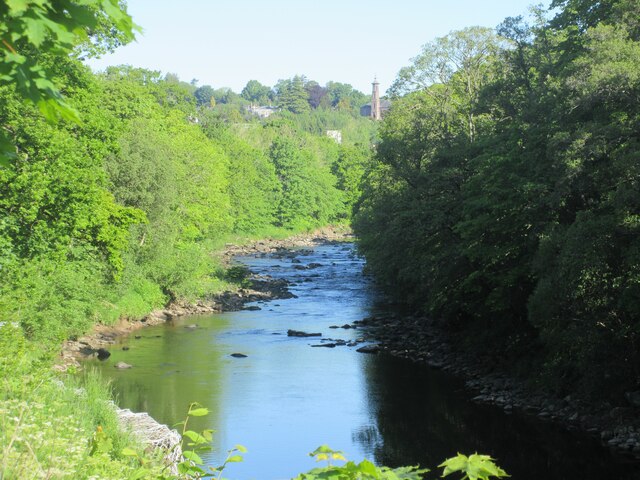
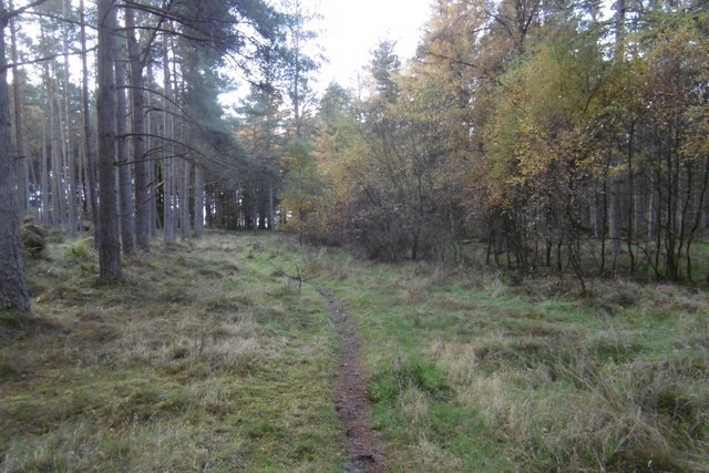
Rosemount benefits from its proximity to the River Ericht, which flows nearby and provides opportunities for fishing and water activities. The village also lies close to the Cairngorms National Park, offering residents and visitors alike ample opportunities for outdoor recreation, including hiking, cycling, and wildlife spotting.

In terms of amenities, Rosemount boasts a primary school, a village hall, and a small shop that caters to the basic needs of the community. For more extensive services, residents often travel to Blairgowrie, which offers a wider range of shops, supermarkets, and healthcare facilities.

Overall, Rosemount is a tranquil and scenic village that provides a peaceful rural lifestyle for its residents. Its natural beauty and proximity to the Cairngorms National Park make it an attractive destination for nature enthusiasts and those seeking a slower pace of life amidst stunning surroundings.

If you have any feedback on the listing, please let us know in the comments section below.

Rosemount Images

Images are sourced within 2km of 56.573758/-3.3202349 or Grid Reference NO1843. Thanks to Geograph Open Source API. All images are credited.

Field near Rosemount Looking north-west over a green field near Rosemount, with Blairgowrie in the distance.
Field near Rosemount
Looking north-west over a green field near Rosemount, with Blairgowrie in the distance.
A923 Coupar Angus Road The A923 heading into Blairgowrie at Rosemount.
A923 Coupar Angus Road
The A923 heading into Blairgowrie at Rosemount.
Stormont Crossing Cottage White house viewed from the A923 near Stormont Loch.
Stormont Crossing Cottage
White house viewed from the A923 near Stormont Loch.
Draffin from the A923 Cottage at Draffin next to the A923 between Coupar Angus and Blairgowrie.
Draffin from the A923
Cottage at Draffin next to the A923 between Coupar Angus and Blairgowrie.
Timber at The Welton Piles of logs stacked up at The Welton.
Timber at The Welton
Piles of logs stacked up at The Welton.
River Ericht The River Ericht looking upstream towards Blairgowrie with the tower of the old Hill Church in the distance.
River Ericht
The River Ericht looking upstream towards Blairgowrie with the tower of the old Hill Church in the distance.
Hedge bounding field east of Rosemount The hedge, the south boundary of the field, has what seems to be the remnants of a stone wall embedded within it. Also embedded in the bushes is a trig point; the lower part of the flush bracket face can be seen close to the bottom right corner of the image. The flush bracket number is S7133.
Hedge bounding field east of Rosemount
The hedge, the south boundary of the field, has what seems to be the remnants of a stone wall embedded within it. Also embedded in the bushes is a trig point; the lower part of the flush bracket face can be seen close to the bottom right corner of the image. The flush bracket number is S7133.
Old Milestone by the A923, Old Military Road, Blairgowrie Parish By the A923, in parish of Blairgowrie (Perth and Kinross District), South of Rosemount, Bennathie, in hedgerow.

Inscription reads:- : 2¾ / TO / BLAIR / GOWRIE : : 2 / COUPAR / ANGUS : 

Surveyed

Milestone Society National ID: PK_BGCA03
Old Milestone by the A923, Old Military Road, Blairgowrie Parish
By the A923, in parish of Blairgowrie (Perth and Kinross District), South of Rosemount, Bennathie, in hedgerow. Inscription reads:- : 2¾ / TO / BLAIR / GOWRIE : : 2 / COUPAR / ANGUS : Surveyed Milestone Society National ID: PK_BGCA03
Minor road at Rosemount Looking north-eastward.
Minor road at Rosemount
Looking north-eastward.
Hazelwood Road, Ardblair Beside Blairgowrie's cemetery.
Hazelwood Road, Ardblair
Beside Blairgowrie's cemetery.
Hazelwood Road, Ardblair Beside Blairgowrie cemetery.
Hazelwood Road, Ardblair
Beside Blairgowrie cemetery.
Blairgowrie Golf Club One of the three courses south of Blairgowrie.
Blairgowrie Golf Club
One of the three courses south of Blairgowrie.
Lansdowne Course One of the Blairgowrie Golf Club courses set in woodland south of the town.  This is taken from near the 2nd tee.
Lansdowne Course
One of the Blairgowrie Golf Club courses set in woodland south of the town. This is taken from near the 2nd tee.
Pinewoods and path, Blairgowrie Golf Club A path to Stormont Loch and Meikleour Wood passes through the golf courses.
Pinewoods and path, Blairgowrie Golf Club
A path to Stormont Loch and Meikleour Wood passes through the golf courses.
Sand trap at Blairgowrie A bunker beside what I suspect is the 17th fairway on the Lansdown Course.
Sand trap at Blairgowrie
A bunker beside what I suspect is the 17th fairway on the Lansdown Course.
Track across Meikleour Wood Much of the track runs through the Lansdowne course at Blairgowrie Golf Club.
Track across Meikleour Wood
Much of the track runs through the Lansdowne course at Blairgowrie Golf Club.
Meikleour Wood The southern part of Meikleour Wood has not been affected by the golf club and is an attractive mainly Scots pine plantation on flat ground.
Meikleour Wood
The southern part of Meikleour Wood has not been affected by the golf club and is an attractive mainly Scots pine plantation on flat ground.
Show me another place!

Rosemount is located at Grid Ref: NO1843 (Lat: 56.573758, Lng: -3.3202349)

Unitary Authority: Perth and Kinross

Police Authority: Tayside

What 3 Words

///maybe.distracts.party. Near Blairgowrie, Perth & Kinross

Nearby Locations

Rosemount

Related Wikis

Rosemount Halt railway station

Rosemount Halt railway station served the suburb of Rosemount, Perth and Kinross, Scotland, from 1857 to 1955 on the Scottish Midland Junction Railway...

Stormont Loch Halt railway station

Stormont Loch Halt railway station served the area of Stormont, Perth and Kinross, Scotland from 1920 to 1955 on the Scottish Midland Junction Railway...
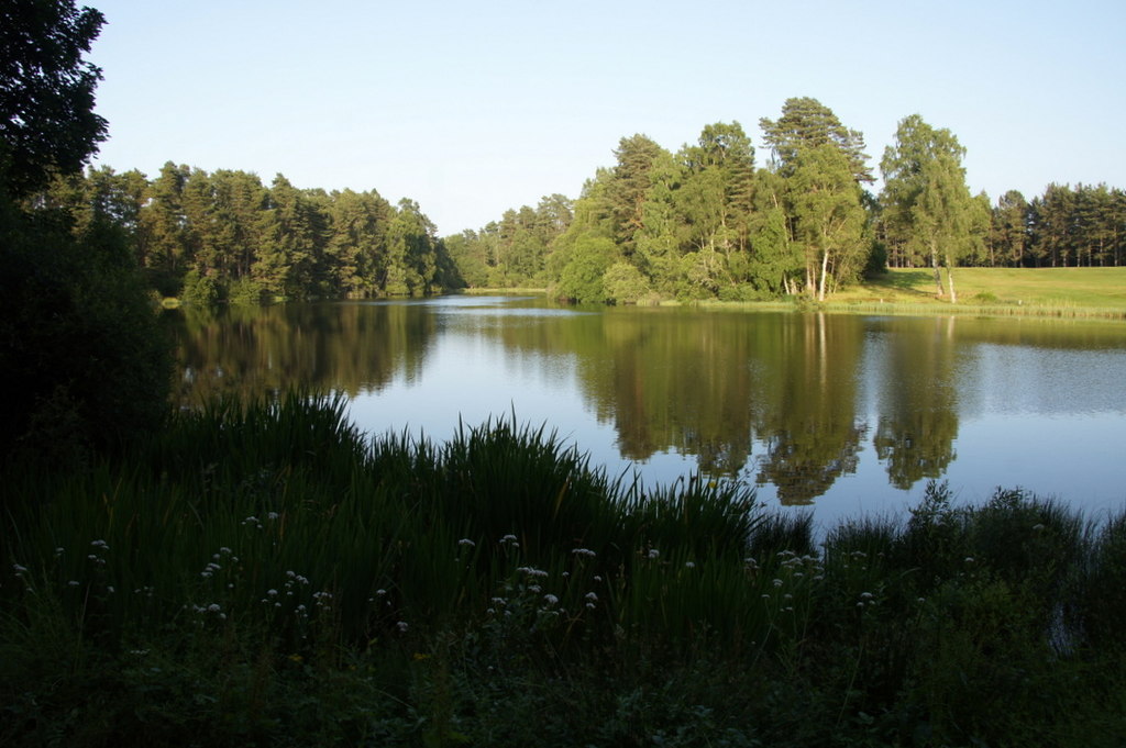
Stormont Loch

Stormont Loch is a small irregular lowland freshwater loch, that is partially in-filled. It located in a nature reserve owned by the Scottish Wildlife...

Black Loch (Perth and Kinross)

Black Loch is a small lowland freshwater loch that is located directly to the east of Fingask Loch in the valley of the Lunan Burn and is 1 mile south...

Nearby Amenities

Located within 500m of 56.573758,-3.3202349
Post Box
Collection Times: Mo-Fr 09:00; Sa 07:00
Manufacturer: Machan Scotland
Operator: Royal Mail
Post Box Mounting: pier
Post Box Type: lamp
Ref: PH10 129D
Royal Cypher: scottish_crown
Source: survey;local knowledge
Lat/Long: 56.5736837/-3.3203457
Rosemount
Place: suburb
Lat/Long: 56.5775583/-3.3241432
Golf: pin
Lat/Long: 56.5719158/-3.3272811
Power: pole
Lat/Long: 56.5732295/-3.3186188
Power: pole
Lat/Long: 56.5727509/-3.3181321
Power: pole
Lat/Long: 56.5722836/-3.3176499
Power: pole
Lat/Long: 56.5713552/-3.3167061
Power: pole
Lat/Long: 56.5708703/-3.3162148
Power: pole
Lat/Long: 56.570433/-3.3155348
Power: pole
Lat/Long: 56.571587/-3.315835
Power: pole
Lat/Long: 56.5718639/-3.3148161
Power: pole
Lat/Long: 56.5721784/-3.3136698
Power: pole
Lat/Long: 56.5724828/-3.31261
Rosemount
Historic Railway: station
Railway: site
Wikidata: Q101003938
Wikipedia: en:Rosemount Halt railway station
Lat/Long: 56.5740664/-3.3190562
The data included in this document is from www.openstreetmap.org. The data is made available under ODbL.

Have you been to Rosemount?

Leave your review of Rosemount below (or comments, questions and feedback).