Rogerton

Settlement in Lanarkshire

Scotland

Rogerton

Nerston Industrial Estate Home Store More, Carpet Right and Benson for Beds.  B&Q is behind the photographer.
Nerston Industrial Estate Credit: Gordon Brown

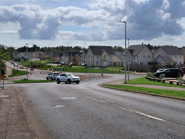
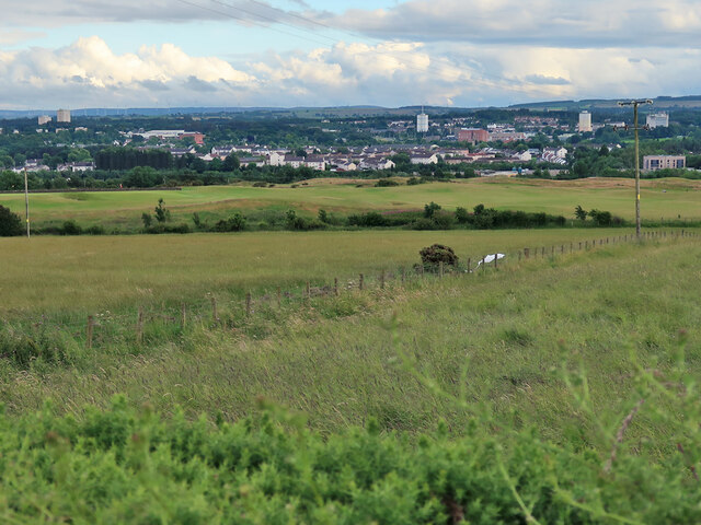
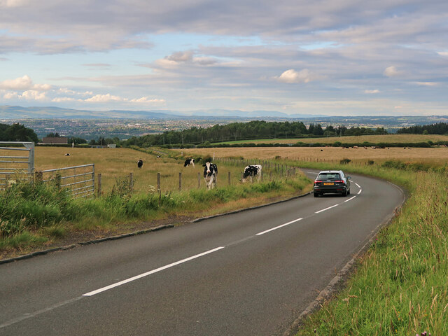
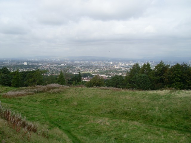
Rogerton is a small village located in the county of Lanarkshire, Scotland. Situated just 10 miles south of Glasgow, it lies in close proximity to several other villages such as East Kilbride and Blantyre. The village is nestled in a picturesque rural setting, encompassed by rolling hills and green pastures.

Rogerton is known for its tranquil and friendly atmosphere, making it an ideal place for those seeking a peaceful retreat from the bustling city life. The village primarily consists of residential properties, with a mix of traditional cottages and modern houses. The community is tightly-knit, and residents often engage in local events and activities that foster a sense of belonging.

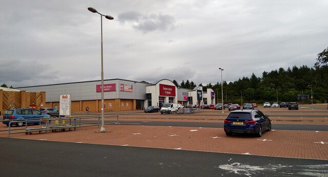
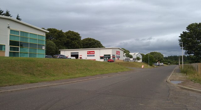
Although Rogerton is a relatively small village, it boasts several amenities to cater to its population. These include a local convenience store, a post office, and a pub where residents can socialize and unwind. For recreational purposes, there are several scenic walking trails, perfect for outdoor enthusiasts and nature lovers. Additionally, the nearby Calderglen Country Park offers beautiful landscapes, a children's zoo, and various recreational activities.

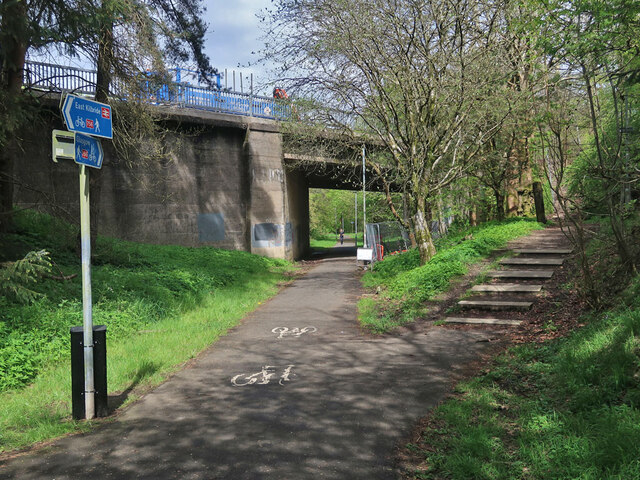
Transportation in Rogerton is well-served, with frequent bus services connecting the village to nearby towns and cities. The M74 motorway is also easily accessible, providing convenient links to Glasgow and other major cities.

In conclusion, Rogerton is a charming village in Lanarkshire, offering a tranquil lifestyle amidst beautiful natural surroundings. It provides a close-knit community, essential amenities, and convenient transportation options, making it an attractive place to reside.

If you have any feedback on the listing, please let us know in the comments section below.
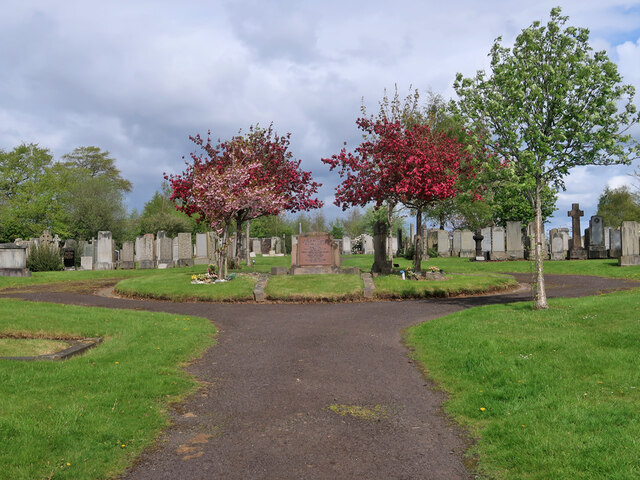
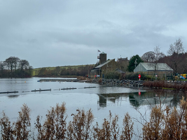
Rogerton Images

Images are sourced within 2km of 55.784536/-4.1876899 or Grid Reference NS6256. Thanks to Geograph Open Source API. All images are credited.

Nerston Industrial Estate Home Store More, Carpet Right and Benson for Beds.  B&Q is behind the photographer.
Nerston Industrial Estate
Home Store More, Carpet Right and Benson for Beds. B&Q is behind the photographer.
Law Place, Nerston, East Kilbride
Hill Field Trig Point Flush Bracket S3609 Not shown on OS maps
Hill Field Trig Point Flush Bracket S3609
Not shown on OS maps
Streetview car Filling up at Sainsbury's, Nerston
Streetview car
Filling up at Sainsbury's, Nerston
Streetview camera
Streetview camera
Mavor Avenue, East Kilbride The houses are on the site of the old Rolls-Royce Aero-Engine Works which opened in 1953 and closed in 2019. The new streets Avon Drive and Dart Avenue are named after some of the engines associated with the works.
The Mavor and Coulson Mining Equipment works was on the left side of the road and was built around 1930. This site has also been re-developed with new housing. See,  <span class="nowrap"><a title="https://maps.nls.uk/geo/explore/#zoom=15.8&lat=55.77874&lon=-4.16692&layers=170&b=1" rel="nofollow ugc noopener" href="https://maps.nls.uk/geo/explore/#zoom=15.8&lat=55.77874&lon=-4.16692&layers=170&b=1">Link</a><img style="margin-left:2px;" alt="External link" title="External link - shift click to open in new window" src="https://s1.geograph.org.uk/img/external.png" width="10" height="10"/></span>
Mavor Avenue, East Kilbride
The houses are on the site of the old Rolls-Royce Aero-Engine Works which opened in 1953 and closed in 2019. The new streets Avon Drive and Dart Avenue are named after some of the engines associated with the works. The Mavor and Coulson Mining Equipment works was on the left side of the road and was built around 1930. This site has also been re-developed with new housing. See, LinkExternal link
East Kilbride Cemetery The cemetery dates from around 1910 and is still in use.
East Kilbride Cemetery
The cemetery dates from around 1910 and is still in use.
National Cycle Route 756 in East Kilbride The route runs for 8 miles from Kelvindale in Glasgow to East Kilbride railway station. Here it follows the course of the old East Kilbride to Hamilton railway under East Mains Road. The line to Hamilton was closed in 1935 but this section remained open till 1966 to connect to the nearby Mavor and Coulson Mining Equipment works.
National Cycle Route 756 in East Kilbride
The route runs for 8 miles from Kelvindale in Glasgow to East Kilbride railway station. Here it follows the course of the old East Kilbride to Hamilton railway under East Mains Road. The line to Hamilton was closed in 1935 but this section remained open till 1966 to connect to the nearby Mavor and Coulson Mining Equipment works.
Secure dog walking field near East Kilbride The entrance to one of the three dog walking fields along this dead-end road. Current rates for 30mins are £7 for up to 4 dogs and £10 for up to 8 dogs.
Secure dog walking field near East Kilbride
The entrance to one of the three dog walking fields along this dead-end road. Current rates for 30mins are £7 for up to 4 dogs and £10 for up to 8 dogs.
National Cycle Route 756 near East Kilbride On Glasgow Road looking uphill towards East Kilbride. 
The route runs for 8 miles from Kelvindale in Glasgow to East Kilbride railway station.
National Cycle Route 756 near East Kilbride
On Glasgow Road looking uphill towards East Kilbride. The route runs for 8 miles from Kelvindale in Glasgow to East Kilbride railway station.
View from Nerston Road, East Kilbride Looking towards some farm fields and a golf course, which is part of a sports complex, and East Kilbride town.
View from Nerston Road, East Kilbride
Looking towards some farm fields and a golf course, which is part of a sports complex, and East Kilbride town.
Cairnmuir Road The road goes through an area of farming between East Kilbride and the outskirts of Glasgow. Looking north-east towards the Ochil Hills.
Cairnmuir Road
The road goes through an area of farming between East Kilbride and the outskirts of Glasgow. Looking north-east towards the Ochil Hills.
James Hamilton Heritage Park Geocaching is a type of global treasure hunt of people looking for caches, or hidden stashes of objects. Geocaching may also be described as a series of hide-and-seek games, where hiders provide online clues for seekers. Seekers use global positioning system (GPS) devices to find hidden caches
James Hamilton Heritage Park
Geocaching is a type of global treasure hunt of people looking for caches, or hidden stashes of objects. Geocaching may also be described as a series of hide-and-seek games, where hiders provide online clues for seekers. Seekers use global positioning system (GPS) devices to find hidden caches
Staff Carpark Geocaching is a type of global treasure hunt of people looking for caches, or hidden stashes of objects. Geocaching may also be described as a series of hide-and-seek games, where hiders provide online clues for seekers. Seekers use global positioning system (GPS) devices to find hidden caches
Staff Carpark
Geocaching is a type of global treasure hunt of people looking for caches, or hidden stashes of objects. Geocaching may also be described as a series of hide-and-seek games, where hiders provide online clues for seekers. Seekers use global positioning system (GPS) devices to find hidden caches
Greenleeshill from the air Greenleeshill Farm is located off the A749 Glasgow Road between Glasgow and East Kilbride.
Greenleeshill from the air
Greenleeshill Farm is located off the A749 Glasgow Road between Glasgow and East Kilbride.
Lollipop Land Lollipop Land is part of "Play Sport". The complex was heaving with children, many going to celebrate birthdays. The noise of happy screaming children was extremely loud once you got inside the building.
Lollipop Land
Lollipop Land is part of "Play Sport". The complex was heaving with children, many going to celebrate birthdays. The noise of happy screaming children was extremely loud once you got inside the building.
Car park view Play Sport alias Lollipop Land car park looking towards the snowy hills.
Car park view
Play Sport alias Lollipop Land car park looking towards the snowy hills.
Roundabout at Nerston Looking across the roundabout towards the Burger King Cafe on a bright but cold February afternoon.
Roundabout at Nerston
Looking across the roundabout towards the Burger King Cafe on a bright but cold February afternoon.
Show me another place!

Rogerton is located at Grid Ref: NS6256 (Lat: 55.784536, Lng: -4.1876899)

Unitary Authority: South Lanarkshire

Police Authority: Lanarkshire

What 3 Words

///ticket.calms.adjust. Near East Kilbride, South Lanarkshire

Nearby Locations

Mains Castle Rogerton

Related Wikis

Mains Castle, South Lanarkshire

Mains Castle is a rectangular tower house dating from the fifteenth century, situated near East Kilbride, South Lanarkshire, Scotland. It is a Category...

Playsport Arena

Playsport Arena is a two-stage sports and entertainment arena in East Kilbride, Scotland. The main arena will have a seating capacity for 6,000 spectators...

Stewartfield, East Kilbride

Stewartfield is an area of the Scottish new town East Kilbride, in South Lanarkshire. There are no schools in Stewartfield, although there are two primary...

Nerston

Nerston is a village situated on the northern green-belt boundary of the new town of East Kilbride in South Lanarkshire, Scotland. == Etymology == Nerston...

Cathkin Braes

Cathkin Braes is an area of hills to the south east of the city of Glasgow, in Scotland. It lies to the south of the districts of Castlemilk, Fernhill...

Calderwood, East Kilbride

Calderwood is a neighbourhood of the Scottish new town of East Kilbride, in South Lanarkshire. It lies on its north-east edge and is one of the largest...

Greatest Hits Radio Glasgow & The West

Greatest Hits Radio Glasgow & The West (previously known as Clyde 2) is an Independent Local Radio station based in Glasgow, Scotland, owned and operated...

East Kilbride railway station

East Kilbride railway station serves the town of East Kilbride, South Lanarkshire, Scotland. The station is managed by ScotRail and it is a terminus on...

Nearby Amenities

Located within 500m of 55.784536,-4.1876899
Power: pole
Lat/Long: 55.7812722/-4.1913718
Power: pole
Lat/Long: 55.784537/-4.1952257
Power: pole
Lat/Long: 55.7809875/-4.190876
Power: pole
Lat/Long: 55.7833504/-4.195082
Power: pole
Lat/Long: 55.7804955/-4.1899948
Power: pole
Lat/Long: 55.782883/-4.1942404
Power: pole
Lat/Long: 55.7851449/-4.1947237
Power: pole
Lat/Long: 55.7819598/-4.192603
Power: pole
Lat/Long: 55.7819317/-4.192953
Power: pole
Lat/Long: 55.7804967/-4.190401
Power: pole
Lat/Long: 55.7810285/-4.1913426
Power: pole
Lat/Long: 55.7814842/-4.1921613
Power: pole
Lat/Long: 55.7826276/-4.1941966
Power: pole
Lat/Long: 55.7832426/-4.1952903
Power: pole
Lat/Long: 55.784592/-4.195459
Power: pole
Lat/Long: 55.7853546/-4.1947049
Power: tower
Lat/Long: 55.7864587/-4.1934964
Power: tower
Lat/Long: 55.7853489/-4.1929341
Power: tower
Lat/Long: 55.7851653/-4.1931752
Power: tower
Lat/Long: 55.7863375/-4.1822967
Power: tower
Lat/Long: 55.7859665/-4.1857621
Power: pole
Lat/Long: 55.7836373/-4.1869376
Power: pole
Lat/Long: 55.7838826/-4.1858945
Power: pole
Lat/Long: 55.7840266/-4.1853028
Power: pole
Lat/Long: 55.7854262/-4.1844792
Man Made: tower
Tower Type: communication
Lat/Long: 55.7855463/-4.1847257
Power: tower
Lat/Long: 55.7855856/-4.189348
Power: tower
Lat/Long: 55.7858724/-4.1894232
Power: tower
Lat/Long: 55.7863479/-4.1860937
Power: tower
Lat/Long: 55.786863/-4.1825938
Power: tower
Source: bing
Lat/Long: 55.7870661/-4.1891377
Power: tower
Source: bing
Lat/Long: 55.7878018/-4.1838984
Golf: pin
Lat/Long: 55.7810953/-4.1843894
Power: pole
Lat/Long: 55.7836737/-4.1808309
Power: pole
Lat/Long: 55.7834769/-4.1819954
Power: pole
Lat/Long: 55.7836666/-4.183112
Power: pole
Lat/Long: 55.7838588/-4.1842327
Power: pole
Lat/Long: 55.7824304/-4.1934377
Power: pole
Lat/Long: 55.7839417/-4.1951536
Power: pole
Lat/Long: 55.7839164/-4.1953745
The data included in this document is from www.openstreetmap.org. The data is made available under ODbL.

Have you been to Rogerton?

Leave your review of Rogerton below (or comments, questions and feedback).