Blackheath

Settlement in Kent

England

Blackheath

Blackheath Conservatoire by the mini-roundabout at the junction of Blackheath Village, Lee Road, Lee Park and Lee Terrace. Not quite as famous as the Paris Conservatoire, Blackheath Conservatoire of Music and the Arts <span class="nowrap"><a title="http://www.blackheath.org/bcma.htm" rel="nofollow ugc noopener" href="http://www.blackheath.org/bcma.htm">Link</a><img style="margin-left:2px;" alt="External link" title="External link - shift click to open in new window" src="https://s1.geograph.org.uk/img/external.png" width="10" height="10"/></span> was founded in 1881 and this building was opened in 1896. This image completes hectad <a href="https://www.geograph.org.uk/gridref/TQ37">TQ37</a>.
Blackheath Conservatoire Credit: Roger W Haworth

Blackheath is a charming village located in the London Borough of Lewisham, within the county of Kent, England. It is situated on the southeastern edge of London, about 8 miles from Charing Cross. The village is known for its picturesque surroundings and rich historical heritage.

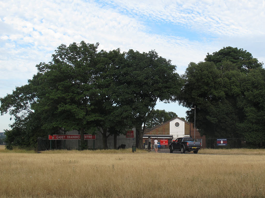
Blackheath is characterized by its vast open heathland, which provides a peaceful and serene atmosphere. The heath covers an area of 85 acres and is a designated conservation area, ensuring the preservation of its natural beauty. It is a popular spot among locals and visitors for recreational activities such as picnicking, jogging, and kite flying.

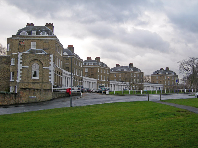
The village itself boasts a vibrant community and a range of amenities. The main hub, Blackheath Village, is a bustling area filled with independent shops, cafes, restaurants, and pubs. The Blackheath Farmers' Market, held every Sunday, attracts crowds with its array of fresh produce and local delicacies.

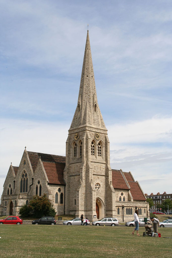
Blackheath is also home to several notable landmarks and historical sites. One such landmark is All Saints' Church, a beautiful medieval church that dates back to the 14th century. The Grade II listed Blackheath Halls, a concert venue and conservatoire, is another prominent feature of the village.

Transportation in Blackheath is well-connected, with Blackheath railway station providing direct links to Central London and other parts of Kent. Additionally, the village is served by several bus routes, making it easily accessible to residents and visitors alike.

Overall, Blackheath, Kent offers a unique blend of rural charm and urban convenience, making it a highly desirable place to live or visit.

If you have any feedback on the listing, please let us know in the comments section below.
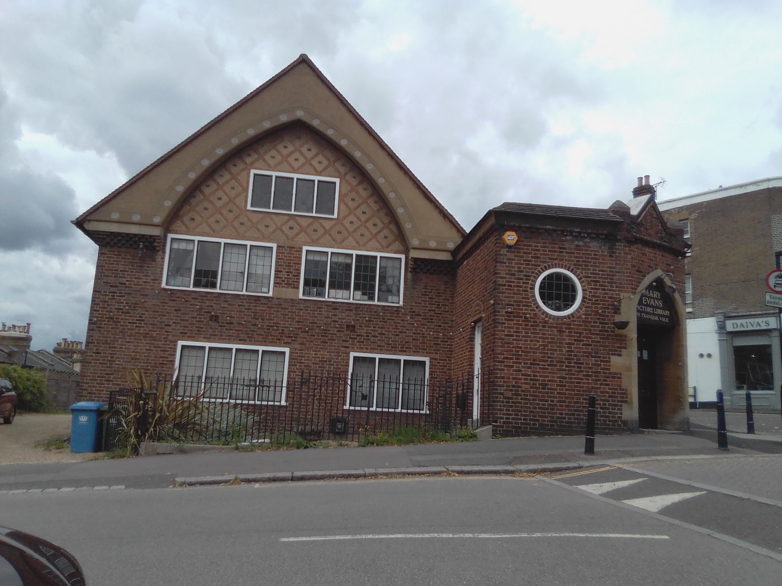
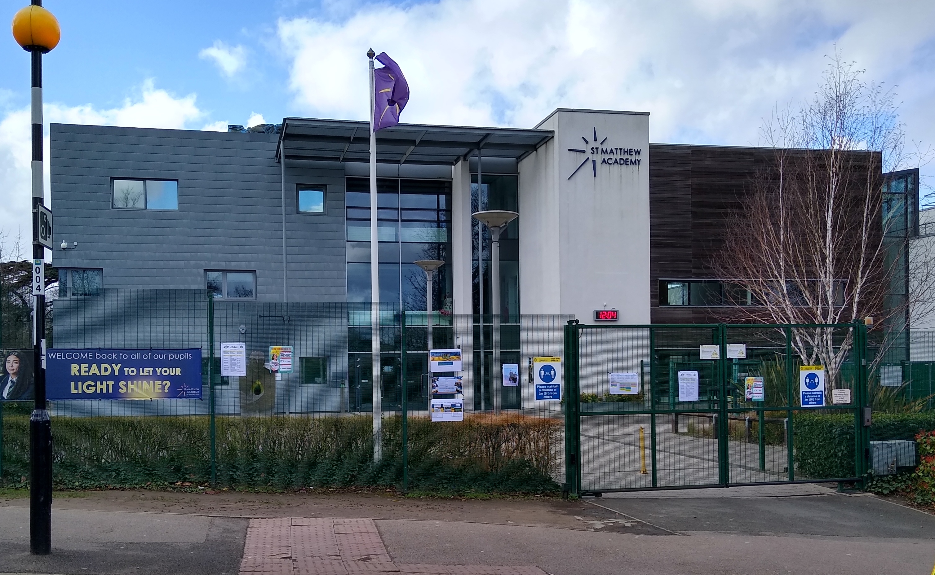
Blackheath Images

Images are sourced within 2km of 51.469158/-0.000085 or Grid Reference TQ3976. Thanks to Geograph Open Source API. All images are credited.

Blackheath Conservatoire by the mini-roundabout at the junction of Blackheath Village, Lee Road, Lee Park and Lee Terrace. Not quite as famous as the Paris Conservatoire, Blackheath Conservatoire of Music and the Arts <span class="nowrap"><a title="http://www.blackheath.org/bcma.htm" rel="nofollow ugc noopener" href="http://www.blackheath.org/bcma.htm">Link</a><img style="margin-left:2px;" alt="External link" title="External link - shift click to open in new window" src="https://s1.geograph.org.uk/img/external.png" width="10" height="10"/></span> was founded in 1881 and this building was opened in 1896. This image completes hectad <a href="https://www.geograph.org.uk/gridref/TQ37">TQ37</a>.
Blackheath Conservatoire
by the mini-roundabout at the junction of Blackheath Village, Lee Road, Lee Park and Lee Terrace. Not quite as famous as the Paris Conservatoire, Blackheath Conservatoire of Music and the Arts LinkExternal link was founded in 1881 and this building was opened in 1896. This image completes hectad TQ37.
Blackheath, Royal Standard For many years the name of the Royal Standard pub has been used to describe the locality. It's located about half a mile from the start of the London Marathon
Blackheath, Royal Standard
For many years the name of the Royal Standard pub has been used to describe the locality. It's located about half a mile from the start of the London Marathon
Blackheath, Royal Standard Unfortunately, this interesting sign that explains the Royal Standard's history was removed during a recent renovation and wasn't replaced
Blackheath, Royal Standard
Unfortunately, this interesting sign that explains the Royal Standard's history was removed during a recent renovation and wasn't replaced
Dover Patrol SE3 The 'Dover Patrol' was a pub on the busy A2, with a pub sign showing a boat in the choppy waters of the English Channel. However, the opening of the new A102M motorway from the Blackwall Tunnel out towards Kent cut it off from its passing trade. In the 1980s it closed and in the 1990s it was demolished and replaced with a small housing development.
Dover Patrol SE3
The 'Dover Patrol' was a pub on the busy A2, with a pub sign showing a boat in the choppy waters of the English Channel. However, the opening of the new A102M motorway from the Blackwall Tunnel out towards Kent cut it off from its passing trade. In the 1980s it closed and in the 1990s it was demolished and replaced with a small housing development.
Thomas Tallis Secondary School, Kidbrooke Park Road Built in the 1970s the fabric of the school is falling apart and will be replaced with a new building within the next decade. Very much a multi-ethnic inner London school, it is also extremely popular with parents over quite a radius and achieves excellent academic results
Thomas Tallis Secondary School, Kidbrooke Park Road
Built in the 1970s the fabric of the school is falling apart and will be replaced with a new building within the next decade. Very much a multi-ethnic inner London school, it is also extremely popular with parents over quite a radius and achieves excellent academic results
Rush hour on the A102 The tail end of the morning rush hour (9.10am) and traffic is still queueing  over 2km from the Blackwall Tunnel northbound entrance.  The tunnel entrance itself is close to the O2 Dome (background, left)
Rush hour on the A102
The tail end of the morning rush hour (9.10am) and traffic is still queueing over 2km from the Blackwall Tunnel northbound entrance. The tunnel entrance itself is close to the O2 Dome (background, left)
The Paragon, SE3 These flats overlook the heath.
The Paragon, SE3
These flats overlook the heath.
Wricklemarsh Road, SE3
Parish Church of St James, Kidbrooke On Kidbrooke Park Road, SE3.
Parish Church of St James, Kidbrooke
On Kidbrooke Park Road, SE3.
Parish Church of St James, Kidbrooke (2) Taken from the footpath between Kidbrooke Park Road and Kidbrooke Grove.
Parish Church of St James, Kidbrooke (2)
Taken from the footpath between Kidbrooke Park Road and Kidbrooke Grove.
Morden College Not actually a college at all, but a charity providing residential care, this link tells a little more <span class="nowrap"><a title="http://en.wikipedia.org/wiki/Morden_College" rel="nofollow ugc noopener" href="http://en.wikipedia.org/wiki/Morden_College">Link</a><img style="margin-left:2px;" alt="External link" title="External link - shift click to open in new window" src="https://s1.geograph.org.uk/img/external.png" width="10" height="10"/></span>
Morden College
Not actually a college at all, but a charity providing residential care, this link tells a little more LinkExternal link
Island near Royal Standard This island is near the Royal Standard pub. There is a green space, phone boxes and a public toilet -- the presence of a drinking fountain (to left) suggests this has long been an amenity area.
Island near Royal Standard
This island is near the Royal Standard pub. There is a green space, phone boxes and a public toilet -- the presence of a drinking fountain (to left) suggests this has long been an amenity area.
Blackheath Standard village
Sun in the Sands inn The inn stands right by the junction where the A2 coming out of London meets the A102 coming out of the Blackwall Tunnel and from this point the modern dual carriageway adopts the A2 identity.  But the Sun in the Sands, which gave its name to the junction, has a history going back centuries as a coaching inn on the Dover Road.
Sun in the Sands inn
The inn stands right by the junction where the A2 coming out of London meets the A102 coming out of the Blackwall Tunnel and from this point the modern dual carriageway adopts the A2 identity. But the Sun in the Sands, which gave its name to the junction, has a history going back centuries as a coaching inn on the Dover Road.
Old Dover Road The flat-roofed building on the right is Blackheath Library.  On the opposite side of the road is a parade of shops.
Old Dover Road
The flat-roofed building on the right is Blackheath Library. On the opposite side of the road is a parade of shops.
Vicarage Avenue As the map shows, this strip of greenery, with a footpath, between suburban streets follows the route of a railway tunnel below.  Presumably it was not possible to build houses over the tunnel.
Vicarage Avenue
As the map shows, this strip of greenery, with a footpath, between suburban streets follows the route of a railway tunnel below. Presumably it was not possible to build houses over the tunnel.
St John's Church, Blackheath The Parish church of St John the Evangelist, Blackheath.  This is the east end, which because of the trees can only be seen properly in winter.  A grade 2 listed building (List Entry Number 1289727), details at <span class="nowrap"><a title="http://www.southwark.anglican.org/parishes/032j" rel="nofollow ugc noopener" href="http://www.southwark.anglican.org/parishes/032j">Link</a><img style="margin-left:2px;" alt="External link" title="External link - shift click to open in new window" src="https://s1.geograph.org.uk/img/external.png" width="10" height="10"/></span>

For a close-up of the war memorial seen outside the church, see <a href="https://www.geograph.org.uk/photo/2694825">TQ4077 : St John's parish war memorial</a>.
St John's Church, Blackheath
The Parish church of St John the Evangelist, Blackheath. This is the east end, which because of the trees can only be seen properly in winter. A grade 2 listed building (List Entry Number 1289727), details at LinkExternal link For a close-up of the war memorial seen outside the church, see TQ4077 : St John's parish war memorial.
St John's Park, Blackheath The 'Park' is just the name of this road which runs roughly east/west either way from <a href="https://www.geograph.org.uk/photo/691816">TQ4077 : St John's Church, Blackheath</a>.
St John's Park, Blackheath
The 'Park' is just the name of this road which runs roughly east/west either way from TQ4077 : St John's Church, Blackheath.
Show me another place!

Blackheath is located at Grid Ref: TQ3976 (Lat: 51.469158, Lng: -0.000085)

Unitary Authority: Lewisham

Police Authority: Metropolitan

What 3 Words

///dogs.other.modern. Near Blackheath, London

Related Wikis

Nearby Amenities

Located within 500m of 51.469158,-0.000085
Barrier: cycle_barrier
Bicycle: yes
Cycle Barrier: double
Cycle Barrier Installation: fixed
Foot: yes
Motor Vehicle: no
Lat/Long: 51.4657028/-0.000188
Crossing
Crossing: unmarked
Crossing Island: yes
Crossing Markings: no
Supervised: no
Tactile Paving: yes
Lat/Long: 51.4680933/0.0034909
Mini Roundabout
Direction: clockwise
Lat/Long: 51.4714488/-0.0061937
Give Way
Direction: forward
Lat/Long: 51.4682649/0.0044635
Mini Roundabout
Direction: clockwise
Lat/Long: 51.4682866/0.0045723
Direction: both
Traffic Calming: table
Lat/Long: 51.4705755/-0.003906
Ref GB Tflcid: RWG195573
Traffic Calming: hump
Lat/Long: 51.4667562/0.0004686
Crossing
Crossing Island: no
Crossing Markings: no
Crossing Signals: no
Tactile Paving: no
Lat/Long: 51.4701922/0.0017316
Post Box
Brand: Royal Mail
Brand Wikidata: Q638098
Collection Times: Mo-Fr 17:30; Sa 12:00; Su off
Description: GROTES PLACE
Drive Through: no
Operator: Royal Mail
Operator Wikidata: Q638098
Post Box Design: type_a
Post Box Type: pillar
Ref: SE3 12
Royal Cypher: GR
Royal Cypher Wikidata: Q33102273
Source: survey
Lat/Long: 51.4680206/0.0040514
Post Box
Brand: Royal Mail
Brand Wikidata: Q638098
Collection Times: Mo-Fr 17:30; Sa 12:00; Su off
Drive Through: no
Operator: Royal Mail
Operator Wikidata: Q638098
Post Box Design: type_b
Post Box Type: pillar
Ref: SE3 1
Royal Cypher: EVIIR
Royal Cypher Wikidata: Q33102324
Source: survey
Lat/Long: 51.4682859/-0.0026763
Booth: KX200
Covered: no
Phone: +44 20 8852 9953
Removed Amenity: telephone
Lat/Long: 51.4686431/-0.0042722
Telephone
Booth: KX200
Covered: booth
Lat/Long: 51.4661113/0.0030495
Barrier: bollard
Bicycle: yes
Foot: yes
Horse: yes
Motor Vehicle: no
Lat/Long: 51.4700512/0.0049314
Crossing
Crossing: unmarked
Crossing Island: no
Crossing Markings: no
Tactile Paving: no
Lat/Long: 51.4691341/0.0032921
Bus Stop
Hail & Ride Dartmouth Grove
Bus: yes
Local Ref: H
Naptan AtcoCode: 490005971N
Naptan Bearing: N
Naptan CommonName: Dartmouth Grove
Naptan Indicator: Stop H/R
Naptan Street: WAT TYLER ROAD
Naptan Verified: no
Public Transport: platform
Lat/Long: 51.4707104/-0.0068302
Bus Stop
Hail & Ride Dartmouth Hill
Bench: no
Bin: no
Bus: yes
Lit: yes
Local Ref: H
Naptan AtcoCode: 490005972E
Naptan Bearing: E
Naptan CommonName: Dartmouth Hill
Naptan Indicator: Stop H/R
Naptan Verified: no
Public Transport: platform
Shelter: no
Tactile Paving: no
Lat/Long: 51.4711851/-0.0054172
Bus Stop
Hail & Ride Dartmouth Grove
Bus: yes
Local Ref: H
Naptan AtcoCode: 490005972S
Naptan Bearing: S
Naptan CommonName: Dartmouth Hill
Naptan Indicator: Stop H\R
Naptan Street: WAT TYLER ROAD
Naptan Verified: no
Public Transport: platform
Lat/Long: 51.4709108/-0.0065008
Bus Stop
Hail & Ride Dartmouth Hill
Bench: no
Bin: no
Bus: yes
Lit: yes
Naptan AtcoCode: 490005972W
Naptan Bearing: W
Naptan CommonName: Dartmouth Hill
Naptan Verified: no
Public Transport: platform
Shelter: no
Tactile Paving: no
Lat/Long: 51.4705399/-0.0040192
Bus Stop
Greenwich Park
Bench: yes
Bus: yes
Departures Board: yes
Lit: yes
Local Ref: S
Naptan AtcoCode: 490007512S
Naptan Bearing: E
Naptan CommonName: Greenwich Park
Naptan Indicator: S
Naptan Street: CHARLTON WAY
Naptan Verified: no
Public Transport: platform
Ref: 73645
Shelter: yes
Source Ref: naptan
Tactile Paving: no
Lat/Long: 51.4729216/0.0031108
Bus Stop
Greenwich Park
Bench: yes
Bin: yes
Bus: yes
Check Date Shelter: 2022-01-23
Lit: yes
Local Ref: T
Naptan AtcoCode: 490007512T
Naptan Bearing: W
Naptan CommonName: Greenwich Park
Naptan Indicator: T
Naptan Street: SHOOTERS HILL ROAD
Naptan Verified: no
Public Transport: platform
Ref: 49120
Shelter: yes
Source Ref: naptan
Tactile Paving: no
Lat/Long: 51.4721658/0.0035489
Bus Stop
Hail & Ride Orchard Road
Bench: no
Bin: no
Bus: yes
Lit: yes
Naptan AtcoCode: 490010620W
Naptan Bearing: W
Naptan CommonName: Orchard Rd Hare & Billet Rd
Naptan Indicator: Stop
Naptan Verified: no
Public Transport: platform
Shelter: no
Tactile Paving: no
Lat/Long: 51.4693397/-0.0004984
Bus Stop
Hail & Ride Mounts Pond Road
Bench: no
Bin: no
Bus: yes
Lit: yes
Naptan AtcoCode: 490010098E
Naptan Bearing: N
Naptan CommonName: Mounts Pond Road
Naptan Street: HARE AND BILLET ROAD
Naptan Verified: no
Public Transport: platform
Shelter: no
Tactile Paving: no
Lat/Long: 51.4695963/-0.0009338
Bus Stop
Hail & Ride Vale Eliot Place
Bench: no
Bin: no
Bus: yes
Lit: yes
Naptan AtcoCode: 490013983E
Naptan Bearing: E
Naptan CommonName: Vale Eliot Place
Naptan Street: HARE AND BILLET ROAD
Naptan Verified: no
Public Transport: platform
Tactile Paving: no
Lat/Long: 51.4683624/0.002688
Bus Stop
Hail & Ride Vale Eliot Place
Bench: no
Bin: no
Bus: yes
Lit: yes
Naptan AtcoCode: 490013983W
Naptan Bearing: W
Naptan CommonName: Vale Eliot Place
Naptan Indicator: Stop
Naptan Verified: no
Public Transport: platform
Shelter: no
Tactile Paving: no
Lat/Long: 51.4682414/0.0028402
Crossing
Bicycle: yes
Button Operated: yes
Crossing: traffic_signals
Crossing Island: no
Crossing Markings: dots
Crossing Ref: toucan
Foot: yes
Segregated: no
Tactile Paving: yes
Traffic Signals Sound: yes
Traffic Signals Vibration: yes
Lat/Long: 51.4722827/0.004048
Crossing
Crossing: unmarked
Crossing Markings: no
Tactile Paving: yes
Lat/Long: 51.4730355/0.0033235
Crossing
Crossing: unmarked
Crossing Markings: no
Lat/Long: 51.4730664/0.0034284
Proposed Traffic Calming: island
Source Proposed: https://consultations.royalgreenwich.gov.uk/KMS/DownloadFileHandler.ashx?PageContext=Documents&DMartId=338
Traffic Calming Island: removable
Was Highway: mini_roundabout
Lat/Long: 51.4730049/0.0034203
Crossing
Bicycle: designated
Crossing: unmarked
Crossing Island: no
Crossing Markings: no
Segregated: no
Tactile Paving: yes
Lat/Long: 51.47209/-0.002286
Traffic Calming: hump
Lat/Long: 51.471459/-0.0001177
Crossing
Crossing: unmarked
Crossing Markings: no
Tactile Paving: yes
Lat/Long: 51.4729547/0.0032719
Give Way
Direction: forward
Lat/Long: 51.4729733/0.003308
Give Way
Direction: backward
Lat/Long: 51.4687483/-0.0046739
Crossing
Crossing: unmarked
Crossing Island: no
Crossing Markings: no
Tactile Paving: yes
Traffic Calming: table
Lat/Long: 51.4696303/-0.0011524
Crossing
Crossing: unmarked
Crossing Island: no
Crossing Markings: no
Tactile Paving: no
Lat/Long: 51.4696785/-0.0014317
Park Office
Information: yes
Tourism: information
Lat/Long: 51.4732369/0.0027237
Bench: yes
Covered: no
Leisure: picnic_table
Lat/Long: 51.4717042/-0.0001934
Bench
Backrest: yes
Source: gps+mapnoter
Lat/Long: 51.4693328/-0.0070758
Waste Basket
Source: gps+mapnoter
Lat/Long: 51.4693541/-0.0065916
Bench
Backrest: yes
Source: gps+mapnoter
Lat/Long: 51.4693599/-0.0066232
Bench
Backrest: yes
Source: gps+mapnoter
Lat/Long: 51.4707045/-0.0055897
Waste Basket
Check Date: 2022-01-19
Source: gps+mapnoter
Lat/Long: 51.4719262/-0.0057725
Bench
Source: gps+mapnoter
Lat/Long: 51.4709231/-0.0064343
Bench
Backrest: yes
Source: gps+mapnoter
Lat/Long: 51.4691806/-0.0062509
Bench
Backrest: yes
Direction: 55
Openbenches Id: 22124
Lat/Long: 51.4734921/-0.0012123
Barrier: chain
Lat/Long: 51.4734969/-0.0014984
Bench
Backrest: yes
Direction: 55
Openbenches Id: 388
Lat/Long: 51.473312/-0.001024
Bench
Backrest: yes
Direction: 55
Openbenches Id: 24148
Lat/Long: 51.4734212/-0.0011355
Waste Basket
Source: gps+mapnoter
Lat/Long: 51.4726638/0.0012647
Waste Basket
Source: gps+mapnoter
Waste: dog_excrement
Lat/Long: 51.472505/3.82E-5
Waste Basket
Source: gps+mapnoter
Lat/Long: 51.472607/0.0014739
Bench
Backrest: yes
Source: gps+mapnoter
Lat/Long: 51.4725866/0.0002601
Bench
Backrest: yes
Direction: 55
Source: gps+mapnoter
Lat/Long: 51.4727822/-0.0004782
Waste Basket
Source: gps+mapnoter
Lat/Long: 51.472813/0.0018373
Bench
Backrest: yes
Source: gps+mapnoter
Lat/Long: 51.4727862/0.0002736
Bicycle Parking
Bicycle Parking: stands
Capacity: 6
Covered: no
Ref GB Tflcid: RWG197899
Lat/Long: 51.4730118/0.0031462
Bench
Backrest: yes
Colour: black
Inscription: In Loving Memory Of JOE Yusuf Mehmet The Ice Cream Man 25.10.1914 - 31.8.2000
Material: metal
Openbenches Id: 8889
Lat/Long: 51.472717/0.0031862
Crossing
Crossing: unmarked
Crossing Island: yes
Crossing Markings: no
Lat/Long: 51.4717332/-0.0004371
Crossing
Crossing: unmarked
Crossing Island: no
Crossing Markings: no
Tactile Paving: no
Lat/Long: 51.4675168/0.0039079
Ref GB Tflcid: RWG195639
Traffic Calming: hump
Lat/Long: 51.4684981/0.004239
Noexit: yes
Lat/Long: 51.4721712/0.0034891
Waste Basket
Colour: green
Lat/Long: 51.472241/0.004185
Tactile Paving: yes
Lat/Long: 51.4722421/0.0040603
Tactile Paving: yes
Lat/Long: 51.4723254/0.004035
Barrier: kerb
Kerb: lowered
Tactile Paving: yes
Lat/Long: 51.471959/4.16E-5
Telephone
HE Ref: 1080772
Booth: K6
Check Date: 2021-06-28
Colour: red
Covered: booth
Heritage: 2
Heritage Operator: Historic England
Heritage Operator Wikidata: Q19604421
Heritage Website: https://historicengland.org.uk/listing/the-list/list-entry/1080772
Listed Status: Grade II
Ref GB Nhle: 1080772
Wikidata: Q26355781
Lat/Long: 51.4719686/-0.0002956
Tactile Paving: yes
Lat/Long: 51.4718392/0.0004286
Crossing
Bicycle: yes
Crossing: unmarked
Crossing Island: yes
Crossing Markings: no
Tactile Paving: yes
Lat/Long: 51.4718919/0.0004171
Tactile Paving: yes
Lat/Long: 51.4719324/0.000408
Crossing
Bicycle: yes
Crossing: unmarked
Crossing Island: no
Crossing Markings: no
Tactile Paving: yes
Lat/Long: 51.4719639/0.0001187
Barrier: kerb
Kerb: lowered
Tactile Paving: yes
Lat/Long: 51.4719688/0.0001952
Traffic Calming: hump
Lat/Long: 51.4709851/0.0005712
Bench
Backrest: yes
Lat/Long: 51.470346/0.0005428
Waste Basket
Check Date: 2024-03-09
Lat/Long: 51.4705474/0.0010578
Barrier: kerb
Kerb: lowered
Tactile Paving: yes
Wheelchair: yes
Lat/Long: 51.4683675/0.0046602
Barrier: kerb
Kerb: lowered
Tactile Paving: yes
Lat/Long: 51.4719303/-0.0024737
Crossing
Crossing: unmarked
Crossing Island: yes
Crossing Markings: no
Kerb: lowered
Tactile Paving: yes
Lat/Long: 51.4719779/-0.0024576
Barrier: kerb
Kerb: lowered
Tactile Paving: yes
Lat/Long: 51.4720197/-0.0024434
Barrier: kerb
Kerb: flush
Tactile Paving: yes
Lat/Long: 51.472084/-0.0022397
Barrier: kerb
Kerb: flush
Tactile Paving: yes
Lat/Long: 51.4720959/-0.0023323
Ref GB Tflcid: RWG195581
Traffic Calming: hump
Lat/Long: 51.4723256/-0.0024241
Bus Stop
Greenwich Park / Chesterfield Gate
Bench: no
Bin: no
Bus: yes
Lit: yes
Naptan AtcoCode: 490020086E
Note: The bus sign is attached to a streetlamp
Public Transport: platform
Ref: 91290
Shelter: no
Source Ref: naptan
Tactile Paving: no
Lat/Long: 51.4720219/0.0011711
Crossing
Crossing: unmarked
Crossing Island: no
Crossing Markings: no
Tactile Paving: no
Lat/Long: 51.4687095/0.005112
Ref GB Tflcid: RWG193685
Traffic Calming: cushion
Lat/Long: 51.4675621/0.0055764
Direction: both
Traffic Calming: bump
Lat/Long: 51.4682506/0.0029943
Crossing
Crossing: unmarked
Crossing Island: yes
Crossing Markings: no
Lat/Long: 51.4683286/0.0047141
Barrier: kerb
Kerb: lowered
Tactile Paving: yes
Wheelchair: yes
Lat/Long: 51.4682874/0.0047719
Street Lamp
Colour: black
Height: 4
Lamp Mount: straight_mast
Lamp Type: electric
Light Colour: white
Light Lit: dusk-dawn
Light Method: incandescent
Light Shape: cylindrical
Support: pole
Lat/Long: 51.4683672/0.0069669
Street Lamp
Height: 4
Lamp Mount: straight_mast
Lamp Type: electric
Light Colour: white
Light Lit: dusk-dawn
Light Method: incandescent
Light Shape: cylindrical
Support: pole
Lat/Long: 51.4681986/0.0047995
Barrier: kerb
Kerb: raised
Lat/Long: 51.4689083/0.0008278
Crossing
Crossing: unmarked
Crossing Island: no
Crossing Markings: no
Lat/Long: 51.4679613/0.0042244
Baizdon Road Estate
Place: neighbourhood
Lat/Long: 51.4663307/0.0012522
Access: yes
Barrier: bollard
Bollard: removable
Motorcar: no
Motorcycle: no
Lat/Long: 51.4728924/0.0035157
Crossing
Crossing: unmarked
Crossing Island: no
Crossing Markings: no
Tactile Paving: yes
Lat/Long: 51.4729136/0.0034977
Greenwich Park
Bus: yes
Local Ref: S
Public Transport: stop_position
Lat/Long: 51.4728992/0.0031338
Tactile Paving: yes
Lat/Long: 51.4729339/0.0035613
Parking Entrance
Access: private
Parking: underground
Lat/Long: 51.4671374/-0.0012615
Bench
Backrest: yes
Lat/Long: 51.4703231/0.0003399
Bench
Backrest: yes
Lat/Long: 51.4682506/0.0042271
Bench
Backrest: yes
Lat/Long: 51.4685881/0.0039106
Bench
Backrest: yes
Lat/Long: 51.4686482/0.0036772
Bench
Backrest: yes
Lat/Long: 51.4686265/0.0034734
Bench
Backrest: yes
Lat/Long: 51.468538/0.0033634
Bench
Backrest: yes
Lat/Long: 51.4684611/0.0033312
Bench
Backrest: yes
Lat/Long: 51.4683542/0.0033527
Bench
Backrest: yes
Lat/Long: 51.4683224/0.0034707
Crossing
Crossing: unmarked
Crossing Island: no
Crossing Markings: no
Tactile Paving: no
Lat/Long: 51.4699994/-0.0022704
Give Way
Direction: forward
Lat/Long: 51.4701719/0.0018366
Bench
Backrest: yes
Lat/Long: 51.4690902/-0.003085
Tactile Paving: yes
Lat/Long: 51.4728929/0.0034322
Give Way
Direction: backward
Lat/Long: 51.4715014/-0.0061624
Give Way
Direction: forward
Lat/Long: 51.4713943/-0.0062362
Give Way
Direction: backward
Lat/Long: 51.4714222/-0.0061234
Direction: both
Traffic Calming: bump
Lat/Long: 51.470932/-0.0048533
Direction: both
Traffic Calming: bump
Lat/Long: 51.4712854/-0.0057896
Crossing
Crossing: unmarked
Crossing Markings: no
Lat/Long: 51.4714076/-0.0062259
Direction: both
Traffic Calming: bump
Lat/Long: 51.4701922/-0.0028395
Direction: both
Traffic Calming: bump
Lat/Long: 51.4697816/-0.0015963
Give Way
Direction: forward
Lat/Long: 51.4696896/-0.0014212
Direction: both
Traffic Calming: bump
Lat/Long: 51.4694641/-0.0007044
Give Way
Direction: backward
Lat/Long: 51.4691648/-5.86E-5
Direction: both
Traffic Calming: table
Lat/Long: 51.4688164/0.0010028
Direction: both
Traffic Calming: bump
Lat/Long: 51.468554/0.0018233
Give Way
Direction: backward
Lat/Long: 51.4681297/0.0035114
Barrier: kerb
Kerb: lowered
Tactile Paving: no
Lat/Long: 51.4696462/-0.0013386
Give Way
Direction: backward
Lat/Long: 51.4689289/-0.0040551
Access: permissive
Entrance: yes
Opening Hours: Apr-Oct We-Su 11:00-16:00 open; 2022 Jun 26-2022 Jul 06 closed
Opening Hours Url: https://www.english-heritage.org.uk/visit/places/rangers-house-the-wernher-collection/prices-and-opening-times/
Lat/Long: 51.4735125/-0.0019
Kerb: raised
Lat/Long: 51.4715445/-0.0002337
Garnet Wolseley
Historic: memorial
Inscription: Garnet 1st Viscount Wolseley (1833–1913) Field-Marshal Lived here
Material: stone
Memorial: plaque
Note: not a blue plaque
Openplaques Id: 344
Subject Wikidata: Q336077
Lat/Long: 51.4734072/-0.0016787
Samuel Smiles
Historic: memorial
Inscription: Samuel Smiles (1812-1904) Author of Self-Help lived here
Memorial: blue_plaque
Openplaques Id: 528
Subject Wikidata: Q1195422
Lat/Long: 51.4668835/-0.004256
Traffic Calming: hump
Lat/Long: 51.4679435/-0.0020349
Maxwidth: 7'0"
Traffic Calming: choker
Lat/Long: 51.4672066/0.0063865
Maxwidth: 7'0"
Traffic Calming: choker
Lat/Long: 51.4671536/0.0063163
Give Way
Lat/Long: 51.4671808/0.0062903
Give Way
Lat/Long: 51.4671865/0.0064058
Noexit: yes
Lat/Long: 51.4655572/-0.001849
Noexit: yes
Lat/Long: 51.4655657/-0.0036738
Noexit: yes
Lat/Long: 51.4660127/-0.0030166
Noexit: yes
Lat/Long: 51.4660521/-0.0021556
Waste Basket
Colour: green
Material: metal
Waste: trash
Lat/Long: 51.4715021/0.0032988
Waste Basket
Waste: trash
Lat/Long: 51.4701596/0.0019972
Waste Basket
Waste: trash
Lat/Long: 51.4700535/0.0018189
Waste Basket
Waste: dog_excrement
Lat/Long: 51.4701362/0.0014588
Waste Basket
Waste: trash
Lat/Long: 51.4696669/-0.0015356
Waste Basket
Waste: trash
Lat/Long: 51.4691594/-0.0030752
Waste Basket
Waste: dog_excrement
Lat/Long: 51.4691218/-0.0036317
Waste Basket
Waste: trash
Lat/Long: 51.4686224/-0.0050063
Waste Basket
Waste: trash
Lat/Long: 51.4684641/-0.005701
Waste Basket
Waste: trash
Lat/Long: 51.4682958/-0.0063599
Barrier: kerb
Kerb: lowered
Tactile Paving: yes
Lat/Long: 51.4681093/0.0033967
Natural: tree_stump
Lat/Long: 51.4693164/-0.0024435
Information: map
Map Size: site
Operator: The Royal Parks
Tourism: information
Lat/Long: 51.4722025/0.000233
Bench
Backrest: yes
Colour: green
Material: metal
Lat/Long: 51.4722533/-0.0037872
Bench
Backrest: yes
Colour: green
Material: metal
Lat/Long: 51.4721851/-0.0032744
Waste Basket
Waste: dog_excrement
Lat/Long: 51.4730056/-0.0014971
Street Lamp
Lamp Mount: straight_mast
Lat/Long: 51.4721939/-0.0005886
Bench
Backrest: yes
Colour: green
Material: metal
Lat/Long: 51.4720237/-0.0018857
Bench
Backrest: yes
Material: metal
Lat/Long: 51.4719365/-0.0009305
Waste Basket
Waste: trash
Lat/Long: 51.4729933/-0.0014835
Waste Basket
Waste: trash
Lat/Long: 51.4719736/-0.0015566
Waste Basket
Waste: trash
Lat/Long: 51.4719309/-0.0004155
Waste Basket
Waste: trash
Lat/Long: 51.47222/-0.0035374
Street Lamp
Lamp Mount: straight_mast
Lat/Long: 51.4726855/-0.0011149
Street Lamp
Lamp Mount: straight_mast
Lat/Long: 51.4724654/-0.0008843
Bench
Backrest: yes
Material: metal
Lat/Long: 51.4719452/-0.0012392
Street Lamp
Lamp Mount: straight_mast
Lat/Long: 51.4732067/-0.0016696
Waste Basket
Waste: trash
Lat/Long: 51.472145/-0.0030135
Waste Basket
Waste: trash
Lat/Long: 51.472063/-0.002165
Street Lamp
Lamp Mount: straight_mast
Lat/Long: 51.4729123/-0.0013846
Bench
Backrest: yes
Colour: green
Material: metal
Lat/Long: 51.472118/-0.0027556
Waste Basket
Colour: red
Waste: dog_excrement
Lat/Long: 51.472973/0.0036355
Traffic Signals
Crossing: no
Traffic Signals: pedestrian_crossing
Traffic Signals Direction: backward
Lat/Long: 51.472292/0.0041298
Traffic Signals
Crossing: no
Traffic Signals: pedestrian_crossing
Traffic Signals Direction: forward
Lat/Long: 51.4722721/0.0039546
Bench
Backrest: yes
Lat/Long: 51.4684385/-0.0044056
Historic: memorial
Memorial: war_memorial
Lat/Long: 51.4701111/-0.0058354
Lion
HE Ref: 1194163
Artwork Type: sculpture
Heritage: 2
Heritage Operator: Historic England
Heritage Operator Wikidata: Q19604421
Heritage Website: https://historicengland.org.uk/listing/the-list/list-entry/1194163
Inscription: NELSON|CXXII BATTLES
Listed Status: Grade II
Material: stone
Ref GB Nhle: 1194163
Tourism: artwork
Wikidata: Q26488794
Lat/Long: 51.4702127/-0.0057253
Barrier: kerb
Kerb: lowered
Tactile Paving: no
Lat/Long: 51.4720534/0.0016329
Bench
Backrest: yes
Direction: 280
Openbenches Id: 401
Lat/Long: 51.4734478/-0.0005603
Bench
Backrest: yes
Direction: 290
Lat/Long: 51.4733503/-0.0006214
Bench
Backrest: yes
Direction: 310
Openbenches Id: 402
Lat/Long: 51.4732637/-0.0007124
Bench
Backrest: yes
Direction: 270
Openbenches Id: 389
Lat/Long: 51.4735597/-0.0005415
Man Made: planter
Lat/Long: 51.4735702/-0.0012072
Board Type: nature
Direction: 240
Information: board
Tourism: information
Lat/Long: 51.4732439/-0.0008911
Street Lamp
Colour: black
Height: 4
Lamp Mount: straight_mast
Lamp Type: electric
Light Colour: white
Light Lit: dusk-dawn
Light Method: incandescent
Light Shape: cylindrical
Support: pole
Lat/Long: 51.4707861/0.0050839
Street Lamp
Colour: black
Height: 4
Lamp Mount: straight_mast
Lamp Type: electric
Light Colour: white
Light Lit: dusk-dawn
Light Method: incandescent
Light Shape: cylindrical
Support: pole
Lat/Long: 51.4711243/0.004928
Street Lamp
Colour: black
Height: 4
Lamp Mount: straight_mast
Lamp Type: electric
Light Colour: white
Light Lit: dusk-dawn
Light Method: incandescent
Light Shape: cylindrical
Support: pole
Lat/Long: 51.4704864/0.0052981
Street Lamp
Colour: black
Height: 4
Lamp Mount: straight_mast
Lamp Type: electric
Light Colour: white
Light Lit: dusk-dawn
Light Method: incandescent
Light Shape: cylindrical
Support: pole
Lat/Long: 51.4701376/0.0053844
Street Lamp
Colour: black
Height: 4
Lamp Mount: straight_mast
Lamp Type: electric
Light Colour: white
Light Lit: dusk-dawn
Light Method: incandescent
Light Shape: cylindrical
Support: pole
Lat/Long: 51.4712202/0.0050703
Street Lamp
Colour: black
Height: 4
Lamp Mount: straight_mast
Lamp Type: electric
Light Colour: white
Light Lit: dusk-dawn
Light Method: incandescent
Light Shape: cylindrical
Support: pole
Lat/Long: 51.4714268/0.0046462
Street Lamp
Colour: black
Height: 4
Lamp Mount: straight_mast
Lamp Type: electric
Light Colour: white
Light Lit: dusk-dawn
Light Method: incandescent
Light Shape: cylindrical
Support: pole
Lat/Long: 51.4717833/0.0044588
Street Lamp
Colour: black
Height: 4
Lamp Mount: straight_mast
Lamp Type: electric
Light Colour: white
Light Lit: dusk-dawn
Light Method: incandescent
Light Shape: cylindrical
Support: pole
Lat/Long: 51.4721014/0.0041523
Street Lamp
Height: 4
Lamp Mount: straight_mast
Lamp Type: electric
Light Colour: white
Light Lit: dusk-dawn
Light Method: incandescent
Light Shape: cylindrical
Support: pole
Lat/Long: 51.4710985/0.0056596
Street Lamp
Height: 4
Lamp Mount: straight_mast
Lamp Type: electric
Light Colour: white
Light Lit: dusk-dawn
Light Method: incandescent
Light Shape: cylindrical
Support: pole
Lat/Long: 51.4710592/0.0062029
Street Lamp
Colour: black
Height: 4
Lamp Mount: straight_mast
Lamp Type: electric
Light Colour: white
Light Lit: dusk-dawn
Light Method: incandescent
Light Shape: cylindrical
Support: pole
Lat/Long: 51.469457/0.0058627
Street Lamp
Colour: black
Height: 4
Lamp Mount: straight_mast
Lamp Type: electric
Light Colour: white
Light Lit: dusk-dawn
Light Method: incandescent
Light Shape: cylindrical
Support: pole
Lat/Long: 51.4697916/0.0055416
Street Lamp
Colour: black
Height: 4
Lamp Mount: straight_mast
Lamp Type: electric
Light Colour: white
Light Lit: dusk-dawn
Light Method: incandescent
Light Shape: cylindrical
Support: pole
Lat/Long: 51.4691412/0.0061472
Street Lamp
Colour: black
Height: 4
Lamp Mount: straight_mast
Lamp Type: electric
Light Colour: white
Light Lit: dusk-dawn
Light Method: incandescent
Light Shape: cylindrical
Support: pole
Lat/Long: 51.4688462/0.0064985
Street Lamp
Colour: black
Height: 4
Lamp Mount: straight_mast
Lamp Type: electric
Light Colour: white
Light Lit: dusk-dawn
Light Method: incandescent
Light Shape: cylindrical
Support: pole
Lat/Long: 51.4685316/0.0067754
Street Lamp
Colour: black
Height: 4
Lamp Mount: straight_mast
Lamp Type: electric
Light Colour: white
Light Lit: dusk-dawn
Light Method: incandescent
Light Shape: cylindrical
Support: pole
Lat/Long: 51.4684498/0.0062828
Street Lamp
Height: 4
Lamp Mount: straight_mast
Lamp Type: electric
Light Colour: white
Light Lit: dusk-dawn
Light Method: incandescent
Light Shape: cylindrical
Support: pole
Lat/Long: 51.468389/0.0056154
Street Lamp
Height: 4
Lamp Mount: straight_mast
Lamp Type: electric
Light Colour: white
Light Lit: dusk-dawn
Light Method: incandescent
Light Shape: cylindrical
Support: pole
Lat/Long: 51.4683211/0.0049759
Street Lamp
Height: 4
Lamp Mount: straight_mast
Lamp Type: electric
Light Colour: white
Light Lit: dusk-dawn
Light Method: incandescent
Light Shape: cylindrical
Support: pole
Lat/Long: 51.4683622/0.0049098
Street Lamp
Height: 4
Lamp Mount: straight_mast
Lamp Type: electric
Light Colour: white
Light Lit: dusk-dawn
Light Method: incandescent
Light Shape: cylindrical
Support: pole
Lat/Long: 51.4685513/0.0050778
Street Lamp
Height: 4
Lamp Mount: straight_mast
Lamp Type: electric
Light Colour: white
Light Lit: dusk-dawn
Light Method: incandescent
Light Shape: cylindrical
Support: pole
Lat/Long: 51.4688824/0.005244
Street Lamp
Height: 4
Lamp Mount: straight_mast
Lamp Type: electric
Light Colour: white
Light Lit: dusk-dawn
Light Method: incandescent
Light Shape: cylindrical
Support: pole
Lat/Long: 51.4691992/0.0052807
Street Lamp
Colour: black
Height: 4
Lamp Mount: straight_mast
Lamp Type: electric
Light Colour: white
Light Lit: dusk-dawn
Light Method: incandescent
Light Shape: cylindrical
Support: pole
Lat/Long: 51.4694832/0.005463
Bench
Backrest: yes
Colour: black
Inscription: In Memory of John G Fisher 19 December 1953 - 4 October 1997 Artist, Designer and a Fine Story-teller Aged 43 Years Forever Loved
Material: metal
Openbenches Id: 8890
Lat/Long: 51.472585/0.0030795
Street Lamp
Lat/Long: 51.4710467/-0.0052745
Street Lamp
Lat/Long: 51.470907/-0.0048918
Street Lamp
Lat/Long: 51.4707791/-0.0045575
Street Lamp
Lat/Long: 51.4706391/-0.0041839
Street Lamp
Lat/Long: 51.4704953/-0.0037999
Street Lamp
Lat/Long: 51.4703579/-0.0034262
Street Lamp
Lat/Long: 51.4702229/-0.0030383
Street Lamp
Lat/Long: 51.4696981/-0.0015443
Street Lamp
Lat/Long: 51.4697264/-0.0013143
Street Lamp
Lat/Long: 51.4697575/-0.0016306
Street Lamp
Lat/Long: 51.4699102/-0.0018852
Street Lamp
Lat/Long: 51.4699512/-0.0022475
Street Lamp
Lat/Long: 51.4700844/-0.0026353
Maxwidth: 7'0"
Surface: concrete
Traffic Calming: island
Lat/Long: 51.4687032/-0.004973
Street Lamp
Lat/Long: 51.4690506/-0.00353
Street Lamp
Lat/Long: 51.4686111/-0.0030676
Street Lamp
Lat/Long: 51.4683592/-0.0063177
Street Lamp
Lat/Long: 51.468552/-0.0057549
Street Lamp
Lat/Long: 51.4691172/-0.0023866
Street Lamp
Lat/Long: 51.4686677/-0.0036274
Street Lamp
Lat/Long: 51.4683641/-0.0043425
Street Lamp
Lat/Long: 51.4685194/-0.0050842
Street Lamp
Lat/Long: 51.4679988/-0.0043563
Street Lamp
Lat/Long: 51.4688252/-0.0047116
Street Lamp
Lat/Long: 51.4690005/-0.0040655
Street Lamp
Lat/Long: 51.4682639/-0.0068145
Street Lamp
Lat/Long: 51.4686627/-0.0043859
Street Lamp
Lat/Long: 51.4683536/-0.0053194
Street Lamp
Lat/Long: 51.4687874/-0.0024407
Street Lamp
Lat/Long: 51.4678757/-0.0069563
Street Lamp
Lat/Long: 51.4693044/-0.0025152
Street Lamp
Lat/Long: 51.4684516/-0.005535
Street Lamp
Lat/Long: 51.4687112/-0.005157
Street Lamp
Lat/Long: 51.4687712/-0.004147
Street Lamp
Lat/Long: 51.4692685/-0.0030802
Street Lamp
Lat/Long: 51.4682813/-0.00501
Waste Basket
Waste: trash
Lat/Long: 51.4708921/-0.0064597
Barrier: bollard
Bollard: fixed
Foot: yes
Motor Vehicle: no
Lat/Long: 51.4675511/0.0053984
Barrier: kerb
Kerb: lowered
Tactile Paving: no
Wheelchair: yes
Lat/Long: 51.4679461/0.0042913
Give Way
Direction: forward
Lat/Long: 51.4678293/0.0033956
Give Way
Direction: forward
Lat/Long: 51.4679286/0.0030915
Bench
Backrest: yes
Direction: 55
Material: metal
Seats: 3
Lat/Long: 51.4728671/-0.001206
Bench
Backrest: yes
Direction: 55
Material: metal
Seats: 3
Lat/Long: 51.4726206/-0.0009419
Bench
Backrest: yes
Direction: 55
Material: metal
Seats: 3
Lat/Long: 51.472374/-0.0006777
Bench
Access: yes
Backrest: yes
Colour: green
Material: metal
Openbenches Id: 23434
Lat/Long: 51.4696733/-0.0009206
Bench
Backrest: yes
Inscription: Violet and George Smyth - 2008
Material: wood
Openbenches Id: 23431
Lat/Long: 51.4676548/0.0050655
Bench
Lat/Long: 51.4678707/0.0044536
Barrier: bollard
Bollard: fixed
Foot: yes
Motor Vehicle: no
Lat/Long: 51.4675546/0.0054488
Bench
Backrest: yes
Material: wood
Lat/Long: 51.4685074/0.0015818
Bench
Backrest: yes
Material: wood
Lat/Long: 51.468696/0.0009762
Waste Basket
Lat/Long: 51.4681054/0.0032627
Bench
Backrest: yes
Material: wood
Openbenches Id: 12756
Lat/Long: 51.4702522/0.0013045
Board Type: history
Information: board
Tourism: information
Lat/Long: 51.4700619/0.0006889
Bench
Source: gps+mapnoter
Lat/Long: 51.4707907/-0.0067539
Waste Basket
Waste: trash
Lat/Long: 51.4707636/-0.0067367
Direction: both
Traffic Calming: bump
Lat/Long: 51.4690757/0.0002759
Direction: both
Traffic Calming: bump
Lat/Long: 51.4681326/0.0038056
Direction: both
Traffic Calming: table
Lat/Long: 51.470767/-0.0066635
Give Way
Direction: backward
Lat/Long: 51.4703016/-0.0069615
Direction: both
Traffic Calming: table
Lat/Long: 51.4701093/-0.0071377
Give Way
Direction: backward
Lat/Long: 51.473032/0.0035147
Was Highway: give_way
Lat/Long: 51.4729427/0.0034734
Crossing
Crossing: unmarked
Crossing Island: yes
Crossing Markings: no
Tactile Paving: yes
Lat/Long: 51.4730438/0.0035558
Barrier: bollard
Bollard: fixed
Lat/Long: 51.4718061/0.0004326
Barrier: bollard
Bollard: fixed
Lat/Long: 51.4718034/0.0003925
Bench
Backrest: yes
Inscription: In loving memory Paul Gawan 11.08.1977 - 14.04.2017 A peaceful green space, for us to remember
Material: wood
Openbenches Id: 23430
Lat/Long: 51.4681034/0.005308
Bench
Backrest: yes
Colour: green
Direction: NE
Material: metal
Lat/Long: 51.4692776/0.0059962
Bench
Backrest: yes
Direction: SW
Material: metal
Lat/Long: 51.4690461/0.006288
Bench
Backrest: yes
Colour: green
Direction: NE
Material: metal
Lat/Long: 51.4686782/0.0066193
Bench
Backrest: yes
Lat/Long: 51.4674326/0.0061939
Waste Basket
Lat/Long: 51.4683216/0.0048654
Waste Basket
Colour: green
Lat/Long: 51.4683221/0.006969
Waste Basket
Lat/Long: 51.4677426/0.0057095
Bench
Backrest: no
Direction: 42
Material: stone
Lat/Long: 51.4712024/0.0047716
Bench
Backrest: no
Direction: 227
Material: stone
Lat/Long: 51.4712684/0.004864
Crossing
Crossing: unmarked
Crossing Island: no
Crossing Markings: no
Tactile Paving: no
Lat/Long: 51.4701878/0.0018949
Crossing
Crossing: unmarked
Crossing Island: no
Crossing Markings: no
Tactile Paving: no
Lat/Long: 51.4685231/0.0019319
Crossing
Crossing: unmarked
Crossing Island: no
Crossing Markings: no
Tactile Paving: no
Lat/Long: 51.4683529/0.0044655
Crossing
Crossing: unmarked
Crossing Markings: no
Lat/Long: 51.468883/0.0008112
Barrier: kerb
Kerb: raised
Lat/Long: 51.4688573/0.000794
Barrier: kerb
Kerb: raised
Lat/Long: 51.4685495/0.0019567
Barrier: kerb
Kerb: raised
Lat/Long: 51.4684995/0.0019108
Barrier: kerb
Kerb: raised
Lat/Long: 51.467527/0.0038702
Barrier: kerb
Kerb: raised
Tactile Paving: no
Lat/Long: 51.4700221/-0.0022475
Barrier: kerb
Kerb: raised
Tactile Paving: no
Lat/Long: 51.4699723/-0.0022927
Bench
Backrest: yes
Openbenches Id: 23408
Lat/Long: 51.4708355/0.0061781
Bench
Backrest: yes
Material: wood
Openbenches Id: 23433
Lat/Long: 51.4680662/0.0026436
Bench
Backrest: yes
Material: wood
Lat/Long: 51.4680441/0.002247
Bench
Backrest: yes
Material: wood
Openbenches Id: 23432
Lat/Long: 51.4680063/0.0016921
Bench
Backrest: yes
Material: wood
Lat/Long: 51.4679789/0.0015359
Bench
Backrest: yes
Material: wood
Openbenches Id: 9673
Lat/Long: 51.4682719/0.0003898
Bench
Backrest: yes
Inscription: IN LOVING MEMORY OF 3 BROTHERS WHO USED TO PLAY HERE TOGETHER AS KIDS BOB PEARTON 19.05.1940 - 25.04.2020 TOM PEARTON 09.07.1941 - 01.06.2020 TERRY PEARTON 09.09.1941 -
Material: wood
Openbenches Id: 23429
Lat/Long: 51.4685971/0.0051773
Barrier: kerb
Kerb: raised
Tactile Paving: no
Wheelchair: no
Lat/Long: 51.4682158/0.0035376
Barrier: kerb
Kerb: lowered
Tactile Paving: yes
Wheelchair: yes
Lat/Long: 51.4680724/0.0036209
Barrier: kerb
Kerb: lowered
Tactile Paving: no
Wheelchair: yes
Lat/Long: 51.4679771/0.004155
Bench
Backrest: yes
Direction: 55
Openbenches Id: 406
Lat/Long: 51.4732539/-0.0009626
Street Lamp
Lamp Mount: straight_mast
Lamp Type: electric
Lat/Long: 51.4699959/0.0002145
Street Lamp
Lamp Mount: straight_mast
Lamp Type: electric
Lat/Long: 51.4701168/0.0015362
Street Lamp
Lamp Mount: straight_mast
Lamp Type: electric
Lat/Long: 51.4697612/-0.0003413
Street Lamp
Lamp Mount: straight_mast
Lamp Type: electric
Lat/Long: 51.4701125/0.000881
Board Type: history
Direction: 60
Information: board
Tourism: information
Lat/Long: 51.4727826/-0.0006535
Entrance: main
Lat/Long: 51.4734151/-0.0016869
Barrier: kerb
Kerb: lowered
Lat/Long: 51.4687112/-0.004719
Give Way
Direction: backward
Lat/Long: 51.4683045/0.0046676
Give Way
Direction: backward
Lat/Long: 51.4682224/0.0046625
Give Way
Direction: forward
Lat/Long: 51.4683421/0.004483
Ref GB Tflcid: RWG195640
Traffic Calming: hump
Lat/Long: 51.4689544/0.0035554
Ref GB Tflcid: RWG195643
Traffic Calming: hump
Lat/Long: 51.4700404/0.0019563
Ref GB Tflcid: RWG195635
Traffic Calming: hump
Lat/Long: 51.46794/0.0028006
Ref GB Tflcid: RWG195571
Traffic Calming: hump
Lat/Long: 51.4677483/-1.1E-6
Ref GB Tflcid: RWG195645
Traffic Calming: hump
Lat/Long: 51.4703378/0.0015146
Ref GB Tflcid: RWG195636
Traffic Calming: hump
Lat/Long: 51.4678788/0.0019181
Ref GB Tflcid: RWG195637
Traffic Calming: hump
Lat/Long: 51.4678237/0.0011224
Ref GB Tflcid: RWG195621
Traffic Calming: hump
Lat/Long: 51.4655024/0.0035018
Ref GB Tflcid: RWG195641
Traffic Calming: hump
Lat/Long: 51.4694256/0.0028623
Ref GB Tflcid: RWG195566
Traffic Calming: hump
Lat/Long: 51.4684363/-0.0054111
Bicycle Parking
Bicycle Parking: stands
Capacity: 6
Ref GB Tflcid: RWG197789
Lat/Long: 51.4662454/0.0034258
Bicycle Parking
Bicycle Parking: stands
Capacity: 2
Ref GB Tflcid: RWG197787
Lat/Long: 51.4666227/0.0029433
Bicycle Parking
Bicycle Parking: stands
Capacity: 4
Ref GB Tflcid: RWG197785
Lat/Long: 51.4665795/0.000891
Bicycle Parking
Bicycle Parking: stands
Capacity: 6
Ref GB Tflcid: RWG197788
Lat/Long: 51.4664183/0.0034098
Bicycle Parking
Bicycle Parking: stands
Capacity: 4
Ref GB Tflcid: RWG197786
Lat/Long: 51.4664758/0.0012714
Park Office
Office: yes
Lat/Long: 51.4729926/0.0030254
Police
Greenwich Park Police
Operator: Metropolitan Police
Operator Wikidata: Q1139213
Lat/Long: 51.473051/0.0029555
Phone
Emergency: phone
Operator: Metropolitan Police
Lat/Long: 51.4730759/0.0030416
Waste Basket
Colour: green
Lat/Long: 51.4685879/0.0067683
Waste Basket
Lat/Long: 51.4705878/0.0053042
London County Council Boundary Marker
Format: cylindrical
Format Top: spherical
Historic: boundary_stone
Inscription: London County Council Boundary
Material: iron
Lat/Long: 51.4682587/-0.006633
Barrier: kerb
Kerb: raised
Tactile Paving: no
Lat/Long: 51.4698485/-0.0061675
Barrier: kerb
Kerb: raised
Tactile Paving: no
Lat/Long: 51.4699263/-0.006143
Barrier: kerb
Kerb: raised
Tactile Paving: no
Lat/Long: 51.4703826/-0.0060361
Barrier: kerb
Kerb: raised
Tactile Paving: no
Lat/Long: 51.4704427/-0.0060168
Board Type: history
Direction: 285
Information: board
Tourism: information
Lat/Long: 51.4728391/0.0033107
Waste Basket
Lat/Long: 51.4726263/0.0035045
Waste Basket
Lat/Long: 51.4724981/0.0036126
Waste Basket
Lat/Long: 51.4728288/0.0033017
Old Donkey Pit
Disused Attraction: animal
Wikidata: Q116838707
Lat/Long: 51.4726346/0.0035584
Waste Basket
Colour: green
Lat/Long: 51.4711341/0.0049262
Description: End of route
Traffic Sign: GB:965
Lat/Long: 51.472059/0.0015561
Bicycle: yes
Direction: backward
Foot: yes
Traffic Sign: GB:956
Lat/Long: 51.4719569/1.0E-7
Give Way
Direction: backward
Lat/Long: 51.4717781/-0.0004462
Bicycle: yes
Direction: backward
Foot: yes
Traffic Sign: GB:956
Lat/Long: 51.4720982/-0.0023585
Give Way
Direction: forward
Lat/Long: 51.4719875/-0.0022239
Public Bookcase
Lat/Long: 51.4668165/0.0003673
Defibrillator
Emergency: defibrillator
Indoor: no
Lat/Long: 51.4730351/0.0030595
Addr Housenumber: 21
Addr Street: St Joseph's Vale
Lat/Long: 51.4657056/-0.0017683
Addr Housenumber: 34
Addr Street: St Joseph's Vale
Lat/Long: 51.4657763/-0.0021426
Addr Housenumber: 36
Addr Street: St Joseph's Vale
Lat/Long: 51.4657532/-0.0026656
Addr Housenumber: 90-99
Addr Street: St Joseph's Vale
Lat/Long: 51.4658577/-0.003374
Addr Housenumber: 89
Addr Street: St Joseph's Vale
Lat/Long: 51.4661034/-0.0031563
Addr Housenumber: 110
Addr Street: St Joseph's Vale
Lat/Long: 51.4660186/-0.0026306
Addr Housenumber: 100-109
Addr Street: St Joseph's Vale
Lat/Long: 51.4658673/-0.0027629
Addr Housenumber: 37
Addr Street: St Joseph's Vale
Lat/Long: 51.4657449/-0.0028351
Addr Housenumber: 20
Addr Street: St Joseph's Vale
Lat/Long: 51.4657121/-0.0016159
Addr Housenumber: 57
Addr Street: St Joseph's Vale
Lat/Long: 51.4657457/-0.0034388
Addr Housenumber: 120-129
Addr Street: St Joseph's Vale
Lat/Long: 51.4658868/-0.0022304
Addr Housenumber: 130-139
Addr Street: St Joseph's Vale
Lat/Long: 51.4658206/-0.0017038
Addr Housenumber: 35
Addr Street: St Joseph's Vale
Lat/Long: 51.4657693/-0.0023015
Addr Housenumber: 1,2,3,4
Addr Street: Hurren Close
Lat/Long: 51.4654979/0.0021816
Addr Housenumber: 56
Addr Street: St Joseph's Vale
Lat/Long: 51.4657495/-0.003287
Waste Basket
Colour: green
Lat/Long: 51.4727313/0.0038013
Barrier: bollard
Lat/Long: 51.4695752/-0.0012005
Description: Men's toilets entrance
Entrance: yes
Lat/Long: 51.4733313/0.0025771
Waste Basket
Lat/Long: 51.4721653/0.0003604
Waste Basket
Lat/Long: 51.4721352/0.0002585
Bench: yes
Covered: no
Leisure: picnic_table
Lat/Long: 51.4717089/-0.0002328
Waste Basket
Lat/Long: 51.4717482/-0.000195
Waste Basket
Colour: green
Lat/Long: 51.4697037/0.0055515
Bench
Backrest: yes
Colour: green
Direction: SW
Material: metal
Lat/Long: 51.46959/0.0057305
Bench
Backrest: yes
Colour: green
Direction: NE
Material: metal
Lat/Long: 51.469108/0.0061798
Waste Basket
Colour: green
Lat/Long: 51.4690211/0.0063166
John Payne Commercial
Addr Housenumber: 7
Addr Street: Hare and Billet Road
Check Date: 2023-12-10
Level: 0
Office: estate_agent
Lat/Long: 51.4680087/0.0039047
Give Way
Direction: backward
Lat/Long: 51.468005/0.0042238
The data included in this document is from www.openstreetmap.org. The data is made available under ODbL.

Have you been to Blackheath?

Leave your review of Blackheath below (or comments, questions and feedback).