Addinston

Settlement in Berwickshire

Scotland

Addinston

Caravan park, Carfraemill
Caravan park, Carfraemill Credit: Stanley Howe

Addinston is a small village located in the Berwickshire region of Scotland. Situated about 1.5 miles west of the town of Cockburnspath, it lies close to the border with England. With a population of around 200 residents, Addinston is a tight-knit community that offers a tranquil and picturesque setting.

The village is nestled amidst rolling hills and lush greenery, offering stunning views of the surrounding countryside. It is primarily a residential area, with a mix of traditional stone houses and more modern dwellings. The architectural charm of the village is evident in its well-preserved historic buildings, including the old church, which dates back to the 18th century.

Although modest in size, Addinston boasts a strong sense of community spirit and has a range of amenities to cater to its residents. These include a local pub, a village hall, and a small primary school, which serves the educational needs of the village and the neighboring areas.

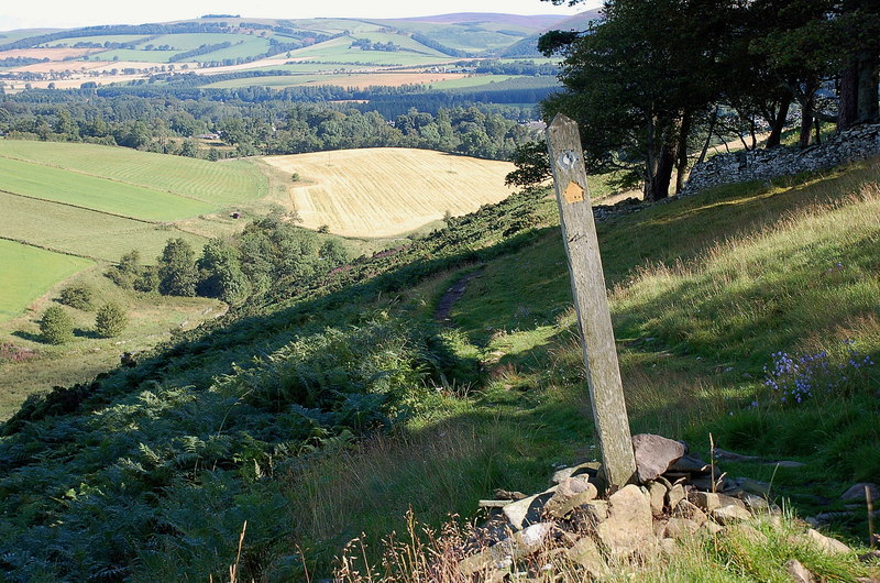
Nature enthusiasts will find plenty to explore in the vicinity of Addinston. The village is situated close to the Southern Upland Way, a popular long-distance walking trail that stretches across Scotland. The surrounding countryside offers ample opportunities for hiking, cycling, and bird-watching.

While Addinston may be a peaceful retreat, it is within easy reach of larger towns such as Dunbar and Berwick-upon-Tweed, which provide additional amenities and services. With its idyllic setting and strong sense of community, Addinston offers a charming and welcoming place to call home.

If you have any feedback on the listing, please let us know in the comments section below.

Addinston Images

Images are sourced within 2km of 55.767946/-2.7666037 or Grid Reference NT5253. Thanks to Geograph Open Source API. All images are credited.

Caravan park, Carfraemill
The Lodge at Carfraemill
Fields by Kelphope Burn Viewed from near The Lodge, Carfrae Mill.
Fields by Kelphope Burn
Viewed from near The Lodge, Carfrae Mill.
Access to Thimble Ha' With A687 to Greenlaw alongside on left.
Access to Thimble Ha'
With A687 to Greenlaw alongside on left.
A farm track near Carfraemill
Marquee at The Lodge, Carfraemill May Day weekend 2011.
Marquee at The Lodge, Carfraemill
May Day weekend 2011.
Flowering tree In 'The Lodge' car park at Carfraemill.
Flowering tree
In 'The Lodge' car park at Carfraemill.
WB106:GR type wall box Manufactured by W.T.Allen & Co, London. Introduced in 1936 at the start of the reign of George VI. See <span class="nowrap"><a title="http://en.wikipedia.org/wiki/Wall_box" rel="nofollow ugc noopener" href="http://en.wikipedia.org/wiki/Wall_box">Link</a><img style="margin-left:2px;" alt="External link" title="External link - shift click to open in new window" src="https://s1.geograph.org.uk/img/external.png" width="10" height="10"/></span> . This one is mounted on the wall of 'The Lodge' at Carfraemill.
WB106:GR type wall box
Manufactured by W.T.Allen & Co, London. Introduced in 1936 at the start of the reign of George VI. See LinkExternal link . This one is mounted on the wall of 'The Lodge' at Carfraemill.
A697 at Carfraemill Trunk road between Edinburgh and Newcastle-upon-Tyne.
A697 at Carfraemill
Trunk road between Edinburgh and Newcastle-upon-Tyne.
Longcroft Looking downstream along the Cleekhimin Burn from the farming community of Longcroft.
Longcroft
Looking downstream along the Cleekhimin Burn from the farming community of Longcroft.
West side of Lylestone Hill Farmland at the mouth of one of the Lammermuir glens.
West side of Lylestone Hill
Farmland at the mouth of one of the Lammermuir glens.
Track, Longhope Track up a Lammermuir glen.
Track, Longhope
Track up a Lammermuir glen.
Cleekhimin Burn The burn shows signs of previous spates.
Cleekhimin Burn
The burn shows signs of previous spates.
Carfraemill Hotel north of Lauder in Berwickshire
A roundabout on the A68 with the A697
Wiselawmill Farm sign A farm sign by the A 68 with a rugby ball.
Wiselawmill Farm sign
A farm sign by the A 68 with a rugby ball.
Farmland near Wiselawmill This stubble field with round bales is on the east side of the A68.
Farmland near Wiselawmill
This stubble field with round bales is on the east side of the A68.
Show me another place!

Addinston is located at Grid Ref: NT5253 (Lat: 55.767946, Lng: -2.7666037)

Unitary Authority: The Scottish Borders

Police Authority: The Lothians and Scottish Borders

What 3 Words

///bicker.gone.wound. Near Lauder, Scottish Borders

Nearby Locations

Addinston

Related Wikis

Addinston

Addinston is a farming village, off the A697, close to the Carfraemill roundabout, with two hill forts and settlements, in Lauderdale in the Scottish...

Oxton railway station

Oxton railway station served the village of Oxton, Scottish Borders, Scotland, from 1901 to 1958 on the Lauder Light Railway. == History == The station...

Oxton, Scottish Borders

Oxton is a small rural village in the Scottish Borders area of Scotland, just off the A68. It is 4+1⁄2 miles (7 kilometres) north of Lauder, and 20 mi...

Carfrae Bastle

Carfrae Bastle is a small ruined tower house about 5 miles (8.0 km) north of Lauder, Scottish Borders, Scotland, near Hillhouse == History == Carfrae Bastle...

Channelkirk

Channelkirk is a parish and community council area in the north-west corner of the historic county of Berwickshire in the Scottish Borders area of Scotland...

Lauderdale

Lauderdale is the valley of the Leader Water (a tributary of the Tweed) in the Scottish Borders. It contains the town of Lauder, as well as Earlston. The...

Lauder railway station

Lauder railway station served the town of Lauder, Berwickshire, Scotland, from 1901 to 1958. It was situated on the Lauder Light Railway. == History... ==

Thirlestane Castle

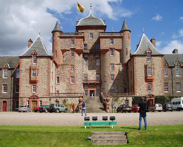
Thirlestane Castle is a castle set in extensive parklands near Lauder in the Borders of Scotland. The site is aptly named Castle Hill, as it stands upon...

Nearby Amenities

Located within 500m of 55.767946,-2.7666037
Addinston
Place: hamlet
Wikidata: Q4681196
Wikipedia: en:Addinston
Lat/Long: 55.7687799/-2.7644524
Passing Place
Lat/Long: 55.7645637/-2.761591
Power: pole
Lat/Long: 55.7663457/-2.7603773
Power: pole
Lat/Long: 55.7656339/-2.760728
Power: pole
Lat/Long: 55.769475/-2.761529
Power: pole
Lat/Long: 55.7689811/-2.7600783
Power: pole
Lat/Long: 55.7685244/-2.7587396
Power: pole
Lat/Long: 55.7699174/-2.7628601
Power: pole
Lat/Long: 55.7702839/-2.7639469
Power: pole
Lat/Long: 55.7706604/-2.7650311
Power: pole
Lat/Long: 55.7707263/-2.7663367
Power: pole
Lat/Long: 55.7698673/-2.7651227
Power: pole
Lat/Long: 55.769611/-2.7651354
Power: pole
Lat/Long: 55.7708036/-2.7676169
Power: pole
Lat/Long: 55.7708752/-2.7690498
Power: pole
Lat/Long: 55.7709539/-2.7705335
Power: pole
Lat/Long: 55.7710384/-2.772058
Power: pole
Lat/Long: 55.7669294/-2.7595871
Power: pole
Lat/Long: 55.7676797/-2.7587243
The data included in this document is from www.openstreetmap.org. The data is made available under ODbL.

Have you been to Addinston?

Leave your review of Addinston below (or comments, questions and feedback).