Rhippinllwyd

Settlement in Cardiganshire

Wales

Rhippinllwyd

Ordnance Survey Cut Mark This OS cut mark can be found on the roadside barn at Allt y cordde Farm. It marks a point 131.461m above mean sea level.
Ordnance Survey Cut Mark Credit: Adrian Dust

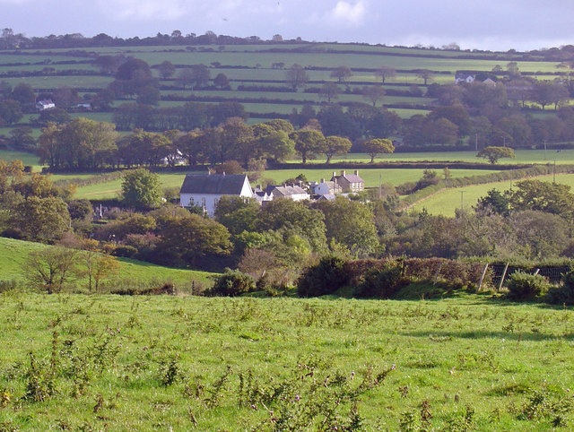
Rhippinllwyd is a small village located in the county of Cardiganshire, Wales. Situated in the beautiful countryside, it is surrounded by rolling hills and lush green fields. The village is known for its picturesque charm and tranquility, making it an ideal destination for those seeking a peaceful retreat.

The village is home to a close-knit community, with a population of around 200 residents. The locals are known for their warm hospitality and strong sense of community spirit. Rhippinllwyd has a rich history, with evidence of human habitation dating back to ancient times. There are several historic sites in the area, including old churches and ancient burial mounds, which attract history enthusiasts and tourists alike.

Despite its small size, Rhippinllwyd offers a range of amenities and services to its residents. The village has a primary school, a small shop, and a community hall that hosts various events throughout the year. Additionally, there are several walking and hiking trails in the surrounding countryside, allowing visitors to explore the natural beauty of the area.

The village is well-connected to the rest of Cardiganshire, with good transport links to nearby towns and cities. It is located a short distance from the coast, offering easy access to beautiful beaches and seaside resorts. Rhippinllwyd is a hidden gem in Cardiganshire, offering a peaceful and idyllic lifestyle surrounded by stunning natural landscapes.

If you have any feedback on the listing, please let us know in the comments section below.
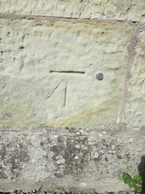
Rhippinllwyd Images

Images are sourced within 2km of 52.122102/-4.484604 or Grid Reference SN3050. Thanks to Geograph Open Source API. All images are credited.

Ordnance Survey Cut Mark This OS cut mark can be found on the roadside barn at Allt y cordde Farm. It marks a point 131.461m above mean sea level.
Ordnance Survey Cut Mark
This OS cut mark can be found on the roadside barn at Allt y cordde Farm. It marks a point 131.461m above mean sea level.
Ordnance Survey Cut Mark This OS cut mark can be found on the end of the north parapet of the bridge. It marks a point 114.722m above mean sea level.
Ordnance Survey Cut Mark
This OS cut mark can be found on the end of the north parapet of the bridge. It marks a point 114.722m above mean sea level.
Corbalengi Stone Standing stone with the Roman inscription 'CORBALENGI IACIT ORDOVS' which translates to here lies Corbalengi the Ordovician. <span class="nowrap"><a title="https://www.megalithic.co.uk/article.php?sid=11054" rel="nofollow ugc noopener" href="https://www.megalithic.co.uk/article.php?sid=11054">Link</a><img style="margin-left:2px;" alt="External link" title="External link - shift click to open in new window" src="https://s1.geograph.org.uk/img/external.png" width="10" height="10"/></span>
Corbalengi Stone
Standing stone with the Roman inscription 'CORBALENGI IACIT ORDOVS' which translates to here lies Corbalengi the Ordovician. LinkExternal link
A sweep of the A487 road Between Blaenporth and Sarnau.
A sweep of the A487 road
Between Blaenporth and Sarnau.
A487 at Bwlchcrwys
A487 at Bwlchcrwys
Ordnance Survey Trig Pillar S5813 This pillar can be found in the middle of waste land that used to be Pwntan Quarry.
Ordnance Survey Trig Pillar S5813
This pillar can be found in the middle of waste land that used to be Pwntan Quarry.
Ordnance Survey Flush Bracket S7793 This can be found on the wall of Pwntan Mawr Farm House.
For more detail see : <span class="nowrap"><a title="http://www.bench-marks.org.uk/bm15263" rel="nofollow ugc noopener" href="http://www.bench-marks.org.uk/bm15263">Link</a><img style="margin-left:2px;" alt="External link" title="External link - shift click to open in new window" src="https://s1.geograph.org.uk/img/external.png" width="10" height="10"/></span>
Ordnance Survey Flush Bracket S7793
This can be found on the wall of Pwntan Mawr Farm House. For more detail see : LinkExternal link
Fronlwyd from B4333 South of Tan-y-groes
Fronlwyd from B4333
South of Tan-y-groes
Beulah market and boot sale entrance From B4333
Beulah market and boot sale entrance
From B4333
Betws Ifan road approaching wooded area This is the road from the B4333
Betws Ifan road approaching wooded area
This is the road from the B4333
Minor road approaching Betws Ifan Although the sign says Betws Ifan it is Penton Betws
Minor road approaching Betws Ifan
Although the sign says Betws Ifan it is Penton Betws
Road junction and phone box at Penlon Betws
Gaer Pwntan Parked below house of Preston North End supporter then used good marked footpath to access Pwntan Quarry trig at the summit.
Name: Gaer Pwntan
Hill number: 15361
Height:225m / 738ft
Parent (Ma/M): 2221  Rhos Ymryson
Section:31C: South-West Wales
County/UA: Cardiganshire [Ceredigion] (CoU)
Class: Tump (200-299m)
Grid ref:SN291493 (est)
Drop: 41m
Col:184m  SN313508
Gaer Pwntan
Parked below house of Preston North End supporter then used good marked footpath to access Pwntan Quarry trig at the summit. Name: Gaer Pwntan Hill number: 15361 Height:225m / 738ft Parent (Ma/M): 2221 Rhos Ymryson Section:31C: South-West Wales County/UA: Cardiganshire [Ceredigion] (CoU) Class: Tump (200-299m) Grid ref:SN291493 (est) Drop: 41m Col:184m SN313508
Ordnance Survey 1GL Bolt This OS Bolt can be found on the SE face of the Methodist Chapel. It marks a point 183.318m above mean sea level. <a title="https://www.geograph.org.uk/photo/4668516" href="https://www.geograph.org.uk/photo/4668516">Link</a>
Ordnance Survey 1GL Bolt
This OS Bolt can be found on the SE face of the Methodist Chapel. It marks a point 183.318m above mean sea level. Link
Methodist Chapel There is an OS Bolt on the SE face of the chapel. <a title="https://www.geograph.org.uk/photo/4668510" href="https://www.geograph.org.uk/photo/4668510">Link</a>
Methodist Chapel
There is an OS Bolt on the SE face of the chapel. Link
NW to Cardigan Bay from A487 near Tan-y-Groes Out of sight by the sea is the village of Tresaith, a mile or so east of Aberporth.
NW to Cardigan Bay from A487 near Tan-y-Groes
Out of sight by the sea is the village of Tresaith, a mile or so east of Aberporth.
Internal Fire Museum of Power - Browett, Lindley steam engine Inverted vertical compound enclosed engine by Browett, Lindley, Works No. 2253, built 1913 and installed in HMS Tiger. It drives a Rees Roturbo 200 kW dynamo. The ship fought in the battles of Dogger Bank and Jutland, and survived. The vessel was scrapped in 1932 and the engine used at Storthes Hall Hospital, Huddersfield. The engine was latterly on standby until 1982 and was acquired by the National Maritime Museum and kept in store. It came to Internal Fire in 2017 and is now steamable but waiting for more boiler capacity.

Internal Fire was set up as a museum of the internal combustion engine but has branched into external combustion engines in the form of steam engines. This is in the first steam hall and is one of several significant items.
Internal Fire Museum of Power - Browett, Lindley steam engine
Inverted vertical compound enclosed engine by Browett, Lindley, Works No. 2253, built 1913 and installed in HMS Tiger. It drives a Rees Roturbo 200 kW dynamo. The ship fought in the battles of Dogger Bank and Jutland, and survived. The vessel was scrapped in 1932 and the engine used at Storthes Hall Hospital, Huddersfield. The engine was latterly on standby until 1982 and was acquired by the National Maritime Museum and kept in store. It came to Internal Fire in 2017 and is now steamable but waiting for more boiler capacity. Internal Fire was set up as a museum of the internal combustion engine but has branched into external combustion engines in the form of steam engines. This is in the first steam hall and is one of several significant items.
Internal Fire Museum of Power - Willans central valve engine The Willans engine was a compact high speed design that could be direct coupled to a generator and revolutionised electrical generation. For a time it was the dominant design and it is claimed that in 1892 68% of all electricity generation was by Willans engines. However, they were progressively ousted by double acting, pressure lubricated high speed engines and then by turbines. The Willans Works moved to turbine production and thus stayed afloat and turbines are still made there today; in a works dating in part from 1897.

This engine was built in 1901 and returned to the works in 1957 for preservation. It is a three crank engine with compound cylinders on each crank and developing 140 horsepower at 360 rpm and direct coupled to a dynamo with an open commutator, It came to Internal Fire in 2017 and will turn on steam but is awaiting a bigger boiler. Also see - <a href="https://www.geograph.org.uk/photo/2698928">SP4975 : Alstom, Rugby - Engineering Heritage Award</a>.
Internal Fire Museum of Power - Willans central valve engine
The Willans engine was a compact high speed design that could be direct coupled to a generator and revolutionised electrical generation. For a time it was the dominant design and it is claimed that in 1892 68% of all electricity generation was by Willans engines. However, they were progressively ousted by double acting, pressure lubricated high speed engines and then by turbines. The Willans Works moved to turbine production and thus stayed afloat and turbines are still made there today; in a works dating in part from 1897. This engine was built in 1901 and returned to the works in 1957 for preservation. It is a three crank engine with compound cylinders on each crank and developing 140 horsepower at 360 rpm and direct coupled to a dynamo with an open commutator, It came to Internal Fire in 2017 and will turn on steam but is awaiting a bigger boiler. Also see - SP4975 : Alstom, Rugby - Engineering Heritage Award.
Show me another place!

Rhippinllwyd is located at Grid Ref: SN3050 (Lat: 52.122102, Lng: -4.484604)

Unitary Authority: Ceredigion

Police Authority: Dyfed Powys

What 3 Words

///instead.purse.comb. Near Aberporth, Ceredigion

Related Wikis

Castell Nadolig

Castell Nadolig ("Christmas Castle") is an Iron Age hillfort, about 2.5 miles (4 km) east of the village of Aberporth and about 1 mile (2 km) south of...

Tan-y-groes

Tan-y-groes (or Tanygroes) is a hamlet in the community of Penbryn, Ceredigion, Wales, which is 11 km (7 mi) east of Cardigan on the A487 trunk road....

Dyffryn-bern

Dyffryn-bern is a small village in the community of Penbryn, Ceredigion, Wales, which is 72.4 miles (116.5 km) from Cardiff and 191.8 miles (308.6 km...

Penbryn

Penbryn (grid reference SN296520) is a small coastal village and community in Ceredigion, Wales, about 8 miles (13 km) from Cardigan. == History == �...

Glynarthen

Glynarthen is a small village located in Ceredigion, Wales. It is part of the community of Penbryn, along with the neighbouring villages of Brynhoffnant...

Llain-wen

Llain-wen is a hamlet in the community of Penbryn, Ceredigion, Wales, which is 71.9 miles (115.7 km) from Cardiff and 191.9 miles (308.8 km) from London...

Penmorfa

Penmorfa is the name of two villages in Wales. One is a small village in the community of Penbryn, Ceredigion, Wales. Penmorfa is represented in the Senedd...

Tŷ-llwyd

Tŷ-llwyd is an old mansion and estate in the community of Beulah, Ceredigion, Wales, which is 71.4 miles (114.8 km) from Cardiff and 191.4 miles (308...

Nearby Amenities

Located within 500m of 52.122102,-4.484604
Ele: 212
Natural: peak
Lat/Long: 52.1254601/-4.4867746
Natural: spring
Lat/Long: 52.1252974/-4.4877129
Power: pole
Lat/Long: 52.1232709/-4.4784737
Power: pole
Lat/Long: 52.1225842/-4.4799167
Power: pole
Lat/Long: 52.1219008/-4.4812632
Power: pole
Lat/Long: 52.1213672/-4.4823816
Power: pole
Lat/Long: 52.1206393/-4.4839159
Power: pole
Lat/Long: 52.1201518/-4.4848761
Power: pole
Lat/Long: 52.1195252/-4.4861716
Power: pole
Lat/Long: 52.1188944/-4.4874859
Power: pole
Lat/Long: 52.1185535/-4.4890563
The data included in this document is from www.openstreetmap.org. The data is made available under ODbL.

Have you been to Rhippinllwyd?

Leave your review of Rhippinllwyd below (or comments, questions and feedback).