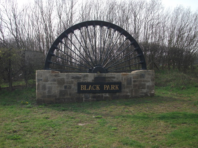
Black Park

Settlement in Denbighshire

Wales

Black Park

Hemmed in by roads A small field west of Halton created by the building of the A5 and its slip road.
Hemmed in by roads Credit: John H Darch

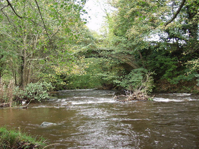
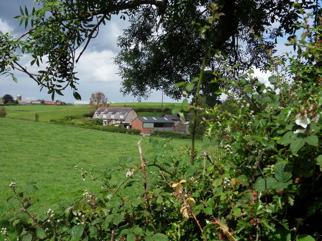
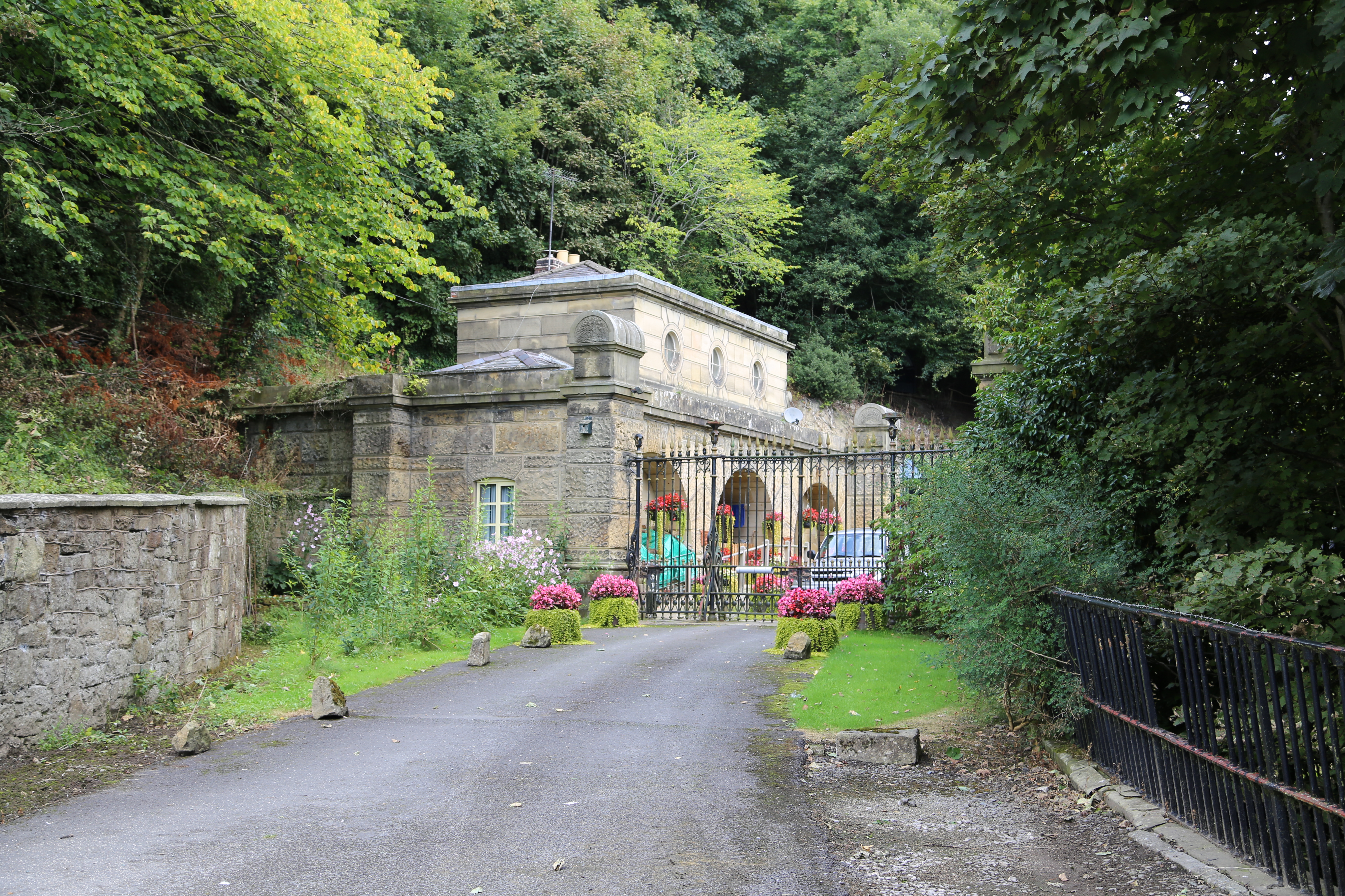
Black Park is a picturesque village located in Denbighshire, Wales. Situated in the Vale of Clwyd, this rural settlement is surrounded by stunning rolling hills and vast green pastures. The village is nestled within the Clwydian Range Area of Outstanding Natural Beauty, offering breathtaking views and a tranquil atmosphere.

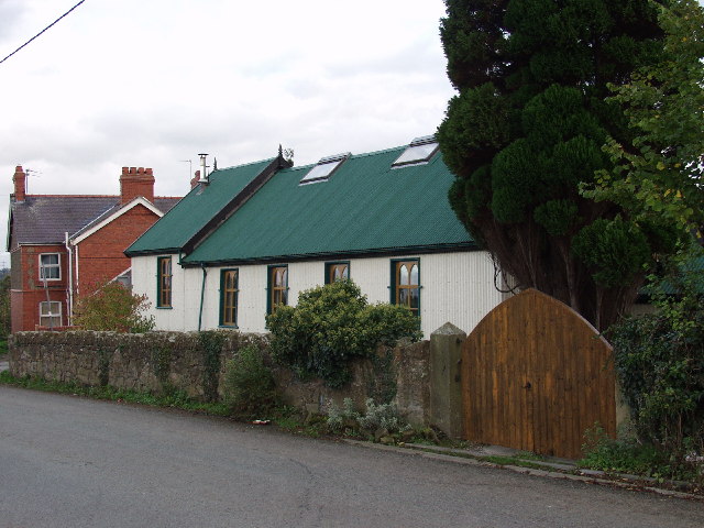
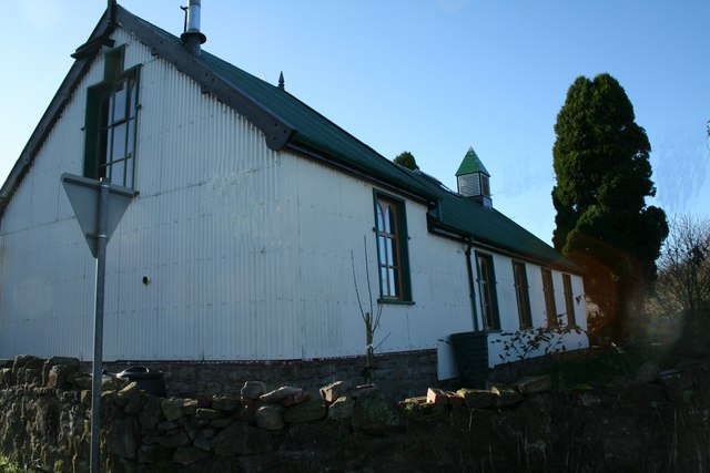
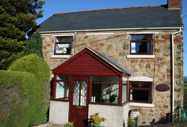
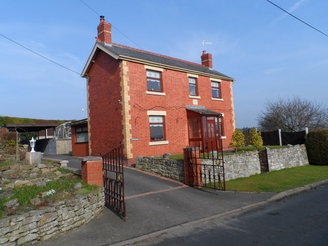
Black Park is known for its charming historic buildings, with many dating back several centuries. The village is home to a number of traditional Welsh stone cottages, giving it a timeless and quaint feel. The local community takes great pride in preserving the village's heritage, and the buildings are well-maintained, adding to the village's charm.

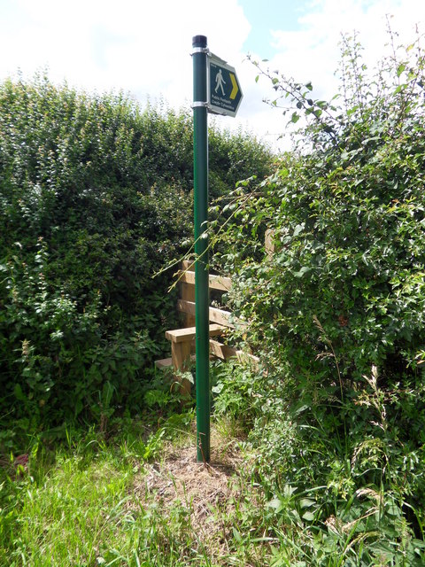
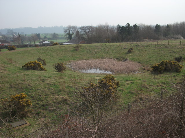
The area is a haven for outdoor enthusiasts, with numerous walking and hiking trails crisscrossing the surrounding countryside. The Clwydian Range offers a variety of routes for all abilities, from leisurely strolls to more challenging hikes, providing opportunities to explore the stunning natural landscapes.

Black Park is also home to a vibrant community, with a local pub and a small shop catering to the needs of residents and visitors. The village hosts various events throughout the year, including agricultural shows and summer fairs, which bring the community together and attract visitors from near and far.

Overall, Black Park is a hidden gem in Denbighshire, offering a peaceful and idyllic setting, rich in natural beauty and historical charm. It is a place where visitors can immerse themselves in the tranquility of the Welsh countryside and experience the warmth and hospitality of the local community.

If you have any feedback on the listing, please let us know in the comments section below.
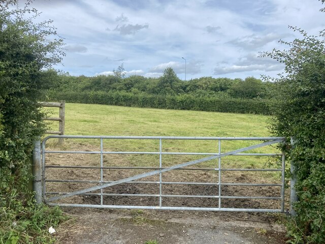
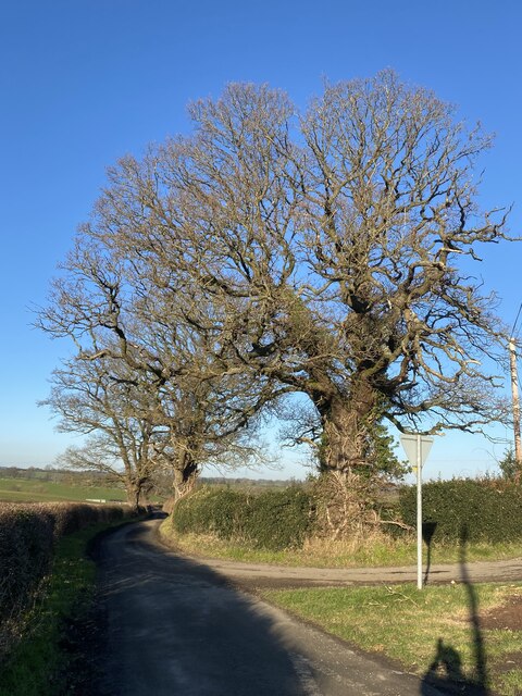
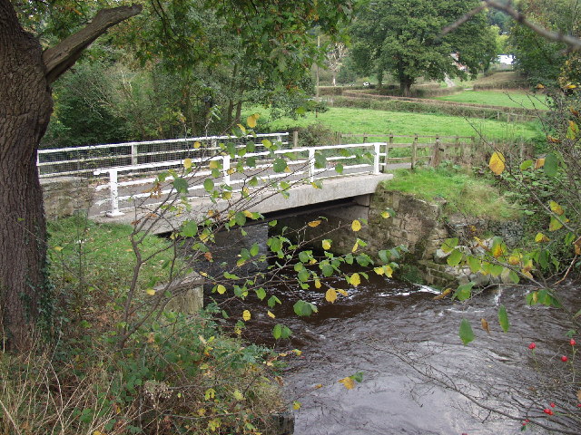
Black Park Images

Images are sourced within 2km of 52.952791/-3.0433537 or Grid Reference SJ3040. Thanks to Geograph Open Source API. All images are credited.

Hemmed in by roads A small field west of Halton created by the building of the A5 and its slip road.
Hemmed in by roads
A small field west of Halton created by the building of the A5 and its slip road.
Early 19th-Century house on the Brynkinalt Estate
Trees at junction of country roads
Tin Chapel at Halton This redundant "Tin Chapel" (which is a listed building) has been converted to a wonderful home. The basic structure has been enhanced by sympathetic window openings and although out of style the roof lights for the added first floor do not look out of place. I think this is because some "Tin Chapels" do have roof vents.
Tin Chapel at Halton
This redundant "Tin Chapel" (which is a listed building) has been converted to a wonderful home. The basic structure has been enhanced by sympathetic window openings and although out of style the roof lights for the added first floor do not look out of place. I think this is because some "Tin Chapels" do have roof vents.
Pont Llygoden - number 1 bridge on  Afon Ceiriog Pont Llygoden ("Mouse Bridge") - the first bridge over Afon Ceiriog at Ddol. It is about 400m from the confluence of Afon Dyfrdwy (the River Dee) and Afon Ceiriog and right on the Welsh border. The far side of the bridge is in England, North Shropshire District.
Pont Llygoden - number 1 bridge on Afon Ceiriog
Pont Llygoden ("Mouse Bridge") - the first bridge over Afon Ceiriog at Ddol. It is about 400m from the confluence of Afon Dyfrdwy (the River Dee) and Afon Ceiriog and right on the Welsh border. The far side of the bridge is in England, North Shropshire District.
Pont-y-blew bridge over Afon Ceiriog Wonderful traditional built sandstone bridge which has reinforced concrete slab laid on top of the arch. The traditional and probably original stone side walls fitted to the top. The stone dressing marks can still be seen on these slabs of stone, which are approx. 150mm thick.
Pont-y-blew bridge over Afon Ceiriog
Wonderful traditional built sandstone bridge which has reinforced concrete slab laid on top of the arch. The traditional and probably original stone side walls fitted to the top. The stone dressing marks can still be seen on these slabs of stone, which are approx. 150mm thick.
House and outbuildings near Chirk Tucked in behind the wood this house must be baffled from some of the A 5 T road which is behind the wood.
House and outbuildings near Chirk
Tucked in behind the wood this house must be baffled from some of the A 5 T road which is behind the wood.
Tin Tabernacle One of the many corrugated iron chapels which are fast disappearing, but not in this case, having been sympathetically converted to private residence.
Tin Tabernacle
One of the many corrugated iron chapels which are fast disappearing, but not in this case, having been sympathetically converted to private residence.
Another sympathetic conversion. This fine stone cottage was the Post Office at Halton now " Old Post Office " cottage.
Another sympathetic conversion.
This fine stone cottage was the Post Office at Halton now " Old Post Office " cottage.
Green Lane Minor road leading to Halton, near Wrexham.
Green Lane
Minor road leading to Halton, near Wrexham.
Llwybr Cyhoeddus Public footpath leading to Lower Halton.
Llwybr Cyhoeddus
Public footpath leading to Lower Halton.
Lower Halton View across fields towards Lower Halton Farm, near Chirk.
Lower Halton
View across fields towards Lower Halton Farm, near Chirk.
Black Park village sign This is one of several "colliery" community signs that have been commissioned to commemorate the North East Wales coalfield. Erected beside the entrance to a 24 hour McDonald's, perhaps showing how the area has moved from primary industries to the service sector.
<a href="https://www.geograph.org.uk/photo/2863648">SJ2946 : Rhosllannerchrugog village sign</a>
<a href="https://www.geograph.org.uk/photo/2863709">SJ2943 : Rhiwabon village sign</a>
Black Park village sign
This is one of several "colliery" community signs that have been commissioned to commemorate the North East Wales coalfield. Erected beside the entrance to a 24 hour McDonald's, perhaps showing how the area has moved from primary industries to the service sector. SJ2946 : Rhosllannerchrugog village sign SJ2943 : Rhiwabon village sign
Storm drain pond This pond will accept water from the storm drains of the roads, roundabouts and car parks nearby. The water will then be slowly released so as to avoid erosion of local ditches.
Storm drain pond
This pond will accept water from the storm drains of the roads, roundabouts and car parks nearby. The water will then be slowly released so as to avoid erosion of local ditches.
A house called Winterfield Winterfield was built in 1912 of local Ruabon red and yellow bricks and still has a view across the nearby fields.
A house called Winterfield
Winterfield was built in 1912 of local Ruabon red and yellow bricks and still has a view across the nearby fields.
Grazing fields north of Ddol Farm Which is almost hidden in the centre of the picture
Grazing fields north of Ddol Farm
Which is almost hidden in the centre of the picture
Grazing field leading towards the River Dee The woodland in the distance is on the other side of the River Dee
Grazing field leading towards the River Dee
The woodland in the distance is on the other side of the River Dee
Grazing field beside the River Dee Coedleoedd-isaf is hidden behind trees on the other side of the river
Grazing field beside the River Dee
Coedleoedd-isaf is hidden behind trees on the other side of the river
Show me another place!

Black Park is located at Grid Ref: SJ3040 (Lat: 52.952791, Lng: -3.0433537)

Unitary Authority: Wrexham

Police Authority: North Wales

What 3 Words

///reporter.firewall.unzips. Near Chirk, Wrexham

Related Wikis

River Eitha

The River Eitha (Welsh: Afon Eitha) is a small river in Wrexham County Borough, Wales. It is part of the River Dee catchment. Its name was probably derived...

Chirk Community Hospital

Chirk Community Hospital (Welsh: Ysbyty Cymuned Y Waun) is a community hospital in Chirk, Wales. It is managed by the Betsi Cadwaladr University Health...

Whitehurst Halt railway station

Whitehurst Halt was a small railway station located on the Shrewsbury to Chester Line about a mile and a half north of Chirk in Wales, immediately on the...

Waking the Dragon

Waking the Dragon (Welsh: Deffro'r Ddraig) is a proposed bronze sculpture which is intended to be built near Wrexham, North Wales. The original idea, made...

Cefn Viaduct, Wrexham

The Cefn (Newbridge) Viaduct is Grade II* listed railway viaduct across the River Dee between Cefn and Chirk communities in Wrexham County Borough, Wales...

Brynkinalt

Brynkinalt Hall (Welsh: Neuadd Bryncunallt; or simply Brynkinalt (Welsh: Bryncunallt)) is a Grade-II* listed private property, built in 1612, near Chirk...

Newbridge, Wrexham

Newbridge () is a village in Wrexham County Borough, Wales. The village is within the community of Cefn, to the south-east of Cefn Mawr. Newbridge is bounded...

Newbridge Lodge

Newbridge Lodge is a gatehouse to the Wynnstay estate near Ruabon, in Wrexham County Borough, North Wales. Designed by Charles Robert Cockerell in 1827...

Nearby Amenities

Located within 500m of 52.952791,-3.0433537
Post Box
Lat/Long: 52.9546105/-3.0406602
Black Park
Name Cy: Parc Du
Name En: Black Park
Place: village
Source: OS_OpenData_StreetView
Lat/Long: 52.9546687/-3.040974
Grit Bin
Lat/Long: 52.951041/-3.039958
Turning Circle
Source: Bing
Lat/Long: 52.9556412/-3.0396503
Access: no
Barrier: debris
Lat/Long: 52.9500266/-3.0417204
Give Way
Direction: backward
Lat/Long: 52.9510163/-3.0398548
Halton
Name Cy: Halton
Name En: Halton
Place: village
Wikidata: Q107033308
Lat/Long: 52.9511506/-3.039331
Direction: S
Generator Method: photovoltaic
Generator Output Electricity: yes
Generator Solar Modules: 4
Generator Source: solar
Generator Type: solar_photovoltaic_panel
Location: roof
Power: generator
Lat/Long: 52.9505449/-3.0393411
Direction: 180
Maxspeed: 20 mph
Traffic Sign: maxspeed
Lat/Long: 52.9530185/-3.0410885
The data included in this document is from www.openstreetmap.org. The data is made available under ODbL.

Have you been to Black Park?

Leave your review of Black Park below (or comments, questions and feedback).