Redhill

Settlement in Nottinghamshire Gedling

England

Redhill

Houses on Cromdale Close, Killisick At the bottom of one of several cul de sacs of this part of Howbeck Road.
Houses on Cromdale Close, Killisick Credit: Richard Vince

Redhill is a small village located in the county of Nottinghamshire, England. It is situated approximately 8 miles southwest of the city of Nottingham and lies within the Rushcliffe borough. The village is surrounded by picturesque countryside, offering residents and visitors a peaceful and rural atmosphere.

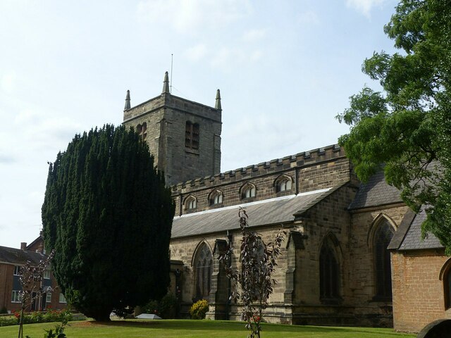
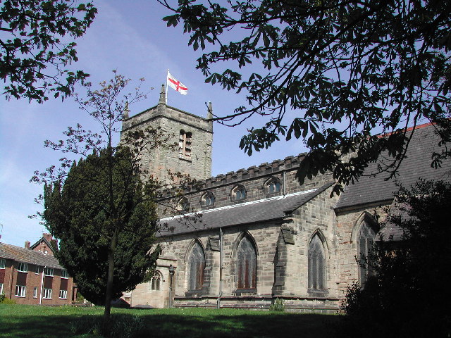
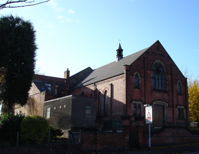
Redhill boasts a close-knit community, with a population of around 500 people. The village is known for its charming traditional architecture, including several historic cottages and farmhouses that date back to the 18th and 19th centuries. The village also features a small but well-maintained church, St. Luke's, which serves as a focal point for religious and community events.

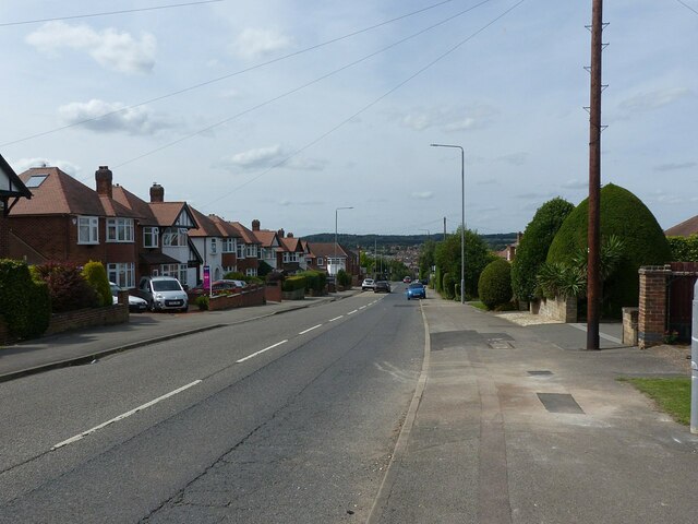
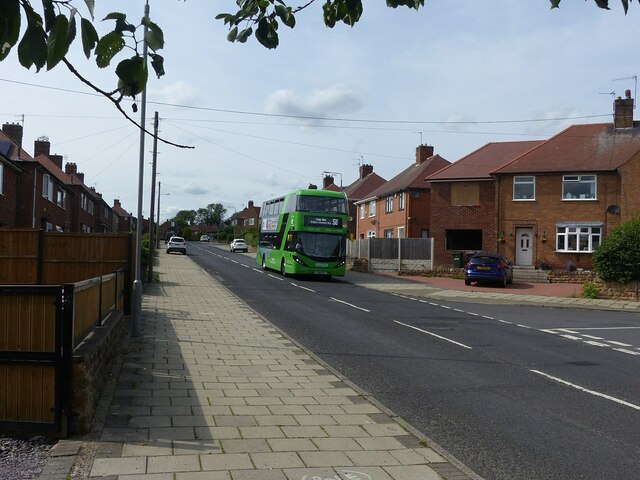
The village is well-connected to nearby towns and cities by road, with the A52 and A46 highways providing easy access. The nearby city of Nottingham offers a wide range of amenities, including shopping centers, restaurants, and leisure facilities.

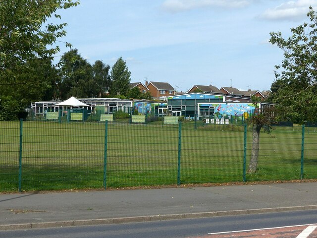
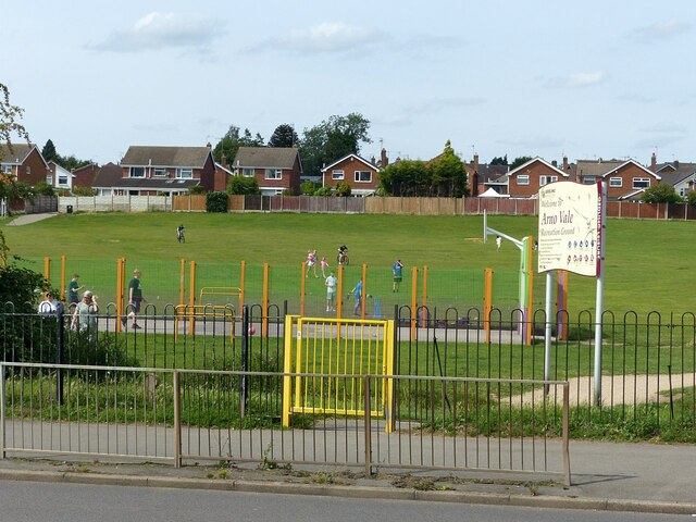
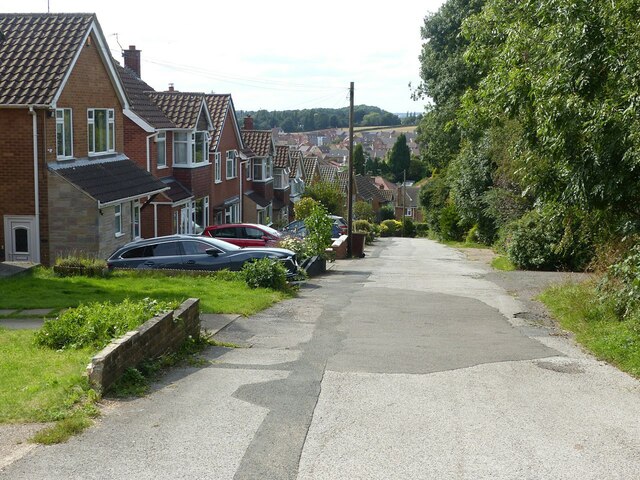
In terms of recreational activities, Redhill benefits from its proximity to the beautiful countryside of Nottinghamshire. The village is surrounded by rolling hills, lush green fields, and quaint woodland areas, making it a perfect location for outdoor pursuits such as walking, cycling, and horse riding.

Overall, Redhill is a charming and peaceful village, offering residents a tranquil and idyllic place to call home. With its close-knit community and easy access to nearby amenities, it is an ideal location for those seeking a rural lifestyle while still being within reach of urban conveniences.

If you have any feedback on the listing, please let us know in the comments section below.

Redhill Images

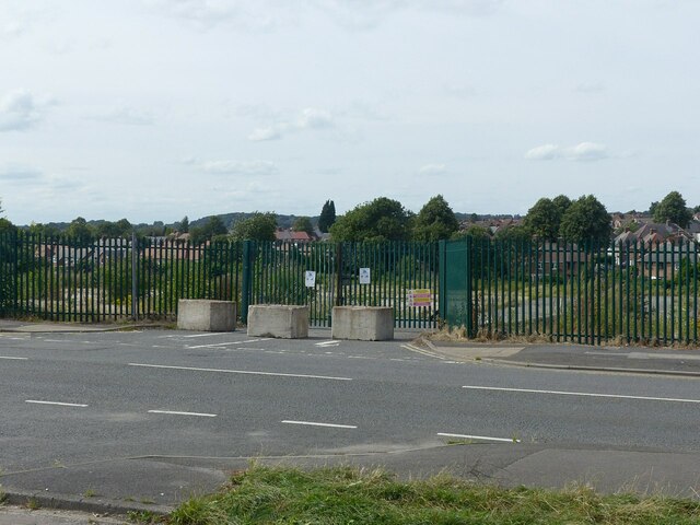
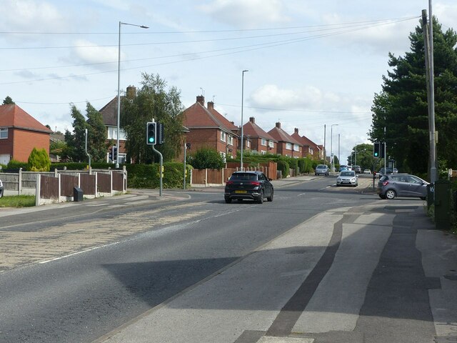
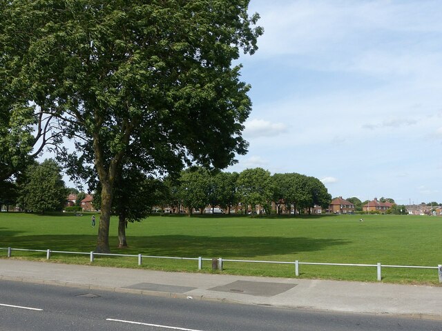
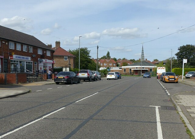
Images are sourced within 2km of 53.010833/-1.134011 or Grid Reference SK5846. Thanks to Geograph Open Source API. All images are credited.

Houses on Cromdale Close, Killisick At the bottom of one of several cul de sacs of this part of Howbeck Road.
Houses on Cromdale Close, Killisick
At the bottom of one of several cul de sacs of this part of Howbeck Road.
Howbeck Road, Killisick Looking towards Hamilton Close.
Howbeck Road, Killisick
Looking towards Hamilton Close.
Be Kind, Be Brave, Be Happy . . . . . . is the message on Woodthorpe Infant School.
Be Kind, Be Brave, Be Happy . . .
. . . is the message on Woodthorpe Infant School.
Arno Vale Recreation Ground Open space alongside Arno Vale Road.
Arno Vale Recreation Ground
Open space alongside Arno Vale Road.
Gedling Road, Arnold Part of the historic road network, with housing developed in the post-WW2 period.
Gedling Road, Arnold
Part of the historic road network, with housing developed in the post-WW2 period.
The Major Oak, Rolleston Drive 1960s pub, contemporary with the development of Rolleston Drive.
The Major Oak, Rolleston Drive
1960s pub, contemporary with the development of Rolleston Drive.
Ripe for new housing? This was the Nottinghamshire County Council's central workshops and Training Centre, closed around 2010 and demolished c.2016.
Ripe for new housing?
This was the Nottinghamshire County Council's central workshops and Training Centre, closed around 2010 and demolished c.2016.
Coppice Road at Howbeck Road Coppice Road was originally Spout Lane, before housing was developed in the area. Mapping from just before WW2 shows that there was a small development just around this cross-roads, clearly intended as the basis of later development, but delayed by the war. The style of housing is typical of local council estates.
Coppice Road at Howbeck Road
Coppice Road was originally Spout Lane, before housing was developed in the area. Mapping from just before WW2 shows that there was a small development just around this cross-roads, clearly intended as the basis of later development, but delayed by the war. The style of housing is typical of local council estates.
Killisick Recreation Ground Seen from Coppice Road.
Killisick Recreation Ground
Seen from Coppice Road.
Beechwood Road, Arnold Recreating this 'First' for the square <a title="https://www.geograph.org.uk/photo/35574" href="https://www.geograph.org.uk/photo/35574">Link</a> .

This was the main bus terminus in the area when I first came to Nottingham in the late 70s, but became redundant as a bus route following the development of the Killisick housing estate. Now the only bus service is the night service N58 which operates Friday and Saturday nights only.
Beechwood Road, Arnold
Recreating this 'First' for the square Link . This was the main bus terminus in the area when I first came to Nottingham in the late 70s, but became redundant as a bus route following the development of the Killisick housing estate. Now the only bus service is the night service N58 which operates Friday and Saturday nights only.
Lime line service 58 on Birchfield Road Service 58 is the principal service from Nottingham to the Arnold area, running at least every 10 minutes Monday to Saturday daytime. Seen here is one of Nottingham City Transport's large fleet of biogas-powered buses.
Lime line service 58 on Birchfield Road
Service 58 is the principal service from Nottingham to the Arnold area, running at least every 10 minutes Monday to Saturday daytime. Seen here is one of Nottingham City Transport's large fleet of biogas-powered buses.
Shergill Stores Local estate shop on Homefield Avenue.
Shergill Stores
Local estate shop on Homefield Avenue.
Footpath off Surgeys Lane The area has been retained as local open space.
Footpath off Surgeys Lane
The area has been retained as local open space.
Killisick Lane trig pillar Now surrounded by heavy vegetation.
Killisick Lane trig pillar
Now surrounded by heavy vegetation.
Flush bracket S4613, Killisick Lane trig pillar See <a title="https://www.geograph.org.uk/photo/6933247" href="https://www.geograph.org.uk/photo/6933247">Link</a> for location.
Flush bracket S4613, Killisick Lane trig pillar
See Link for location.
The top of Surgeys Lane 1970s housing along what was a traditional country lane.
The top of Surgeys Lane
1970s housing along what was a traditional country lane.
Surgeys Lane, Arnold, Notts Recreating this 'First' for the square <a title="https://www.geograph.org.uk/photo/34094" href="https://www.geograph.org.uk/photo/34094">Link</a> . The precise location, as indicated by the description of the original view, was naturally not accessible!
Surgeys Lane, Arnold, Notts
Recreating this 'First' for the square Link . The precise location, as indicated by the description of the original view, was naturally not accessible!
Arnold, Nottinghamshire Recreating this 'First' for the square <a title="https://www.geograph.org.uk/photo/32037" href="https://www.geograph.org.uk/photo/32037">Link</a> . The title is taken from the original; this is St Mary's Church, to be specific.
Arnold, Nottinghamshire
Recreating this 'First' for the square Link . The title is taken from the original; this is St Mary's Church, to be specific.
Show me another place!

Redhill is located at Grid Ref: SK5846 (Lat: 53.010833, Lng: -1.134011)

Administrative County: Nottinghamshire

District: Gedling

Police Authority: Nottinghamshire

What 3 Words

///code.truth.unless. Near Arnold, Nottinghamshire

Nearby Locations

Redhill

Related Wikis

Redhill, Nottinghamshire

Redhill () is a small community forming part of the much larger town of Arnold in Nottinghamshire, England. It is approximately 4 miles (6.4 km) north...

Redhill Academy

Redhill Academy is a secondary school and sixth form with academy status, situated on Redhill Road in Arnold, Nottinghamshire, England. The school has...

St Mary's Church, Arnold

St. Mary's Church is a parish church in Arnold, Nottinghamshire, England. Though there is no official founding date, it is estimated that the church dates...

Cross Street Baptist Church

Cross Street Baptist Church is on Cross Street in Arnold, Nottinghamshire. == History == The original Baptist chapel on this site was built in 1825 by...

Nearby Amenities

Located within 500m of 53.010833,-1.134011
Post Box
Collection Times: Mo-Fr 09:00; Sa 07:00
Post Box Type: pillar
Ref: NG5 415D
Royal Cypher: EIIR
Royal Cypher Wikidata: Q33102113
Lat/Long: 53.0075311/-1.137218
Turning Circle
Lat/Long: 53.0090371/-1.1385473
Turning Circle
Lat/Long: 53.0110491/-1.1382271
Post Box
Collection Times: Mo-Fr 09:00; Sa 07:00
Post Box Type: pillar
Ref: NG5 474
Royal Cypher: EIIR
Royal Cypher Wikidata: Q33102113
Lat/Long: 53.0097414/-1.1360469
Bus Stop
Henry Street
Bus: yes
Naptan AtcoCode: 3300GE0315
Naptan Bearing: NE
Naptan CommonName: Henry Street
Naptan Crossing: Henry Street
Naptan Indicator: adj
Naptan Landmark: Ram Inn
Naptan NaptanCode: ntsatdtj
Naptan Notes: none
Naptan PlusbusZoneRef: NTNG
Naptan Street: Mansfield Road
Naptan Verified: no
Public Transport: platform
Source: naptan_import
Lat/Long: 53.0123749/-1.1334847
Bus Stop
Henry Street
Bus: yes
Local Ref: GE0316
Naptan AtcoCode: 3300GE0316
Naptan Bearing: SW
Naptan CommonName: Henry Street
Naptan Crossing: Henry Street
Naptan Indicator: opp
Naptan Landmark: Ram Inn
Naptan NaptanCode: ntsatdtm
Naptan Notes: none
Naptan PlusbusZoneRef: NTNG
Naptan Street: Mansfield Road
Naptan Verified: yes
Public Transport: platform
Shelter: no
Source: naptan_import
Lat/Long: 53.0121695/-1.1333368
Bus Stop
Cemetery
Bus: yes
Naptan AtcoCode: 3300GE0428
Naptan Bearing: NE
Naptan CommonName: Cemetery
Naptan Indicator: adj
Naptan Landmark: Cemetery
Naptan NaptanCode: ntsapjpm
Naptan Notes: (This stop renumbered from 3300AR96)
Naptan PlusbusZoneRef: NTNG
Naptan Street: Mansfield Road
Naptan Verified: no
Public Transport: platform
Shelter: no
Source: naptan_import
Lat/Long: 53.0069949/-1.1378549
Bus Stop
Redhill Lodge Drive
Bus: yes
Local Ref: GE0429
Naptan AtcoCode: 3300GE0429
Naptan Bearing: NE
Naptan CommonName: Redhill Lodge Drive
Naptan Crossing: Redhill Lodge Drive
Naptan Indicator: adj
Naptan NaptanCode: ntsapjpt
Naptan Notes: (This stop renumbered from 3300AR97)
Naptan PlusbusZoneRef: NTNG
Naptan Street: Mansfield Road
Naptan Verified: yes
Public Transport: platform
Shelter: no
Source: naptan_import
Lat/Long: 53.0099107/-1.1358145
Bus Stop
Mansfield Road
Bus: yes
Local Ref: GE0430
Naptan AtcoCode: 3300GE0430
Naptan Bearing: SE
Naptan CommonName: Mansfield Road
Naptan Crossing: Mansfield Road
Naptan Indicator: SE-bound
Naptan NaptanCode: ntsapjpw
Naptan Notes: (This stop renumbered from 3300AR98)
Naptan PlusbusZoneRef: NTNG
Naptan Street: Redhill Road
Naptan Verified: yes
Public Transport: platform
Shelter: no
Source: naptan_import
Lat/Long: 53.0114825/-1.1331448
Bus Stop
Lodge Farm Lane
Bus: yes
Naptan AtcoCode: 3300GE0431
Naptan Bearing: SE
Naptan CommonName: Lodge Farm Lane
Naptan Crossing: Lodge Farm Lane
Naptan Indicator: adj
Naptan NaptanCode: ntsapjta
Naptan Notes: (This stop renumbered from 3300AR99)
Naptan PlusbusZoneRef: NTNG
Naptan Street: Redhill Road
Naptan Verified: no
Public Transport: platform
Source: naptan_import
Lat/Long: 53.0109112/-1.1312335
Bus Stop
Churchmoor Lane
Bus: yes
Naptan AtcoCode: 3300GE0432
Naptan Bearing: SE
Naptan CommonName: Churchmoor Lane
Naptan Crossing: Churchmoor Lane
Naptan Indicator: adj
Naptan NaptanCode: ntsapjtd
Naptan Notes: (This stop renumbered from 3300AR100)
Naptan PlusbusZoneRef: NTNG
Naptan Street: Mellors Road
Naptan Verified: no
Public Transport: platform
Source: naptan_import
Lat/Long: 53.0095672/-1.1293826
Bus Stop
Churchmoor Lane
Bus: yes
Local Ref: GE0433
Naptan AtcoCode: 3300GE0433
Naptan Bearing: NW
Naptan CommonName: Churchmoor Lane
Naptan Crossing: Churchmoor Lane
Naptan Indicator: opp
Naptan NaptanCode: ntsapjtg
Naptan Notes: (This stop renumbered from 3300AR101)
Naptan PlusbusZoneRef: NTNG
Naptan Street: Redhill Road
Naptan Verified: yes
Public Transport: platform
Shelter: yes
Source: naptan_import
Lat/Long: 53.0097693/-1.1299747
Bus Stop
Mansfield Road
Bus: yes
Local Ref: GE0434
Naptan AtcoCode: 3300GE0434
Naptan Bearing: NW
Naptan CommonName: Mansfield Road
Naptan Crossing: Mansfield Road
Naptan Indicator: NW-bound
Naptan NaptanCode: ntsatmjp
Naptan Notes: (This stop renumbered from 3300AR102)
Naptan PlusbusZoneRef: NTNG
Naptan Street: Redhill Road
Naptan Verified: yes
Public Transport: platform
Shelter: no
Source: naptan_import
Lat/Long: 53.0114762/-1.1335176
Bus Stop
Redhill Lodge Drive
Bus: yes
Local Ref: GE0435
Naptan AtcoCode: 3300GE0435
Naptan Bearing: S
Naptan CommonName: Redhill Lodge Drive
Naptan Crossing: Redhill Lodge Drive
Naptan Indicator: opp
Naptan NaptanCode: ntsatmjt
Naptan Notes: (This stop renumbered from 3300AR103)
Naptan PlusbusZoneRef: NTNG
Naptan Street: Mansfield Road
Naptan Verified: yes
Public Transport: platform
Shelter: no
Source: naptan_import
Lat/Long: 53.0092906/-1.1358418
Bus Stop
Cemetery
Bus: yes
Local Ref: GE0436
Naptan AtcoCode: 3300GE0436
Naptan Bearing: SW
Naptan CommonName: Cemetery
Naptan Indicator: opp
Naptan Landmark: Cemetery
Naptan NaptanCode: ntsatmjw
Naptan Notes: (This stop renumbered from 3300AR104)
Naptan PlusbusZoneRef: NTNG
Naptan Street: Mansfield Road
Naptan Verified: yes
Public Transport: platform
Shelter: yes
Source: naptan_import
Lat/Long: 53.0073957/-1.1373402
Entrance: main
Operator: Sizzling Pub Co
Lat/Long: 53.0122986/-1.1329878
Entrance: main
Lat/Long: 53.0093383/-1.1269749
Barrier: bollard
Lat/Long: 53.0074542/-1.1310765
Give Way
Direction: backward
Lat/Long: 53.0111038/-1.1345512
Barrier: bollard
Motor Vehicle: no
Lat/Long: 53.0091862/-1.1278352
Pub
Waggon & Horses
Addr City: Nottingham
Addr Housenumber: 260
Addr Postcode: NG5 8JY
Addr Street: Mansfield Road
Fhrs Id: 357093
Source Addr: Food Hygiene Open Data
Lat/Long: 53.0127017/-1.1327061
Redhill
Place: suburb
Source: OS OpenData StreetView;local knowledge
Wikidata: Q7305901
Wikipedia: en:Redhill, Nottinghamshire
Lat/Long: 53.0119416/-1.1310666
Turning Circle
Lat/Long: 53.0124098/-1.1271158
Crown Deepclean
Addr City: Nottingham
Addr Housename: 2
Addr Postcode: NG5 7BB
Addr Street: Goodwood Avenue
Office: yes
Source: survey
Lat/Long: 53.0064593/-1.133387
Kiln
Note: Second hand?
Shop: electronics
Source: survey
Lat/Long: 53.0064841/-1.1332919
NG Magazines
Addr Housename: 5A
Addr Street: Stanhope Crescent
Office: yes
Source: survey
Lat/Long: 53.00651/-1.1332181
Telephone
Booth: KX100
Source: survey
Lat/Long: 53.0063779/-1.1333761
Post Box
Collection Times: Mo-Fr 09:00; Sa 07:00
Post Box Type: pillar
Ref: NG5 196D
Royal Cypher: EIIR
Royal Cypher Wikidata: Q33102113
Source: survey
Lat/Long: 53.0064165/-1.1332705
Post Box
Collection Times: Mo-Fr 09:00; Sa 07:00
Post Box Type: pillar
Ref: NG5 417D
Royal Cypher: GVIR
Royal Cypher Wikidata: Q33102169
Source: survey
Lat/Long: 53.0096097/-1.1299187
Entrance: main
Lat/Long: 53.0097196/-1.1300963
Crossing
Crossing: traffic_signals
Source: survey
Lat/Long: 53.0097389/-1.1297515
Redhill Service Centre
Addr Street: Mansfield Road
Shop: car_repair
Lat/Long: 53.012009/-1.1331853
Crossing
Crossing: traffic_signals
Source: survey
Lat/Long: 53.009573/-1.135817
Give Way
Direction: forward
Lat/Long: 53.012216/-1.1333431
Access: yes
Door: yes
Entrance: main
Level: 0
Wheelchair: yes
Lat/Long: 53.0080247/-1.1313694
Barrier: bollard
Motor Vehicle: no
Lat/Long: 53.0083669/-1.1284989
Entrance: service
Lat/Long: 53.0094628/-1.1271664
Direction: SSW
Generator Method: photovoltaic
Generator Output Electricity: yes
Generator Solar Modules: 16
Generator Source: solar
Generator Type: solar_photovoltaic_panel
Location: roof
Power: generator
Lat/Long: 53.0129724/-1.1299278
Generator Method: photovoltaic
Generator Output Electricity: yes
Generator Source: solar
Generator Type: solar_photovoltaic_panel
Location: roof
Power: generator
Lat/Long: 53.0110655/-1.1368143
Direction: 190
Generator Method: photovoltaic
Generator Output Electricity: yes
Generator Solar Modules: 8
Generator Source: solar
Generator Type: solar_photovoltaic_panel
Location: roof
Power: generator
Lat/Long: 53.0098326/-1.1382198
Direction: SW
Generator Method: photovoltaic
Generator Output Electricity: yes
Generator Solar Modules: 12
Generator Source: solar
Generator Type: solar_photovoltaic_panel
Location: roof
Power: generator
Lat/Long: 53.0131629/-1.1289005
Direction: SSW
Generator Method: photovoltaic
Generator Output Electricity: yes
Generator Solar Modules: 18
Generator Source: solar
Generator Type: solar_photovoltaic_panel
Location: roof
Power: generator
Lat/Long: 53.0129962/-1.1300338
Direction: SSW
Generator Method: photovoltaic
Generator Output Electricity: yes
Generator Solar Modules: 16
Generator Source: solar
Generator Type: solar_photovoltaic_panel
Location: roof
Power: generator
Lat/Long: 53.0133472/-1.1301815
Direction: SSW
Generator Method: photovoltaic
Generator Output Electricity: yes
Generator Solar Modules: 14
Generator Source: solar
Generator Type: solar_photovoltaic_panel
Location: roof
Power: generator
Lat/Long: 53.0142728/-1.1292671
Direction: ESE
Generator Method: photovoltaic
Generator Output Electricity: yes
Generator Solar Modules: 18
Generator Source: solar
Generator Type: solar_photovoltaic_panel
Location: roof
Power: generator
Lat/Long: 53.013331/-1.1315852
Direction: SE
Generator Method: photovoltaic
Generator Output Electricity: yes
Generator Solar Modules: 16
Generator Source: solar
Generator Type: solar_photovoltaic_panel
Location: roof
Power: generator
Lat/Long: 53.0114369/-1.1276313
Direction: SSW
Generator Method: photovoltaic
Generator Output Electricity: yes
Generator Solar Modules: 13
Generator Source: solar
Generator Type: solar_photovoltaic_panel
Location: roof
Power: generator
Lat/Long: 53.0107844/-1.1317931
Generator Method: photovoltaic
Generator Output Electricity: yes
Generator Source: solar
Generator Type: solar_photovoltaic_panel
Location: roof
Power: generator
Lat/Long: 53.0125591/-1.1358038
Generator Method: photovoltaic
Generator Output Electricity: yes
Generator Source: solar
Generator Type: solar_photovoltaic_panel
Location: roof
Power: generator
Lat/Long: 53.0123856/-1.1362491
Direction: SSW
Generator Method: photovoltaic
Generator Output Electricity: yes
Generator Solar Modules: 18
Generator Source: solar
Generator Type: solar_photovoltaic_panel
Location: roof
Power: generator
Source: Bing
Lat/Long: 53.0106534/-1.137697
Generator Method: photovoltaic
Generator Output Electricity: yes
Generator Source: solar
Generator Type: solar_photovoltaic_panel
Location: roof
Power: generator
Lat/Long: 53.0105677/-1.1369277
Generator Method: photovoltaic
Generator Output Electricity: yes
Generator Source: solar
Generator Type: solar_photovoltaic_panel
Location: roof
Power: generator
Lat/Long: 53.0110091/-1.1365347
Generator Method: photovoltaic
Generator Output Electricity: yes
Generator Source: solar
Generator Type: solar_photovoltaic_panel
Location: roof
Power: generator
Lat/Long: 53.0092956/-1.1386979
Generator Method: photovoltaic
Generator Output Electricity: yes
Generator Source: solar
Generator Type: solar_photovoltaic_panel
Location: roof
Power: generator
Lat/Long: 53.0087875/-1.1384635
Generator Method: photovoltaic
Generator Output Electricity: yes
Generator Source: solar
Generator Type: solar_photovoltaic_panel
Location: roof
Power: generator
Lat/Long: 53.0075284/-1.1386728
Entrance: yes
Source: survey
Lat/Long: 53.0066606/-1.1315799
Entrance: yes
Source: survey
Lat/Long: 53.0067843/-1.1316165
Entrance: yes
Source: survey
Lat/Long: 53.0066677/-1.1311926
Addr City: Nottingham
Addr Housenumber: 64,66
Addr Postcode: NG5 7BG
Addr Street: Cross Street
Source: survey
Source Addr Postcode: code-point_open
Lat/Long: 53.0065469/-1.1317755
Addr City: Nottingham
Addr Housenumber: 60B,62B
Addr Postcode: NG5 7BG
Addr Street: Cross Street
Source: survey
Source Addr Postcode: code-point_open
Lat/Long: 53.0065711/-1.1316857
Addr City: Nottingham
Addr Housenumber: 60A,62A
Addr Postcode: NG5 7BG
Addr Street: Cross Street
Source: survey
Source Addr Postcode: code-point_open
Lat/Long: 53.0065961/-1.1315999
Addr City: Nottingham
Addr Housenumber: 60,62
Addr Postcode: NG5 7BG
Addr Street: Cross Street
Source: survey
Source Addr Postcode: code-point_open
Lat/Long: 53.006684/-1.1316441
Addr City: Nottingham
Addr Housenumber: 56,58
Addr Postcode: NG5 7BG
Addr Street: Cross Street
Source: survey
Source Addr Postcode: code-point_open
Lat/Long: 53.006743/-1.1316589
Addr City: Nottingham
Addr Housenumber: 56,58A
Addr Postcode: NG5 7BG
Addr Street: Cross Street
Source: survey
Source Addr Postcode: code-point_open
Lat/Long: 53.0068438/-1.1316883
Addr City: Nottingham
Addr Housenumber: 56B,58B
Addr Postcode: NG5 7BG
Addr Street: Cross Street
Source: survey
Source Addr Postcode: code-point_open
Lat/Long: 53.0068196/-1.1316052
Addr City: Nottingham
Addr Housenumber: 52A,54A
Addr Postcode: NG5 7BG
Addr Street: Cross Street
Source: survey
Source Addr Postcode: code-point_open
Lat/Long: 53.0066792/-1.1312807
Addr City: Nottingham
Addr Housenumber: 52,54
Addr Postcode: NG5 7BG
Addr Street: Cross Street
Source: survey
Source Addr Postcode: code-point_open
Lat/Long: 53.0067042/-1.1311801
Entrance: yes
Level: 0
Source: survey;aerial imagery
Lat/Long: 53.0069928/-1.1302351
Entrance: yes
Level: 0
Source: survey;aerial imagery
Lat/Long: 53.0071062/-1.1301426
Addr City: Nottingham
Addr Housenumber: 32,34B
Addr Postcode: NG5 7BL
Addr Street: Cross Street
Source: survey
Source Addr Postcode: code-point_open
Lat/Long: 53.0069777/-1.1303911
Addr City: Nottingham
Addr Housenumber: 32A,34A
Addr Postcode: NG5 7BL
Addr Street: Cross Street
Source: survey
Source Addr Postcode: code-point_open
Lat/Long: 53.0069366/-1.1303032
Addr City: Nottingham
Addr Housenumber: 32,34
Addr Postcode: NG5 7BL
Addr Street: Cross Street
Source: survey
Source Addr Postcode: code-point_open
Lat/Long: 53.0070152/-1.1302824
Addr City: Nottingham
Addr Housenumber: 28,30
Addr Postcode: NG5 7BL
Addr Street: Cross Street
Source: survey
Source Addr Postcode: code-point_open
Lat/Long: 53.0070919/-1.130218
Addr City: Nottingham
Addr Housenumber: 28A,30A
Addr Postcode: NG5 7BL
Addr Street: Cross Street
Source: survey
Source Addr Postcode: code-point_open
Lat/Long: 53.0071734/-1.130155
Addr City: Nottingham
Addr Housenumber: 28B,30B
Addr Postcode: NG5 7BL
Addr Street: Cross Street
Source: survey
Source Addr Postcode: code-point_open
Lat/Long: 53.007133/-1.1300772
Addr City: Nottingham
Addr Housenumber: 24,26
Addr Postcode: NG5 7BL
Addr Street: Cross Street
Source: survey
Source Addr Postcode: code-point_open
Lat/Long: 53.0071234/-1.1298707
Direction: ESE
Generator Method: photovoltaic
Generator Output Electricity: yes
Generator Solar Modules: 5
Generator Source: solar
Generator Type: solar_photovoltaic_panel
Location: roof
Power: generator
Source: Bing
Lat/Long: 53.0116911/-1.1287886
Direction: SSW
Generator Method: photovoltaic
Generator Output Electricity: yes
Generator Solar Modules: 5
Generator Source: solar
Generator Type: solar_photovoltaic_panel
Location: roof
Power: generator
Source: Bing
Lat/Long: 53.0116789/-1.1288417
Direction: SW
Generator Method: photovoltaic
Generator Output Electricity: yes
Generator Solar Modules: 4
Generator Source: solar
Generator Type: solar_photovoltaic_panel
Location: roof
Power: generator
Source: Bing
Lat/Long: 53.0102751/-1.1403524
Direction: SW
Generator Method: photovoltaic
Generator Output Electricity: yes
Generator Solar Modules: 6
Generator Source: solar
Generator Type: solar_photovoltaic_panel
Location: roof
Power: generator
Source: Bing
Lat/Long: 53.010256/-1.1403895
Direction: SW
Generator Method: photovoltaic
Generator Output Electricity: yes
Generator Solar Modules: 8
Generator Source: solar
Generator Type: solar_photovoltaic_panel
Location: roof
Power: generator
Source: Bing
Lat/Long: 53.0102421/-1.1397576
Direction: SE
Generator Method: photovoltaic
Generator Output Electricity: yes
Generator Solar Modules: 4
Generator Source: solar
Generator Type: solar_photovoltaic_panel
Location: roof
Power: generator
Source: Bing
Lat/Long: 53.0102291/-1.1396788
Direction: SSW
Generator Method: photovoltaic
Generator Output Electricity: yes
Generator Solar Modules: 16
Generator Source: solar
Generator Type: solar_photovoltaic_panel
Location: roof
Power: generator
Source: Bing
Lat/Long: 53.0103982/-1.1380817
Direction: SSE
Generator Method: photovoltaic
Generator Output Electricity: yes
Generator Solar Modules: 84
Generator Source: solar
Generator Type: solar_photovoltaic_panel
Location: roof
Power: generator
Source: Bing
Lat/Long: 53.0090896/-1.1310287
Direction: SSW
Generator Method: photovoltaic
Generator Output Electricity: yes
Generator Solar Modules: 6
Generator Source: solar
Generator Type: solar_photovoltaic_panel
Location: roof
Power: generator
Source: Bing
Lat/Long: 53.0113722/-1.1308404
Direction: ESE
Generator Method: photovoltaic
Generator Output Electricity: yes
Generator Solar Modules: 12
Generator Source: solar
Generator Type: solar_photovoltaic_panel
Location: roof
Power: generator
Source: Bing
Lat/Long: 53.0132253/-1.1320645
Direction: SSE
Generator Method: photovoltaic
Generator Output Electricity: yes
Generator Solar Modules: 87
Generator Source: solar
Generator Type: solar_photovoltaic_panel
Location: roof
Power: generator
Source: Bing
Lat/Long: 53.0091893/-1.1319905
Direction: SSW
Generator Method: photovoltaic
Generator Output Electricity: yes
Generator Solar Modules: 41
Generator Source: solar
Generator Type: solar_photovoltaic_panel
Location: roof
Power: generator
Source: Bing
Lat/Long: 53.0121458/-1.127582
Direction: SSE
Generator Method: photovoltaic
Generator Output Electricity: yes
Generator Solar Modules: 39
Generator Source: solar
Generator Type: solar_photovoltaic_panel
Location: roof
Power: generator
Source: Bing
Lat/Long: 53.0095283/-1.1308748
Direction: ESE
Generator Method: photovoltaic
Generator Output Electricity: yes
Generator Solar Modules: 9
Generator Source: solar
Generator Type: solar_photovoltaic_panel
Location: roof
Power: generator
Source: Bing
Lat/Long: 53.0113948/-1.1307923
Direction: 190
Generator Method: photovoltaic
Generator Output Electricity: yes
Generator Source: solar
Generator Type: solar_photovoltaic_panel
Location: roof
Power: generator
Lat/Long: 53.0074928/-1.1381092
Direction: WNW
Generator Method: photovoltaic
Generator Output Electricity: yes
Generator Source: solar
Generator Type: solar_photovoltaic_panel
Location: roof
Power: generator
Lat/Long: 53.0104478/-1.138416
Direction: ESE
Generator Method: photovoltaic
Generator Output Electricity: yes
Generator Solar Modules: 7
Generator Source: solar
Generator Type: solar_photovoltaic_panel
Location: roof
Power: generator
Lat/Long: 53.0104157/-1.13836
Direction: 190
Generator Method: photovoltaic
Generator Output Electricity: yes
Generator Source: solar
Generator Type: solar_photovoltaic_panel
Location: roof
Power: generator
Lat/Long: 53.00743/-1.1378763
Junction: roundabout
Lat/Long: 53.0091787/-1.1407391
Access: customers
Door: hinged
Entrance: emergency
Level: 0
Lat/Long: 53.0081988/-1.1311029
Direction: SSW
Generator Method: photovoltaic
Generator Output Electricity: yes
Generator Solar Modules: 13
Generator Source: solar
Generator Type: solar_photovoltaic_panel
Location: roof
Power: generator
Lat/Long: 53.0093006/-1.1344678
Direction: SSW
Generator Method: photovoltaic
Generator Output Electricity: yes
Generator Solar Modules: 13
Generator Source: solar
Generator Type: solar_photovoltaic_panel
Location: roof
Power: generator
Lat/Long: 53.0113287/-1.1339132
Camera Mount: pole
Camera Type: dome
Contact Webcam: http://data.nottinghamtravelwise.org.uk/images140.jpg
Man Made: surveillance
Surveillance: public
Surveillance Type: camera
Surveillance Zone: traffic
Lat/Long: 53.0118241/-1.1339537
Give Way
Direction: forward
Lat/Long: 53.0070225/-1.137616
Give Way
Direction: forward
Lat/Long: 53.0070963/-1.1377954
Give Way
Direction: backward
Lat/Long: 53.0079332/-1.1369356
Give Way
Direction: backward
Lat/Long: 53.0081331/-1.1369322
Give Way
Direction: backward
Lat/Long: 53.0086155/-1.1364707
Give Way
Direction: backward
Lat/Long: 53.0089382/-1.136051
Give Way
Direction: backward
Lat/Long: 53.0097645/-1.1358223
Give Way
Direction: backward
Lat/Long: 53.0102237/-1.1354233
Give Way
Direction: backward
Lat/Long: 53.0107083/-1.1352192
Give Way
Direction: forward
Lat/Long: 53.0121554/-1.1336893
Give Way
Direction: forward
Lat/Long: 53.0126072/-1.1331855
Give Way
Direction: forward
Lat/Long: 53.0130679/-1.1325212
Give Way
Direction: forward
Lat/Long: 53.01339/-1.1325228
Traffic Signals
Traffic Signals Direction: backward
Lat/Long: 53.011914/-1.1338078
Traffic Signals
Traffic Signals Direction: forward
Lat/Long: 53.0116692/-1.1338423
Traffic Signals
Traffic Signals Direction: forward
Lat/Long: 53.0116123/-1.1338809
Traffic Signals
Traffic Signals Direction: forward
Lat/Long: 53.0116402/-1.1341112
Crossing
Crossing Island: yes
Tactile Paving: yes
Lat/Long: 53.0116825/-1.1340645
Crossing
Crossing Island: yes
Lat/Long: 53.0116863/-1.1338883
Crossing
Crossing Island: yes
Lat/Long: 53.0118917/-1.1338325
Crossing
Lat/Long: 53.0116092/-1.1339314
The data included in this document is from www.openstreetmap.org. The data is made available under ODbL.

Have you been to Redhill?

Leave your review of Redhill below (or comments, questions and feedback).