Bisley

Settlement in Gloucestershire Stroud

England

Bisley

Lane to Througham Slad One of many such dead-end lanes in the Cotswolds.
Lane to Througham Slad Credit: Jonathan Billinger

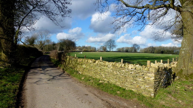
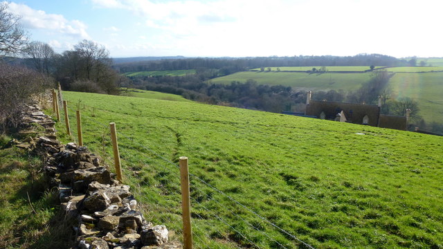
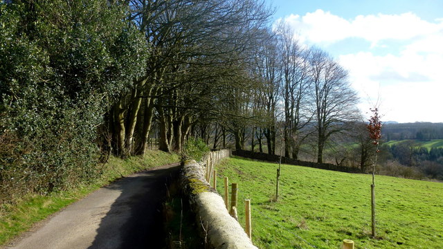
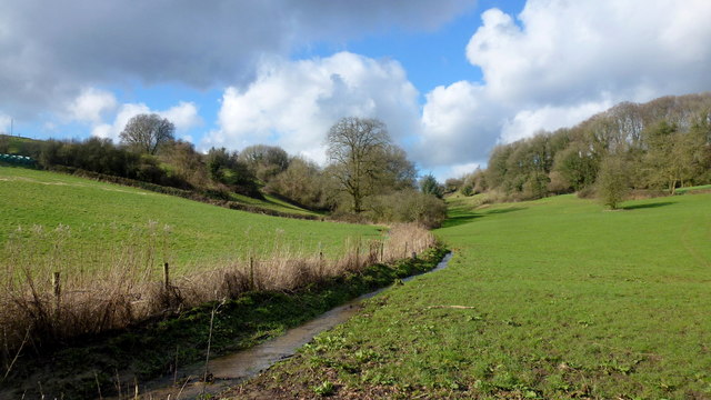
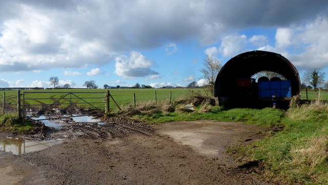
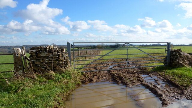
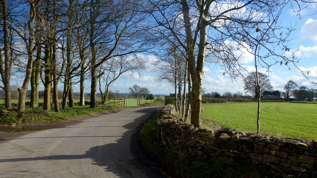
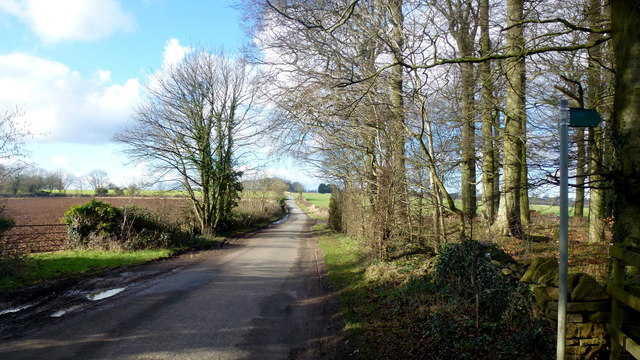
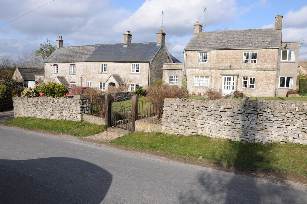
Bisley is a small village located in the Stroud district of Gloucestershire, England. Situated in the picturesque Cotswold Hills, it is surrounded by stunning natural beauty with rolling green hills, meandering streams, and charming countryside landscapes. The village is nestled approximately 6 miles southwest of Stroud, the nearest town.

Historically, Bisley has been inhabited since the Roman times, with evidence of Roman coins and artifacts discovered in the area. The village has a rich heritage, with several old buildings and structures still standing today. St. Mary's Church, a Grade I listed building, is a prominent feature in the village and dates back to the 12th century, showcasing impressive Norman architecture.

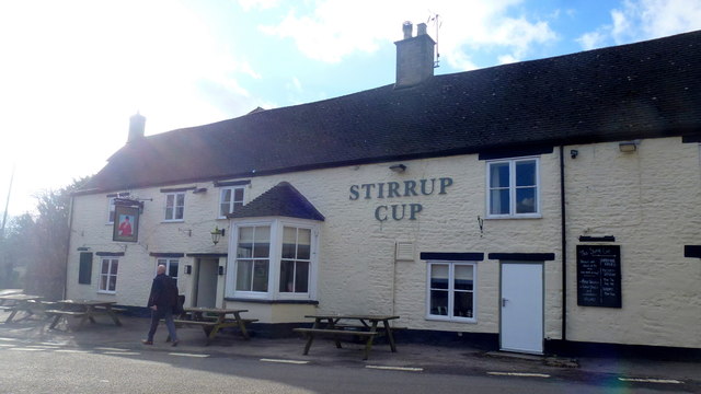
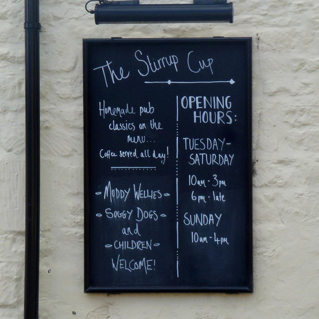
Bisley is known for its strong sense of community and friendly atmosphere. The village has a village hall, a primary school, and a local pub, the Bear Inn, which serves as a social hub for residents and visitors alike. The annual Bisley Flower Show, held in August, is a popular event that brings the community together and showcases the village's horticultural talents.

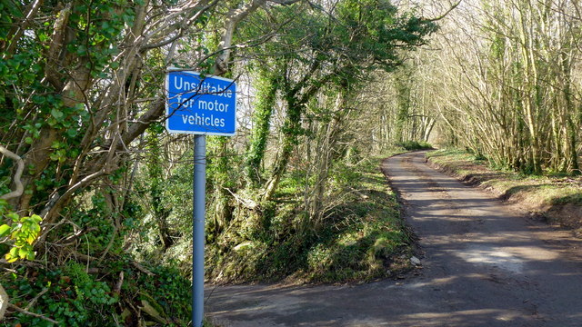
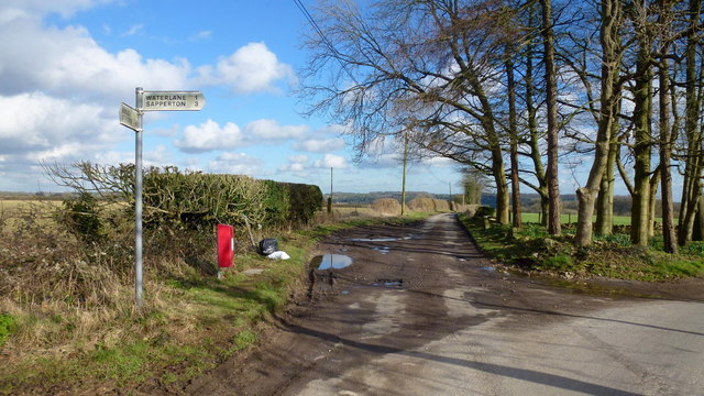
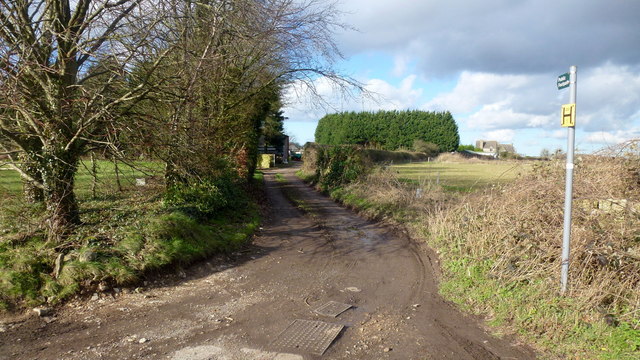
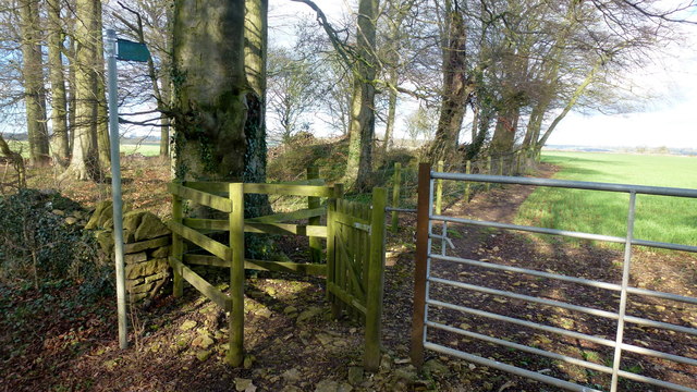
For outdoor enthusiasts, Bisley offers ample opportunities for exploring the surrounding countryside. There are numerous footpaths and bridleways that crisscross the area, providing access to scenic walks and horse riding routes. The nearby Cotswold Way National Trail is a popular choice for those seeking longer hikes and breathtaking views.

Overall, Bisley is a charming village with a rich history, stunning natural surroundings, and a strong community spirit, making it an attractive destination for both residents and visitors seeking a tranquil and picturesque countryside experience.

If you have any feedback on the listing, please let us know in the comments section below.
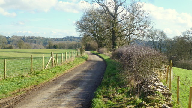
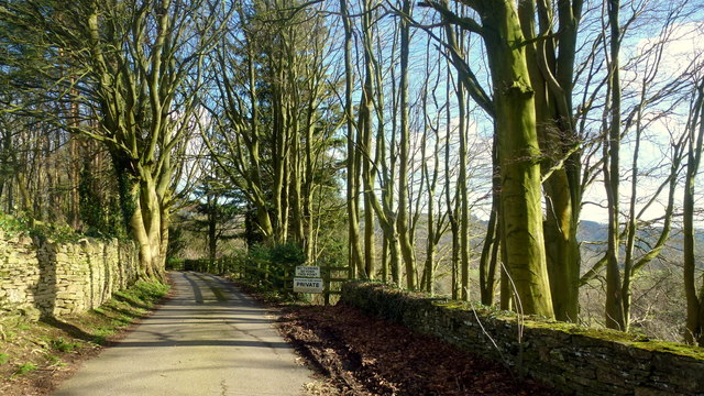
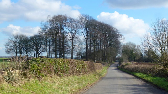
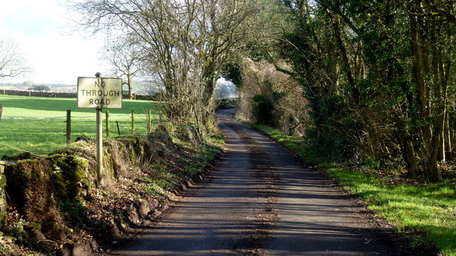
Bisley Images

Images are sourced within 2km of 51.752673/-2.139519 or Grid Reference SO9006. Thanks to Geograph Open Source API. All images are credited.

Lane to Througham Slad One of many such dead-end lanes in the Cotswolds.
Lane to Througham Slad
One of many such dead-end lanes in the Cotswolds.
The end of the lane at Througham Slad Manor According to OS mapping, the public road appears to carry on another 100m or so from this point. However our country landowners would seem to annex a bit of public property by just putting up a PRIVATE sign with NO TURNING BEYOND THIS POINT to drive home the message. No change in road surface though.
I didn't take the car any further.
The end of the lane at Througham Slad Manor
According to OS mapping, the public road appears to carry on another 100m or so from this point. However our country landowners would seem to annex a bit of public property by just putting up a PRIVATE sign with NO TURNING BEYOND THIS POINT to drive home the message. No change in road surface though. I didn't take the car any further.
Limekiln Lane, 1 Heading south-east towards Waterlane. The beech copse surrounds Bisley long barrow.
It's the time of year when beech trees look black against a sunny winter sky.
Limekiln Lane, 1
Heading south-east towards Waterlane. The beech copse surrounds Bisley long barrow. It's the time of year when beech trees look black against a sunny winter sky.
No Through Road to Througham Slad The lane boasts a pre-Worboys sign.
No Through Road to Througham Slad
The lane boasts a pre-Worboys sign.
Unsuitable? I beg to differ; I was able to use this steep, narrow lane without any trouble.
Unsuitable?
I beg to differ; I was able to use this steep, narrow lane without any trouble.
Lane from Througham Slad Nice bit of new-build drystone walling here.
Lane from Througham Slad
Nice bit of new-build drystone walling here.
View over Jones Slad Farm Cotswolds house with a fine southerly aspect.
View over Jones Slad Farm
Cotswolds house with a fine southerly aspect.
Approaching Througham Slad Winter sunlight glints off the shiny grey bark of the beeches.
Approaching Througham Slad
Winter sunlight glints off the shiny grey bark of the beeches.
Cotswolds stream by Calfway Farm This winter stream in full flow feeds the Holy Brook and the River Frome to become part of the Greater Stroud drainage basin.
Cotswolds stream by Calfway Farm
This winter stream in full flow feeds the Holy Brook and the River Frome to become part of the Greater Stroud drainage basin.
Small agricultural structure North of Calfway Lane, Bisley.
Small agricultural structure
North of Calfway Lane, Bisley.
Young cereal field near Bisley Typical Cotswold view in late winter.
Young cereal field near Bisley
Typical Cotswold view in late winter.
The Stirrup Cup, Bisley Walker-friendly pub at the north end of the village.
The Stirrup Cup, Bisley
Walker-friendly pub at the north end of the village.
Notice on the Stirrup Cup Not unfriendly to outdoor-types!
Notice on the Stirrup Cup
Not unfriendly to outdoor-types!
Hayhedge Lane, Bisley The lane leads a to dead end at Battlescombe. Right is Limekiln Lane.
Hayhedge Lane, Bisley
The lane leads a to dead end at Battlescombe. Right is Limekiln Lane.
Track and footpath to Bisley Leading north-west from the lane junction in <a href="https://www.geograph.org.uk/photo/5013309">SO9005 : Hayhedge Lane, Bisley</a>.
Track and footpath to Bisley
Leading north-west from the lane junction in SO9005 : Hayhedge Lane, Bisley.
Limekiln Lane Looking south-east from Hayhedge Lane, Bisley.
Limekiln Lane
Looking south-east from Hayhedge Lane, Bisley.
Limekiln Lane, 2 The opposite view to <a href="https://www.geograph.org.uk/photo/4824246">SO9105 : Limekiln Lane, 1</a>.
Limekiln Lane, 2
The opposite view to SO9105 : Limekiln Lane, 1.
Footpath by Bisley barrow The path heads north from Limekiln Lane to Battlescombe.
Footpath by Bisley barrow
The path heads north from Limekiln Lane to Battlescombe.
Show me another place!

Bisley is located at Grid Ref: SO9006 (Lat: 51.752673, Lng: -2.139519)

Administrative County: Gloucestershire

District: Stroud

Police Authority: Gloucestershire

What 3 Words

///locator.between.arise. Near Chalford, Gloucestershire

Nearby Locations

Bisley

Related Wikis

Bisley, Gloucestershire

Bisley is a village and former civil parish, now in the parish of Bisley-with-Lypiatt, in the Stroud district, in Gloucestershire, England, about 4 miles...

Lypiatt

Lypiatt is a small village and former civil parish, now in the parish of Miserden, in the Stroud district, in Gloucestershire, England, approximately 4...

Bisley-with-Lypiatt

Bisley-with-Lypiatt is a civil parish in the Stroud district of Gloucestershire, England. It had a population of 2350 in 2019. It includes Bisley, Lypiatt...

Battlescombe

Battlescombe is an area in the village of Bisley in Gloucestershire, England. == References ==

Lypiatt Park

Lypiatt Park is a medieval and Tudor manor house with notable nineteenth-century additions in the parish of Bisley, near Stroud, in Gloucestershire, England...

Eastcombe, Gloucestershire

Eastcombe is a village in Stroud District in Gloucestershire, England. The Parish Church is called Eastcombe: St Augustine and served the parish of Bussage...

Juniper Hill, Edgeworth

Juniper Hill, Edgeworth (SO928058 and SO928064) is an 11.25-hectare (27.8-acre) biological Site of Special Scientific Interest in Gloucestershire, notified...

Thomas Keble School

Thomas Keble School is a mixed secondary school located in Eastcombe in the English county of Gloucestershire. The school is named after Thomas Keble,...

Nearby Amenities

Located within 500m of 51.752673,-2.139519
Pub
Stirrup Cup
Addr City: Bisley
Addr Country: GB
Addr Postcode: GL6 7BL
Addr Street: Cheltenham Road
Air Conditioning: no
Fhrs Id: 1045845
Indoor Seating: yes
Outdoor Seating: yes
Lat/Long: 51.7533152/-2.1395182
Pub
The Bear
Addr City: Bisley
Addr Country: GB
Addr Postcode: GL6 7BD
Addr Street: George Street
Fhrs Id: 916528
Wikidata: Q17537997
Lat/Long: 51.7530518/-2.1415324
Bisley
Is In: Gloucestershire, England, UK
Is In District: Stroud
Place: village
Wikidata: Q2915726
Lat/Long: 51.7528475/-2.1408991
Barrier: kissing_gate
Lat/Long: 51.7521444/-2.1366181
Barrier: lytch_gate
Lat/Long: 51.7520089/-2.1404012
Barrier: kissing_gate
Lat/Long: 51.7510819/-2.1347162
Barrier: chicane
Lat/Long: 51.752874/-2.1392906
Barrier: kissing_gate
Lat/Long: 51.7529905/-2.1380688
Barrier: chicane
Lat/Long: 51.75293/-2.1392065
Barrier: chicane
Lat/Long: 51.752871/-2.1394243
Barrier: bollard
Vehicle: no
Lat/Long: 51.7528336/-2.1397233
Seven Wells
Addr City: Bisley
Addr Postcode: GL6 7AF
Addr Street: Wells Road
Alt Name: Bisley Wells
Drinking Water: no
Natural: spring
Website: https://megalithic.co.uk/article.php?sid=8251
Lat/Long: 51.7510499/-2.1406027
Post Box
Collection Times: Mo-Fr 16:15; Sa 11:00
Fixme: check ref -- location is outside GL5 postal district
Post Box Type: wall
Ref: GL5 92
Royal Cypher: EIIR
Royal Cypher Wikidata: Q33102113
Lat/Long: 51.7527305/-2.1394467
Sports Pavillion
Addr City: Bisley
Addr Postcode: GL6 7BA
Addr Street: Van Der Breen Street
Building: public
Leisure: sports_centre
Sport: multi
Lat/Long: 51.7532962/-2.1370658
Community Centre
WI Bisley Village Hall
Addr City: Bisley
Addr Postcode: GL6 7AX
Addr Street: Manor Street
Community Centre: village_hall
Lat/Long: 51.7539005/-2.1412232
Copsegrove Farm Meeting Point
Addr City: Bisley
Addr Postcode: GL6 7BG
Addr Street: Back Lane
Leisure: park
Lat/Long: 51.7512671/-2.1440207
Bus Stop
The Bear Inn
Bus: yes
Naptan AtcoCode: 1600GL460
Naptan Bearing: W
Naptan CommonName: The Bear Inn
Naptan Indicator: before
Naptan NaptanCode: glodmptm
Naptan Street: George Street
Naptan Verified: no
Public Transport: platform
Lat/Long: 51.7530262/-2.1410448
Bus Stop
Little Close
Bus: yes
Naptan AtcoCode: 1600GLS179
Naptan Bearing: SE
Naptan CommonName: Little Close
Naptan Indicator: after
Naptan NaptanCode: glodmpma
Naptan Street: Stroud Road
Naptan Verified: no
Public Transport: platform
Lat/Long: 51.754437/-2.1435144
Bus Stop
Stirrup Cup
Bus: yes
Naptan AtcoCode: 1600GL466
Naptan Bearing: NW
Naptan CommonName: Stirrup Cup
Naptan Indicator: o/s
Naptan NaptanCode: glodmpwp
Naptan Street: Cheltenham Road
Naptan Verified: no
Public Transport: platform
Lat/Long: 51.7534457/-2.1395367
Bus Stop
Windyridge
Bus: yes
Naptan AtcoCode: 1600GLA06390
Naptan Bearing: SE
Naptan BusStopType: CUS
Naptan CommonName: Windyridge
Naptan Indicator: opp
Naptan NaptanCode: glogpmpg
Naptan Verified: no
Public Transport: platform
Lat/Long: 51.7553568/-2.141197
SmallPrint
Lat/Long: 51.7521606/-2.1426212
Post Office
George Stores, Post Office and Tea Room
Addr City: Bisley
Addr Housename: George Stores
Addr Postcode: GL6 7BA
Addr Street: High Street
Shop: yes
Lat/Long: 51.7527325/-2.1393941
Power: pole
Lat/Long: 51.7500441/-2.13727
Power: pole
Lat/Long: 51.7515535/-2.1372673
Power: pole
Lat/Long: 51.7521828/-2.1373639
Material: wood
Power: pole
Lat/Long: 51.752832/-2.1374497
Power: pole
Lat/Long: 51.7550769/-2.1397054
Power: pole
Lat/Long: 51.7552512/-2.1388793
Power: pole
Lat/Long: 51.7560565/-2.1383429
Power: pole
Lat/Long: 51.7569697/-2.1384233
Bisley War Memorial
Historic: memorial
Inscription: To the glory of God and to the memory of the men of Bisley who gave their lives serving the King in the years of our Lord 1914-1919.
Material: stone
Memorial: war_memorial
Source: survey
Wikidata: Q26673009
Lat/Long: 51.7535071/-2.1394213
Telephone
Booth: K6
Covered: booth
Listed Status: Grade II
Operator: BT
Phone: +44 1452 770271
Lat/Long: 51.7529976/-2.1405621
The data included in this document is from www.openstreetmap.org. The data is made available under ODbL.

Have you been to Bisley?

Leave your review of Bisley below (or comments, questions and feedback).