Prescott

Settlement in Gloucestershire Tewkesbury

England

Prescott

Bridleway on Langley Hill A bridleway to Winchcombe crossing Langley Hill at a junction with a footpath.
Bridleway on Langley Hill Credit: Philip Halling

The requested URL returned error: 429 Too Many Requests

If you have any feedback on the listing, please let us know in the comments section below.
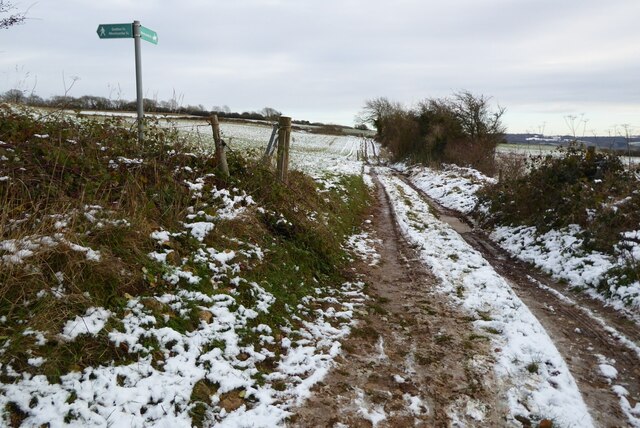
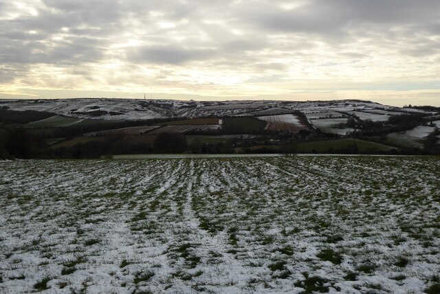
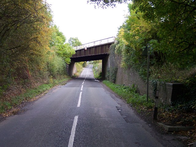
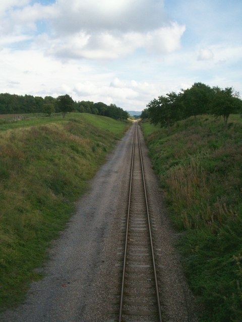
Prescott Images

Images are sourced within 2km of 51.96591/-2.02199 or Grid Reference SO9829. Thanks to Geograph Open Source API. All images are credited.

Bridleway on Langley Hill A bridleway to Winchcombe crossing Langley Hill at a junction with a footpath.
Bridleway on Langley Hill
A bridleway to Winchcombe crossing Langley Hill at a junction with a footpath.
View to Cleeve Hill View to Cleeve Hill from a bridleway on Langley Hill on a late November day after light snowfall on the Cotswold Hills.
View to Cleeve Hill
View to Cleeve Hill from a bridleway on Langley Hill on a late November day after light snowfall on the Cotswold Hills.
G.W.R. Bridge That is the Gloucestershire and Warwickshire Railway on the section between Gotherington and Gretton
G.W.R. Bridge
That is the Gloucestershire and Warwickshire Railway on the section between Gotherington and Gretton
Dixton Hill With Dixton Manor peeking through the trees. Looking NE diagonally across the square from near the Gloucestershire and Warwickshire Railway.
Dixton Hill
With Dixton Manor peeking through the trees. Looking NE diagonally across the square from near the Gloucestershire and Warwickshire Railway.
Far Stanley Railway Bridge The lane to Far Stanley farms passing under the Gloucestershire and Warwickshire Railway.
Far Stanley Railway Bridge
The lane to Far Stanley farms passing under the Gloucestershire and Warwickshire Railway.
Farm Track to Black Barn Looking eastwards from the Dixton to Alstone road.
Farm Track to Black Barn
Looking eastwards from the Dixton to Alstone road.
Stacked Timber Freshly sawn oak from a fallen tree. The trees on the right hand side is Dixton Wood.
Stacked Timber
Freshly sawn oak from a fallen tree. The trees on the right hand side is Dixton Wood.
Lower Farm near Gretton Taken from the footpath/farm track to Black Barn and Alstone. 
Looking West with Oxenton Hill in the background.
Lower Farm near Gretton
Taken from the footpath/farm track to Black Barn and Alstone. Looking West with Oxenton Hill in the background.
Farm Building redevelopment, Lower Farm, Gretton Beautiful cotswold stone farm building being given a new lease of life thanks to careful redevelopment.
Farm Building redevelopment, Lower Farm, Gretton
Beautiful cotswold stone farm building being given a new lease of life thanks to careful redevelopment.
Slopes below Stanley Mount Looking across the Lower Jurassic clay vale to Oxenton and Bredon hills.
Slopes below Stanley Mount
Looking across the Lower Jurassic clay vale to Oxenton and Bredon hills.
The Gloucestershire & Warwickshire Railway
Dixton Hill Looking from the bridge over the railway. Part of Dixton Manor is visible between the trees.
Dixton Hill
Looking from the bridge over the railway. Part of Dixton Manor is visible between the trees.
Triangulation Pillar- detail
The Gloucestershire Way and Dixton Hill The farmer has left a good track for walkers of the Gloucestershire Way to Follow. Dixton Hill can be seen in the background.
The Gloucestershire Way and Dixton Hill
The farmer has left a good track for walkers of the Gloucestershire Way to Follow. Dixton Hill can be seen in the background.
The railway embankment at Far Stanley Picture taken on 10-10-2002 just after embankment was cleared.
The railway embankment at Far Stanley
Picture taken on 10-10-2002 just after embankment was cleared.
Cattle feeding below Dixton Wood Cattle feeding at hay racks below Dixton Hill on the eastern slopes of Oxenton Hill.
Cattle feeding below Dixton Wood
Cattle feeding at hay racks below Dixton Hill on the eastern slopes of Oxenton Hill.
Farmland to the east of Oxenton Hill View of farmland from the footpath between Alstone and Dixton. Alderton Hill and Dumbleton Hill is in the background.
Farmland to the east of Oxenton Hill
View of farmland from the footpath between Alstone and Dixton. Alderton Hill and Dumbleton Hill is in the background.
Dixton and Dixton Hill Dixton and Dixton Hill viewed from the footpath to the west.
Dixton and Dixton Hill
Dixton and Dixton Hill viewed from the footpath to the west.
Show me another place!

Prescott is located at Grid Ref: SO9829 (Lat: 51.96591, Lng: -2.02199)

Administrative County: Gloucestershire

District: Tewkesbury

Police Authority: Gloucestershire

What 3 Words

///scoping.motoring.prop. Near Bishops Cleeve, Gloucestershire

Nearby Locations

Prescott Prescott Wood

Related Wikis

Prescott Speed Hill Climb

Prescott Speed Hill Climb is a hillclimb in Gloucestershire, England. The course used for most events (the "Long Course") is 1,128 yards (1,031 m) in length...

Prescott, Gloucestershire

Prescott is a settlement and civil parish in the Cotswolds within the English county of Gloucestershire. There are scattered farms and houses. There may...

Dixton Manor

Dixton Manor is a Grade II*-listed 16th-century manor house in the south of Alderton parish, Gloucestershire, England. The manor was built for John Higford...

Gotherington railway station

Gotherington railway station is a railway station serving the village of Gotherington in Gloucestershire, England. The station is located just to the north...

Nearby Amenities

Located within 500m of 51.96591,-2.02199
Bus Stop
The Bugatti Trust
Bus: yes
Naptan AtcoCode: 1600GLA785
Naptan Bearing: SE
Naptan CommonName: The Bugatti Trust
Naptan Indicator: Opp
Naptan NaptanCode: glodwjgp
Naptan Street: Gretton Rd
Naptan Verified: no
Public Transport: platform
Source: naptan_import
Lat/Long: 51.9659599/-2.0220661
Bus Stop
The Bugatti Trust
Bus: yes
Naptan AtcoCode: 1600GLA786
Naptan Bearing: NW
Naptan CommonName: The Bugatti Trust
Naptan NaptanCode: glogjtmd
Naptan Street: Gretton Rd
Naptan Verified: no
Public Transport: platform
Source: naptan_import
Lat/Long: 51.9659149/-2.0221388
Power: tower
Source: bing
Lat/Long: 51.9639146/-2.0170976
Power: tower
Source: bing
Lat/Long: 51.9659262/-2.016839
Material: wood
Power: pole
Lat/Long: 51.9689334/-2.0169173
Pardon Hill
Material: wood
Power: pole
Transformer: distribution
Voltage Primary: 11000
Lat/Long: 51.9654166/-2.0267286
Material: wood
Power: pole
Lat/Long: 51.9655534/-2.0279245
Material: wood
Power: pole
Lat/Long: 51.9656379/-2.0287817
Barrier: stile
Lat/Long: 51.9674126/-2.0171149
Barrier: stile
Lat/Long: 51.9674198/-2.0170377
Barrier: stile
Lat/Long: 51.9677099/-2.0161207
Barrier: stile
Lat/Long: 51.967731/-2.0160845
Barrier: stile
Lat/Long: 51.9678659/-2.0212102
Barrier: stile
Lat/Long: 51.9679013/-2.0211617
Barrier: stile
Lat/Long: 51.9685147/-2.0226481
Barrier: stile
Lat/Long: 51.9687019/-2.0185161
Post Box
Brand: Royal Mail
Brand Wikidata: Q638098
Letters Only: yes
Operator: Royal Mail
Operator Wikidata: Q638098
Post Box Design: hovis
Post Box Mounting: wall
Post Box Type: lamp
Ref: GL52 178
Royal Cypher: GR
Royal Cypher Wikidata: Q33102273
Lat/Long: 51.9660907/-2.0222056
Prescott Speed Hill Climb
Leisure: sports_centre
Sport: motor
Website: https://www.prescott-hillclimb.com/
Wikidata: Q7240870
Wikipedia: en:Prescott Speed Hill Climb
Lat/Long: 51.9661587/-2.0226092
Barrier: stile
Foot: designated
Material: wood
Stile: stepover
Lat/Long: 51.9682483/-2.0277719
Prescott
Place: village
Lat/Long: 51.9677052/-2.0283309
Material: wood
Power: pole
Lat/Long: 51.9621601/-2.0192461
Material: wood
Power: pole
Lat/Long: 51.9623394/-2.020036
Material: wood
Power: pole
Lat/Long: 51.9624985/-2.0207548
Middle Hill Farm
Material: wood
Power: pole
Transformer: distribution
Voltage Primary: 11000
Lat/Long: 51.9629381/-2.0215105
Material: wood
Power: pole
Lat/Long: 51.9635605/-2.0223776
Material: wood
Power: pole
Lat/Long: 51.9632306/-2.0220087
Orchard Farm
Material: wood
Power: pole
Transformer: distribution
Voltage Primary: 11000
Lat/Long: 51.9639565/-2.0227946
Prescott House
Material: wood
Power: pole
Transformer: distribution
Voltage Primary: 11000
Lat/Long: 51.9617675/-2.0244361
Material: wood
Power: pole
Lat/Long: 51.9626088/-2.0240868
Material: wood
Power: pole
Lat/Long: 51.9633401/-2.0237388
Material: wood
Power: pole
Lat/Long: 51.964183/-2.0234089
Prescott Hill
Material: wood
Power: pole
Transformer: distribution
Voltage Primary: 11000
Lat/Long: 51.9646895/-2.0247285
Material: wood
Power: pole
Lat/Long: 51.9649779/-2.0255037
The data included in this document is from www.openstreetmap.org. The data is made available under ODbL.

Have you been to Prescott?

Leave your review of Prescott below (or comments, questions and feedback).