Tre'resgob

Settlement in Brecknockshire

Wales

Tre'resgob

Pentref Llywel Village Rhes o dai ym mhentref bach Llywel. Y ty cyntaf ar y dde yw hen dafarn y Cross Keys (caewyd oddeutu 1925). 

A row of houses in the tiny village of Llywel. The first house on the right is the former Cross Keys Inn (closed c1925).
Pentref Llywel Village Credit: Alan Richards

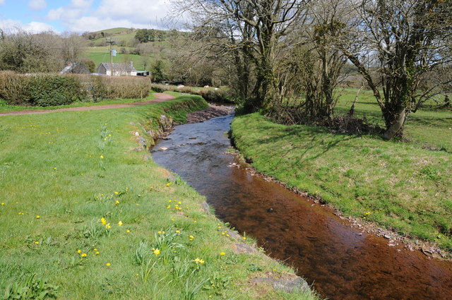
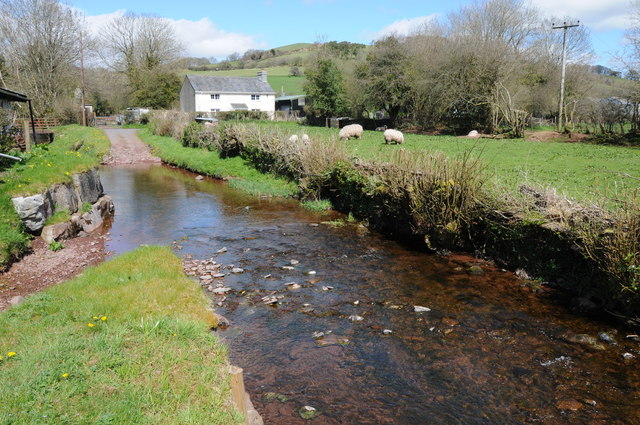
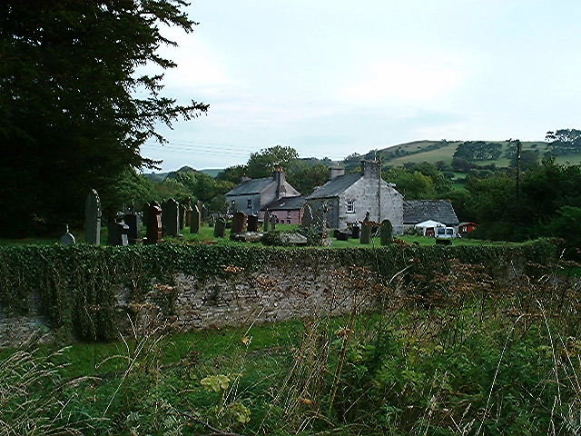
Tre'resgob is a small village located in the county of Brecknockshire, Wales. Situated on the eastern edge of the Brecon Beacons National Park, the village is nestled amidst beautiful rolling hills and lush green countryside. It is approximately 5 miles south of the town of Brecon.

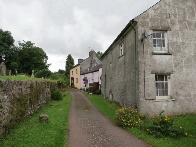
The name Tre'resgob translates to "village of the bishops" in Welsh, indicating its historical connection to the Church. The village is known for its charming and picturesque setting, with traditional stone houses and a close-knit community.

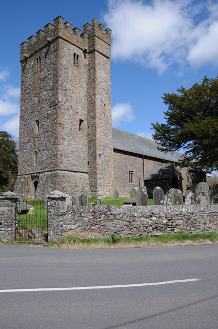
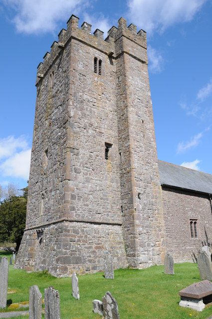
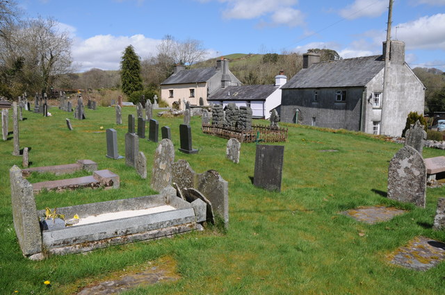
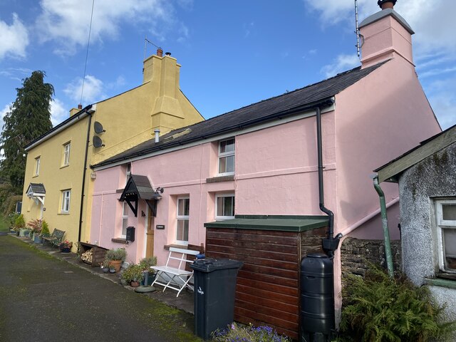
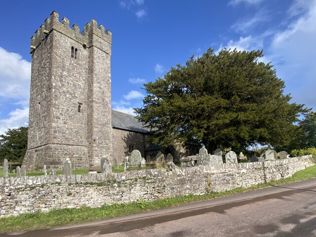
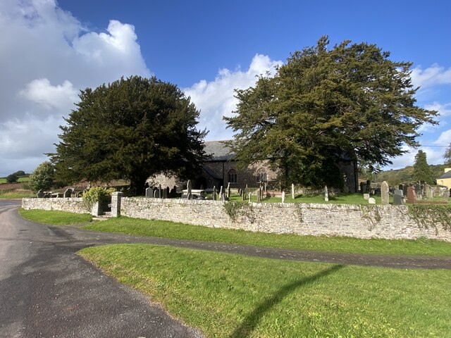
Tre'resgob is home to a population of around 200 residents, who primarily engage in agricultural activities and various local businesses. The village boasts a quaint church, St. Michael's, which dates back to the 13th century and stands as a testament to its rich history. The church is a focal point for the community, hosting religious ceremonies, events, and providing a tranquil space for reflection.

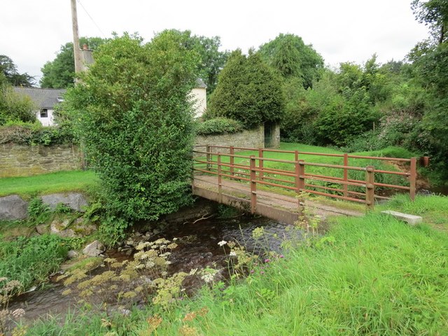
Nature enthusiasts are drawn to Tre'resgob for its proximity to the Brecon Beacons, offering numerous opportunities for outdoor activities such as hiking, biking, and birdwatching. The nearby Talybont Reservoir also attracts visitors, providing a scenic spot for fishing, boating, and picnicking.

Despite its small size, Tre'resgob offers a range of amenities to its residents and visitors. These include a village hall, a local pub serving traditional Welsh cuisine, and a primary school, ensuring a close-knit and vibrant community spirit.

Overall, Tre'resgob is a peaceful and idyllic village, offering a charming escape for those seeking tranquility and natural beauty in the heart of Brecknockshire.

If you have any feedback on the listing, please let us know in the comments section below.
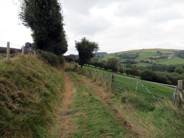
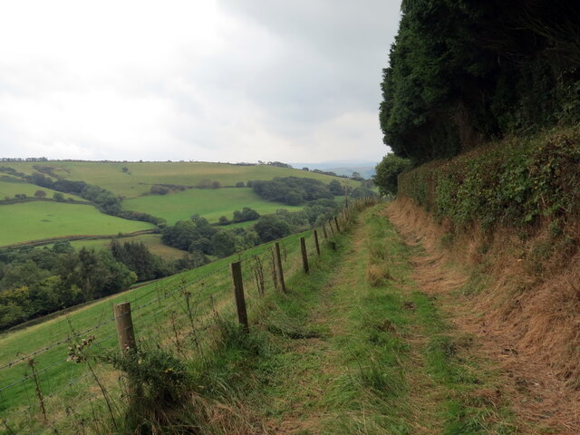
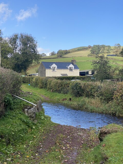
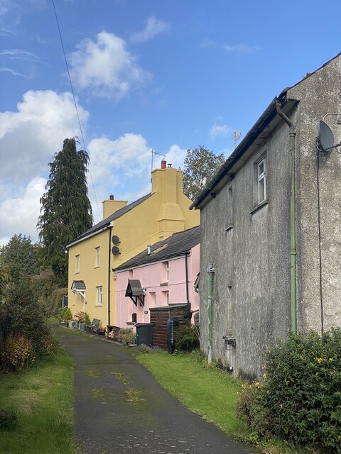
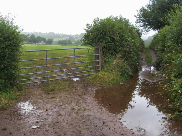
Tre'resgob Images

Images are sourced within 2km of 51.952609/-3.633375 or Grid Reference SN8729. Thanks to Geograph Open Source API. All images are credited.

Pentref Llywel Village Rhes o dai ym mhentref bach Llywel. Y ty cyntaf ar y dde yw hen dafarn y Cross Keys (caewyd oddeutu 1925). 

A row of houses in the tiny village of Llywel. The first house on the right is the former Cross Keys Inn (closed c1925).
Pentref Llywel Village
Rhes o dai ym mhentref bach Llywel. Y ty cyntaf ar y dde yw hen dafarn y Cross Keys (caewyd oddeutu 1925). A row of houses in the tiny village of Llywel. The first house on the right is the former Cross Keys Inn (closed c1925).
Pontdroed Llywel /Llywel footbridge Pontdroed yn rhychwantu Nant Gwydderig yn Llywel

A footbridge spanning the Gwydderig stream, Llywel.
Pontdroed Llywel /Llywel footbridge
Pontdroed yn rhychwantu Nant Gwydderig yn Llywel A footbridge spanning the Gwydderig stream, Llywel.
St David's church, Llywel St David's church, Llywel from the route of the old A40 before it was straightened.
St David's church, Llywel
St David's church, Llywel from the route of the old A40 before it was straightened.
Tower of Llywel church Tower of St David's church, Llywel.
Tower of Llywel church
Tower of St David's church, Llywel.
Nant Gwydderig Nant Gwydderig flowing through Llywel.
Nant Gwydderig
Nant Gwydderig flowing through Llywel.
Ford on Nant Gwydderig
Churchyard in Llywel
Ordnance Survey 1GL Bolt This OS Bolt can be found on the tower of St David's Church. It marks a point 230.5724m above mean sea level.
Ordnance Survey 1GL Bolt
This OS Bolt can be found on the tower of St David's Church. It marks a point 230.5724m above mean sea level.
Heol fach ger Llywel / Minor road near Llywel Heol fach uwchben pentre Llywel. 

A minor road above the village of Llywel.
Heol fach ger Llywel / Minor road near Llywel
Heol fach uwchben pentre Llywel. A minor road above the village of Llywel.
Heol las i Fedw / Green lane to Fedw Heol las yn mynd i gyfeiriad Ffarm y Fedw.

A green lane heading in the direction of Fedw Farm (trans. birch tree).
Heol las i Fedw / Green lane to Fedw
Heol las yn mynd i gyfeiriad Ffarm y Fedw. A green lane heading in the direction of Fedw Farm (trans. birch tree).
Heol las ger Ffarm Llwyngronw / Green lane near Llwyngronw Farm Heol las yn mynd i gyfeiriad Ffarm Llwyngronw.

A green lane heading in the direction of Llwyngronw Farm (trans. Gronw's grove).
Heol las ger Ffarm Llwyngronw / Green lane near Llwyngronw Farm
Heol las yn mynd i gyfeiriad Ffarm Llwyngronw. A green lane heading in the direction of Llwyngronw Farm (trans. Gronw's grove).
Across the ford to Brookside Nant Gwydderig flows west from here towards Llandovery where it joins the Tywi and flows onwards past Carmarthen to the sea.  Rain falling the other side of Brookside joins Nant Logyn which flows south east into the Usk at Trecastle and flows onwards to Newport. Small margins, large outcomes.
Across the ford to Brookside
Nant Gwydderig flows west from here towards Llandovery where it joins the Tywi and flows onwards past Carmarthen to the sea. Rain falling the other side of Brookside joins Nant Logyn which flows south east into the Usk at Trecastle and flows onwards to Newport. Small margins, large outcomes.
Old lane in Llywel The lane leads towards Y Bwthyn (pink) and Ty Mawr (yellow).
Old lane in Llywel
The lane leads towards Y Bwthyn (pink) and Ty Mawr (yellow).
Ty Mawr and Y Bwthyn, Llywel
St David’s Church, Llywel
Two old yew trees In the churchyard of St David’s, Llywel.
Two old yew trees
In the churchyard of St David’s, Llywel.
Llywel village
Llywel village
Cycle route down to A40 A wet start to the cycle route down to A40
Cycle route down to A40
A wet start to the cycle route down to A40
Show me another place!

Tre'resgob is located at Grid Ref: SN8729 (Lat: 51.952609, Lng: -3.633375)

Unitary Authority: Powys

Police Authority: Dyfed Powys

Also known as: Bishops Town

What 3 Words

///sonic.finally.steam. Near Cray, Powys

Related Wikis

Trecastle

Trecastle (Welsh: Trecastell) ("the town of the castle") is a village in Powys, Wales, situated on the edge of the Brecon Beacons National Park (Welsh...

Bishops Town

Bishops Town (Welsh: Tre'r Esgob) is an area in the community of Llywel, Powys, Wales, which is 38 miles (61 km) from Cardiff and 153 miles (246 km) from...

Castle Tump

Castle Tump (Trecastle Motte) is an early 11th-century motte and bailey castle in Trecastle, Powys, Wales. == History == This early 11th-century Norman...

Caeau Bronydd-mawr

Caeau Bronydd-mawr is a Site of Special Scientific Interest in Brecknock, Powys, Wales. It is a fen meadow, notable for its contrasting neutral and acid...

Llywel

Llywel () is a small village located on the A40, about 4 miles (6.4 km) west of Sennybridge in Brecknockshire (currently administered as part of the unitary...

Afon Crai

The Afon Crai is a river in Powys, Wales rising in the Fforest Fawr section of the Brecon Beacons National Park and flowing north into the River Usk....

Afon Hydfer

The Afon Hydfer is a short river in Powys in the west of the Brecon Beacons National Park, south Wales. Its headwaters rise on the northeastern slopes...

Cwmwysg

Cwmwysg (Welsh for "Usk valley") is a small rural community southwest of Trecastle in the valley of the Usk river, Powys, Wales. It includes the Saron...

Nearby Amenities

Located within 500m of 51.952609,-3.633375
Cafe
Vicarage Row Cafe
Cuisine: sandwich
Wifi: no
Lat/Long: 51.9505669/-3.6316818
Castle Coaching Inn
Tourism: hotel
Wikidata: Q29485898
Lat/Long: 51.9493303/-3.6297453
Parking
Parking: layby
Lat/Long: 51.9542701/-3.6397683
Post Box
Collection Times: Mo-Fr 12:00; Sa 11:15
Post Box Type: lamp
Ref: LD3 334
Royal Cypher: EIIR
Royal Cypher Wikidata: Q33102113
Lat/Long: 51.9504281/-3.6319188
Barrier: stile
Stile: stepover
Lat/Long: 51.9483445/-3.6328401
Direction: 195
Generator Method: photovoltaic
Generator Output Electricity: yes
Generator Solar Modules: 10
Generator Source: solar
Generator Type: solar_photovoltaic_panel
Location: roof
Power: generator
Lat/Long: 51.9495562/-3.6302995
Direction: 105
Generator Method: photovoltaic
Generator Output Electricity: yes
Generator Solar Modules: 5
Generator Source: solar
Generator Type: solar_photovoltaic_panel
Location: roof
Power: generator
Lat/Long: 51.9495492/-3.6304289
Direction: 165
Generator Method: photovoltaic
Generator Output Electricity: yes
Generator Solar Modules: 18
Generator Source: solar
Generator Type: solar_photovoltaic_panel
Location: roof
Power: generator
Lat/Long: 51.9499199/-3.635216
Direction: 100
Generator Method: photovoltaic
Generator Output Electricity: yes
Generator Solar Modules: 8
Generator Source: solar
Generator Type: solar_photovoltaic_panel
Location: roof
Power: generator
Lat/Long: 51.9504237/-3.6339238
Direction: 280
Generator Method: photovoltaic
Generator Output Electricity: yes
Generator Solar Modules: 8
Generator Source: solar
Generator Type: solar_photovoltaic_panel
Location: roof
Power: generator
Lat/Long: 51.9504287/-3.6339822
Public Bookcase
Booth: K6
Colour: blue
Disused Amenity: telephone
Man Made: telephone_box
Old Phone: +44 1874 636204
Public Bookcase Type: phone_box
Lat/Long: 51.9507759/-3.6320969
The data included in this document is from www.openstreetmap.org. The data is made available under ODbL.

Have you been to Tre'resgob?

Leave your review of Tre'resgob below (or comments, questions and feedback).