Bishopbridge
Settlement in Lincolnshire West Lindsey
England
Bishopbridge

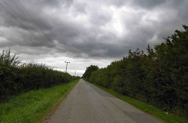
Bishopbridge is a small village located in the county of Lincolnshire, England. Situated approximately 10 miles north of the city of Lincoln, this rural settlement is nestled amidst picturesque countryside and rolling green fields. The village is positioned near the River Ancholme, adding to its scenic charm.
With a population of around 500 residents, Bishopbridge retains a close-knit community atmosphere. The village features a mix of traditional and modern architecture, with historic stone cottages and newer housing developments blending seamlessly together. Bishopbridge is known for its peaceful and tranquil ambiance, making it an ideal escape from the hustle and bustle of city life.
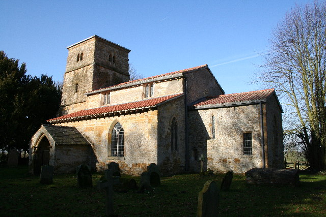
Although small in size, Bishopbridge offers several amenities to its residents. These include a local shop for everyday essentials, a village hall that serves as a hub for community events, and a primary school providing education for children in the area. The village also boasts a charming church, St. Mary's, which dates back to the 12th century and is a popular landmark.
The surrounding natural beauty of the area provides ample opportunities for outdoor activities. Residents and visitors can enjoy scenic walks along the river or explore nearby woodland areas. The village is also within close proximity to the Lincolnshire Wolds, an Area of Outstanding Natural Beauty, offering stunning landscapes and a range of recreational pursuits.
Overall, Bishopbridge is a picturesque village that offers a peaceful countryside lifestyle, community spirit, and easy access to the nearby city of Lincoln and the natural wonders of Lincolnshire.
If you have any feedback on the listing, please let us know in the comments section below.
Bishopbridge Images
Images are sourced within 2km of 53.407201/-0.452029 or Grid Reference TF0391. Thanks to Geograph Open Source API. All images are credited.


Bishopbridge is located at Grid Ref: TF0391 (Lat: 53.407201, Lng: -0.452029)
Division: Parts of Lindsey
Administrative County: Lincolnshire
District: West Lindsey
Police Authority: Lincolnshire
What 3 Words
///originate.sailors.fonts. Near Middle Rasen, Lincolnshire
Nearby Locations
Related Wikis

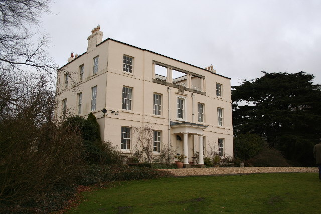
The Manor House Bishop Bridge
The Manor House, Bishop Bridge is located in Lincolnshire, England. 53.406°N 0.446°W / 53.406; -0.446 The house was built circa 1849, named "Kingerby...

Glentham
Glentham is a village and civil parish in the West Lindsey district of Lincolnshire, England. It is situated on the A631, 6 miles (9.7 km) west from Market...
Kingerby Castle
Kingerby Castle was in the small settlement of Kingerby some five miles north-west of Market Rasen, Lincolnshire. It was a motte and bailey castle which...
St Peter's Church, Kingerby
St Peter's Church is a redundant Anglican church in Kingerby, Lincolnshire, England. It is recorded in the National Heritage List for England as a designated...
Kingerby
Kingerby is a village and former civil parish, now in the parish of Osgodby, in the West Lindsey district of Lincolnshire, England. It is situated 5 miles...
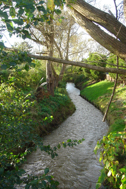
River Rase
The River Rase is 16 mile (25 km) long tributary of the River Ancholme that flows through Lincolnshire, in the east of England. == Course == The source...
Kirkby cum Osgodby
Kirkby cum Osgodby, sometimes called Kirkby, is hamlet and former civil parish in the West Lindsey district of Lincolnshire, England. It lies 3.5 miles...

West Rasen
West Rasen is a village and civil parish in the West Lindsey district of Lincolnshire, England. It is situated on the A631 road, and approximately 3 miles...
Nearby Amenities
Located within 500m of 53.407201,-0.452029Have you been to Bishopbridge?
Leave your review of Bishopbridge below (or comments, questions and feedback).