Poplars

Settlement in Hertfordshire Stevenage

England

Poplars

Hydean Way Shops Typical of local shops in Stevenage new town.  Above a parade of shops including a small supermarket, take away food outlet and Post Office there are maisonettes accessed from the rear.  To the right there are 2/3 bedroomed homes.
Hydean Way Shops Credit: Robin Hall

Poplars is a small village located in Hertfordshire, England. Situated in the East of England region, it is part of the local government district of Three Rivers. The village lies approximately 25 miles northwest of central London and is surrounded by the picturesque countryside of Hertfordshire.

Poplars is known for its tranquil and scenic setting, with rolling hills, green fields, and charming country lanes. The village is home to a close-knit community, and residents enjoy a peaceful rural lifestyle while still having easy access to nearby towns and cities.

The village itself boasts a range of amenities, including a local shop, a primary school, and a village hall. It also has several traditional pubs and restaurants that offer a warm and friendly atmosphere. Poplars is well-connected, with good transport links to nearby towns such as Watford and Hemel Hempstead, as well as to London via the M25 motorway and the nearby railway stations.

The surrounding area offers plenty of opportunities for outdoor activities, with numerous walking and cycling paths, as well as parks and nature reserves nearby. Poplars is also within close proximity to popular attractions such as the Warner Bros. Studio Tour London – The Making of Harry Potter and the historic city of St Albans.

Overall, Poplars is a charming village that offers a peaceful and idyllic lifestyle, making it an attractive place to live for those seeking a quieter setting while still being within reach of urban amenities.

If you have any feedback on the listing, please let us know in the comments section below.
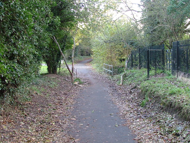
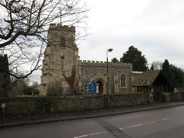
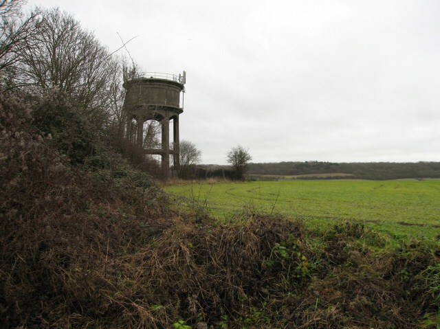
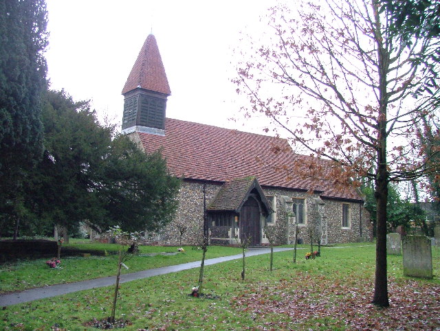
Poplars Images

Images are sourced within 2km of 51.894121/-0.156883 or Grid Reference TL2623. Thanks to Geograph Open Source API. All images are credited.

Hydean Way Shops Typical of local shops in Stevenage new town.  Above a parade of shops including a small supermarket, take away food outlet and Post Office there are maisonettes accessed from the rear.  To the right there are 2/3 bedroomed homes.
Hydean Way Shops
Typical of local shops in Stevenage new town. Above a parade of shops including a small supermarket, take away food outlet and Post Office there are maisonettes accessed from the rear. To the right there are 2/3 bedroomed homes.
Fairlands Valley Park This large lake is used by sailors and fishermen.  This photo is taken facing south.  To the rear there are two smaller lakes.  The park is very popular in the summer.
Fairlands Valley Park
This large lake is used by sailors and fishermen. This photo is taken facing south. To the rear there are two smaller lakes. The park is very popular in the summer.
Parishes Mead. Parishes mead is a newer development on the east side of Stevenage.  There is a mixture of private and social housing here.
Parishes Mead.
Parishes mead is a newer development on the east side of Stevenage. There is a mixture of private and social housing here.
Ferrier Rd This could be any road in this area.  Plans seem to have been bought as a job lot.
Ferrier Rd
This could be any road in this area. Plans seem to have been bought as a job lot.
Ridlins Athletics Track This photo of the Ridlins Athletics track shows the west corner and the Bert Hill stand.  The back of the stand has space for community groups such as playgroups.
Ridlins Athletics Track
This photo of the Ridlins Athletics track shows the west corner and the Bert Hill stand. The back of the stand has space for community groups such as playgroups.
Football pitches These are to the north west of the running track.
Football pitches
These are to the north west of the running track.
Footbridge over Stevenage Brook. This footpath runs parallel to and within 30 yards of the main Stevenage - Hertford Road.
Footbridge over Stevenage Brook.
This footpath runs parallel to and within 30 yards of the main Stevenage - Hertford Road.
Longmeadow Evangelical Church Many of Stevenage's churche seem to thrive and this is one of them.
Longmeadow Evangelical Church
Many of Stevenage's churche seem to thrive and this is one of them.
St Mary's Church, Aston The church is built of flint with stone dressings on the nave and chancel and the roofs are covered with copper.
St Mary's Church, Aston
The church is built of flint with stone dressings on the nave and chancel and the roofs are covered with copper.
Aston Water Tower The Water Tower and surrounding countryside from the lane to Aston End
Aston Water Tower
The Water Tower and surrounding countryside from the lane to Aston End
The Crown, Aston End
St Marys, Shephall St Mary's Shephall is a lovely little old church in the middle of a sprawl of 20th century buildings.
St Marys, Shephall
St Mary's Shephall is a lovely little old church in the middle of a sprawl of 20th century buildings.
Shephalbury Park Primary School. This small area of Stevenage is stuffed with schools of all sizes and ages.
Shephalbury Park Primary School.
This small area of Stevenage is stuffed with schools of all sizes and ages.
Grace Community Church. I'm not sure what one of these is and it is not quite where the OS say it is.  It's round the corner.
Grace Community Church.
I'm not sure what one of these is and it is not quite where the OS say it is. It's round the corner.
Peartree Spring Infants and Junior Schools. Just up the road from the Grace Community Church on busy Hydean Way.
Peartree Spring Infants and Junior Schools.
Just up the road from the Grace Community Church on busy Hydean Way.
Heathcote School It is clear to me that the problem with photographing schools is that if done during the daytime you run the risk of attracting attention that you don't want.  By night it is too dark.  And you can't get close enough really most of the time.
Heathcote School
It is clear to me that the problem with photographing schools is that if done during the daytime you run the risk of attracting attention that you don't want. By night it is too dark. And you can't get close enough really most of the time.
Greenside School. This small area of Stevenage has so many schools that the average age in this area during the day must be about 11.
Greenside School.
This small area of Stevenage has so many schools that the average age in this area during the day must be about 11.
Telephone Box - may I borrow your mobile. Not particularly significant but as I was passing I noticed it and couldn't resist.
Telephone Box - may I borrow your mobile.
Not particularly significant but as I was passing I noticed it and couldn't resist.
Show me another place!

Poplars is located at Grid Ref: TL2623 (Lat: 51.894121, Lng: -0.156883)

Administrative County: Hertfordshire

District: Stevenage

Police Authority: Hertfordshire

What 3 Words

///pining.file.tightest. Near Stevenage, Hertfordshire

Nearby Locations

Poplars Pond Poplars

Related Wikis

Aston, Hertfordshire

Aston is a village and civil parish in the East Hertfordshire district of Hertfordshire, England. According to the 2001 census it had a population of...

Aston End

Aston End is a hamlet in Hertfordshire, England. It is in the civil parish of Aston. It features a pub and a butchers, as well as a few houses. == References... ==

Barnwell School

Barnwell School is a coeducational secondary school and sixth form that was established in 1959 and is situated in the south of Stevenage, Hertfordshire...

Ridlins Mire

Ridlins Mire is a 1.6-hectare (4.0-acre) nature reserve managed by the Herts and Middlesex Wildlife Trust in Stevenage, Hertfordshire, England.This wetland...

Stevenage (UK Parliament constituency)

Stevenage is a constituency in Hertfordshire represented in the House of Commons of the UK Parliament since 2010 by Stephen McPartland, a member of the...

Shephall

Shephall (SHEP-all) is a neighbourhood of the new town of Stevenage in Hertfordshire. It was formerly a separate village and parish, being absorbed into...

The Heathcote School

The Heathcote School was an 11-18 comprehensive school in Stevenage, Hertfordshire. The school was founded in the 1950s. It was awarded Specialist Engineering...

Benington High Wood

Benington High Wood is a 20.7-hectare (51-acre) biological Site of Special Scientific Interest in Benington, Hertfordshire. The planning authority is East...

Nearby Amenities

Located within 500m of 51.894121,-0.156883
Created By: osmeditor2
Lat/Long: 51.8898567/-0.1575676
Created By: osmeditor2
Lat/Long: 51.8961683/-0.157966
Created By: osmeditor2
Lat/Long: 51.89675/-0.1584476
Created By: osmeditor2
Lat/Long: 51.897325/-0.1589393
Kerb: raised
Lat/Long: 51.8945507/-0.1506815
Fuel
Sainsburys
Wheelchair: yes
Lat/Long: 51.8949057/-0.160231
Pharmacy
Lloyds
Addr City: Stevenage
Addr Postcode: SG2 7DU
Addr Street: Magpie Crescent
Dispensing: yes
Fhrs Id: 349494
Source Addr: FHRS Open Data
Wheelchair: yes
Lat/Long: 51.895132/-0.1590508
Recycling
Recycling Cardboard: yes
Recycling Paper: yes
Recycling Type: container
Lat/Long: 51.8954153/-0.1607019
Crossing
Crossing: uncontrolled
Crossing Island: no
Crossing Ref: zebra
Lat/Long: 51.8954362/-0.1589799
Barrier: kissing_gate
Lat/Long: 51.8973964/-0.1528631
Barrier: kissing_gate
Lat/Long: 51.8975044/-0.1529816
Note: Marker post for "Circular Walk Town to Country No 2"
Lat/Long: 51.8896461/-0.1572625
Bus Stop
Dene Lane
Bench: yes
Bin: no
Lit: yes
Naptan AtcoCode: 210021201530
Naptan Bearing: NE
Naptan CommonName: Dene Lane
Naptan Crossing: Footbridge
Naptan Indicator: opp
Naptan Landmark: Footbridge
Naptan NaptanCode: hrtgadmj
Naptan PlusbusZoneRef: STEVNGE
Naptan ShortCommonName: NA
Naptan Street: Gresley Way
Naptan Verified: no
Shelter: yes
Source: naptan_import
Tactile Paving: no
Lat/Long: 51.8903161/-0.1574347
Bus Stop
Sainsbury's
Bench: yes
Bin: no
Bus: yes
Lit: yes
Naptan AtcoCode: 210021201535
Naptan Bearing: N
Naptan CommonName: Sainsbury's
Naptan Crossing: Sainsbury's
Naptan Indicator: opp
Naptan Landmark: Sainsbury's
Naptan NaptanCode: hrtgadaj
Naptan PlusbusZoneRef: STEVNGE
Naptan ShortCommonName: NA
Naptan Street: Magpie Crescent
Naptan Verified: no
Public Transport: platform
Shelter: yes
Source: naptan_import
Tactile Paving: no
Lat/Long: 51.8946096/-0.1605728
Bus Stop
The Coopers Inn
Bench: yes
Bin: yes
Lit: yes
Local Ref: NR
Naptan AtcoCode: 210021201540
Naptan Bearing: N
Naptan CommonName: The Coopers Inn
Naptan Crossing: Sainsburys Superstore
Naptan Indicator: nr
Naptan Landmark: Sainsburys Superstore
Naptan NaptanCode: hrtgadam
Naptan PlusbusZoneRef: STEVNGE
Naptan ShortCommonName: NA
Naptan Street: Gresley Way
Naptan Verified: no
Shelter: yes
Source: naptan_import
Tactile Paving: no
Lat/Long: 51.8946737/-0.1571983
Bus Stop
Sainsbury's
Bench: no
Bin: no
Bus: yes
Lit: yes
Naptan AtcoCode: 210021203085
Naptan Bearing: SE
Naptan CommonName: Sainsbury's
Naptan Crossing: The Lawns
Naptan Indicator: adj
Naptan Landmark: The Lawns
Naptan NaptanCode: hrtdwmga
Naptan PlusbusZoneRef: STEVNGE
Naptan ShortCommonName: NA
Naptan Street: Magpie Crescent
Naptan Verified: no
Public Transport: platform
Shelter: no
Source: naptan_import
Tactile Paving: no
Lat/Long: 51.8956337/-0.1609113
Bus Stop
Sainsbury's Community Centre
Bench: yes
Bin: no
Bus: yes
Naptan AtcoCode: 210021203090
Naptan Bearing: W
Naptan CommonName: Sainsbury's Community Centre
Naptan Crossing: Coopers Apprentice PH
Naptan Indicator: o/s
Naptan Landmark: Coopers Apprentice PH
Naptan NaptanCode: hrtdwmgd
Naptan PlusbusZoneRef: STEVNGE
Naptan ShortCommonName: NA
Naptan Street: Poplars
Naptan Verified: no
Network: SB1
Public Transport: platform
Shelter: no
Source: naptan_import
Tactile Paving: no
Wheelchair: yes
Lat/Long: 51.895075/-0.1587117
Bus Stop
The Coopers Inn
Bench: yes
Bin: yes
Lit: yes
Naptan AtcoCode: 210021203100
Naptan Bearing: S
Naptan CommonName: The Coopers Inn
Naptan Crossing: Sainsburys Superstore
Naptan Indicator: opp
Naptan Landmark: Sainsburys Superstore
Naptan NaptanCode: hrtdwmgj
Naptan PlusbusZoneRef: STEVNGE
Naptan ShortCommonName: NA
Naptan Street: Gresley Way
Naptan Verified: no
Shelter: yes
Source: naptan_import
Tactile Paving: no
Lat/Long: 51.8946419/-0.1568944
Bus Stop
Featherston Road
Bench: no
Bin: no
Bus: yes
Lit: yes
Naptan AtcoCode: 210021203190
Naptan Bearing: SE
Naptan CommonName: Featherston Road
Naptan Crossing: opp Featherstone Road
Naptan Indicator: S-bound
Naptan Landmark: opp Featherstone Road
Naptan NaptanCode: hrtdwmag
Naptan PlusbusZoneRef: STEVNGE
Naptan ShortCommonName: NA
Naptan Street: Chertsey Rise
Naptan Verified: no
Public Transport: platform
Shelter: no
Source: naptan_import
Tactile Paving: no
Lat/Long: 51.8945269/-0.1636965
Bus Stop
Bandley Rise
Bench: no
Bin: no
Bus: yes
Lit: yes
Naptan AtcoCode: 210021203195
Naptan Bearing: SE
Naptan CommonName: Bandley Rise
Naptan Crossing: Bandley Rise
Naptan Indicator: S-bound
Naptan Landmark: Bandley Rise
Naptan NaptanCode: hrtgtdgt
Naptan PlusbusZoneRef: STEVNGE
Naptan ShortCommonName: NA
Naptan Street: Chertsey Rise
Naptan Verified: no
Public Transport: platform
Shelter: no
Source: naptan_import
Tactile Paving: no
Lat/Long: 51.8934639/-0.1626398
Kerb: raised
Lat/Long: 51.8903732/-0.1573102
Pub
The Coopers Inn
Addr City: Stevenage
Addr Postcode: SG2 9RZ
Addr Street: Magpie Crescent
Fhrs Id: 349492
Source Addr: FHRS Open Data
Lat/Long: 51.8942517/-0.1575773
Turning Circle
Lat/Long: 51.8919497/-0.1619425
Turning Circle
Lat/Long: 51.8923355/-0.1615443
Turning Circle
Lat/Long: 51.8917969/-0.1595197
Turning Circle
Lat/Long: 51.8924845/-0.1604991
Turning Circle
Lat/Long: 51.8923907/-0.1592342
Post Box
Collection Times: Mo-Fr 18:30; Sa 12:45
Post Box Type: pillar
Ref: SG2 415
Royal Cypher: EIIR
Royal Cypher Wikidata: Q33102113
Lat/Long: 51.893901/-0.1587354
Post Box
Check Date: 2021-02-14
Collection Times: Mo-Fr 09:00, Sa 07:00
Post Box Type: pillar
Ref: SG2 408
Royal Cypher: EIIR
Royal Cypher Wikidata: Q33102113
Lat/Long: 51.890106/-0.159669
Library
Stevenage Mobile Library
Mobile: true
Opening Hours: Fr 09:30-13:00,14:00-16:15
Operator: Hertfordshire County Council
Lat/Long: 51.8955143/-0.1607676
Post Box
Collection Times: Mo-Fr 09:00, Sa 07:00
Post Box Type: pillar
Ref: SG2 333
Royal Cypher: EIIR
Royal Cypher Wikidata: Q33102113
Lat/Long: 51.8946737/-0.1637995
Barrier: chicane
Lat/Long: 51.8946788/-0.1627753
Waste Basket
Check Date: 2021-05-09
Lat/Long: 51.8930356/-0.1585162
Waste Basket
Check Date: 2021-03-28
Lat/Long: 51.8958711/-0.1591331
Fire Hydrant
Emergency: fire_hydrant
Fire Hydrant Type: underground
Lat/Long: 51.8914646/-0.1593111
Waste Basket
Waste: dog_excrement
Lat/Long: 51.8911229/-0.1593916
Grit Bin
Lat/Long: 51.8955964/-0.158961
Barrier: cycle_barrier
Bollard: fixed
Lat/Long: 51.8937451/-0.1616551
Fire Hydrant
Emergency: fire_hydrant
Fire Hydrant Type: underground
Lat/Long: 51.8961729/-0.1625571
Waste Basket
Waste: dog_excrement
Lat/Long: 51.892659/-0.1618715
Waste Basket
Waste: dog_excrement
Lat/Long: 51.89378/-0.1616628
Waste Basket
Check Date: 2021-02-14
Lat/Long: 51.8920246/-0.1622717
Waste Basket
Check Date: 2021-02-14
Lat/Long: 51.8946192/-0.1627405
Waste Basket
Check Date: 2021-03-28
Fixme: Bin is at eight o'clock at this junction with W-bound spur.
Lat/Long: 51.8973754/-0.1600341
Waste Basket
Check Date: 2021-02-14
Lat/Long: 51.8956203/-0.1626404
Barrier: bollard
Bollard: fixed
Lat/Long: 51.8946354/-0.1629263
Barrier: bollard
Bollard: foldable
Note: bollards can be removed with suitable key.
Lat/Long: 51.8918108/-0.1612396
Barrier: kissing_gate
Lat/Long: 51.8935742/-0.150015
Barrier: kissing_gate
Lat/Long: 51.8942979/-0.150518
Power: pole
Lat/Long: 51.8937183/-0.1509128
Barrier: kissing_gate
Foot: yes
Lat/Long: 51.8980307/-0.1532835
Atm
Cash In: no
Check Date: 2023-06-19
Operator: Sainsbury's Bank
Lat/Long: 51.8952298/-0.1591491
Waste Basket
Lat/Long: 51.8974223/-0.15876
Waste Basket
Lat/Long: 51.8962718/-0.1582027
Waste Basket
Lat/Long: 51.8965186/-0.1579875
Waste Basket
Lat/Long: 51.8946639/-0.1569065
Waste Basket
Lat/Long: 51.8946979/-0.1571989
Waste Basket
Lat/Long: 51.8940755/-0.1584327
Waste Basket
Lat/Long: 51.8956997/-0.1611605
Waste Basket
Lat/Long: 51.8967176/-0.1620799
Waste Basket
Lat/Long: 51.8969617/-0.1623414
Barrier: bollard
Bollard: foldable
Note: bollards can be removed with suitable key.
Lat/Long: 51.891625/-0.1611256
Waste Basket
Lat/Long: 51.8917457/-0.1574001
Recycling
Recycling Glass Bottles: yes
Recycling Type: container
Lat/Long: 51.8955544/-0.1607783
Recycling
Recycling Plastic: yes
Recycling Plastic Bottles: yes
Recycling Type: container
Lat/Long: 51.8954593/-0.16073
Waste Basket
Lat/Long: 51.8940548/-0.1633546
Waste Basket
Lat/Long: 51.8926169/-0.1565113
Barrier: bollard
Bollard: fixed
Lat/Long: 51.8948125/-0.1563471
Waste Basket
Lat/Long: 51.892958/-0.1587542
Waste Basket
Lat/Long: 51.8907561/-0.1596297
Barrier: cycle_barrier
Lat/Long: 51.8955662/-0.163087
Waste Basket
Lat/Long: 51.8959044/-0.1626226
Barrier: cycle_barrier
Lat/Long: 51.8955073/-0.1628557
Waste Basket
Lat/Long: 51.895612/-0.1630932
Grit Bin
Lat/Long: 51.8921358/-0.1594486
Waste Basket
Lat/Long: 51.8932797/-0.1601543
Grit Bin
Lat/Long: 51.8930758/-0.1598159
Waste Basket
Lat/Long: 51.8934219/-0.156958
Grit Bin
Lat/Long: 51.8963748/-0.155721
Waste Basket
Lat/Long: 51.8963854/-0.1557241
Waste Basket
Waste: trash
Lat/Long: 51.8909114/-0.1585843
The data included in this document is from www.openstreetmap.org. The data is made available under ODbL.

Have you been to Poplars?

Leave your review of Poplars below (or comments, questions and feedback).