Bishop Norton

Settlement in Lincolnshire West Lindsey

England

Bishop Norton

A15 at Old Leys Lane/Atterby Lane junction
A15 at Old Leys Lane/Atterby Lane junction Credit: Colin Pyle

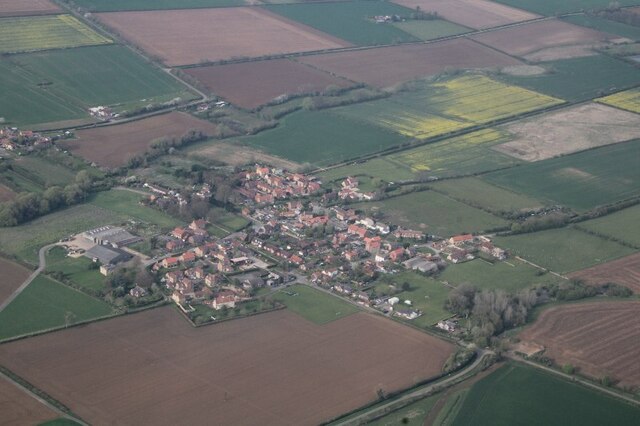
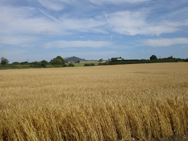
Bishop Norton is a small village located in the county of Lincolnshire, in the East Midlands region of England. Situated approximately 10 miles north of the city of Lincoln, Bishop Norton is nestled in a picturesque rural setting, surrounded by rolling fields and farmland.

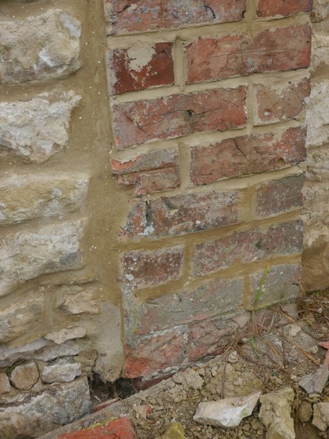
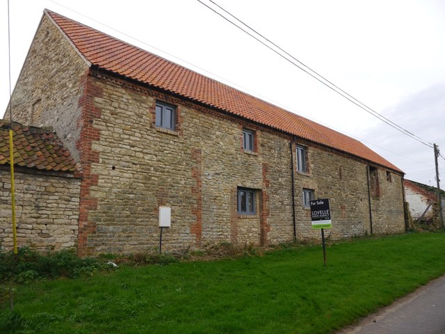
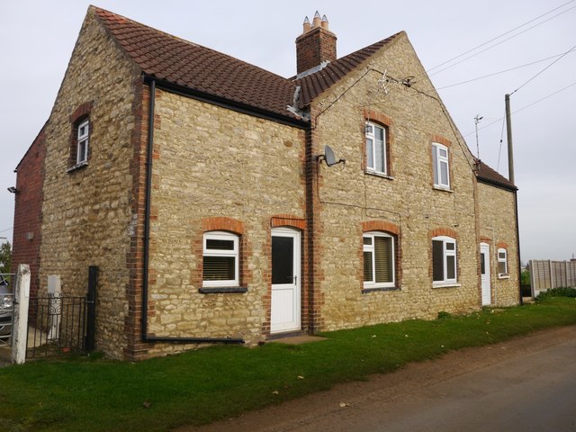
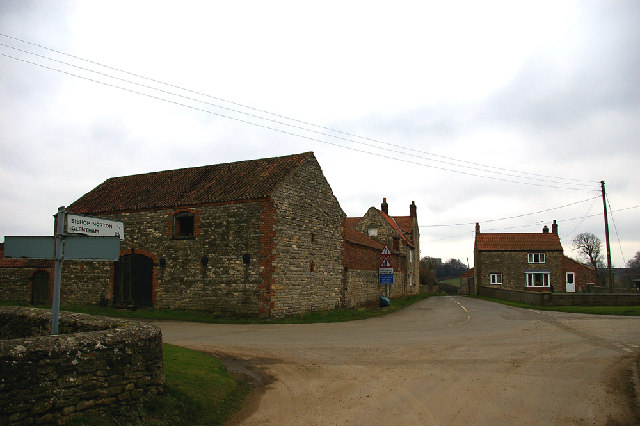
The village has a long history, with evidence of human settlement dating back to the Roman period. It is named after the Bishop of Lincoln, whose seat was located in the nearby city. The village itself is characterized by a mix of traditional stone and brick houses, giving it a charming and timeless feel.

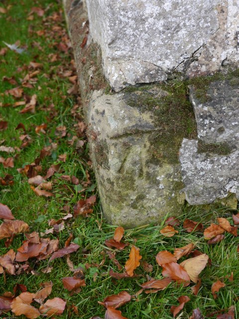
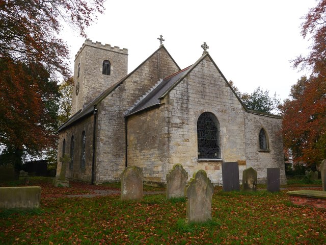
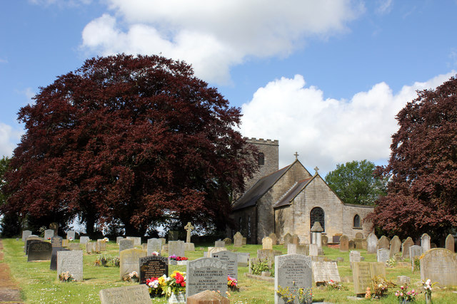
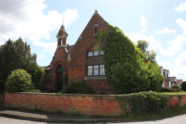
Despite its small size, Bishop Norton offers a range of amenities for its residents. These include a local pub, a community center, and a primary school, providing essential services and fostering a strong sense of community. The village is also known for its beautiful St. Peter's Church, which dates back to the 13th century and features stunning architectural details.

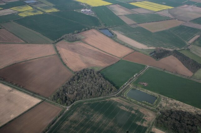
Surrounded by the Lincolnshire Wolds, an Area of Outstanding Natural Beauty, Bishop Norton provides ample opportunities for outdoor activities. The village is a popular starting point for hikers and cyclists, with numerous trails and paths leading to the surrounding countryside and nearby landmarks.

Overall, Bishop Norton is a tranquil and idyllic village that offers a peaceful retreat from the hustle and bustle of urban life. With its rich history, strong community spirit, and stunning natural surroundings, it is a place that holds great appeal for both residents and visitors alike.

If you have any feedback on the listing, please let us know in the comments section below.

Bishop Norton Images

Images are sourced within 2km of 53.42102/-0.521008 or Grid Reference SK9892. Thanks to Geograph Open Source API. All images are credited.

A15 at Old Leys Lane/Atterby Lane junction
Bishop Norton: aerial 2022
New Close Plantation, Glentham: aerial 2022
Farm track near Atterby
Field edge near Atterby
Wheatfield and Atterby Farm
Cut Mark: Bishop Norton, St Peter's Church Cut mark on the south-east angle.  See <a title="https://www.geograph.org.uk/photo/5187629" href="https://www.geograph.org.uk/photo/5187629">Link</a> for a wider view and <span class="nowrap"><a title="http://www.bench-marks.org.uk/bm36510" rel="nofollow ugc noopener" href="http://www.bench-marks.org.uk/bm36510">Link</a><img style="margin-left:2px;" alt="External link" title="External link - shift click to open in new window" src="https://s1.geograph.org.uk/img/external.png" width="10" height="10"/></span> for details.
Cut Mark: Bishop Norton, St Peter's Church
Cut mark on the south-east angle. See Link for a wider view and LinkExternal link for details.
Bishop Norton, St Peter's Church There is cut mark on the nearest (south-east) angle.  See <a title="https://www.geograph.org.uk/photo/5187627" href="https://www.geograph.org.uk/photo/5187627">Link</a> for a closer view and <span class="nowrap"><a title="http://www.bench-marks.org.uk/bm36510" rel="nofollow ugc noopener" href="http://www.bench-marks.org.uk/bm36510">Link</a><img style="margin-left:2px;" alt="External link" title="External link - shift click to open in new window" src="https://s1.geograph.org.uk/img/external.png" width="10" height="10"/></span> for details.
Bishop Norton, St Peter's Church
There is cut mark on the nearest (south-east) angle. See Link for a closer view and LinkExternal link for details.
Cut Mark: Bishop Norton, Crossholme Farm Cut mark on the north face of a farm building under conversion to accommodation.  See <a title="https://www.geograph.org.uk/photo/5187775" href="https://www.geograph.org.uk/photo/5187775">Link</a> for a wider view and <span class="nowrap"><a title="http://www.bench-marks.org.uk/bm80190" rel="nofollow ugc noopener" href="http://www.bench-marks.org.uk/bm80190">Link</a><img style="margin-left:2px;" alt="External link" title="External link - shift click to open in new window" src="https://s1.geograph.org.uk/img/external.png" width="10" height="10"/></span> for details.
Cut Mark: Bishop Norton, Crossholme Farm
Cut mark on the north face of a farm building under conversion to accommodation. See Link for a wider view and LinkExternal link for details.
Bishop Norton, Crossholme Farm This farm building is under conversion to accommodation.  Below the nearer ground floor window is a cut bench mark.  See <a title="https://www.geograph.org.uk/photo/5187768" href="https://www.geograph.org.uk/photo/5187768">Link</a> for a closer view and <span class="nowrap"><a title="http://www.bench-marks.org.uk/bm80190" rel="nofollow ugc noopener" href="http://www.bench-marks.org.uk/bm80190">Link</a><img style="margin-left:2px;" alt="External link" title="External link - shift click to open in new window" src="https://s1.geograph.org.uk/img/external.png" width="10" height="10"/></span> for details.
Bishop Norton, Crossholme Farm
This farm building is under conversion to accommodation. Below the nearer ground floor window is a cut bench mark. See Link for a closer view and LinkExternal link for details.
Cut Mark: Atterby, Bishop Norton Road Cut mark to the right of the entrance door of the house.  See <a title="https://www.geograph.org.uk/photo/5208865" href="https://www.geograph.org.uk/photo/5208865">Link</a> for a wider view and <span class="nowrap"><a title="http://www.bench-marks.org.uk/bm80189" rel="nofollow ugc noopener" href="http://www.bench-marks.org.uk/bm80189">Link</a><img style="margin-left:2px;" alt="External link" title="External link - shift click to open in new window" src="https://s1.geograph.org.uk/img/external.png" width="10" height="10"/></span> for details.
Cut Mark: Atterby, Bishop Norton Road
Cut mark to the right of the entrance door of the house. See Link for a wider view and LinkExternal link for details.
Atterby, Bishop Norton Road, house There is a cut mark to the right of the entrance door of the house.  See <a title="https://www.geograph.org.uk/photo/5208862" href="https://www.geograph.org.uk/photo/5208862">Link</a> for a closer view and <span class="nowrap"><a title="http://www.bench-marks.org.uk/bm80189" rel="nofollow ugc noopener" href="http://www.bench-marks.org.uk/bm80189">Link</a><img style="margin-left:2px;" alt="External link" title="External link - shift click to open in new window" src="https://s1.geograph.org.uk/img/external.png" width="10" height="10"/></span> for details.
Atterby, Bishop Norton Road, house
There is a cut mark to the right of the entrance door of the house. See Link for a closer view and LinkExternal link for details.
A15 The A15 is the main north-south road in Lincolnshire, running the entire length of the county for almost 100 miles between Hessle, near Kingston upon Hull, and Peterborough via Lincoln, Sleaford and Bourne. It is also the road that crosses the Humber Bridge.
A15
The A15 is the main north-south road in Lincolnshire, running the entire length of the county for almost 100 miles between Hessle, near Kingston upon Hull, and Peterborough via Lincoln, Sleaford and Bourne. It is also the road that crosses the Humber Bridge.
Crossroads, A15 The A15 is the main north-south road in Lincolnshire, running the entire length of the county for almost 100 miles between Hessle, near Kingston upon Hull, and Peterborough via Lincoln, Sleaford and Bourne. It is also the road that crosses the Humber Bridge.
Crossroads, A15
The A15 is the main north-south road in Lincolnshire, running the entire length of the county for almost 100 miles between Hessle, near Kingston upon Hull, and Peterborough via Lincoln, Sleaford and Bourne. It is also the road that crosses the Humber Bridge.
Ordnance Survey Cut Mark This OS cut mark can be found on the east face of St Peter's Church. It marks a point 25.594m above mean sea level.
Ordnance Survey Cut Mark
This OS cut mark can be found on the east face of St Peter's Church. It marks a point 25.594m above mean sea level.
St Peters Church, Main Street, Bishop Norton Grade II* Listed Church. The settlement is listed in the Domesday Survey of 1086 but no mention of a church. There was definitely a church in Bishop Norton by 1146.  A further link with a Norman past is a semi—circular tympanum stone that is set on the external western wall. This was carved in about 1145 and may originally have filled a semi-circular arch in a Norman doorway. Largely a 19th century church the tower was erected in 1737. Its chamber holds 3 bells. An hourly chiming clock was installed in 1906. After the Great War, a lychgate was erected on the southern path as a lasting memorial to 6 men from the Parish who had been killed in Flanders. St Peter’s was last restored in 1974 after a thunderbolt struck the tower. During archaeological monitoring of the excavations for an extension and drainage ditches in February and March 2009, evidence emerged of the rebuilding of the nave which dates from 1892. Medieval pottery, ridge tile, middle Saxon pottery and an earlier construction boundary, which pre-dates the existing church was also found.
St Peters Church, Main Street, Bishop Norton
Grade II* Listed Church. The settlement is listed in the Domesday Survey of 1086 but no mention of a church. There was definitely a church in Bishop Norton by 1146. A further link with a Norman past is a semi—circular tympanum stone that is set on the external western wall. This was carved in about 1145 and may originally have filled a semi-circular arch in a Norman doorway. Largely a 19th century church the tower was erected in 1737. Its chamber holds 3 bells. An hourly chiming clock was installed in 1906. After the Great War, a lychgate was erected on the southern path as a lasting memorial to 6 men from the Parish who had been killed in Flanders. St Peter’s was last restored in 1974 after a thunderbolt struck the tower. During archaeological monitoring of the excavations for an extension and drainage ditches in February and March 2009, evidence emerged of the rebuilding of the nave which dates from 1892. Medieval pottery, ridge tile, middle Saxon pottery and an earlier construction boundary, which pre-dates the existing church was also found.
The Old School, Main Street, Bishop Norton Grade II Listed former school built 1872.
The Old School, Main Street, Bishop Norton
Grade II Listed former school built 1872.
Bishop Norton Road towards Bishop Norton
Show me another place!

Bishop Norton is located at Grid Ref: SK9892 (Lat: 53.42102, Lng: -0.521008)

Division: Parts of Lindsey

Administrative County: Lincolnshire

District: West Lindsey

Police Authority: Lincolnshire

What 3 Words

///empty.foot.runways. Near Redbourne, Lincolnshire

Nearby Locations

Atterby Bishop Norton

Related Wikis

Bishop Norton

Bishop Norton is a village and the main settlement of the civil parish of the same name in the West Lindsey district of Lincolnshire, England. The village...

Atterby

Atterby is a hamlet and former civil parish, now in the parish of Bishop Norton, in the West Lindsey district of Lincolnshire, England. It lies 1 mile...

Snitterby

Snitterby is a village and civil parish in the West Lindsey district of Lincolnshire, England. The population of the civil parish was 215 at the 2001 census...

Glentham

Glentham is a village and civil parish in the West Lindsey district of Lincolnshire, England. It is situated on the A631, 6 miles (9.7 km) west from Market...

Nearby Amenities

Located within 500m of 53.42102,-0.521008
Atterby
Is In: Lincolnshire, England, UK
Place: hamlet
Source: NPE
Wikidata: Q4818263
Lat/Long: 53.4250086/-0.5240091
Bishop Norton
Is In: Lincolnshire, England, UK
Place: village
Source: NPE
Wikidata: Q4917674
Lat/Long: 53.4210569/-0.5210492
Bus Stop
St Peter's Church
Naptan AtcoCode: 270000010209
Naptan Bearing: NE
Naptan CommonName: St Peter's Church
Naptan Indicator: adj
Naptan Landmark: St Peter's Church
Naptan NaptanCode: linjmdap
Naptan Street: Main Street
Naptan Verified: no
Source: naptan_import
Lat/Long: 53.42133/-0.5204322
St Peter's Church
Naptan AtcoCode: 270000010210
Naptan Bearing: SW
Naptan BusStopType: CUS
Naptan CommonName: St Peter's Church
Naptan Indicator: opp
Naptan Landmark: St Peter's Church
Naptan NaptanCode: linjmdat
Naptan Street: Main Street
Naptan Verified: no
Source: naptan_import
Lat/Long: 53.4212216/-0.5203908
Letter Box
Naptan AtcoCode: 270000010211
Naptan Bearing: E
Naptan BusStopType: CUS
Naptan CommonName: Letter Box
Naptan Indicator: adj
Naptan Landmark: Letter Box
Naptan NaptanCode: linjmdaw
Naptan Street: Atterby Lane
Naptan Verified: no
Source: naptan_import
Lat/Long: 53.4248499/-0.5237414
Letter Box
Naptan AtcoCode: 270000010212
Naptan Bearing: W
Naptan BusStopType: CUS
Naptan CommonName: Letter Box
Naptan Indicator: opp
Naptan Landmark: Letter Box
Naptan NaptanCode: linjmdga
Naptan Street: Atterby Lane
Naptan Verified: no
Source: naptan_import
Lat/Long: 53.4247685/-0.5236991
East Farm
Place: farm
Source: Bing
Lat/Long: 53.4242921/-0.5226523
Newholme Farm
Place: farm
Source: Bing
Lat/Long: 53.422669/-0.5202056
White House Farm
Place: farm
Source: Bing
Lat/Long: 53.42194/-0.5179204
Note: End of public highway
Lat/Long: 53.4195683/-0.5217158
Generator Method: photovoltaic
Generator Output Electricity: yes
Generator Source: solar
Generator Type: solar_photovoltaic_panel
Location: roof
Power: generator
Lat/Long: 53.4194526/-0.520185
Generator Method: photovoltaic
Generator Output Electricity: yes
Generator Source: solar
Generator Type: solar_photovoltaic_panel
Location: roof
Power: generator
Lat/Long: 53.4194926/-0.5202547
Generator Method: photovoltaic
Generator Output Electricity: yes
Generator Source: solar
Generator Type: solar_photovoltaic_panel
Location: roof
Power: generator
Lat/Long: 53.4215721/-0.5202225
Generator Method: photovoltaic
Generator Output Electricity: yes
Generator Source: solar
Generator Type: solar_photovoltaic_panel
Location: roof
Power: generator
Lat/Long: 53.4214922/-0.5201903
Generator Method: photovoltaic
Generator Output Electricity: yes
Generator Source: solar
Generator Type: solar_photovoltaic_panel
Location: roof
Power: generator
Lat/Long: 53.4221459/-0.5190799
Generator Method: photovoltaic
Generator Output Electricity: yes
Generator Source: solar
Generator Type: solar_photovoltaic_panel
Location: roof
Power: generator
Lat/Long: 53.4227437/-0.5191362
Generator Method: photovoltaic
Generator Output Electricity: yes
Generator Source: solar
Generator Type: solar_photovoltaic_panel
Location: roof
Power: generator
Lat/Long: 53.4211693/-0.5215288
Generator Method: photovoltaic
Generator Output Electricity: yes
Generator Source: solar
Generator Type: solar_photovoltaic_panel
Location: roof
Power: generator
Lat/Long: 53.4209791/-0.5217393
Generator Method: photovoltaic
Generator Output Electricity: yes
Generator Source: solar
Generator Type: solar_photovoltaic_panel
Location: roof
Power: generator
Lat/Long: 53.4209943/-0.5216441
Generator Method: photovoltaic
Generator Output Electricity: yes
Generator Source: solar
Generator Type: solar_photovoltaic_panel
Location: roof
Power: generator
Lat/Long: 53.4209056/-0.5220035
Generator Method: photovoltaic
Generator Output Electricity: yes
Generator Source: solar
Generator Type: solar_photovoltaic_panel
Location: roof
Power: generator
Lat/Long: 53.420892/-0.5220773
Generator Method: photovoltaic
Generator Output Electricity: yes
Generator Source: solar
Generator Type: solar_photovoltaic_panel
Location: roof
Power: generator
Lat/Long: 53.4208824/-0.5221349
Leisure: playground
Lat/Long: 53.4195685/-0.521059
Give Way
Direction: backward
Lat/Long: 53.4198407/-0.5206867
Give Way
Direction: forward
Lat/Long: 53.4199358/-0.5205893
Information: guidepost
Tourism: information
Lat/Long: 53.4197588/-0.5207011
The data included in this document is from www.openstreetmap.org. The data is made available under ODbL.

Have you been to Bishop Norton?

Leave your review of Bishop Norton below (or comments, questions and feedback).