Polsham

Settlement in Somerset Mendip

England

Polsham

Junction, Godney See also <a href="https://www.geograph.org.uk/photo/2065537">ST4942 : Lane junction at Godney</a>, with a different view of the junction.
Junction, Godney Credit: Derek Harper

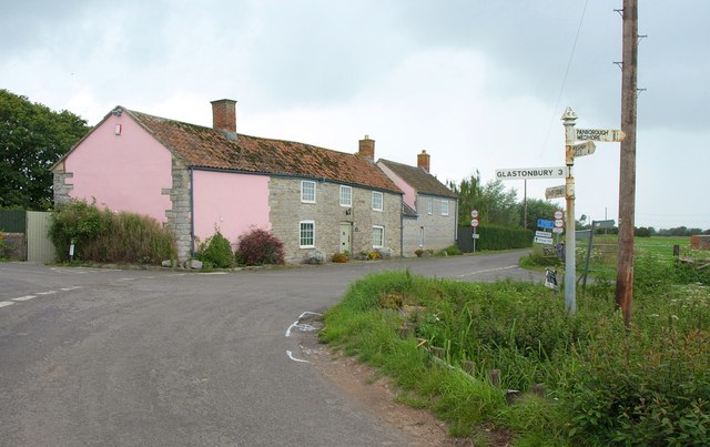
Polsham is a small village located in the county of Somerset, England. Situated in the picturesque countryside, it falls within the Mendip district and lies approximately 3 miles southwest of the town of Shepton Mallet. The village is nestled in a valley, surrounded by rolling hills and lush green fields, offering residents and visitors a tranquil and idyllic setting.

With a population of around 200 residents, Polsham retains its charm as a close-knit community. The village is characterized by its traditional stone-built cottages and well-maintained gardens, which add to its aesthetic appeal. The local church, St. Mary's, is a prominent feature in the village, dating back to the 13th century and serving as a focal point for religious and community gatherings.

Despite its small size, Polsham offers a range of amenities to cater to the needs of its residents. These include a village hall, which acts as a hub for social events and gatherings, a primary school, and a local pub that serves as a meeting point for locals and visitors alike.

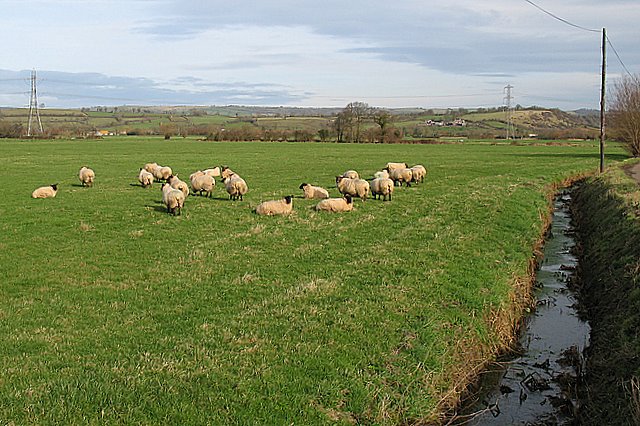
The surrounding natural beauty of Polsham provides ample opportunities for outdoor activities, such as hiking, cycling, and horse riding. The village is also well-connected to nearby towns and cities, with good transport links ensuring easy access to amenities and services.

Overall, Polsham, Somerset, offers a peaceful and rural lifestyle, with a strong sense of community and a beautiful natural environment. It is an ideal place for those seeking a tranquil retreat amidst the picturesque Somerset countryside.

If you have any feedback on the listing, please let us know in the comments section below.
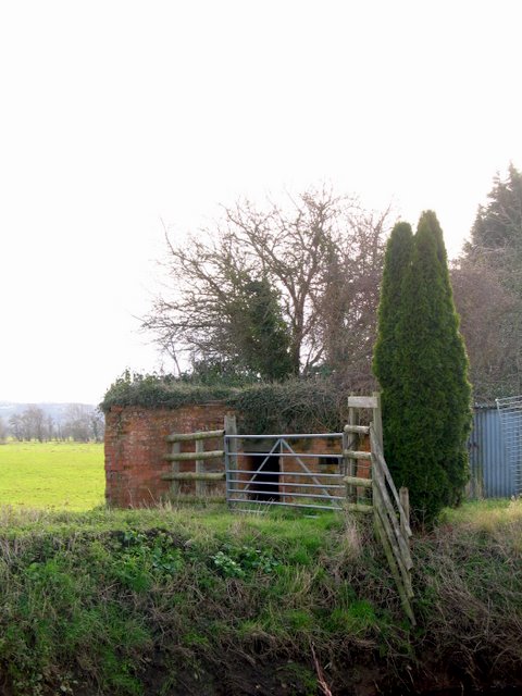
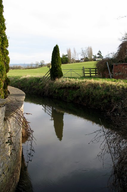
Polsham Images

Images are sourced within 2km of 51.182635/-2.700601 or Grid Reference ST5142. Thanks to Geograph Open Source API. All images are credited.

Junction, Godney See also <a href="https://www.geograph.org.uk/photo/2065537">ST4942 : Lane junction at Godney</a>, with a different view of the junction.
Junction, Godney
See also ST4942 : Lane junction at Godney, with a different view of the junction.
Flow Measuring Station on River Sheppey The River Sheppey is a significant watercourse on this part of the Somerset Levels, taking water from the foot of the Mendips at Wells, meandering around Godney and into the rhynes that feed the River Brue. 
The Environment Agency monitor the river flow and can thus predict flooding: data available at <span class="nowrap"><a title="http://www.environment-agency.gov.uk/homeandleisure/floods/riverlevels/riverstation.aspx?StationId=3054&RegionId=5&AreaId=9&CatchmentId=19" rel="nofollow ugc noopener" href="http://www.environment-agency.gov.uk/homeandleisure/floods/riverlevels/riverstation.aspx?StationId=3054&RegionId=5&AreaId=9&CatchmentId=19">Link</a><img style="margin-left:2px;" alt="External link" title="External link - shift click to open in new window" src="https://s1.geograph.org.uk/img/external.png" width="10" height="10"/></span>
Flow Measuring Station on River Sheppey
The River Sheppey is a significant watercourse on this part of the Somerset Levels, taking water from the foot of the Mendips at Wells, meandering around Godney and into the rhynes that feed the River Brue. The Environment Agency monitor the river flow and can thus predict flooding: data available at LinkExternal link
Derelict House on the Levels It amazes me that there are houses on the levels. They must flood from time to time and what with global warming!!! The area is marked as Piggery on the 25,000 map but there are no pigs there now.
Derelict House on the Levels
It amazes me that there are houses on the levels. They must flood from time to time and what with global warming!!! The area is marked as Piggery on the 25,000 map but there are no pigs there now.
River Sheppey flow measuring station The discharge of the river Sheppey is measured at this point.
River Sheppey flow measuring station
The discharge of the river Sheppey is measured at this point.
Sheep Grazing Sheep grazing on low lying pasture near the village of Upper Godney on the Somerset Levels.  The Mendip Hills can be seen in the far distance.
Sheep Grazing
Sheep grazing on low lying pasture near the village of Upper Godney on the Somerset Levels. The Mendip Hills can be seen in the far distance.
Pill Box in Upper Godney This Pill Box is just to the south of the river Sheppey and is nowhere near as obvious as the other pill box in this square as it is behind a farm making it somewhat inaccessible.  It is a Type 29 Pill Box on 'Stop Line Green'.

Stop Line Green was a 100 mile continuous semi-circular defensive line (also known as Bristol Outer Defences). It ran from Highbridge on the Bristol Channel in the south to Upper Framilode on the river Severn in the north. It was a last line of defence against an attack from the east and was built on the assumption that the Germans had already advanced this far west. It was designed to defend Bristol and so keep the port open for evacuation, resupply or reinforcements. There were many other 'stop lines' in Southern Britain, with different colour codes, all designed to be a hindrance to tanks in the event of an invasion. (Taken from 'Warwalks - Stop Line Green' by Major Green - 1999.)
Pill Box in Upper Godney
This Pill Box is just to the south of the river Sheppey and is nowhere near as obvious as the other pill box in this square as it is behind a farm making it somewhat inaccessible. It is a Type 29 Pill Box on 'Stop Line Green'. Stop Line Green was a 100 mile continuous semi-circular defensive line (also known as Bristol Outer Defences). It ran from Highbridge on the Bristol Channel in the south to Upper Framilode on the river Severn in the north. It was a last line of defence against an attack from the east and was built on the assumption that the Germans had already advanced this far west. It was designed to defend Bristol and so keep the port open for evacuation, resupply or reinforcements. There were many other 'stop lines' in Southern Britain, with different colour codes, all designed to be a hindrance to tanks in the event of an invasion. (Taken from 'Warwalks - Stop Line Green' by Major Green - 1999.)
River Sheppey in Upper Godney - facing east The River Sheppey is a tributary of the river Brue.  It originates in the Mendips; the source being a group of springs to the west of the settlement of Doulting where water draining through the limestone of the Mendips appears. From Doulting the Sheppey flows southwest through the wetlands to the north of the Polden Hills. At Charlton parts of the rivers course have been culverted and the river flows beneath ground through Shepton Mallet. 

The river reappears at Darshill and its course continues southwest through Croscombe, Dinder, Woodford, Coxley. From Coxley the course of the river heads north through Hay Moor and North Moor, wetlands, supplied and drained by the river. The river continues west through Ash Moor, here the river course turns sharply to the south through Frogmore and west through Godney. At Lower Godney the river is channelled through the ‘James Wear River’ and the ‘Decoy Rhine’to Westhay Level where it joins ‘Whites River’ and then the River Brue. No part of the Sheppey is tidal.
River Sheppey in Upper Godney - facing east
The River Sheppey is a tributary of the river Brue. It originates in the Mendips; the source being a group of springs to the west of the settlement of Doulting where water draining through the limestone of the Mendips appears. From Doulting the Sheppey flows southwest through the wetlands to the north of the Polden Hills. At Charlton parts of the rivers course have been culverted and the river flows beneath ground through Shepton Mallet. The river reappears at Darshill and its course continues southwest through Croscombe, Dinder, Woodford, Coxley. From Coxley the course of the river heads north through Hay Moor and North Moor, wetlands, supplied and drained by the river. The river continues west through Ash Moor, here the river course turns sharply to the south through Frogmore and west through Godney. At Lower Godney the river is channelled through the ‘James Wear River’ and the ‘Decoy Rhine’to Westhay Level where it joins ‘Whites River’ and then the River Brue. No part of the Sheppey is tidal.
The river Sheppey and Garlsade Farm The river Sheppey flows across land that is below 5m above sea level.  Garslade farm stands atop the ridge which leads up from the flat land - and stands about 10m above sea level.
The river Sheppey and Garlsade Farm
The river Sheppey flows across land that is below 5m above sea level. Garslade farm stands atop the ridge which leads up from the flat land - and stands about 10m above sea level.
Flow measuring station
River Sheppey View upstream of the typical levels river from the bridge at Garslade Farm. The bridge carries the minor road from Polsham to Godney across the river.
River Sheppey
View upstream of the typical levels river from the bridge at Garslade Farm. The bridge carries the minor road from Polsham to Godney across the river.
Godney Drove, Upper Godney
View from Hurn Drove near Godney Looking south from Hurn Drove over the Somerset Levels towards Glastonbury Tor.
View from Hurn Drove near Godney
Looking south from Hurn Drove over the Somerset Levels towards Glastonbury Tor.
Fields next to Ashmoor Drove
Cottage, Upper Godney
Shott's Farm
Shott's Farm
River Sheppey flow measuring station With viewing seat!
River Sheppey flow measuring station
With viewing seat!
Old Direction Sign - Signpost, Upper Godney Pyramid finial - 4 arms; Somerset SCC pyramid by the UC road, in parish of Godney (Mendip District), Upper Godney, 4 lanes junction.

Surveyed

Milestone Society National ID: SO_ST4942.
Old Direction Sign - Signpost, Upper Godney
Pyramid finial - 4 arms; Somerset SCC pyramid by the UC road, in parish of Godney (Mendip District), Upper Godney, 4 lanes junction. Surveyed Milestone Society National ID: SO_ST4942.
Castle Hill, Fenny Castle
Show me another place!

Polsham is located at Grid Ref: ST5142 (Lat: 51.182635, Lng: -2.700601)

Administrative County: Somerset

District: Mendip

Police Authority: Avon and Somerset

What 3 Words

///falters.sues.ideals. Near Glastonbury, Somerset

Nearby Locations

Polsham Southway

Related Wikis

St Cuthbert Out

St Cuthbert Out, sometimes Wells St Cuthbert Out, is a civil parish in the Mendip district of Somerset, England. It entirely surrounds (but does not include...

Polsham railway station

Polsham was a railway station on the Somerset and Dorset Railway in the village of Polsham, Somerset in England. Opening in December 1861 on the Somerset...

Fenny Castle

Fenny Castle is the remains of a motte and bailey castle in the parish of Wookey, Somerset, England. It is a Scheduled Ancient Monument, but not accessible...

Christ Church, Coxley

Christ Church is a Church of England church in Coxley, Somerset, England. It was built in 1839–40 to the designs of Richard Carver and is a Grade II listed...

Ben Knowle

Ben Knowle (grid reference ST513450) is a 1.5 hectare geological Site of Special Scientific Interest in Somerset, notified in 1984. Ben Knowle is a natural...

Holy Trinity Church, Godney

Holy Trinity Church is a former Church of England church in Godney, Somerset, England. Designed by George Phillips Manners, it was built in 1839–41 and...

Godney

Godney is a village and civil parish near Glastonbury on the River Sheppey on the Somerset Levels in the Mendip district of Somerset, England. == History... ==

Glastonbury Lake Village

Glastonbury Lake Village was an Iron Age village, situated on a crannog or man made island in the Somerset Levels, near Godney, some 3 miles (5 km) north...

Nearby Amenities

Located within 500m of 51.182635,-2.700601
Polsham
Place: hamlet
Source: New Popular Edition
Lat/Long: 51.1837103/-2.6999941
Colour: grey
Design: three-level
Height: 7.57
Line Attachment: suspension
Material: metal
Operator: National Grid
Operator Wikidata: Q1465461
Power: tower
Ref: ZG092
Source: Bing
Start Date: 1960
Structure: lattice
Lat/Long: 51.1859626/-2.6983012
Colour: grey
Design: three-level
Height: 6.66
Line Attachment: suspension
Material: metal
Operator: National Grid
Operator Wikidata: Q1465461
Power: tower
Ref: ZG091
Source: Bing
Start Date: 1960
Structure: lattice
Lat/Long: 51.1861086/-2.7030551
Power: pole
Lat/Long: 51.1830379/-2.6935977
Material: wood
Power: pole
Lat/Long: 51.1837161/-2.7072877
Power: pole
Lat/Long: 51.1841361/-2.7062839
Power: pole
Lat/Long: 51.1844231/-2.7056248
Power: pole
Lat/Long: 51.1849139/-2.7045438
Power: pole
Lat/Long: 51.1856002/-2.7030823
Power: pole
Lat/Long: 51.1858439/-2.702528
Power: pole
Lat/Long: 51.1864955/-2.7010389
Power: pole
Lat/Long: 51.1866683/-2.6992492
Power: pole
Lat/Long: 51.1824673/-2.6944048
Power: pole
Lat/Long: 51.1819725/-2.6946809
Power: pole
Lat/Long: 51.1816863/-2.6948437
Material: wood
Power: pole
Lat/Long: 51.181074/-2.6952082
Material: wood
Power: pole
Lat/Long: 51.1804861/-2.695548
Material: wood
Power: pole
Lat/Long: 51.1798671/-2.6958948
Material: wood
Power: pole
Lat/Long: 51.1792636/-2.6962416
Material: wood
Power: pole
Lat/Long: 51.1789733/-2.704629
Material: wood
Power: pole
Lat/Long: 51.1798962/-2.7049121
Material: wood
Power: pole
Lat/Long: 51.1807393/-2.7051917
Material: wood
Power: pole
Lat/Long: 51.181518/-2.7054359
Material: wood
Power: pole
Lat/Long: 51.1823211/-2.7057013
Material: wood
Power: pole
Lat/Long: 51.1834104/-2.7060446
Power: pole
Lat/Long: 51.184777/-2.7064977
Public Bookcase
Booth: K6
Disused Amenity: telephone
Man Made: telephone_box
Public Bookcase Type: phone_box
Lat/Long: 51.1823382/-2.6988818
The data included in this document is from www.openstreetmap.org. The data is made available under ODbL.

Have you been to Polsham?

Leave your review of Polsham below (or comments, questions and feedback).