Plymstock

Settlement in Devon

England

Plymstock

The pillar in Hooe Lake This was a discharge tower where sewage sludge was pumped into barges for disposal at sea, a procedure now discontinued.
The pillar in Hooe Lake Credit: Alan Murray-Rust

Plymstock is a suburban area located in the county of Devon, England. It is situated on the eastern bank of the River Plym, about 4 miles southeast of the city of Plymouth. With a population of around 25,000 residents, Plymstock is a thriving residential community that offers a peaceful and picturesque setting.

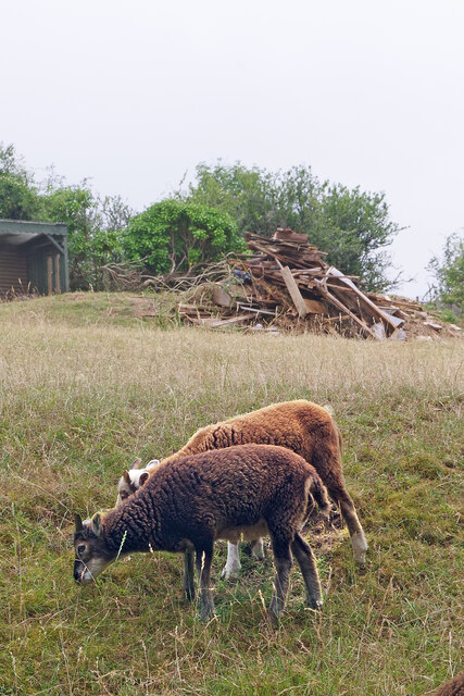
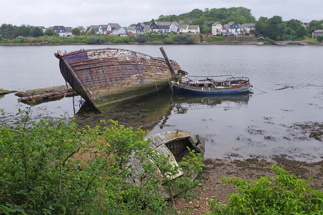
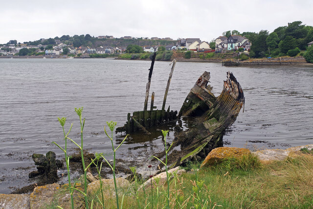
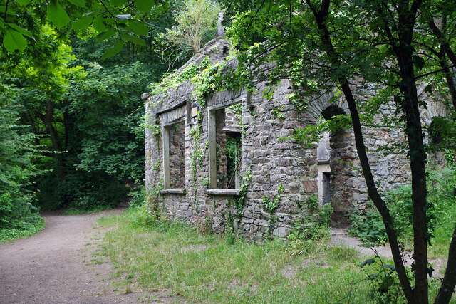
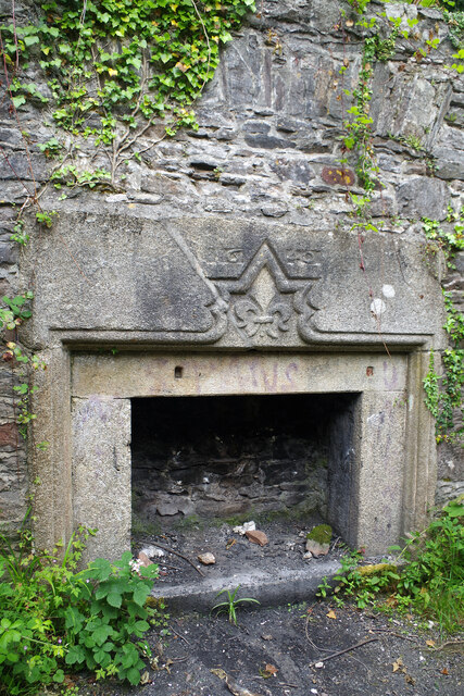
The area boasts a rich history that dates back to the medieval times, with evidence of human settlement found in the form of ancient burial mounds and stone circles. Today, Plymstock is known for its blend of modern amenities and natural beauty. The region is surrounded by lush green fields, rolling hills, and stunning coastline, making it an attractive destination for outdoor enthusiasts.

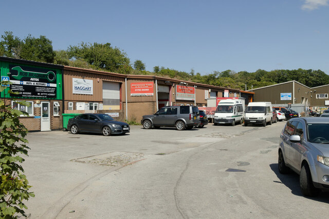
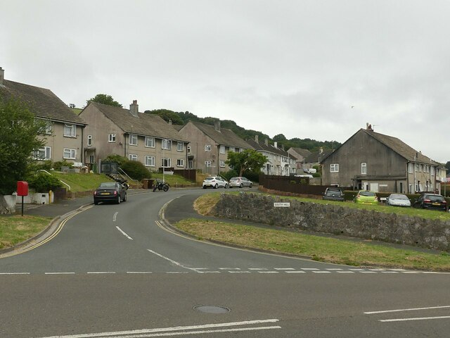
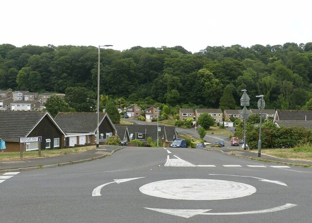
Plymstock offers a range of facilities and services to cater to its residents' needs. The area features several primary and secondary schools, providing excellent educational opportunities. There are also various shopping centers, supermarkets, and local businesses, ensuring that residents have convenient access to everyday necessities.

For leisure and recreation, Plymstock has a number of parks, playgrounds, and sports facilities, including a leisure center with swimming pools and a gymnasium. The nearby coastline offers beautiful beaches and access to water sports activities like sailing, kayaking, and fishing.

Transportation in Plymstock is well-served by a network of bus routes, linking the area to Plymouth city center and other surrounding towns. The A379 road runs through the area, providing convenient access to the wider region.

Overall, Plymstock is a vibrant and welcoming community that offers a high quality of life, combining the beauty of the countryside with the convenience of modern amenities.

If you have any feedback on the listing, please let us know in the comments section below.
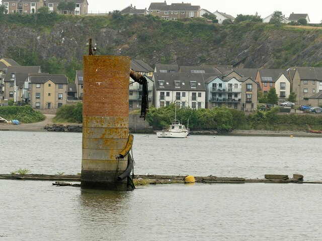
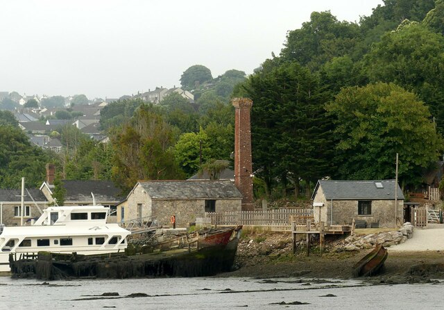
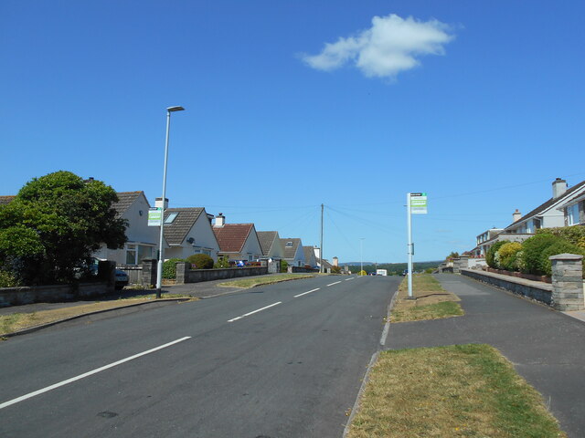
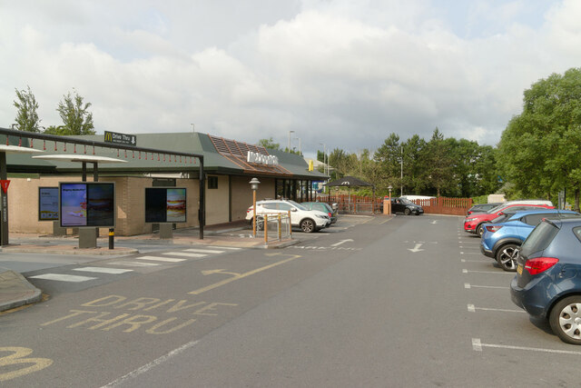
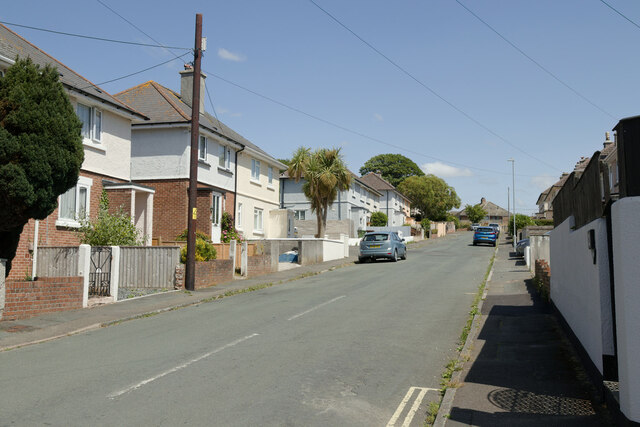
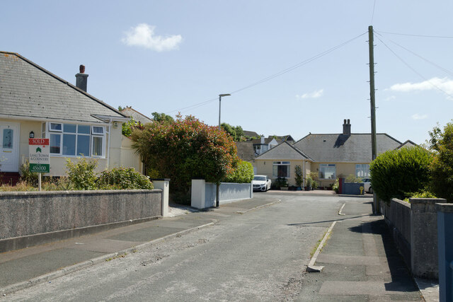
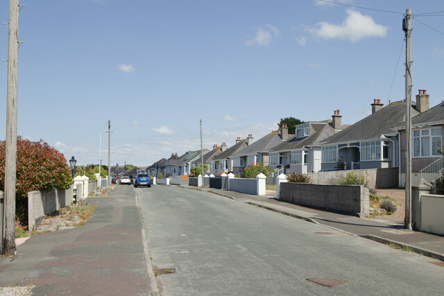
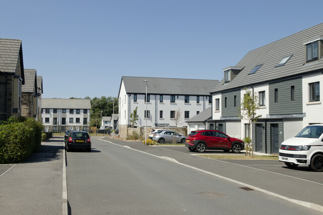
Plymstock Images

Images are sourced within 2km of 50.355385/-4.086647 or Grid Reference SX5152. Thanks to Geograph Open Source API. All images are credited.

The pillar in Hooe Lake This was a discharge tower where sewage sludge was pumped into barges for disposal at sea, a procedure now discontinued.
The pillar in Hooe Lake
This was a discharge tower where sewage sludge was pumped into barges for disposal at sea, a procedure now discontinued.
Hexton Hill Quay The old buildings with chimney served a quarry on the hillside to the right.
Hexton Hill Quay
The old buildings with chimney served a quarry on the hillside to the right.
Rotting hulls Probably late 19th century coasting/fishing vessels.
Rotting hulls
Probably late 19th century coasting/fishing vessels.
Two bus stops One either side of the road in Mountbatten Way.
Two bus stops
One either side of the road in Mountbatten Way.
McDonald's, Pomphlett Road
Meadow Park, Hooe
Meadow Park, Hooe
Berry Park Close
Berry Park Close
Berry Park Road
Berry Park Road
Broxton Drive, Pomphlett
Pomphlett Farm Industrial Estate
Soay lambs Soay sheep are descended from a population of feral sheep on the island of Soay off the Western Isles of Scotland. These two lambs, however, live in the altogether more benign environment of the Plymouth suburbs.
Soay lambs
Soay sheep are descended from a population of feral sheep on the island of Soay off the Western Isles of Scotland. These two lambs, however, live in the altogether more benign environment of the Plymouth suburbs.
Hooe Lake One of Hooe Lake's hulks (there are over 30 abandoned vessels around the lake) lies just east of Hexton Quay. The boat next to it is much newer but is equally derelict having been burnt out at some point.
Hooe Lake
One of Hooe Lake's hulks (there are over 30 abandoned vessels around the lake) lies just east of Hexton Quay. The boat next to it is much newer but is equally derelict having been burnt out at some point.
Hooe Lake One of the many Hooe Lake hulks languishes here at the eastern end.
Hooe Lake
One of the many Hooe Lake hulks languishes here at the eastern end.
Armoury Cottage, Radford Lake Armoury Cottage is one of a group of ruined buildings on the south side of Radford Lake in Radford Woods that include an old boathouse. They formed part of the grounds of Radford House which was demolished in 1937. Collectively the buildings are grade II listed and it is said they are haunted by the White Lady who searches the ruins for her lover.
Armoury Cottage, Radford Lake
Armoury Cottage is one of a group of ruined buildings on the south side of Radford Lake in Radford Woods that include an old boathouse. They formed part of the grounds of Radford House which was demolished in 1937. Collectively the buildings are grade II listed and it is said they are haunted by the White Lady who searches the ruins for her lover.
Fireplace - Armoury Cottage, Radford Lake This grand fireplace suggests that the ruined Armoury Cottage was once a dwelling of some importance. Above the fireplace is a date - 1640 - and a fleur-de-lys carving. The fleur-de-lys design is typically associated with French heraldry and it may signify the original owners of Radford House, the 'le Abbé' family, who later changed their name to 'de Radford'. See <a href="https://www.geograph.org.uk/photo/7529687">SX5052 : Armoury Cottage, Radford Lake</a> for an external view of the cottage.
Fireplace - Armoury Cottage, Radford Lake
This grand fireplace suggests that the ruined Armoury Cottage was once a dwelling of some importance. Above the fireplace is a date - 1640 - and a fleur-de-lys carving. The fleur-de-lys design is typically associated with French heraldry and it may signify the original owners of Radford House, the 'le Abbé' family, who later changed their name to 'de Radford'. See SX5052 : Armoury Cottage, Radford Lake for an external view of the cottage.
Hull in Hooe Lake Not quite a hulk, like many others, there does appear to have been some attempt to rescue this one.
Hull in Hooe Lake
Not quite a hulk, like many others, there does appear to have been some attempt to rescue this one.
South Hill, Hooe Post-WW2 council housing estate.
South Hill, Hooe
Post-WW2 council housing estate.
Reddicliff Road, Hooe Late 20th century housing development
Reddicliff Road, Hooe
Late 20th century housing development
Show me another place!

Plymstock is located at Grid Ref: SX5152 (Lat: 50.355385, Lng: -4.086647)

Unitary Authority: Plymouth

Police Authority: Devon and Cornwall

What 3 Words

///wires.bits.strain. Near Plymstock, Devon

Related Wikis

Plymstock

Plymstock is a commuter suburb of Plymouth and former civil parish in the English county of Devon. == Geography == Situated on the east bank of the River...

Coombe Dean School

Coombe Dean School Academy, opened in 1976, is a secondary school located on the outskirts of Plymouth, Devon, England. As of April 2018, it had 970 pupils...

Plymstock School

Plymstock School is a state comprehensive secondary school (ages 11–19) in Plymstock, a suburb of Plymouth, Devon, England. It was the first West Devon...

Radford Cave

Radford Cave, in Hexton Wood, near Hooe, Plymouth, Devon is a small phreatic cave of some ecological interest. It has been known to speleologists and...

Nearby Amenities

Located within 500m of 50.355385,-4.086647
Mini Roundabout
Direction: clockwise
Lat/Long: 50.3544253/-4.0863461
Mini Roundabout
Direction: clockwise
Lat/Long: 50.353745/-4.0862058
Crossing
Crossing: unmarked
Crossing Island: no
Crossing Markings: no
Tactile Paving: yes
Lat/Long: 50.3544215/-4.0864456
Goosewell
Place: suburb
Lat/Long: 50.3563115/-4.0925924
One Stop
Brand: One Stop
Brand Wikidata: Q65954217
Contact Website: https://www.onestop.co.uk/store?store=d9d2c773-d1e1-4140-8dc3-a738fb8bf55a
Name En: One Stop
Shop: convenience
Survey Date: 2022-03-25
Lat/Long: 50.3527848/-4.0853089
Plymstock War Memorial
Historic: memorial
Memorial: war_memorial
Lat/Long: 50.3559663/-4.0917655
Post Box
Collection Times: Mo-Fr 09:00; Sa 07:00
Mapillary: 521552879628060
Post Box Type: pillar
Ref: PL9 824D
Royal Cypher: EIIR
Royal Cypher Wikidata: Q33102113
Survey Date: 2022-04-20
Lat/Long: 50.3516069/-4.0854714
Mini Roundabout
Direction: clockwise
Source: bing
Lat/Long: 50.3520118/-4.0851878
Barrier: bollard
Lat/Long: 50.3518198/-4.0849232
Barrier: kissing_gate
Lat/Long: 50.3518399/-4.0847674
Direction: NW
Generator Method: photovoltaic
Generator Output Electricity: yes
Generator Solar Modules: 8
Generator Source: solar
Generator Type: solar_photovoltaic_panel
Location: roof
Power: generator
Lat/Long: 50.3511824/-4.0851686
Direction: SE
Generator Method: photovoltaic
Generator Output Electricity: yes
Generator Solar Modules: 8
Generator Source: solar
Generator Type: solar_photovoltaic_panel
Location: roof
Power: generator
Lat/Long: 50.3511548/-4.0851307
Direction: SSE
Generator Method: photovoltaic
Generator Output Electricity: yes
Generator Solar Modules: 8
Generator Source: solar
Generator Type: solar_photovoltaic_panel
Location: roof
Power: generator
Lat/Long: 50.3513229/-4.0840025
Direction: 170
Generator Method: photovoltaic
Generator Output Electricity: yes
Generator Solar Modules: 16
Generator Source: solar
Generator Type: solar_photovoltaic_panel
Location: roof
Power: generator
Lat/Long: 50.3552747/-4.0802693
Direction: SSE
Generator Method: photovoltaic
Generator Output Electricity: yes
Generator Solar Modules: 8
Generator Source: solar
Generator Type: solar_photovoltaic_panel
Location: roof
Power: generator
Lat/Long: 50.3546839/-4.080871
Direction: 145
Generator Method: photovoltaic
Generator Output Electricity: yes
Generator Solar Modules: 18
Generator Source: solar
Generator Type: solar_photovoltaic_panel
Location: roof
Power: generator
Lat/Long: 50.3566143/-4.0891346
Direction: 165
Generator Method: photovoltaic
Generator Output Electricity: yes
Generator Solar Modules: 16
Generator Source: solar
Generator Type: solar_photovoltaic_panel
Location: roof
Power: generator
Lat/Long: 50.3557926/-4.0887138
Direction: 165
Generator Method: photovoltaic
Generator Output Electricity: yes
Generator Solar Modules: 20
Generator Source: solar
Generator Type: solar_photovoltaic_panel
Location: roof
Power: generator
Lat/Long: 50.3550807/-4.0887929
Direction: 260
Generator Method: photovoltaic
Generator Output Electricity: yes
Generator Solar Modules: 16
Generator Source: solar
Generator Type: solar_photovoltaic_panel
Location: roof
Power: generator
Lat/Long: 50.3548914/-4.0909813
Direction: 170
Generator Method: photovoltaic
Generator Output Electricity: yes
Generator Solar Modules: 13
Generator Source: solar
Generator Type: solar_photovoltaic_panel
Location: roof
Power: generator
Lat/Long: 50.3545433/-4.0858093
Direction: 170
Generator Method: photovoltaic
Generator Output Electricity: yes
Generator Solar Modules: 13
Generator Source: solar
Generator Type: solar_photovoltaic_panel
Location: roof
Power: generator
Lat/Long: 50.3545658/-4.0855334
Direction: 255
Generator Method: photovoltaic
Generator Output Electricity: yes
Generator Solar Modules: 8
Generator Source: solar
Generator Type: solar_photovoltaic_panel
Location: roof
Power: generator
Lat/Long: 50.3541046/-4.0872665
Direction: 165
Generator Method: photovoltaic
Generator Output Electricity: yes
Generator Solar Modules: 8
Generator Source: solar
Generator Type: solar_photovoltaic_panel
Location: roof
Power: generator
Lat/Long: 50.3540774/-4.0872094
Direction: WNW
Generator Method: photovoltaic
Generator Output Electricity: yes
Generator Solar Modules: 8
Generator Source: solar
Generator Type: solar_photovoltaic_panel
Location: roof
Power: generator
Lat/Long: 50.3524465/-4.0844096
Direction: ESE
Generator Method: photovoltaic
Generator Output Electricity: yes
Generator Solar Modules: 8
Generator Source: solar
Generator Type: solar_photovoltaic_panel
Location: roof
Power: generator
Lat/Long: 50.3524316/-4.0843526
Direction: SSE
Generator Method: photovoltaic
Generator Output Electricity: yes
Generator Solar Modules: 12
Generator Source: solar
Generator Type: solar_photovoltaic_panel
Location: roof
Power: generator
Lat/Long: 50.3531452/-4.0868953
Direction: 165
Generator Method: photovoltaic
Generator Output Electricity: yes
Generator Solar Modules: 6
Generator Source: solar
Generator Type: solar_photovoltaic_panel
Location: roof
Power: generator
Lat/Long: 50.3536257/-4.0897498
Direction: 165
Generator Method: photovoltaic
Generator Output Electricity: yes
Generator Solar Modules: 12
Generator Source: solar
Generator Type: solar_photovoltaic_panel
Location: roof
Power: generator
Lat/Long: 50.3534207/-4.0909364
Direction: 185
Generator Method: photovoltaic
Generator Output Electricity: yes
Generator Solar Modules: 15
Generator Source: solar
Generator Type: solar_photovoltaic_panel
Location: roof
Power: generator
Lat/Long: 50.3533865/-4.0927553
Direction: 170
Generator Method: photovoltaic
Generator Output Electricity: yes
Generator Solar Modules: 15
Generator Source: solar
Generator Type: solar_photovoltaic_panel
Location: roof
Power: generator
Lat/Long: 50.357194/-4.0916884
Direction: SSE
Generator Method: photovoltaic
Generator Output Electricity: yes
Generator Solar Modules: 14
Generator Source: solar
Generator Type: solar_photovoltaic_panel
Location: roof
Power: generator
Lat/Long: 50.356928/-4.0929823
Direction: 170
Generator Method: photovoltaic
Generator Output Electricity: yes
Generator Solar Modules: 12
Generator Source: solar
Generator Type: solar_photovoltaic_panel
Location: roof
Power: generator
Lat/Long: 50.3572092/-4.0915631
Direction: 75
Generator Method: photovoltaic
Generator Output Electricity: yes
Generator Solar Modules: 8
Generator Source: solar
Generator Type: solar_photovoltaic_panel
Location: roof
Power: generator
Lat/Long: 50.3536772/-4.0897093
Direction: SSE
Generator Method: photovoltaic
Generator Output Electricity: yes
Generator Solar Modules: 8
Generator Source: solar
Generator Type: solar_photovoltaic_panel
Location: roof
Power: generator
Lat/Long: 50.3546651/-4.0809415
Direction: 165
Generator Method: photovoltaic
Generator Output Electricity: yes
Generator Solar Modules: 16
Generator Source: solar
Generator Type: solar_photovoltaic_panel
Location: roof
Power: generator
Lat/Long: 50.3552874/-4.0910167
Direction: 175
Generator Method: photovoltaic
Generator Output Electricity: yes
Generator Solar Modules: 8
Generator Source: solar
Generator Type: solar_photovoltaic_panel
Location: roof
Power: generator
Lat/Long: 50.3544532/-4.0931947
Direction: 265
Generator Method: photovoltaic
Generator Output Electricity: yes
Generator Solar Modules: 8
Generator Source: solar
Generator Type: solar_photovoltaic_panel
Location: roof
Power: generator
Lat/Long: 50.3545604/-4.0932664
Direction: SSE
Generator Method: photovoltaic
Generator Output Electricity: yes
Generator Solar Modules: 14
Generator Source: solar
Generator Type: solar_photovoltaic_panel
Location: roof
Power: generator
Lat/Long: 50.3564687/-4.080149
Direction: 235
Generator Method: photovoltaic
Generator Output Electricity: yes
Generator Solar Modules: 16
Generator Source: solar
Generator Type: solar_photovoltaic_panel
Location: roof
Power: generator
Lat/Long: 50.3557642/-4.0814318
Direction: WSW
Generator Method: photovoltaic
Generator Output Electricity: yes
Generator Solar Modules: 16
Generator Source: solar
Generator Type: solar_photovoltaic_panel
Location: roof
Power: generator
Lat/Long: 50.3558591/-4.0830578
Direction: 145
Generator Method: photovoltaic
Generator Output Electricity: yes
Generator Solar Modules: 12
Generator Source: solar
Generator Type: solar_photovoltaic_panel
Location: roof
Power: generator
Lat/Long: 50.3592459/-4.0846196
Direction: SSE
Generator Method: photovoltaic
Generator Output Electricity: yes
Generator Solar Modules: 8
Generator Source: solar
Generator Type: solar_photovoltaic_panel
Location: roof
Power: generator
Lat/Long: 50.3590194/-4.0843836
Direction: SSE
Generator Method: photovoltaic
Generator Output Electricity: yes
Generator Solar Modules: 7
Generator Source: solar
Generator Type: solar_photovoltaic_panel
Location: roof
Power: generator
Lat/Long: 50.3586156/-4.0839578
Direction: ENE
Generator Method: photovoltaic
Generator Output Electricity: yes
Generator Solar Modules: 5
Generator Source: solar
Generator Type: solar_photovoltaic_panel
Location: roof
Power: generator
Lat/Long: 50.3586528/-4.0839303
Direction: 165
Generator Method: photovoltaic
Generator Output Electricity: yes
Generator Solar Modules: 9
Generator Source: solar
Generator Type: solar_photovoltaic_panel
Location: roof
Power: generator
Lat/Long: 50.3585554/-4.0842186
Direction: 165
Generator Method: photovoltaic
Generator Output Electricity: yes
Generator Solar Modules: 14
Generator Source: solar
Generator Type: solar_photovoltaic_panel
Location: roof
Power: generator
Lat/Long: 50.3584155/-4.0847872
Direction: 185
Generator Method: photovoltaic
Generator Output Electricity: yes
Generator Solar Modules: 12
Generator Source: solar
Generator Type: solar_photovoltaic_panel
Location: roof
Power: generator
Lat/Long: 50.3585411/-4.0833201
Direction: SSE
Generator Method: photovoltaic
Generator Output Electricity: yes
Generator Solar Modules: 10
Generator Source: solar
Generator Type: solar_photovoltaic_panel
Location: roof
Power: generator
Lat/Long: 50.3588132/-4.0833637
Direction: 175
Generator Method: photovoltaic
Generator Output Electricity: yes
Generator Solar Modules: 16
Generator Source: solar
Generator Type: solar_photovoltaic_panel
Location: roof
Power: generator
Lat/Long: 50.3575435/-4.0832691
Direction: 165
Generator Method: photovoltaic
Generator Output Electricity: yes
Generator Solar Modules: 10
Generator Source: solar
Generator Type: solar_photovoltaic_panel
Location: roof
Power: generator
Lat/Long: 50.3580131/-4.081696
Crossing
Lat/Long: 50.3572842/-4.088122
Bench
Lat/Long: 50.3559989/-4.0920188
Bench
Lat/Long: 50.3559748/-4.0919899
Bench
Lat/Long: 50.3560581/-4.0919805
Crossing
Crossing: zebra
Crossing Island: no
Kerb: flush
Tactile Paving: yes
Lat/Long: 50.3551201/-4.0860081
Bus Stop
Foxwood Gardens
Bench: yes
Bus: yes
Lit: yes
Naptan AtcoCode: 1180PLB11945
Naptan Bearing: SW
Naptan CommonName: Foxwood Gardens
Naptan Indicator: SW-bound
Naptan NaptanCode: plymdwt
Naptan PlusbusZoneRef: PLYMTH
Naptan Street: Green Park Road
Naptan Verified: no
Public Transport: platform
Shelter: yes
Lat/Long: 50.3536075/-4.086773
Crossing
Crossing: unmarked
Crossing Island: no
Crossing Markings: no
Kerb: lowered
Tactile Paving: yes
Lat/Long: 50.3537212/-4.0863282
Crossing
Crossing: unmarked
Crossing Island: no
Crossing Markings: no
Tactile Paving: no
Lat/Long: 50.3538254/-4.0862317
Crossing
Crossing: unmarked
Crossing Markings: no
Lat/Long: 50.3538791/-4.0901804
Crossing
Crossing: unmarked
Crossing Markings: no
Lat/Long: 50.3571626/-4.0889175
Crossing
Crossing: unmarked
Crossing Island: no
Crossing Markings: no
Tactile Paving: no
Lat/Long: 50.3584731/-4.090634
Street Lamp
Survey Date: 2022-03-07
Lat/Long: 50.3594219/-4.0892416
Street Lamp
Survey Date: 2022-03-07
Lat/Long: 50.3588003/-4.0880336
Street Lamp
Survey Date: 2022-03-07
Lat/Long: 50.3588579/-4.0879132
Street Lamp
Survey Date: 2022-03-07
Lat/Long: 50.3589109/-4.0876829
Man Made: utility_pole
Material: steel
Survey Date: 2022-03-07
Lat/Long: 50.3588896/-4.0876117
Street Lamp
Survey Date: 2022-03-07
Lat/Long: 50.3587336/-4.0875308
Street Lamp
Survey Date: 2022-03-07
Lat/Long: 50.3584773/-4.0873554
Man Made: utility_pole
Material: wood
Survey Date: 2022-03-07
Lat/Long: 50.3581058/-4.0863383
Street Lamp
Survey Date: 2022-03-07
Lat/Long: 50.358464/-4.0861876
Man Made: utility_pole
Material: wood
Survey Date: 2022-03-07
Lat/Long: 50.3585334/-4.0861339
Street Lamp
Ref: 19
Survey Date: 2022-03-07
Lat/Long: 50.3587088/-4.0857867
Street Lamp
Survey Date: 2022-03-07
Lat/Long: 50.3586439/-4.0843453
Street Lamp
Survey Date: 2022-03-07
Lat/Long: 50.3587624/-4.083875
Street Lamp
Survey Date: 2022-03-07
Lat/Long: 50.3592388/-4.0889014
Street Lamp
Survey Date: 2022-03-07
Lat/Long: 50.3590684/-4.0885992
Fire Hydrant
Emergency: fire_hydrant
Fire Hydrant Type: underground
Survey Date: 2022-03-07
Lat/Long: 50.3580813/-4.086295
Post Box
Collection Times: Mo-Fr 09:00, Sa 07:00
Post Box Type: lamp
Ref: PL9 423D
Royal Cypher: EIIR
Royal Cypher Wikidata: Q33102113
Survey Date: 2022-03-07
Lat/Long: 50.3580463/-4.0862683
Street Lamp
Survey Date: 2022-03-07
Lat/Long: 50.358836/-4.0854757
Fire Hydrant
Emergency: fire_hydrant
Fire Hydrant Diameter: 4"
Fire Hydrant Position: sidewalk
Fire Hydrant Type: underground
Survey Date: 2022-03-07
Lat/Long: 50.3586526/-4.084859
Street Lamp
Survey Date: 2022-03-07
Lat/Long: 50.3578945/-4.0867828
Street Lamp
Survey Date: 2022-03-07
Lat/Long: 50.3581882/-4.0863269
Man Made: street_cabinet
Survey Date: 2022-03-07
Lat/Long: 50.3588768/-4.0879911
Fire Hydrant
Emergency: fire_hydrant
Fire Hydrant Diameter: 3"
Fire Hydrant Position: sidewalk
Fire Hydrant Type: underground
Survey Date: 2022-03-07
Lat/Long: 50.3589066/-4.0877652
Man Made: utility_pole
Material: wood
Survey Date: 2022-03-07
Lat/Long: 50.3585167/-4.0875173
Street Lamp
Survey Date: 2022-03-07
Lat/Long: 50.3581766/-4.087218
Fire Hydrant
Emergency: fire_hydrant
Fire Hydrant Diameter: 9"
Fire Hydrant Position: lane
Fire Hydrant Type: underground
Survey Date: 2022-03-07
Lat/Long: 50.3586907/-4.0859313
Street Lamp
Survey Date: 2022-03-07
Lat/Long: 50.3587799/-4.0851997
Street Lamp
Survey Date: 2022-03-07
Lat/Long: 50.3586132/-4.0846996
Street Lamp
Ref: 14
Survey Date: 2022-03-07
Lat/Long: 50.3588959/-4.0834627
Man Made: utility_pole
Material: wood
Survey Date: 2022-03-07
Lat/Long: 50.3586129/-4.0845801
Bench
Backrest: yes
Material: wood
Survey Date: 2022-03-07
Lat/Long: 50.3588244/-4.0839229
Street Lamp
Survey Date: 2022-03-07
Lat/Long: 50.3590046/-4.0830025
Bus Stop
Dunstone Road
Bench: no
Bin: no
Bus: yes
Lit: no
Naptan AtcoCode: 1180PLA10754
Naptan Bearing: S
Naptan CommonName: Dunstone Road
Naptan Indicator: S-bound
Naptan NaptanCode: plymgtd
Naptan PlusbusZoneRef: PLYMTH
Naptan Street: Dolphin Court Road
Public Transport: platform
Shelter: no
Survey Date: 2022-03-07
Tactile Paving: no
Lat/Long: 50.3589431/-4.0826703
Street Lamp
Ref: 1
Survey Date: 2022-03-07
Lat/Long: 50.3590353/-4.082656
Bus Stop
Goosewell Primary School
Bench: yes
Bin: yes
Bus: yes
Departures Board: timetable
Lit: yes
Mapillary: 628698158347909
Naptan AtcoCode: 1180PLB11943
Naptan Bearing: S
Naptan CommonName: Goosewell Primary School
Naptan Indicator: S-bound
Naptan NaptanCode: plymgat
Naptan PlusbusZoneRef: PLYMTH
Naptan Street: Goosewell Road
Naptan Verified: no
Public Transport: platform
Shelter: yes
Tactile Paving: yes
Lat/Long: 50.3548545/-4.0860596
Waste Basket
Lat/Long: 50.3547845/-4.0860566
Post Box
Collection Times: Mo-Fr 09:00; Sa 07:00
Mapillary: 628698158347909
Post Box Type: pillar
Ref: PL9 483D
Royal Cypher: EIIR
Royal Cypher Wikidata: Q33102113
Lat/Long: 50.3547779/-4.0860529
Street Lamp
Survey Date: 2022-03-25
Lat/Long: 50.3519762/-4.0850791
Man Made: utility_pole
Material: wood
Survey Date: 2022-03-25
Lat/Long: 50.3531887/-4.0924964
Street Lamp
Ref: 13
Survey Date: 2022-04-20
Lat/Long: 50.3531784/-4.0922936
Street Lamp
Ref: 8
Survey Date: 2022-03-25
Lat/Long: 50.3533562/-4.091424
Street Lamp
Survey Date: 2022-03-25
Lat/Long: 50.3534855/-4.091121
Man Made: utility_pole
Survey Date: 2022-03-25
Lat/Long: 50.3535629/-4.0908754
Street Lamp
Survey Date: 2022-03-25
Lat/Long: 50.3536603/-4.0904104
Street Lamp
Survey Date: 2022-03-25
Lat/Long: 50.3546831/-4.0863145
Street Lamp
Survey Date: 2022-03-25
Lat/Long: 50.3546493/-4.086062
Grit Bin
Seasonal: no
Survey Date: 2022-03-25
Lat/Long: 50.3543253/-4.0863796
Street Lamp
Survey Date: 2022-03-25
Lat/Long: 50.354199/-4.0862649
Street Lamp
Survey Date: 2022-03-25
Lat/Long: 50.3539162/-4.0862993
Street Lamp
Survey Date: 2022-03-25
Lat/Long: 50.3533666/-4.0859134
Man Made: utility_pole
Survey Date: 2022-03-25
Lat/Long: 50.3527335/-4.0852584
Man Made: utility_pole
Material: wood
Survey Date: 2022-03-25
Lat/Long: 50.3531818/-4.0916037
Man Made: street_cabinet
Survey Date: 2022-03-25
Lat/Long: 50.3533655/-4.0912826
Fire Hydrant
Emergency: fire_hydrant
Fire Hydrant Type: underground
Survey Date: 2022-03-25
Lat/Long: 50.3536416/-4.0910759
Fire Hydrant
Emergency: fire_hydrant
Fire Hydrant Type: underground
Survey Date: 2022-03-25
Lat/Long: 50.3538789/-4.0893785
Man Made: utility_pole
Survey Date: 2022-03-25
Lat/Long: 50.3542165/-4.087856
Fire Hydrant
Emergency: fire_hydrant
Fire Hydrant Diameter: 6"
Fire Hydrant Position: sidewalk
Fire Hydrant Type: underground
Survey Date: 2022-03-25
Lat/Long: 50.3544167/-4.086476
Street Lamp
Ref: 6
Survey Date: 2022-03-25
Lat/Long: 50.3544654/-4.0862655
Man Made: street_cabinet
Survey Date: 2022-03-25
Lat/Long: 50.3539549/-4.0861955
Street Lamp
Survey Date: 2022-03-25
Lat/Long: 50.3537998/-4.0863086
Waste Basket
Survey Date: 2022-03-25
Lat/Long: 50.3532994/-4.0858484
Man Made: utility_pole
Material: wood
Survey Date: 2022-03-25
Lat/Long: 50.3532417/-4.0858236
Bus Stop
Orchardton Terrace
Bench: no
Bin: no
Bus: yes
Lit: yes
Naptan AtcoCode: 1180PLB11942
Naptan Bearing: NW
Naptan CommonName: Orchardton Terrace
Naptan Indicator: NW-bound
Naptan NaptanCode: plymgdg
Naptan PlusbusZoneRef: PLYMTH
Naptan Street: Goosewell Road
Public Transport: platform
Shelter: no
Survey Date: 2022-03-25
Tactile Paving: no
Lat/Long: 50.352987/-4.0857477
Fire Hydrant
Emergency: fire_hydrant
Fire Hydrant Diameter: 9"
Fire Hydrant Position: sidewalk
Fire Hydrant Type: underground
Survey Date: 2022-03-25
Lat/Long: 50.3529836/-4.0857145
Man Made: street_cabinet
Survey Date: 2022-03-25
Lat/Long: 50.3528909/-4.0855179
Waste Basket
Survey Date: 2022-03-25
Lat/Long: 50.3528209/-4.0853305
Man Made: street_cabinet
Survey Date: 2022-03-25
Lat/Long: 50.3527012/-4.0852494
Fire Hydrant
Emergency: fire_hydrant
Fire Hydrant Diameter: 6"
Fire Hydrant Position: sidewalk
Fire Hydrant Type: underground
Survey Date: 2022-03-25
Lat/Long: 50.3522801/-4.0851347
Street Lamp
Ref: 17
Survey Date: 2022-03-25
Lat/Long: 50.3518797/-4.0853055
Street Lamp
Ref: 14
Survey Date: 2022-04-20
Lat/Long: 50.3532803/-4.0927699
Street Lamp
Ref: 11
Survey Date: 2022-04-20
Lat/Long: 50.353088/-4.0914586
Man Made: utility_pole
Survey Date: 2022-03-25
Lat/Long: 50.3538925/-4.0897571
Street Lamp
Survey Date: 2022-03-25
Lat/Long: 50.353935/-4.0890614
Man Made: utility_pole
Survey Date: 2022-03-25
Lat/Long: 50.3540008/-4.0890663
Man Made: utility_pole
Survey Date: 2022-03-25
Lat/Long: 50.3540879/-4.0885379
Street Lamp
Survey Date: 2022-03-25
Lat/Long: 50.354136/-4.0878637
Post Box
Brand: Royal Mail
Brand Wikidata: Q638098
Collection Times: Mo-Fr 09:00; Sa 07:00
Operator: Royal Mail
Operator Wikidata: Q638098
Post Box Type: pillar
Ref: PL9 811D
Royal Cypher: EIIR
Royal Cypher Wikidata: Q33102113
Survey Date: 2022-03-25
Lat/Long: 50.353286/-4.0928783
Fire Hydrant
Emergency: fire_hydrant
Fire Hydrant Diameter: 4"
Fire Hydrant Position: sidewalk
Fire Hydrant Type: underground
Survey Date: 2022-03-25
Lat/Long: 50.3532677/-4.0922974
Bus Stop
Staddon Park Road
Bench: no
Bin: no
Bus: yes
Lit: yes
Naptan AtcoCode: 1180PLB11948
Naptan Bearing: SE
Naptan CommonName: Staddon Park Road
Naptan Indicator: SE-bound
Naptan NaptanCode: plymawt
Naptan PlusbusZoneRef: PLYMTH
Naptan Street: Green Park Road
Public Transport: platform
Shelter: no
Survey Date: 2022-03-25
Tactile Paving: no
Lat/Long: 50.3531997/-4.0919006
Man Made: utility_pole
Survey Date: 2022-03-25
Lat/Long: 50.3537152/-4.0905437
Street Lamp
Survey Date: 2022-03-25
Lat/Long: 50.3537789/-4.0899172
Street Lamp
Survey Date: 2022-03-25
Lat/Long: 50.3540164/-4.0885466
Fire Hydrant
Emergency: fire_hydrant
Fire Hydrant Type: underground
Survey Date: 2022-03-25
Lat/Long: 50.3539384/-4.0893918
Man Made: street_cabinet
Survey Date: 2022-03-25
Lat/Long: 50.3542095/-4.0879901
Fire Hydrant
Emergency: fire_hydrant
Fire Hydrant Type: underground
Survey Date: 2022-03-25
Lat/Long: 50.3542049/-4.0879338
Street Lamp
Survey Date: 2022-03-25
Lat/Long: 50.35426/-4.0871823
Street Lamp
Survey Date: 2022-03-25
Lat/Long: 50.3543839/-4.0863862
Street Lamp
Survey Date: 2022-03-25
Lat/Long: 50.3528524/-4.0854303
Street Lamp
Ref: 15
Survey Date: 2022-03-25
Lat/Long: 50.3525303/-4.085235
Street Lamp
Ref: 16
Survey Date: 2022-03-25
Lat/Long: 50.3522523/-4.085102
Street Lamp
Survey Date: 2022-03-25
Lat/Long: 50.3536873/-4.0862406
Street Lamp
Ref: 11
Survey Date: 2022-03-25
Lat/Long: 50.3535954/-4.0861707
Street Lamp
Ref: 16B
Survey Date: 2022-04-08
Lat/Long: 50.3520253/-4.0852559
Street Lamp
Survey Date: 2022-03-25
Lat/Long: 50.352039/-4.0850067
Bus Stop
Greenhill Close
Bench: no
Bin: no
Bus: yes
Lit: yes
Naptan AtcoCode: 1180PLB11941
Naptan Bearing: S
Naptan CommonName: Greenhill Close
Naptan Indicator: S-bound
Naptan NaptanCode: plymgdw
Naptan PlusbusZoneRef: PLYMTH
Naptan Street: Goosewell Road
Public Transport: platform
Shelter: no
Survey Date: 2022-03-25
Tactile Paving: yes
Lat/Long: 50.3517515/-4.0852421
Bus Stop
Greenhill Close
Bench: no
Bin: yes
Bus: yes
Departures Board: timetable
Lit: yes
Mapillary: 186548257188044
Naptan AtcoCode: 1180PLB11940
Naptan Bearing: N
Naptan CommonName: Greenhill Close
Naptan Indicator: N-bound
Naptan NaptanCode: plymgdp
Naptan PlusbusZoneRef: PLYMTH
Naptan Street: Goosewell Road
Public Transport: platform
Shelter: no
Survey Date: 2023-05-01
Tactile Paving: yes
Lat/Long: 50.3516667/-4.0854447
Waste Basket
Survey Date: 2022-03-25
Lat/Long: 50.3516714/-4.0854295
Fire Hydrant
Emergency: fire_hydrant
Fire Hydrant Type: underground
Survey Date: 2022-03-25
Lat/Long: 50.3515967/-4.0854818
Street Lamp
Survey Date: 2022-03-25
Lat/Long: 50.3514307/-4.0854321
Grit Bin
Survey Date: 2022-03-25
Lat/Long: 50.3515116/-4.0856883
Street Lamp
Survey Date: 2022-03-25
Lat/Long: 50.3517299/-4.0867649
Street Lamp
Survey Date: 2022-03-25
Lat/Long: 50.351515/-4.0857623
Street Lamp
Ref: 2
Survey Date: 2022-03-25
Lat/Long: 50.3515901/-4.0862179
Man Made: street_cabinet
Survey Date: 2022-03-25
Lat/Long: 50.3514707/-4.0863519
Street Lamp
Survey Date: 2022-03-25
Lat/Long: 50.3514836/-4.0865542
Bus Stop
Challgood Rise
Bench: yes
Bin: no
Bus: yes
Departures Board: timetable
Lit: yes
Naptan AtcoCode: 1180PLB11938
Naptan Bearing: NE
Naptan CommonName: Challgood Rise
Naptan Indicator: NE-bound
Naptan NaptanCode: plymdtj
Naptan PlusbusZoneRef: PLYMTH
Naptan Street: Holmwood Avenue
Public Transport: platform
Shelter: yes
Survey Date: 2022-03-25
Tactile Paving: yes
Lat/Long: 50.351434/-4.0876735
Fire Hydrant
Emergency: fire_hydrant
Fire Hydrant Type: underground
Survey Date: 2022-03-25
Lat/Long: 50.3516466/-4.0868356
Street Lamp
Survey Date: 2022-03-25
Lat/Long: 50.3515845/-4.0869173
Street Lamp
Ref: 6
Survey Date: 2022-03-25
Lat/Long: 50.351423/-4.0877463
Bus Stop
Challgood Rise
Bench: no
Bin: no
Bus: yes
Departures Board: timetable
Lit: yes
Mapillary: 1433180897097514
Naptan AtcoCode: 1180PLB11939
Naptan Bearing: SW
Naptan CommonName: Challgood Rise
Naptan Indicator: SW-bound
Naptan NaptanCode: plymdtm
Naptan PlusbusZoneRef: PLYMTH
Naptan Street: Holmwood Avenue
Public Transport: platform
Shelter: no
Survey Date: 2022-04-20
Tactile Paving: yes
Lat/Long: 50.3513575/-4.0876612
Fire Hydrant
Emergency: fire_hydrant
Fire Hydrant Diameter: 6"
Fire Hydrant Position: sidewalk
Fire Hydrant Type: underground
Survey Date: 2022-03-25
Lat/Long: 50.3514605/-4.0878125
Street Lamp
Survey Date: 2022-03-25
Lat/Long: 50.3514185/-4.087302
Street Lamp
Ref: 7
Survey Date: 2022-03-25
Lat/Long: 50.3512423/-4.0881694
Street Lamp
Ref: 8
Survey Date: 2022-03-25
Lat/Long: 50.3512497/-4.0887802
Street Lamp
Survey Date: 2022-04-08
Lat/Long: 50.3560599/-4.0877209
Street Lamp
Survey Date: 2022-04-08
Lat/Long: 50.3558534/-4.0859419
Street Lamp
Ref: 2
Survey Date: 2022-04-08
Lat/Long: 50.3555618/-4.0859538
Bus Stop
Goosewell Primary School
Bench: no
Bin: no
Bus: yes
Naptan AtcoCode: 1180PLB11944
Naptan Bearing: NE
Naptan CommonName: Goosewell Primary School
Naptan Indicator: NE-bound
Naptan NaptanCode: plymgda
Naptan PlusbusZoneRef: PLYMTH
Naptan Street: Goosewell Road
Public Transport: platform
Shelter: yes
Survey Date: 2022-04-08
Lat/Long: 50.3554451/-4.0859905
Fire Hydrant
Emergency: fire_hydrant
Fire Hydrant Type: underground
Survey Date: 2022-04-08
Lat/Long: 50.3576747/-4.0902718
Grit Bin
Seasonal: no
Survey Date: 2022-04-08
Lat/Long: 50.3576182/-4.0902066
Street Lamp
Survey Date: 2022-04-08
Lat/Long: 50.3574475/-4.090078
Street Lamp
Survey Date: 2022-04-08
Lat/Long: 50.3573522/-4.0894066
Street Lamp
Survey Date: 2022-04-08
Lat/Long: 50.3572923/-4.0889404
Fire Hydrant
Emergency: fire_hydrant
Fire Hydrant Type: underground
Survey Date: 2022-04-08
Lat/Long: 50.3566452/-4.0884848
Street Lamp
Survey Date: 2022-04-08
Lat/Long: 50.3559411/-4.087244
Street Lamp
Survey Date: 2022-04-08
Lat/Long: 50.3579313/-4.0904295
Street Lamp
Survey Date: 2022-04-08
Lat/Long: 50.3557978/-4.0868214
Fire Hydrant
Emergency: fire_hydrant
Fire Hydrant Type: underground
Survey Date: 2022-04-08
Lat/Long: 50.3560697/-4.0874181
Man Made: utility_pole
Survey Date: 2022-04-08
Lat/Long: 50.3587235/-4.0911928
Bus Stop
Berry Park Road
Bench: no
Bus: yes
Departures Board: timetable
Mapillary: 135184286202608
Naptan AtcoCode: 1180PLA11413
Naptan Bearing: NW
Naptan CommonName: Berry Park Road
Naptan Indicator: NW-bound
Naptan NaptanCode: plymdgm
Naptan PlusbusZoneRef: PLYMTH
Naptan Street: Dean Hill
Public Transport: platform
Shelter: no
Survey Date: 2023-05-01
Lat/Long: 50.3586719/-4.0911189
Fire Hydrant
Emergency: fire_hydrant
Fire Hydrant Type: underground
Survey Date: 2022-04-08
Lat/Long: 50.3585723/-4.0908411
Street Lamp
Survey Date: 2022-04-08
Lat/Long: 50.3584375/-4.0908757
Street Lamp
Survey Date: 2022-04-08
Lat/Long: 50.3581424/-4.0905895
Bus Stop
Church Road
Bench: no
Bus: yes
Naptan AtcoCode: 1180PLA11415
Naptan Bearing: NW
Naptan CommonName: Church Road
Naptan Indicator: NW-bound
Naptan NaptanCode: plymdpm
Naptan PlusbusZoneRef: PLYMTH
Naptan Street: Dean Hill
Public Transport: platform
Shelter: no
Survey Date: 2022-04-08
Lat/Long: 50.3568933/-4.0886578
Bus Stop
Church Road
Bench: no
Bus: yes
Naptan AtcoCode: 1180PLA10750
Naptan Bearing: SE
Naptan CommonName: Church Road
Naptan Indicator: SE-bound
Naptan NaptanCode: plymdpt
Naptan PlusbusZoneRef: PLYMTH
Naptan Street: Dean Hill
Public Transport: platform
Shelter: no
Survey Date: 2022-04-08
Lat/Long: 50.3568579/-4.0884671
Street Lamp
Survey Date: 2022-04-08
Lat/Long: 50.3565968/-4.0884681
Street Lamp
Survey Date: 2022-04-08
Lat/Long: 50.3562216/-4.0880686
Street Lamp
Survey Date: 2022-04-08
Lat/Long: 50.3558859/-4.0863255
Street Lamp
Survey Date: 2022-04-08
Lat/Long: 50.3557177/-4.0857884
Street Lamp
Ref: 4
Survey Date: 2022-04-08
Lat/Long: 50.3550231/-4.0859998
Street Lamp
Survey Date: 2022-04-08
Lat/Long: 50.3511836/-4.0856738
Street Lamp
Ref: 21
Survey Date: 2022-04-08
Lat/Long: 50.3509552/-4.0857338
Street Lamp
Ref: 9
Survey Date: 2022-04-20
Lat/Long: 50.3530253/-4.0903482
Street Lamp
Survey Date: 2022-04-20
Lat/Long: 50.3528567/-4.0873117
Street Lamp
Survey Date: 2022-04-20
Lat/Long: 50.3521004/-4.0875877
Man Made: utility_pole
Survey Date: 2022-04-20
Lat/Long: 50.3534572/-4.0874613
Man Made: utility_pole
Survey Date: 2022-04-20
Lat/Long: 50.3530914/-4.0895422
Fire Hydrant
Emergency: fire_hydrant
Fire Hydrant Type: underground
Survey Date: 2022-04-20
Lat/Long: 50.3531462/-4.0894946
Man Made: utility_pole
Survey Date: 2022-04-20
Lat/Long: 50.353058/-4.0911666
Man Made: utility_pole
Survey Date: 2022-04-20
Lat/Long: 50.353044/-4.0902517
Man Made: utility_pole
Survey Date: 2022-04-20
Lat/Long: 50.3531994/-4.0889287
Fire Hydrant
Emergency: fire_hydrant
Fire Hydrant Type: underground
Survey Date: 2022-04-20
Lat/Long: 50.3522894/-4.0876954
Man Made: street_cabinet
Survey Date: 2022-04-20
Lat/Long: 50.3513207/-4.0882555
Street Lamp
Ref: 10
Survey Date: 2022-04-20
Lat/Long: 50.3530992/-4.0909056
Street Lamp
Ref: 8
Survey Date: 2022-04-20
Lat/Long: 50.3531293/-4.0898952
Street Lamp
Ref: 7
Survey Date: 2022-04-20
Lat/Long: 50.3530964/-4.089439
Street Lamp
Ref: 4
Survey Date: 2022-04-20
Lat/Long: 50.3534337/-4.088061
Man Made: street_cabinet
Survey Date: 2022-04-20
Lat/Long: 50.3534519/-4.0879996
Street Lamp
Ref: 3
Survey Date: 2022-04-20
Lat/Long: 50.3535277/-4.0875151
Fire Hydrant
Emergency: fire_hydrant
Fire Hydrant Type: underground
Survey Date: 2022-04-20
Lat/Long: 50.3534767/-4.0875003
Street Lamp
Ref: 1
Survey Date: 2022-04-20
Lat/Long: 50.3533014/-4.0874706
Street Lamp
Ref: 1
Survey Date: 2022-04-20
Lat/Long: 50.3521131/-4.0880331
Street Lamp
Ref: 1
Survey Date: 2022-04-20
Lat/Long: 50.3515805/-4.0874919
Street Lamp
Survey Date: 2022-04-20
Lat/Long: 50.3532549/-4.0889481
Street Lamp
Survey Date: 2022-04-20
Lat/Long: 50.3532721/-4.0884983
Man Made: utility_pole
Survey Date: 2022-04-20
Lat/Long: 50.3532925/-4.0883869
Man Made: street_cabinet
Survey Date: 2022-04-20
Lat/Long: 50.3530733/-4.0873448
Street Lamp
Ref: 2
Survey Date: 2022-04-20
Lat/Long: 50.3530484/-4.0874422
Street Lamp
Ref: 6
Survey Date: 2022-04-20
Lat/Long: 50.3528441/-4.0877446
Bus Stop
Stokingway Close
Bench: no
Bus: yes
Naptan AtcoCode: 118000031
Naptan Bearing: S
Naptan CommonName: Stokingway Close
Naptan Indicator: S-bound
Naptan NaptanCode: plypwtg
Public Transport: platform
Shelter: no
Survey Date: 2022-04-20
Lat/Long: 50.3521009/-4.087591
Bus Stop
Green Park Road
Bench: no
Bus: yes
Naptan AtcoCode: 1180PLA01842
Naptan Bearing: NE
Naptan CommonName: Green Park Road
Naptan Indicator: NE-bound
Naptan NaptanCode: plypgmp
Naptan PlusbusZoneRef: PLYMTH
Naptan Street: Green Park Road
Public Transport: platform
Shelter: no
Survey Date: 2022-04-20
Lat/Long: 50.3532549/-4.0889481
Man Made: street_cabinet
Survey Date: 2022-04-20
Lat/Long: 50.3530959/-4.0873516
Grit Bin
Survey Date: 2022-04-20
Lat/Long: 50.3532811/-4.0875376
Street Lamp
Survey Date: 2022-04-20
Lat/Long: 50.3526471/-4.0878287
Street Lamp
Ref: 3
Survey Date: 2022-04-20
Lat/Long: 50.3524005/-4.0878446
Waste Basket
Survey Date: 2023-10-05
Lat/Long: 50.3586484/-4.0896889
Bench
Backrest: yes
Survey Date: 2023-10-05
Lat/Long: 50.3584323/-4.089695
Bench
Backrest: yes
Survey Date: 2023-10-05
Lat/Long: 50.3581964/-4.088775
Defibrillator
Emergency: defibrillator
Indoor: no
Ref GB The Circuit: 259E47EB-0B6A-4B61-AC53-AEDB00FED180
Survey Date: 2023-10-05
Lat/Long: 50.3581782/-4.0865219
Addr Housenumber: 3
Addr Street: Sackville Close
Lat/Long: 50.3586428/-4.0879994
Addr Housenumber: 40
Addr Street: Horn Lane
Lat/Long: 50.3586432/-4.0876322
Addr Housenumber: 2
Addr Street: Sackville Close
Lat/Long: 50.358804/-4.0881841
Addr Housenumber: 63
Addr Street: Horn Lane
Lat/Long: 50.3582336/-4.0870167
Addr Housenumber: 1
Addr Street: Sackville Close
Lat/Long: 50.3587733/-4.088003
Addr Housenumber: 4
Addr Street: Sackville Close
Lat/Long: 50.358695/-4.0882231
The data included in this document is from www.openstreetmap.org. The data is made available under ODbL.

Have you been to Plymstock?

Leave your review of Plymstock below (or comments, questions and feedback).