Plympton

Settlement in Devon

England

Plympton

Old Boundary Marker on Plymouth Road, Plympton St Mary Parish Boundary Marker at the east end of the parapet of Long Bridge on the north side of the B3416 Plymouth Road. Inscribed Plympton / St / Mary. Until 1939 this marked the boundary of Egg Buckland and Plympton St Mary parishes, after which Egg Buckland became part of Plymouth parish and borough. See also <a title="https://www.geograph.org.uk/photo/1526519" href="https://www.geograph.org.uk/photo/1526519">Link</a>.

Milestone Society National ID: DV_PLEX02bpb
Old Boundary Marker on Plymouth Road, Plympton St Mary Credit: T Jenkinson

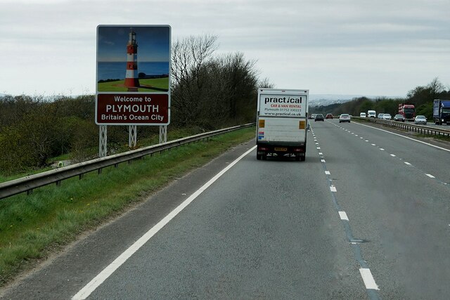
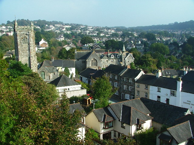
Plympton is a historic town located in the county of Devon, England. Situated on the outskirts of Plymouth, it lies on the eastern bank of the River Plym. With a population of around 35,000, it is one of the largest settlements in the South Hams district.

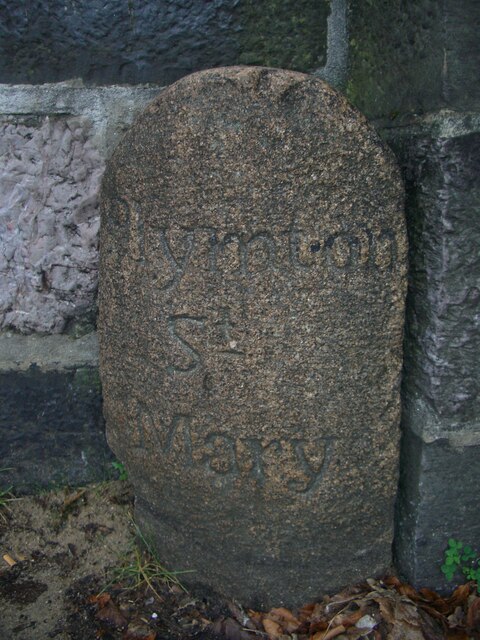
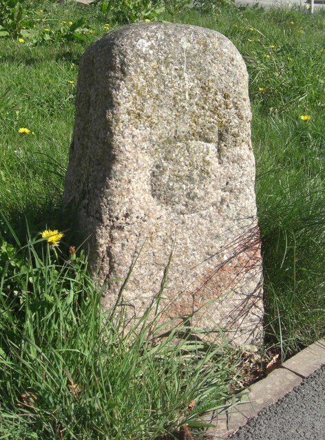
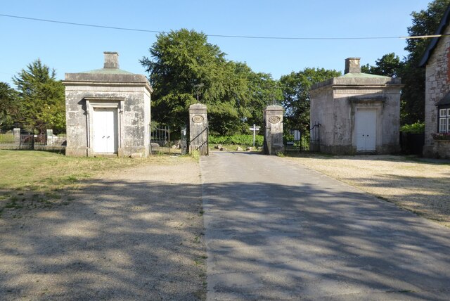
The town is known for its rich history, dating back to the Saxon period. It was once an important trading and market center, as evidenced by the medieval market cross that still stands in the town center. Plympton also has several well-preserved historic buildings, such as St. Maurice's Church, which dates back to the 13th century.

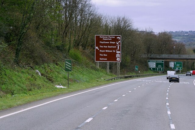
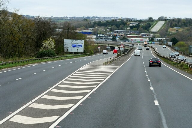
In addition to its historical significance, Plympton boasts a vibrant community and a range of amenities. The town center features a variety of shops, cafes, and restaurants, providing a bustling atmosphere for locals and visitors alike. It also offers excellent transport links, with regular bus services connecting to Plymouth city center and other nearby towns.

Nature lovers will appreciate Plympton's proximity to beautiful countryside and stunning coastal areas. Dartmoor National Park, renowned for its rugged landscapes and wild ponies, is just a short drive away. The nearby South Devon Area of Outstanding Natural Beauty also offers picturesque coastal walks and sandy beaches.

Plympton provides a range of educational facilities, including primary and secondary schools, as well as a campus of Plymouth University. The town has a strong sense of community, with various local events and activities held throughout the year, including the popular Plympton St. Maurice Carnival.

Overall, Plympton offers a blend of historical charm, modern conveniences, and natural beauty, making it an attractive place to live or visit in Devon.

If you have any feedback on the listing, please let us know in the comments section below.
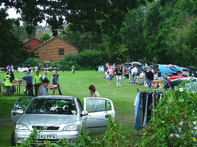
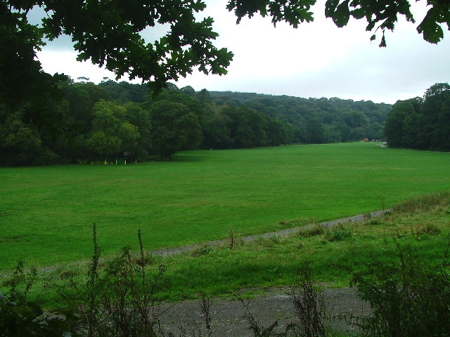
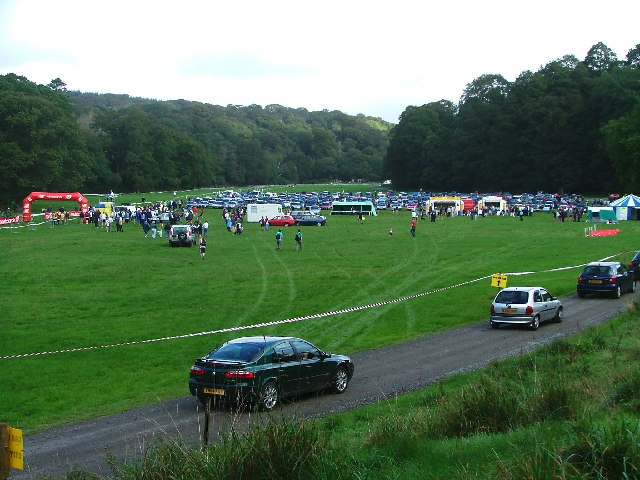
Plympton Images

Images are sourced within 2km of 50.389769/-4.055994 or Grid Reference SX5356. Thanks to Geograph Open Source API. All images are credited.

Old Boundary Marker on Plymouth Road, Plympton St Mary Parish Boundary Marker at the east end of the parapet of Long Bridge on the north side of the B3416 Plymouth Road. Inscribed Plympton / St / Mary. Until 1939 this marked the boundary of Egg Buckland and Plympton St Mary parishes, after which Egg Buckland became part of Plymouth parish and borough. See also <a title="https://www.geograph.org.uk/photo/1526519" href="https://www.geograph.org.uk/photo/1526519">Link</a>.

Milestone Society National ID: DV_PLEX02bpb
Old Boundary Marker on Plymouth Road, Plympton St Mary
Parish Boundary Marker at the east end of the parapet of Long Bridge on the north side of the B3416 Plymouth Road. Inscribed Plympton / St / Mary. Until 1939 this marked the boundary of Egg Buckland and Plympton St Mary parishes, after which Egg Buckland became part of Plymouth parish and borough. See also Link. Milestone Society National ID: DV_PLEX02bpb
Old Bridge Marker on Plymouth Road, Lee Mill County Bridge Marker in Lee Mill on the northwest side of the junction of Plymouth Road and New Park Road, 96 metres west of Leemill Bridge, River Yealm. Sparkwell parish. The stone marks the extent of roadway adjoining the bridge that the County was obliged to maintain.

Milestone Society National ID: DV_PLEX08br
Old Bridge Marker on Plymouth Road, Lee Mill
County Bridge Marker in Lee Mill on the northwest side of the junction of Plymouth Road and New Park Road, 96 metres west of Leemill Bridge, River Yealm. Sparkwell parish. The stone marks the extent of roadway adjoining the bridge that the County was obliged to maintain. Milestone Society National ID: DV_PLEX08br
Devon Expressway on the Outskirts of Plymouth The A38 is a major A-class trunk route. When first designated in 1922, it ran from Derby to Plymouth but it was later extended at both ends so that it now runs for 292 miles from Mansfield in Nottinghamshire to Bodmin in Cornwall.

Prior to the opening of the M5 motorway in the 1960s and 1970s, the A38 formed the main "holiday route" from the Midlands to Somerset, Devon and Cornwall and the south-western section was notorious at holiday times for the congestion. Nowadays, for most of the southern section, the A38 is a fairly quiet road shadowing the M5 extremely closely; often running alongside the motorway as a single carriageway road. The section between Exeter and Plymouth is, however, a busy dual carriageway which serves as the southern extension of the M5 and is known as “the Devon Expressway”.

More information at <span class="nowrap"><a title="http://en.wikipedia.org/wiki/A38_road" rel="nofollow ugc noopener" href="http://en.wikipedia.org/wiki/A38_road">Link</a><img style="margin-left:2px;" alt="External link" title="External link - shift click to open in new window" src="https://s1.geograph.org.uk/img/external.png" width="10" height="10"/></span>  (Wikipedia) and <span class="nowrap"><a title="http://www.sabre-roads.org.uk/wiki/index.php?title=A38" rel="nofollow ugc noopener" href="http://www.sabre-roads.org.uk/wiki/index.php?title=A38">Link</a><img style="margin-left:2px;" alt="External link" title="External link - shift click to open in new window" src="https://s1.geograph.org.uk/img/external.png" width="10" height="10"/></span>  (SABRE).
Devon Expressway on the Outskirts of Plymouth
The A38 is a major A-class trunk route. When first designated in 1922, it ran from Derby to Plymouth but it was later extended at both ends so that it now runs for 292 miles from Mansfield in Nottinghamshire to Bodmin in Cornwall. Prior to the opening of the M5 motorway in the 1960s and 1970s, the A38 formed the main "holiday route" from the Midlands to Somerset, Devon and Cornwall and the south-western section was notorious at holiday times for the congestion. Nowadays, for most of the southern section, the A38 is a fairly quiet road shadowing the M5 extremely closely; often running alongside the motorway as a single carriageway road. The section between Exeter and Plymouth is, however, a busy dual carriageway which serves as the southern extension of the M5 and is known as “the Devon Expressway”. More information at LinkExternal link (Wikipedia) and LinkExternal link (SABRE).
Westbound A38 near Plymouth The A38 is a major A-class trunk route. When first designated in 1922, it ran from Derby to Plymouth but it was later extended at both ends so that it now runs for 292 miles from Mansfield in Nottinghamshire to Bodmin in Cornwall.

Prior to the opening of the M5 motorway in the 1960s and 1970s, the A38 formed the main "holiday route" from the Midlands to Somerset, Devon and Cornwall and the south-western section was notorious at holiday times for the congestion. Nowadays, for most of the southern section, the A38 is a fairly quiet road shadowing the M5 extremely closely; often running alongside the motorway as a single carriageway road. The section between Exeter and Plymouth is, however, a busy dual carriageway which serves as the southern extension of the M5 and is known as “the Devon Expressway”.

More information at <span class="nowrap"><a title="http://en.wikipedia.org/wiki/A38_road" rel="nofollow ugc noopener" href="http://en.wikipedia.org/wiki/A38_road">Link</a><img style="margin-left:2px;" alt="External link" title="External link - shift click to open in new window" src="https://s1.geograph.org.uk/img/external.png" width="10" height="10"/></span>  (Wikipedia) and <span class="nowrap"><a title="http://www.sabre-roads.org.uk/wiki/index.php?title=A38" rel="nofollow ugc noopener" href="http://www.sabre-roads.org.uk/wiki/index.php?title=A38">Link</a><img style="margin-left:2px;" alt="External link" title="External link - shift click to open in new window" src="https://s1.geograph.org.uk/img/external.png" width="10" height="10"/></span>  (SABRE).
Westbound A38 near Plymouth
The A38 is a major A-class trunk route. When first designated in 1922, it ran from Derby to Plymouth but it was later extended at both ends so that it now runs for 292 miles from Mansfield in Nottinghamshire to Bodmin in Cornwall. Prior to the opening of the M5 motorway in the 1960s and 1970s, the A38 formed the main "holiday route" from the Midlands to Somerset, Devon and Cornwall and the south-western section was notorious at holiday times for the congestion. Nowadays, for most of the southern section, the A38 is a fairly quiet road shadowing the M5 extremely closely; often running alongside the motorway as a single carriageway road. The section between Exeter and Plymouth is, however, a busy dual carriageway which serves as the southern extension of the M5 and is known as “the Devon Expressway”. More information at LinkExternal link (Wikipedia) and LinkExternal link (SABRE).
Variable Message Sign on the Devon Expressway A variable message sign on the westbound carriageway of the A38 near Plymouth.

Variable message signs (VMS), also sometimes referred to as matrix signs, are electronic traffic signs used on motorways (and some other major routes) to give drivers information about special events and to warn them about traffic congestion, accidents, incidents, roadworks or speed limits on specific sections of the route. They may also suggest (or instruct) drivers to take alternative routes, limit speed, warn of the duration and location of the incidents or just inform of the traffic conditions.
Variable Message Sign on the Devon Expressway
A variable message sign on the westbound carriageway of the A38 near Plymouth. Variable message signs (VMS), also sometimes referred to as matrix signs, are electronic traffic signs used on motorways (and some other major routes) to give drivers information about special events and to warn them about traffic congestion, accidents, incidents, roadworks or speed limits on specific sections of the route. They may also suggest (or instruct) drivers to take alternative routes, limit speed, warn of the duration and location of the incidents or just inform of the traffic conditions.
Devon Expressway approaching Marsh Mills The A38 is a major A-class trunk route. When first designated in 1922, it ran from Derby to Plymouth but it was later extended at both ends so that it now runs for 292 miles from Mansfield in Nottinghamshire to Bodmin in Cornwall.

Prior to the opening of the M5 motorway in the 1960s and 1970s, the A38 formed the main "holiday route" from the Midlands to Somerset, Devon and Cornwall and the south-western section was notorious at holiday times for the congestion. Nowadays, for most of the southern section, the A38 is a fairly quiet road shadowing the M5 extremely closely; often running alongside the motorway as a single carriageway road. The section between Exeter and Plymouth is, however, a busy dual carriageway which serves as the southern extension of the M5 and is known as “the Devon Expressway”.

More information at <span class="nowrap"><a title="http://en.wikipedia.org/wiki/A38_road" rel="nofollow ugc noopener" href="http://en.wikipedia.org/wiki/A38_road">Link</a><img style="margin-left:2px;" alt="External link" title="External link - shift click to open in new window" src="https://s1.geograph.org.uk/img/external.png" width="10" height="10"/></span>  (Wikipedia) and <span class="nowrap"><a title="http://www.sabre-roads.org.uk/wiki/index.php?title=A38" rel="nofollow ugc noopener" href="http://www.sabre-roads.org.uk/wiki/index.php?title=A38">Link</a><img style="margin-left:2px;" alt="External link" title="External link - shift click to open in new window" src="https://s1.geograph.org.uk/img/external.png" width="10" height="10"/></span>  (SABRE).
Devon Expressway approaching Marsh Mills
The A38 is a major A-class trunk route. When first designated in 1922, it ran from Derby to Plymouth but it was later extended at both ends so that it now runs for 292 miles from Mansfield in Nottinghamshire to Bodmin in Cornwall. Prior to the opening of the M5 motorway in the 1960s and 1970s, the A38 formed the main "holiday route" from the Midlands to Somerset, Devon and Cornwall and the south-western section was notorious at holiday times for the congestion. Nowadays, for most of the southern section, the A38 is a fairly quiet road shadowing the M5 extremely closely; often running alongside the motorway as a single carriageway road. The section between Exeter and Plymouth is, however, a busy dual carriageway which serves as the southern extension of the M5 and is known as “the Devon Expressway”. More information at LinkExternal link (Wikipedia) and LinkExternal link (SABRE).
A38 Devon Expressway near Saltram Park The A38 is a major A-class trunk route. When first designated in 1922, it ran from Derby to Plymouth but it was later extended at both ends so that it now runs for 292 miles from Mansfield in Nottinghamshire to Bodmin in Cornwall.

Prior to the opening of the M5 motorway in the 1960s and 1970s, the A38 formed the main "holiday route" from the Midlands to Somerset, Devon and Cornwall and the south-western section was notorious at holiday times for the congestion. Nowadays, for most of the southern section, the A38 is a fairly quiet road shadowing the M5 extremely closely; often running alongside the motorway as a single carriageway road. The section between Exeter and Plymouth is, however, a busy dual carriageway which serves as the southern extension of the M5 and is known as “the Devon Expressway”.

More information at <span class="nowrap"><a title="http://en.wikipedia.org/wiki/A38_road" rel="nofollow ugc noopener" href="http://en.wikipedia.org/wiki/A38_road">Link</a><img style="margin-left:2px;" alt="External link" title="External link - shift click to open in new window" src="https://s1.geograph.org.uk/img/external.png" width="10" height="10"/></span>  (Wikipedia) and <span class="nowrap"><a title="http://www.sabre-roads.org.uk/wiki/index.php?title=A38" rel="nofollow ugc noopener" href="http://www.sabre-roads.org.uk/wiki/index.php?title=A38">Link</a><img style="margin-left:2px;" alt="External link" title="External link - shift click to open in new window" src="https://s1.geograph.org.uk/img/external.png" width="10" height="10"/></span>  (SABRE).
A38 Devon Expressway near Saltram Park
The A38 is a major A-class trunk route. When first designated in 1922, it ran from Derby to Plymouth but it was later extended at both ends so that it now runs for 292 miles from Mansfield in Nottinghamshire to Bodmin in Cornwall. Prior to the opening of the M5 motorway in the 1960s and 1970s, the A38 formed the main "holiday route" from the Midlands to Somerset, Devon and Cornwall and the south-western section was notorious at holiday times for the congestion. Nowadays, for most of the southern section, the A38 is a fairly quiet road shadowing the M5 extremely closely; often running alongside the motorway as a single carriageway road. The section between Exeter and Plymouth is, however, a busy dual carriageway which serves as the southern extension of the M5 and is known as “the Devon Expressway”. More information at LinkExternal link (Wikipedia) and LinkExternal link (SABRE).
A38 at Marsh Mills Junction The A38 is a major A-class trunk route. When first designated in 1922, it ran from Derby to Plymouth but it was later extended at both ends so that it now runs for 292 miles from Mansfield in Nottinghamshire to Bodmin in Cornwall.

Prior to the opening of the M5 motorway in the 1960s and 1970s, the A38 formed the main "holiday route" from the Midlands to Somerset, Devon and Cornwall and the south-western section was notorious at holiday times for the congestion. Nowadays, for most of the southern section, the A38 is a fairly quiet road shadowing the M5 extremely closely; often running alongside the motorway as a single carriageway road. The section between Exeter and Plymouth is, however, a busy dual carriageway which serves as the southern extension of the M5 and is known as “the Devon Expressway”.

More information at <span class="nowrap"><a title="http://en.wikipedia.org/wiki/A38_road" rel="nofollow ugc noopener" href="http://en.wikipedia.org/wiki/A38_road">Link</a><img style="margin-left:2px;" alt="External link" title="External link - shift click to open in new window" src="https://s1.geograph.org.uk/img/external.png" width="10" height="10"/></span>  (Wikipedia) and <span class="nowrap"><a title="http://www.sabre-roads.org.uk/wiki/index.php?title=A38" rel="nofollow ugc noopener" href="http://www.sabre-roads.org.uk/wiki/index.php?title=A38">Link</a><img style="margin-left:2px;" alt="External link" title="External link - shift click to open in new window" src="https://s1.geograph.org.uk/img/external.png" width="10" height="10"/></span>  (SABRE).
A38 at Marsh Mills Junction
The A38 is a major A-class trunk route. When first designated in 1922, it ran from Derby to Plymouth but it was later extended at both ends so that it now runs for 292 miles from Mansfield in Nottinghamshire to Bodmin in Cornwall. Prior to the opening of the M5 motorway in the 1960s and 1970s, the A38 formed the main "holiday route" from the Midlands to Somerset, Devon and Cornwall and the south-western section was notorious at holiday times for the congestion. Nowadays, for most of the southern section, the A38 is a fairly quiet road shadowing the M5 extremely closely; often running alongside the motorway as a single carriageway road. The section between Exeter and Plymouth is, however, a busy dual carriageway which serves as the southern extension of the M5 and is known as “the Devon Expressway”. More information at LinkExternal link (Wikipedia) and LinkExternal link (SABRE).
A38 Flyover
A38 Flyover
Park and Ride car park, Coypool, Plymouth
Sycamore tree A mature and large sycamore tree beside the car park at Saltram House.
Sycamore tree
A mature and large sycamore tree beside the car park at Saltram House.
Gate piers at Saltram This pair of gate piers on the drive in the grounds of Saltram House.  The piers are Grade II* listed, see: <span class="nowrap"><a title="https://historicengland.org.uk/listing/the-list/list-entry/1386236?section=official-list-entry" rel="nofollow ugc noopener" href="https://historicengland.org.uk/listing/the-list/list-entry/1386236?section=official-list-entry">Link</a><img style="margin-left:2px;" alt="External link" title="External link - shift click to open in new window" src="https://s1.geograph.org.uk/img/external.png" width="10" height="10"/></span>.  Originally these piers were at Boringdon Hall.
Gate piers at Saltram
This pair of gate piers on the drive in the grounds of Saltram House. The piers are Grade II* listed, see: LinkExternal link. Originally these piers were at Boringdon Hall.
Lodges at entrance to Saltram Star Lodge and these gate piers provide and eastern entrance to Saltram.  The lodge and piers are Grade II listed, see: <span class="nowrap"><a title="https://historicengland.org.uk/listing/the-list/list-entry/1386241?section=official-list-entry" rel="nofollow ugc noopener" href="https://historicengland.org.uk/listing/the-list/list-entry/1386241?section=official-list-entry">Link</a><img style="margin-left:2px;" alt="External link" title="External link - shift click to open in new window" src="https://s1.geograph.org.uk/img/external.png" width="10" height="10"/></span>
Lodges at entrance to Saltram
Star Lodge and these gate piers provide and eastern entrance to Saltram. The lodge and piers are Grade II listed, see: LinkExternal link
Peacock Meadow, Colebrook Regular car boot sales on the meadow aid funding of the community centre and annual events.
Peacock Meadow, Colebrook
Regular car boot sales on the meadow aid funding of the community centre and annual events.
Newnham Park Adjacent to Torry Brook and just off the Lee Moor Road, is Newnham Park; the photograph showing the 'meadow' which is frequently the focal point for a variety of activities ranging from mountain biking, carriage eventing through to trail running and music festivals, dependent on the time and date.
Newnham Park
Adjacent to Torry Brook and just off the Lee Moor Road, is Newnham Park; the photograph showing the 'meadow' which is frequently the focal point for a variety of activities ranging from mountain biking, carriage eventing through to trail running and music festivals, dependent on the time and date.
Newnham Park Scene of the 'gathering' for the 2005 Autumn Trail - an eight mile offroad run in the woods of Newnham Estate.
Newnham Park
Scene of the 'gathering' for the 2005 Autumn Trail - an eight mile offroad run in the woods of Newnham Estate.
Television and Relay Masts, Hardwick Hill Upon the skyline, the television and relay masts situated on Hardwick Hill can be seen, as viewed looking north from Elburton Playing Fields, as they tower over "The Gables" residential home (right foreground).
Television and Relay Masts, Hardwick Hill
Upon the skyline, the television and relay masts situated on Hardwick Hill can be seen, as viewed looking north from Elburton Playing Fields, as they tower over "The Gables" residential home (right foreground).
Dorsmouth Rock Trig. Pillar Standing on the hillside to the south of Plympton, this view from the pillar has Mudge Way to the centre foreground (cream and terracota brick row), with Newnham valley to centre left distant.
Dorsmouth Rock Trig. Pillar
Standing on the hillside to the south of Plympton, this view from the pillar has Mudge Way to the centre foreground (cream and terracota brick row), with Newnham valley to centre left distant.
Show me another place!

Plympton is located at Grid Ref: SX5356 (Lat: 50.389769, Lng: -4.055994)

Unitary Authority: Plymouth

Police Authority: Devon and Cornwall

What 3 Words

///cable.shift.begun. Near Plympton, Devon

Related Wikis

Plympton Priory

Plympton Priory was a priory in Devon, England. Its history is recorded in the Annales Plymptonienses. == History == The site of an Anglo-Saxon minster...

Plympton Academy

Plympton Academy (formerly, The Ridgeway School and, before that, Plympton County Secondary School) is a state secondary school in Plympton, Plymouth,...

Plympton Hundred

Plympton Hundred was the name of one of thirty two ancient administrative units of Devon, England.The parishes in the hundred were: Brixton, Plympton...

Plympton

Plympton is a suburb of the city of Plymouth in Devon, England. It is in origin an ancient stannary town. It was an important trading centre for locally...

Nearby Amenities

Located within 500m of 50.389769,-4.055994
Mini Roundabout
Direction: clockwise
Lat/Long: 50.3900788/-4.0587765
Traffic Signals
Lat/Long: 50.3898474/-4.0589247
Mini Roundabout
Direction: clockwise
Lat/Long: 50.3895666/-4.0593494
Mini Roundabout
Direction: clockwise
Lat/Long: 50.3909987/-4.0601677
Mini Roundabout
Direction: clockwise
Lat/Long: 50.3874706/-4.0504532
Mini Roundabout
Direction: clockwise
Lat/Long: 50.3868843/-4.0526174
Plympton
Is In: Devon, England, UK
Place: town
Wikidata: Q7205889
Wikipedia: en:Plympton
Lat/Long: 50.3898235/-4.0585654
Parking
Plympton
Lat/Long: 50.3893319/-4.0542647
Mini Roundabout
Direction: clockwise
Lat/Long: 50.3879363/-4.0550517
Plympton Central
Place: suburb
Lat/Long: 50.3866374/-4.051134
Colebrook Village
Place: village
Lat/Long: 50.393916/-4.0537948
Crossing
Crossing: uncontrolled
Crossing Island: no
Crossing Markings: zebra
Kerb: flush
Tactile Paving: yes
Lat/Long: 50.3873344/-4.0534982
Crossing
Crossing: marked
Crossing Island: no
Crossing Markings: yes
Mapillary: 739079787506756
Survey Date: 2022-06-05
Tactile Paving: yes
Lat/Long: 50.386969/-4.0510215
Post Office
Plympton Post Office
Addr Postcode: PL7 2AW
Brand: Post Office
Brand Wikidata: Q1783168
Ref Pol Id: 70253
Lat/Long: 50.3877115/-4.0540595
Crossing
Crossing: marked
Crossing Island: no
Crossing Markings: yes
Kerb: flush
Tactile Paving: yes
Lat/Long: 50.3875996/-4.0504048
Direction: 185
Generator Method: photovoltaic
Generator Output Electricity: yes
Generator Solar Modules: 42
Generator Source: solar
Generator Type: solar_photovoltaic_panel
Location: roof
Power: generator
Lat/Long: 50.3861747/-4.059753
Direction: 185
Generator Method: photovoltaic
Generator Output Electricity: yes
Generator Solar Modules: 2
Generator Source: solar
Generator Type: solar_photovoltaic_panel
Location: roof
Power: generator
Lat/Long: 50.3881106/-4.0605976
Direction: 185
Generator Method: photovoltaic
Generator Output Electricity: yes
Generator Solar Modules: 2
Generator Source: solar
Generator Type: solar_photovoltaic_panel
Location: roof
Power: generator
Lat/Long: 50.3881191/-4.0606861
Direction: 185
Generator Method: photovoltaic
Generator Output Electricity: yes
Generator Solar Modules: 2
Generator Source: solar
Generator Type: solar_photovoltaic_panel
Location: roof
Power: generator
Lat/Long: 50.388123/-4.0607444
Direction: 185
Generator Method: photovoltaic
Generator Output Electricity: yes
Generator Solar Modules: 2
Generator Source: solar
Generator Type: solar_photovoltaic_panel
Location: roof
Power: generator
Lat/Long: 50.3881328/-4.0608316
Direction: 185
Generator Method: photovoltaic
Generator Output Electricity: yes
Generator Solar Modules: 6
Generator Source: solar
Generator Type: solar_photovoltaic_panel
Location: roof
Note: larger module size
Power: generator
Lat/Long: 50.3881918/-4.0611602
Direction: 280
Generator Method: photovoltaic
Generator Output Electricity: yes
Generator Solar Modules: 8
Generator Source: solar
Generator Type: solar_photovoltaic_panel
Location: roof
Power: generator
Lat/Long: 50.3876724/-4.0608252
Direction: 285
Generator Method: photovoltaic
Generator Output Electricity: yes
Generator Solar Modules: 6
Generator Source: solar
Generator Type: solar_photovoltaic_panel
Location: roof
Power: generator
Lat/Long: 50.3877831/-4.0590979
Direction: 285
Generator Method: photovoltaic
Generator Output Electricity: yes
Generator Solar Modules: 5
Generator Source: solar
Generator Type: solar_photovoltaic_panel
Location: roof
Power: generator
Lat/Long: 50.3875869/-4.0591612
Direction: 285
Generator Method: photovoltaic
Generator Output Electricity: yes
Generator Solar Modules: 5
Generator Source: solar
Generator Type: solar_photovoltaic_panel
Location: roof
Power: generator
Lat/Long: 50.3875454/-4.0591773
Direction: 285
Generator Method: photovoltaic
Generator Output Electricity: yes
Generator Solar Modules: 5
Generator Source: solar
Generator Type: solar_photovoltaic_panel
Location: roof
Power: generator
Lat/Long: 50.3875009/-4.0591981
Direction: 195
Generator Method: photovoltaic
Generator Output Electricity: yes
Generator Solar Modules: 10
Generator Source: solar
Generator Type: solar_photovoltaic_panel
Location: roof
Power: generator
Lat/Long: 50.3874244/-4.0592069
Direction: 170
Generator Method: photovoltaic
Generator Output Electricity: yes
Generator Solar Modules: 17
Generator Source: solar
Generator Type: solar_photovoltaic_panel
Location: roof
Power: generator
Lat/Long: 50.3870106/-4.0573545
Direction: 195
Generator Method: photovoltaic
Generator Output Electricity: yes
Generator Solar Modules: 10
Generator Source: solar
Generator Type: solar_photovoltaic_panel
Location: roof
Power: generator
Lat/Long: 50.3865224/-4.0580897
Direction: 195
Generator Method: photovoltaic
Generator Output Electricity: yes
Generator Solar Modules: 18
Generator Source: solar
Generator Type: solar_photovoltaic_panel
Location: roof
Power: generator
Lat/Long: 50.3857685/-4.0567794
Direction: 175
Generator Method: photovoltaic
Generator Output Electricity: yes
Generator Solar Modules: 8
Generator Source: solar
Generator Type: solar_photovoltaic_panel
Location: roof
Power: generator
Lat/Long: 50.3894415/-4.054629
Direction: 175
Generator Method: photovoltaic
Generator Output Electricity: yes
Generator Solar Modules: 8
Generator Source: solar
Generator Type: solar_photovoltaic_panel
Location: roof
Power: generator
Lat/Long: 50.3894321/-4.0547309
Direction: 265
Generator Method: photovoltaic
Generator Output Electricity: yes
Generator Solar Modules: 8
Generator Source: solar
Generator Type: solar_photovoltaic_panel
Location: roof
Power: generator
Lat/Long: 50.3895505/-4.0547912
Direction: 265
Generator Method: photovoltaic
Generator Output Electricity: yes
Generator Solar Modules: 8
Generator Source: solar
Generator Type: solar_photovoltaic_panel
Location: roof
Power: generator
Lat/Long: 50.3896147/-4.0547966
Direction: 265
Generator Method: photovoltaic
Generator Output Electricity: yes
Generator Solar Modules: 8
Generator Source: solar
Generator Type: solar_photovoltaic_panel
Location: roof
Power: generator
Lat/Long: 50.3896857/-4.0548469
Direction: 265
Generator Method: photovoltaic
Generator Output Electricity: yes
Generator Solar Modules: 8
Generator Source: solar
Generator Type: solar_photovoltaic_panel
Location: roof
Power: generator
Lat/Long: 50.3897531/-4.0548483
Direction: 265
Generator Method: photovoltaic
Generator Output Electricity: yes
Generator Solar Modules: 8
Generator Source: solar
Generator Type: solar_photovoltaic_panel
Location: roof
Power: generator
Lat/Long: 50.3897973/-4.0548509
Direction: S
Generator Method: photovoltaic
Generator Output Electricity: yes
Generator Solar Modules: 7
Generator Source: solar
Generator Type: solar_photovoltaic_panel
Location: roof
Power: generator
Lat/Long: 50.3899626/-4.0548238
Direction: S
Generator Method: photovoltaic
Generator Output Electricity: yes
Generator Solar Modules: 8
Generator Source: solar
Generator Type: solar_photovoltaic_panel
Location: roof
Power: generator
Lat/Long: 50.3900037/-4.0547219
Direction: S
Generator Method: photovoltaic
Generator Output Electricity: yes
Generator Solar Modules: 12
Generator Source: solar
Generator Type: solar_photovoltaic_panel
Location: roof
Power: generator
Lat/Long: 50.3900039/-4.0546035
Direction: W
Generator Method: photovoltaic
Generator Output Electricity: yes
Generator Solar Modules: 8
Generator Source: solar
Generator Type: solar_photovoltaic_panel
Location: roof
Power: generator
Lat/Long: 50.389902/-4.0544221
Direction: 175
Generator Method: photovoltaic
Generator Output Electricity: yes
Generator Solar Modules: 9
Generator Source: solar
Generator Type: solar_photovoltaic_panel
Location: roof
Power: generator
Lat/Long: 50.3907422/-4.0522221
Direction: 175
Generator Method: photovoltaic
Generator Output Electricity: yes
Generator Solar Modules: 9
Generator Source: solar
Generator Type: solar_photovoltaic_panel
Location: roof
Power: generator
Lat/Long: 50.3908027/-4.0527796
Direction: 190
Generator Method: photovoltaic
Generator Output Electricity: yes
Generator Solar Modules: 10
Generator Source: solar
Generator Type: solar_photovoltaic_panel
Location: roof
Power: generator
Lat/Long: 50.3910343/-4.0515857
Direction: 190
Generator Method: photovoltaic
Generator Output Electricity: yes
Generator Solar Modules: 10
Generator Source: solar
Generator Type: solar_photovoltaic_panel
Location: roof
Power: generator
Lat/Long: 50.3909955/-4.0513157
Direction: 195
Generator Method: photovoltaic
Generator Output Electricity: yes
Generator Solar Modules: 12
Generator Source: solar
Generator Type: solar_photovoltaic_panel
Location: roof
Power: generator
Lat/Long: 50.3905282/-4.0506617
Direction: 195
Generator Method: photovoltaic
Generator Output Electricity: yes
Generator Solar Modules: 12
Generator Source: solar
Generator Type: solar_photovoltaic_panel
Location: roof
Power: generator
Lat/Long: 50.3905375/-4.0507478
Direction: 195
Generator Method: photovoltaic
Generator Output Electricity: yes
Generator Solar Modules: 12
Generator Source: solar
Generator Type: solar_photovoltaic_panel
Location: roof
Power: generator
Lat/Long: 50.3902466/-4.0510657
Direction: 285
Generator Method: photovoltaic
Generator Output Electricity: yes
Generator Solar Modules: 16
Generator Source: solar
Generator Type: solar_photovoltaic_panel
Location: roof
Power: generator
Lat/Long: 50.3880145/-4.0514305
Direction: 105
Generator Method: photovoltaic
Generator Output Electricity: yes
Generator Solar Modules: 5
Generator Source: solar
Generator Type: solar_photovoltaic_panel
Location: roof
Power: generator
Lat/Long: 50.3880704/-4.0513654
Direction: 105
Generator Method: photovoltaic
Generator Output Electricity: yes
Generator Solar Modules: 16
Generator Source: solar
Generator Type: solar_photovoltaic_panel
Location: roof
Power: generator
Lat/Long: 50.3879832/-4.0513265
Direction: 195
Generator Method: photovoltaic
Generator Output Electricity: yes
Generator Solar Modules: 24
Generator Source: solar
Generator Type: solar_photovoltaic_panel
Location: roof
Power: generator
Lat/Long: 50.3877875/-4.051466
Direction: 145
Generator Method: photovoltaic
Generator Output Electricity: yes
Generator Solar Modules: 14
Generator Source: solar
Generator Type: solar_photovoltaic_panel
Location: roof
Power: generator
Lat/Long: 50.3905324/-4.0596879
Direction: SSE
Generator Method: photovoltaic
Generator Output Electricity: yes
Generator Solar Modules: 10
Generator Source: solar
Generator Type: solar_photovoltaic_panel
Location: roof
Power: generator
Lat/Long: 50.3905867/-4.0610579
Direction: 175
Generator Method: photovoltaic
Generator Output Electricity: yes
Generator Solar Modules: 8
Generator Source: solar
Generator Type: solar_photovoltaic_panel
Location: roof
Note: module size v large
Power: generator
Lat/Long: 50.3916727/-4.0606861
Direction: SSE
Generator Method: photovoltaic
Generator Output Electricity: yes
Generator Solar Modules: 14
Generator Source: solar
Generator Type: solar_photovoltaic_panel
Location: roof
Power: generator
Lat/Long: 50.3915/-4.0589346
Direction: 235
Generator Method: photovoltaic
Generator Output Electricity: yes
Generator Solar Modules: 16
Generator Source: solar
Generator Type: solar_photovoltaic_panel
Location: roof
Power: generator
Lat/Long: 50.3919488/-4.0571898
Direction: SSE
Generator Method: photovoltaic
Generator Output Electricity: yes
Generator Solar Modules: 16
Generator Source: solar
Generator Type: solar_photovoltaic_panel
Location: roof
Power: generator
Lat/Long: 50.3925114/-4.0560962
Direction: S
Generator Method: photovoltaic
Generator Output Electricity: yes
Generator Solar Modules: 6
Generator Source: solar
Generator Type: solar_photovoltaic_panel
Location: roof
Power: generator
Lat/Long: 50.3933023/-4.0571178
Direction: 105
Generator Method: photovoltaic
Generator Output Electricity: yes
Generator Solar Modules: 2
Generator Source: solar
Generator Type: solar_photovoltaic_panel
Location: roof
Power: generator
Lat/Long: 50.3879666/-4.051409
Direction: 285
Generator Method: photovoltaic
Generator Output Electricity: yes
Generator Solar Modules: 2
Generator Source: solar
Generator Type: solar_photovoltaic_panel
Location: roof
Power: generator
Lat/Long: 50.3879627/-4.0513795
Direction: 285
Generator Method: photovoltaic
Generator Output Electricity: yes
Generator Solar Modules: 2
Generator Source: solar
Generator Type: solar_photovoltaic_panel
Location: roof
Power: generator
Lat/Long: 50.3879862/-4.0513647
Direction: 105
Generator Method: photovoltaic
Generator Output Electricity: yes
Generator Solar Modules: 2
Generator Source: solar
Generator Type: solar_photovoltaic_panel
Location: roof
Power: generator
Lat/Long: 50.3879952/-4.0514009
Direction: 105
Generator Method: photovoltaic
Generator Output Electricity: yes
Generator Solar Modules: 3
Generator Source: solar
Generator Type: solar_photovoltaic_panel
Location: roof
Power: generator
Lat/Long: 50.3880277/-4.0513862
Direction: 285
Generator Method: photovoltaic
Generator Output Electricity: yes
Generator Solar Modules: 3
Generator Source: solar
Generator Type: solar_photovoltaic_panel
Location: roof
Power: generator
Lat/Long: 50.388026/-4.0513507
Direction: 285
Generator Method: photovoltaic
Generator Output Electricity: yes
Generator Solar Modules: 5
Generator Source: solar
Generator Type: solar_photovoltaic_panel
Location: roof
Power: generator
Lat/Long: 50.3880657/-4.0513319
Direction: 190
Generator Method: photovoltaic
Generator Output Electricity: yes
Generator Solar Modules: 2
Generator Source: solar
Generator Type: solar_photovoltaic_panel
Location: roof
Power: generator
Tilt Angle: 0
Lat/Long: 50.3910458/-4.0516363
Direction: 10
Generator Method: photovoltaic
Generator Output Electricity: yes
Generator Solar Modules: 6
Generator Source: solar
Generator Type: solar_photovoltaic_panel
Location: roof
Power: generator
Lat/Long: 50.3910317/-4.0513141
Direction: S
Generator Method: photovoltaic
Generator Output Electricity: yes
Generator Solar Modules: 5
Generator Source: solar
Generator Type: solar_photovoltaic_panel
Location: roof
Power: generator
Lat/Long: 50.3899603/-4.0548771
Direction: S
Generator Method: photovoltaic
Generator Output Electricity: yes
Generator Solar Modules: 10
Generator Source: solar
Generator Type: solar_photovoltaic_panel
Location: roof
Power: generator
Lat/Long: 50.3892996/-4.0542199
Direction: N
Generator Method: photovoltaic
Generator Output Electricity: yes
Generator Solar Modules: 7
Generator Source: solar
Generator Type: solar_photovoltaic_panel
Location: roof
Power: generator
Lat/Long: 50.3933545/-4.0571167
Direction: 175
Generator Method: photovoltaic
Generator Output Electricity: yes
Generator Solar Modules: 3
Generator Source: solar
Generator Type: solar_photovoltaic_panel
Location: roof
Power: generator
Lat/Long: 50.3916684/-4.0607833
Direction: 175
Generator Method: photovoltaic
Generator Output Electricity: yes
Generator Solar Modules: 6
Generator Source: solar
Generator Type: solar_photovoltaic_panel
Location: roof
Power: generator
Lat/Long: 50.3916753/-4.0606244
Direction: 175
Generator Method: photovoltaic
Generator Output Electricity: yes
Generator Solar Modules: 6
Generator Source: solar
Generator Type: solar_photovoltaic_panel
Location: roof
Power: generator
Lat/Long: 50.3916663/-4.0607464
Crossing
Crossing: unmarked
Mapillary: 1111644906107695
Survey Date: 2022-08-29
Tactile Paving: no
Lat/Long: 50.3884552/-4.0541048
Bus Stop
Mudgeway
Bench: yes
Bin: yes
Bus: yes
Departures Board: timetable
Lit: yes
Naptan AtcoCode: 1180PLA11479
Naptan Bearing: NW
Naptan CommonName: Mudge Way
Naptan Indicator: NW-bound
Naptan NaptanCode: plymtad
Naptan PlusbusZoneRef: PLYMTH
Naptan Street: Mudge Way
Naptan Verified: no
Public Transport: platform
Shelter: yes
Tactile Paving: yes
Lat/Long: 50.3871725/-4.0532538
Bus Stop
Mudgeway
Bench: no
Bin: no
Bus: yes
Departures Board: timetable
Lit: yes
Mapillary: 505316750691975
Naptan AtcoCode: 1180PLA11480
Naptan Bearing: SE
Naptan CommonName: Dark Street Lane
Naptan Indicator: SE-bound
Naptan NaptanCode: plymtag
Naptan PlusbusZoneRef: PLYMTH
Naptan Street: Mudge Way
Public Transport: platform
Shelter: no
Survey Date: 2021-12-23
Tactile Paving: yes
Lat/Long: 50.3871795/-4.05309
Bus Stop
Ridgeway
Bench: yes
Bin: yes
Bus: yes
Departures Board: realtime
Lit: yes
Mapillary: 1610669749277369
Naptan AtcoCode: 1180PLA11477
Naptan Bearing: SE
Naptan CommonName: Ridgeway
Naptan Indicator: SE-bound
Naptan NaptanCode: plympwj
Naptan PlusbusZoneRef: PLYMTH
Naptan Street: Mudge Way
Public Transport: platform
Shelter: yes
Survey Date: 2022-09-30
Tactile Paving: yes
Lat/Long: 50.3882916/-4.0555231
Bus Stop
Old Priory
Bench: no
Bus: yes
Departures Board: timetable
Lit: yes
Mapillary: 1173316650158658
Naptan AtcoCode: 1180PLA11476
Naptan Bearing: NW
Naptan CommonName: Old Priory Junior School
Naptan Indicator: NW-bound
Naptan NaptanCode: plymptw
Naptan PlusbusZoneRef: PLYMTH
Naptan Street: Ridgeway
Public Transport: platform
Shelter: no
Survey Date: 2022-09-30
Lat/Long: 50.3885135/-4.0565114
Bus Stop
St Mary's Bridge
Bench: yes
Bin: no
Bus: yes
Departures Board: timetable
Naptan AtcoCode: 1180PLA11474
Naptan Bearing: SE
Naptan CommonName: St Mary's Bridge
Naptan Indicator: SE-bound
Naptan NaptanCode: plympmt
Naptan PlusbusZoneRef: PLYMTH
Naptan Verified: no
Public Transport: platform
Shelter: yes
Tactile Paving: yes
Lat/Long: 50.3892244/-4.0582114
Bus Stop
St Mary's Bridge
Bench: yes
Bin: no
Bus: yes
Departures Board: realtime
Lit: yes
Naptan AtcoCode: 1180PLA11475
Naptan Bearing: NW
Naptan CommonName: St Mary's Church
Naptan Indicator: NW-bound
Naptan NaptanCode: plympmp
Naptan PlusbusZoneRef: PLYMTH
Naptan Street: Ridgeway
Naptan Verified: no
Public Transport: platform
Shelter: yes
Tactile Paving: yes
Lat/Long: 50.3893171/-4.0589676
Crossing
Crossing: zebra
Crossing Island: no
Kerb: flush
Mapillary: 507799827620945
Survey Date: 2021-12-23
Tactile Paving: yes
Lat/Long: 50.3892744/-4.0586286
Leisure: pitch
Sport: cricket
Lat/Long: 50.389842/-4.0571365
Plympton Vinyl Centre
Shop: carpet
Lat/Long: 50.3897495/-4.0592928
A1 Carpet
Shop: carpet
Lat/Long: 50.389734/-4.0594188
Need a Cab
Office: taxi
Lat/Long: 50.3897107/-4.0595367
Bus Stop
Tory Brook
Bus: yes
Departures Board: timetable
Mapillary: 747838066469881
Naptan AtcoCode: 1180PCY38516
Naptan Bearing: SW
Naptan CommonName: Tory Brook
Naptan Indicator: SW-bound
Naptan NaptanCode: plympwm
Naptan PlusbusZoneRef: PLYMTH
Naptan Street: Glen Road
Public Transport: platform
Shelter: no
Survey Date: 2022-08-29
Lat/Long: 50.3913222/-4.0555666
Leisure: pitch
Sport: football
Lat/Long: 50.3886049/-4.0618983
Bicycle Parking
Access: private
Bicycle Parking: lockers
Survey Date: 2021-12-23
Lat/Long: 50.3885154/-4.0540642
Waste Basket
Survey Date: 2021-12-23
Lat/Long: 50.3882137/-4.0541394
Bench
Backrest: yes
Survey Date: 2021-12-23
Lat/Long: 50.3878818/-4.0534536
Taxi
Survey Date: 2021-12-23
Lat/Long: 50.3882815/-4.0541642
Post Box
Brand: Royal Mail
Brand Wikidata: Q638098
Brand Wikipedia: en:Royal Mail
Collection Times: Mo-Fr 17:30; Sa 12:30; Su off
Drive Through: no
Operator: Royal Mail
Operator Wikidata: Q638098
Post Box Apertures: 2
Post Box Design: type_c
Post Box Type: pillar
Ref: PL7 716;PL7 7160
Royal Cypher: EIIR
Royal Cypher Wikidata: Q33102113
Source: survey;streetlevel imagery;aerial imagery
Survey Date: 2022-08-29
Lat/Long: 50.388128/-4.0541298
Bench
Backrest: yes
Survey Date: 2022-08-29
Lat/Long: 50.3880964/-4.0539351
Taxi
Capacity: 3
Survey Date: 2021-12-23
Lat/Long: 50.3880331/-4.0534548
Bench
Backrest: yes
Survey Date: 2022-08-29
Lat/Long: 50.3881104/-4.0540214
Atm
Cash In: yes
Check Date: 2024-03-17
Operator: Santander
Lat/Long: 50.3877531/-4.052083
Waste Basket
Survey Date: 2021-12-23
Lat/Long: 50.3874268/-4.0517442
Grit Bin
Survey Date: 2021-12-23
Lat/Long: 50.3872073/-4.0515984
Bench
Backrest: yes
Survey Date: 2021-12-23
Lat/Long: 50.3876942/-4.0516548
Defibrillator
Defibrillator Location: On outside wall at St Stephens shopping district next to Oceanvape
Emergency: defibrillator
Indoor: no
Survey Date: 2021-12-23
Lat/Long: 50.3875937/-4.0518036
Waste Basket
Survey Date: 2021-12-23
Lat/Long: 50.3874306/-4.0516421
Waste Basket
Survey Date: 2021-12-23
Lat/Long: 50.3872044/-4.0516261
Recycling
Recycling Glass Bottles: yes
Recycling Type: container
Survey Date: 2021-12-23
Lat/Long: 50.3867958/-4.0513351
Charging Station
Access: yes
Capacity: 2
Operator: evolt
Survey Date: 2021-12-23
Lat/Long: 50.3869591/-4.0512262
Waste Basket
Survey Date: 2021-12-23
Lat/Long: 50.3870484/-4.0519209
Recycling
Check Date Recycling: 2024-04-01
Recycling Glass Bottles: yes
Recycling Paper: no
Recycling Plastic: no
Recycling Type: container
Survey Date: 2021-12-23
Lat/Long: 50.3867685/-4.0513547
Waste Basket
Survey Date: 2021-12-23
Lat/Long: 50.3876472/-4.051424
Bicycle Parking
Bicycle Parking: stands
Capacity: 12
Covered: no
Survey Date: 2021-12-23
Lat/Long: 50.3869885/-4.0513687
Recycling
Recycling Clothes: yes
Recycling Glass Bottles: yes
Recycling Paper: yes
Recycling Shoes: yes
Recycling Type: container
Survey Date: 2021-12-23
Lat/Long: 50.3876682/-4.0514205
Waste Basket
Survey Date: 2021-12-23
Lat/Long: 50.3876476/-4.0514821
Waste Basket
Survey Date: 2021-12-23
Lat/Long: 50.3874586/-4.0505742
Bench
Backrest: yes
Survey Date: 2021-12-23
Lat/Long: 50.387503/-4.0508455
Bench
Backrest: yes
Survey Date: 2021-12-23
Lat/Long: 50.38749/-4.0507881
Bus Stop
Ridgeway Shops
Bench: no
Bin: no
Bus: yes
Lit: yes
Naptan AtcoCode: 1180PLA11478
Naptan Bearing: E
Naptan CommonName: Ridgeway Shops
Naptan Indicator: E-bound
Naptan NaptanCode: plymtda
Naptan PlusbusZoneRef: PLYMTH
Naptan Street: Ridgeway
Public Transport: platform
Shelter: no
Survey Date: 2021-12-23
Tactile Paving: yes
Lat/Long: 50.3876151/-4.0508852
Atm
Check Date: 2024-03-17
Operator: The Co-operative Bank
Lat/Long: 50.3880814/-4.0542112
Bus Stop
Ridgeway School
Bench: yes
Bus: yes
Lit: yes
Naptan AtcoCode: 1180PLA11481
Naptan Bearing: N
Naptan CommonName: Ridgeway School
Naptan Indicator: N-bound
Naptan NaptanCode: plymtdm
Naptan PlusbusZoneRef: PLYMTH
Naptan Street: Moorland Road
Public Transport: platform
Shelter: yes
Survey Date: 2022-01-23
Tactile Paving: yes
Lat/Long: 50.3884017/-4.0501747
Waste Basket
Survey Date: 2022-01-23
Lat/Long: 50.3884895/-4.0501279
Post Box
Brand: Royal Mail
Brand Wikidata: Q638098
Brand Wikipedia: en:Royal Mail
Collection Times: Mo-Fr 09:00; Sa 07:00; Su off
Drive Through: no
Operator: Royal Mail
Operator Wikidata: Q638098
Post Box Mounting: brick_pillar
Post Box Type: wall
Ref: PL7 618D
Royal Cypher: VR
Royal Cypher Wikidata: Q33102356
Source: survey;streetlevel imagery;aerial imagery
Lat/Long: 50.3921724/-4.0607616
Post Box
Brand: Royal Mail
Brand Wikidata: Q638098
Brand Wikipedia: en:Royal Mail
Collection Times: Mo-Fr 09:00; Sa 07:00
Drive Through: no
Operator: Royal Mail
Operator Wikidata: Q638098
Post Box Design: type_k
Post Box Type: pillar
Ref: PL7 672D
Royal Cypher: EIIR
Royal Cypher Wikidata: Q33102113
Source: survey;streetlevel imagery;aerial imagery
Survey Date: 2024-05-03
Lat/Long: 50.3934293/-4.0541082
Post Box
Brand: Royal Mail
Brand Wikidata: Q638098
Brand Wikipedia: en:Royal Mail
Collection Times: Mo-Fr 09:00; Sa 07:00; Su off
Drive Through: no
Mapillary: 3051481605132705
Operator: Royal Mail
Operator Wikidata: Q638098
Post Box Design: type_b
Post Box Mounting: stone_wall
Post Box Type: wall
Ref: PL7 555D
Royal Cypher: GVIR
Royal Cypher Wikidata: Q33102169
Source: survey;streetlevel imagery;aerial imagery
Lat/Long: 50.3894803/-4.05897
Post Box
Brand: Royal Mail
Brand Wikidata: Q638098
Brand Wikipedia: en:Royal Mail
Collection Times: Mo-Fr 09:00; Sa 07:00; Su off
Drive Through: no
Operator: Royal Mail
Operator Wikidata: Q638098
Post Box Mounting: pier
Post Box Type: lamp
Ref: PL7 326D
Royal Cypher: EIIR
Source: survey;streetlevel imagery;aerial imagery
Lat/Long: 50.39064/-4.0541626
Post Box
Brand: Royal Mail
Brand Wikidata: Q638098
Brand Wikipedia: en:Royal Mail
Collection Times: Mo-Fr 09:00; Sa 07:00; Su off
Drive Through: no
Operator: Royal Mail
Operator Wikidata: Q638098
Post Box Design: type_b
Post Box Type: pillar
Ref: PL7 528D
Royal Cypher: EIIR
Royal Cypher Wikidata: Q33102113
Source: survey;streetlevel imagery;aerial imagery
Lat/Long: 50.3907854/-4.0494758
Post Box
Brand: Royal Mail
Brand Wikidata: Q638098
Brand Wikipedia: en:Royal Mail
Collection Times: Mo-Fr 09:00; Sa 07:00; Su off
Drive Through: no
Operator: Royal Mail
Operator Wikidata: Q638098
Post Box Design: type_b
Post Box Mounting: stone_wall
Post Box Type: wall
Ref: PL7 577D
Royal Cypher: EIIR
Royal Cypher Wikidata: Q33102113
Source: survey;streetlevel imagery;aerial imagery
Lat/Long: 50.3915689/-4.0565493
Fire Hydrant
Emergency: fire_hydrant
Fire Hydrant Position: sidewalk
Fire Hydrant Type: underground
Survey Date: 2022-06-03
Lat/Long: 50.3876934/-4.0515632
Fire Hydrant
Emergency: fire_hydrant
Fire Hydrant Diameter: 110
Fire Hydrant Position: sidewalk
Fire Hydrant Type: underground
Survey Date: 2022-06-03
Lat/Long: 50.3878802/-4.0526377
Recycling
Recycling Cans: yes
Recycling Glass Bottles: yes
Recycling Paper: yes
Recycling Plastic: yes
Recycling Type: container
Ref: 171
Survey Date: 2022-06-10
Lat/Long: 50.3897063/-4.0558509
Waste Basket
Survey Date: 2022-06-10
Lat/Long: 50.3882451/-4.0552956
Bicycle Parking
Bicycle Parking: wall_loops
Capacity: 5
Covered: no
Survey Date: 2022-06-10
Lat/Long: 50.3899245/-4.055773
Waste Basket
Ref: 168
Survey Date: 2022-06-10
Lat/Long: 50.388867/-4.0555215
Bicycle Parking
Bicycle Parking: stands
Capacity: 8
Covered: no
Survey Date: 2022-06-10
Lat/Long: 50.3897611/-4.0556407
Grit Bin
Survey Date: 2022-06-10
Lat/Long: 50.3893255/-4.0554184
Recycling
Recycling Cans: yes
Recycling Glass Bottles: yes
Recycling Paper: yes
Recycling Plastic: yes
Recycling Type: container
Ref: 169
Survey Date: 2022-06-10
Lat/Long: 50.3888478/-4.0555106
Grit Bin
Survey Date: 2022-06-10
Lat/Long: 50.3881612/-4.0544881
Waste Basket
Ref: 170
Survey Date: 2022-06-10
Lat/Long: 50.3897162/-4.0558661
Street Lamp
Survey Date: 2022-06-10
Lat/Long: 50.389102/-4.0554465
Fire Hydrant
Emergency: fire_hydrant
Fire Hydrant Diameter: 6"
Fire Hydrant Position: sidewalk
Fire Hydrant Type: underground
Survey Date: 2022-06-10
Lat/Long: 50.3881872/-4.0547501
Bench
Backrest: yes
Survey Date: 2022-06-10
Lat/Long: 50.3887781/-4.0555363
Bus Stop
Bench: no
Bus: yes
Public Transport: platform
Shelter: no
Lat/Long: 50.3906947/-4.059499
Bench
Backrest: yes
Survey Date: 2022-08-29
Lat/Long: 50.38806/-4.0537315
Bench
Backrest: yes
Survey Date: 2022-08-29
Lat/Long: 50.3879613/-4.0535137
Bench
Backrest: yes
Survey Date: 2022-08-29
Lat/Long: 50.3879878/-4.0536109
Bench
Backrest: yes
Survey Date: 2022-08-29
Lat/Long: 50.3880509/-4.0536565
Recycling
Recycling Cans: yes
Recycling Glass Bottles: yes
Recycling Paper: yes
Recycling Plastic: yes
Recycling Type: container
Survey Date: 2022-08-29
Lat/Long: 50.388131/-4.054156
Waste Basket
Survey Date: 2022-08-29
Lat/Long: 50.3881313/-4.054173
Fire Hydrant
Emergency: fire_hydrant
Fire Hydrant Diameter: 6"
Fire Hydrant Position: lane
Fire Hydrant Type: underground
Survey Date: 2022-09-06
Lat/Long: 50.3892245/-4.0617091
Bus Stop
St Mary's Court
Bench: no
Bin: no
Bus: yes
Lit: yes
Naptan AtcoCode: 1180PLA88911
Naptan Bearing: NE
Naptan CommonName: St Marys Court
Naptan Indicator: NE-bound
Naptan NaptanCode: plypjgj
Naptan PlusbusZoneRef: PLYMTH
Public Transport: platform
Shelter: no
Survey Date: 2022-09-06
Tactile Paving: no
Lat/Long: 50.3895587/-4.0600113
Waste Basket
Survey Date: 2022-09-06
Lat/Long: 50.3894348/-4.0598471
Bus Stop
Ridge Park Road
Bench: no
Bus: yes
Naptan AtcoCode: 1180PLA11483
Naptan Bearing: N
Naptan CommonName: Ridge Park Road
Naptan Indicator: N-bound
Naptan NaptanCode: plymtga
Naptan PlusbusZoneRef: PLYMTH
Naptan Street: Moorland Road
Public Transport: platform
Shelter: no
Survey Date: 2022-09-30
Lat/Long: 50.3897377/-4.0496652
Bus Stop
Moorland Avenue
Bench: no
Bin: no
Bus: yes
Lit: yes
Naptan AtcoCode: 1180PLA11484
Naptan Bearing: S
Naptan CommonName: Moorland Avenue
Naptan Indicator: S-bound
Naptan NaptanCode: plymtgj
Naptan PlusbusZoneRef: PLYMTH
Naptan Street: Moorland Road
Public Transport: platform
Shelter: no
Survey Date: 2022-09-30
Tactile Paving: no
Lat/Long: 50.3903713/-4.0495073
Bench
Backrest: yes
Survey Date: 2022-09-30
Lat/Long: 50.3875137/-4.0503145
Bicycle Parking
Bicycle Parking: stands
Capacity: 8
Survey Date: 2022-09-30
Lat/Long: 50.389446/-4.0598544
Fire Hydrant
Emergency: fire_hydrant
Fire Hydrant Type: underground
Survey Date: 2022-09-30
Lat/Long: 50.3887285/-4.0499741
Fire Hydrant
Emergency: fire_hydrant
Fire Hydrant Type: wall
Survey Date: 2022-09-30
Lat/Long: 50.389464/-4.0495449
Grit Bin
Survey Date: 2022-11-16
Lat/Long: 50.3870517/-4.0530391
Fire Hydrant
Emergency: fire_hydrant
Fire Hydrant Diameter: 225
Fire Hydrant Position: sidewalk
Fire Hydrant Type: underground
Survey Date: 2022-11-16
Lat/Long: 50.3869069/-4.0511343
Fire Hydrant
Emergency: fire_hydrant
Fire Hydrant Type: underground
Survey Date: 2022-11-16
Lat/Long: 50.3874299/-4.0503433
Fire Hydrant
Emergency: fire_hydrant
Fire Hydrant Type: underground
Survey Date: 2022-11-16
Lat/Long: 50.3875442/-4.0541747
Fire Hydrant
Emergency: fire_hydrant
Fire Hydrant Diameter Signed: no
Fire Hydrant Position: sidewalk
Fire Hydrant Type: underground
Survey Date: 2022-11-16
Lat/Long: 50.3880315/-4.05528
Waste Basket
Survey Date: 2022-11-16
Lat/Long: 50.3872129/-4.0533463
Fire Hydrant
Emergency: fire_hydrant
Fire Hydrant Type: underground
Survey Date: 2022-11-16
Lat/Long: 50.3871198/-4.0529844
Crossing
Crossing: uncontrolled
Crossing Island: no
Crossing Markings: zebra
Tactile Paving: yes
Lat/Long: 50.3885262/-4.0500237
Pharmacy
Boots
Brand: Boots
Brand Wikidata: Q6123139
Healthcare: pharmacy
Lat/Long: 50.3859979/-4.0523463
Fast Food
The Plym Fish Bar
Cuisine: fish_and_chips
Lat/Long: 50.387281/-4.0516663
Skin Deep
Shop: hairdresser
Lat/Long: 50.3874228/-4.0516136
Historic: yes
Inscription: Augustinian Priory Arch
Lat/Long: 50.3876458/-4.0517202
Addr Housenumber: 7
Addr Street: Market Road
Lat/Long: 50.3877118/-4.0598172
Addr Housenumber: 11
Addr Street: Moorland Avenue
Lat/Long: 50.3905663/-4.0491473
Addr Housenumber: 38
Addr Street: Earls Mill Road
Lat/Long: 50.3906573/-4.0521189
Addr Housenumber: 1
Addr Street: Auctioneers Close
Lat/Long: 50.3878316/-4.0600186
Addr Housenumber: 16
Addr Street: Market Road
Lat/Long: 50.3879531/-4.0598935
Addr Housenumber: 2
Addr Street: Earls Mill Road
Lat/Long: 50.3903617/-4.0498822
Addr Housenumber: 147
Addr Street: Ridgeway
Lat/Long: 50.3874742/-4.0499852
Addr Housenumber: 3
Addr Street: Earls Mill Road
Lat/Long: 50.3901788/-4.0502297
Addr Housenumber: 9
Addr Street: Moorland Avenue
Lat/Long: 50.390572/-4.0492102
Addr Housenumber: 149
Addr Street: Ridgeway
Lat/Long: 50.3874786/-4.0499234
Addr Housenumber: 36
Addr Street: Market Road
Lat/Long: 50.3865489/-4.0600732
Addr Housenumber: 20A
Addr Street: Market Road
Lat/Long: 50.3874821/-4.0600947
Addr Housenumber: 18A
Addr Street: Market Road
Lat/Long: 50.3875441/-4.060067
Addr Housenumber: 79
Addr Street: Earls Mill Road
Lat/Long: 50.3905896/-4.0536101
Addr Housenumber: 2
Addr Street: Moorland Avenue
Lat/Long: 50.3904726/-4.0494519
Addr Housenumber: 19
Addr Street: Market Road
Lat/Long: 50.3874798/-4.0599204
Addr Housenumber: 49
Addr Street: Moorland Road
Lat/Long: 50.3907979/-4.0496932
Addr Housenumber: 33A
Addr Street: Market Road
Lat/Long: 50.386561/-4.0598968
Addr Housenumber: 5A
Addr Street: Market Road
Lat/Long: 50.3877995/-4.0597735
Addr Housenumber: 44
Addr Street: Moorland Road
Lat/Long: 50.3901953/-4.0494476
Addr Housenumber: 11A
Addr Street: Moorland Avenue
Lat/Long: 50.3905591/-4.0490715
Addr Housenumber: 28
Addr Street: Market Road
Lat/Long: 50.3867489/-4.0601267
Addr Housenumber: 1
Addr Street: Potters Way
Lat/Long: 50.3872041/-4.0603131
Addr Housenumber: 42
Addr Street: Moorland Road
Lat/Long: 50.3900839/-4.0494611
Addr Housenumber: 13
Addr Street: Market Road
Lat/Long: 50.3875463/-4.0599055
Addr Housenumber: 1
Addr Street: Earls Mill Road
Lat/Long: 50.3900841/-4.0499226
Addr Housenumber: 18
Addr Street: Market Road
Lat/Long: 50.3875885/-4.060056
Addr Housenumber: 36
Addr Street: Earls Mill Road
Lat/Long: 50.3906468/-4.0520541
Addr Housenumber: 14A
Addr Street: Market Road
Lat/Long: 50.3880032/-4.0598794
Addr Housenumber: 52
Addr Street: Earls Mill Road
Lat/Long: 50.3907105/-4.0527491
Addr Housenumber: 7
Addr Street: Earls Mill Road
Lat/Long: 50.3902418/-4.0504096
Addr Housenumber: 20
Addr Street: Market Road
Lat/Long: 50.3875176/-4.0600796
Addr Housenumber: 7
Addr Street: Moorland Avenue
Lat/Long: 50.3905777/-4.0492643
Addr Housenumber: 9
Addr Street: Earls Mill Road
Lat/Long: 50.3902481/-4.0504879
Addr Housenumber: 30
Addr Street: Earls Mill Road
Lat/Long: 50.3905721/-4.0516543
Addr Housenumber: 4
Addr Street: Earls Mill Road
Lat/Long: 50.3903699/-4.0502753
Addr Housenumber: 1
Addr Street: Moorland Avenue
Lat/Long: 50.3905797/-4.0494439
Addr Housenumber: 31
Addr Street: Market Road
Lat/Long: 50.3866262/-4.0599068
Addr Housenumber: 5
Addr Street: Moorland Avenue
Lat/Long: 50.3905777/-4.0493338
Addr Housenumber: 70
Addr Street: Earls Mill Road
Lat/Long: 50.3907971/-4.053512
Bench
Survey Date: 2023-09-04
Lat/Long: 50.3881471/-4.0596412
Defibrillator
Emergency: defibrillator
Indoor: no
Ref GB The Circuit: 4FDB9F29-67A9-46DD-925F-B08F00DD3B79
Survey Date: 2023-09-04
Lat/Long: 50.3883032/-4.0600607
Waste Basket
Survey Date: 2023-09-04
Lat/Long: 50.3882729/-4.0595933
Bicycle Rental
Bicycle Rental: docking_station
Brand: Beryl
Brand Wikidata: Q106575365
Capacity: 6
Fee: yes
Mapillary: 596850358689464
Network: Beryl Plymouth
Operator: Beryl
Operator Type: business
Operator Wikidata: Q106575369
Survey Date: 2023-09-04
Lat/Long: 50.3886034/-4.059644
Waste Basket
Survey Date: 2023-09-04
Lat/Long: 50.3892624/-4.0588271
Bicycle Rental
Bicycle Rental: docking_station
Brand: Beryl
Brand Wikidata: Q106575365
Capacity: 6
Fee: yes
Mapillary: 596850358689464
Network: Beryl Plymouth
Operator: Beryl
Operator Type: business
Operator Wikidata: Q106575369
Survey Date: 2023-09-04
Lat/Long: 50.3883466/-4.0541283
Charging Station
Survey Date: 2023-09-04
Lat/Long: 50.3886293/-4.0541757
Charging Station
Survey Date: 2023-09-04
Lat/Long: 50.3886549/-4.0542003
Fire Hydrant
Emergency: fire_hydrant
Fire Hydrant Position: lane
Fire Hydrant Type: underground
Survey Date: 2023-09-04
Lat/Long: 50.388913/-4.0541521
Grit Bin
Survey Date: 2023-09-04
Lat/Long: 50.3893933/-4.0541934
Fire Hydrant
Emergency: fire_hydrant
Fire Hydrant Position: lane
Fire Hydrant Type: underground
Survey Date: 2023-09-04
Lat/Long: 50.3896848/-4.0541644
Grit Bin
Survey Date: 2023-09-04
Lat/Long: 50.3904602/-4.0542642
Fire Hydrant
Emergency: fire_hydrant
Fire Hydrant Position: sidewalk
Fire Hydrant Type: underground
Survey Date: 2023-09-04
Lat/Long: 50.3903401/-4.0509458
Addr Housenumber: 13
Addr Street: Earls Mill Road
Lat/Long: 50.3902714/-4.0506773
Addr Housenumber: 47
Addr Street: Moorland Road
Lat/Long: 50.3907062/-4.0497012
Addr Housenumber: 3
Addr Street: Moorland Avenue
Lat/Long: 50.3905747/-4.0493978
Addr Housenumber: 44
Addr Street: Market Road
Lat/Long: 50.3862394/-4.0600689
Addr Housenumber: 12
Addr Street: Market Road
Lat/Long: 50.3880777/-4.0598516
Addr Housenumber: 3
Addr Street: Market Road
Lat/Long: 50.3879346/-4.0597066
Addr Housenumber: 45
Addr Street: Earls Mill Road
Lat/Long: 50.3904641/-4.0522147
Addr Housenumber: 11
Addr Street: Earls Mill Road
Lat/Long: 50.3902622/-4.0506028
Fire Hydrant
Emergency: fire_hydrant
Fire Hydrant Position: lane
Fire Hydrant Type: underground
Survey Date: 2023-09-21
Lat/Long: 50.3924508/-4.060739
Fire Hydrant
Emergency: fire_hydrant
Fire Hydrant Diameter: 125
Fire Hydrant Position: lane
Fire Hydrant Type: underground
Survey Date: 2023-09-21
Lat/Long: 50.3914135/-4.0603997
Waste Basket
Survey Date: 2023-09-21
Lat/Long: 50.3913442/-4.0604316
Bench
Backrest: yes
Survey Date: 2023-09-21
Lat/Long: 50.3912052/-4.0603462
Addr Housenumber: 35
Addr Street: Underwood Road
Lat/Long: 50.3858326/-4.0593991
Addr Housenumber: 30
Addr Street: Priory Mill
Lat/Long: 50.3866811/-4.0577123
Addr Housenumber: 19
Addr Street: Priory Mill
Lat/Long: 50.3865019/-4.0564167
Addr Housenumber: 64
Addr Street: Underwood Road
Lat/Long: 50.3856394/-4.0585571
Addr Housenumber: 17
Addr Street: Priory Mill
Lat/Long: 50.3865959/-4.0563112
Addr Housenumber: 27
Addr Street: Priory Mill
Lat/Long: 50.3866227/-4.0573382
Addr Housenumber: 11
Addr Street: Priory ridge
Lat/Long: 50.3874487/-4.0558324
Addr Housenumber: 18
Addr Street: Priory Mill
Lat/Long: 50.3865479/-4.0563545
Addr Housenumber: 2
Addr Street: Priory ridge
Lat/Long: 50.38806/-4.0556936
Addr Housenumber: 92
Addr Street: Underwood Road
Lat/Long: 50.3854166/-4.0575254
Addr Housenumber: 89
Addr Street: Underwood Road
Lat/Long: 50.3854959/-4.0573201
Addr Housenumber: 39
Addr Street: Underwood Road
Lat/Long: 50.385864/-4.0592073
Addr Housenumber: 15
Addr Street: Priory ridge
Lat/Long: 50.3873682/-4.0558756
Addr Housenumber: 25
Addr Street: Priory Mill
Lat/Long: 50.386615/-4.057059
Addr Housenumber: 58
Addr Street: Underwood Road
Lat/Long: 50.38567/-4.0587727
Addr Housenumber: 15
Addr Street: Longbrook Barton
Lat/Long: 50.3860188/-4.0573969
Addr Housenumber: 21
Addr Street: Priory Mill
Lat/Long: 50.3865046/-4.0566029
Addr Housenumber: 78
Addr Street: Underwood Road
Lat/Long: 50.385516/-4.0580161
Addr Housenumber: 19
Addr Street: Priory ridge
Lat/Long: 50.3871532/-4.0559573
Addr Housenumber: 45
Addr Street: Underwood Road
Lat/Long: 50.3858036/-4.0588537
Addr Housenumber: 24
Addr Street: Priory Mill
Lat/Long: 50.3865882/-4.0569162
Addr Housenumber: 12
Addr Street: Priory Mill
Lat/Long: 50.3868136/-4.056475
Waste Basket
Survey Date: 2023-10-03
Lat/Long: 50.3889677/-4.0607765
Bench
Backrest: yes
Survey Date: 2023-10-03
Lat/Long: 50.3885664/-4.06097
Bench
Backrest: yes
Survey Date: 2023-10-03
Lat/Long: 50.388835/-4.0626647
Fire Hydrant
Emergency: fire_hydrant
Fire Hydrant Position: lane
Fire Hydrant Type: underground
Survey Date: 2023-10-03
Lat/Long: 50.3855094/-4.0577194
Fire Hydrant
Emergency: fire_hydrant
Fire Hydrant Position: sidewalk
Fire Hydrant Type: underground
Survey Date: 2023-10-03
Lat/Long: 50.3858406/-4.0571433
Fire Hydrant
Emergency: fire_hydrant
Fire Hydrant Position: sidewalk
Fire Hydrant Type: underground
Survey Date: 2023-10-03
Lat/Long: 50.3867141/-4.0576613
Defibrillator
Defibrillator Location: Rugby club wooden building
Emergency: defibrillator
Ref GB The Circuit: 95D617EA-B3D7-4973-947D-AD2400E245E6
Survey Date: 2023-10-03
Lat/Long: 50.3888271/-4.0601712
Addr Housenumber: 15
Addr Street: Priory Mill
Lat/Long: 50.3867166/-4.0562959
Addr Housenumber: 23
Addr Street: Longbrook Barton
Lat/Long: 50.3861181/-4.0576046
Addr Housenumber: 1
Addr Street: Priory ridge
Lat/Long: 50.3879341/-4.0555393
Addr Housenumber: 29
Addr Street: Priory Mill
Lat/Long: 50.3866825/-4.0575596
Addr Housenumber: 16
Addr Street: Priory Mill
Lat/Long: 50.3866544/-4.056288
Addr Housenumber: 14
Addr Street: Priory Mill
Lat/Long: 50.3867778/-4.0563827
Addr Housenumber: 26
Addr Street: Priory Mill
Lat/Long: 50.386612/-4.0571831
Addr Housenumber: 3
Addr Street: Priory ridge
Lat/Long: 50.3878633/-4.0556274
Addr Housenumber: 69
Addr Street: Underwood Road
Lat/Long: 50.3855913/-4.0578446
Addr Housenumber: 23
Addr Street: Priory Mill
Lat/Long: 50.3865546/-4.0567936
Addr Housenumber: 5
Addr Street: Priory ridge
Lat/Long: 50.3877449/-4.055697
Addr Housenumber: 7
Addr Street: Priory ridge
Lat/Long: 50.3876469/-4.0557209
Addr Housenumber: 4
Addr Street: Priory ridge
Lat/Long: 50.3879664/-4.0558448
Addr Housenumber: 20
Addr Street: Priory Mill
Lat/Long: 50.3864769/-4.056502
Addr Housenumber: 21
Addr Street: Priory ridge
Lat/Long: 50.3870137/-4.0560578
Addr Housenumber: 9
Addr Street: Priory ridge
Lat/Long: 50.3875443/-4.0557755
Addr Housenumber: 57
Addr Street: Underwood Road
Lat/Long: 50.3857167/-4.0583774
Addr Housenumber: 28
Addr Street: Priory Mill
Lat/Long: 50.3866366/-4.0574391
Addr Housenumber: 22
Addr Street: Priory Mill
Lat/Long: 50.3865325/-4.0566882
Barrier: cycle_barrier
Lat/Long: 50.3870221/-4.0562381
Defibrillator
Defibrillator Location: Outside wall of red building near gym car park
Emergency: defibrillator
Indoor: no
Ref GB The Circuit: D0A6EE01-752E-41E4-A310-AEA700EA39FF
Survey Date: 2023-12-29
Lat/Long: 50.389096/-4.0501289
Defibrillator
Defibrillator Location: Outside wall of Plympton Tennis Club building
Emergency: defibrillator
Indoor: no
Survey Date: 2023-12-29
Lat/Long: 50.3891777/-4.0564524
Bicycle Parking
Bicycle Parking: stands
Capacity: 10
Covered: no
Survey Date: 2023-12-29
Lat/Long: 50.3884836/-4.0558666
Waste Basket
Survey Date: 2023-12-29
Lat/Long: 50.3884638/-4.0558541
Waste Basket
Survey Date: 2024-02-11
Lat/Long: 50.3901001/-4.056003
Recycling
Recycling Clothes: yes
Recycling Glass Bottles: no
Recycling Paper: no
Recycling Plastic: no
Recycling Type: container
Survey Date: 2024-02-11
Lat/Long: 50.3899569/-4.0557799
Bench
Backrest: yes
Survey Date: 2024-02-11
Lat/Long: 50.3898657/-4.056009
Addr Housenumber: 44
Addr Street: Dark Street Lane
Lat/Long: 50.3863015/-4.0530897
Addr Housenumber: 42
Addr Street: Dark Street Lane
Lat/Long: 50.3863802/-4.0531272
Addr Housenumber: 46
Addr Street: Dark Street Lane
Lat/Long: 50.386183/-4.0530477
Addr Housenumber: 52
Addr Street: Dark Street Lane
Lat/Long: 50.3859896/-4.0529125
Fire Hydrant
Emergency: fire_hydrant
Fire Hydrant Position: sidewalk
Fire Hydrant Type: underground
Survey Date: 2024-04-01
Lat/Long: 50.3862779/-4.0530092
Street Lamp
Ref: 13
Survey Date: 2024-04-01
Lat/Long: 50.3873389/-4.0514333
Street Lamp
Survey Date: 2024-04-01
Lat/Long: 50.387124/-4.0512235
Fire Hydrant
Emergency: fire_hydrant
Fire Hydrant Position: lane
Fire Hydrant Type: underground
Survey Date: 2024-04-01
Lat/Long: 50.3875706/-4.0535995
Power: substation
Survey Date: 2024-05-03
Lat/Long: 50.3910458/-4.061096
Fire Hydrant
Emergency: fire_hydrant
Fire Hydrant Diameter: 125
Fire Hydrant Position: lane
Fire Hydrant Type: underground
Survey Date: 2024-05-03
Lat/Long: 50.3914374/-4.0602491
Fire Hydrant
Emergency: fire_hydrant
Fire Hydrant Diameter: 100
Fire Hydrant Position: lane
Fire Hydrant Type: underground
Survey Date: 2024-05-03
Lat/Long: 50.3912658/-4.0573196
The data included in this document is from www.openstreetmap.org. The data is made available under ODbL.

Have you been to Plympton?

Leave your review of Plympton below (or comments, questions and feedback).