Pleasley Vale
Settlement in Derbyshire / Nottinghamshire Bolsover
England
Pleasley Vale

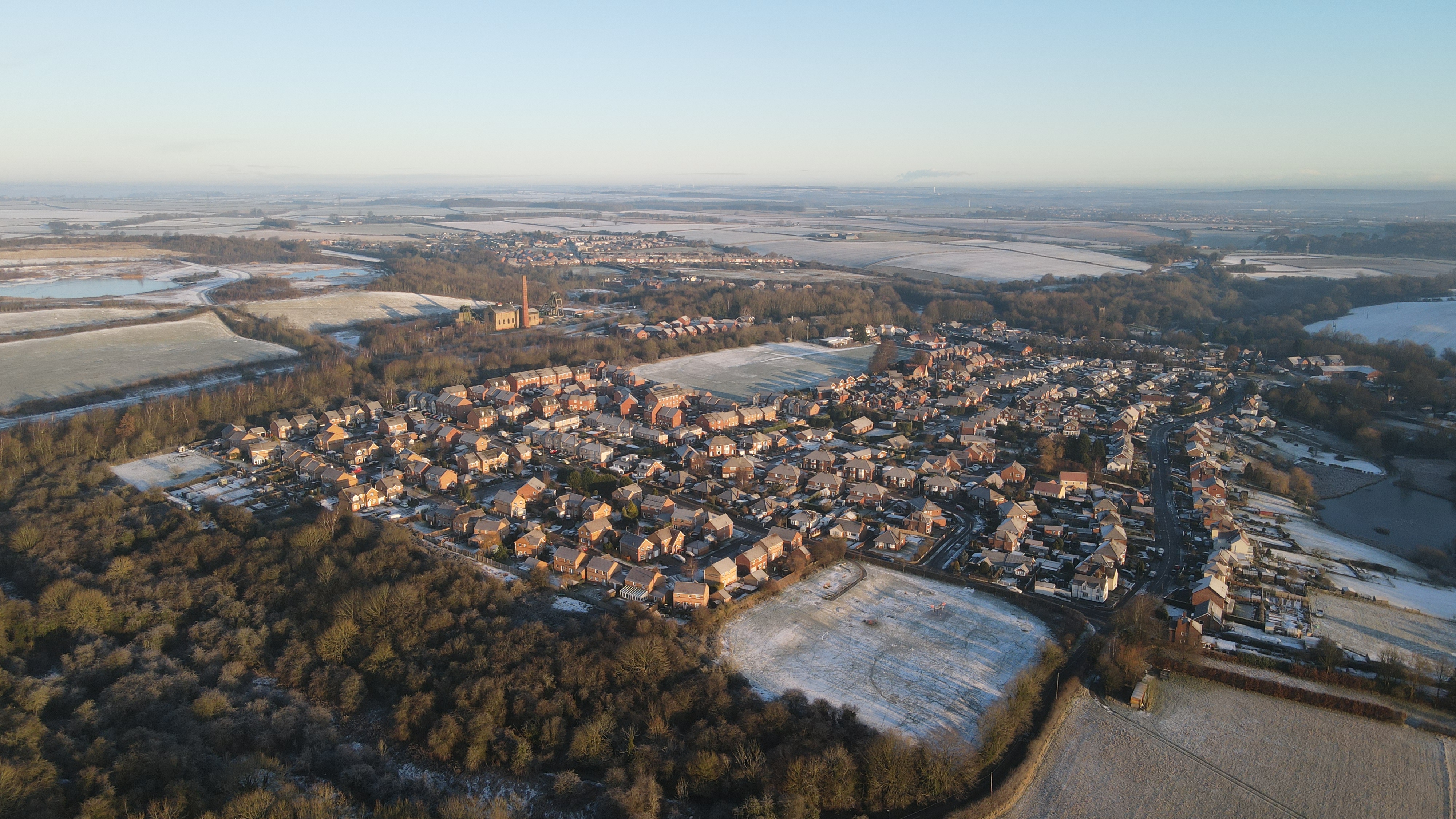
Pleasley Vale is a small village located on the border between Derbyshire and Nottinghamshire, in the East Midlands region of England. It is situated approximately 5 miles northeast of Mansfield and 12 miles northwest of Nottingham. The village is nestled in a picturesque valley, surrounded by rolling hills and lush green fields, offering residents and visitors a tranquil and scenic environment.
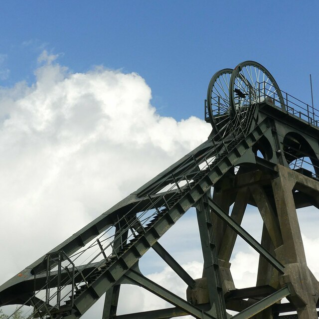
Historically, Pleasley Vale was an important industrial area during the 19th and early 20th centuries, known for its coal mining and textile industries. The remnants of these industries can still be seen today, with preserved mining structures and mill buildings scattered across the landscape. The Pleasley Colliery Country Park, a former mining site turned nature reserve, is a popular attraction for nature lovers and history enthusiasts.
The village itself is primarily residential, with a mix of old stone cottages and modern housing developments. It has a close-knit community, with a village hall and a local pub providing social gathering spaces. Pleasley Vale benefits from its proximity to nearby towns, offering convenient access to amenities and services.
For outdoor enthusiasts, the surrounding countryside offers ample opportunities for walking, hiking, and cycling. The area is also home to several nature reserves, including Pleasley Pit Nature Reserve and Hardwick Hall Park, providing opportunities for wildlife observation and outdoor recreation.
In summary, Pleasley Vale is a charming village with a rich industrial heritage, picturesque surroundings, and a tight-knit community. It offers a peaceful and scenic environment for residents and visitors to enjoy.
If you have any feedback on the listing, please let us know in the comments section below.
Pleasley Vale Images
Images are sourced within 2km of 53.180033/-1.229485 or Grid Reference SK5165. Thanks to Geograph Open Source API. All images are credited.


Pleasley Vale is located at Grid Ref: SK5165 (Lat: 53.180033, Lng: -1.229485)
Administrative County: Derbyshire
District: Bolsover
Police Authority: Derbyshire
What 3 Words
///binds.scavenger.poodle. Near Shirebrook, Derbyshire
Nearby Locations
Related Wikis

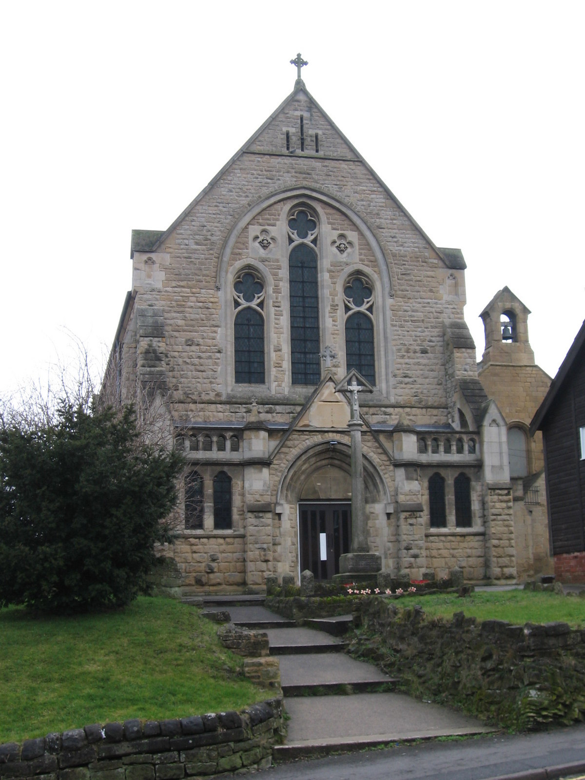
Church of St Chad, Pleasley Vale
The Church of St Chad (also known as St Chad's) is on Church Lane, Pleasley Vale, Nottinghamshire, England. It is an active Church of England parish church...
Pleasley
Pleasley is a village and civil parish with parts in both Derbyshire and Nottinghamshire. It lies between Chesterfield and Mansfield, 5 miles (8 km) south...

New Houghton
New Houghton is a former mining village in the Bolsover District of Derbyshire, England, 3 miles (4.8 km) from both Bolsover and Mansfield. == Governance... ==

Pleasley East railway station
Pleasley East is a former railway station in Pleasley, Derbyshire, England on the Nottinghamshire border near Mansfield. == Context == The station was...

Pleasley West railway station
Pleasley West was a railway station on the Doe Lea line in Pleasley, Derbyshire, England on the border of Derbyshire and Nottinghamshire. It opened in...
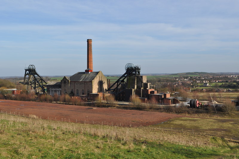
Pleasley Colliery
Pleasley Colliery is a former English coal mine. It is located to the north-west of Pleasley village, which sits above the north bank of the River Meden...

Shirebrook South railway station
Shirebrook South is a former railway station in Shirebrook, north eastern Derbyshire, England. == See also == There have been four separate stations with...
Holy Trinity Church, Shirebrook
Holy Trinity Church is a Grade II listed parish church in the Church of England in Shirebrook, Derbyshire. == History == Construction of the first church...
Nearby Amenities
Located within 500m of 53.180033,-1.229485Have you been to Pleasley Vale?
Leave your review of Pleasley Vale below (or comments, questions and feedback).