Pitcot

Settlement in Somerset Mendip

England

Pitcot

Direction Sign – Signpost at Church Farm, Stratton on the Fosse parish Located at Church Farm on the northwest side of the junction of Church Lane, Stratton Road and Watery Lane in Stratton on the Fosse parish. 4 arms and pyramid finial.

Milestone Society National ID: SO_ST6650
Direction Sign – Signpost at Church Farm, Stratton on the Fosse parish Credit: J Dowding

Pitcot is a small village located in the county of Somerset, England. Situated approximately 8 miles southwest of the town of Glastonbury, Pitcot is nestled in a picturesque rural setting surrounded by rolling hills and farmland. The village is part of the Mendip district and falls within the parish of Ashcott.

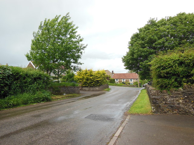
With a population of around 200 residents, Pitcot exudes a strong sense of community and tranquility. The settlement dates back to medieval times, and its history is reflected in its charming architecture, including a number of thatched cottages and traditional stone buildings.

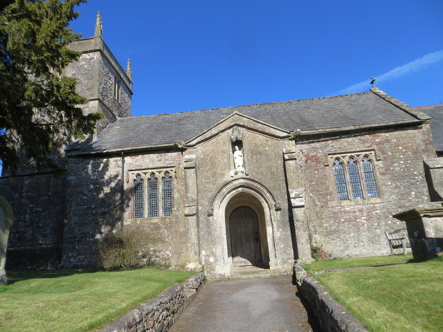
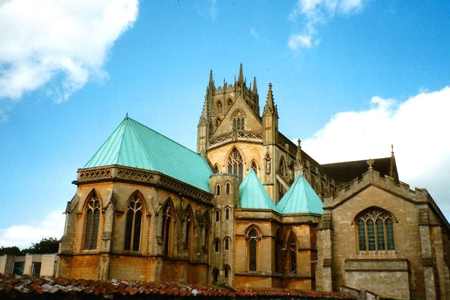
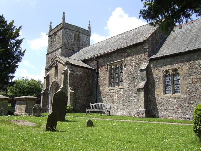
Pitcot is home to the 13th-century St. Mary's Church, a notable landmark in the area. The church boasts beautiful stained glass windows and an impressive bell tower, adding to the village's historical appeal. The surrounding countryside offers ample opportunities for outdoor activities such as walking, cycling, and birdwatching, making it an attractive destination for nature enthusiasts.

Despite its small size, Pitcot has a few amenities to cater to its residents' needs. These include a village hall, where various community events and gatherings take place, and a local pub that serves as a social hub for both locals and visitors.

Overall, Pitcot is a charming and idyllic village, offering a peaceful retreat from the hustle and bustle of city life. Its rich history, stunning landscapes, and close-knit community make it a desirable place to live or visit for those seeking a more rural and traditional experience in Somerset.

If you have any feedback on the listing, please let us know in the comments section below.

Pitcot Images

Images are sourced within 2km of 51.241511/-2.493629 or Grid Reference ST6549. Thanks to Geograph Open Source API. All images are credited.

Direction Sign – Signpost at Church Farm, Stratton on the Fosse parish Located at Church Farm on the northwest side of the junction of Church Lane, Stratton Road and Watery Lane in Stratton on the Fosse parish. 4 arms and pyramid finial.

Milestone Society National ID: SO_ST6650
Direction Sign – Signpost at Church Farm, Stratton on the Fosse parish
Located at Church Farm on the northwest side of the junction of Church Lane, Stratton Road and Watery Lane in Stratton on the Fosse parish. 4 arms and pyramid finial. Milestone Society National ID: SO_ST6650
Downside Abbey Despite appearances, most of this abbey was built in the 20th century (see <a href="https://www.geograph.org.uk/photo/4261979">ST6550 : Downside Abbey</a> for full description). The remaining Benedictine monks who have been at Downside since 1814 plan to leave in March 2022.
Downside Abbey
Despite appearances, most of this abbey was built in the 20th century (see ST6550 : Downside Abbey for full description). The remaining Benedictine monks who have been at Downside since 1814 plan to leave in March 2022.
The church of St Andrew, Holcombe
The church of St Vigor at Stratton-on-the-Fosse One of only two churches named after St Vigor.
The church of St Vigor at Stratton-on-the-Fosse
One of only two churches named after St Vigor.
Ordnance Survey Cut Mark This mark can be found on the wall of St Andrew's Church.
For more detail see : <span class="nowrap"><a title="http://www.bench-marks.org.uk/bm47754" rel="nofollow ugc noopener" href="http://www.bench-marks.org.uk/bm47754">Link</a><img style="margin-left:2px;" alt="External link" title="External link - shift click to open in new window" src="https://s1.geograph.org.uk/img/external.png" width="10" height="10"/></span>
Ordnance Survey Cut Mark
This mark can be found on the wall of St Andrew's Church. For more detail see : LinkExternal link
Croft House and the B3356 Croft House stands behind the trees on the left. Taken between heavy showers on a Saturday lunchtime.
Croft House and the B3356
Croft House stands behind the trees on the left. Taken between heavy showers on a Saturday lunchtime.
Keeping pupils and the public apart These gates close off the grounds of Downside School. Two notices tell the public that this is private property with no right of way; a third tells pupils that they are not to go (in the other direction) past this point.
Keeping pupils and the public apart
These gates close off the grounds of Downside School. Two notices tell the public that this is private property with no right of way; a third tells pupils that they are not to go (in the other direction) past this point.
South porch of Old St Andrew's Church, Holcombe The late Lella Raymond, in her 1996 guide written for the Churches Conservation Trust, tells us that "the south porch holds fascinating evidence of antiquity.  The cut stone is Doulting limestone, used for Bath, Glastonbury and Wells.  The gable incorporates a Norman arch, with zigzag around it and short rolls inserted at intervals in the hollow beneath the hood.  Above the arch, in place of the keystone, is a 16th-century carved angel with wings outstretched and arms folded.  The chevron at the apex of the gable could have been carved from the tympanum ...  The walls of the porch are blind, with plain stone benches each side, one inscribed D C 1743.  The inner doorway was continuous quarter-round moulding round a four-centred arch. The door itself is a fine medieval example."
South porch of Old St Andrew's Church, Holcombe
The late Lella Raymond, in her 1996 guide written for the Churches Conservation Trust, tells us that "the south porch holds fascinating evidence of antiquity. The cut stone is Doulting limestone, used for Bath, Glastonbury and Wells. The gable incorporates a Norman arch, with zigzag around it and short rolls inserted at intervals in the hollow beneath the hood. Above the arch, in place of the keystone, is a 16th-century carved angel with wings outstretched and arms folded. The chevron at the apex of the gable could have been carved from the tympanum ... The walls of the porch are blind, with plain stone benches each side, one inscribed D C 1743. The inner doorway was continuous quarter-round moulding round a four-centred arch. The door itself is a fine medieval example."
Old St Andrew's Church, Holcombe In parkland a mile north of the village, the old church ceased to be used for regular worship when the new church in the village centre <a href="https://www.geograph.org.uk/photo/137605">ST6749 : Holcombe St Andrew</a> was opened in 1884.  It is now vested in the Churches Conservation Trust.  The 14th-century west tower shows the emerging Perpendicular style and is unbuttressed. To its west can be seen one of an avenue of Lawson cypresses.
Old St Andrew's Church, Holcombe
In parkland a mile north of the village, the old church ceased to be used for regular worship when the new church in the village centre ST6749 : Holcombe St Andrew was opened in 1884. It is now vested in the Churches Conservation Trust. The 14th-century west tower shows the emerging Perpendicular style and is unbuttressed. To its west can be seen one of an avenue of Lawson cypresses.
Downside Abbey The Basilica of St Gregory the Great is the largest neo-Gothic church, not a cathedral, in England and home to the senior community of English Benedictines.  The brothers came to Downside from Douai in northern France in 1814, as refugees from the Napoleonic regime, but most of what we see today was built in the 20th century. The cluster of eastern chapels and the transept were constructed between 1882 and 1890, the architects being Archibald Dunn and Edward Hansom.  The quire was designed by Thomas Garner and completed in 1905; the tower beyond, placed over the south transept rather than the central crossing, was completed by Sir Giles Gilbert Scott in 1938.  At 166 feet it is the tallest tower in Somerset after Wells Cathedral at 182 ft (Bath Abbey's tower is 162 ft). The great church is 74 feet high (Bath 75 ft, Exeter Cathedral 69 ft, Wells 73 ft)  and 328 feet long at present (Bristol Cathedral 338 ft), but Scott's nave still awaits its final two western bays.
Downside Abbey
The Basilica of St Gregory the Great is the largest neo-Gothic church, not a cathedral, in England and home to the senior community of English Benedictines. The brothers came to Downside from Douai in northern France in 1814, as refugees from the Napoleonic regime, but most of what we see today was built in the 20th century. The cluster of eastern chapels and the transept were constructed between 1882 and 1890, the architects being Archibald Dunn and Edward Hansom. The quire was designed by Thomas Garner and completed in 1905; the tower beyond, placed over the south transept rather than the central crossing, was completed by Sir Giles Gilbert Scott in 1938. At 166 feet it is the tallest tower in Somerset after Wells Cathedral at 182 ft (Bath Abbey's tower is 162 ft). The great church is 74 feet high (Bath 75 ft, Exeter Cathedral 69 ft, Wells 73 ft) and 328 feet long at present (Bristol Cathedral 338 ft), but Scott's nave still awaits its final two western bays.
Industrial Buildings at Stoke Bottom These buildings are heavily protected with large metal fences and razor wire but have no signage to indicate their use.
Industrial Buildings at Stoke Bottom
These buildings are heavily protected with large metal fences and razor wire but have no signage to indicate their use.
Old Milestone by A367, just South of Stratton on the Fosse Way The Milestone is located on grass verge on the East of the road.  Parish of Stratton On The Fosse (Mendip District). Cast iron post, plated iron casting design, erected by the Shepton Mallet turnpike trust in the 19th century. An earlier photograph can be found here: <a title="https://www.geograph.org.uk/photo/6095973" href="https://www.geograph.org.uk/photo/6095973">Link</a> 

Inscription reads:-
SHEPTON / MALLET / 5 : : BATH / 12 : : CHELT.M / 49 

Grade II listed. List Entry Number: 1058636 <span class="nowrap"><a title="https://historicengland.org.uk/listing/the-list/list-entry/1058636" rel="nofollow ugc noopener" href="https://historicengland.org.uk/listing/the-list/list-entry/1058636">Link</a><img style="margin-left:2px;" alt="External link" title="External link - shift click to open in new window" src="https://s1.geograph.org.uk/img/external.png" width="10" height="10"/></span> 

Milestone Society National ID: SO_CMSM49
Old Milestone by A367, just South of Stratton on the Fosse Way
The Milestone is located on grass verge on the East of the road.  Parish of Stratton On The Fosse (Mendip District). Cast iron post, plated iron casting design, erected by the Shepton Mallet turnpike trust in the 19th century. An earlier photograph can be found here: Link  Inscription reads:- SHEPTON / MALLET / 5 : : BATH / 12 : : CHELT.M / 49 Grade II listed. List Entry Number: 1058636 LinkExternal link Milestone Society National ID: SO_CMSM49
Old Milestone by A367, Fosse Way, outside front of "The George at Nettlebridge" PH The Milestone is located against front wall of inn on the East of the road.  Parish of Stratton On The Fosse (Mendip District). Cast iron post, plated iron casting design, erected by the Shepton Mallet turnpike trust in the 19th century. An earlier photograph can be found here: <a title="https://www.geograph.org.uk/photo/6037563" href="https://www.geograph.org.uk/photo/6037563">Link</a> 

Inscription reads:- 
SHEPTON / MALLET / 4 : : BATH / 13 : : CHELT.M / 50  

Grade II listed. List Entry Number: 1178363 <span class="nowrap"><a title="https://historicengland.org.uk/listing/the-list/list-entry/1178363" rel="nofollow ugc noopener" href="https://historicengland.org.uk/listing/the-list/list-entry/1178363">Link</a><img style="margin-left:2px;" alt="External link" title="External link - shift click to open in new window" src="https://s1.geograph.org.uk/img/external.png" width="10" height="10"/></span> 

Milestone Society National ID: SO_CMSM50
Old Milestone by A367, Fosse Way, outside front of "The George at Nettlebridge" PH
The Milestone is located against front wall of inn on the East of the road.  Parish of Stratton On The Fosse (Mendip District). Cast iron post, plated iron casting design, erected by the Shepton Mallet turnpike trust in the 19th century. An earlier photograph can be found here: Link  Inscription reads:- SHEPTON / MALLET / 4 : : BATH / 13 : : CHELT.M / 50 Grade II listed. List Entry Number: 1178363 LinkExternal link Milestone Society National ID: SO_CMSM50
2011 : View north from Blackey Lane On the other side of Blackey Lane from <a href="https://www.geograph.org.uk/photo/2308116">ST6348 : 2011 : Ashwick Court from Blackley Lane</a> looking up the northern slope of the valley in the direction of West Farm which is out of shot to the right.
2011 : View north from Blackey Lane
On the other side of Blackey Lane from ST6348 : 2011 : Ashwick Court from Blackley Lane looking up the northern slope of the valley in the direction of West Farm which is out of shot to the right.
2011 : Blackey Lane heading east Down the valley toward Benter.
The footpath (see sign) to the right takes the walker to Ashwick, less than half a mile, another path to the left climbs the side of the valley to West Farm and T'other Side The Hill.
2011 : Blackey Lane heading east
Down the valley toward Benter. The footpath (see sign) to the right takes the walker to Ashwick, less than half a mile, another path to the left climbs the side of the valley to West Farm and T'other Side The Hill.
Fernhill Cave The fabulous curtains.
Fernhill Cave
The fabulous curtains.
Fernhill Cave Stalagmite curtain.
Fernhill Cave
Stalagmite curtain.
Show me another place!

Pitcot is located at Grid Ref: ST6549 (Lat: 51.241511, Lng: -2.493629)

Administrative County: Somerset

District: Mendip

Police Authority: Avon and Somerset

What 3 Words

///unspoiled.pines.dorm. Near Chilcompton, Somerset

Related Wikis

Edford Woods and Meadows

Edford Woods and Meadows (grid reference ST665485) is a 54.3 hectare (134.1 acre) biological Site of Special Scientific Interest, between Nettlebridge...

Harridge Wood

Harridge Wood is an area of woodland in Somerset, England. From about 1300 AD part of the wood was the scene of coal mining, which continued until around...

Stratton-on-the-Fosse

Stratton-on-the-Fosse is a village and civil parish located on the edge of the Mendip Hills, 2 miles (3 km) south-west of Westfield, 6 miles (10 km) north...

Downside School

Downside School is a co-educational Catholic independent boarding and day school in the English public school tradition for pupils aged 11 to 18. It is...
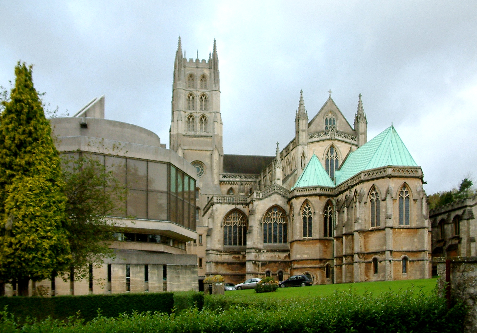
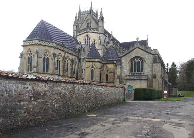
Downside Abbey

Downside Abbey is a Benedictine monastery in England and the senior community of the English Benedictine Congregation. Until 2019, the community had close...
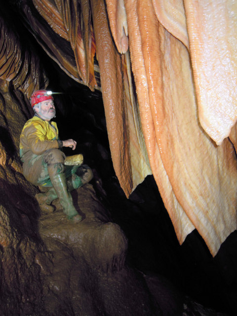
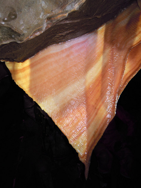
W/L Cave

W/L Cave is part of the Fairy Cave Quarry group of caves between Stoke St Michael and Oakhill in the limestone of the Mendip Hills, in Somerset, England...

Hillier's Cave

Hillier's Cave (grid reference ST65734753) is a cave in Fairy Cave Quarry, near Stoke St Michael in the limestone of the Mendip Hills, in Somerset, England...

Balch Cave

Balch Cave (grid reference ST65734753) is a cave in Fairy Cave Quarry, near Stoke St Michael in the limestone of the Mendip Hills, in Somerset, England...

Nearby Amenities

Located within 500m of 51.241511,-2.493629
Parking
Ley-by
Capacity: 3
Parking: surface
Lat/Long: 51.2424521/-2.5003325
Barrier: stile
Lat/Long: 51.2444174/-2.4892698
Power: pole
Lat/Long: 51.2440664/-2.4989337
Power: pole
Lat/Long: 51.2444929/-2.4973673
Power: pole
Lat/Long: 51.2450134/-2.4957472
Power: pole
Lat/Long: 51.2455205/-2.4941647
Power: pole
Lat/Long: 51.2441823/-2.4906483
Power: pole
Lat/Long: 51.2448119/-2.4899349
Turning Circle
Lat/Long: 51.2430011/-2.4915194
The data included in this document is from www.openstreetmap.org. The data is made available under ODbL.

Have you been to Pitcot?

Leave your review of Pitcot below (or comments, questions and feedback).