Pirbright Camp

Settlement in Surrey Guildford

England

Pirbright Camp

Navigating northwards up the Basher (23) Looking from Thornycroft Avenue into Huntspill Drive
Navigating northwards up the Basher (23) Credit: Basher Eyre

Pirbright Camp is a military training facility located in the village of Pirbright, Surrey, England. It is situated approximately 30 miles southwest of central London. The camp has a long and storied history, dating back to its establishment in 1892.

Pirbright Camp covers an area of around 2,400 acres and is primarily used by the British Army for basic training and officer training courses. It is also home to the Royal Logistic Corps and the Royal Electrical and Mechanical Engineers. The camp provides a range of facilities, including barracks, training areas, firing ranges, and sports fields.

The camp plays a vital role in the training and development of soldiers for active duty. It offers rigorous and comprehensive training in various military disciplines, including infantry, logistics, engineering, and communications. The training programs are designed to equip soldiers with the necessary skills, knowledge, and physical fitness required for their roles within the armed forces.

Pirbright Camp also serves as a hub for community engagement and support. It actively participates in local events and initiatives, fostering positive relationships between the military and the surrounding community. Additionally, the camp provides various amenities for its personnel, such as a gymnasium, recreational facilities, and welfare services.

Overall, Pirbright Camp is a significant military training establishment in Surrey, contributing to the readiness and effectiveness of the British Army. Its rich history, state-of-the-art facilities, and commitment to community engagement make it an essential part of the local area.

If you have any feedback on the listing, please let us know in the comments section below.

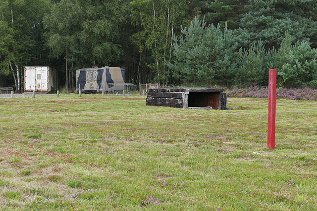
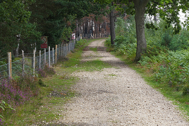
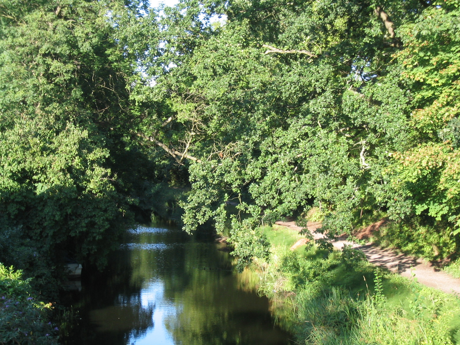
Pirbright Camp Images

Images are sourced within 2km of 51.295706/-0.681884 or Grid Reference SU9256. Thanks to Geograph Open Source API. All images are credited.

Navigating northwards up the Basher (23) Looking from Thornycroft Avenue into Huntspill Drive
Navigating northwards up the Basher (23)
Looking from Thornycroft Avenue into Huntspill Drive
Navigating northwards up the Basher (22) Looking south-east on the Old Guildford Road
Navigating northwards up the Basher (22)
Looking south-east on the Old Guildford Road
New Pond
New Pond
Gapemouth Plantation
Ash Ranges perimeter road The perimeter road near the clay pigeon shooting range on Tunnel Hill.
Ash Ranges perimeter road
The perimeter road near the clay pigeon shooting range on Tunnel Hill.
Mytchett Place Road The road running to the north of the Ash Ranges near the entrance to the Old Guildford Road on Tunnel Hill.
Mytchett Place Road
The road running to the north of the Ash Ranges near the entrance to the Old Guildford Road on Tunnel Hill.
Ash Ranges shotgun range The shotgun range inside Ash Ranges, a large military firing range in northwest Surrey. The wooden structure is the launching bunker for the clays.
Ash Ranges shotgun range
The shotgun range inside Ash Ranges, a large military firing range in northwest Surrey. The wooden structure is the launching bunker for the clays.
Ash Ranges shotgun range One of two clay launching bunkers on the shotgun range near Tunnel Hill.
Ash Ranges shotgun range
One of two clay launching bunkers on the shotgun range near Tunnel Hill.
Track, Ash Ranges The track running south from the range entrance on Tunnel Hill towards Scragley Hill. The fence on the left marks the perimeter of the shotgun range.
Track, Ash Ranges
The track running south from the range entrance on Tunnel Hill towards Scragley Hill. The fence on the left marks the perimeter of the shotgun range.
Ash Range parimeter road Looking west along the perimeter road from the Tunnel Hill entrance with one of the warning flag posts on the bend.
Ash Range parimeter road
Looking west along the perimeter road from the Tunnel Hill entrance with one of the warning flag posts on the bend.
The Old Guildford Road This must at one time run from Frimley down to Guildford via Henley Park and Littlewick Common before it was cut off by the creation of the Ash Ranges. This section that runs from Mytchett Place Road to Frimley Green through the military training area still exists.
The Old Guildford Road
This must at one time run from Frimley down to Guildford via Henley Park and Littlewick Common before it was cut off by the creation of the Ash Ranges. This section that runs from Mytchett Place Road to Frimley Green through the military training area still exists.
Wood Ant nest, Ash training area A large Wood Ant nest beside the Old Guildford Road in the woods used as a military training area. These nests can get very large and hold more than 100,000 individuals with multiple queens to each nest. There are a number of Formica species that go under the name of Wood Ant, this one is probably Formica rufa.
Wood Ant nest, Ash training area
A large Wood Ant nest beside the Old Guildford Road in the woods used as a military training area. These nests can get very large and hold more than 100,000 individuals with multiple queens to each nest. There are a number of Formica species that go under the name of Wood Ant, this one is probably Formica rufa.
Ash military training area A barrier along the Old Guildford Road, a public right of way, preventing vehicle entrance to the training grounds.
Ash military training area
A barrier along the Old Guildford Road, a public right of way, preventing vehicle entrance to the training grounds.
Track, Ash training area A track through the pine woods that cover most of the military training area north of Mytchett Place Road.
Track, Ash training area
A track through the pine woods that cover most of the military training area north of Mytchett Place Road.
The Old Guildford Road New build houses along the Old Guildford Road just outside the military training area.
The Old Guildford Road
New build houses along the Old Guildford Road just outside the military training area.
Portaloos, Ash training area Two portaloos just off the Old Guildford Road on the northern boundary track of the military training area.
Portaloos, Ash training area
Two portaloos just off the Old Guildford Road on the northern boundary track of the military training area.
Railway Line at Curzon Bridge The main railway line looking towards London from the Curzon Bridge. The bridge in the distance carries a branch line over the tracks to join further on.
Railway Line at Curzon Bridge
The main railway line looking towards London from the Curzon Bridge. The bridge in the distance carries a branch line over the tracks to join further on.
Basingstoke Canal Lock No 25 & Curzon Bridge Lock No 25 on the Basingstoke canal which lies under the Curzon Canal Bridge. Refer to picture <a href="https://www.geograph.org.uk/photo/4726595">SU9256 : Autumn Trees on the Basingstoke Canal</a> for the next view along the canal. For the same view of the bridge in February 2015 refer to picture <a href="https://www.geograph.org.uk/photo/4363012">SU9256 : Curzon Bridge & Lock 25, Basingstoke Canal</a>.
Basingstoke Canal Lock No 25 & Curzon Bridge
Lock No 25 on the Basingstoke canal which lies under the Curzon Canal Bridge. Refer to picture SU9256 : Autumn Trees on the Basingstoke Canal for the next view along the canal. For the same view of the bridge in February 2015 refer to picture SU9256 : Curzon Bridge & Lock 25, Basingstoke Canal.
Show me another place!

Pirbright Camp is located at Grid Ref: SU9256 (Lat: 51.295706, Lng: -0.681884)

Administrative County: Surrey

District: Guildford

Police Authority: Surrey

What 3 Words

///dote.smiles.snapper. Near Normandy, Surrey

Related Wikis

Pirbright Camp

Pirbright Camp is a British Army installation in Pirbright, Surrey. It houses the Army Training Centre Pirbright, and a number of other units. == History... ==

Princess Royal Barracks, Deepcut

The Princess Royal Barracks, Deepcut, commonly referred to as Deepcut Barracks, is a former British Army installation near Camberley, Surrey. It was the...

Army Training Centre Pirbright

The Army Training Centre Pirbright is an initial training establishment of the British Army, at Pirbright Camp. == Scope == The ATC, along with the Army...

Basingstoke Canal

The Basingstoke Canal is an English canal, completed in 1794, built to connect Basingstoke with the River Thames at Weybridge via the Wey Navigation. From...

Nearby Amenities

Located within 500m of 51.295706,-0.681884
Seamark Type: gate
Waterway: lock_gate
Lat/Long: 51.2992648/-0.6813581
Stoney Castle
Building: yes
Source: npe
Lat/Long: 51.2937284/-0.6781685
Seamark Type: gate
Waterway: lock_gate
Lat/Long: 51.2993583/-0.6809068
Disused: yes
Historic: ruins
Military: bunker
Lat/Long: 51.2974977/-0.68077
Parking
Lat/Long: 51.2977615/-0.678407
Parking
Lat/Long: 51.2928493/-0.6844345
Pirbright Bends
Place: locality
Lat/Long: 51.2971298/-0.6819408
Give Way
Source: Bing
Lat/Long: 51.2970338/-0.6801316
Distance: 16.0
Operator: Basingstoke Canal
Waterway: milestone
Lat/Long: 51.2988619/-0.6828072
Bench
Lat/Long: 51.2997776/-0.6789046
Historic: yes
Military: bunker
Lat/Long: 51.2971171/-0.6797428
The data included in this document is from www.openstreetmap.org. The data is made available under ODbL.

Have you been to Pirbright Camp?

Leave your review of Pirbright Camp below (or comments, questions and feedback).