Acton Trussell

Settlement in Staffordshire South Staffordshire

England

Acton Trussell

Canal near Acton Trussell in Staffordshire This is the Staffordshire and Worcestershire Canal, looking north-north-east towards Acton Bridge (No 93), Stafford and Great Haywood.
Canal near Acton Trussell in Staffordshire Credit: Roger Kidd

Acton Trussell is a village located in Staffordshire, England. Situated along the banks of the River Penk, the village is part of the civil parish of Acton Trussell and Bednall. It is located approximately 4 miles south of Stafford, the county town of Staffordshire.

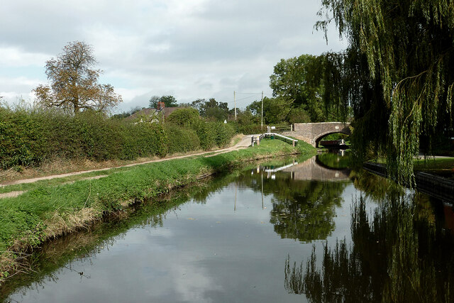
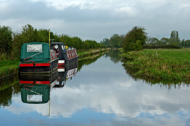
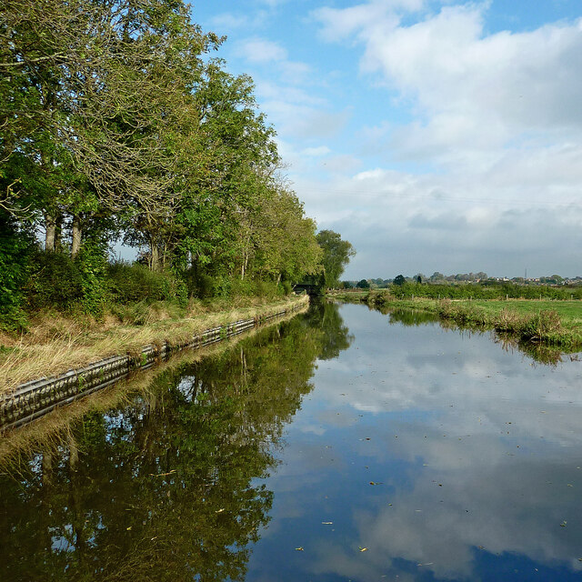
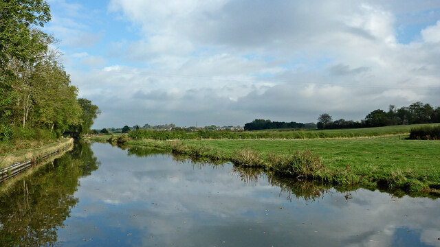
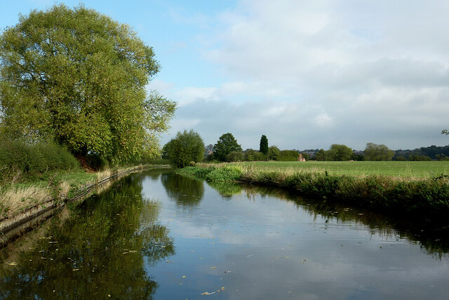
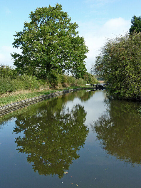
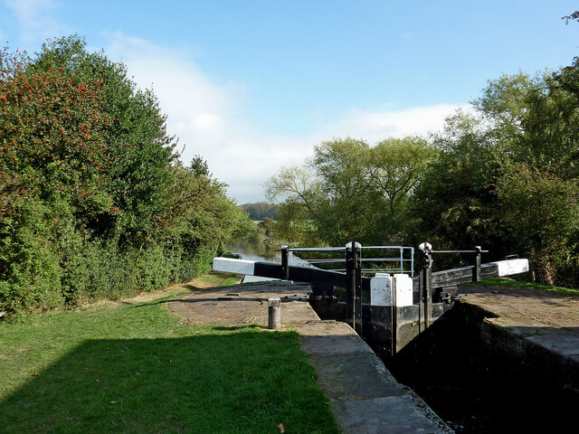
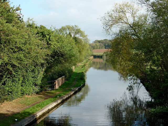
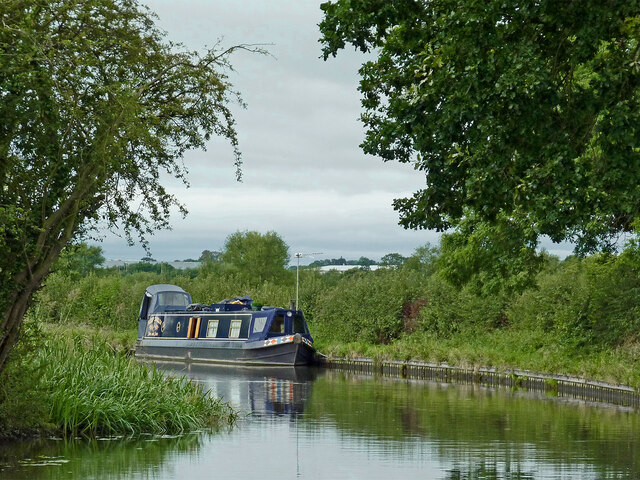
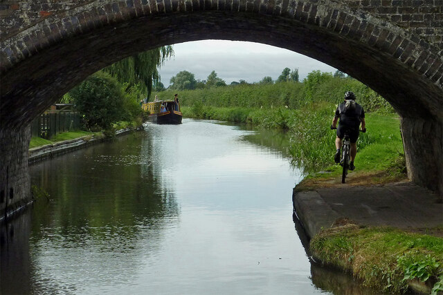
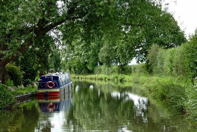
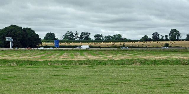
The village is known for its picturesque setting and charming rural atmosphere. It is surrounded by beautiful countryside and offers stunning views of the Staffordshire landscape. The River Penk, which flows through the village, adds to its natural beauty and provides opportunities for leisurely walks and fishing.

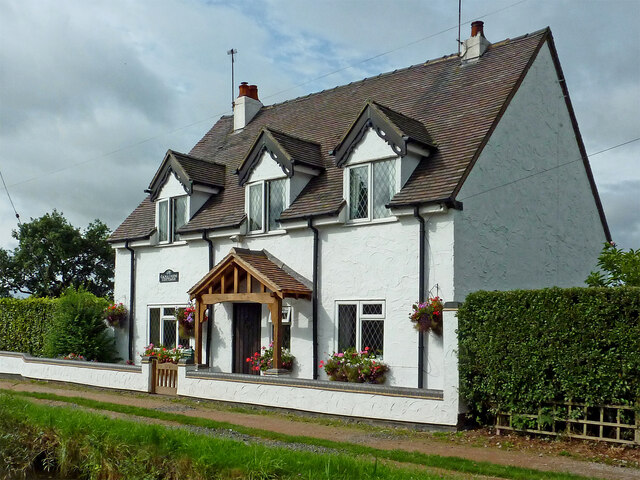
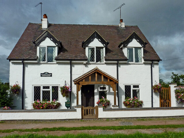
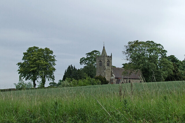
Acton Trussell has a rich history that can be traced back to the Domesday Book of 1086. It was once a farming community, and remnants of its agricultural past can still be seen today. The village is also home to several historic buildings, including Acton Trussell Hall, a Grade II listed mansion dating back to the 18th century.

Despite its small size, Acton Trussell offers a range of amenities for its residents and visitors. These include a village hall, a primary school, and a village pub. The village is also well-connected, with good transportation links to nearby towns and cities.

Overall, Acton Trussell is a peaceful and idyllic village that offers a glimpse into Staffordshire's rural heritage. Its natural beauty, historic buildings, and community spirit make it a charming place to visit or call home.

If you have any feedback on the listing, please let us know in the comments section below.

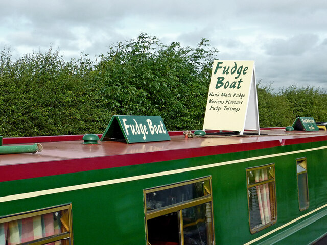
Acton Trussell Images

Images are sourced within 2km of 52.768076/-2.10594 or Grid Reference SJ9218. Thanks to Geograph Open Source API. All images are credited.

Canal near Acton Trussell in Staffordshire This is the Staffordshire and Worcestershire Canal, looking north-north-east towards Acton Bridge (No 93), Stafford and Great Haywood.
Canal near Acton Trussell in Staffordshire
This is the Staffordshire and Worcestershire Canal, looking north-north-east towards Acton Bridge (No 93), Stafford and Great Haywood.
Canal north of Acton Trussell in Staffordshire This is the Staffordshire and Worcestershire Canal, looking north towards  Stafford and Great Haywood.
Canal north of Acton Trussell in Staffordshire
This is the Staffordshire and Worcestershire Canal, looking north towards Stafford and Great Haywood.
Canal north of Acton Trussell in Staffordshire This is the Staffordshire and Worcestershire Canal, looking north towards Roseford Bridge, No 94.
Canal north of Acton Trussell in Staffordshire
This is the Staffordshire and Worcestershire Canal, looking north towards Roseford Bridge, No 94.
Canal and pasture north of Acton Trussell Staffordshire This is the Staffordshire and Worcestershire Canal, looking north towards Roseford Bridge, No 94.
Canal and pasture north of Acton Trussell Staffordshire
This is the Staffordshire and Worcestershire Canal, looking north towards Roseford Bridge, No 94.
Canal and pasture north of Acton Trussell Staffordshire This is the Staffordshire and Worcestershire Canal, looking north towards Stafford. The distant brick cottage is by Deptmore (Deepmore) Lock, No 42.
Canal and pasture north of Acton Trussell Staffordshire
This is the Staffordshire and Worcestershire Canal, looking north towards Stafford. The distant brick cottage is by Deptmore (Deepmore) Lock, No 42.
Canal approaching Deptmore Lock near Stafford This is the Staffordshire and Worcestershire Canal near Deptmore (Deepmore) Lock, No 42, meandering towards Great Haywood Junction.
Canal approaching Deptmore Lock near Stafford
This is the Staffordshire and Worcestershire Canal near Deptmore (Deepmore) Lock, No 42, meandering towards Great Haywood Junction.
Deptmore Lock near Wildwood, Stafford Looking north-east as the canal meanders towards Great Haywood Junction, Deptmore Lock (Deepmore Lock) is No 42 on the Staffordshire and Worcestershire Canal. It is a deep one, allowing a fall (or rise) of 10ft 3in (about 3·1 metres).
Deptmore Lock near Wildwood, Stafford
Looking north-east as the canal meanders towards Great Haywood Junction, Deptmore Lock (Deepmore Lock) is No 42 on the Staffordshire and Worcestershire Canal. It is a deep one, allowing a fall (or rise) of 10ft 3in (about 3·1 metres).
Staffordshire and Worcestershire Canal near Wildwood, Stafford From Deptmore Lock, looking north-east as the canal meanders past Stafford towards Great Haywood Junction.
Staffordshire and Worcestershire Canal near Wildwood, Stafford
From Deptmore Lock, looking north-east as the canal meanders past Stafford towards Great Haywood Junction.
Narrowboat on the Staffordshire and Worcestershire Canal Narrowboat "Keep Smilin" is moored south-west of Deptmore Lock near Wildwood, Stafford.
Narrowboat on the Staffordshire and Worcestershire Canal
Narrowboat "Keep Smilin" is moored south-west of Deptmore Lock near Wildwood, Stafford.
Get your fudge here! The very smart boat was moored in a very rural place north of Acton Trussell in Staffordshire. A permit is required to trade from a narrowboat on the canals. I expect they do get occasional ales from passing craft. I have read that their best seller is the rhubarb and custard flavour.

Traders of all kinds of wares can be found at boat festivals and other popular canal venues.
Get your fudge here!
The very smart boat was moored in a very rural place north of Acton Trussell in Staffordshire. A permit is required to trade from a narrowboat on the canals. I expect they do get occasional ales from passing craft. I have read that their best seller is the rhubarb and custard flavour. Traders of all kinds of wares can be found at boat festivals and other popular canal venues.
Canal near Acton Trussell in Staffordshire Looking south-south-west towards Penkridge and Wolverhampton, this image shows the Staffordshire and Worcestershire Canal at Acton Bridge, No 93. The bridge carries Mill Lane.
Canal near Acton Trussell in Staffordshire
Looking south-south-west towards Penkridge and Wolverhampton, this image shows the Staffordshire and Worcestershire Canal at Acton Bridge, No 93. The bridge carries Mill Lane.
Canalside Cottage near Acton Trussell in Staffordshire By the Staffordshire and Worcestershire Canal.
There is no actual road access to the premises; just a strengthened towpath.
Canalside Cottage near Acton Trussell in Staffordshire
By the Staffordshire and Worcestershire Canal. There is no actual road access to the premises; just a strengthened towpath.
Canal near Acton Trussell in Staffordshire Looking south towards Penkridge, this is the Staffordshire and Worcestershire Canal near the southern part of Acton Trussell (off to the left). The large overhanging tree has been felled since the image was obtained.
Canal near Acton Trussell in Staffordshire
Looking south towards Penkridge, this is the Staffordshire and Worcestershire Canal near the southern part of Acton Trussell (off to the left). The large overhanging tree has been felled since the image was obtained.
Farmland and motorway near Acton Trussell, Staffordshire Looking west-south-west from the Staffordshire and Worcestershire Canal. Cockpit Plantation is on the left. The M6 motorway crosses the view, and just below it, the River Penk (hidden) meanders, flowing from left to right.
Farmland and motorway near Acton Trussell, Staffordshire
Looking west-south-west from the Staffordshire and Worcestershire Canal. Cockpit Plantation is on the left. The M6 motorway crosses the view, and just below it, the River Penk (hidden) meanders, flowing from left to right.
Across the fields to church No, it's not a route, just a view from the Staffordshire and Worcestershire Canal, looking north-east towards the Church of St James in Acton Trussell.
Across the fields to church
No, it's not a route, just a view from the Staffordshire and Worcestershire Canal, looking north-east towards the Church of St James in Acton Trussell.
Show me another place!

Acton Trussell is located at Grid Ref: SJ9218 (Lat: 52.768076, Lng: -2.10594)

Administrative County: Staffordshire

District: South Staffordshire

Police Authority: Staffordshire

What 3 Words

///keeps.vibes.eaten. Near Stafford, Staffordshire

Nearby Locations

Acton Trussell

Related Wikis

Acton Trussell

Acton Trussell is a village in the English county of Staffordshire. It is known as Actone in the Domesday Book. Located around 4 miles southeast of Stafford...

Dunston, Staffordshire

Dunston is a small village in England lying on the west side of the A449 trunk road about 3 miles (4.8 km) south of Stafford, close to Junction 13 of the...

Radford Meadows

Radford Meadows is a nature reserve of the Staffordshire Wildlife Trust, on the southern edge of Stafford, in Staffordshire, England. The reserve is a...

1996 Stafford rail crash

The 1996 Stafford rail crash occurred on 8 March 1996 when a Transrail freight train travelling from Mossend, North Lanarkshire, to Willesden, North London...

Acton Trussell and Bednall

Acton Trussell and Bednall is a civil parish in the South Staffordshire district of Staffordshire, England. As the name indicates, it contains the two...

Hyde Lea

Hyde Lea is a village and parish in Staffordshire, England, just west of Stafford itself. Hyde Lea borders the southern boundary of Castle Church parish...

Stafford Manor High School

Stafford Manor High School is a mixed secondary school and sixth form located in Stafford in the English county of Staffordshire.Previously known as Rising...

Stafford Grammar School

Stafford Grammar School is a mixed independent day school at Burton Manor, located on the outskirts of Stafford, the county town of Staffordshire. Founded...

Related Videos

Walking The Staffordshire and Worcester Canal (Part 2)

My second walk along the towpath of The Staffordshire and Worcestershire Canal continuing from Saint Thomas Bridge in ...

Our daily walk

Our First EVER you tube video! During this lockdown for Covid-19 we thought we'd try something different and make a video of ...

Hyde Lea & Coppenhall Walk - Staffordshire countryside at its best

We hadn't been for a walk around the local fields and villages for a while so we decided to take a walk around the local area and ...

New Month, New Challenge

This month we signed up to the Ultra Challenge anyway in May. This is our start of the challenge. We'll keep you updated on our ...

Nearby Amenities

Located within 500m of 52.768076,-2.10594
Motorway Junction
Dunston Interchange
Alt Name: Dunston
Ref: 13
Lat/Long: 52.7663479/-2.110874
Bus Stop
Argos
Bus: yes
Naptan AtcoCode: 3800C600000
Naptan Bearing: N
Naptan CommonName: Argos
Naptan Indicator: Adj
Naptan Landmark: Argos
Naptan Street: Wolverhampton Rd
Naptan Verified: no
Public Transport: platform
Source: naptan_import
Lat/Long: 52.7695995/-2.1078006
Bus Stop
Garage
Bus: yes
Naptan AtcoCode: 3800C749301
Naptan Bearing: NW
Naptan CommonName: Garage
Naptan Indicator: Adj
Naptan Landmark: Moss Pit Garage
Naptan PlusbusZoneRef: STAFFRD
Naptan Street: Wolverhampton Road
Naptan Verified: no
Public Transport: platform
Source: naptan_import
Lat/Long: 52.7715945/-2.1086208
Post Box
Brand: Royal Mail
Brand Wikidata: Q638098
Brand Wikipedia: en:Royal Mail
Operator: Royal Mail
Operator Wikidata: Q638098
Post Box Type: lamp
Ref: ST17 380
Source: drive-by survey (not the ref)
Lat/Long: 52.770721/-2.1076947
Acton Gate
Is In: Staffordshire,UK
Place: hamlet
Lat/Long: 52.77178/-2.106827
Bus Stop
Garage
Bus: yes
Naptan AtcoCode: 3800C749302
Naptan NaptanCode: stagjdjm
Naptan Verified: no
Public Transport: platform
Source: naptan
Lat/Long: 52.7717927/-2.1085462
INTRA COMMUNITY CONSIGNMENT
Description: Склад
Office: company
Lat/Long: 52.770947/-2.1107262
The data included in this document is from www.openstreetmap.org. The data is made available under ODbL.

Have you been to Acton Trussell?

Leave your review of Acton Trussell below (or comments, questions and feedback).