Birdholme

Settlement in Derbyshire Chesterfield

England

Birdholme

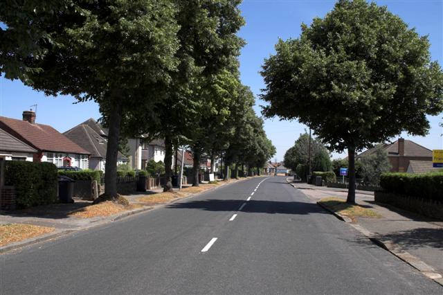
Matlock Road heading towards Chesterfield Passing through the suburb of Walton, most of which is to the left. A footpath which predates most of the housing crosses at this point.
Matlock Road heading towards Chesterfield Credit: Bill Boaden

The requested URL returned error: 429 Too Many Requests

If you have any feedback on the listing, please let us know in the comments section below.

Birdholme Images

Images are sourced within 2km of 53.219371/-1.429352 or Grid Reference SK3869. Thanks to Geograph Open Source API. All images are credited.

Matlock Road heading towards Chesterfield Passing through the suburb of Walton, most of which is to the left. A footpath which predates most of the housing crosses at this point.
Matlock Road heading towards Chesterfield
Passing through the suburb of Walton, most of which is to the left. A footpath which predates most of the housing crosses at this point.
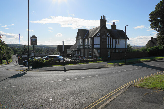
Blue Stoops A challenging view taken directly into the sun. The pub is the only one on Matlock Road in Chesterfield, seen here from across Foljambe Avenue.
Blue Stoops
A challenging view taken directly into the sun. The pub is the only one on Matlock Road in Chesterfield, seen here from across Foljambe Avenue.
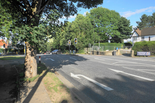
The end of Matlock Road The A632 take a left turn here, though there are not many signs to tell you. The entrance to Chesterfield Golf Club is on the right.
The end of Matlock Road
The A632 take a left turn here, though there are not many signs to tell you. The entrance to Chesterfield Golf Club is on the right.
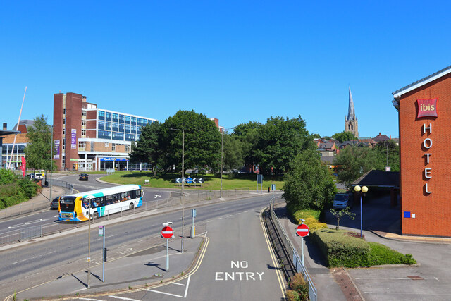
Chesterfield Parish Church A view of Chesterfield Parish Church taken with a wide angle lens.
Chesterfield Parish Church
A view of Chesterfield Parish Church taken with a wide angle lens.
Churchyard of All Saints, Wingerworth
Lych gate at All Saints, Wingerworth The church is Grade I listed but the lych gate does not appear to have historical significance.
Lych gate at All Saints, Wingerworth
The church is Grade I listed but the lych gate does not appear to have historical significance.
Longedge Lane Almost the highest point in the village.
Longedge Lane
Almost the highest point in the village.
All Saints Church, Wingerworth The church is Grade I listed, with the oldest part dating from the 12th Century. It has had additions at numerous times since, including the extension seen here which was built in 1964.
All Saints Church, Wingerworth
The church is Grade I listed, with the oldest part dating from the 12th Century. It has had additions at numerous times since, including the extension seen here which was built in 1964.
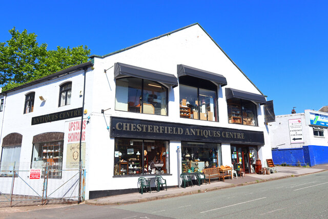
Chesterfield Antiques Centre Retail opportunity in Chesterfield.
Chesterfield Antiques Centre
Retail opportunity in Chesterfield.
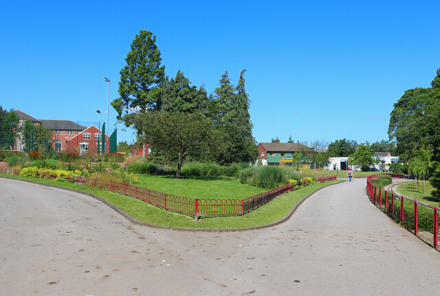
Queen's Park Park in Chesterfield.
Queen's Park
Park in Chesterfield.
Chesterfield Roundabout Main road in Chesterfield.
Chesterfield Roundabout
Main road in Chesterfield.
Hunloke Arms A part of Wingerworth on the A61. Most of it is to the west. This was a wet day.
Hunloke Arms
A part of Wingerworth on the A61. Most of it is to the west. This was a wet day.
Hornbeam Drive A new road providing access to The Avenue, a large new housing development on a brown field site, a former coking plant. It is viewed in rain.
Hornbeam Drive
A new road providing access to The Avenue, a large new housing development on a brown field site, a former coking plant. It is viewed in rain.
Path down to the River Rother Some flood alleviation works have been undertaken in the valley.
Path down to the River Rother
Some flood alleviation works have been undertaken in the valley.
River Rother near Wingerworth Flood alleviation works have been undertaken, linked to remediation of the nearby former Avenue coking works.
River Rother near Wingerworth
Flood alleviation works have been undertaken, linked to remediation of the nearby former Avenue coking works.
Path to Wingerworth The path has to cross the valley of the River Rother.
Path to Wingerworth
The path has to cross the valley of the River Rother.
River Rother near Wingerworth The river is flowing under the Midland Main Line.
River Rother near Wingerworth
The river is flowing under the Midland Main Line.
River Rother near Wingerworth Meandering through farmland and scrub in the bottom of the valley.
River Rother near Wingerworth
Meandering through farmland and scrub in the bottom of the valley.
Show me another place!

Birdholme is located at Grid Ref: SK3869 (Lat: 53.219371, Lng: -1.429352)

Administrative County: Derbyshire

District: Chesterfield

Police Authority: Derbyshire

What 3 Words

///looks.locals.rare. Near Wingerworth, Derbyshire

Nearby Locations

Birdholme

Related Wikis

Birdholme

Birdholme is a suburb of the town of Chesterfield, Derbyshire, England. To its south is Wingerworth, to its north is the town centre, to its west is Boythorpe...

Boythorpe

Boythorpe is a small suburb to the south-west of Chesterfield town centre in Derbyshire, England. It also borders Birdholme to its east, and Walton to...

Horns Bridge

Horns Bridge is a small area on the southeastern edge of Chesterfield, Derbyshire, England which was remarkable at one time for its congested intersection...

Parkside Community School

Parkside Community School (formerly William Rhodes Secondary School) is a co-educational secondary school located in the Boythorpe area of Chesterfield...

Nearby Amenities

Located within 500m of 53.219371,-1.429352
Note: 30 mph speed limit sign northbound
Lat/Long: 53.2156096/-1.4275952
Crossing
Crossing: unmarked
Crossing Island: yes
Crossing Markings: no
Tactile Paving: yes
Lat/Long: 53.2221883/-1.4266342
Crossing
Crossing: unmarked
Crossing Markings: no
Tactile Paving: yes
Lat/Long: 53.2220859/-1.4302717
Traffic Calming: hump
Lat/Long: 53.2209252/-1.4274898
Turning Circle
Lat/Long: 53.2160297/-1.430651
Turning Circle
Lat/Long: 53.2220289/-1.4342176
Turning Circle
Lat/Long: 53.2200228/-1.4325945
Turning Circle
Lat/Long: 53.2222356/-1.4322708
Turning Circle
Lat/Long: 53.2227793/-1.432898
Turning Circle
Lat/Long: 53.2228642/-1.433754
Turning Circle
Lat/Long: 53.220123/-1.4360385
Turning Circle
Lat/Long: 53.2229184/-1.4286577
Turning Circle
Lat/Long: 53.2236006/-1.4279337
Turning Circle
Lat/Long: 53.21846/-1.4295141
Turning Circle
Lat/Long: 53.2215367/-1.4306035
Ele: 77
Lat/Long: 53.2233744/-1.4263781
Ele: 87
Lat/Long: 53.2202613/-1.4270118
Ele: 87.3648682
Removed Amenity: telephone
Lat/Long: 53.2204109/-1.4273385
Post Box
Collection Times: Mo-Fr 09:00, Sa 07:00
Post Box Type: pillar
Ref: S40 109
Royal Cypher: EIIR
Royal Cypher Wikidata: Q33102113
Lat/Long: 53.2202953/-1.4271078
Post Box
Collection Times: Mo-Fr 09:00, Sa 07:00
Ele: 95.7763672
Operator: Royal Mail
Operator Wikidata: Q638098
Post Box Type: wall
Ref: S40 242
Royal Cypher: EIIR
Royal Cypher Wikidata: Q33102113
Lat/Long: 53.2171089/-1.4283381
Turning Circle
Lat/Long: 53.2188811/-1.4264543
Bus Stop
Storforth Lane, Mellor Way
Bus: yes
Ele: 85.2019043
Naptan AtcoCode: 1000DBSL2360
Naptan NaptanCode: dbsgjmtg
Public Transport: platform
Shelter: yes
Tactile Paving: no
Lat/Long: 53.2200733/-1.4262999
Bus Stop
Bus: yes
Ele: 78.4727783
Naptan AtcoCode: 1000DBSL2543
Naptan NaptanCode: dbsgjmtj
Public Transport: platform
Shelter: no
Lat/Long: 53.219924/-1.4232209
Bus Stop
Bus: yes
Ele: 96
Public Transport: platform
Lat/Long: 53.2164077/-1.4322035
Bus Stop
Bus: yes
Ele: 96
Public Transport: platform
Lat/Long: 53.2166172/-1.4320399
Bus Stop
Langfield Avenue
Bus: yes
Ele: 93
Naptan AtcoCode: 1000DBLL3030
Naptan NaptanCode: dbsgjwdg
Public Transport: platform
Shelter: yes
Tactile Paving: no
Lat/Long: 53.2171032/-1.4294139
Bus Stop
Langer Lane
Bus: yes
Ele: 92
Public Transport: platform
Shelter: no
Tactile Paving: no
Lat/Long: 53.2178125/-1.42814
Bus Stop
Langer Lane, Derby Road
Bus: yes
Ele: 93
Naptan AtcoCode: 1000DBLL2928
Naptan NaptanCode: dbsgjwda
Public Transport: platform
Shelter: no
Tactile Paving: no
Lat/Long: 53.2171467/-1.428776
Bus Stop
Bus: yes
Ele: 94.0941162
Public Transport: platform
Lat/Long: 53.2200062/-1.4307165
Turning Circle
Ele: 92.
Lat/Long: 53.218216/-1.4297046
Ele: 84
Lat/Long: 53.221057/-1.4270388
Birdholme
Place: village
Wikidata: Q4915985
Wikipedia: en:Birdholme
Lat/Long: 53.2199768/-1.4285819
Post Box
Brand: Royal Mail
Brand Wikidata: Q638098
Brand Wikipedia: en:Royal Mail
Collection Times: Mo-Fr 09:00, Sa 07:00
Operator: Royal Mail
Operator Wikidata: Q638098
Post Box Type: wall
Ref: S40 164
Royal Cypher: EIIR
Royal Cypher Wikidata: Q33102113
Source: survey
Lat/Long: 53.2233454/-1.4280627
Traffic Signals
Crossing: no
Traffic Signals Direction: forward
Lat/Long: 53.220077/-1.4273165
Crossing
Crossing: unmarked
Crossing Island: yes
Crossing Markings: no
Tactile Paving: yes
Lat/Long: 53.2173009/-1.4283343
Crossing
Crossing: unmarked
Crossing Island: no
Crossing Markings: no
Tactile Paving: yes
Lat/Long: 53.2180276/-1.4337765
Traffic Calming: hump
Lat/Long: 53.2179253/-1.4333124
Turning Circle
Lat/Long: 53.2186171/-1.4359181
Bench
Lat/Long: 53.2215374/-1.4347409
Barrier: bollard
Lat/Long: 53.2226067/-1.434254
Bus Stop
Langer Lane
Bus: yes
Departures Board: realtime
Public Transport: platform
Shelter: yes
Tactile Paving: no
Lat/Long: 53.2164904/-1.428054
Bench
Lat/Long: 53.2188583/-1.4345201
Bench
Lat/Long: 53.2207999/-1.434182
Pharmacy
Cohens
Addr City: Chesterfield
Addr Postcode: S40 2HP
Addr Street: Stubbing Road
Fhrs Id: 589142
Healthcare: pharmacy
Lat/Long: 53.2199135/-1.4364769
Bus Stop
Spire Infant School
Bus: yes
Naptan AtcoCode: 1000DBDS6452
Naptan NaptanCode: dbsjagtd
Public Transport: platform
Shelter: no
Lat/Long: 53.2197547/-1.4273877
Post Office
Birdholme Post Office
Addr City: Chesterfield
Addr Country: GB
Addr Housenumber: 71
Addr Postcode: S40 2TD
Addr Street: Grangewood Road
Addr Suburb: Birdholme
Opening Hours: Mo-Sa 06:30-22:00; Su 07:00-22:00
Operator: Co-Op
Ref Pol Id: 14998
Lat/Long: 53.2191814/-1.4326677
Make up & lashes by Lauren
Phone: +44 1246 236308
Shop: beauty
Lat/Long: 53.2215762/-1.4268733
Cheryl Hollingworth & Co
Phone: +44 1246 236308
Shop: hairdresser
Website: https://www.cherylhollingworthhair.co.uk/
Lat/Long: 53.2215393/-1.426882
Wolseley
Brand: Wolseley
Brand Wikidata: Q8030423
Shop: trade
Trade: plumbing
Website: https://www.wolseley.co.uk/branch/chesterfield/
Lat/Long: 53.2198087/-1.4230146
Premier spas
Shop: swimming_pool
Website: https://www.premierspas.com/
Lat/Long: 53.2199837/-1.4248532
Brampton Bakery
Shop: bakery
Lat/Long: 53.2203789/-1.42429
Trim Centre
Shop: car_parts
Lat/Long: 53.2198649/-1.4244133
Kitchen Craft
Shop: kitchen
Lat/Long: 53.2205548/-1.4247471
ATI Tyres
Shop: tyres
Lat/Long: 53.2198617/-1.4243007
Rachel Skeemer
Craft: counsellor
Source: survey
Lat/Long: 53.2185049/-1.4282197
Traffic Signals
Crossing: no
Traffic Signals Direction: forward
Lat/Long: 53.2231906/-1.4269279
Barrier: cycle_barrier
Lat/Long: 53.2207036/-1.4357877
Turning Circle
Lat/Long: 53.2191089/-1.4300029
Defibrillator
Access: yes
Check Date: 2023-03-09
Emergency: defibrillator
Indoor: no
Ref GB The Circuit: B90B7C25-4EF0-4019-A143-B116007B5E29
Lat/Long: 53.2191579/-1.4327904
Access: private
Door: hinged
Entrance: home
Lat/Long: 53.2205222/-1.4328735
Access: private
Door: hinged
Entrance: home
Lat/Long: 53.2204567/-1.4329129
Access: private
Door: hinged
Entrance: home
Lat/Long: 53.2203875/-1.4329552
Access: private
Door: hinged
Entrance: home
Lat/Long: 53.2203283/-1.4329913
Access: private
Door: hinged
Entrance: home
Lat/Long: 53.2202126/-1.4329645
Access: private
Door: hinged
Entrance: home
Lat/Long: 53.2201539/-1.4329062
Access: private
Door: hinged
Entrance: home
Lat/Long: 53.220083/-1.4328668
Access: private
Door: hinged
Entrance: home
Lat/Long: 53.2200264/-1.4328097
Access: private
Door: hinged
Entrance: home
Lat/Long: 53.2199539/-1.4327825
Access: private
Door: hinged
Entrance: home
Lat/Long: 53.2198986/-1.4325124
Access: private
Door: hinged
Entrance: home
Lat/Long: 53.2199254/-1.4324004
Access: private
Door: hinged
Entrance: home
Lat/Long: 53.2199605/-1.4323059
Access: private
Door: hinged
Entrance: home
Lat/Long: 53.2199888/-1.432197
Access: private
Door: hinged
Entrance: home
Lat/Long: 53.2200255/-1.432098
Access: private
Door: hinged
Entrance: home
Lat/Long: 53.2200505/-1.4319832
Access: private
Door: hinged
Entrance: home
Lat/Long: 53.220084/-1.431893
Access: private
Door: hinged
Entrance: home
Lat/Long: 53.2202761/-1.4320297
Access: private
Door: hinged
Entrance: home
Lat/Long: 53.2203279/-1.4320836
Access: private
Door: hinged
Entrance: home
Lat/Long: 53.220389/-1.4321684
Access: private
Door: hinged
Entrance: home
Lat/Long: 53.2204461/-1.4322278
Access: private
Door: hinged
Entrance: home
Lat/Long: 53.2205018/-1.4323068
Access: private
Door: hinged
Entrance: home
Lat/Long: 53.2198628/-1.4326088
Access: private
Door: hinged
Entrance: home
Lat/Long: 53.2198973/-1.4327243
Access: private
Door: hinged
Entrance: home
Lat/Long: 53.2206038/-1.4328259
Post Box
Collection Times: Mo-Fr 16:45; Sa 10:30
Operator: Royal Mail
Operator Wikidata: Q638098
Post Box Type: pillar
Ref: S40 270
Royal Cypher: GR
Royal Cypher Wikidata: Q33102273
Lat/Long: 53.2191051/-1.4329682
Crossing
Crossing: unmarked
Crossing Markings: no
Tactile Paving: yes
Lat/Long: 53.2222064/-1.4303102
Crossing
Crossing: unmarked
Crossing Markings: no
Lat/Long: 53.221918/-1.430309
Crossing
Crossing: unmarked
Crossing Island: yes
Crossing Markings: no
Tactile Paving: yes
Lat/Long: 53.2171335/-1.428165
Crossing
Crossing: unmarked
Crossing Island: no
Crossing Markings: no
Tactile Paving: yes
Lat/Long: 53.2201391/-1.4270881
Crossing
Button Operated: yes
Crossing: traffic_signals
Crossing Island: yes
Crossing Ref: puffin
Tactile Paving: yes
Traffic Signals Sound: no
Lat/Long: 53.2203343/-1.4271618
Traffic Signals
Crossing: no
Traffic Signals Direction: backward
Lat/Long: 53.2201391/-1.4270157
Traffic Signals
Crossing: no
Traffic Signals Direction: backward
Lat/Long: 53.2203857/-1.427135
Crossing
Button Operated: yes
Crossing: traffic_signals
Crossing Island: no
Tactile Paving: yes
Traffic Signals Sound: yes
Lat/Long: 53.2215235/-1.4267233
Traffic Signals
Crossing: no
Traffic Signals Direction: forward
Lat/Long: 53.2214849/-1.4267274
Traffic Signals
Crossing: no
Traffic Signals Direction: backward
Lat/Long: 53.2215572/-1.426718
Traffic Signals
Crossing: no
Traffic Signals Direction: forward
Lat/Long: 53.2230507/-1.426557
Crossing
Button Operated: yes
Crossing: traffic_signals
Crossing Ref: puffin
Tactile Paving: yes
Traffic Signals Sound: yes
Lat/Long: 53.2231775/-1.4267072
Crossing
Button Operated: yes
Crossing: traffic_signals
Crossing Island: yes
Crossing Ref: puffin
Tactile Paving: yes
Traffic Signals Sound: yes
Lat/Long: 53.2233999/-1.4265436
Traffic Signals
Crossing: no
Traffic Signals Direction: backward
Lat/Long: 53.2234697/-1.4265382
Direction: 185
Generator Method: photovoltaic
Generator Output Electricity: yes
Generator Solar Modules: 11
Generator Source: solar
Generator Type: solar_photovoltaic_panel
Location: roof
Power: generator
Lat/Long: 53.2226531/-1.4268641
Direction: 185
Generator Method: photovoltaic
Generator Output Electricity: yes
Generator Solar Modules: 11
Generator Source: solar
Generator Type: solar_photovoltaic_panel
Location: roof
Power: generator
Lat/Long: 53.2226583/-1.4269318
Direction: 185
Generator Method: photovoltaic
Generator Output Electricity: yes
Generator Solar Modules: 12
Generator Source: solar
Generator Type: solar_photovoltaic_panel
Location: roof
Power: generator
Lat/Long: 53.2224098/-1.4272296
Direction: 185
Generator Method: photovoltaic
Generator Output Electricity: yes
Generator Solar Modules: 8
Generator Source: solar
Generator Type: solar_photovoltaic_panel
Location: roof
Power: generator
Lat/Long: 53.2224046/-1.4271511
Direction: 185
Generator Method: photovoltaic
Generator Output Electricity: yes
Generator Solar Modules: 11
Generator Source: solar
Generator Type: solar_photovoltaic_panel
Location: roof
Power: generator
Lat/Long: 53.222399/-1.4269681
Direction: SSW
Generator Method: photovoltaic
Generator Output Electricity: yes
Generator Solar Modules: 18
Generator Source: solar
Generator Type: solar_photovoltaic_panel
Location: roof
Power: generator
Lat/Long: 53.2221665/-1.4279987
Direction: 195
Generator Method: photovoltaic
Generator Output Electricity: yes
Generator Solar Modules: 18
Generator Source: solar
Generator Type: solar_photovoltaic_panel
Location: roof
Power: generator
Lat/Long: 53.2221934/-1.4281476
Direction: 195
Generator Method: photovoltaic
Generator Output Electricity: yes
Generator Solar Modules: 18
Generator Source: solar
Generator Type: solar_photovoltaic_panel
Location: roof
Power: generator
Lat/Long: 53.2222099/-1.4282569
Direction: 195
Generator Method: photovoltaic
Generator Output Electricity: yes
Generator Solar Modules: 18
Generator Source: solar
Generator Type: solar_photovoltaic_panel
Location: roof
Power: generator
Lat/Long: 53.2222259/-1.4283675
Direction: 195
Generator Method: photovoltaic
Generator Output Electricity: yes
Generator Solar Modules: 18
Generator Source: solar
Generator Type: solar_photovoltaic_panel
Location: roof
Power: generator
Lat/Long: 53.2222705/-1.428627
Direction: 195
Generator Method: photovoltaic
Generator Output Electricity: yes
Generator Solar Modules: 18
Generator Source: solar
Generator Type: solar_photovoltaic_panel
Location: roof
Power: generator
Lat/Long: 53.2222882/-1.4287384
Direction: 195
Generator Method: photovoltaic
Generator Output Electricity: yes
Generator Solar Modules: 8
Generator Source: solar
Generator Type: solar_photovoltaic_panel
Location: roof
Power: generator
Lat/Long: 53.2224844/-1.4284883
Direction: 195
Generator Method: photovoltaic
Generator Output Electricity: yes
Generator Solar Modules: 11
Generator Source: solar
Generator Type: solar_photovoltaic_panel
Location: roof
Power: generator
Lat/Long: 53.2224696/-1.4283977
Direction: 185
Generator Method: photovoltaic
Generator Output Electricity: yes
Generator Solar Modules: 12
Generator Source: solar
Generator Type: solar_photovoltaic_panel
Location: roof
Power: generator
Lat/Long: 53.2224468/-1.4282113
Direction: 190
Generator Method: photovoltaic
Generator Output Electricity: yes
Generator Solar Modules: 11
Generator Source: solar
Generator Type: solar_photovoltaic_panel
Location: roof
Power: generator
Lat/Long: 53.2226929/-1.4282522
Direction: 190
Generator Method: photovoltaic
Generator Output Electricity: yes
Generator Solar Modules: 11
Generator Source: solar
Generator Type: solar_photovoltaic_panel
Location: roof
Power: generator
Lat/Long: 53.2226872/-1.4281852
Direction: 185
Generator Method: photovoltaic
Generator Output Electricity: yes
Generator Solar Modules: 10
Generator Source: solar
Generator Type: solar_photovoltaic_panel
Location: roof
Power: generator
Lat/Long: 53.2230381/-1.4273926
Direction: SW
Generator Method: photovoltaic
Generator Output Electricity: yes
Generator Solar Modules: 18
Generator Source: solar
Generator Type: solar_photovoltaic_panel
Location: roof
Power: generator
Lat/Long: 53.2225303/-1.4292372
Direction: SW
Generator Method: photovoltaic
Generator Output Electricity: yes
Generator Solar Modules: 18
Generator Source: solar
Generator Type: solar_photovoltaic_panel
Location: roof
Power: generator
Lat/Long: 53.2224175/-1.4290434
Direction: SW
Generator Method: photovoltaic
Generator Output Electricity: yes
Generator Solar Modules: 16
Generator Source: solar
Generator Type: solar_photovoltaic_panel
Location: roof
Power: generator
Lat/Long: 53.2223735/-1.4289623
Direction: 170
Generator Method: photovoltaic
Generator Output Electricity: yes
Generator Solar Modules: 16
Generator Source: solar
Generator Type: solar_photovoltaic_panel
Location: roof
Power: generator
Lat/Long: 53.2219582/-1.4294032
Direction: 145
Generator Method: photovoltaic
Generator Output Electricity: yes
Generator Solar Modules: 18
Generator Source: solar
Generator Type: solar_photovoltaic_panel
Location: roof
Power: generator
Lat/Long: 53.2200319/-1.4318665
Direction: 145
Generator Method: photovoltaic
Generator Output Electricity: yes
Generator Solar Modules: 18
Generator Source: solar
Generator Type: solar_photovoltaic_panel
Location: roof
Power: generator
Lat/Long: 53.2199963/-1.4319698
Direction: 145
Generator Method: photovoltaic
Generator Output Electricity: yes
Generator Solar Modules: 18
Generator Source: solar
Generator Type: solar_photovoltaic_panel
Location: roof
Power: generator
Lat/Long: 53.2199706/-1.4320891
Direction: 145
Generator Method: photovoltaic
Generator Output Electricity: yes
Generator Solar Modules: 18
Generator Source: solar
Generator Type: solar_photovoltaic_panel
Location: roof
Power: generator
Lat/Long: 53.2199325/-1.4321839
Direction: 145
Generator Method: photovoltaic
Generator Output Electricity: yes
Generator Solar Modules: 18
Generator Source: solar
Generator Type: solar_photovoltaic_panel
Location: roof
Power: generator
Lat/Long: 53.2199048/-1.4322879
Direction: 145
Generator Method: photovoltaic
Generator Output Electricity: yes
Generator Solar Modules: 18
Generator Source: solar
Generator Type: solar_photovoltaic_panel
Location: roof
Power: generator
Lat/Long: 53.219866/-1.4323915
Direction: 145
Generator Method: photovoltaic
Generator Output Electricity: yes
Generator Solar Modules: 18
Generator Source: solar
Generator Type: solar_photovoltaic_panel
Location: roof
Power: generator
Lat/Long: 53.2198468/-1.4325008
Direction: 145
Generator Method: photovoltaic
Generator Output Electricity: yes
Generator Solar Modules: 18
Generator Source: solar
Generator Type: solar_photovoltaic_panel
Location: roof
Power: generator
Lat/Long: 53.2198058/-1.4325981
Direction: WSW
Generator Method: photovoltaic
Generator Output Electricity: yes
Generator Solar Modules: 16
Generator Source: solar
Generator Type: solar_photovoltaic_panel
Location: roof
Power: generator
Lat/Long: 53.2214415/-1.4308831
Direction: SSE
Generator Method: photovoltaic
Generator Output Electricity: yes
Generator Solar Modules: 18
Generator Source: solar
Generator Type: solar_photovoltaic_panel
Location: roof
Power: generator
Lat/Long: 53.2219738/-1.4310746
Direction: SSE
Generator Method: photovoltaic
Generator Output Electricity: yes
Generator Solar Modules: 18
Generator Source: solar
Generator Type: solar_photovoltaic_panel
Location: roof
Power: generator
Lat/Long: 53.2219505/-1.431155
Direction: SSE
Generator Method: photovoltaic
Generator Output Electricity: yes
Generator Solar Modules: 18
Generator Source: solar
Generator Type: solar_photovoltaic_panel
Location: roof
Power: generator
Lat/Long: 53.2221364/-1.431613
Direction: 215
Generator Method: photovoltaic
Generator Output Electricity: yes
Generator Solar Modules: 18
Generator Source: solar
Generator Type: solar_photovoltaic_panel
Location: roof
Power: generator
Lat/Long: 53.2225849/-1.4319141
Direction: 215
Generator Method: photovoltaic
Generator Output Electricity: yes
Generator Solar Modules: 18
Generator Source: solar
Generator Type: solar_photovoltaic_panel
Location: roof
Power: generator
Lat/Long: 53.2226922/-1.432191
Direction: 125
Generator Method: photovoltaic
Generator Output Electricity: yes
Generator Solar Modules: 18
Generator Source: solar
Generator Type: solar_photovoltaic_panel
Location: roof
Power: generator
Lat/Long: 53.2226909/-1.4326677
Direction: 125
Generator Method: photovoltaic
Generator Output Electricity: yes
Generator Solar Modules: 18
Generator Source: solar
Generator Type: solar_photovoltaic_panel
Location: roof
Power: generator
Lat/Long: 53.2226471/-1.4327248
Direction: 215
Generator Method: photovoltaic
Generator Output Electricity: yes
Generator Solar Modules: 18
Generator Source: solar
Generator Type: solar_photovoltaic_panel
Location: roof
Power: generator
Lat/Long: 53.2226812/-1.4331989
Direction: SW
Generator Method: photovoltaic
Generator Output Electricity: yes
Generator Solar Modules: 10
Generator Source: solar
Generator Type: solar_photovoltaic_panel
Location: roof
Power: generator
Lat/Long: 53.2230088/-1.4334456
Direction: SW
Generator Method: photovoltaic
Generator Output Electricity: yes
Generator Solar Modules: 8
Generator Source: solar
Generator Type: solar_photovoltaic_panel
Location: roof
Power: generator
Lat/Long: 53.2230281/-1.4335207
Direction: E
Generator Method: photovoltaic
Generator Output Electricity: yes
Generator Solar Modules: 6
Generator Source: solar
Generator Type: solar_photovoltaic_panel
Location: roof
Power: generator
Lat/Long: 53.2203952/-1.4356728
Direction: W
Generator Method: photovoltaic
Generator Output Electricity: yes
Generator Solar Modules: 6
Generator Source: solar
Generator Type: solar_photovoltaic_panel
Location: roof
Power: generator
Lat/Long: 53.2203992/-1.4357433
Direction: E
Generator Method: photovoltaic
Generator Output Electricity: yes
Generator Solar Modules: 10
Generator Source: solar
Generator Type: solar_photovoltaic_panel
Location: roof
Power: generator
Lat/Long: 53.2187585/-1.436789
Direction: SSE
Generator Method: photovoltaic
Generator Output Electricity: yes
Generator Solar Modules: 15
Generator Source: solar
Generator Type: solar_photovoltaic_panel
Location: roof
Power: generator
Lat/Long: 53.2186895/-1.4319939
Direction: SSE
Generator Method: photovoltaic
Generator Output Electricity: yes
Generator Solar Modules: 6
Generator Source: solar
Generator Type: solar_photovoltaic_panel
Location: roof
Power: generator
Lat/Long: 53.2186383/-1.4322906
Direction: WSW
Generator Method: photovoltaic
Generator Output Electricity: yes
Generator Solar Modules: 8
Generator Source: solar
Generator Type: solar_photovoltaic_panel
Location: roof
Power: generator
Lat/Long: 53.2196262/-1.4311872
Direction: SSE
Generator Method: photovoltaic
Generator Output Electricity: yes
Generator Source: solar
Generator Type: solar_photovoltaic_panel
Location: roof
Power: generator
Lat/Long: 53.2197189/-1.4309864
Direction: 190
Generator Method: photovoltaic
Generator Output Electricity: yes
Generator Solar Modules: 120
Generator Source: solar
Generator Type: solar_photovoltaic_panel
Location: roof
Power: generator
Lat/Long: 53.2185612/-1.4277506
Direction: SSE
Generator Method: photovoltaic
Generator Output Electricity: yes
Generator Solar Modules: 12
Generator Source: solar
Generator Type: solar_photovoltaic_panel
Location: roof
Power: generator
Lat/Long: 53.2167666/-1.4298492
Crossing
Crossing: unmarked
Crossing Island: yes
Crossing Markings: no
Tactile Paving: yes
Lat/Long: 53.2228001/-1.4265865
Crossing
Crossing: unmarked
Crossing Island: yes
Crossing Markings: no
Tactile Paving: yes
Lat/Long: 53.2190985/-1.4277734
Entrance: main
Lat/Long: 53.2234951/-1.4273507
Bus Stop
King Street South
Bench: yes
Bin: no
Bus: yes
Naptan AtcoCode: 1000DSAD6472
Naptan NaptanCode: dbsdagaw
Public Transport: platform
Shelter: yes
Lat/Long: 53.2223874/-1.4267166
Bus Stop
King Street South
Bus: yes
Naptan AtcoCode: 1000DSAD6471
Naptan NaptanCode: dbsdagat
Public Transport: platform
Lat/Long: 53.2212179/-1.4267575
Bus Stop
Spire Infant School
Bus: yes
Public Transport: platform
Lat/Long: 53.2194389/-1.4277157
Crossing
Crossing: unmarked
Crossing Island: yes
Crossing Markings: no
Tactile Paving: yes
Lat/Long: 53.2233549/-1.4291252
Traffic Calming: hump
Lat/Long: 53.2229214/-1.4310228
Traffic Calming: hump
Lat/Long: 53.2221052/-1.4301827
Traffic Signals
Crossing: no
Traffic Signals Direction: forward
Lat/Long: 53.2234842/-1.4307332
Traffic Signals
Crossing: no
Traffic Signals Direction: backward
Lat/Long: 53.2234746/-1.4306058
Crossing
Button Operated: yes
Crossing: traffic_signals
Crossing Island: no
Tactile Paving: yes
Traffic Calming: table
Traffic Signals Sound: yes
Lat/Long: 53.2234794/-1.4306662
Cycleway: asl
Direction: backward
Lat/Long: 53.2234316/-1.4265402
Cycleway: asl
Direction: forward
Lat/Long: 53.2230836/-1.426557
Traffic Calming: hump
Lat/Long: 53.2225777/-1.4313528
Traffic Calming: hump
Lat/Long: 53.2219554/-1.4269848
Traffic Calming: hump
Lat/Long: 53.2220687/-1.4279357
Traffic Calming: hump
Lat/Long: 53.2221409/-1.4291842
Traffic Calming: hump
Lat/Long: 53.2216094/-1.430009
Traffic Calming: hump
Lat/Long: 53.2195498/-1.4319442
Traffic Calming: hump
Lat/Long: 53.2199834/-1.4306742
Traffic Calming: hump
Lat/Long: 53.2204105/-1.4293921
Traffic Calming: hump
Lat/Long: 53.2206587/-1.4285003
Traffic Calming: hump
Lat/Long: 53.2209437/-1.4292191
Traffic Calming: hump
Lat/Long: 53.2216808/-1.432604
Traffic Calming: hump
Lat/Long: 53.2219474/-1.4317524
Traffic Calming: hump
Lat/Long: 53.2221971/-1.4309599
Traffic Calming: hump
Lat/Long: 53.2233602/-1.4310236
Traffic Calming: hump
Lat/Long: 53.2228997/-1.4321548
Traffic Calming: hump
Lat/Long: 53.2232257/-1.4328039
Crossing
Crossing: unmarked
Crossing Island: no
Crossing Markings: no
Tactile Paving: yes
Lat/Long: 53.22249/-1.4308932
Crossing
Crossing: unmarked
Crossing Island: no
Crossing Markings: no
Tactile Paving: yes
Lat/Long: 53.2222058/-1.4309166
Traffic Calming: hump
Lat/Long: 53.221407/-1.4328025
Traffic Calming: hump
Lat/Long: 53.2208731/-1.432415
Traffic Calming: hump
Lat/Long: 53.2201568/-1.4317015
Traffic Calming: hump
Lat/Long: 53.2204547/-1.4338499
Traffic Calming: hump
Lat/Long: 53.2212721/-1.4340886
Traffic Calming: hump
Lat/Long: 53.2168918/-1.4312509
Traffic Calming: hump
Lat/Long: 53.2171881/-1.4314681
Traffic Calming: hump
Lat/Long: 53.2177213/-1.4318544
Traffic Calming: hump
Lat/Long: 53.2184585/-1.4323962
Traffic Calming: hump
Lat/Long: 53.2190639/-1.4328414
Traffic Calming: hump
Lat/Long: 53.2197336/-1.4333296
Traffic Calming: hump
Lat/Long: 53.2159313/-1.4288476
Bus Stop
Bus: yes
Public Transport: platform
Lat/Long: 53.222169/-1.4304489
Bus Stop
Bus: yes
Public Transport: platform
Lat/Long: 53.2179289/-1.4328669
Bus Stop
Bus: yes
Naptan AtcoCode: 1000DBSL2709
Naptan NaptanCode: dbsgjmtm
Public Transport: platform
Lat/Long: 53.2200821/-1.4225927
Direction: ENE
Generator Method: photovoltaic
Generator Output Electricity: yes
Generator Solar Modules: 4
Generator Source: solar
Generator Type: solar_photovoltaic_panel
Location: roof
Power: generator
Lat/Long: 53.2184015/-1.4320743
Direction: SSE
Generator Method: photovoltaic
Generator Output Electricity: yes
Generator Solar Modules: 4
Generator Source: solar
Generator Type: solar_photovoltaic_panel
Location: roof
Power: generator
Lat/Long: 53.2183742/-1.4321038
Direction: SSE
Generator Method: photovoltaic
Generator Output Electricity: yes
Generator Solar Modules: 8
Generator Source: solar
Generator Type: solar_photovoltaic_panel
Location: roof
Power: generator
Lat/Long: 53.2195769/-1.4311215
Direction: 215
Generator Method: photovoltaic
Generator Output Electricity: yes
Generator Solar Modules: 12
Generator Source: solar
Generator Type: solar_photovoltaic_panel
Location: roof
Power: generator
Lat/Long: 53.2226506/-1.4320924
Grangewood Farm Estate
Place: neighbourhood
Lat/Long: 53.2201897/-1.4362559
Location Transition: yes
Power: pole
Lat/Long: 53.2152929/-1.4279088
Power: pole
Lat/Long: 53.2151644/-1.4289174
Power: pole
Lat/Long: 53.2150472/-1.4298803
Bus Stop
Bench: no
Bin: no
Bus: yes
Naptan AtcoCode: 1000DBS07147
Naptan NaptanCode: dbsagwgm
Public Transport: platform
Shelter: no
Source: bustimes.org
Source Location: bing
Source Shelter: bing
Lat/Long: 53.2235918/-1.4315265
The data included in this document is from www.openstreetmap.org. The data is made available under ODbL.

Have you been to Birdholme?

Leave your review of Birdholme below (or comments, questions and feedback).