Pennsylvania

Settlement in Gloucestershire

England

Pennsylvania

The Tollgate, Dyrham Grade II listed former gatehouse, now a cafe not far from Dyrham Park
The Tollgate, Dyrham Credit: Eirian Evans

Pennsylvania is a small village located in the county of Gloucestershire, England. Situated in the picturesque Cotswolds region, it is nestled amidst rolling hills and lush green countryside. The village is part of the Stroud district and lies approximately 5 miles southwest of the town of Stroud.

Pennsylvania is known for its tranquil and idyllic setting, making it a popular destination for those seeking a peaceful retreat away from the bustling city life. The village is characterized by traditional stone-built houses, charming cottages, and a close-knit community atmosphere.

Despite its small size, Pennsylvania boasts a number of amenities for its residents and visitors. The village has a local pub, The Pennsylvania Arms, which serves as a gathering point for locals and a place to enjoy traditional British food and drinks. It also has a village hall that hosts various community events and activities throughout the year.

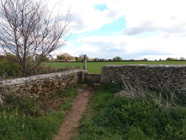
Nature enthusiasts will appreciate the abundance of walking and cycling routes in the area, offering stunning views of the surrounding countryside. The nearby Woodchester Park is a particular highlight, with its beautiful lakes, woodland trails, and historic mansion.

Pennsylvania is conveniently located near several larger towns and cities, providing easy access to a range of amenities and attractions. The town of Stroud offers a wider selection of shops, restaurants, and cultural activities, while the city of Gloucester is within a reasonable driving distance, offering even more options for entertainment and leisure.

Overall, Pennsylvania, Gloucestershire, is a charming village that captivates visitors with its natural beauty, peaceful ambiance, and strong sense of community.

If you have any feedback on the listing, please let us know in the comments section below.

Pennsylvania Images

Images are sourced within 2km of 51.458396/-2.371893 or Grid Reference ST7473. Thanks to Geograph Open Source API. All images are credited.

The Tollgate, Dyrham Grade II listed former gatehouse, now a cafe not far from Dyrham Park
The Tollgate, Dyrham
Grade II listed former gatehouse, now a cafe not far from Dyrham Park
Stone Stile, Dyrham In West Littleton on Gloucestershire footpath LMA/58 looking from Middledown Road. The view looking to the road is <a href="https://www.geograph.org.uk/photo/7204259">ST7474 : Stone Stile, Dyrham</a>.
Stone Stile, Dyrham
In West Littleton on Gloucestershire footpath LMA/58 looking from Middledown Road. The view looking to the road is ST7474 : Stone Stile, Dyrham.
Stone Stile, Dyrham In West Littleton on Gloucestershire footpath LMA/58 with Middledown Road in the background. The view from the road is <a href="https://www.geograph.org.uk/photo/7204257">ST7474 : Stone Stile, Dyrham</a>.
Stone Stile, Dyrham
In West Littleton on Gloucestershire footpath LMA/58 with Middledown Road in the background. The view from the road is ST7474 : Stone Stile, Dyrham.
Stone Stile, Cold Aston In the area known as Pennsylvania on the Gloucestershire footpath LCA/8 part of the Macmillan Way, looking West to the road. The view from the road is <a href="https://www.geograph.org.uk/photo/7248567">ST7473 : Stone Stile, Cold Aston</a>.
Stone Stile, Cold Aston
In the area known as Pennsylvania on the Gloucestershire footpath LCA/8 part of the Macmillan Way, looking West to the road. The view from the road is ST7473 : Stone Stile, Cold Aston.
Stone Stile, Cold Aston In the area known as Pennsylvania on the Gloucestershire footpath LCA/8 part of the Macmillan Way, looking SE from the road. The view looking to the road is <a href="https://www.geograph.org.uk/photo/7248566">ST7473 : Stone Stile, Cold Aston</a>.
Stone Stile, Cold Aston
In the area known as Pennsylvania on the Gloucestershire footpath LCA/8 part of the Macmillan Way, looking SE from the road. The view looking to the road is ST7473 : Stone Stile, Cold Aston.
Stone Stile, Cold Aston On Gloucestershire footpaths LCA/8 & LCA/9, East of the A46, part of the Cotswold Way, looking SE. The views looking back are <a href="https://www.geograph.org.uk/photo/7248585">ST7472 : Stone Stile, Cold Aston</a> & <a href="https://www.geograph.org.uk/photo/6949904">ST7472 : Stone stile</a>.
Stone Stile, Cold Aston
On Gloucestershire footpaths LCA/8 & LCA/9, East of the A46, part of the Cotswold Way, looking SE. The views looking back are ST7472 : Stone Stile, Cold Aston & ST7472 : Stone stile.
Stone Stile, Cold Aston On Gloucestershire footpaths LCA/8 & LCA/9, East of the A46, part of the Cotswold Way, looking NW. The view looking back is <a href="https://www.geograph.org.uk/photo/7248584">ST7472 : Stone Stile, Cold Aston</a>.
Stone Stile, Cold Aston
On Gloucestershire footpaths LCA/8 & LCA/9, East of the A46, part of the Cotswold Way, looking NW. The view looking back is ST7472 : Stone Stile, Cold Aston.
Nimlet : Slough Lane Looking along Slough Lane off A46.
Nimlet : Slough Lane
Looking along Slough Lane off A46.
Cold Ashton : A46 Looking along the A46.
Cold Ashton : A46
Looking along the A46.
Cold Ashton : Road A road heads into Cold Ashton off the A46.
Cold Ashton : Road
A road heads into Cold Ashton off the A46.
Cold Ashton : A420 Looking along the A420.
Cold Ashton : A420
Looking along the A420.
Cold Ashton : Pennsylvania A track off the A46.
Cold Ashton : Pennsylvania
A track off the A46.
Cold Ashton : Pennsylvania Houses seen from the A46.
Cold Ashton : Pennsylvania
Houses seen from the A46.
Marshfield : A46 Looking along the A46.
Marshfield : A46
Looking along the A46.
Marshfield : Marshfield Farm Entrance Entrance sign to Marshfield Farm for ice cream.
Marshfield : Marshfield Farm Entrance
Entrance sign to Marshfield Farm for ice cream.
Marshfield : A46 Looking along the A46.
Marshfield : A46
Looking along the A46.
Marshfield : Middledown Road Looking along Middledown Road off the A46.
Marshfield : Middledown Road
Looking along Middledown Road off the A46.
Dyrham : A46 Looking along the A46.
Dyrham : A46
Looking along the A46.
Show me another place!

Pennsylvania is located at Grid Ref: ST7473 (Lat: 51.458396, Lng: -2.371893)

Unitary Authority: South Gloucestershire

Police Authority: Avon and Somerset

What 3 Words

///conductor.hothouse.flux. Near Cold Ashton, Gloucestershire

Nearby Locations

Pennsylvania

Related Wikis

Pennsylvania, Gloucestershire

Pennsylvania is a small village in South Gloucestershire, England. It is situated on the A46 near the historic cities of Bristol (to the west) and Bath...

Cold Ashton

Cold Ashton is a village in South Gloucestershire, England. It is located 5 miles (8.0 km) north of Bath, near the junction between the A46 and A420 roads...

St. Catherine's Valley

St. Catherine's Valley (grid reference ST760725) is a 156.1 hectare biological Site of Special Scientific Interest southwest of the village of Marshfield...

Doynton

Doynton is a village in South Gloucestershire, England. The population of this village taken at the 2011 census was 320. == Setting == Doynton is a village...

Nearby Amenities

Located within 500m of 51.458396,-2.371893
Old Swan Cottage
Guest House: bed_and_breakfast
Tourism: guest_house
Lat/Long: 51.4588531/-2.3696189
Pennsylvania
Place: hamlet
Wikidata: Q7163629
Lat/Long: 51.4586203/-2.3689861
Barrier: kissing_gate
Lat/Long: 51.4616924/-2.3752481
Barrier: kissing_gate
Lat/Long: 51.4622155/-2.3741441
Barrier: kissing_gate
Lat/Long: 51.4616017/-2.3751434
Barrier: stile
Lat/Long: 51.4577839/-2.3694755
Post Box
Post Box Design: off_street_box
Post Box Type: pillar
Lat/Long: 51.4582572/-2.369797
The data included in this document is from www.openstreetmap.org. The data is made available under ODbL.

Have you been to Pennsylvania?

Leave your review of Pennsylvania below (or comments, questions and feedback).