Pendeen

Settlement in Cornwall

England

Pendeen

OS Flush Bracket S7040 - Higher Boscaswell, St John's Church <span class="nowrap"><a title="https://www.bench-marks.org.uk/bm11683" rel="nofollow ugc noopener" href="https://www.bench-marks.org.uk/bm11683">Link</a><img style="margin-left:2px;" alt="External link" title="External link - shift click to open in new window" src="https://s1.geograph.org.uk/img/external.png" width="10" height="10"/></span>
OS Flush Bracket S7040 - Higher Boscaswell, St John's Church Credit: thejackrustles

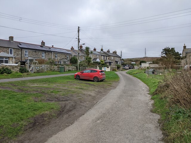
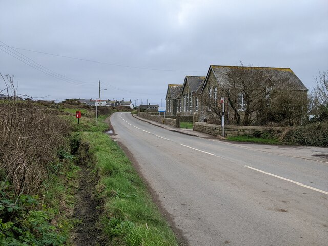
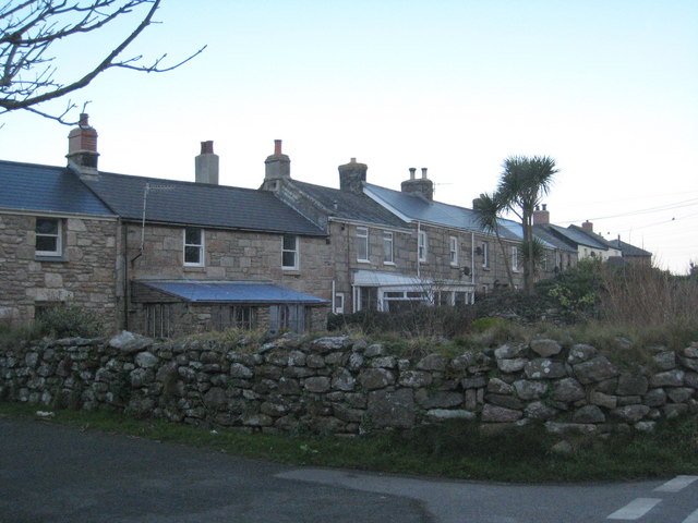
Pendeen is a picturesque village located on the north coast of Cornwall, England. Situated in the Penwith peninsula, it is nestled between the bustling town of St Ives to the east and the famous Land's End to the west. With a population of around 1,300 residents, Pendeen embodies the charm and tranquility of a traditional Cornish village.

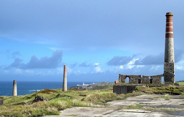
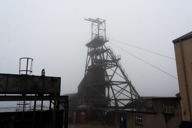
The village is renowned for its mining heritage, with the iconic Geevor Tin Mine serving as a reminder of its historical significance. Visitors can explore the preserved mine buildings and learn about the area's mining past through interactive exhibits. The rugged coastal landscape surrounding Pendeen also offers breathtaking views and is a haven for hikers and nature enthusiasts.

Pendeen boasts a tight-knit community and offers a range of amenities for both residents and tourists. The village center features a post office, a convenience store, and a few local shops. There are also several pubs and cafes where visitors can savor traditional Cornish cuisine and enjoy a pint of local ale.

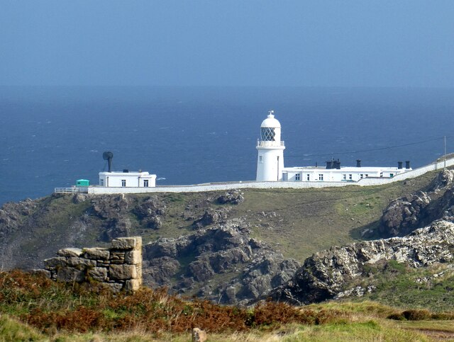
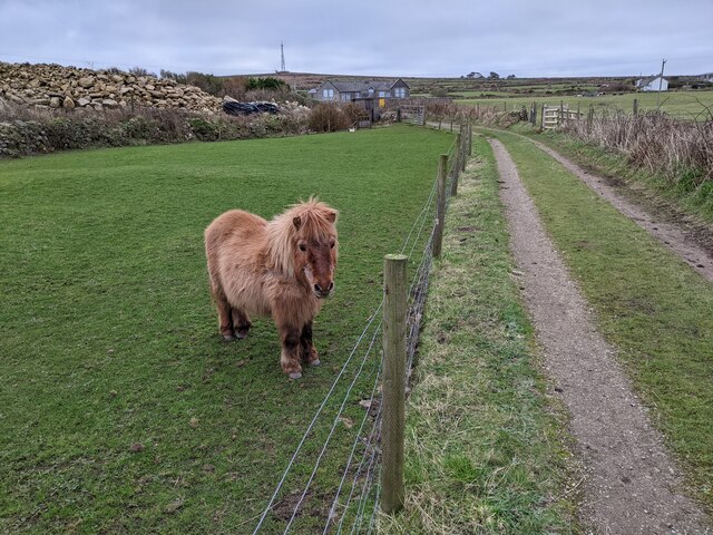
For those seeking outdoor adventures, Pendeen is an ideal base for exploring the nearby cliff paths, which lead to hidden coves and sandy beaches. The area is also a popular spot for birdwatching, with various species of seabirds and migratory birds gracing the skies.

In summary, Pendeen is a charming village in Cornwall that showcases its mining history, offers stunning coastal scenery, and provides a warm and welcoming atmosphere for all who visit.

If you have any feedback on the listing, please let us know in the comments section below.
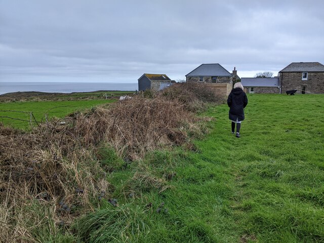
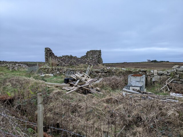
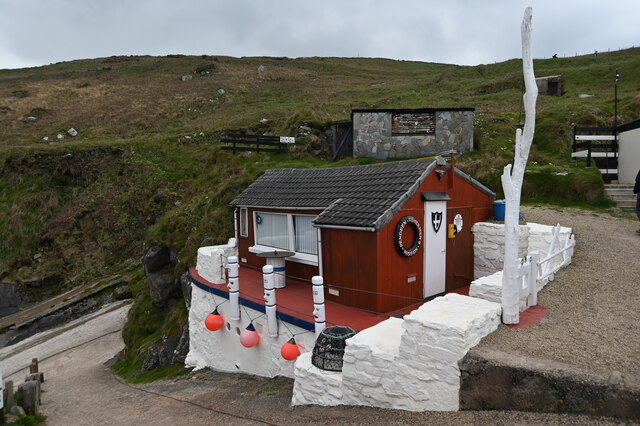
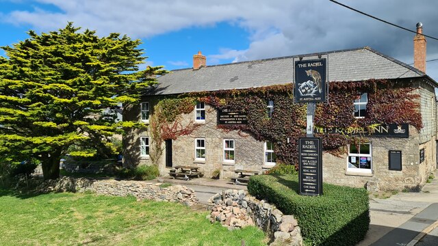
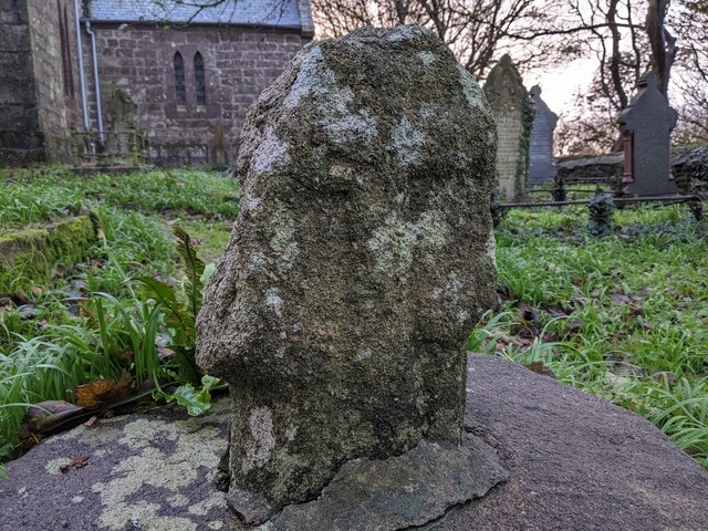
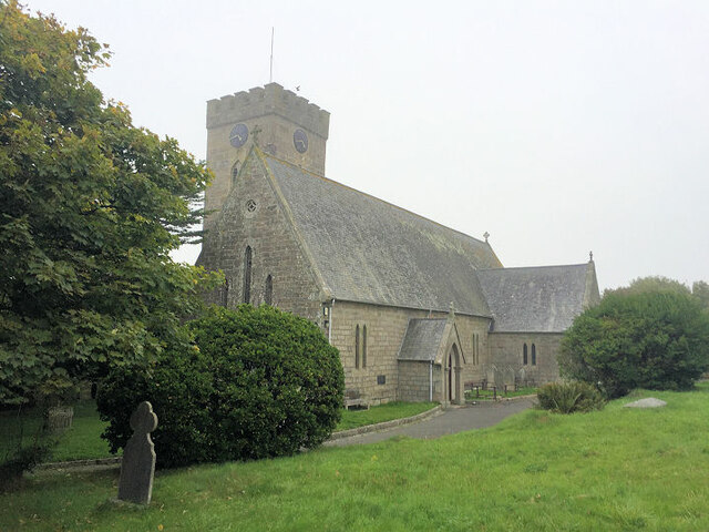
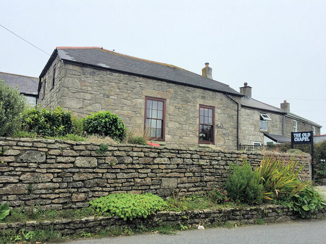
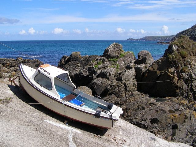
Pendeen Images

Images are sourced within 2km of 50.151782/-5.662136 or Grid Reference SW3834. Thanks to Geograph Open Source API. All images are credited.

OS Flush Bracket S7040 - Higher Boscaswell, St John's Church <span class="nowrap"><a title="https://www.bench-marks.org.uk/bm11683" rel="nofollow ugc noopener" href="https://www.bench-marks.org.uk/bm11683">Link</a><img style="margin-left:2px;" alt="External link" title="External link - shift click to open in new window" src="https://s1.geograph.org.uk/img/external.png" width="10" height="10"/></span>
OS Flush Bracket S7040 - Higher Boscaswell, St John's Church
Location of OS Flush Bracket S7040 - Higher Boscaswell, St John's Church
Chimneys of the Levant Mine There are numerous chimneys dotted about the former Levant Mine workings. Some belonged to engine houses such as those required to pump water from the mine, to operate lifts for men, ponies and ore, while others were required for the smelting process or to retrieve minerals. For example, the left-most one seen here was for the 'calciner' where ores were heated to remove such useful minerals as arsenic. The most important elements to be recovered however were Tin and Copper, but this was generally extracted from the ore offsite.
Chimneys of the Levant Mine
There are numerous chimneys dotted about the former Levant Mine workings. Some belonged to engine houses such as those required to pump water from the mine, to operate lifts for men, ponies and ore, while others were required for the smelting process or to retrieve minerals. For example, the left-most one seen here was for the 'calciner' where ores were heated to remove such useful minerals as arsenic. The most important elements to be recovered however were Tin and Copper, but this was generally extracted from the ore offsite.
Pendeen Lighthouse from the Levant Mine Looking along the western coast of Cornwall from the clifftop Levant Mine to Penlee Lighthouse a couple of miles distant.
Pendeen Lighthouse from the Levant Mine
Looking along the western coast of Cornwall from the clifftop Levant Mine to Penlee Lighthouse a couple of miles distant.
Headframe and surrounding buildings at Geevor Tin Mine
Houses in Carnyorth village
Carnyorth Outdoor Education Centre, on the B3306
Pony in a paddock at Carnyorth
Walker on a public footpath at Nineveh
Ruined building near the coast path
Fishermen's hut at Boat Cove, Portheras This hut and associated buildings have been built and maintained by the Pendeen Fishermen's Mission. A steep slipway allows boats to be lowered into the cove below.
Fishermen's hut at Boat Cove, Portheras
This hut and associated buildings have been built and maintained by the Pendeen Fishermen's Mission. A steep slipway allows boats to be lowered into the cove below.
Geevor Tin Mine
Geevor Tin Mine
The Radjel Inn, Boscaswell, Pendeen
Old Cross in Pendeen Churchyard Portherras Cross, the old head and neck of a wayside cross. Moved to the northeast side of Pendeen Churchyard and set close to the gate of the vicarage. St Just parish. A Scheduled Monument <span class="nowrap"><a title="https://historicengland.org.uk/listing/the-list/list-entry/1019166" rel="nofollow ugc noopener" href="https://historicengland.org.uk/listing/the-list/list-entry/1019166">Link</a><img style="margin-left:2px;" alt="External link" title="External link - shift click to open in new window" src="https://s1.geograph.org.uk/img/external.png" width="10" height="10"/></span>. 

Milestone Society National ID: CWPW_SJP05
Old Cross in Pendeen Churchyard
Portherras Cross, the old head and neck of a wayside cross. Moved to the northeast side of Pendeen Churchyard and set close to the gate of the vicarage. St Just parish. A Scheduled Monument LinkExternal link. Milestone Society National ID: CWPW_SJP05
St John The Baptist Church
The Old Chapel
The Old Chapel
Former Methodist Free Chapel 1886
Wheal Bal Farm Looking at the buildings of Wheal Bal Farm from the public bridleway.
Wheal Bal Farm
Looking at the buildings of Wheal Bal Farm from the public bridleway.
Show me another place!

Pendeen is located at Grid Ref: SW3834 (Lat: 50.151782, Lng: -5.662136)

Unitary Authority: Cornwall

Police Authority: Devon and Cornwall

What 3 Words

///community.drifting.donates. Near St Just, Cornwall

Related Wikis

Pendeen

Pendeen (from Cornish: Penn Din meaning "headland fort", previously known as Cornish: Boskaswal Wartha, meaning "Caswal's high dwelling") is a village...

Higher Boscaswell

Higher Boscaswell is a hamlet near Pendeen in west Cornwall, England. It is east of Pendeen and on the B road from St Ives to St Just. Higher Boscaswell...

Boscaswell

Boscaswell (Cornish: Boscaswal) is a village in the extreme west of Cornwall, England, UK. It lies towards the cliffs from Pendeen, looking west across...

Lower Boscaswell

Lower Boscaswell is a hamlet near Pendeen in Cornwall, England.Lower Boscaswell lies within the Cornwall Area of Outstanding Natural Beauty (AONB). �...

Related Videos

Travel & Walking Part 9 Seal and Ocean wave watch at Portheras Cove Cornwall

Seal watch and Ocean waves on a secret beach tour. One of my favourite and most rewarding walks down to the beach. As one ...

BOSCAWELL CLIFF hiking area in PENDEEN - CORNWALL #BoscawellNorthcliff-Cornwall

The cliff is on the path of SW CP what an experience!! Marvellous views!! Gorgeous view and walk by the cliff Stunning area and ...

I FOUND A SECRET PARADISE BEACH JUST A FEW MILES FROM ST IVES! CORNWALL

What a find! If you're tired of the crowds while you're staying in St Ives, and fancy a little spot of remote and quiet stunning beauty, ...

Nearby Amenities

Located within 500m of 50.151782,-5.662136
Pendeen
Is In: Cornwall, England, UK
Is In Country: England
Is In Country Code: GB
Is In County: Cornwall
Name Kw: Boskaswal Wartha
Place: village
Postal Code: TR19 7
Source: npe
Source Name Br: proper translation
Wikidata: Q3374651
Lat/Long: 50.1513312/-5.6652773
Bus Stop
Portherras Cross
Bench: no
Bin: no
Check Date Shelter: 2023-09-03
Naptan AtcoCode: 0800COD40189
Naptan Bearing: NE
Naptan CommonName: Portherras Cross
Naptan Crossing: Calartha Road
Naptan NaptanCode: coradgpt
Naptan Street: St Ives Road
Naptan Verified: no
Shelter: no
Source: naptan_import
Lat/Long: 50.1526047/-5.6584333
Portherras Cross
Place: locality
Lat/Long: 50.1529371/-5.6578571
Disused
Pendeen Post Office
Addr City: Penzance
Addr Country: GB
Addr Housenumber: 11
Addr Postcode: TR19 7DN
Addr Street: The Square
Addr Village: Pendeen
Disused: post_office
Note: This Post Office closed here in 2021. Hopes are that it will reopen nearby
Ref Pol Id: 13989
Lat/Long: 50.1514176/-5.6659293
Costcutter
Brand: Costcutter
Brand Wikidata: Q5175072
Contact Website: https://store-locator.costcutter.co.uk/costcutter-de4ebb6c947d
Shop: convenience
Lat/Long: 50.1517722/-5.6647784
Bus Stop
Boscaswell Stores
Bus: yes
Naptan AtcoCode: 0800COD40192
Naptan Bearing: E
Naptan CommonName: Boscaswell Stores
Naptan Indicator: E-bound
Naptan NaptanCode: coradgmp
Naptan Verified: no
Public Transport: platform
Source: local_knowledge;naptan;bing;naptan_compare_tool
Lat/Long: 50.1517704/-5.6644172
Bus Stop
Church Road
Bus: yes
Naptan AtcoCode: 0800COD40196
Naptan Bearing: SW
Naptan CommonName: Church Road
Naptan Indicator: SW-bound
Naptan NaptanCode: coradgjm
Naptan Street: B3306
Naptan Verified: no
Public Transport: platform
Source: local_knowledge;naptan;bing;naptan_compare_tool
Lat/Long: 50.1507481/-5.66736
Pendeen Carn
Place: locality
Source: local_knowledge
Lat/Long: 50.1481675/-5.6633618
Fast Food
Lils Fish And Chips
Addr City: Penzance
Addr Country: GB
Addr Hamlet: Pendeen
Addr Postcode: TR19 7DN
Addr Street: Church Road
Fhrs Id: 492676
Lat/Long: 50.1517533/-5.6648602
Pub
The Radjel Inn
Addr City: Penzance
Addr Country: GB
Addr Hamlet: Pendeen
Addr Postcode: TR19 7DS
Addr Street: Boscaswell Terrace
Check Date: 2023-09-03
Fhrs Id: 502505
Source: survey
Lat/Long: 50.1520792/-5.6628114
Post Box
Check Date: 2022-09-12
Check Date Collection Times: 2022-09-12
Collection Times: Mo-Fr 16:45; Sa 11:15
Operator: Royal Mail
Post Box Type: pillar
Ref: TR19 81
Royal Cypher: EIIR
Royal Cypher Wikidata: Q33102113
Source: survey
Lat/Long: 50.1513827/-5.6659675
Post Box
Brand: Royal Mail
Brand Wikidata: Q638098
Collection Times: Mo-Fr 16:45; Sa 11:00
Operator: Royal Mail
Operator Wikidata: Q638098
Post Box Type: wall
Ref: TR19 6
Royal Cypher: EIIR
Royal Cypher Wikidata: Q33102113
Source: survey
Survey Date: 2015-09-29
Lat/Long: 50.1520421/-5.6626908
Barrier: stile
Material: stone
Step Count: 2
Stile: stepover
Lat/Long: 50.1509245/-5.6672095
Man Made: water_well
Lat/Long: 50.1486295/-5.6591037
Pump
Man Made: water_well + pump=manual
Lat/Long: 50.1520833/-5.6600236
Direction: SE
Generator Method: photovoltaic
Generator Output Electricity: small_installation
Generator Source: solar
Generator Type: solar_photovoltaic_panel
Location: roof
Power: generator
Source: bing
Lat/Long: 50.1511852/-5.666876
Direction: SE
Generator Method: photovoltaic
Generator Output Electricity: small_installation
Generator Source: solar
Generator Type: solar_photovoltaic_panel
Location: roof
Power: generator
Source: bing
Lat/Long: 50.1511302/-5.6667271
Direction: S
Generator Method: photovoltaic
Generator Output Electricity: small_installation
Generator Source: solar
Generator Type: solar_photovoltaic_panel
Location: roof
Power: generator
Source: bing
Lat/Long: 50.1530207/-5.6628594
Direction: S
Generator Method: photovoltaic
Generator Output Electricity: small_installation
Generator Source: solar
Generator Type: solar_photovoltaic_panel
Location: roof
Power: generator
Source: bing
Lat/Long: 50.1521743/-5.6625697
Direction: S
Generator Method: photovoltaic
Generator Output Electricity: small_installation
Generator Source: solar
Generator Type: solar_photovoltaic_panel
Location: roof
Power: generator
Source: bing
Lat/Long: 50.1522113/-5.6623444
Direction: S
Generator Method: photovoltaic
Generator Output Electricity: small_installation
Generator Source: solar
Generator Type: solar_photovoltaic_panel
Location: roof
Power: generator
Source: bing
Lat/Long: 50.1522293/-5.6622706
Direction: W
Generator Method: photovoltaic
Generator Output Electricity: small_installation
Generator Source: solar
Generator Type: solar_photovoltaic_panel
Location: roof
Power: generator
Source: bing
Lat/Long: 50.151596/-5.6627548
Direction: W
Generator Method: photovoltaic
Generator Output Electricity: small_installation
Generator Source: solar
Generator Type: solar_photovoltaic_panel
Location: roof
Power: generator
Source: bing
Lat/Long: 50.1509635/-5.6619689
Direction: S
Generator Method: photovoltaic
Generator Output Electricity: small_installation
Generator Source: solar
Generator Type: solar_photovoltaic_panel
Location: roof
Power: generator
Source: bing
Lat/Long: 50.1510134/-5.6614378
Direction: S
Generator Method: photovoltaic
Generator Output Electricity: small_installation
Generator Source: solar
Generator Type: solar_photovoltaic_panel
Location: roof
Power: generator
Source: bing
Lat/Long: 50.1516751/-5.6620118
Direction: S
Generator Method: photovoltaic
Generator Output Electricity: small_installation
Generator Source: solar
Generator Type: solar_photovoltaic_panel
Location: roof
Power: generator
Source: bing
Lat/Long: 50.1517112/-5.6618214
Direction: S
Generator Method: photovoltaic
Generator Output Electricity: small_installation
Generator Source: solar
Generator Type: solar_photovoltaic_panel
Location: roof
Power: generator
Source: bing
Lat/Long: 50.151639/-5.6596555
Direction: SE
Generator Method: photovoltaic
Generator Output Electricity: small_installation
Generator Source: solar
Generator Type: solar_photovoltaic_panel
Location: roof
Power: generator
Source: bing
Lat/Long: 50.1521907/-5.658478
Townhall
Pendeen village hall and theatre
Lat/Long: 50.1506364/-5.6664396
Barrier: chain
Foot: yes
Motor Vehicle: no
Lat/Long: 50.1498418/-5.6658618
Man Made: chimney
Ruined: yes
Lat/Long: 50.1500532/-5.6611415
Power: pole
Lat/Long: 50.1551964/-5.6666547
Power: pole
Lat/Long: 50.1545434/-5.6676096
Power: pole
Transformer: distribution
Lat/Long: 50.1508157/-5.6683365
Power: pole
Lat/Long: 50.1526289/-5.6675372
Power: pole
Lat/Long: 50.1524906/-5.6667016
Power: pole
Lat/Long: 50.1523634/-5.6659842
Power: pole
Transformer: distribution
Lat/Long: 50.1519234/-5.6654786
Location Transition: yes
Power: pole
Lat/Long: 50.1541533/-5.667733
Power: pole
Lat/Long: 50.1534074/-5.6679636
Power: pole
Lat/Long: 50.1527372/-5.6682184
Portherras Cross
Power: pole
Transformer: distribution
Lat/Long: 50.1521958/-5.6573468
Location Transition: yes
Power: pole
Transformer: distribution
Lat/Long: 50.1518667/-5.6592143
Location Transition: yes
Power: pole
Lat/Long: 50.1517799/-5.6578812
Public Bookcase
Defibrillator
Access: yes
Booth: K6
Defibrillator Location: inside old red phone box that is now used as book exchange in Portherras Cross
Disused Amenity: telephone
Emergency: defibrillator
Man Made: telephone_box
Public Bookcase Type: phone_box
Lat/Long: 50.1521917/-5.657451
Stop
Direction: forward
Lat/Long: 50.1527329/-5.6578889
Give Way
Direction: backward
Lat/Long: 50.1527882/-5.6579388
The data included in this document is from www.openstreetmap.org. The data is made available under ODbL.

Have you been to Pendeen?

Leave your review of Pendeen below (or comments, questions and feedback).