Pencelli

Settlement in Brecknockshire

Wales

Pencelli

Hillside south-west of the Monmouthshire & Brecon Canal
Hillside south-west of the Monmouthshire & Brecon Canal Credit: Andrew Longton

The requested URL returned error: 429 Too Many Requests

If you have any feedback on the listing, please let us know in the comments section below.
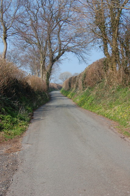
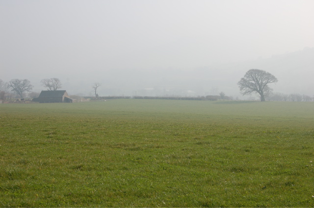
Pencelli Images

Images are sourced within 2km of 51.916126/-3.319781 or Grid Reference SO0925. Thanks to Geograph Open Source API. All images are credited.

Hillside south-west of the Monmouthshire & Brecon Canal
Drawbridge One of the many drawbridges on the canal.
Drawbridge
One of the many drawbridges on the canal.
Brynderwen trig
Brynderwen trig
Debris from the flooding Usk The Afon Wysg/River usk rises and falls rapidly in response to heavy rain.  This field beside the A40 Abergavenny/Brecon road is littered with debris from earlier in the day when the swollen river extended across the full width of its floodplain.  The Romans avoided flooding problems by building their road over the top of the hill known as Yr Allt in the background.
Debris from the flooding Usk
The Afon Wysg/River usk rises and falls rapidly in response to heavy rain. This field beside the A40 Abergavenny/Brecon road is littered with debris from earlier in the day when the swollen river extended across the full width of its floodplain. The Romans avoided flooding problems by building their road over the top of the hill known as Yr Allt in the background.
Scethrog A little hamlet just off the A40 - no pub or church, just a public telephone box.
Scethrog
A little hamlet just off the A40 - no pub or church, just a public telephone box.
Country lane near Scethrog
Field near Maes-y-crwper farm Looking towards the misty Usk valley.
Field near Maes-y-crwper farm
Looking towards the misty Usk valley.
Lift Bridge on the Monmouthshire & Brecon Canal between Cross Oak and Pencelli In use by a local farmer to allow him access to his sheep on the other side of the canal.
Lift Bridge on the Monmouthshire & Brecon Canal between Cross Oak and Pencelli
In use by a local farmer to allow him access to his sheep on the other side of the canal.
Accommodation Bridge over the Monmouthshire & Brecon Canal near Pencelli
River Usk in flood near Llanhamlach The Usk in flood with the Brecon beacons in the background.
River Usk in flood near Llanhamlach
The Usk in flood with the Brecon beacons in the background.
Bridge 151 over the Monmouthshire and Brecon Canal Bridge 151 over the Monmouthshire and Brecon Canal heading to Pencelli
Bridge 151 over the Monmouthshire and Brecon Canal
Bridge 151 over the Monmouthshire and Brecon Canal heading to Pencelli
Cross Oak Drawbridge Cross Oak Drawbridge on the Monmouthshire and Brecon Canal
Cross Oak Drawbridge
Cross Oak Drawbridge on the Monmouthshire and Brecon Canal
Coety Wood The Usk Valley Walk passes through the eastern edge of Coety Wood, part of the larger Talybont Forest.
Coety Wood
The Usk Valley Walk passes through the eastern edge of Coety Wood, part of the larger Talybont Forest.
View across the Usk valley View across the Usk valley from above Talybont towards the Black Mountains and the Sugar Loaf.
View across the Usk valley
View across the Usk valley from above Talybont towards the Black Mountains and the Sugar Loaf.
The River Usk The meanderings of the River Usk near Scethrog, viewed from the Usk Valley Walk.
The River Usk
The meanderings of the River Usk near Scethrog, viewed from the Usk Valley Walk.
Gethinog Lift Bridge Bridge no 149 is the middle one of three consecutive lift bridges on the stretch of the Monmouthshire and Brecon Canal between Talybont-on-Usk and Pencelli. They are provided for farmers to allow the movement of livestock and are left up or down according to their requirements. Boaters should leave them as they find them; in this case the bridge has been left in the down position and boaters need to raise it manually using a windlass.
Gethinog Lift Bridge
Bridge no 149 is the middle one of three consecutive lift bridges on the stretch of the Monmouthshire and Brecon Canal between Talybont-on-Usk and Pencelli. They are provided for farmers to allow the movement of livestock and are left up or down according to their requirements. Boaters should leave them as they find them; in this case the bridge has been left in the down position and boaters need to raise it manually using a windlass.
Mare and foal Seen on the south bank of the Monmouthshire & Brecon Canal approaching Penawr Drawbridge (No 150).
Mare and foal
Seen on the south bank of the Monmouthshire & Brecon Canal approaching Penawr Drawbridge (No 150).
Taff Trail / B4558 through Cross Oak
Show me another place!

Pencelli is located at Grid Ref: SO0925 (Lat: 51.916126, Lng: -3.319781)

Unitary Authority: Powys

Police Authority: Dyfed Powys

Also known as: Pengelli

What 3 Words

///bullion.views.prevents. Near Brecon, Powys

Nearby Locations

Pencelli Pengelli

Related Wikis

Pencelli

Pencelli is a small village within the community of Talybont-on-Usk in the county of Powys, Wales, and the historic county of Brecknockshire. The Welsh...

Nant Menasgin

The Nant Menasgin is a short river in Powys, Wales whose headwaters rise in Cwm Oergwm, beneath Fan y Bîg, in the central Brecon Beacons, and flow northeastwards...

Llanhamlach

Llanhamlach is a village in rural Powys, Wales about 4 miles east of Brecon, in the community of Llanfrynach. It had a railway junction called Talyllyn...

Llanfrynach

Llanfrynach is a village and community in the county of Powys, Wales, and the historic county of Brecknockshire. The population of the community as taken...

Nearby Amenities

Located within 500m of 51.916126,-3.319781
Post Box
Post Box Type: lamp
Ref: LD3 377
Royal Cypher: EIIR
Royal Cypher Wikidata: Q33102113
Lat/Long: 51.9164446/-3.3207643
Telephone
Booth: K6
Covered: booth
Operator: BT
Phone: +44 1874 665213
Lat/Long: 51.916432/-3.3206998
Pub
Royal Oak
Addr City: Brecon
Addr County: Powys
Addr Place: Pencelli
Addr Postcode: LD3 7LX
Description Floor: stone
Fhrs Id: 162761
Food: yes
Outdoor Seating: yes
Real Ale: 2 beers
Source Addr: fhrs opendata
Wikidata: Q29498473
Lat/Long: 51.9161252/-3.3198671
Barrier: stile
Lat/Long: 51.9160429/-3.3217308
Pencelli
Place: hamlet
Source: local_knowledge
Wikidata: Q13130664
Lat/Long: 51.9171746/-3.3191294
Parking
Ele: 134.0000000
Parking: lane
Lat/Long: 51.9138703/-3.3177626
Ford: yes
Lat/Long: 51.9124072/-3.3233263
Drinking Water
Access: customers
Lat/Long: 51.9133036/-3.3159974
Recycling
Recycling Type: container
Lat/Long: 51.9133259/-3.3160656
Drinking Water
Access: customers
Lat/Long: 51.9133588/-3.3151836
Noexit: yes
Lat/Long: 51.913786/-3.3145653
Recycling
Recycling Type: container
Lat/Long: 51.9145073/-3.3176076
Access: customers
Leisure: playground
Lat/Long: 51.9151878/-3.3177047
Leisure: slipway
Lat/Long: 51.9163124/-3.3218562
Access: customers
Tourism: picnic_site
Lat/Long: 51.9159823/-3.3199034
Parking
Lat/Long: 51.9163177/-3.3219506
Power: pole
Lat/Long: 51.919664/-3.3214653
Power: pole
Lat/Long: 51.9191991/-3.3226025
Power: pole
Lat/Long: 51.9176159/-3.3179288
Power: pole
Lat/Long: 51.9171064/-3.3186677
Power: pole
Lat/Long: 51.916419/-3.3197191
Power: pole
Lat/Long: 51.9161882/-3.3140677
Power: pole
Lat/Long: 51.9169525/-3.3150172
Power: pole
Lat/Long: 51.9176275/-3.3159292
Power: pole
Lat/Long: 51.9182859/-3.3169082
Power: pole
Lat/Long: 51.9189791/-3.3179006
Power: pole
Lat/Long: 51.9196524/-3.3188903
Power: pole
Lat/Long: 51.9203092/-3.3198532
Direction: 215
Generator Method: photovoltaic
Generator Output Electricity: yes
Generator Solar Modules: 10
Generator Source: solar
Generator Type: solar_photovoltaic_panel
Location: roof
Power: generator
Lat/Long: 51.9165116/-3.3209422
Direction: SSW
Generator Method: photovoltaic
Generator Output Electricity: yes
Generator Solar Modules: 14
Generator Source: solar
Generator Type: solar_photovoltaic_panel
Location: roof
Power: generator
Lat/Long: 51.9163036/-3.320563
Toilets
Access: customers
Lat/Long: 51.9149496/-3.3171827
The data included in this document is from www.openstreetmap.org. The data is made available under ODbL.

Have you been to Pencelli?

Leave your review of Pencelli below (or comments, questions and feedback).