Penbidwal

Settlement in Monmouthshire

Wales

Penbidwal

Borderland farmland Borderland farmland above the Monnow valley in the extreme south-west of Herefordshire.
Borderland farmland Credit: Philip Halling

Penbidwal is a small village located in the county of Monmouthshire, Wales. Nestled within the picturesque countryside, the village is situated approximately 5 miles north of the town of Usk and 12 miles northeast of the city of Newport.

The village boasts a rich history, with evidence of human settlement dating back to the Roman times. It is believed that Penbidwal was once an important stop on the Roman road between Usk and Caerleon. Today, remnants of this ancient road can still be seen in the surrounding area.

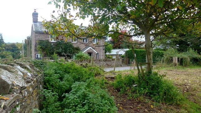
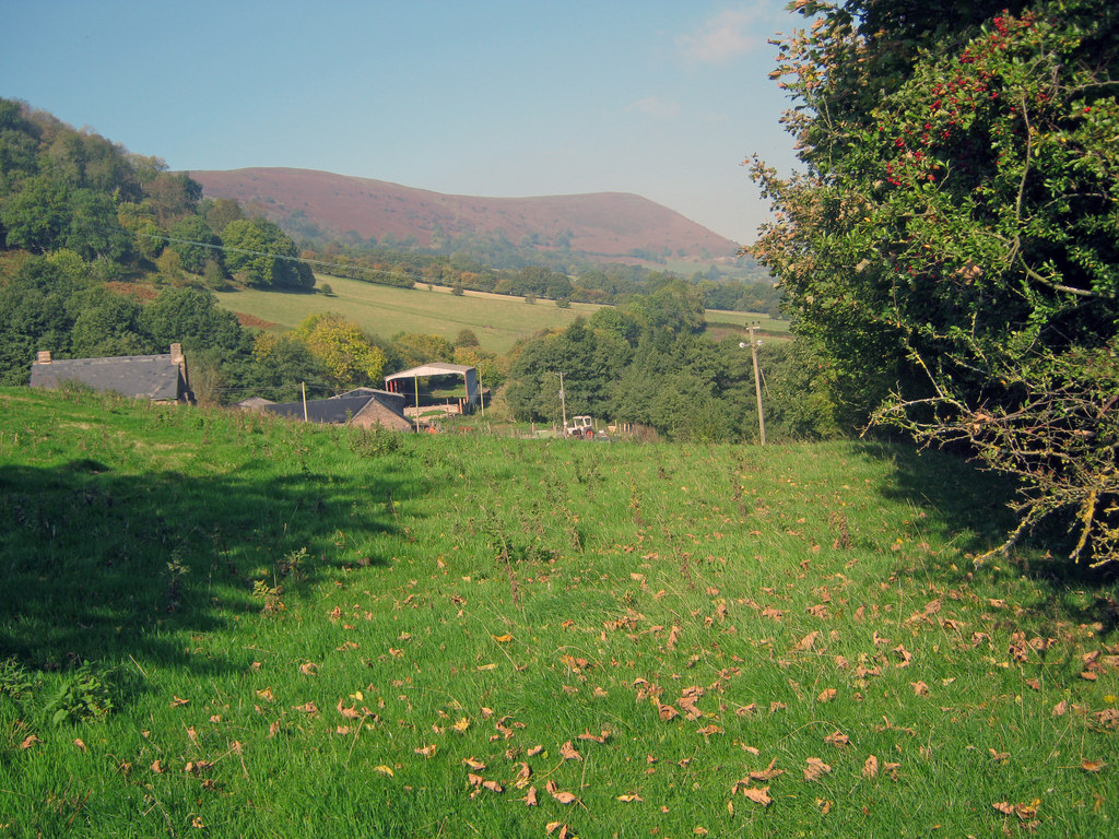
Penbidwal is primarily a residential village, characterized by its charming stone cottages and peaceful atmosphere. The community is close-knit, with a small population that values its rural surroundings. The village is surrounded by rolling hills and farmland, offering residents and visitors alike a tranquil and idyllic setting.

Despite its small size, Penbidwal is within easy reach of amenities and services. The nearby towns of Usk and Newport provide a range of facilities, including shops, schools, and healthcare services. The village also benefits from excellent transport links, with the A449 road passing close by, connecting it to major cities such as Newport and Cardiff.

Overall, Penbidwal is a picturesque and peaceful village, offering residents a rural lifestyle while still being within reach of essential amenities. With its rich history and beautiful surroundings, it is an attractive location for those seeking a quiet retreat in the heart of Monmouthshire.

If you have any feedback on the listing, please let us know in the comments section below.
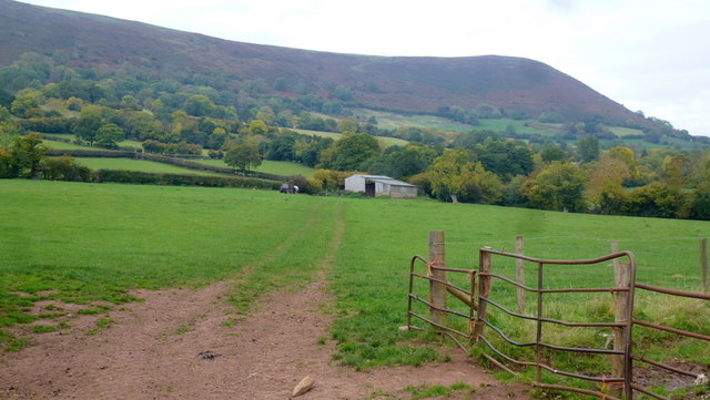
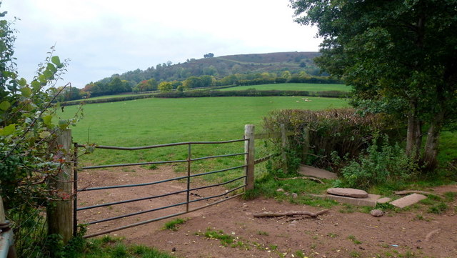
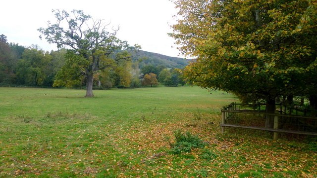
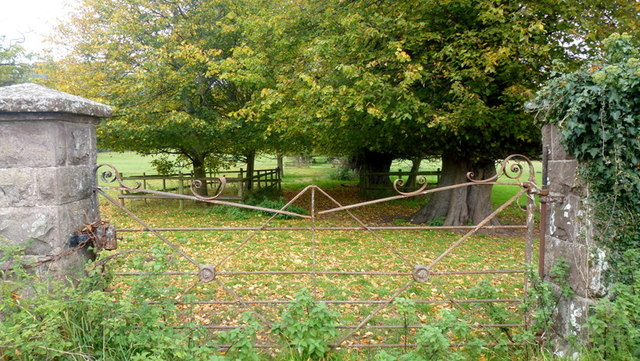
Penbidwal Images

Images are sourced within 2km of 51.892507/-2.975016 or Grid Reference SO3322. Thanks to Geograph Open Source API. All images are credited.

Borderland farmland Borderland farmland above the Monnow valley in the extreme south-west of Herefordshire.
Borderland farmland
Borderland farmland above the Monnow valley in the extreme south-west of Herefordshire.
Lane junction of National Cycle Route 46
Lane junction, with The Skirrid in the background
Farm yard entrance
Farm yard entrance
Bus stop on the A465
Barn in the shadow of Hatterrall Hill Looking along the line of a footpath from the Pandy road.
Barn in the shadow of Hatterrall Hill
Looking along the line of a footpath from the Pandy road.
Farmland below Pentwyn hill fort Lush grazing land on the side of the Monnow valley.
Farmland below Pentwyn hill fort
Lush grazing land on the side of the Monnow valley.
Line of a footpath Heading north-west from Trewyn Lodge.
The hill beyond is Pentwyn hillfort and is at the southern tip of the Hatterrall Ridge which forms the English/Welsh border from Pandy to Hay Bluff.
Line of a footpath
Heading north-west from Trewyn Lodge. The hill beyond is Pentwyn hillfort and is at the southern tip of the Hatterrall Ridge which forms the English/Welsh border from Pandy to Hay Bluff.
Old iron gate Suggestive of the park-like appearance of the field opposite Trewyn Lodge.
See also <a href="https://www.geograph.org.uk/photo/4234222">SO3322 : Gate at Trewyn Lodge, Pandy</a> showing Geographers' minds tend to think alike.
Old iron gate
Suggestive of the park-like appearance of the field opposite Trewyn Lodge. See also SO3322 : Gate at Trewyn Lodge, Pandy showing Geographers' minds tend to think alike.
Trewyn Lodge Viewed from just inside the field on a public footpath.
How many nettle-infested corners like this are there in this great country of ours?
Trewyn Lodge
Viewed from just inside the field on a public footpath. How many nettle-infested corners like this are there in this great country of ours?
Lane to Tre-wyn By Trawellwyd the lane to Tre-wyn
Lane to Tre-wyn
By Trawellwyd the lane to Tre-wyn
Pont Rhys Powell Cerddwyr yn croesi Pont Rhys Powell sy'n rhychwantu Afon Honddu.

Walkers crossing Pont Rhys Powell (trans. Rhys Powell's Bridge) which spans the Honddu River.
Pont Rhys Powell
Cerddwyr yn croesi Pont Rhys Powell sy'n rhychwantu Afon Honddu. Walkers crossing Pont Rhys Powell (trans. Rhys Powell's Bridge) which spans the Honddu River.
Arwydd Ffordd / Road Sign Cerddwyr yn mynd heibio i arwydd ffordd yn Stanton

Walkers passing a road sign at Stanton.
Arwydd Ffordd / Road Sign
Cerddwyr yn mynd heibio i arwydd ffordd yn Stanton Walkers passing a road sign at Stanton.
Trout Cottage Cerddwyr yn mynd heibio i Trout Cottage.

Walkers passing Trout Cottage.
Trout Cottage
Cerddwyr yn mynd heibio i Trout Cottage. Walkers passing Trout Cottage.
Llwybr Llanfihangel Court Path Cerddwyr yn dilyn llwybr cyhoeddus tuag at Lys Llanfihangel.

Walkers following  a public footpath in the direction of Llanfihangel Court.
Llwybr Llanfihangel Court Path
Cerddwyr yn dilyn llwybr cyhoeddus tuag at Lys Llanfihangel. Walkers following a public footpath in the direction of Llanfihangel Court.
The Skirrid Inn Skirrid Inn, Llanvihangel Crucorney
The Skirrid Inn claims to be the oldest inn in Wales, however, of more interest it used to be used for trials and executions and the hangman's rope still hangs in the stairwell <a href="https://www.geograph.org.uk/photo/216736">SO3220 : Hangman's rope, Skirrid Inn</a>
The Skirrid Inn
Skirrid Inn, Llanvihangel Crucorney The Skirrid Inn claims to be the oldest inn in Wales, however, of more interest it used to be used for trials and executions and the hangman's rope still hangs in the stairwell SO3220 : Hangman's rope, Skirrid Inn
Great Llwygy Path Cerddwyr yn dilyn Ffordd y Bannau tuag at Ffarm Great Llwygwy.

Walkers following the Beacons Way towards Great Llwygy Farm.
Great Llwygy Path
Cerddwyr yn dilyn Ffordd y Bannau tuag at Ffarm Great Llwygwy. Walkers following the Beacons Way towards Great Llwygy Farm.
Ger Trawellwyd / Near Trawellwyd Cerddwyr yn dilyn heol fach ger anhedd-dy o'r enw Trawellwyd.

Walkers following a minor road near a property called Trawellwyd.
Ger Trawellwyd / Near Trawellwyd
Cerddwyr yn dilyn heol fach ger anhedd-dy o'r enw Trawellwyd. Walkers following a minor road near a property called Trawellwyd.
Show me another place!

Penbidwal is located at Grid Ref: SO3322 (Lat: 51.892507, Lng: -2.975016)

Unitary Authority: Monmouthshire

Police Authority: Gwent

What 3 Words

///soils.expensive.suspends. Near Llancillo, Herefordshire

Nearby Locations

Penbidwal Pandy

Related Wikis

Pandy, Monmouthshire

Pandy is a hamlet in Monmouthshire, south east Wales, United Kingdom. == Location == Pandy is 5 miles (8 km) north of Abergavenny on the A465 road to Hereford...

Trewyn Farm barn, Llanvihangel Crucorney

The barn at Trewyn Farm, Llanvihangel Crucorney, Monmouthshire is part of a complex of farm buildings dating from the late 16th century. The barn has a...

Trewyn House

Trewyn House, Llanvihangel Crucorney, Monmouthshire, Wales, is a country house dating from 1692. Its origins are older but the present building was constructed...

Pandy railway station

Pandy railway station was a railway station which served the Monmouthshire village of Pandy. It was located on the Welsh Marches Line between Hereford...

Nearby Amenities

Located within 500m of 51.892507,-2.975016
Bus Stop
Lancaster Arms
Lat/Long: 51.8905778/-2.970337
Post Box
Collection Times: Mo-Fr 17:00; Sa 11:15
Operator: Royal Mail
Post Box Type: lamp
Ref: NP7 73
Royal Cypher: EIIR
Royal Cypher Wikidata: Q33102113
Source: survey
Survey Date: 2019-07-01
Lat/Long: 51.892777/-2.9689968
Bus Stop
Lancaster Arms
Lat/Long: 51.8900472/-2.9703454
Information: guidepost
Tourism: information
Lat/Long: 51.8905593/-2.9706498
Direction: 100
Generator Method: photovoltaic
Generator Output Electricity: yes
Generator Solar Modules: 14
Generator Source: solar
Generator Type: solar_photovoltaic_panel
Location: roof
Power: generator
Lat/Long: 51.8941773/-2.9691169
Telephone
Booth: K6
Covered: booth
Operator: BT
Phone: +44 1873 890111
Lat/Long: 51.8943457/-2.9685961
The data included in this document is from www.openstreetmap.org. The data is made available under ODbL.

Have you been to Penbidwal?

Leave your review of Penbidwal below (or comments, questions and feedback).