Peel Common

Settlement in Hampshire Gosport

England

Peel Common

Daedalus in Flight This 21 foot tall, three-tonne steel sculpture is named Daedalus in Flight. It is on the edge of Solent Airport which used to be named HMS Daedalus. It was designed by Nigel Searle and made by blacksmith Peter Clutterbuck, who is based in nearby Southsea, and his team.
Daedalus in Flight Credit: Barry Shimmon

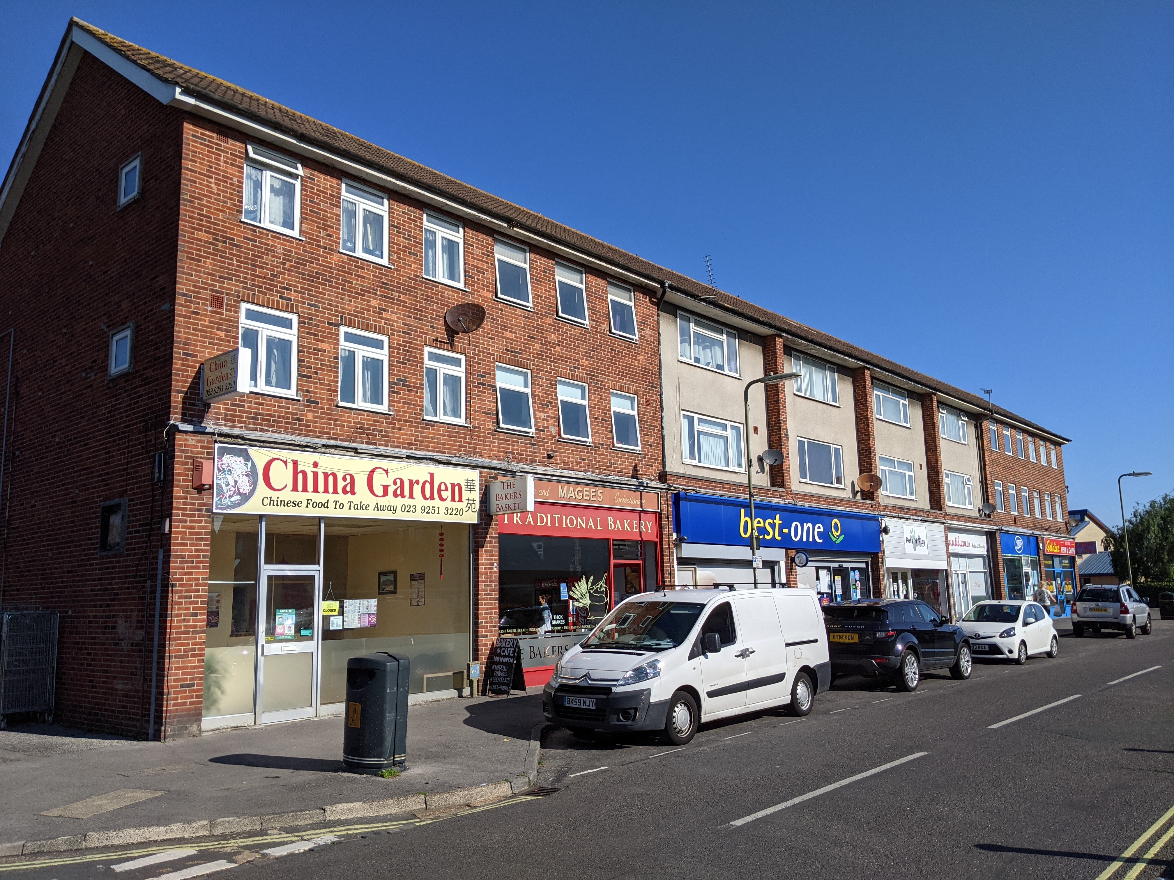
Peel Common is a small residential area located in Hampshire, England. Situated near the town of Gosport, Peel Common is known for its quiet and peaceful atmosphere, making it an ideal place for families and individuals looking to escape the hustle and bustle of city life.

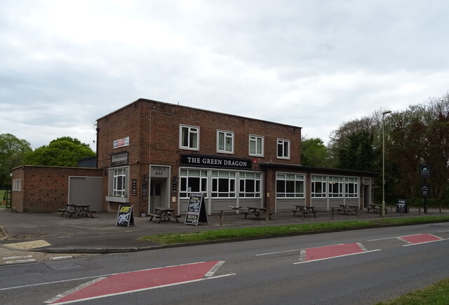
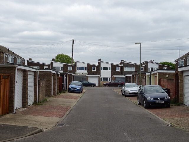
The area is predominantly made up of residential housing, with a mix of detached and semi-detached homes. There are also a number of amenities nearby, including shops, schools, and parks, making it a convenient place to live.

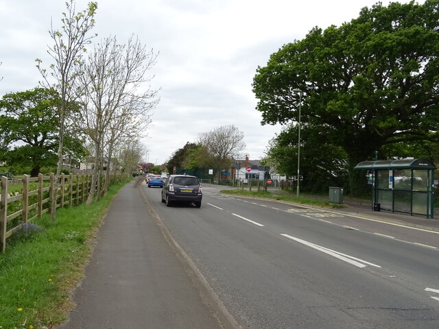
Peel Common is well-connected to nearby towns and cities, with good transport links via road and public transportation. The area is also close to the coast, offering residents the opportunity to enjoy seaside activities and beautiful views.

Overall, Peel Common is a charming and inviting place to live, with a strong sense of community and a welcoming atmosphere. Its proximity to amenities and natural beauty make it a desirable location for those seeking a peaceful and convenient lifestyle in Hampshire.

If you have any feedback on the listing, please let us know in the comments section below.
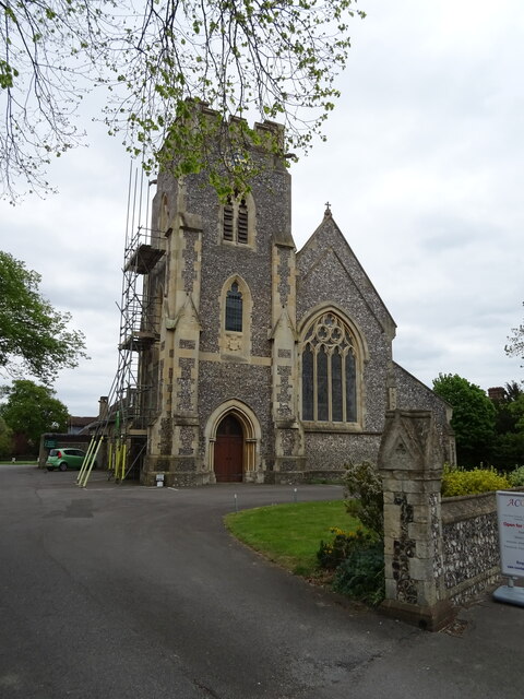
Peel Common Images

Images are sourced within 2km of 50.823476/-1.1912127 or Grid Reference SU5702. Thanks to Geograph Open Source API. All images are credited.

Daedalus in Flight This 21 foot tall, three-tonne steel sculpture is named Daedalus in Flight. It is on the edge of Solent Airport which used to be named HMS Daedalus. It was designed by Nigel Searle and made by blacksmith Peter Clutterbuck, who is based in nearby Southsea, and his team.
Daedalus in Flight
This 21 foot tall, three-tonne steel sculpture is named Daedalus in Flight. It is on the edge of Solent Airport which used to be named HMS Daedalus. It was designed by Nigel Searle and made by blacksmith Peter Clutterbuck, who is based in nearby Southsea, and his team.
Welcome to Alver Valley Country Park
The Green Dragon
The Green Dragon
Sign for the Green Dragon
Long Drive off Rowner Road
Path beside Rowner Road (B3334)
Houses on Rowner Road
Rowner Road (B3334)
Rowner Road (B3334)
B3385 towards Fareham
Houses on Gosport Road
Gosport Road
Gosport Road
Houses on Gosport Road
Gosport Road
Gosport Road
Holy Rood Church
Holy Rood Church
The Red Lion, Stubbington
Sign for the Red Lion, Stubbington
Red Lion, Stubbington
Show me another place!

Peel Common is located at Grid Ref: SU5702 (Lat: 50.823476, Lng: -1.1912127)

Administrative County: Hampshire

District: Gosport

Police Authority: Hampshire

What 3 Words

///robe.ideal.third. Near Lee-on-the-Solent, Hampshire

Nearby Locations

Chark Common Peel Common

Related Wikis

Crofton, Hampshire

Crofton was a village in the area of Stubbington that was mentioned in the Domesday Book in 1086. It was called 'Croftone' then. This is where many local...

Crofton School

Crofton School is a coeducational secondary school, located in Stubbington, Hampshire, England. The school has around 1200 students aged between 11 and...

Baycroft School

Baycroft School is a special needs secondary school in Stubbington, Hampshire, England, near Fareham and Gosport. Baycroft School is a day, community...

Rowner

Rowner is a small settlement which forms part of the borough of Gosport, on the south coast of Hampshire, England. == History == As Roman burial shrouds...

Nearby Amenities

Located within 500m of 50.823476,-1.1912127
Traffic Signals
Source: bing
Lat/Long: 50.8201018/-1.1890869
Bus Stop
Peel Common
Bus: yes
Naptan AtcoCode: 1900HA040334
Naptan Bearing: S
Naptan CommonName: Peel Common
Naptan NaptanCode: hamdpwma
Naptan PlusbusZoneRef: FAREHAM
Naptan Street: B3385 Broom Way
Naptan Verified: no
Public Transport: platform
Source: naptan_import
Lat/Long: 50.819345/-1.1896464
Bus Stop
Peel Common
Bus: yes
Naptan AtcoCode: 1900HA040335
Naptan Bearing: N
Naptan CommonName: Peel Common
Naptan NaptanCode: hamdpwjw
Naptan PlusbusZoneRef: FAREHAM
Naptan Street: B3385 Broom Way
Naptan Verified: no
Public Transport: platform
Source: naptan_import
Lat/Long: 50.8193547/-1.1897939
Odbl: clean
Lat/Long: 50.8256556/-1.193523
Odbl: clean
Lat/Long: 50.8269161/-1.1951538
Odbl: clean
Lat/Long: 50.8267399/-1.1951109
Odbl: clean
Lat/Long: 50.8259809/-1.1934372
Post Box
Post Box Type: lamp
Ref: PO14 26
Royal Cypher: EIIR
Royal Cypher Wikidata: Q33102113
Lat/Long: 50.823613/-1.1913943
Crossing
Button Operated: yes
Crossing: traffic_signals
Crossing Island: no
Crossing Markings: dots
Tactile Paving: yes
Lat/Long: 50.8206686/-1.1890267
Crossing
Button Operated: yes
Crossing: traffic_signals
Crossing Island: no
Crossing Markings: dots
Tactile Paving: yes
Lat/Long: 50.820181/-1.1904078
Traffic Signals
Lat/Long: 50.8199544/-1.1897215
Crossing
Button Operated: yes
Crossing: traffic_signals
Crossing Island: no
Crossing Markings: dots
Tactile Paving: yes
Lat/Long: 50.8197487/-1.1895921
Power: pole
Lat/Long: 50.8235756/-1.1864313
Power: pole
Lat/Long: 50.8240425/-1.1870734
Power: pole
Lat/Long: 50.820796/-1.1866335
Power: pole
Lat/Long: 50.8217779/-1.1865627
Power: pole
Lat/Long: 50.8227539/-1.186501
Power: pole
Lat/Long: 50.8259138/-1.1896338
Power: pole
Lat/Long: 50.8247854/-1.1880594
Power: pole
Lat/Long: 50.8227785/-1.1863841
Power: pole
Lat/Long: 50.8269829/-1.1909642
Power: pole
Lat/Long: 50.8240747/-1.1869634
Power: pole
Lat/Long: 50.8259104/-1.1894944
Power: pole
Lat/Long: 50.8208452/-1.1865262
Power: pole
Lat/Long: 50.8269315/-1.1910328
Power: pole
Lat/Long: 50.8218059/-1.1864565
Power: pole
Lat/Long: 50.8236088/-1.186317
Power: pole
Lat/Long: 50.8248278/-1.1879735
Traffic Signals
Crossing: traffic_signals
Lat/Long: 50.8198028/-1.1897846
Peel Common
Place: locality
Lat/Long: 50.8224486/-1.1926817
Barrier: stile
Lat/Long: 50.8230615/-1.1942651
Barrier: stile
Lat/Long: 50.8232297/-1.192815
Post Box
Brand: Royal Mail
Brand Wikidata: Q638098
Operator: Royal Mail
Operator Wikidata: Q638098
Post Box Type: lamp
Ref: PO13 50
Lat/Long: 50.823901/-1.1849887
Traffic Signals
Crossing: traffic_signals
Lat/Long: 50.8199771/-1.1888876
Crossing
Button Operated: yes
Crossing: traffic_signals
Crossing Island: no
Crossing Markings: dots
Tactile Paving: yes
Lat/Long: 50.8199803/-1.1889558
Crossing
Button Operated: yes
Crossing: traffic_signals
Crossing Island: no
Crossing Markings: dots
Tactile Paving: yes
Lat/Long: 50.820034/-1.1883696
Bus Stop
Waterworks
Bench: yes
Bus: yes
Naptan AtcoCode: 1900HA040339
Naptan Bearing: N
Naptan CommonName: Woodcote Lane
Naptan Indicator: N-bound
Naptan NaptanCode: hamdpwga
Naptan PlusbusZoneRef: FAREHAM
Naptan Street: Newgate Lane
Naptan Verified: no
Public Transport: platform
Shelter: yes
Source: GPS
Lat/Long: 50.8242716/-1.1876221
Bus Stop
Waterworks
Bench: yes
Bus: yes
Naptan AtcoCode: 1900HA040338
Naptan NaptanCode: hamdpwgd
Public Transport: platform
Shelter: yes
Lat/Long: 50.8238739/-1.187614
Traffic Signals
Source: bing
Lat/Long: 50.8205433/-1.1891969
Barrier: bollard
Bicycle: yes
Foot: yes
Motor Vehicle: no
Lat/Long: 50.8239636/-1.1880515
Power: substation
Lat/Long: 50.8233495/-1.184312
Noexit: yes
Lat/Long: 50.8208087/-1.19019
Crossing
Button Operated: yes
Crossing: traffic_signals
Crossing Island: no
Crossing Markings: dots
Tactile Paving: yes
Lat/Long: 50.8198441/-1.1898138
Traffic Signals
Source: bing
Lat/Long: 50.820713/-1.1890273
Crossing
Button Operated: yes
Crossing: traffic_signals
Crossing Island: no
Crossing Markings: dots
Tactile Paving: yes
Lat/Long: 50.8208197/-1.1892821
Generator Method: photovoltaic
Generator Output Electricity: yes
Generator Source: solar
Generator Type: solar_photovoltaic_panel
Location: roof
Power: generator
Lat/Long: 50.8209544/-1.1906782
Generator Method: photovoltaic
Generator Output Electricity: yes
Generator Source: solar
Generator Type: solar_photovoltaic_panel
Location: roof
Power: generator
Lat/Long: 50.8213458/-1.1906809
Generator Method: photovoltaic
Generator Output Electricity: yes
Generator Source: solar
Generator Type: solar_photovoltaic_panel
Location: roof
Power: generator
Lat/Long: 50.821323/-1.1907117
Generator Method: photovoltaic
Generator Output Electricity: yes
Generator Source: solar
Generator Type: solar_photovoltaic_panel
Location: roof
Power: generator
Lat/Long: 50.8213382/-1.1907801
Generator Method: photovoltaic
Generator Output Electricity: yes
Generator Source: solar
Generator Type: solar_photovoltaic_panel
Location: roof
Power: generator
Lat/Long: 50.8224582/-1.1909464
Generator Method: photovoltaic
Generator Output Electricity: yes
Generator Source: solar
Generator Type: solar_photovoltaic_panel
Location: roof
Power: generator
Lat/Long: 50.8226209/-1.1910872
Generator Method: photovoltaic
Generator Output Electricity: yes
Generator Source: solar
Generator Type: solar_photovoltaic_panel
Location: roof
Power: generator
Lat/Long: 50.8218318/-1.1857462
Generator Method: photovoltaic
Generator Output Electricity: yes
Generator Source: solar
Generator Type: solar_photovoltaic_panel
Location: roof
Power: generator
Lat/Long: 50.8215657/-1.1854995
Generator Method: photovoltaic
Generator Output Electricity: yes
Generator Source: solar
Generator Type: solar_photovoltaic_panel
Location: roof
Power: generator
Lat/Long: 50.8218033/-1.1857141
Generator Method: photovoltaic
Generator Output Electricity: yes
Generator Source: solar
Generator Type: solar_photovoltaic_panel
Location: roof
Power: generator
Lat/Long: 50.8217983/-1.1857644
Crossing
Button Operated: yes
Crossing: traffic_signals
Crossing Island: no
Crossing Markings: dots
Tactile Paving: yes
Lat/Long: 50.8198891/-1.1902239
Crossing
Crossing: traffic_signals
Lat/Long: 50.8200223/-1.1902422
Bus Stop
Peel Common
Bus: yes
Naptan AtcoCode: 1900HA040336
Naptan Bearing: W
Naptan CommonName: Peel Common
Naptan Indicator: W-bound
Naptan NaptanCode: hamdpwgw
Naptan PlusbusZoneRef: FAREHAM
Naptan Street: B3385 Newgate Lane
Naptan Verified: no
Public Transport: platform
Lat/Long: 50.8200332/-1.1914544
Bus Stop
Peel Common
Bus: yes
Naptan AtcoCode: 1900HA040337
Naptan Bearing: E
Naptan CommonName: Peel Common
Naptan Indicator: E-bound
Naptan NaptanCode: hamdpwgp
Naptan PlusbusZoneRef: FAREHAM
Naptan Street: B3385 Newgate Lane
Naptan Verified: no
Public Transport: platform
Lat/Long: 50.8200981/-1.1916107
The data included in this document is from www.openstreetmap.org. The data is made available under ODbL.

Have you been to Peel Common?

Leave your review of Peel Common below (or comments, questions and feedback).