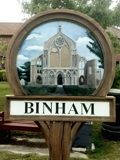
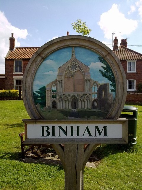
Binham

Settlement in Norfolk North Norfolk

England

Binham

Binham Priory View from the dormitory undercroft looking towards the church <span class="nowrap"><a title="https://historicengland.org.uk/listing/the-list/list-entry/1014862?section=official-listing" rel="nofollow ugc noopener" href="https://historicengland.org.uk/listing/the-list/list-entry/1014862?section=official-listing">Link</a><img style="margin-left:2px;" alt="External link" title="External link - shift click to open in new window" src="https://s1.geograph.org.uk/img/external.png" width="10" height="10"/></span>
Binham Priory Credit: Sandy Gerrard

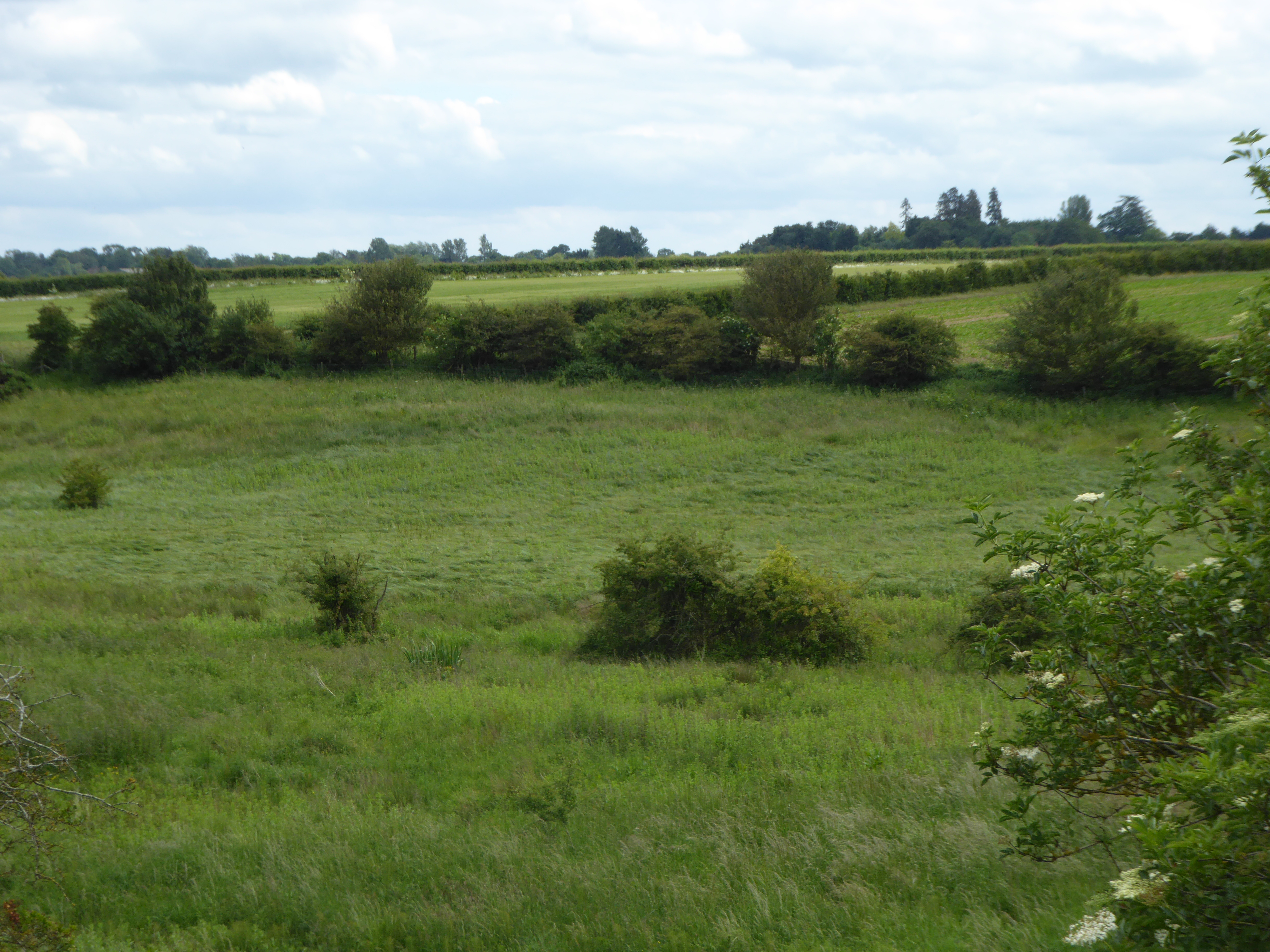
Binham is a charming village located in the English county of Norfolk. Nestled in the countryside, it is situated about 4 miles inland from the North Norfolk coast. The village is known for its picturesque setting, with rolling green fields and a tranquil atmosphere.

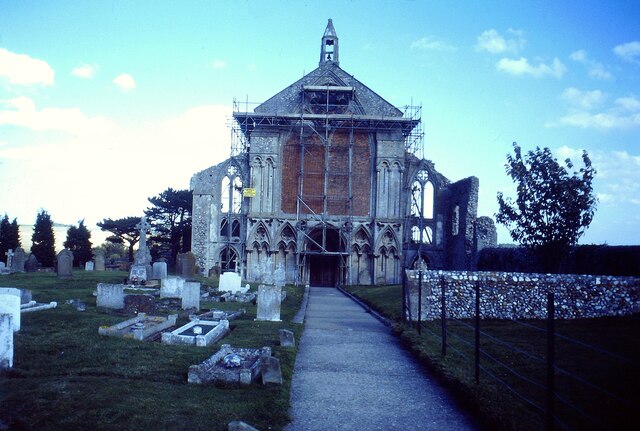
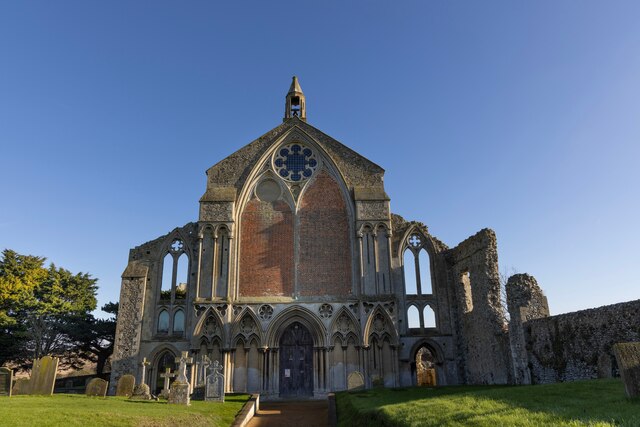
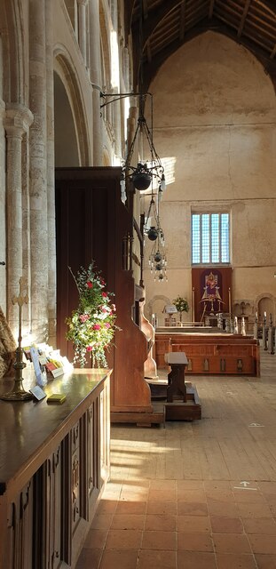
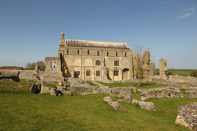
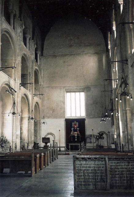
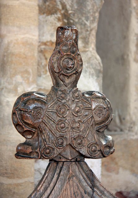
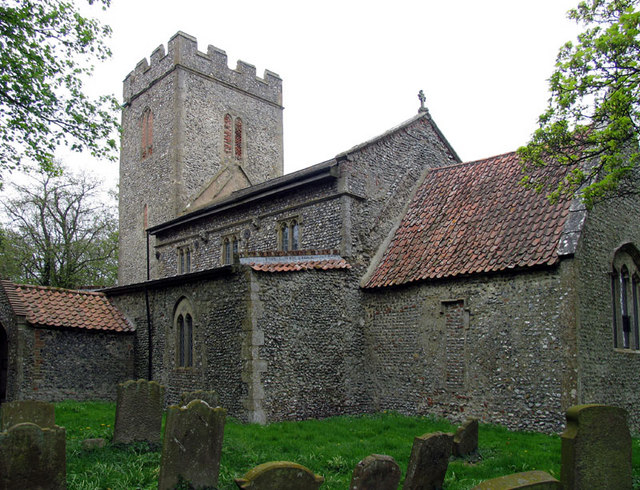
Binham is perhaps most famous for its stunning medieval priory, Binham Priory. Founded in the late 11th century, it was once a Benedictine monastery and is now a Grade I listed building. The priory's impressive ruins still stand today, showcasing its rich architectural history. Visitors can explore the remains, including the nave, transepts, and the west front, which features intricate carvings.

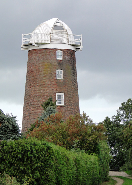
In addition to the priory, Binham boasts a handful of other interesting historical sites. The village features a traditional village green, surrounded by charming cottages and the village pub, The Chequers Inn, which dates back to the 17th century. Nearby, the remains of a moated medieval manor house, known as Binham Grange, can also be found.

Binham is a popular destination for nature lovers and outdoor enthusiasts due to its proximity to the North Norfolk coast and the surrounding countryside. Visitors can enjoy scenic walks along the nearby coastal path, taking in the breathtaking views of the salt marshes and the beautiful coastline.

Overall, Binham offers a fascinating blend of history, natural beauty, and rural charm, making it a delightful destination for those seeking a peaceful and picturesque retreat.

If you have any feedback on the listing, please let us know in the comments section below.
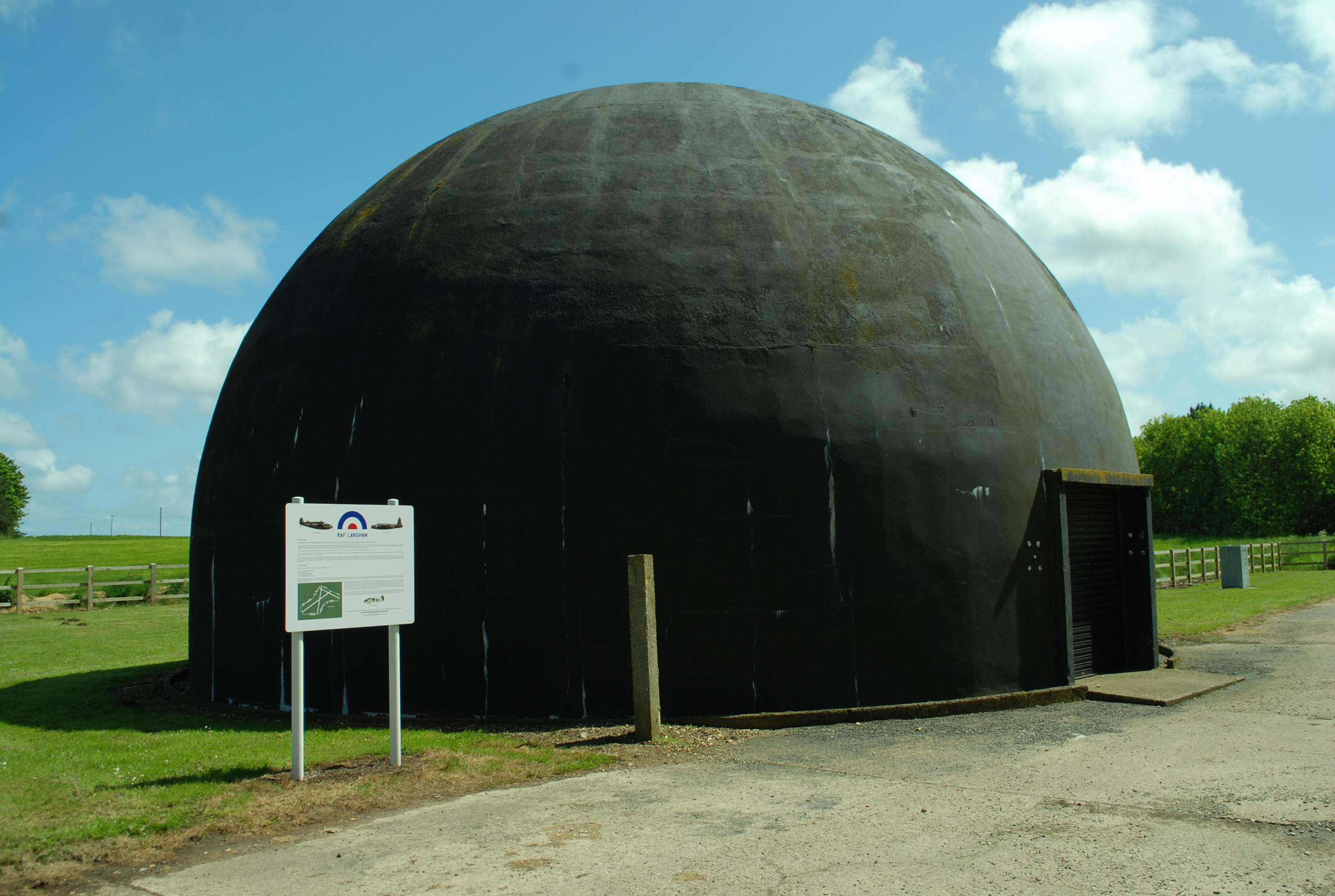
Binham Images

Images are sourced within 2km of 52.916496/0.948288 or Grid Reference TF9839. Thanks to Geograph Open Source API. All images are credited.

Binham Priory View from the dormitory undercroft looking towards the church <span class="nowrap"><a title="https://historicengland.org.uk/listing/the-list/list-entry/1014862?section=official-listing" rel="nofollow ugc noopener" href="https://historicengland.org.uk/listing/the-list/list-entry/1014862?section=official-listing">Link</a><img style="margin-left:2px;" alt="External link" title="External link - shift click to open in new window" src="https://s1.geograph.org.uk/img/external.png" width="10" height="10"/></span>
Binham Priory
View from the dormitory undercroft looking towards the church LinkExternal link
Binham Priory Church Repairs were being carried out when this photograph was taken in 1989 <span class="nowrap"><a title="https://historicengland.org.uk/listing/the-list/list-entry/1014862?section=official-listing" rel="nofollow ugc noopener" href="https://historicengland.org.uk/listing/the-list/list-entry/1014862?section=official-listing">Link</a><img style="margin-left:2px;" alt="External link" title="External link - shift click to open in new window" src="https://s1.geograph.org.uk/img/external.png" width="10" height="10"/></span>
Binham Priory Church
Repairs were being carried out when this photograph was taken in 1989 LinkExternal link
Binham Priory Kiln south of the dormitory undercroft <span class="nowrap"><a title="https://historicengland.org.uk/listing/the-list/list-entry/1014862?section=official-listing" rel="nofollow ugc noopener" href="https://historicengland.org.uk/listing/the-list/list-entry/1014862?section=official-listing">Link</a><img style="margin-left:2px;" alt="External link" title="External link - shift click to open in new window" src="https://s1.geograph.org.uk/img/external.png" width="10" height="10"/></span>
Binham Priory
Kiln south of the dormitory undercroft LinkExternal link
Binham village sign, refurbished The west end of the famous Binham Priory is featured on the village sign.
Binham village sign, refurbished
The west end of the famous Binham Priory is featured on the village sign.
Binham Priory, Norfolk Binham Priory is an English Heritage building, part of which is still used as a church.
Binham Priory, Norfolk
Binham Priory is an English Heritage building, part of which is still used as a church.
Binham Priory, Norfolk The priory is on the edge of the village.
Binham Priory, Norfolk
The priory is on the edge of the village.
Inside Binham Priory, Norfolk The priory is on the edge of the village.
Inside Binham Priory, Norfolk
The priory is on the edge of the village.
Binham Priory  Norfolk Seen on a winter's day.
Binham Priory Norfolk
Seen on a winter's day.
Binham Priory West front of The Priory Church of St. Mary & The Holy Cross
Binham Priory
West front of The Priory Church of St. Mary & The Holy Cross
Binham Priory View across the ruins to the church
Binham Priory
View across the ruins to the church
Memorial to the crew of B24, Liberator, 42-50717 466th BG (H), 785th B Sqdn. B24 'Berlin Bound' took off from RAF / USAAF Attlebridge on 15 February 1945, during assembly number 2 engine caught fire  causing the a/c to crash at Field Dalling near Langham. Six of the crew were killed in the crash, three had managed to parachute from the plane to safety, two bailed out over the sea and drowned.
<a title="https://www.geograph.org.uk/photo/6403756" href="https://www.geograph.org.uk/photo/6403756">Link</a>
<a title="https://www.geograph.org.uk/photo/6403763" href="https://www.geograph.org.uk/photo/6403763">Link</a>
Memorial to the crew of B24, Liberator, 42-50717
466th BG (H), 785th B Sqdn. B24 'Berlin Bound' took off from RAF / USAAF Attlebridge on 15 February 1945, during assembly number 2 engine caught fire causing the a/c to crash at Field Dalling near Langham. Six of the crew were killed in the crash, three had managed to parachute from the plane to safety, two bailed out over the sea and drowned. Link Link
Memorial to the crew of B24, Liberator, 42-50717 466th BG (H), 785th B Sqdn. B24 'Berlin Bound' took off from RAF / USAAF Attlebridge on 15 February 1945, during assembly number 2 engine caught fire causing the a/c to crash at Field Dalling near Langham. Six of the crew were killed in the crash, three had managed to parachute from the plane to safety, two bailed out over the sea and drowned.
<a title="https://www.geograph.org.uk/photo/6403753" href="https://www.geograph.org.uk/photo/6403753">Link</a>
<a title="https://www.geograph.org.uk/photo/6403763" href="https://www.geograph.org.uk/photo/6403763">Link</a>
Memorial to the crew of B24, Liberator, 42-50717
466th BG (H), 785th B Sqdn. B24 'Berlin Bound' took off from RAF / USAAF Attlebridge on 15 February 1945, during assembly number 2 engine caught fire causing the a/c to crash at Field Dalling near Langham. Six of the crew were killed in the crash, three had managed to parachute from the plane to safety, two bailed out over the sea and drowned. Link Link
The plaque on the memorial to Liberator "Berlin Bound" 466th BG (H), 785th B Sqdn. B24 'Berlin Bound' took off from RAF / USAAF Attlebridge on 15 February 1945, during assembly number 2 engine caught fire causing the a/c to crash at Field Dalling near Langham. Six of the crew were killed in the crash, three had managed to parachute from the plane to safety, two bailed out over the sea and drowned.
<a title="https://www.geograph.org.uk/photo/6403753" href="https://www.geograph.org.uk/photo/6403753">Link</a>
<a title="https://www.geograph.org.uk/photo/6403756" href="https://www.geograph.org.uk/photo/6403756">Link</a>
The plaque on the memorial to Liberator "Berlin Bound"
466th BG (H), 785th B Sqdn. B24 'Berlin Bound' took off from RAF / USAAF Attlebridge on 15 February 1945, during assembly number 2 engine caught fire causing the a/c to crash at Field Dalling near Langham. Six of the crew were killed in the crash, three had managed to parachute from the plane to safety, two bailed out over the sea and drowned. Link Link
Binham Pictorial village sign and Front Street in the North Norfolk village of Binham.
Binham
Pictorial village sign and Front Street in the North Norfolk village of Binham.
Binham Priory Ruins and church at the Priory Church of St Mary and the Holy Cross.
<span class="nowrap"><a title="www.binhampriory.org" rel="nofollow ugc noopener" href="http://www.binhampriory.org">Link</a><img style="margin-left:2px;" alt="External link" title="External link - shift click to open in new window" src="https://s1.geograph.org.uk/img/external.png" width="10" height="10"/></span>
Binham Priory
Ruins and church at the Priory Church of St Mary and the Holy Cross. LinkExternal link
Binham Village Sign The old village sign that represents BINHAM
Binham Village Sign
The old village sign that represents BINHAM
Interior of St Mary & Holy Cross, Binham, Norfolk
St Mary & the Holy Cross, Binham - Poppyhead
Show me another place!

Binham is located at Grid Ref: TF9839 (Lat: 52.916496, Lng: 0.948288)

Administrative County: Norfolk

District: North Norfolk

Police Authority: Norfolk

What 3 Words

///fallback.albatross.hammer. Near Wells-next-the-Sea, Norfolk

Nearby Locations

Binham

Related Wikis

Nearby Amenities

Located within 500m of 52.916496,0.948288
Binham
Place: village
Source: npe
Lat/Long: 52.9181642/0.9484432
Bus Stop
bus shelter, opp
Naptan AtcoCode: 2900B281
Naptan Bearing: S
Naptan BusStopType: CUS
Naptan CommonName: bus shelter
Naptan Indicator: opp
Naptan Landmark: bus shelter
Naptan Locality: Binham
Naptan NaptanCode: nfoadwjm
Naptan ShortCommonName: bus shelter
Naptan Street: Front Street
Naptan Verified: no
Public Transport: platform
Source: naptan_import
Lat/Long: 52.917148/0.9483969
Bus Stop
bus shelter, adj
Naptan AtcoCode: 2900B283
Naptan Bearing: N
Naptan CommonName: bus shelter
Naptan Indicator: adj
Naptan Landmark: bus shelter
Naptan Locality: Binham
Naptan NaptanCode: nfoadwjp
Naptan ShortCommonName: bus shelter
Naptan Street: Front Street
Naptan Verified: no
Source: naptan_import
Lat/Long: 52.9171071/0.9482305
Howell's Superstore
Shop: convenience
Lat/Long: 52.9175261/0.9486973
Pub
Chequers Inn
Food: yes
Wikidata: Q26464370
Lat/Long: 52.9179857/0.9481184
Turning Circle
Lat/Long: 52.916787/0.9466059
Turning Circle
Lat/Long: 52.9159173/0.9466137
Traffic Calming: bump
Lat/Long: 52.9189843/0.9465597
Post Box
Collection Times: Mo-Fr 14:45; Sa 10:30
Operator: Royal Mail
Operator Wikidata: Q638098
Post Box Design: type_n
Post Box Mounting: pier
Post Box Type: lamp
Ref: NR21 2117
Royal Cypher: EIIR
Royal Cypher Wikidata: Q33102113
Lat/Long: 52.917062/0.9482331
Telephone
Booth: K6
Covered: booth
Listed Status: Grade II
Lat/Long: 52.9172253/0.9484531
Bench
Lat/Long: 52.9202932/0.9457407
Traffic Calming: bump
Lat/Long: 52.919066/0.94661
Bench
Backrest: yes
Material: wood
Lat/Long: 52.9177195/0.9485565
Binham
Man Made: village_sign
Material: wood
Lat/Long: 52.9177429/0.9485471
Give Way
Lat/Long: 52.9179063/0.9485216
Give Way
Lat/Long: 52.9180761/0.948464
Vending Machine
Little Dairy Shop
Vending: Raw milk and raw milk products
Lat/Long: 52.9205343/0.9450516
Binham Market Cross
Historic: monument
Lat/Long: 52.9170036/0.9490562
Defibrillator
Defibrillator Location: next to Chequers Inn, Binham
Emergency: defibrillator
Indoor: no
Lat/Long: 52.9181604/0.9483064
The data included in this document is from www.openstreetmap.org. The data is made available under ODbL.

Have you been to Binham?

Leave your review of Binham below (or comments, questions and feedback).