Peak Hill

Settlement in Lincolnshire South Holland

England

Peak Hill

Cowbit House Farm Cottage
Cowbit House Farm Cottage Credit: Jonathan Thacker

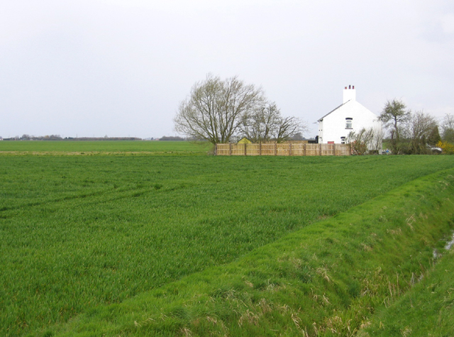
Peak Hill is a small village located in the county of Lincolnshire, England. Situated approximately 5 miles north of the town of Horncastle, Peak Hill is nestled amidst the picturesque Lincolnshire Wolds, an Area of Outstanding Natural Beauty. The village is surrounded by rolling hills, verdant farmland, and quaint rural landscapes, making it an ideal destination for nature enthusiasts and those seeking a peaceful retreat.

The village itself is small, with a population of around 300 residents. It boasts a charming collection of traditional stone cottages, many of which date back several centuries, giving it a timeless and rustic appeal. The local community is close-knit and friendly, with a strong sense of pride in their village and its heritage.

Although Peak Hill is primarily a residential area, it offers a range of amenities for its residents and visitors. These include a village hall, a primary school, a post office, and a local pub, where locals and visitors can gather for a drink and some traditional pub fare. The surrounding area offers ample opportunities for outdoor activities such as hiking, cycling, and horse riding, with numerous footpaths and bridleways crisscrossing the countryside.

Overall, Peak Hill is a tranquil and idyllic village, perfect for those seeking a peaceful escape from the hustle and bustle of city life. Its natural beauty, friendly community, and close proximity to the Lincolnshire Wolds make it a hidden gem in the heart of rural Lincolnshire.

If you have any feedback on the listing, please let us know in the comments section below.
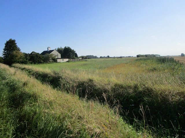
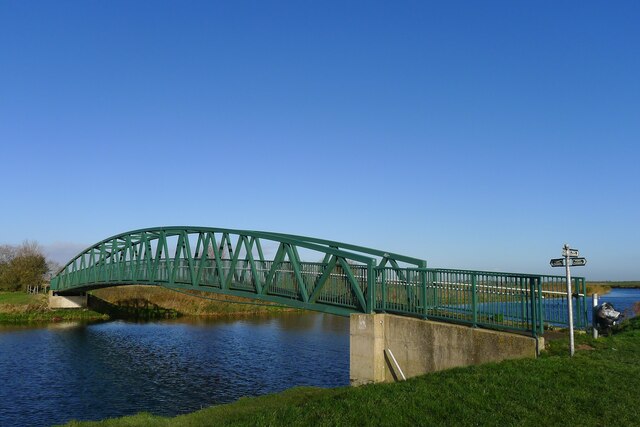
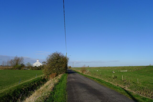
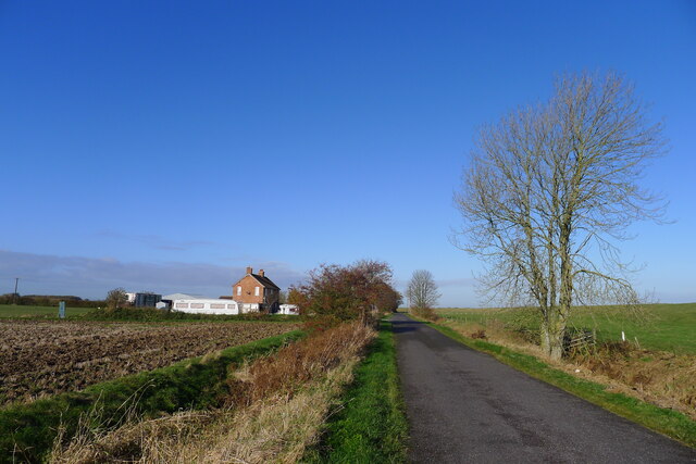
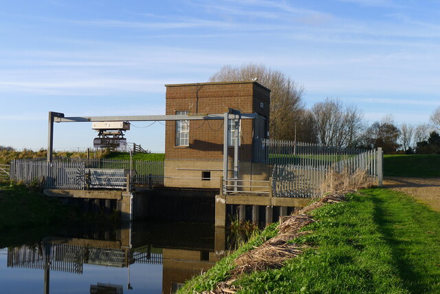
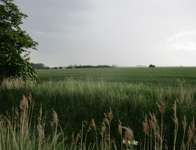
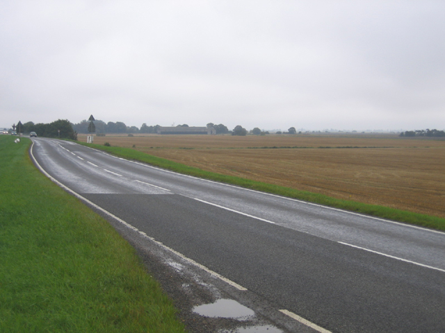
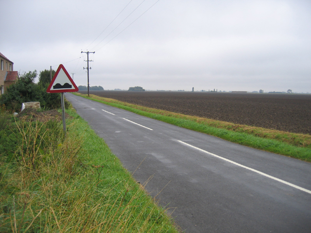
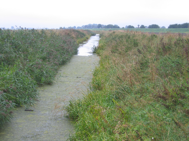
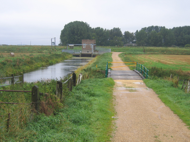
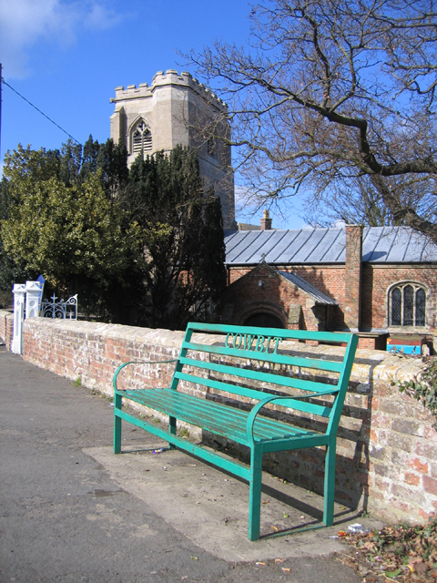
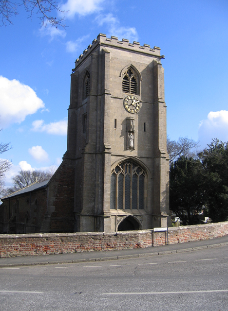
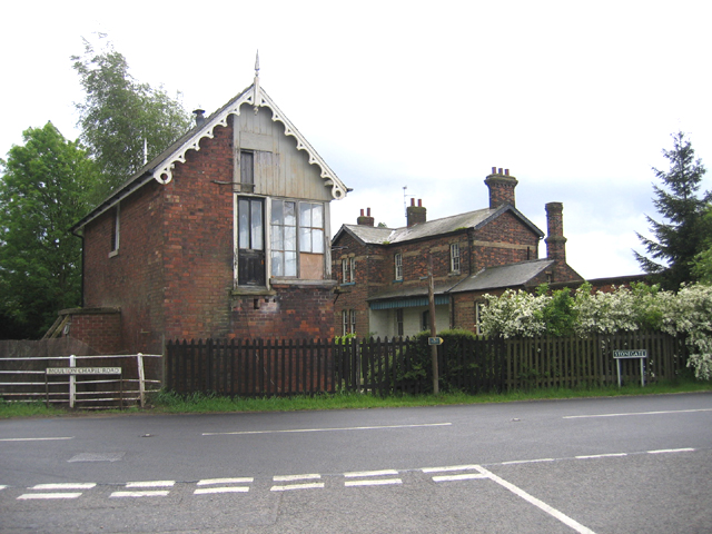
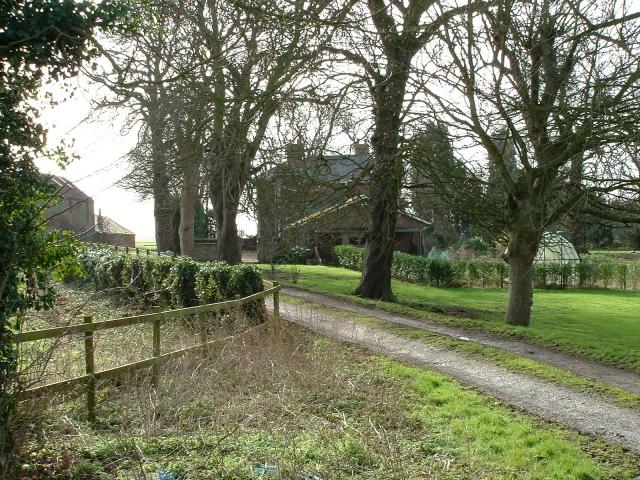
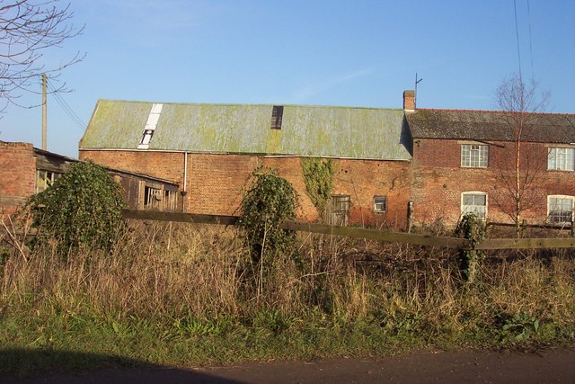
Peak Hill Images

Images are sourced within 2km of 52.7281/-0.128 or Grid Reference TF2616. Thanks to Geograph Open Source API. All images are credited.

Cowbit House Farm Cottage
Four Mile Bar bridge Taking footpaths on the right bank of the Welland over to Welland Bank road. More useful, perhaps, the 1952 OS map shows an earlier bridge here connected to a pub called the Four Mile Bar on the other side.
Four Mile Bar bridge
Taking footpaths on the right bank of the Welland over to Welland Bank road. More useful, perhaps, the 1952 OS map shows an earlier bridge here connected to a pub called the Four Mile Bar on the other side.
Cradge Bank Road approaching Cowbit Cottage Following Cycle Route 12 along the left bank of the Welland north from Crowland. Initially the road ran along the river embankment, but now runs below the embankment (visible on the right), so the river is no longer visible.
Cradge Bank Road approaching Cowbit Cottage
Following Cycle Route 12 along the left bank of the Welland north from Crowland. Initially the road ran along the river embankment, but now runs below the embankment (visible on the right), so the river is no longer visible.
Cradge Bank Road approaching Welland Farm 'Cradge' is apparently a Fenland term for a bank built to contain flooding <span class="nowrap"><a title="https://www.cantab.net/users/michael.behrend/repubs/lincs_dialect_18c/pages/main.html" rel="nofollow ugc noopener" href="https://www.cantab.net/users/michael.behrend/repubs/lincs_dialect_18c/pages/main.html">Link</a><img style="margin-left:2px;" alt="External link" title="External link - shift click to open in new window" src="https://s1.geograph.org.uk/img/external.png" width="10" height="10"/></span> . The flood embankment of the River Welland is on the right.
Cradge Bank Road approaching Welland Farm
'Cradge' is apparently a Fenland term for a bank built to contain flooding LinkExternal link . The flood embankment of the River Welland is on the right.
The Crowland and Cowbit Wash pumping station Two pumps with a combined capacity of 1.55 cubic metres per second <span class="nowrap"><a title="https://www.wellandidb.org.uk/about-us/pumping-stations/" rel="nofollow ugc noopener" href="https://www.wellandidb.org.uk/about-us/pumping-stations/">Link</a><img style="margin-left:2px;" alt="External link" title="External link - shift click to open in new window" src="https://s1.geograph.org.uk/img/external.png" width="10" height="10"/></span> pumping water from the New River into the River Welland
The Crowland and Cowbit Wash pumping station
Two pumps with a combined capacity of 1.55 cubic metres per second LinkExternal link pumping water from the New River into the River Welland
Wheat field off Bellingham's Drove
Cowbit Wash Barrier Bank, Lincs View NE from Brotherhouse Bar along the A1074 towards Cowbit.
Cowbit Wash Barrier Bank, Lincs
View NE from Brotherhouse Bar along the A1074 towards Cowbit.
Queen's Bank and Great Postland, Crowland, Lincs
New River, Cowbit Wash, Lincs In the SE corner of the square; the small New River bounds the eastern side of the flood-relief wash and the raised River Welland the western side.
New River, Cowbit Wash, Lincs
In the SE corner of the square; the small New River bounds the eastern side of the flood-relief wash and the raised River Welland the western side.
Pumping Station, Cowbit Wash, Lincs Pumping from the low-level New River into the raised River Welland; view from Wash Bank.
Pumping Station, Cowbit Wash, Lincs
Pumping from the low-level New River into the raised River Welland; view from Wash Bank.
Parish seat and church, Cowbit, Lincs
Parish church, Cowbit, Lincs dedicated to St Mary and consecrated in 1486.
Parish church, Cowbit, Lincs
dedicated to St Mary and consecrated in 1486.
Cowbit village sign adjacent to the A1073 Barrier Bank.
Cowbit village sign
adjacent to the A1073 Barrier Bank.
Cottage by the Welland Bank, Deeping St Nicholas, Lincs
Cowbit tower windmill, Lincs Built 1789 and extended to a fourth floor shortly afterwards; worked by wind until the mid 1930s and closed down in 1969.  <span class="nowrap"><a title="http://www.lincolnshire.gov.uk/windmills/section.asp?catId=3406" rel="nofollow ugc noopener" href="http://www.lincolnshire.gov.uk/windmills/section.asp?catId=3406">Link</a><img style="margin-left:2px;" alt="External link" title="External link - shift click to open in new window" src="https://s1.geograph.org.uk/img/external.png" width="10" height="10"/></span>
Cowbit tower windmill, Lincs
Built 1789 and extended to a fourth floor shortly afterwards; worked by wind until the mid 1930s and closed down in 1969. LinkExternal link
Cowbit windmill, Lincs – view from Backgate.
Cowbit windmill, Lincs
– view from Backgate.
Signal box, Cowbit, Lincs on the dismantled March to Spalding line, with the former railway station to the right.
Signal box, Cowbit, Lincs
on the dismantled March to Spalding line, with the former railway station to the right.
Queen's Bank farm, Moulton West Fen A pleasant and prosperous farmhouse in the South Holland fens.
Queen's Bank farm, Moulton West Fen
A pleasant and prosperous farmhouse in the South Holland fens.
Show me another place!

Peak Hill is located at Grid Ref: TF2616 (Lat: 52.7281, Lng: -0.128)

Division: Parts of Holland

Administrative County: Lincolnshire

District: South Holland

Police Authority: Lincolnshire

What 3 Words

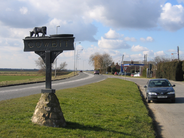
///soonest.super.triads. Near Cowbit, Lincolnshire

Nearby Locations

Peak Hill

Related Wikis

Peak Hill, Lincolnshire

Peak Hill is a hamlet in the South Holland district of Lincolnshire, England. It is situated 4 miles (6 km) south from Spalding and 10 miles (16 km) north...

Cowbit

Cowbit (locally pronounced Cubbit) is a village and civil parish in the South Holland district of Lincolnshire, England. The population of the civil parish...

Cowbit railway station

Cowbit railway station was a station in Cowbit, Lincolnshire, England. It was located on the route between Spalding and March. == History == The station...

South Holland District

South Holland is a local government district of Lincolnshire, England. The council is based in Spalding. Other notable towns and villages include Crowland...

South Holland and The Deepings (UK Parliament constituency)

South Holland and The Deepings is a constituency in Lincolnshire represented in the House of Commons of the UK Parliament since its 1997 creation by John...

Fitton End

Fitton End is a hamlet in the civil parish of Newton-in-the-Isle, in the Fenland district, in the county of Cambridgeshire, England. It has a population...

Moulton Chapel

Moulton Chapel is a village in the South Holland district of Lincolnshire, England. It is on the B1357 road, 4 miles (6 km) south from Moulton, 5 miles...

Spalding Rural District

Spalding was a rural district in Holland in Lincolnshire, England from 1894 to 1974. It was formed under the Local Government Act 1894 from the Spalding...

Nearby Amenities

Located within 500m of 52.7281,-0.128
Bus Stop
Bradbourne House
Naptan AtcoCode: 270002701645
Naptan Bearing: SW
Naptan CommonName: Bradbourne House
Naptan Indicator: adj
Naptan Landmark: Bradbourne House
Naptan Street: Barrier Bank
Naptan Verified: no
Source: naptan_import
Lat/Long: 52.7280975/-0.1277721
Bus Stop
Bradbourne House
Naptan AtcoCode: 270002701646
Naptan Bearing: NE
Naptan CommonName: Bradbourne House
Naptan Indicator: opp
Naptan Landmark: Bradbourne House
Naptan Street: Barrier Bank
Naptan Verified: no
Source: naptan_import
Lat/Long: 52.7281017/-0.1280385
The Slipe
Place: locality
Source: Bing
Lat/Long: 52.7319673/-0.1263568
Blue Bell Farm
Place: farm
Source: Bing
Lat/Long: 52.7300213/-0.1268215
Cowbit Fen
Place: locality
Source: Bing
Lat/Long: 52.7312532/-0.1241918
Peak Hill
Place: locality
Source: Bing
Wikidata: Q7157822
Lat/Long: 52.7284288/-0.1266726
Stamford House Farm
Place: farm
Source: Bing
Lat/Long: 52.7292501/-0.1262757
Whitehouse Farm
Place: farm
Source: Bing
Lat/Long: 52.7277377/-0.1258787
Bellesmere Farm
Place: farm
Source: Bing
Lat/Long: 52.7256188/-0.1269411
The data included in this document is from www.openstreetmap.org. The data is made available under ODbL.

Have you been to Peak Hill?

Leave your review of Peak Hill below (or comments, questions and feedback).