Bingfield

Settlement in Northumberland

England

Bingfield

The Erring Burn below Hallington Mill
The Erring Burn below Hallington Mill Credit: Mike Quinn

Bingfield is a small village located in the county of Northumberland, in the northeast of England. Situated about 10 miles west of the market town of Hexham, Bingfield is nestled in the picturesque Tyne Valley.

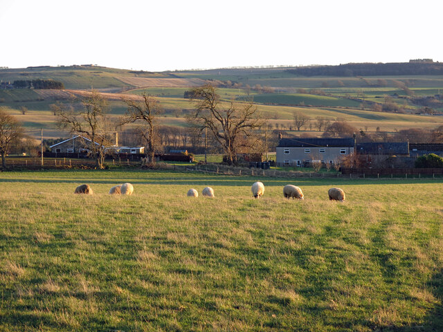
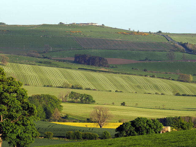
The village is known for its rural charm and tranquil surroundings. Surrounded by rolling hills, lush green fields, and the meandering River Tyne, it offers a peaceful escape from the bustling city life. The area is abundant in natural beauty, with stunning landscapes that attract hikers, nature enthusiasts, and photographers.

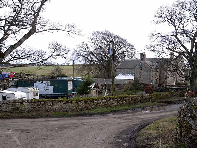
Bingfield itself is a close-knit community, with a population of around 200 residents. It has a quaint village center, featuring a historic church, a primary school, and a few local businesses. The village maintains its traditional character, with many of the buildings constructed from local stone, adding to its charm.

The surrounding area offers plenty of opportunities for outdoor activities. The nearby Tyne Riverside Country Park provides scenic walking and cycling routes along the riverbank, while the Northumberland National Park, just a short drive away, offers vast expanses of unspoiled countryside to explore.

Despite its small size, Bingfield enjoys good transport links. The A69 road passes nearby, connecting the village to Hexham, Newcastle upon Tyne, and Carlisle. The nearest railway station is in Hexham, providing further connections to major cities in the region.

In summary, Bingfield is a picturesque village in Northumberland, offering a tranquil setting and a close community spirit, making it an appealing place for those seeking a peaceful retreat in the heart of the English countryside.

If you have any feedback on the listing, please let us know in the comments section below.

Bingfield Images

Images are sourced within 2km of 55.047829/-2.035494 or Grid Reference NY9772. Thanks to Geograph Open Source API. All images are credited.

The Erring Burn below Hallington Mill
The Erring Burn in open ground south of Hallington Mill The taller trees at the far end of the open ground are at around NY 9812 7404 - see the map and satellite image <span class="nowrap"><a title="https://wtp2.appspot.com/wheresthepath.htm?lat=55.061798&lon=-2.029137&lz=17&rz=17&lt=OS&rt=satellite&lov=None&rov=None&lgrat=None&rgrat=None" rel="nofollow ugc noopener" href="https://wtp2.appspot.com/wheresthepath.htm?lat=55.061798&lon=-2.029137&lz=17&rz=17&lt=OS&rt=satellite&lov=None&rov=None&lgrat=None&rgrat=None">Link</a><img style="margin-left:2px;" alt="External link" title="External link - shift click to open in new window" src="https://s1.geograph.org.uk/img/external.png" width="10" height="10"/></span> . See also <a href="https://www.geograph.org.uk/photo/7081500">NY9874 : Woodland and open ground by the Erring Burn</a>. Image <a href="https://www.geograph.org.uk/photo/7081497">NY9874 : The Erring Burn below Hallington Mill (2)</a> shows the view back towards Hallington Mill from more or less the same position.
The Erring Burn in open ground south of Hallington Mill
The taller trees at the far end of the open ground are at around NY 9812 7404 - see the map and satellite image LinkExternal link . See also NY9874 : Woodland and open ground by the Erring Burn. Image NY9874 : The Erring Burn below Hallington Mill (2) shows the view back towards Hallington Mill from more or less the same position.
The Erring Burn below Hallington Mill (2) It's just possible to see some of the buildings through the trees.
The Erring Burn below Hallington Mill (2)
It's just possible to see some of the buildings through the trees.
Woodland and open ground by the Erring Burn See also <a href="https://www.geograph.org.uk/photo/7081493">NY9874 : The Erring Burn in open ground south of Hallington Mill</a>.
Woodland and open ground by the Erring Burn
Fields and woodland southeast of High Well House
Clump of trees southeast of High Well House See <a href="https://www.geograph.org.uk/photo/7081507">NY9774 : Fields and woodland southeast of High Well House</a>.
Clump of trees southeast of High Well House
Farmland and copse southeast of High Well House
Farmland and woodland in the valley of the Erring Burn
The valley of the Erring Burn below Bingfield
The valley of the Erring Burn below Bingfield (2)
The valley of the Erring Burn south of High Well House
Farmland between Bingfield Combe Farm and Bingfield Paddock The left hand (more northern) of the two buildings at Bingfield Paddock (on the horizon, left) appears to have a former gin gang. [For info about gin gangs, see <a href="https://www.geograph.org.uk/photo/101236">NY9058 : Low Ardley Farmhouse possible Gin Gang</a> photographed by Les Hull.]
Farmland between Bingfield Combe Farm and Bingfield Paddock
The left hand (more northern) of the two buildings at Bingfield Paddock (on the horizon, left) appears to have a former gin gang. [For info about gin gangs, see NY9058 : Low Ardley Farmhouse possible Gin Gang photographed by Les Hull.]
Farmland and trees west of Bingfield Eastside Looking NNW across the valley of the Erring Burn towards with <a href="https://www.geograph.org.uk/photo/960061">NY9774 : High Well House Farm</a> (photographed by Oliver Dixon) on the far side of the valley (left) and the Green Rigg wind farm in <a href="https://www.geograph.org.uk/gridref/NY9281">NY9281</a> in the distance.
Farmland and trees west of Bingfield Eastside
Looking NNW across the valley of the Erring Burn towards with NY9774 : High Well House Farm (photographed by Oliver Dixon) on the far side of the valley (left) and the Green Rigg wind farm in NY9281 in the distance.
Farmland and trees west of Bingfield Eastside (2) Looking NW across the valley of the Erring Burn; see also <a href="https://www.geograph.org.uk/photo/7082285">NY9873 : Farmland and trees west of Bingfield Eastside</a>.
Farmland and trees west of Bingfield Eastside (2)
Looking NW across the valley of the Erring Burn; see also NY9873 : Farmland and trees west of Bingfield Eastside.
Farmland around Well House
Patterned Mown Hay from a Distance
Torridge Farm
Torridge Farm
Hedge and tree-lined minor road approaching Low Errington Looking north-eastward.
Hedge and tree-lined minor road approaching Low Errington
Looking north-eastward.
Show me another place!

Bingfield is located at Grid Ref: NY9772 (Lat: 55.047829, Lng: -2.035494)

Unitary Authority: Northumberland

Police Authority: Northumbria

What 3 Words

///voucher.saved.flags. Near Acomb, Northumberland

Nearby Locations

Bingfield

Related Wikis

Bingfield

Bingfield is a village and former civil parish, now in the parish of Whittington, in Northumberland, in England. It is situated to the north of Corbridge...

Dere Street

Dere Street or Deere Street is a modern designation of a Roman road which ran north from Eboracum (York), crossing the Stanegate at Corbridge (Hadrian...

Hallington, Northumberland

Hallington is a hamlet and former civil parish about 9 miles from Hexham, now in the parish of Whittington, in the county of Northumberland, England. In...

Great Whittington

Great Whittington is a village and former civil parish, now in the parish of Whittington, in Northumberland, England, 7 miles NE of Hexham. In 1951 the...

Nearby Amenities

Located within 500m of 55.047829,-2.035494
Bingfield
Place: hamlet
Source: NPE
Wikidata: Q4914188
Lat/Long: 55.047307/-2.0350364
Power: pole
Lat/Long: 55.045025/-2.0302391
Power: pole
Lat/Long: 55.045781/-2.0301399
Power: pole
Lat/Long: 55.0465463/-2.0300004
Power: pole
Lat/Long: 55.0472885/-2.0299038
Power: pole
Lat/Long: 55.0480584/-2.0298019
Power: pole
Lat/Long: 55.0488097/-2.0296758
Power: pole
Lat/Long: 55.049449/-2.0292333
Power: pole
Lat/Long: 55.0501066/-2.0287773
The data included in this document is from www.openstreetmap.org. The data is made available under ODbL.

Have you been to Bingfield?

Leave your review of Bingfield below (or comments, questions and feedback).