Patrick Brompton

Settlement in Yorkshire Richmondshire

England

Patrick Brompton

A685 near  Patrick Brompton
A685 near Patrick Brompton Credit: David Dixon

Patrick Brompton is a quaint and picturesque village located in the Richmondshire district of North Yorkshire, England. Situated approximately 3 miles south-west of the market town of Leyburn, this rural settlement is nestled in the heart of the Yorkshire Dales National Park.

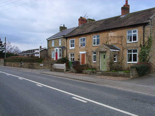
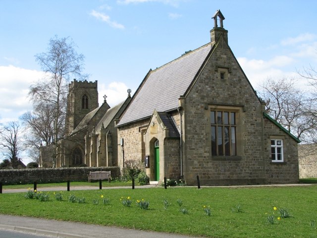
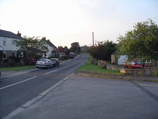
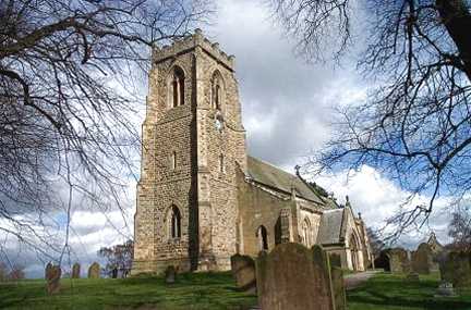
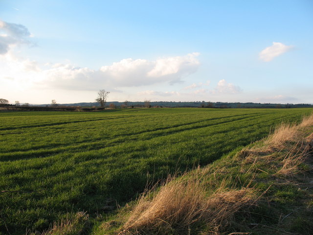
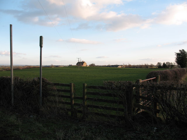
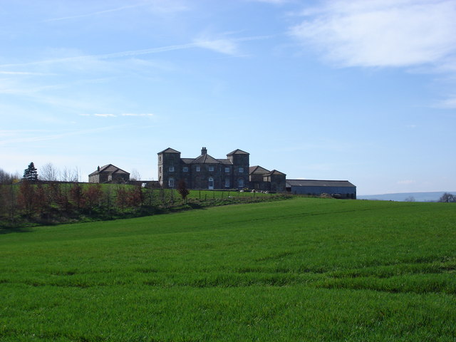
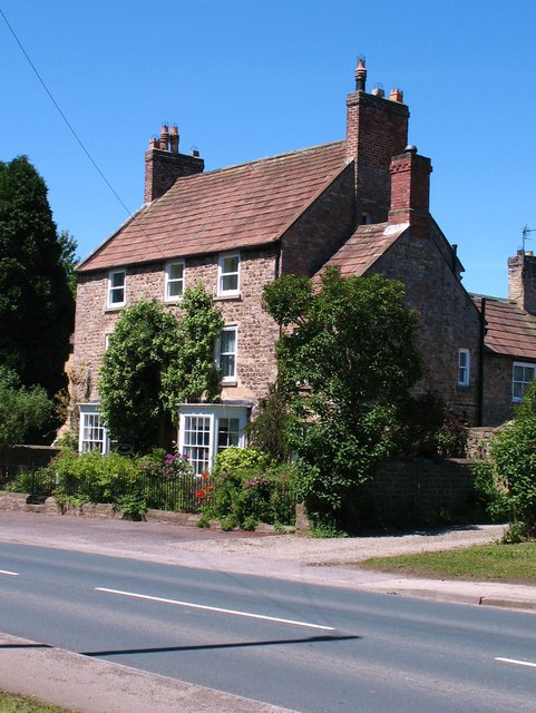
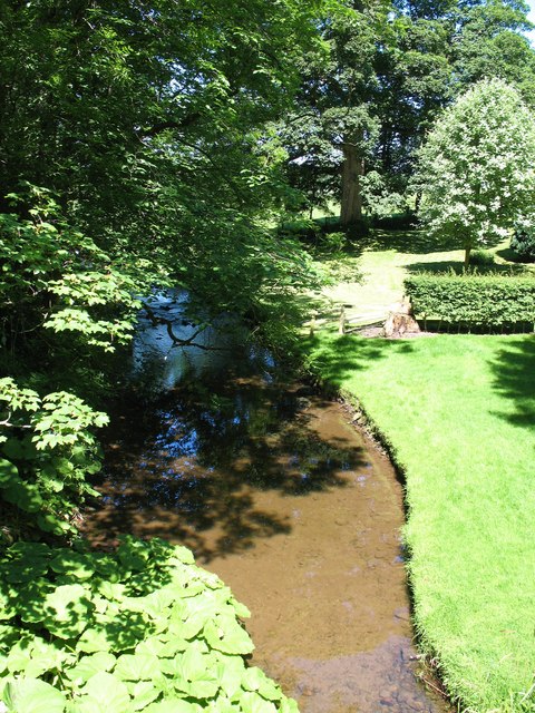
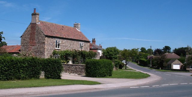
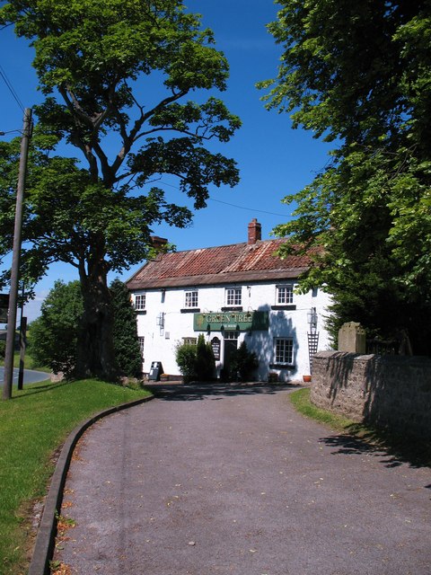
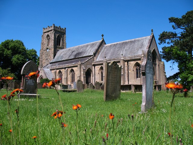
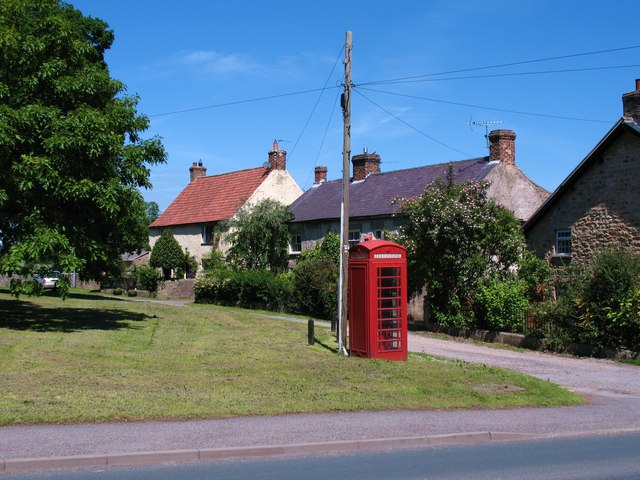
The village is known for its stunning countryside views, rolling hills, and charming stone-built houses. It has a small but tight-knit community that takes great pride in its heritage and natural surroundings. The local church, St. Patrick's, stands as a prominent landmark and dates back to the 12th century, showcasing the village's rich history.

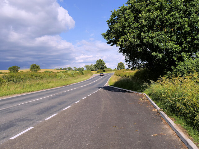
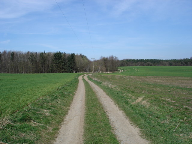
Patrick Brompton offers a tranquil and idyllic escape for residents and visitors alike. The surrounding landscape provides ample opportunities for outdoor activities such as hiking, cycling, and birdwatching. The nearby River Ure also attracts anglers, who enjoy fishing for trout and salmon.

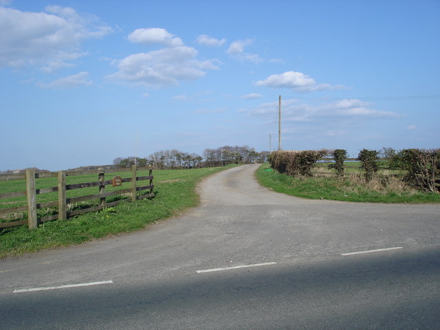
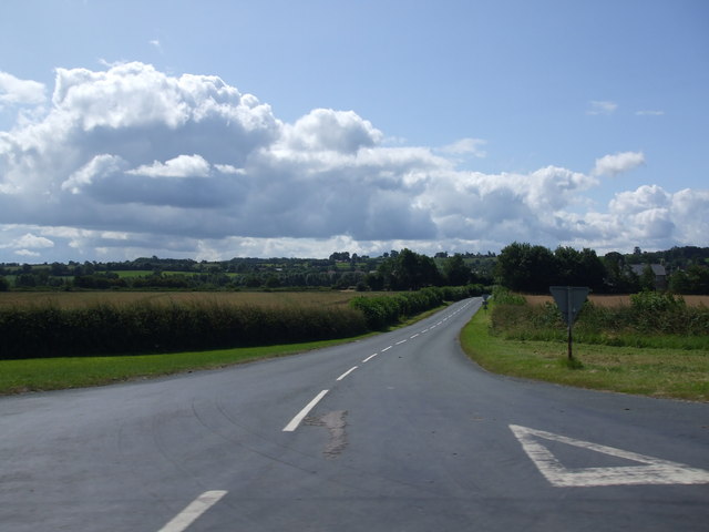
Despite its rural setting, Patrick Brompton benefits from its proximity to Leyburn, which provides essential amenities including shops, schools, and healthcare facilities. The village is well-connected by road, making it easily accessible to neighboring towns and cities.

Throughout the year, the community organizes various events and festivals that showcase local talent, crafts, and produce. These gatherings foster a sense of community spirit and allow residents to come together and celebrate their shared heritage.

In summary, Patrick Brompton is a charming village in the heart of the Yorkshire Dales, offering natural beauty, a rich history, and a close-knit community that makes it an ideal place to live or visit for those seeking a peaceful retreat in the English countryside.

If you have any feedback on the listing, please let us know in the comments section below.

Patrick Brompton Images

Images are sourced within 2km of 54.31297/-1.659882 or Grid Reference SE2290. Thanks to Geograph Open Source API. All images are credited.

A685 near  Patrick Brompton
A685 near Patrick Brompton
Crakehall, west end The main A684 road running west out of Crakehall
Crakehall, west end
The main A684 road running west out of Crakehall
The Old School Room & St. Patrick's church On the very bottom of the picture is the A684 up the dale
The Old School Room & St. Patrick's church
On the very bottom of the picture is the A684 up the dale
Patrick Brompton Typical Wensleydale village.The original settlement of Patrick Brompton was founded, and named after, the parish church of Saint Patrick, which dates back to the times of the Norman Conquest and still stands on the western edge of the village.  There are two village greens, one ancient, one modern, and a local pub built in the 17th century, originally as a vicarage for the local priest.
Patrick Brompton
Typical Wensleydale village.The original settlement of Patrick Brompton was founded, and named after, the parish church of Saint Patrick, which dates back to the times of the Norman Conquest and still stands on the western edge of the village. There are two village greens, one ancient, one modern, and a local pub built in the 17th century, originally as a vicarage for the local priest.
Patrick Brompton, St Patrick's Church
Agricultural Land at Patrick Brompton A field of winter wheat on the north side of the village.
Agricultural Land at Patrick Brompton
A field of winter wheat on the north side of the village.
Footpath to Hunter's Hill Farm Path across pastureland in Crakehall parish.
Footpath to Hunter's Hill Farm
Path across pastureland in Crakehall parish.
Entrance to Carnaby House Farm Entrance to Carnaby House Farm, with the farm buildings just visible in the trees
Entrance to Carnaby House Farm
Entrance to Carnaby House Farm, with the farm buildings just visible in the trees
Arbour Hill Farm The rather grand farmhouse at Arbour Hill, looking for all the world like a miniature Castle Howard!
Arbour Hill Farm
The rather grand farmhouse at Arbour Hill, looking for all the world like a miniature Castle Howard!
Path close to Arbour Hill Taken from the same spot as my picture of Arbour Hill, looking north.
Path close to Arbour Hill
Taken from the same spot as my picture of Arbour Hill, looking north.
Brompton Road
Brompton Road
The Old Rectory, Patrick Brompton Eighteenth century stone built house in the centre of the village.
The Old Rectory, Patrick Brompton
Eighteenth century stone built house in the centre of the village.
Brompton Beck Not the only Brompton Beck in North Yorkshire, this one runs through Patrick Brompton and is one of the feeders for Bedale Beck which joins the Swale.
Brompton Beck
Not the only Brompton Beck in North Yorkshire, this one runs through Patrick Brompton and is one of the feeders for Bedale Beck which joins the Swale.
House on the corner Village house in Patrick Brompton. The village is on the boundary between stone and brick, slate and tiles, so houses here tend to be built of a variety of traditional materials.
House on the corner
Village house in Patrick Brompton. The village is on the boundary between stone and brick, slate and tiles, so houses here tend to be built of a variety of traditional materials.
The Green Tree, Patrick Brompton Pub next to the churchyard in Patrick Brompton.
The Green Tree, Patrick Brompton
Pub next to the churchyard in Patrick Brompton.
St Patrick's, Patrick Brompton Medieval village church much restored and altered in Victorian times, and with a not particularly attractive rockfaced tower of c1865.
St Patrick's, Patrick Brompton
Medieval village church much restored and altered in Victorian times, and with a not particularly attractive rockfaced tower of c1865.
Green and telephone box, Patrick Brompton Small green in Patrick Brompton with cottages and telephone box to one side and the old school room on the other. The 1:25000 map would suggest that the green and phone box are just within this square.
Green and telephone box, Patrick Brompton
Small green in Patrick Brompton with cottages and telephone box to one side and the old school room on the other. The 1:25000 map would suggest that the green and phone box are just within this square.
Wheat field off A684 The trees in the distance line Crakehall Beck.
Wheat field off A684
The trees in the distance line Crakehall Beck.
Show me another place!

Patrick Brompton is located at Grid Ref: SE2290 (Lat: 54.31297, Lng: -1.659882)

Division: North Riding

Administrative County: North Yorkshire

District: Richmondshire

Police Authority: North Yorkshire

What 3 Words

///scoop.still.walnuts. Near Bedale, North Yorkshire

Related Wikis

Patrick Brompton

Patrick Brompton is a village and civil parish in North Yorkshire, England. Patrick Brompton is situated about 4 miles (6.4 km) west of Bedale. It lies...

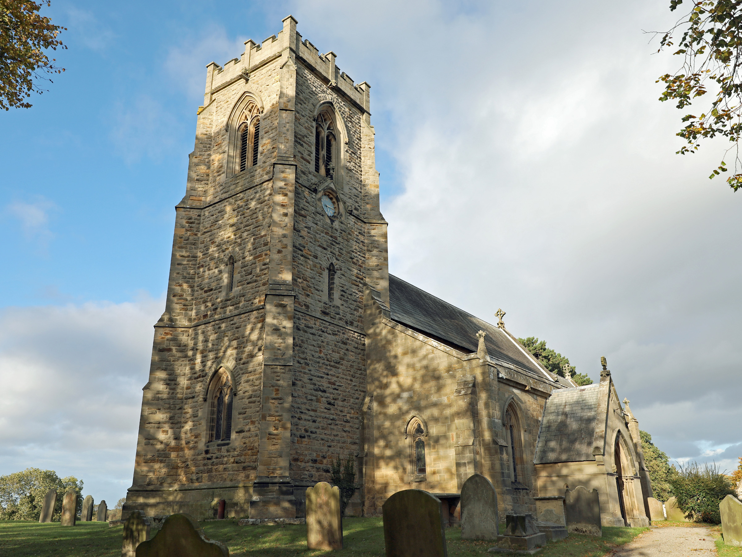
Church of St Patrick, Patrick Brompton

The Church of St Patrick, is the parish church for the village and parish of Patrick Brompton in North Yorkshire, England. The church is one of six in...

Newton-le-Willows, North Yorkshire

Newton-le-Willows is a village and civil parish in the Richmondshire district of North Yorkshire, England, 3 miles (4.8 km) west of Bedale. Historically...

Jervaulx railway station

Jervaulx railway station was a railway station in Newton-le-Willows, North Yorkshire, England. Originally named after this place, it was renamed after...

Aysgarth School

Aysgarth School is an independent day and boarding preparatory school near to the village of Newton-le-Willows, North Yorkshire, England. As the name suggests...

Crakehall

Crakehall is a village and civil parish in the Hambleton District of North Yorkshire, England, approximately 2 miles (3 km) west of Bedale. More known...

Crakehall railway station

Crakehall railway station was a railway station that served the village of Crakehall, North Yorkshire, England. == History == Opened by the Bedale and...

Church of St Mary the Virgin, Hornby

St Mary's Church Hornby, is the parish church for the village of Hornby, Richmondshire in North Yorkshire, England. The church is one of six in the Benefice...

Nearby Amenities

Located within 500m of 54.31297,-1.659882
Patrick Brompton
Place: village
Website: http://www.patrickbrompton.com/
Wikidata: Q933288
Wikipedia: en:Patrick Brompton
Lat/Long: 54.3128965/-1.6600381
Power: pole
Lat/Long: 54.3164832/-1.6644486
Power: pole
Lat/Long: 54.3165997/-1.6633213
Power: pole
Lat/Long: 54.3167296/-1.6634363
Power: pole
Lat/Long: 54.316795/-1.6612197
Power: pole
Lat/Long: 54.3168397/-1.6624387
Power: pole
Lat/Long: 54.3168563/-1.6563623
Power: pole
Lat/Long: 54.3169118/-1.6598957
Power: pole
Lat/Long: 54.3170268/-1.6586314
Power: pole
Lat/Long: 54.3170394/-1.6599062
Power: pole
Lat/Long: 54.3171278/-1.6574337
Power: pole
Lat/Long: 54.3171588/-1.658676
Defibrillator
Booth: K6
Covered: booth
Defibrillator Location: inside red phone box, Patrick Brompton
Disused Amenity: telephone
Emergency: defibrillator
Man Made: telephone_box
Ref GB The Circuit: 6BB847B1-28D3-4730-992C-B0610106E877
Source: survey
Lat/Long: 54.3115455/-1.6634193
Post Box
Post Box Type: lamp
Source: survey
Lat/Long: 54.3123766/-1.6607019
Power: pole
Lat/Long: 54.3106772/-1.6661232
Power: pole
Lat/Long: 54.3103591/-1.6547013
Power: pole
Lat/Long: 54.3111696/-1.6549476
Power: pole
Lat/Long: 54.3116127/-1.6558533
Power: pole
Lat/Long: 54.3121842/-1.6569828
Power: pole
Lat/Long: 54.3127692/-1.658139
Power: pole
Lat/Long: 54.3128118/-1.6586523
Power: pole
Lat/Long: 54.3127931/-1.6561179
Power: pole
Lat/Long: 54.3133347/-1.6553947
Power: pole
Lat/Long: 54.3137752/-1.6547857
Power: pole
Lat/Long: 54.3142157/-1.6542017
Power: pole
Lat/Long: 54.3143714/-1.6550777
Power: pole
Lat/Long: 54.31507/-1.6559012
Power: pole
Lat/Long: 54.3157367/-1.656654
Power: pole
Lat/Long: 54.3161784/-1.6579657
The data included in this document is from www.openstreetmap.org. The data is made available under ODbL.

Have you been to Patrick Brompton?

Leave your review of Patrick Brompton below (or comments, questions and feedback).