Bindon

Settlement in Somerset Somerset West and Taunton

England

Bindon

Bathealton : Countryside Scenery Looking to Screedy Barn.
Bathealton : Countryside Scenery Credit: Lewis Clarke

Bindon is a small village located in the county of Somerset, England. Situated on the southern edge of the Dorset Downs, it lies approximately 5 miles southeast of the town of Dorchester and 15 miles west of the coastal resort of Weymouth. The village is part of the civil parish of West Stafford and falls within the administrative district of West Dorset.

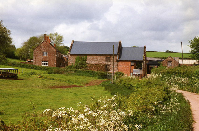
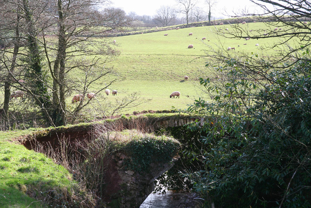
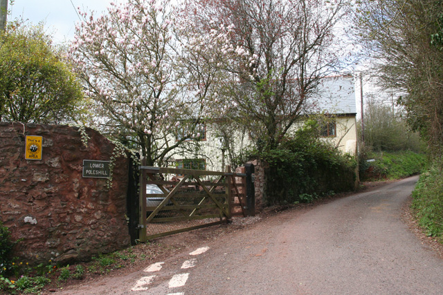
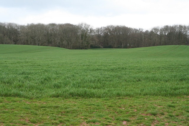
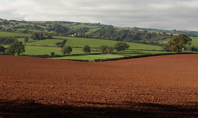
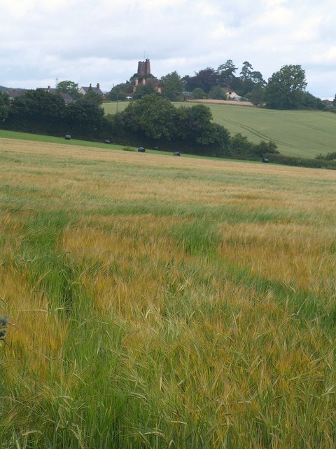
With a population of around 300 residents, Bindon is a quintessential English countryside village. It boasts picturesque thatched cottages, well-maintained gardens, and narrow winding lanes that add to its charm. The village is surrounded by rolling hills and lush green fields, offering breathtaking views of the countryside.

Bindon has a rich history, dating back to the medieval period. The village is known for its historic church, dedicated to St. Martin, which features stunning architecture and is a prominent landmark in the area. Additionally, there are remnants of a motte-and-bailey castle nearby, providing evidence of the village's fortified past.

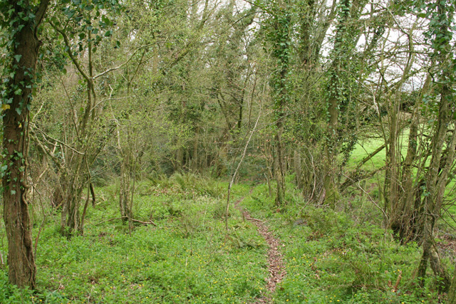
Despite its small size, Bindon offers a close-knit community atmosphere, with various community events held throughout the year. The village has a local pub, which serves as a social hub for residents and visitors alike. The surrounding countryside provides ample opportunities for outdoor activities such as hiking, cycling, and wildlife spotting.

Overall, Bindon is a tranquil and idyllic village that offers a peaceful retreat from the hustle and bustle of modern life. Its rich history, stunning natural beauty, and strong sense of community make it a desirable place to live or visit for those seeking a taste of rural England.

If you have any feedback on the listing, please let us know in the comments section below.

Bindon Images

Images are sourced within 2km of 51.008318/-3.2841953 or Grid Reference ST1024. Thanks to Geograph Open Source API. All images are credited.

Bathealton : Countryside Scenery Looking to Screedy Barn.
Bathealton : Countryside Scenery
Looking to Screedy Barn.
Bathealton : Drive A drive at Pool Court.
Bathealton : Drive
A drive at Pool Court.
Bathealton: Leigh Farm A pond to the south west of the farm fed a leat which powered a waterwheel here. A public footpath passes both pond and farm – at this point using the lane leading to the farm – but the wheel and machinery it drove have long gone
Bathealton: Leigh Farm
A pond to the south west of the farm fed a leat which powered a waterwheel here. A public footpath passes both pond and farm – at this point using the lane leading to the farm – but the wheel and machinery it drove have long gone
Langford Budville: old bridge at Lower Wellisford Part of the arch survives on what was presumably an old crossing of the River Tone. Looking south from a point a little to the east of Wellisford Manor
Langford Budville: old bridge at Lower Wellisford
Part of the arch survives on what was presumably an old crossing of the River Tone. Looking south from a point a little to the east of Wellisford Manor
Langford Budville: edge of Coram’s Wood On a possible deer track as the path seemingly leads nowhere and is not shown on the Ordnance Survey 1: 25,000. On the edge of Langford Heathfield, now largely a nature reserve
Langford Budville: edge of Coram’s Wood
On a possible deer track as the path seemingly leads nowhere and is not shown on the Ordnance Survey 1: 25,000. On the edge of Langford Heathfield, now largely a nature reserve
Bathealton: Lower Poleshill House at the junction of Watery Lane and Carrier’s Lane. Looking west-south-west
Bathealton: Lower Poleshill
House at the junction of Watery Lane and Carrier’s Lane. Looking west-south-west
Bathealton: Pooles & Burgess Farmhouse on the eastern edge of the village. Looking north west
Bathealton: Pooles & Burgess
Farmhouse on the eastern edge of the village. Looking north west
Milverton: Milverton Heath Seen from Screedy. Looking south
Milverton: Milverton Heath
Seen from Screedy. Looking south
Milverton: Milverton Heath Looking south
Milverton: Milverton Heath
Looking south
Country lane in Somerset
Footpath to Cobhay Moor Plantation Further SSE along the path shown in <a href="https://www.geograph.org.uk/photo/1521425">ST0825 : Footpath through Moor Plantation</a>. Grass has withered after a long period of dry weather.
Footpath to Cobhay Moor Plantation
Further SSE along the path shown in ST0825 : Footpath through Moor Plantation. Grass has withered after a long period of dry weather.
Edge of Cobhay Moor Plantation The woodland adjoining this ploughed field forms a triangular extension of the plantation. Seen from the point at which the footpath shown in <a href="https://www.geograph.org.uk/photo/1521543">ST0825 : Footpath to Cobhay Moor Plantation</a> emerges from it.
Edge of Cobhay Moor Plantation
The woodland adjoining this ploughed field forms a triangular extension of the plantation. Seen from the point at which the footpath shown in ST0825 : Footpath to Cobhay Moor Plantation emerges from it.
Field boundary by Cobhay Moor Plantation Taken from the same spot as <a href="https://www.geograph.org.uk/photo/1521581">ST0825 : Edge of Cobhay Moor Plantation</a>, looking to the left of that photo. The footpath mentioned follows the edge of the ploughed field, though nothing has been reinstated following ploughing - perhaps 14 days has not yet elapsed. Fortunately it is very dry. Milverton Wood, in <a href="https://www.geograph.org.uk/gridref/ST0824">ST0824</a>, is on the horizon.
Field boundary by Cobhay Moor Plantation
Taken from the same spot as ST0825 : Edge of Cobhay Moor Plantation, looking to the left of that photo. The footpath mentioned follows the edge of the ploughed field, though nothing has been reinstated following ploughing - perhaps 14 days has not yet elapsed. Fortunately it is very dry. Milverton Wood, in ST0824, is on the horizon.
Towards Cobhay Farm From the footpath described in <a href="https://www.geograph.org.uk/photo/1521611">ST0825 : Field boundary by Cobhay Moor Plantation</a>, looking along a field boundary eastwards, with Cobhay Moor Plantation across the field on the left. Conhay Farm in the distance straddles an easting gridline.
Towards Cobhay Farm
From the footpath described in ST0825 : Field boundary by Cobhay Moor Plantation, looking along a field boundary eastwards, with Cobhay Moor Plantation across the field on the left. Conhay Farm in the distance straddles an easting gridline.
Cobhay Farm Similar to <a href="https://www.geograph.org.uk/photo/1521680">ST0824 : Towards Cobhay Farm</a>, but taken with more zoom from the other side of the hedge. Pond Close Plantation on the right, is in <a href="https://www.geograph.org.uk/gridref/ST0924">ST0924</a>, as are the houses on the hill around Spring Grove Cross.
Cobhay Farm
Similar to ST0824 : Towards Cobhay Farm, but taken with more zoom from the other side of the hedge. Pond Close Plantation on the right, is in ST0924, as are the houses on the hill around Spring Grove Cross.
Ploughed field near Cobhay Farm The footpath described in <a href="https://www.geograph.org.uk/photo/1521611">ST0825 : Field boundary by Cobhay Moor Plantation</a> continues along the edge of this undulating ploughed field, with a view across to the ridge between valleys of the Tone and the Hillfarrance Brook.
Ploughed field near Cobhay Farm
The footpath described in ST0825 : Field boundary by Cobhay Moor Plantation continues along the edge of this undulating ploughed field, with a view across to the ridge between valleys of the Tone and the Hillfarrance Brook.
Lane past Milverton Wood The shadow and the twig belong to the northwest corner of the wood, which is on the other side of the lane. The lane descends towards Bathealton.
Lane past Milverton Wood
The shadow and the twig belong to the northwest corner of the wood, which is on the other side of the lane. The lane descends towards Bathealton.
Fields northeast of Bathealton From the same spot as <a href="https://www.geograph.org.uk/photo/1521810">ST0824 : Lane past Milverton Wood</a>, and looking across the ploughed field shown in <a href="https://www.geograph.org.uk/photo/1521756">ST0824 : Ploughed field near Cobhay Farm</a>. This low area between hills forms a watershed between the Tone and the Hillfarrance Brook - which ends up in the Tone anyway.
Fields northeast of Bathealton
From the same spot as ST0824 : Lane past Milverton Wood, and looking across the ploughed field shown in ST0824 : Ploughed field near Cobhay Farm. This low area between hills forms a watershed between the Tone and the Hillfarrance Brook - which ends up in the Tone anyway.
Show me another place!

Bindon is located at Grid Ref: ST1024 (Lat: 51.008318, Lng: -3.2841953)

Administrative County: Somerset

District: Somerset West and Taunton

Police Authority: Avon and Somerset

What 3 Words

///whirlwind.wording.gymnasium. Near Milverton, Somerset

Nearby Locations

Bindon

Related Wikis

Langford Heathfield

Langford Heathfield (grid reference ST100235) is a 95.4 hectare (235.7 acre) biological Site of Special Scientific Interest at Langford Budville, 3 km...

Langford Budville

Langford Budville is a village and civil parish in Somerset, England, situated near the River Tone 2 miles (3.2 km) north-west of Wellington, 4.5 miles...

Holme Moor & Clean Moor

Holme Moor & Clean Moor (grid reference ST095260) is a 10.8 hectare (26.7 acre) biological Site of Special Scientific Interest south of Wiveliscombe in...

St Bartholomew's Church, Bathealton

St Bartholomew's Church is a Church of England parish church in Bathealton, Somerset, England. It was built in 1854 to the designs of C. E. Giles and is...

Nearby Amenities

Located within 500m of 51.008318,-3.2841953
Power: tower
Source: bing
Lat/Long: 51.0077697/-3.2908243
Power: tower
Source: bing
Lat/Long: 51.0093449/-3.2854534
Power: tower
Source: bing
Lat/Long: 51.0107691/-3.2807576
Ford: yes
Lat/Long: 51.0068094/-3.2798571
The data included in this document is from www.openstreetmap.org. The data is made available under ODbL.

Have you been to Bindon?

Leave your review of Bindon below (or comments, questions and feedback).