Billy Row

Settlement in Durham

England

Billy Row

Terraced housing beyond hedge This is East Terrace in Roddymoor, close to Crook. The hedge and others near to it had been badly treated - 'trimmed' by flailing!
Terraced housing beyond hedge Credit: Trevor Littlewood

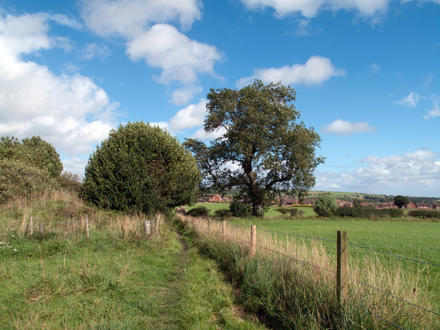
Billy Row is a small village located in the county of Durham, in the northeast of England. Situated approximately 2 miles southeast of the town of Crook, it is part of the civil parish of Willington. Billy Row is surrounded by scenic countryside and benefits from a rural setting.

The village has a rich history that can be traced back to the early 19th century when it was primarily an agricultural community. Over time, the area experienced growth and development with the establishment of coal mines, which became a significant industry in the region. Billy Row, like many other villages in the area, owes its existence to the mining industry.

Today, Billy Row is a quiet residential area with a close-knit community. The village features a range of housing, including traditional terraced houses, semi-detached properties, and some modern developments. Amenities within the village are limited, but nearby Crook offers a wider range of shops, schools, and other services.

The village is well-connected by public transport, with regular bus services connecting Billy Row to surrounding towns and villages. The A689 road runs close by, providing convenient access to larger urban areas such as Durham City, which is approximately 10 miles away.

With its picturesque surroundings and proximity to both rural landscapes and urban centers, Billy Row offers residents a peaceful and idyllic place to call home.

If you have any feedback on the listing, please let us know in the comments section below.

Billy Row Images

Images are sourced within 2km of 54.730259/-1.748403 or Grid Reference NZ1637. Thanks to Geograph Open Source API. All images are credited.

Terraced housing beyond hedge This is East Terrace in Roddymoor, close to Crook. The hedge and others near to it had been badly treated - 'trimmed' by flailing!
Terraced housing beyond hedge
This is East Terrace in Roddymoor, close to Crook. The hedge and others near to it had been badly treated - 'trimmed' by flailing!
Trees along the skyline The trees at the top of a rising slope are close to Grange Farm and south-east of Sunniside. The nature of the concrete feature is unknown, most likely it has to do with a water supply or drainage.
Trees along the skyline
The trees at the top of a rising slope are close to Grange Farm and south-east of Sunniside. The nature of the concrete feature is unknown, most likely it has to do with a water supply or drainage.
The Green at Billy Row Billy Row is a village to the north of the small town of Crook in County Durham. Its green is in two parts; the view here is towards the eastern part.
The Green at Billy Row
Billy Row is a village to the north of the small town of Crook in County Durham. Its green is in two parts; the view here is towards the eastern part.
Houses south of Billy Row An isolated pair of houses seen across a field from the road to Roddymoor.
Houses south of Billy Row
An isolated pair of houses seen across a field from the road to Roddymoor.
Footpath between fields west of Crook Footpaths converge from three directions and meet at this location south of West Roddymoor; housing at the west side of the small town of Crook can be seen beyond the fields.
Footpath between fields west of Crook
Footpaths converge from three directions and meet at this location south of West Roddymoor; housing at the west side of the small town of Crook can be seen beyond the fields.
Fields north from West Roddymoor West Roddymoor is a collection of houses at a junction of minor roads north-west of Crook; the view here is from the junction to the north where in the centre of the image lies the grey, exposed earth of an opencast coal mining operation.
Fields north from West Roddymoor
West Roddymoor is a collection of houses at a junction of minor roads north-west of Crook; the view here is from the junction to the north where in the centre of the image lies the grey, exposed earth of an opencast coal mining operation.
Stockley Lane at Tanner's Hall Farm
North Lane
North Lane
North Lane at St Thomas Church
The Church of St Thomas, Stanley Crook
The Church of St Thomas, Stanley Crook, Doorway
The Church of St Thomas, Stanley Crook, Interior Taken through a window
The Church of St Thomas, Stanley Crook, Interior
Taken through a window
The Church of St Thomas, Stanley Crook, Graveyard
Wolsingham Road
Wolsingham Road
Wolsingham Road
Wolsingham Road
Wolsingham Road
Wolsingham Road
The Church of St Thomas, Stanley Crook, Graveyard Of the churches I visited in the area there seemed to be proliferation in this graveyard of head stone made of ceramics. The dates seemed to span a period of twenty years at the beginning of the 20th century, most unusual?
The Church of St Thomas, Stanley Crook, Graveyard
Of the churches I visited in the area there seemed to be proliferation in this graveyard of head stone made of ceramics. The dates seemed to span a period of twenty years at the beginning of the 20th century, most unusual?
Show me another place!

Billy Row is located at Grid Ref: NZ1637 (Lat: 54.730259, Lng: -1.748403)

Unitary Authority: County Durham

Police Authority: Durham

What 3 Words

///torso.pack.overheard. Near Crook, Co. Durham

Nearby Locations

Stanley Crook Billy Row

Related Wikis

Billy Row

Billy Row is a village in County Durham, England. It is situated a short distance to the north of Crook. According to the 2001 census Billy Row has a population...

Roddymoor

Roddymoor is a village in County Durham, in England. In the 2001 census Roddymoor had a population of 500. == Location == It is situated to the north of...

Stanley Crook

Stanley Crook is a village in County Durham, in England. It is situated to the north of Crook and Billy Row. The area is rural, surrounded by open farm...

Crook railway station

Crook railway station served the town of Crook, County Durham, England. It was located on the Bishop Auckland and Weardale Railway line from Bishop Auckland...

Related Videos

The British Reunion: August 2022 #2

Sights and sounds from me and @thesundoesrise's trip to my home country, the United Kingdom, 14-26 August 2022. --- Part 2/8: ...

White View Lodge

A new walk through of White View Lodge with new hot tub and gazebo's. Please visit us at www.whiteviewlodge.co.uk or look for ...

Deerness Valley Way, Near Crook

I needed a test to optimise some gear for a big project I have coming up, and I want everything to be able to shoot at 24 frames per ...

Some of The Mandalorian collection

This is about stock, icon lights and The Mandalorian collection.

Nearby Amenities

Located within 500m of 54.730259,-1.748403
Billy Row
Place: village
Source: NPE
Wikidata: Q4913264
Wikipedia: en:Billy Row
Lat/Long: 54.7311444/-1.7508419
Post Box
Ele: 246.94
Lat/Long: 54.733984/-1.7482841
Bus Stop
Roddymoor Road End
Bench: no
Naptan AtcoCode: 13004326D
Naptan Bearing: SE
Naptan CommonName: Roddymoor Road End
Naptan Indicator: south east bound
Naptan Landmark: opposite Ambulance Station
Naptan NaptanCode: durdadgt
Naptan Street: B6298
Naptan Verified: no
Shelter: no
Source: naptan_import
Tactile Paving: no
Lat/Long: 54.7279158/-1.7519436
Bus Stop
Roddymoor Road End
Naptan AtcoCode: 13004326H
Naptan Bearing: NW
Naptan CommonName: Roddymoor Road End
Naptan Indicator: north west bound
Naptan Landmark: Outside Ambulance Station
Naptan NaptanCode: durdadgw
Naptan Street: B6298
Naptan Verified: no
Shelter: yes
Source: naptan_import
Tactile Paving: no
Lat/Long: 54.7277809/-1.7518979
Bus Stop
War Memorial
Bench: no
Bin: no
Lit: yes
Naptan AtcoCode: 13004329B
Naptan Bearing: NE
Naptan CommonName: War Memorial
Naptan Indicator: north east bound
Naptan Landmark: On boundary of 13-14 Albert Ter
Naptan NaptanCode: durdadjp
Naptan Street: B6298 Albert Terrace
Naptan Verified: no
Shelter: no
Source: naptan_import
Tactile Paving: no
Lat/Long: 54.7306025/-1.7517564
Bus Stop
War Memorial
Lit: yes
Naptan AtcoCode: 13004329F
Naptan Bearing: SW
Naptan CommonName: War Memorial
Naptan Indicator: south west bound
Naptan Landmark: opposite boundary of 3-4 Albert Ter
Naptan NaptanCode: durdadjt
Naptan Street: B6298 Albert Terrace
Naptan Verified: no
Shelter: yes
Source: naptan_import
Tactile Paving: no
Lat/Long: 54.7301491/-1.7519556
Bus Stop
Royal George
Bench: no
Bin: no
Lit: yes
Naptan AtcoCode: 13004330A
Naptan Bearing: N
Naptan CommonName: Royal George
Naptan Indicator: north bound
Naptan Landmark: oppposite boundary of 40-41 West Ter
Naptan NaptanCode: durdadjw
Naptan Street: B6298 West Terrace
Naptan Verified: no
Shelter: no
Source: naptan_import
Tactile Paving: no
Lat/Long: 54.7327568/-1.7508943
Bus Stop
Royal George
Bench: no
Bin: no
Lit: yes
Naptan AtcoCode: 13004330E
Naptan Bearing: S
Naptan CommonName: Royal George
Naptan Indicator: south bound
Naptan Landmark: On boundary of 40-41 West Ter
Naptan NaptanCode: durdadma
Naptan Street: B6298 West Terrace
Naptan Verified: no
Shelter: no
Source: naptan_import
Tactile Paving: no
Lat/Long: 54.7324967/-1.7507509
Bus Stop
Working Mens Club
Naptan AtcoCode: 13004331C
Naptan Bearing: E
Naptan CommonName: Working Mens Club
Naptan Indicator: east bound
Naptan Landmark: South of War Memorial
Naptan NaptanCode: durdadmd
Naptan Street: B6298 Billy Hill
Naptan Verified: no
Shelter: no
Source: naptan_import
Tactile Paving: no
Lat/Long: 54.7344649/-1.7464991
Bus Stop
Working Mens Club
Naptan AtcoCode: 13004331F
Naptan Bearing: SW
Naptan CommonName: Working Mens Club
Naptan Indicator: south west bound
Naptan Landmark: opposite Billy Row WMC
Naptan NaptanCode: durdadmg
Naptan Street: B6298 Billy Hill
Naptan Verified: no
Shelter: no
Source: naptan_import
Tactile Paving: no
Lat/Long: 54.7342686/-1.7471526
Bus Stop
Co-operative Terrace
Naptan AtcoCode: 13004332D
Naptan Bearing: SE
Naptan CommonName: Co-operative Terrace
Naptan Indicator: south east bound
Naptan Landmark: Landmark not known
Naptan NaptanCode: durdadmj
Naptan Notes: Boundary of 38 and 39 Mount Pleasant- Stanley Crook
Naptan Street: B62999
Naptan Verified: yes
Shelter: no
Source: naptan_import; survey
Lat/Long: 54.7336858/-1.7435066
Bus Stop
Co-operative Terrace
Bench: no
Bin: no
Lit: yes
Naptan AtcoCode: 13004332H
Naptan Bearing: NW
Naptan CommonName: Co-operative Terrace
Naptan Indicator: north west bound
Naptan Landmark: Landmark not known
Naptan NaptanCode: durdadmp
Naptan Notes: Post Office- 13 Cooperative Terrace- Stanley Crook
Naptan Street: B62999
Naptan Verified: no
Shelter: no
Source: naptan_import
Lat/Long: 54.7339124/-1.7444215
Post Box
Ref: DL15 107
Lat/Long: 54.7338716/-1.7443444
Post Office
Billy Row Post Office
Addr City: Crook
Addr Postcode: DL15 9SU
Addr Suburb: Billy Row
Branch: Billy Row
Brand: Post Office
Brand Wikidata: Q1783168
Check Date: 2020-02-20
Ref Pol Id: 11803
Website: https://www.postoffice.co.uk/branch-finder/2943093/billy-row
Lat/Long: 54.7300672/-1.7523731
Billy Row War Memorial
Historic: memorial
Memorial: war_memorial
Wikidata: Q26568506
Wikimedia Commons: File:Billy Row War Memorial - geograph.org.uk - 1327104.jpg
Lat/Long: 54.7301273/-1.7518029
Generator Source: wind
Power: generator
Source: survey
Lat/Long: 54.7277505/-1.7448247
Pub
The Green
Addr City: Crook
Addr Housenumber: 7
Addr Postcode: DL15 9TA
Addr Street: Billy Row Green
Addr Suburb: Billy Row
Fhrs Id: 304511
Opening Hours: Tu-Fr 17:00-23:30; Sa,Su 12:00-24:00
Phone: +44 1388 766339
Wheelchair: limited
Lat/Long: 54.7302685/-1.7513573
Power: pole
Lat/Long: 54.7342608/-1.7502433
Power: pole
Lat/Long: 54.7340641/-1.7510989
Power: pole
Lat/Long: 54.7337621/-1.7521986
Power: pole
Lat/Long: 54.73344/-1.7533413
Crossing
Crossing: unmarked
Crossing Island: yes
Lat/Long: 54.733882/-1.7441035
Pub
Billy Row Club
Addr City: Crook
Addr Housenumber: 13
Addr Postcode: DL15 9SW
Addr Street: Billy Hill
Addr Suburb: Billy Row
Fhrs Id: 665848
Lat/Long: 54.7344593/-1.7471733
Post Box
Lat/Long: 54.7300072/-1.7519643
Power: pole
Lat/Long: 54.7264356/-1.7486058
Power: pole
Lat/Long: 54.7263202/-1.7473264
Power: pole
Lat/Long: 54.7262009/-1.7458673
Power: pole
Lat/Long: 54.727423/-1.74254
Power: pole
Lat/Long: 54.7278923/-1.7418775
Power: pole
Lat/Long: 54.7340664/-1.7476362
Power: pole
Lat/Long: 54.73368/-1.7468423
Power: pole
Lat/Long: 54.7331543/-1.7457238
Power: pole
Lat/Long: 54.7326873/-1.7447287
Power: pole
Lat/Long: 54.7322219/-1.7437792
Power: pole
Lat/Long: 54.7317837/-1.7424408
Power: pole
Lat/Long: 54.7313438/-1.7411506
Power: pole
Lat/Long: 54.7341456/-1.7507445
Power: pole
Lat/Long: 54.7339805/-1.7511579
Power: pole
Lat/Long: 54.7334415/-1.7513417
Power: pole
Lat/Long: 54.7328801/-1.7515348
Give Way
Direction: forward
Lat/Long: 54.7343978/-1.7455145
Social Facility
West Lodge Care Home
Addr City: Crook
Addr Postcode: DL15 9SY
Addr Suburb: Billy Row
Fhrs Id: 301823
Website: https://www.westlodgecarehome.co.uk/
Lat/Long: 54.7290967/-1.7515984
The data included in this document is from www.openstreetmap.org. The data is made available under ODbL.

Have you been to Billy Row?

Leave your review of Billy Row below (or comments, questions and feedback).