Castell-paen

Settlement in Radnorshire

Wales

Castell-paen

The Roast Ox Inn The Roast Ox Inn Painscastle with the B4594 passing by
The Roast Ox Inn Credit: Shaun Ferguson

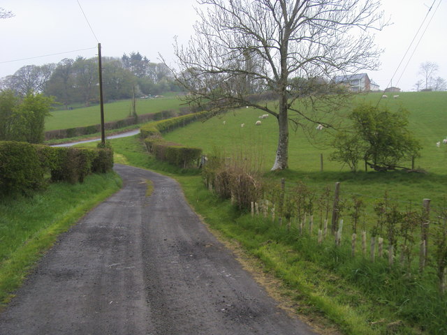
Castell-paen is a small village located in the historic county of Radnorshire, Wales. Situated on the banks of the River Wye, it is nestled within the breathtaking landscape of the Wye Valley, known for its natural beauty and rich history.

The village takes its name from the imposing Castell-paen Castle, a medieval fortress that once stood on a nearby hilltop. Although the castle is now in ruins, its remnants still evoke a sense of grandeur and provide visitors with a glimpse into its past. The castle played a significant role in the defense of the region during the medieval period.

Today, Castell-paen is a tranquil and picturesque village, attracting visitors who seek to explore the surrounding countryside. The village is surrounded by rolling hills, lush woodlands, and meandering rivers, making it an ideal destination for outdoor enthusiasts and nature lovers. The area offers numerous walking and hiking trails, allowing visitors to immerse themselves in the stunning scenery.

In addition to its natural beauty, Castell-paen is also home to a close-knit community. The village features a charming church, quaint cottages, and a small local pub where residents and visitors can gather and socialize.

With its rich history, stunning landscape, and welcoming community, Castell-paen offers a peaceful retreat for those seeking to escape the hustle and bustle of modern life and immerse themselves in the beauty of rural Wales.

If you have any feedback on the listing, please let us know in the comments section below.

Castell-paen Images

Images are sourced within 2km of 52.108591/-3.221417 or Grid Reference SO1646. Thanks to Geograph Open Source API. All images are credited.

The Roast Ox Inn The Roast Ox Inn Painscastle with the B4594 passing by
The Roast Ox Inn
The Roast Ox Inn Painscastle with the B4594 passing by
Path coming out on to the moorland From Painscastle the path coming out on to the moorland
Path coming out on to the moorland
From Painscastle the path coming out on to the moorland
Drive coming out on the road below Painscastle From Tre-wyrlod the path and drive coming out on the road below Painscastle
Drive coming out on the road below Painscastle
From Tre-wyrlod the path and drive coming out on the road below Painscastle
Ford going through Bachaway Ford going through Bachaway to Tre-wyrlod
Ford going through Bachaway
Ford going through Bachaway to Tre-wyrlod
Forking lanes Left goes up a steep hill to Llaneast Farm, right is a private track to Trowley House.
Forking lanes
Left goes up a steep hill to Llaneast Farm, right is a private track to Trowley House.
Fronhowey A farm to the north of the B4594, west of Painscastle.
Fronhowey
A farm to the north of the B4594, west of Painscastle.
B4594 looking east Towards Painscastle by the entrance to Fronhowey.
B4594 looking east
Towards Painscastle by the entrance to Fronhowey.
Trees by the Bachawy The motte of Painscastle can be seen beyond.
Trees by the Bachawy
The motte of Painscastle can be seen beyond.
The Bachawy valley floor Surrounded by the rounded South Radnorshire hills.
The Bachawy valley floor
Surrounded by the rounded South Radnorshire hills.
Lane to Pentre and Cwm A long dead-end lane taking me west into two more gridsquares.
Lane to Pentre and Cwm
A long dead-end lane taking me west into two more gridsquares.
The Bachawy valley North of Middle Pentre, looking towards the Llanbedr ridge in the distance.
The Bachawy valley
North of Middle Pentre, looking towards the Llanbedr ridge in the distance.
Middle Pentre Quite a community!
Middle Pentre
Quite a community!
Farmland east of Cwm On the northern edge of the Begwm ridge, to the left.
Farmland east of Cwm
On the northern edge of the Begwm ridge, to the left.
Sheep country A rounded grassy hill west of Upper Pentre, with plenty of sheep!
Sheep country
A rounded grassy hill west of Upper Pentre, with plenty of sheep!
View above Upper Pentre The Bachawy valley looking north-east towards Painscastle.
View above Upper Pentre
The Bachawy valley looking north-east towards Painscastle.
Tynewydd Farm buildings by the road over the Begwns between Painscastle and Clyro.
Tynewydd
Farm buildings by the road over the Begwns between Painscastle and Clyro.
Minor road to Plaswarren Ascending the ridge to the east of Tynewydd.
Minor road to Plaswarren
Ascending the ridge to the east of Tynewydd.
Haylage bales By the drive to The Glyn on the western edge of the Clyro Hill plateau.
Haylage bales
By the drive to The Glyn on the western edge of the Clyro Hill plateau.
Show me another place!

Castell-paen is located at Grid Ref: SO1646 (Lat: 52.108591, Lng: -3.221417)

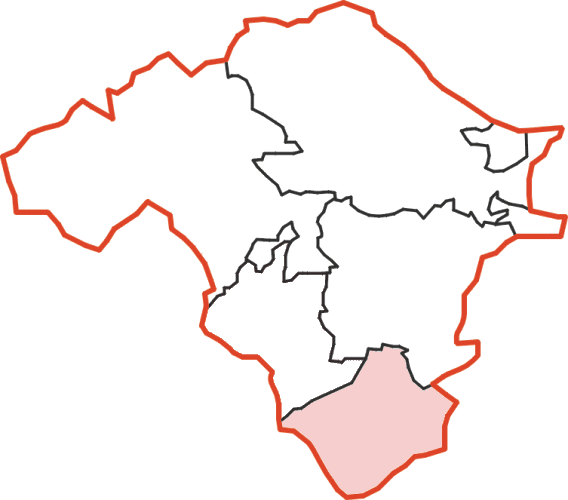
Unitary Authority: Powys

Police Authority: Dyfed Powys

Also known as: Painscastle

What 3 Words

///ironic.debut.stretch. Near Hay, Powys

Related Wikis

Painscastle Rural District

Painscastle was, from 1894 to 1974, a rural district in the administrative county of Radnorshire, Wales. The district was formed by the Local Government...

Painscastle

Painscastle (Welsh: Castell-paen) is a village and community in Powys (formerly Radnorshire), Wales which takes its name from the castle at its heart....

Painscastle Castle

Painscastle Castle is a castle in the village of Painscastle in Powys, Wales. It lies between Builth and Hay-on-Wye, approximately 3 miles from the Wales...

Rhos Goch National Nature Reserve

Rhos Goch National Nature Reserve, located near Painscastle on the England/Wales border, is one of the largest raised bogs in mid and south Wales. ‘Goch...

Nearby Amenities

Located within 500m of 52.108591,-3.221417
Painscastle
Name Cy: Castell-paen
Place: village
Source: npe
Lat/Long: 52.1089269/-3.2178204
Bus Stop
Lat/Long: 52.1087209/-3.2177159
Post Box
Operator: Royal Mail
Post Box Type: wall
Ref: LD2 112D
Royal Cypher: VR
Lat/Long: 52.1084888/-3.2173394
Direction: 170
Generator Method: photovoltaic
Generator Output Electricity: yes
Generator Solar Modules: 22
Generator Source: solar
Generator Type: solar_photovoltaic_panel
Location: roof
Power: generator
Lat/Long: 52.1088626/-3.2206383
Direction: S
Generator Method: photovoltaic
Generator Output Electricity: yes
Generator Solar Modules: 16
Generator Source: solar
Generator Type: solar_photovoltaic_panel
Location: roof
Power: generator
Lat/Long: 52.1070686/-3.216497
The data included in this document is from www.openstreetmap.org. The data is made available under ODbL.

Have you been to Castell-paen?

Leave your review of Castell-paen below (or comments, questions and feedback).