Over End

Settlement in Huntingdonshire Huntingdonshire

England

Over End

Keepers Cottage, Oundle Road, Elton
Keepers Cottage, Oundle Road, Elton Credit: Mark Anderson

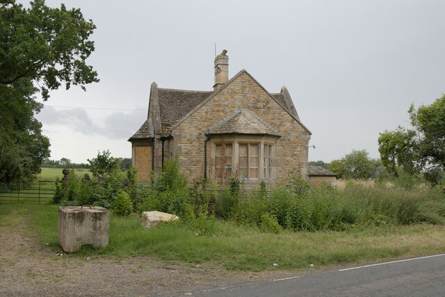
Over End is a small village located in Huntingdonshire, a historic county in the eastern region of England. Situated near the town of Huntingdon, Over End is surrounded by picturesque countryside and offers a tranquil setting for its residents. The village is primarily residential, with a population of around 300 people.

The architecture in Over End is a mix of traditional and modern styles, with charming cottages and newer, more contemporary houses dotting the landscape. The village is known for its well-maintained gardens and green spaces, which contribute to its overall aesthetic appeal.

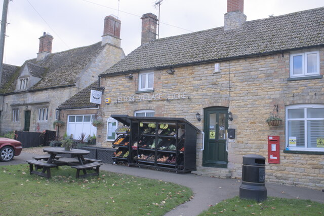
Despite its small size, Over End boasts a strong sense of community. Residents often come together for various events and activities, fostering a friendly and welcoming atmosphere. The village has a local pub, which serves as a popular meeting place for both locals and visitors.

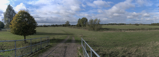
Surrounding Over End are vast expanses of farmland, providing residents with beautiful countryside views and opportunities for outdoor activities such as walking, cycling, and horse riding. The village's location also offers easy access to nearby towns and cities, with the bustling town of Huntingdon just a short drive away.

Overall, Over End provides a peaceful and idyllic setting for those seeking a quiet rural lifestyle within close proximity to amenities and transport links.

If you have any feedback on the listing, please let us know in the comments section below.
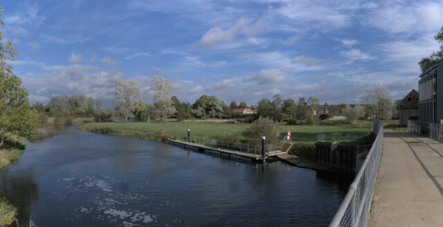
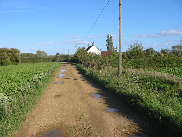
Over End Images

Images are sourced within 2km of 52.528444/-0.394662 or Grid Reference TL0993. Thanks to Geograph Open Source API. All images are credited.

Keepers Cottage, Oundle Road, Elton
The village shop
The village shop
Hand Sanitiser On the windowsill at <a href="https://www.geograph.org.uk/photo/6997860">TL0893 : The village shop</a>, part of the Covid-19 precautions.
Hand Sanitiser
On the windowsill at TL0893 : The village shop, part of the Covid-19 precautions.
Wallbox The postbox at <a href="https://www.geograph.org.uk/photo/6997860">TL0893 : The village shop</a> is one of the COvid-19 priority boxes used for returning postal PCR tests
Wallbox
The postbox at TL0893 : The village shop is one of the COvid-19 priority boxes used for returning postal PCR tests
Change of schedule Notice pasted on <a href="https://www.geograph.org.uk/photo/6998016">TL0893 : Wallbox</a>.
Change of schedule
Notice pasted on TL0893 : Wallbox.
The Nene Valley View from the bridge at Elton Lock.
The Nene Valley
View from the bridge at Elton Lock.
The river Nene Well, most of it.  There are three parallel paths here, because of the former mill and the lock.  This is the main flow, under the lock bridge.  There is a mill leat away to the right, and a relief channel away to the left.  I am standing on the bridge over the lock.
The river Nene
Well, most of it. There are three parallel paths here, because of the former mill and the lock. This is the main flow, under the lock bridge. There is a mill leat away to the right, and a relief channel away to the left. I am standing on the bridge over the lock.
Sluice and Weir The water level for the lock, and the now defunct mill, are controlled by this sluice and weir.  There is a tilting sluice gate straight ahead, and a spillway weir on the right to deal with heavier flows.
Sluice and Weir
The water level for the lock, and the now defunct mill, are controlled by this sluice and weir. There is a tilting sluice gate straight ahead, and a spillway weir on the right to deal with heavier flows.
Automatic weir This is the fully automatic tilting sluice gate seen in <a href="https://www.geograph.org.uk/photo/6998109">TL0893 : Sluice and Weir</a>.
Automatic weir
This is the fully automatic tilting sluice gate seen in TL0893 : Sluice and Weir.
Spillway This is the relief weir, a passive spillway, seen in <a href="https://www.geograph.org.uk/photo/6998109">TL0893 : Sluice and Weir</a>
Spillway
This is the relief weir, a passive spillway, seen in TL0893 : Sluice and Weir
Passive weir In the middle of <a href="https://www.geograph.org.uk/photo/6998119">TL0893 : Spillway</a> is this passive weir, which can be closed with boards in the grooves, but is currently running.
Passive weir
In the middle of TL0893 : Spillway is this passive weir, which can be closed with boards in the grooves, but is currently running.
Sluice gate This is the weir gate seen in <a href="https://www.geograph.org.uk/photo/6998109">TL0893 : Sluice and Weir</a>.  You can clearly see the segment wheels on either side which rotate to alter the angle of the gate, and hence its effective height.  Gear teeth cut into the outer rim of the segment plates make it easy to rotate.
Sluice gate
This is the weir gate seen in TL0893 : Sluice and Weir. You can clearly see the segment wheels on either side which rotate to alter the angle of the gate, and hence its effective height. Gear teeth cut into the outer rim of the segment plates make it easy to rotate.
Elton Hall The garden facade of this complex hall
Elton Hall
The garden facade of this complex hall
Stable Block Arch The entrance tower on the Elton Hall estate
Stable Block Arch
The entrance tower on the Elton Hall estate
Cottages near Fotheringhay Lodge These cottages stand on the track leading to Fotheringhay Lodge.  Just beyond the cottages once stood a railway station on the line between Peterborough and Oundle.  As was often the case the station was a long way from the nearest villages; no trace of it remains.
Cottages near Fotheringhay Lodge
These cottages stand on the track leading to Fotheringhay Lodge. Just beyond the cottages once stood a railway station on the line between Peterborough and Oundle. As was often the case the station was a long way from the nearest villages; no trace of it remains.
River Nene near Elton
Open Farmland near Sibson Aerodrome
Elton Hall near Peterborough
Show me another place!

Over End is located at Grid Ref: TL0993 (Lat: 52.528444, Lng: -0.394662)

Administrative County: Cambridgeshire

District: Huntingdonshire

Police Authority: Cambridgeshire

What 3 Words

///simulates.bank.steaming. Near Wansford, Cambridgeshire

Nearby Locations

End, Over Over End

Related Wikis

Elton, Cambridgeshire

Elton is a village and civil parish in Cambridgeshire, England. Elton lies approximately 7 miles (11 km) south-west of Peterborough. Elton is situated...
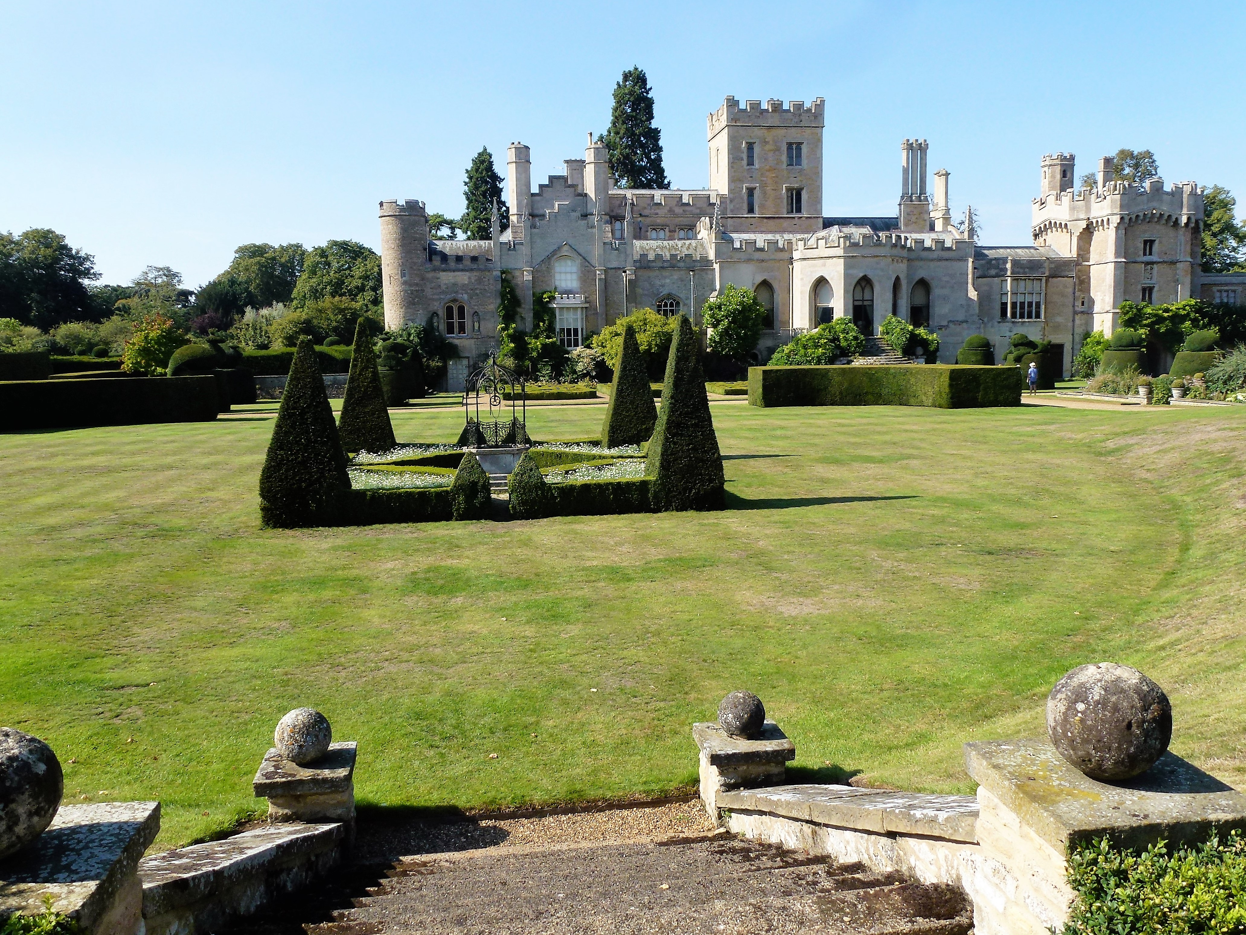
Elton Hall

Elton Hall is a baronial hall in Elton, Cambridgeshire. It has been the ancestral home of the Proby family (sometime known as the Earls of Carysfort)...

Elton railway station

Elton railway station is a former railway station in Elton, Cambridgeshire on former Northampton and Peterborough Railway which connected Peterborough...

RAF Sibson

Royal Air Force Sibson or more simply RAF Sibson is a former Royal Air Force satellite station located in Sibson, Cambridgeshire, England, west of Peterborough...

Nearby Amenities

Located within 500m of 52.528444,-0.394662
Bus Stop
Middle Street
Bus: yes
Naptan AtcoCode: 0500HELTO001
Naptan Bearing: N
Naptan CommonName: Middle Street
Naptan Indicator: near
Naptan Landmark: Middle Street
Naptan NaptanCode: cmbdmwmw
Naptan ShortCommonName: Middle Street
Naptan Street: Over End
Naptan Verified: no
Network: stagecoach
Operator: Stagecoach
Public Transport: platform
Shelter: yes
Source: naptan_import
Lat/Long: 52.5306887/-0.3954408
Bus Stop
St Botolph Green
Bus: yes
Naptan AtcoCode: 0500HELTO002
Naptan Bearing: S
Naptan CommonName: St Botolph Green
Naptan Indicator: near
Naptan Landmark: St Botolph Green
Naptan NaptanCode: cmbdmwpa
Naptan ShortCommonName: St Botolph Green
Naptan Street: Over End
Naptan Verified: no
Network: stagecoach
Operator: Stagecoach
Public Transport: platform
Source: naptan_import
Lat/Long: 52.5252893/-0.3944288
Bus Stop
Black Horse PH
Bus: yes
Naptan AtcoCode: 0500HELTO003
Naptan Bearing: N
Naptan BusStopType: CUS
Naptan CommonName: Black Horse PH
Naptan Indicator: o/s
Naptan Landmark: Black Horse PH
Naptan NaptanCode: cmbdmwpd
Naptan ShortCommonName: Black Horse PH
Naptan Street: Overend
Naptan Verified: no
Network: stagecoach
Operator: Stagecoach
Public Transport: platform
Source: naptan_import
Lat/Long: 52.52822/-0.3957224
Bus Stop
Hayes Walk
Bus: yes
Naptan AtcoCode: 0500HELTO004
Naptan Bearing: W
Naptan BusStopType: CUS
Naptan CommonName: Hayes Walk
Naptan Indicator: opp
Naptan Landmark: Hayes Walk
Naptan NaptanCode: cmbdmwpg
Naptan ShortCommonName: Hayes Walk
Naptan Street: Highgate Green
Naptan Verified: no
Public Transport: platform
Source: naptan_import
Lat/Long: 52.5318931/-0.3967385
Bus Stop
St Botolph Green
Bus: yes
Naptan AtcoCode: 0500HELTO005
Naptan Bearing: N
Naptan CommonName: St Botolph Green
Naptan Indicator: opp
Naptan Landmark: St Botolph Green
Naptan NaptanCode: cmbdmwpj
Naptan ShortCommonName: St Botolph Green
Naptan Street: Over End
Naptan Verified: no
Network: stagecoach
Operator: Stagecoach
Public Transport: platform
Source: naptan_import
Lat/Long: 52.5249471/-0.3943823
Bus Stop
Middle Street
Bus: yes
Naptan AtcoCode: 0500HELTO006
Naptan Bearing: S
Naptan CommonName: Middle Street
Naptan Indicator: opp
Naptan Landmark: Garage
Naptan NaptanCode: cmbdmwpm
Naptan ShortCommonName: Middle Street
Naptan Street: Over End
Naptan Verified: no
Public Transport: platform
Shelter: yes
Source: naptan_import
Lat/Long: 52.5299951/-0.3953481
Bus Stop
Hayes Walk
Bus: yes
Naptan AtcoCode: 0500HELTO007
Naptan Bearing: E
Naptan CommonName: Hayes Walk
Naptan Indicator: near
Naptan Landmark: Hayes Walk
Naptan NaptanCode: cmbdmwpt
Naptan ShortCommonName: Hayes Walk
Naptan Street: Highgate Green
Naptan Verified: no
Public Transport: platform
Source: naptan_import
Lat/Long: 52.5319644/-0.3966917
Bus Stop
Black Horse PH
Bus: yes
Naptan AtcoCode: 0500HELTO010
Naptan Bearing: S
Naptan BusStopType: CUS
Naptan CommonName: Black Horse PH
Naptan Indicator: opp
Naptan Landmark: Black Horse PH
Naptan NaptanCode: cmbgdtmd
Naptan ShortCommonName: Black Horse PH
Naptan Street: Overend
Naptan Verified: no
Network: stagecoach
Operator: Stagecoach
Public Transport: platform
Source: naptan_import
Lat/Long: 52.5281008/-0.3955499
Bus Stop
Highgate Green
Bus: yes
Naptan AtcoCode: 0500HELTO013
Naptan Bearing: N
Naptan BusStopType: CUS
Naptan CommonName: Highgate Green
Naptan Crossing: Highgate Green
Naptan Indicator: near
Naptan Landmark: Highgate Green
Naptan NaptanCode: cmbgjpgm
Naptan ShortCommonName: Highgate Green
Naptan Street: Wansford Road
Naptan Verified: no
Public Transport: platform
Source: naptan_import
Lat/Long: 52.5321955/-0.3951647
Bus Stop
Highgate Green
Bus: yes
Naptan AtcoCode: 0500HELTO014
Naptan Bearing: S
Naptan BusStopType: CUS
Naptan CommonName: Highgate Green
Naptan Crossing: Highgate Green
Naptan Indicator: opp
Naptan Landmark: Highgate Green
Naptan NaptanCode: cmbgjpgp
Naptan ShortCommonName: Highgate Green
Naptan Street: Wansford Road
Naptan Verified: no
Public Transport: platform
Source: naptan_import
Lat/Long: 52.5322835/-0.3950288
Post Box
Operator: Royal Mail
Post Box Type: lamp
Ref: PE8 192
Source: GPS waypoint
Lat/Long: 52.5252187/-0.3942634
Elton Parish Cricket Club
Leisure: pitch
Source: GPS waypoint
Sport: cricket
Lat/Long: 52.5260319/-0.3958173
Defibrillator
Booth: K6
Covered: booth
Defibrillator Location: inside old red telephone box, Elton
Disused Amenity: telephone
Emergency: defibrillator
Indoor: no
Listed Status: Grade II
Man Made: telephone_box
Ref: CHT-13-822
Source: GPS waypoint
Lat/Long: 52.5309194/-0.3967429
Elton Village Store
Addr Housenumber: 7
Addr Street: Middle Street
Shop: convenience
Source: GPS waypoint
Lat/Long: 52.531205/-0.3984755
Post Box
Brand: Royal Mail
Brand Wikidata: Q638098
Operator: Royal Mail
Operator Wikidata: Q638098
Post Box Type: wall
Ref: PE8 107
Royal Cypher: GR
Royal Cypher Wikidata: Q33102273
Source: GPS waypoint
Lat/Long: 52.5312301/-0.398472
Pub
Black Horse Inn
Email: blackhorseelton@gmail.com
Microbrewery: yes
Phone: +44 1832280240
Lat/Long: 52.5282806/-0.3957706
Power: pole
Lat/Long: 52.5318141/-0.3947167
Power: pole
Lat/Long: 52.5326055/-0.3946657
St Botolph Green
Bus: yes
Network: stagecoach
Operator: Stagecoach
Public Transport: stop_position
Lat/Long: 52.5252574/-0.3945273
St Botolph Green
Bus: yes
Network: stagecoach
Operator: Stagecoach
Public Transport: stop_position
Lat/Long: 52.5249627/-0.3942959
Middle Street
Bus: yes
Network: stagecoach
Operator: Stagecoach
Public Transport: stop_position
Lat/Long: 52.5306785/-0.3953201
Black Horse PH
Bus: yes
Network: stagecoach
Operator: Stagecoach
Public Transport: stop_position
Lat/Long: 52.5280975/-0.3956257
Black Horse PH
Bus: yes
Network: stagecoach
Operator: Stagecoach
Public Transport: stop_position
Lat/Long: 52.5282235/-0.3956405
Waste Basket
Lat/Long: 52.5306547/-0.3954542
Inscription: Best Kept Village 1994
Man Made: village_sign
Note: Wood post with stone base, seems like a picture sign is missing.
Lat/Long: 52.5308717/-0.3954783
Grit Bin
Lat/Long: 52.5309178/-0.39669
Waste Basket
Lat/Long: 52.5309276/-0.3970957
Elton Parish Council
Board Type: notice
Information: board
Tourism: information
Lat/Long: 52.5312095/-0.3983858
Leisure: picnic_table
Lat/Long: 52.5312527/-0.398357
Waste Basket
Lat/Long: 52.5312743/-0.3984589
Leisure: picnic_table
Lat/Long: 52.5312804/-0.3984898
Leisure: picnic_table
Lat/Long: 52.5312874/-0.3985347
Addr Housenumber: 30
Addr Street: Overend
Survey Date: 2022-01-30
Lat/Long: 52.5268146/-0.3957202
Addr Housenumber: 28
Addr Street: Overend
Survey Date: 2022-01-30
Lat/Long: 52.5270467/-0.3957847
Addr Housenumber: 26
Addr Street: Overend
Survey Date: 2022-01-30
Lat/Long: 52.527163/-0.3958185
Addr Housenumber: 24
Addr Street: Overend
Survey Date: 2022-01-30
Lat/Long: 52.5275472/-0.3956935
Addr Housenumber: 16
Addr Street: Overend
Survey Date: 2022-01-30
Lat/Long: 52.5279057/-0.3957869
Addr Housenumber: 12
Addr Street: Overend
Survey Date: 2022-01-30
Lat/Long: 52.5295414/-0.3957223
Addr Housenumber: 6
Addr Street: Overend
Survey Date: 2022-01-30
Lat/Long: 52.5298129/-0.3955954
Addr Housenumber: 6b
Addr Street: Overend
Survey Date: 2022-01-30
Lat/Long: 52.5299252/-0.3956092
Church View House
Addr Housenumber: 6a
Addr Street: Overend
Survey Date: 2022-01-30
Lat/Long: 52.5300664/-0.3955738
Addr Housenumber: 4
Addr Street: Overend
Survey Date: 2022-01-30
Lat/Long: 52.5305073/-0.3958805
Potters Cottage
Survey Date: 2022-01-30
Lat/Long: 52.5310228/-0.3975577
Potters Barn
Addr Housenumber: 3a
Addr Street: Middle Street
Survey Date: 2022-01-30
Lat/Long: 52.5310617/-0.3978803
Addr Housenumber: 9
Addr Street: Middle Street
Survey Date: 2022-01-30
Lat/Long: 52.5312925/-0.398841
Jelleys Yard
Survey Date: 2022-01-30
Lat/Long: 52.531138/-0.399016
Addr Housenumber: 11
Addr Street: Middle Street
Survey Date: 2022-01-30
Lat/Long: 52.5313664/-0.3992394
The Angel House
Addr Housenumber: 17
Addr Street: Middle Street
Survey Date: 2022-01-30
Lat/Long: 52.53141/-0.3994448
The data included in this document is from www.openstreetmap.org. The data is made available under ODbL.

Have you been to Over End?

Leave your review of Over End below (or comments, questions and feedback).