Osbournby

Settlement in Lincolnshire North Kesteven

England

Osbournby

Aswarby: aerial 2021 (1)
Aswarby: aerial 2021 (1) Credit: Chris

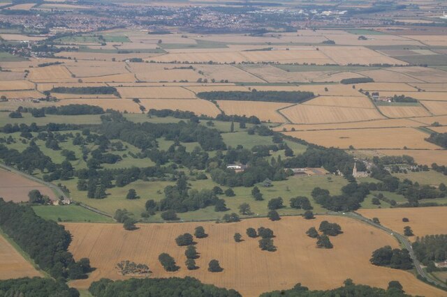
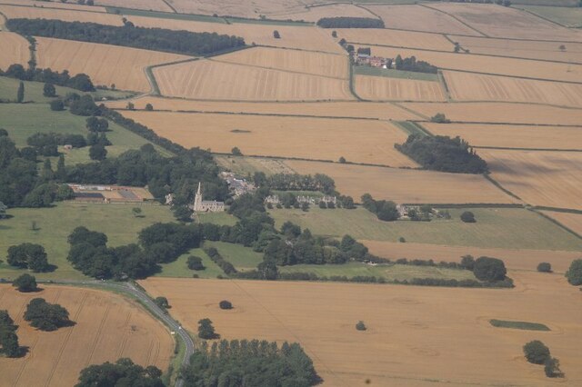
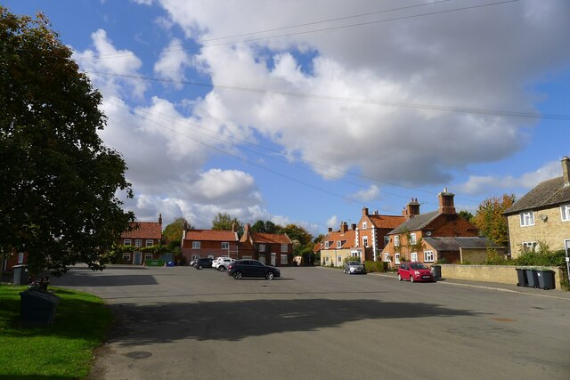
Osbournby is a small village located in the county of Lincolnshire in eastern England. Situated approximately 10 miles south of the town of Sleaford, it is surrounded by picturesque countryside and boasts a peaceful and rural atmosphere.

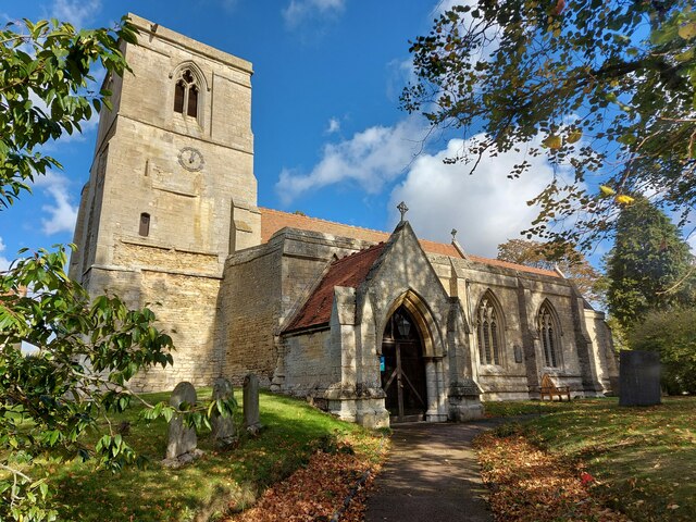
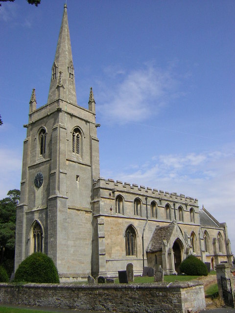
The village is home to a population of around 600 residents, who enjoy the tranquility and close-knit community that Osbournby offers. The architecture of the village reflects its long history, with many charming houses and buildings dating back several centuries. St. Peter and St. Paul's Church, a Grade I listed building, is a prominent feature in the village and showcases stunning medieval architecture.

Osbournby is well-served with local amenities, including a primary school, a village hall, and a pub, providing essential services and a focal point for social gatherings. The village also benefits from several footpaths and bridleways, allowing residents and visitors to explore the beautiful surrounding countryside.

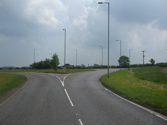
Despite its small size, Osbournby is strategically located, with excellent transport links. The A15 road runs close by, connecting the village to larger nearby towns and cities, making it easily accessible for commuters and visitors.

The village hosts a range of community events throughout the year, such as summer fairs and Christmas celebrations, fostering a strong sense of community spirit. Osbournby offers a tranquil and idyllic lifestyle for its residents, making it an attractive place to live for those seeking a peaceful retreat in the heart of the Lincolnshire countryside.

If you have any feedback on the listing, please let us know in the comments section below.
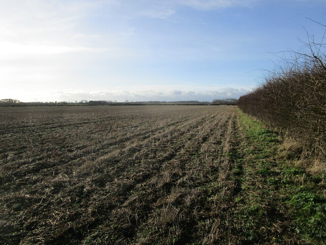
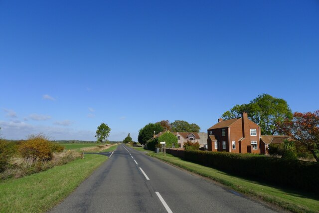
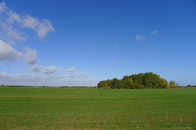
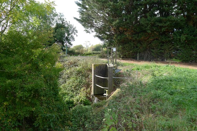
Osbournby Images

Images are sourced within 2km of 52.929663/-0.409343 or Grid Reference TF0738. Thanks to Geograph Open Source API. All images are credited.

Aswarby: aerial 2021 (1)
Aswarby: aerial 2021 (2)
Cropmarks east of Osbournby: aerial 2021 (1) South of The Drove.
Cropmarks east of Osbournby: aerial 2021 (1)
South of The Drove.
Cropmarks east of Osbournby: aerial 2021 (2) South of The Drove.
Cropmarks east of Osbournby: aerial 2021 (2)
South of The Drove.
Autumn sown crop near Aswarby
Stubble field off Mareham Lane
Field west of Spanby Flat Lincolnshire, with clayey soils developed over Jurassic mudstones.
Field west of Spanby
Flat Lincolnshire, with clayey soils developed over Jurassic mudstones.
Mareham Lane passing Brickmakers Farm and the junction with The Drove Formerly the Brickmakers Arms public house. Brick making was common on Lincolnshire's Jurassic clays.
Mareham Lane passing Brickmakers Farm and the junction with The Drove
Formerly the Brickmakers Arms public house. Brick making was common on Lincolnshire's Jurassic clays.
Pylons at power line junction <a href="https://www.geograph.org.uk/photo/405609">TL7511 : Power line junction</a> gives a description of a similar structure
Pylons at power line junction
TL7511 : Power line junction gives a description of a similar structure
Probable site of ancient settlement west of Mareham Lane On the west side of the Roman road, Mareham Lane, <span class="nowrap"><a title="https://heritage-explorer.lincolnshire.gov.uk/Monument/MLI60358" rel="nofollow ugc noopener" href="https://heritage-explorer.lincolnshire.gov.uk/Monument/MLI60358">Link</a><img style="margin-left:2px;" alt="External link" title="External link - shift click to open in new window" src="https://s1.geograph.org.uk/img/external.png" width="10" height="10"/></span> reports  "A large area of complex cropmarks, including enclosures, hut circles and boundary ditches, is visible on aerial photographs. These are likely to represent a late Iron Age and/or Romano-British settlement."
Probable site of ancient settlement west of Mareham Lane
On the west side of the Roman road, Mareham Lane, LinkExternal link reports "A large area of complex cropmarks, including enclosures, hut circles and boundary ditches, is visible on aerial photographs. These are likely to represent a late Iron Age and/or Romano-British settlement."
Sewage works outfall into South Beck, Osbournby
The A15 entering Osbournby The busy Peterborough to Lincoln route bisects the village
The A15 entering Osbournby
The busy Peterborough to Lincoln route bisects the village
Church of St Peter and St Paul, Osbournby Grade I listed

The Domesday Survey records a church on this site in 1086 in the possession of Gilbert of Ghent the wealthiest landowner on the county at that time.
The present church dates from the twelfth century onwards and consists of a western tower, nave with north and south aisles, chancel, and south porch.
The west end of the church is probably the oldest part dating from 12th or early 13th century with walls made of rubble which is 8ft thick in places. The South aisle once extended to embrace the tower but this section was demolished. Most of the church was constructed in 1320 with the nave, south aisle chancel and porch being rebuilt at this time.
The western tower is from the thirteenth century and is of three stages with a plain parapet. The belfry stage has fourteenth century windows.
The south porch, dating from the fourteenth century has arcading above the side benches with ogee headed panels.
The nave has four bay arcades with thirteenth century octagonal piers. At the east end of the south aisle there is a door which once led to the rood loft. Only the lower portion of the rood screen remains at Osbournby.
There is one modern stained-glass window to the north wall.
The chancel has a fine fourteenth century sedilia with ogee arched heads and Crocketts with human head stops. There is also a piscina and aumbry.

The nave has a number of good fourteenth century bench ends with various subjects including Adam and Eve, and St George and the Dragon.
There is a twelfth century tub font with intersecting blank arcading, presumably from an earlier church.
At the south west end of the nave there are commandment boards.
There is a small organ by Harston of Newark, circa 1890.
The church was restored in 1873 by Charles Kirk when the roof was replaced and the east window and pews were installed (cost £1,460).
In 1965 the tower was found to be dangerously cracked and bulging and had to be strengthened. The clock which was removed from the tower face dates from 1740 and now resides in the North Aisle.
Church of St Peter and St Paul, Osbournby
Grade I listed The Domesday Survey records a church on this site in 1086 in the possession of Gilbert of Ghent the wealthiest landowner on the county at that time. The present church dates from the twelfth century onwards and consists of a western tower, nave with north and south aisles, chancel, and south porch. The west end of the church is probably the oldest part dating from 12th or early 13th century with walls made of rubble which is 8ft thick in places. The South aisle once extended to embrace the tower but this section was demolished. Most of the church was constructed in 1320 with the nave, south aisle chancel and porch being rebuilt at this time. The western tower is from the thirteenth century and is of three stages with a plain parapet. The belfry stage has fourteenth century windows. The south porch, dating from the fourteenth century has arcading above the side benches with ogee headed panels. The nave has four bay arcades with thirteenth century octagonal piers. At the east end of the south aisle there is a door which once led to the rood loft. Only the lower portion of the rood screen remains at Osbournby. There is one modern stained-glass window to the north wall. The chancel has a fine fourteenth century sedilia with ogee arched heads and Crocketts with human head stops. There is also a piscina and aumbry. The nave has a number of good fourteenth century bench ends with various subjects including Adam and Eve, and St George and the Dragon. There is a twelfth century tub font with intersecting blank arcading, presumably from an earlier church. At the south west end of the nave there are commandment boards. There is a small organ by Harston of Newark, circa 1890. The church was restored in 1873 by Charles Kirk when the roof was replaced and the east window and pews were installed (cost £1,460). In 1965 the tower was found to be dangerously cracked and bulging and had to be strengthened. The clock which was removed from the tower face dates from 1740 and now resides in the North Aisle.
Centre of Osbournby A huge area of tarmac. One feels there should be a green.
Centre of Osbournby
A huge area of tarmac. One feels there should be a green.
Former Wesleyan Methodist Chapel, Osbournby Founded 1839, rebuilt 1871 <span class="nowrap"><a title="https://heritage-explorer.lincolnshire.gov.uk/Monument/MLI90246" rel="nofollow ugc noopener" href="https://heritage-explorer.lincolnshire.gov.uk/Monument/MLI90246">Link</a><img style="margin-left:2px;" alt="External link" title="External link - shift click to open in new window" src="https://s1.geograph.org.uk/img/external.png" width="10" height="10"/></span> . Current status?
Former Wesleyan Methodist Chapel, Osbournby
Founded 1839, rebuilt 1871 LinkExternal link . Current status?
Willoughby Road leaving Osbournby The footpath on the right leads to Aunsby
Willoughby Road leaving Osbournby
The footpath on the right leads to Aunsby
Church of St Andrew, Scott Willoughby "10th century parish church with alterations or additions in the 12th and 17th centuries, repaired 1826, chancel renewed 1826, walls restored 1882" <span class="nowrap"><a title="https://heritage-explorer.lincolnshire.gov.uk/Monument/MLI90870" rel="nofollow ugc noopener" href="https://heritage-explorer.lincolnshire.gov.uk/Monument/MLI90870">Link</a><img style="margin-left:2px;" alt="External link" title="External link - shift click to open in new window" src="https://s1.geograph.org.uk/img/external.png" width="10" height="10"/></span>
"The smallest church still in use in the county of Lincolnshire" <span class="nowrap"><a title="https://www.parishofsouthlafford.org/scott-willoughby-st-andrew-s-church" rel="nofollow ugc noopener" href="https://www.parishofsouthlafford.org/scott-willoughby-st-andrew-s-church">Link</a><img style="margin-left:2px;" alt="External link" title="External link - shift click to open in new window" src="https://s1.geograph.org.uk/img/external.png" width="10" height="10"/></span>
Church of St Andrew, Scott Willoughby
"10th century parish church with alterations or additions in the 12th and 17th centuries, repaired 1826, chancel renewed 1826, walls restored 1882" LinkExternal link "The smallest church still in use in the county of Lincolnshire" LinkExternal link
Bridleway to Aunsby Climbing up the north slope of the valley of South Beck
Bridleway to Aunsby
Climbing up the north slope of the valley of South Beck
Show me another place!

Osbournby is located at Grid Ref: TF0738 (Lat: 52.929663, Lng: -0.409343)

Division: Parts of Kesteven

Administrative County: Lincolnshire

District: North Kesteven

Police Authority: Lincolnshire

What 3 Words

///push.windmills.junior. Near Billingborough, Lincolnshire

Nearby Locations

Osbournby Osbournby

Related Wikis

Osbournby

Osbournby (locally pronounced Ozzenby or Ossenby) is a small village and civil parish in the North Kesteven district of Lincolnshire, England. The population...

Threekingham Bar

Threekingham Bar is the name given to interception of the A52 (Grantham to Boston) and A15 (Peterborough to Lincoln and Hull) roads, 1 mile (1.6 km) to...

Aswarby

Aswarby () is a village in the civil parish of Aswarby and Swarby, in the North Kesteven district of Lincolnshire, England. It is 3.5 miles (5.6 km) south...

Spanby

Spanby is a village and former civil parish in the North Kesteven district of Lincolnshire, England, about 5 miles (8 km) south from the town of Sleaford...

Aswarby and Swarby

Aswarby and Swarby is a civil parish in the North Kesteven district of Lincolnshire, England. Aswarby (pronounced locally as "as-r-bee") is the ecclesiastical...

Threekingham

Threekingham (sometimes Threckingham or Tricengham) is a village in the North Kesteven district of Lincolnshire, England. The population of the civil parish...

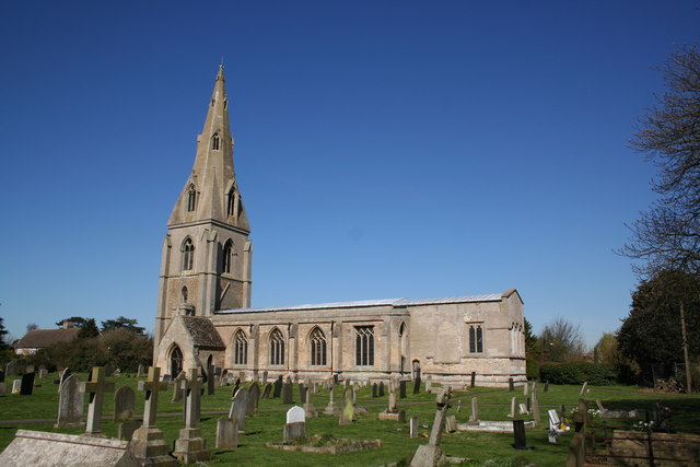
St Peter's Church, Threekingham

St Peter's Church is a church in Threekingham, Lincolnshire. It is dedicated to St. Peter ad Vincula (St Peter in chains). It became a Grade I listed building...

Newton, Lincolnshire

Newton is a hamlet in the North Kesteven district of Lincolnshire, England. The hamlet is situated approximately 8 miles (13 km) east from the town of...

Nearby Amenities

Located within 500m of 52.929663,-0.409343
Osbournby
Is In: Lincolnshire, England, UK
Place: village
Source: NPE
Lat/Long: 52.9305401/-0.4105418
Bus Stop
Whichcote Arms PH
Bus: yes
Naptan AtcoCode: 2700LOBS1330
Naptan Bearing: SE
Naptan CommonName: Whichcote Arms PH
Naptan Indicator: opp
Naptan Landmark: Whichcote Arms PH
Naptan NaptanCode: linajpgw
Naptan Street: London Road
Naptan Verified: no
Public Transport: platform
Source: naptan_import
Lat/Long: 52.9305107/-0.4097199
Bus Stop
Post Office
Bus: yes
Naptan AtcoCode: 2700LOMP5857
Naptan Bearing: W
Naptan CommonName: Post Office
Naptan Indicator: adj
Naptan Landmark: Post Office
Naptan NaptanCode: lindwpmd
Naptan Street: High Street
Naptan Verified: no
Public Transport: platform
Source: naptan_import
Lat/Long: 52.9296204/-0.4123407
Bus Stop
Whichcote Arms PH
Bus: yes
Naptan AtcoCode: 2700LOWAP952
Naptan Bearing: NW
Naptan CommonName: Whichcote Arms PH
Naptan Indicator: adj
Naptan Landmark: Whichcote Arms PH
Naptan NaptanCode: linagtdt
Naptan Street: London Road
Naptan Verified: no
Public Transport: platform
Source: naptan_import
Lat/Long: 52.9303678/-0.4097394
Power: tower
Source: Bing
Lat/Long: 52.9338614/-0.4104474
Turning Circle
Lat/Long: 52.93173/-0.4140065
Hall Farm
Place: farm
Source: Bing
Lat/Long: 52.928718/-0.415465
Note: end of public highway
Lat/Long: 52.9320332/-0.4151475
Turning Circle
Lat/Long: 52.9308702/-0.4115193
Public Bookcase
Booth: K6
Colour: red
Disused Amenity: telephone
Listed Status: Grade II
Man Made: telephone_box
Public Bookcase Type: phone_box
Lat/Long: 52.9295921/-0.4120901
Post Box
Post Box Type: wall
Lat/Long: 52.9295155/-0.41248
Pub
Whichcote Arms
Email: hello@whichcotearms.co.uk
Phone: +44 1529 455295
Website: https://whichcotearms.co.uk
Lat/Long: 52.9307287/-0.4106584
The data included in this document is from www.openstreetmap.org. The data is made available under ODbL.

Have you been to Osbournby?

Leave your review of Osbournby below (or comments, questions and feedback).