Orsett Heath

Settlement in Essex

England

Orsett Heath

Baker Street, Thurrock Passing underneath the A13
Baker Street, Thurrock Credit: David Howard

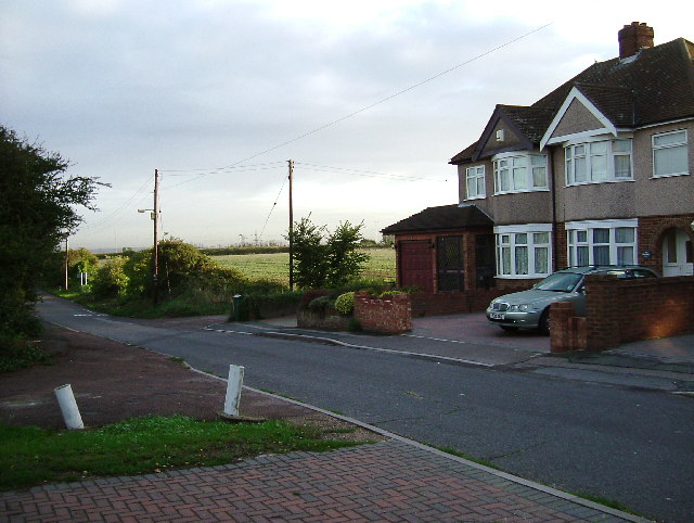
Orsett Heath is a small village located in the county of Essex, England. Situated just east of the town of Grays, it is nestled in a rural area surrounded by open countryside and woodland.

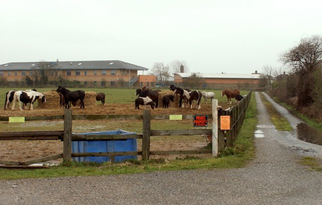
The village is known for its picturesque landscapes and tranquil atmosphere, making it an ideal location for those seeking a peaceful retreat from the bustling city life. The heath itself is a vast expanse of open grassland, scattered with patches of heather and gorse, providing a habitat for a variety of wildlife species.

The village is home to a small population, and the community is tightly-knit. The residents of Orsett Heath enjoy a close connection with nature, often participating in outdoor activities such as walking, cycling, and horse riding. There are also several designated walking trails and bridleways that wind through the heath, allowing visitors to explore the area's natural beauty.

Despite its rural setting, Orsett Heath is not far from essential amenities. The nearby town of Grays offers a range of shops, supermarkets, and leisure facilities, ensuring that residents have easy access to everyday necessities.

In terms of transportation, Orsett Heath is well-connected to major roads, with the A13 and M25 nearby, providing convenient links to London and other parts of Essex. The village is also served by regular bus services, facilitating easy travel to surrounding towns.

Orsett Heath offers a peaceful and idyllic lifestyle, making it an attractive place for those who appreciate the beauty of nature and a sense of community.

If you have any feedback on the listing, please let us know in the comments section below.
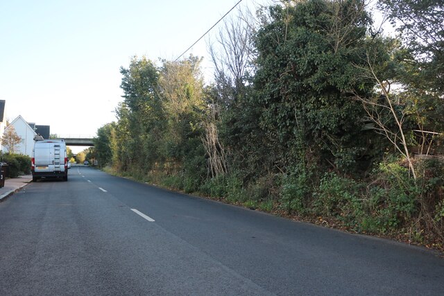
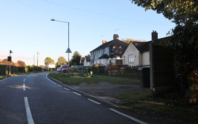
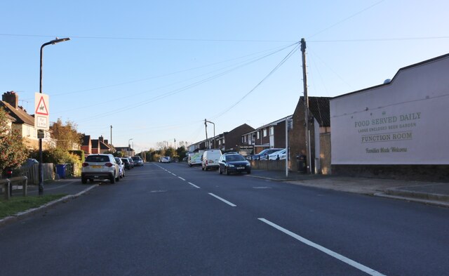
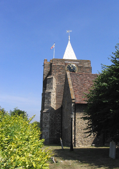
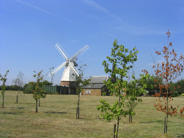
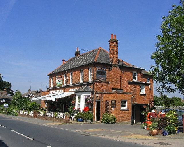
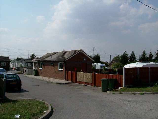
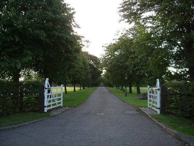
Orsett Heath Images

Images are sourced within 2km of 51.494027/0.359995 or Grid Reference TQ6379. Thanks to Geograph Open Source API. All images are credited.

Baker Street, Thurrock Passing underneath the A13
Baker Street, Thurrock
Passing underneath the A13
Stanford Road, Thurrock
Stifford Clays Road, Baker Street
Baker Street, Baker Street One of many villages named after a road with many more after pubs.
Baker Street, Baker Street
One of many villages named after a road with many more after pubs.
The Village Post Office, Orsett, Essex
Orsett Church, Orsett, Essex St. Giles and All Saints C of E church
Orsett Church, Orsett, Essex
St. Giles and All Saints C of E church
Orsett Windmill, Bakers Lane, Orsett, Essex Nicely preserved and now a private residence.
Orsett Windmill, Bakers Lane, Orsett, Essex
Nicely preserved and now a private residence.
The Foxhounds Public House, Orsett, Essex
"Bill & Ben" at the Foxhounds PH, Orsett, Essex Not quite sure the purpose but throughout the village were life size models of various TV characters.
"Bill & Ben" at the Foxhounds PH, Orsett, Essex
Not quite sure the purpose but throughout the village were life size models of various TV characters.
Princess Diana memorial garden, Orsett, Essex -
Princess Diana memorial garden, Orsett, Essex
-
Travellers Rest Thurrock has three permanent traveller sites like this one.
Travellers Rest
Thurrock has three permanent traveller sites like this one.
Drive to Heath Place This is the tree-lined drive to Heath Place located off Hornsby Lane between Orsett Heath and  the A1013
Drive to Heath Place
This is the tree-lined drive to Heath Place located off Hornsby Lane between Orsett Heath and the A1013
Last House on Blackshots Lane During the 1930’s Grays extended northwards towards Orsett particularly ribbon development along Blackshots and Long Lane. Post war there was much infill but the town and country planning act has ensured there is some countryside between them. This is the point where town and country meet.
Last House on Blackshots Lane
During the 1930’s Grays extended northwards towards Orsett particularly ribbon development along Blackshots and Long Lane. Post war there was much infill but the town and country planning act has ensured there is some countryside between them. This is the point where town and country meet.
Private Road, Orsett Golf Club, Essex This road was originally for access to gravel workings. Now the driveway of Orsett Golf Club.
Private Road, Orsett Golf Club, Essex
This road was originally for access to gravel workings. Now the driveway of Orsett Golf Club.
Baker Street Windmill This is a photograph before the cap and sails were restored. At an earlier stage it had been comprehensively derelict. It is now converted to a dwelling but retains much of the original machinery and is most interesting.
Baker Street Windmill
This is a photograph before the cap and sails were restored. At an earlier stage it had been comprehensively derelict. It is now converted to a dwelling but retains much of the original machinery and is most interesting.
Orsett Hospital
Orsett Hospital
Terraced Cottages, Orsett Situated on east side of Rowley Road opposite Orsett Hospital
Terraced Cottages, Orsett
Situated on east side of Rowley Road opposite Orsett Hospital
Public Footpath 104 Stile and footpath which runs south-east to the A13
Public Footpath 104
Stile and footpath which runs south-east to the A13
Show me another place!

Orsett Heath is located at Grid Ref: TQ6379 (Lat: 51.494027, Lng: 0.359995)

Unitary Authority: Thurrock

Police Authority: Essex

What 3 Words

///wanted.hurls.merit. Near Chadwell St Mary, Essex

Related Wikis

Orsett Heath

Orsett Heath is a location and recently built hamlet in the unitary authority area of Thurrock, in the ceremonial county of Essex, England. It is located...

Treetops School

Treetops School is an all-through special school with academy status in Grays, Essex, England. Students are from 5 to 19 with moderate learning difficulties...

Terrel's Heath

Terrel's Heath is, in spite of its name, an area of woodland in Chadwell St Mary named on the 1938 six-inch Ordnance Survey map. == Location and description... ==

Orsett Heath Academy

The Orsett Heath Academy is a coeducational secondary free school academy in Grays, Essex, England. It is the newest member of the South West Essex Community...

Nearby Amenities

Located within 500m of 51.494027,0.359995
Power: tower
Ref: ZB 21
Lat/Long: 51.4975935/0.3556129
Power: tower
Lat/Long: 51.4970218/0.3596899
Power: tower
Lat/Long: 51.4963378/0.364608
Power: tower
Lat/Long: 51.4960386/0.3642131
Power: tower
Lat/Long: 51.4966851/0.3595439
Power: tower
Lat/Long: 51.4972783/0.3550207
Mini Roundabout
Lat/Long: 51.4939412/0.360215
Bus Stop
Heath Road
Bus: yes
Naptan AtcoCode: 1590030101
Naptan Bearing: N
Naptan CommonName: Heath Road
Naptan Indicator: Northbound
Naptan Landmark: Farm Road
Naptan NaptanCode: thuapta
Naptan Street: Heath Road
Naptan Verified: no
Public Transport: platform
Source: naptan_import
Lat/Long: 51.4933197/0.3610251
Bus Stop
Heath Road
Bus: yes
Naptan AtcoCode: 1590030201
Naptan Bearing: S
Naptan CommonName: Heath Road
Naptan Indicator: Southbound
Naptan Landmark: Farm Road
Naptan NaptanCode: thuaptd
Naptan Street: Heath Road
Naptan Verified: no
Public Transport: platform
Source: naptan_import
Lat/Long: 51.4961181/0.3582737
Crossing
Crossing: unmarked
Crossing Island: no
Tactile Paving: yes
Lat/Long: 51.4942147/0.3528365
Crossing
Crossing: uncontrolled
Crossing Island: no
Crossing Markings: zebra
Crossing Ref: zebra
Tactile Paving: yes
Traffic Calming: table
Lat/Long: 51.4926618/0.3553181
Crossing
Crossing: uncontrolled
Crossing Island: no
Crossing Markings: zebra
Crossing Ref: zebra
Tactile Paving: yes
Lat/Long: 51.4920049/0.3559091
Street Lamp
Lamp Model: Philips MA50
Lamp Type: SOX
Source: Bing
Lat/Long: 51.4978585/0.356467
Street Lamp
Lamp Model: Philips MA60
Lamp Type: SOX
Source: Bing
Lat/Long: 51.4976406/0.3563503
Street Lamp
Ref: A1089 under bridge
Lat/Long: 51.497573/0.3566065
Street Lamp
Lamp Model: Philips MA50
Lamp Type: SOX
Source: Bing
Lat/Long: 51.4973309/0.3567379
Street Lamp
Lamp Model: Philips MA60
Lamp Type: SOX
Source: Bing
Lat/Long: 51.4972207/0.356585
Street Lamp
Lamp Model: Philips MA50
Lamp Type: SOX
Source: Bing
Lat/Long: 51.4970704/0.3568841
Street Lamp
Lamp Model: Philips MA60
Lamp Type: SOX
Source: Bing
Lat/Long: 51.4968391/0.356809
Street Lamp
Lamp Model: Philips MA50
Lamp Type: SOX
Source: Bing
Lat/Long: 51.496668/0.3570893
Street Lamp
Lamp Model: Philips MA60
Lamp Type: SOX
Source: Bing
Lat/Long: 51.4964651/0.3570236
Street Lamp
Lamp Model: Philips MA50
Lamp Type: SOX
Source: Bing
Lat/Long: 51.496314/0.3572864
Street Lamp
Lamp Model: Philips MA60
Lamp Type: SOX
Source: Bing
Lat/Long: 51.4961253/0.3572046
Street Lamp
Lamp Model: Philips MA50
Lamp Type: SOX
Source: Bing
Lat/Long: 51.4959625/0.3574822
Street Lamp
Lamp Model: Philips MA60
Lamp Type: SOX
Source: Bing
Lat/Long: 51.4957779/0.3573924
Street Lamp
Lamp Model: Philips MA60
Lamp Type: SOX
Source: Bing
Lat/Long: 51.4954423/0.3575721
Street Lamp
Lat/Long: 51.4951041/0.3577411
Street Lamp
Lat/Long: 51.4947651/0.3579181
Street Lamp
Lat/Long: 51.4944157/0.3580884
Street Lamp
Lat/Long: 51.4940759/0.358244
Street Lamp
Lat/Long: 51.4937235/0.3584103
Street Lamp
Lat/Long: 51.4933829/0.3585524
Street Lamp
Lat/Long: 51.4930697/0.3586758
Street Lamp
Lat/Long: 51.4927099/0.3588153
Street Lamp
Lat/Long: 51.4923592/0.3589306
Street Lamp
Lat/Long: 51.4920009/0.3590339
Street Lamp
Lat/Long: 51.4916561/0.3591291
Street Lamp
Lat/Long: 51.4913037/0.3592136
Street Lamp
Lat/Long: 51.4909538/0.3592793
Street Lamp
Lat/Long: 51.4906023/0.3593423
Street Lamp
Lat/Long: 51.4902533/0.3593893
Street Lamp
Lat/Long: 51.4898883/0.3594201
Street Lamp
Ref: A1089 under bridge
Lat/Long: 51.4976731/0.3565634
Generator Method: photovoltaic
Generator Output Electricity: yes
Generator Source: solar
Generator Type: solar_photovoltaic_panel
Location: roof
Power: generator
Lat/Long: 51.491835/0.3545894
Generator Method: photovoltaic
Generator Output Electricity: yes
Generator Source: solar
Generator Type: solar_photovoltaic_panel
Location: roof
Power: generator
Lat/Long: 51.4918133/0.354643
Generator Method: photovoltaic
Generator Output Electricity: yes
Generator Source: solar
Generator Type: solar_photovoltaic_panel
Location: roof
Power: generator
Lat/Long: 51.4918442/0.3548777
Generator Method: photovoltaic
Generator Output Electricity: yes
Generator Source: solar
Generator Type: solar_photovoltaic_panel
Location: roof
Power: generator
Lat/Long: 51.4918893/0.3552143
Direction: both
Surface: asphalt
Traffic Calming: hump
Lat/Long: 51.4916865/0.3634225
Direction: both
Surface: asphalt
Traffic Calming: hump
Lat/Long: 51.4923162/0.3623871
Direction: both
Surface: asphalt
Traffic Calming: hump
Lat/Long: 51.4928014/0.361751
Direction: both
Surface: asphalt
Traffic Calming: hump
Lat/Long: 51.4933871/0.3609832
Direction: both
Surface: asphalt
Traffic Calming: cushion
Lat/Long: 51.4942147/0.359799
Direction: both
Surface: asphalt
Traffic Calming: cushion
Lat/Long: 51.4945994/0.3592159
Direction: both
Surface: asphalt
Traffic Calming: hump
Lat/Long: 51.4950881/0.3587819
Direction: both
Surface: asphalt
Traffic Calming: hump
Lat/Long: 51.4956717/0.3584687
Direction: both
Surface: asphalt
Traffic Calming: hump
Lat/Long: 51.4962056/0.3582195
Direction: both
Surface: asphalt
Traffic Calming: cushion
Lat/Long: 51.4967926/0.3579891
Give Way
Direction: forward
Lat/Long: 51.4973751/0.3582292
Generator Method: photovoltaic
Generator Output Electricity: yes
Generator Source: solar
Generator Type: solar_photovoltaic_panel
Location: roof
Power: generator
Lat/Long: 51.4902286/0.362935
Direction: both
Surface: asphalt
Traffic Calming: cushion
Lat/Long: 51.4911737/0.3644558
Traffic Calming: chicane
Lat/Long: 51.4971907/0.3581015
Generator Method: photovoltaic
Generator Output Electricity: yes
Generator Source: solar
Generator Type: solar_photovoltaic_panel
Location: roof
Power: generator
Lat/Long: 51.4917097/0.3646552
Generator Method: photovoltaic
Generator Output Electricity: yes
Generator Source: solar
Generator Type: solar_photovoltaic_panel
Location: roof
Power: generator
Lat/Long: 51.4917023/0.3642106
Generator Method: photovoltaic
Generator Output Electricity: yes
Generator Source: solar
Generator Type: solar_photovoltaic_panel
Location: roof
Power: generator
Lat/Long: 51.4941463/0.3617042
Generator Method: photovoltaic
Generator Output Electricity: yes
Generator Source: solar
Generator Type: solar_photovoltaic_panel
Location: roof
Power: generator
Lat/Long: 51.4945583/0.36149
Generator Method: photovoltaic
Generator Output Electricity: yes
Generator Source: solar
Generator Type: solar_photovoltaic_panel
Location: roof
Power: generator
Lat/Long: 51.4942728/0.3608225
Generator Method: photovoltaic
Generator Output Electricity: yes
Generator Source: solar
Generator Type: solar_photovoltaic_panel
Location: roof
Power: generator
Lat/Long: 51.4942984/0.3608834
Generator Method: photovoltaic
Generator Output Electricity: yes
Generator Source: solar
Generator Type: solar_photovoltaic_panel
Location: roof
Power: generator
Lat/Long: 51.4943264/0.3609406
Generator Method: photovoltaic
Generator Output Electricity: yes
Generator Source: solar
Generator Type: solar_photovoltaic_panel
Location: roof
Power: generator
Lat/Long: 51.4943591/0.360901
Crossing
Crossing: uncontrolled
Crossing Island: no
Crossing Markings: zebra
Tactile Paving: yes
Lat/Long: 51.4922669/0.355932
Crossing
Crossing: uncontrolled
Crossing Island: no
Crossing Markings: zebra
Crossing Ref: zebra
Tactile Paving: yes
Lat/Long: 51.4923574/0.3560359
Crossing
Crossing: uncontrolled
Crossing Island: no
Crossing Markings: zebra
Crossing Ref: zebra
Tactile Paving: yes
Lat/Long: 51.4922716/0.3563182
Crossing
Crossing: uncontrolled
Crossing Island: no
Crossing Markings: zebra
Crossing Ref: zebra
Tactile Paving: yes
Lat/Long: 51.4922945/0.3565542
Crossing
Crossing: uncontrolled
Crossing Island: no
Crossing Markings: zebra
Crossing Ref: zebra
Tactile Paving: yes
Lat/Long: 51.4925309/0.3556833
Crossing
Crossing: unmarked
Crossing Island: no
Tactile Paving: yes
Lat/Long: 51.4942682/0.352904
Bus Stop
Bus: yes
Public Transport: platform
Shelter: no
Lat/Long: 51.4929849/0.3559199
Bus Stop
Bus: yes
Public Transport: platform
Shelter: yes
Lat/Long: 51.4930033/0.356028
Bus Stop
Bus: yes
Public Transport: platform
Shelter: yes
Lat/Long: 51.4930209/0.3561412
Bus Stop
Bus: yes
Public Transport: platform
Shelter: no
Lat/Long: 51.4929721/0.3563226
Bus Stop
Bus: yes
Public Transport: platform
Shelter: no
Lat/Long: 51.4929264/0.3563393
Bus Stop
Bus: yes
Public Transport: platform
Shelter: no
Lat/Long: 51.4928848/0.3563547
Crossing
Crossing: unmarked
Crossing Island: no
Tactile Paving: yes
Lat/Long: 51.4926816/0.3550459
Crossing
Crossing: unmarked
Crossing Island: no
Tactile Paving: yes
Lat/Long: 51.4927073/0.3552129
Post Box
Operator: Royal Mail
Operator Wikidata: Q638098
Post Box Type: wall
Lat/Long: 51.4936741/0.3607156
Orsett Heath
Place: neighbourhood
Lat/Long: 51.4936367/0.360752
The data included in this document is from www.openstreetmap.org. The data is made available under ODbL.

Have you been to Orsett Heath?

Leave your review of Orsett Heath below (or comments, questions and feedback).