Bigby

Settlement in Lincolnshire West Lindsey

England

Bigby

Somerby - St Margaret's Church
Somerby - St Margaret's Church Credit: Colin Park

Bigby is a small village located in the North Lincolnshire district of Lincolnshire, England. Situated approximately 5 miles northeast of the market town of Brigg, Bigby is nestled in the picturesque countryside of the Lincolnshire Wolds, an Area of Outstanding Natural Beauty.

The village boasts a rich history, with records dating back to the Domesday Book of 1086. It is believed that Bigby was once a significant settlement during the Roman occupation, evidenced by the discovery of Roman coins and artifacts in the area.

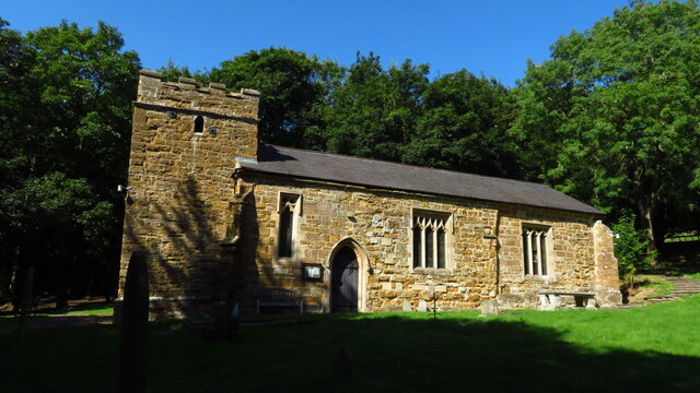
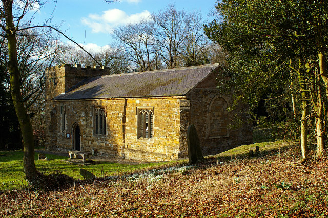
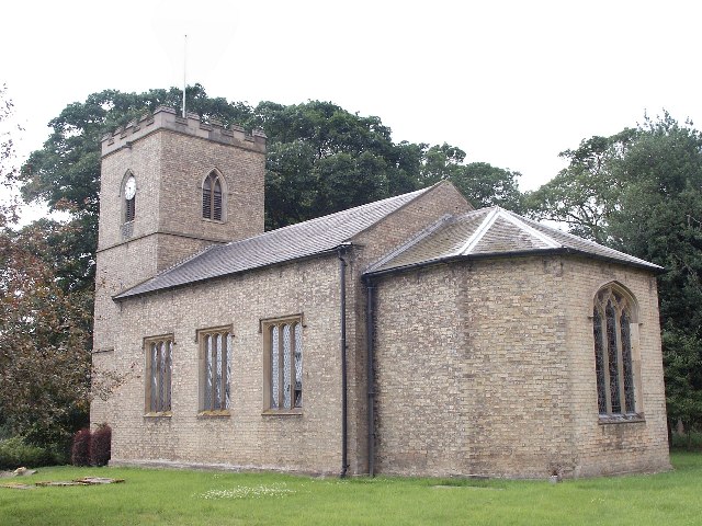
Today, Bigby is a tranquil and close-knit community with a population of around 200 residents. The village is characterized by its charming, traditional stone-built houses, which add to its quaint and idyllic appeal. The St. Martin's Church, a beautiful Grade II listed building, is a prominent landmark in Bigby and serves as the heart of the village.

While Bigby does not have its own school or shop, it benefits from its close proximity to neighboring Brigg, which offers a range of amenities including schools, shops, and leisure facilities. The village is well-connected by road, with the A1084 running nearby, providing easy access to nearby towns and cities.

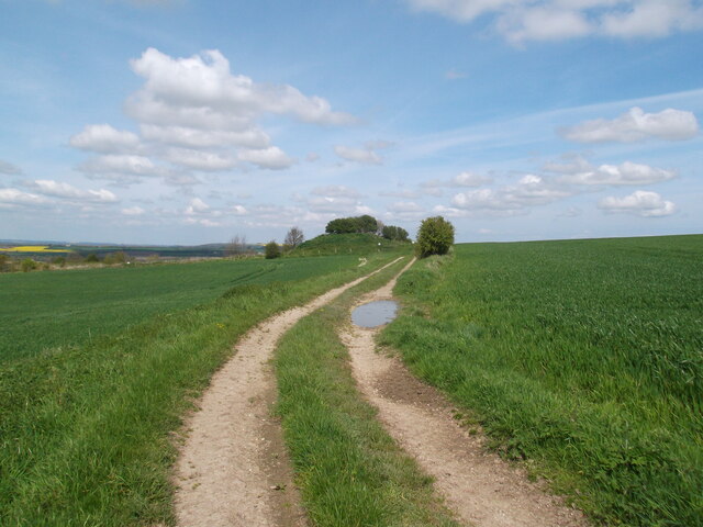
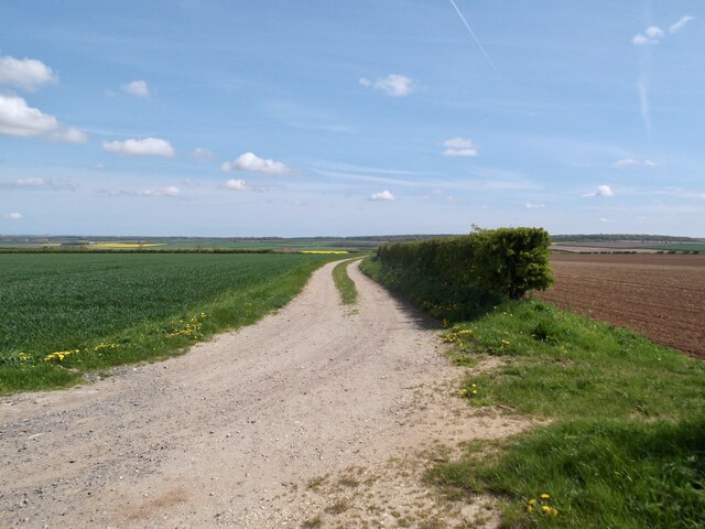
Bigby is a haven for nature lovers, with its surrounding countryside offering ample opportunities for outdoor activities such as walking, cycling, and birdwatching. The village's peaceful and serene atmosphere, combined with its stunning natural surroundings, make it an ideal place for those seeking a tranquil retreat away from the hustle and bustle of urban life.

If you have any feedback on the listing, please let us know in the comments section below.

Bigby Images

Images are sourced within 2km of 53.552148/-0.40212 or Grid Reference TA0507. Thanks to Geograph Open Source API. All images are credited.

Somerby - St Margaret's Church
Somerby Monument on the Viking Way
Track to the quarry, Bigby Top
Track across Bigby Top Fine views for modest effort
Track across Bigby Top
Fine views for modest effort
Stubble field through a fallen tree, A1084 west of Bigby
Farm track and poplars in Somerby
Byway from Somerby Low Farm to Somerby Ahead are Somerby Park and the Wolds, with Viking Way running across.
Byway from Somerby Low Farm to Somerby
Ahead are Somerby Park and the Wolds, with Viking Way running across.
Approaching Somerby Low Farm
Somerby Wold Lane
Somerby Wold Lane
Crates by a farm, Somerby Top
Barnetby road junction On the Melton Ross to Bigby road, east of the village. Church Hill is the road leading off to the left; another lane to the right leads to New Barnetby.
Barnetby road junction
On the Melton Ross to Bigby road, east of the village. Church Hill is the road leading off to the left; another lane to the right leads to New Barnetby.
Prospect Farm, near Barnetby le Wold Farmhouse situated on the bend on the Melton Ross to Bigby road, south east of Barnetby village
Prospect Farm, near Barnetby le Wold
Farmhouse situated on the bend on the Melton Ross to Bigby road, south east of Barnetby village
South Street, Barnetby le Wold One of the older houses in the village
South Street, Barnetby le Wold
One of the older houses in the village
Footpath south of Barnetby Wide muddy track/footpath leading south of the village towards Bigby
Footpath south of Barnetby
Wide muddy track/footpath leading south of the village towards Bigby
Church of St Mary, Barnetby le Wold Disused church on an ancient site, some distance from the village. Its early origins are shown by a Saxon window, with a unique carving of a cat above it, though there are early 19th-century furnishings. Evidence of a north aisle from arcading in the church, indicates that the building was once much larger. The church was  declared redundant and closed in 1972.
Church of St Mary, Barnetby le Wold
Disused church on an ancient site, some distance from the village. Its early origins are shown by a Saxon window, with a unique carving of a cat above it, though there are early 19th-century furnishings. Evidence of a north aisle from arcading in the church, indicates that the building was once much larger. The church was declared redundant and closed in 1972.
St Nicholas' church, Searby cum Owmby Taken from the south.
St Nicholas' church, Searby cum Owmby
Taken from the south.
Interior, St Nicholas' church, Searby cum Owmby Grade II listed

The church was built in 1832 on the site of an old Saxon church. The base of the tower is possibly mediaeval.
It is built in yellow brick with a  slate roof, and there is a western tower, nave, and chancel.
At the east end of the church there is a polygonal apse.
The tower is 44 feet high and has five bells which can all be rung by one person.

The interior of the church has whitewashed walls. The tower has the entrance porch in the base and there is a gallery at the west end of the nave. The gallery was erected in 1832.
The pew ends and altar rails were carved by the Reverend Townsend in the 19th century, and he is commemorated in a stained-glass window in the  nave depicting Saint Nicholas. 
The font dates from the late 18th-century and is an octagonal bowl on a pedestal with a square base.

There is a small organ which was installed in 1887.
The east window was recovered from the redundant church of St John in Eton in 1991.
Interior, St Nicholas' church, Searby cum Owmby
Grade II listed The church was built in 1832 on the site of an old Saxon church. The base of the tower is possibly mediaeval. It is built in yellow brick with a slate roof, and there is a western tower, nave, and chancel. At the east end of the church there is a polygonal apse. The tower is 44 feet high and has five bells which can all be rung by one person. The interior of the church has whitewashed walls. The tower has the entrance porch in the base and there is a gallery at the west end of the nave. The gallery was erected in 1832. The pew ends and altar rails were carved by the Reverend Townsend in the 19th century, and he is commemorated in a stained-glass window in the nave depicting Saint Nicholas. The font dates from the late 18th-century and is an octagonal bowl on a pedestal with a square base. There is a small organ which was installed in 1887. The east window was recovered from the redundant church of St John in Eton in 1991.
East window,  St Nicholas' church, Searby cum Owmby The window was recovered from the redundant church of St John in Eton in 1991, and was donated by John and Jill Rowbottom.
East window, St Nicholas' church, Searby cum Owmby
The window was recovered from the redundant church of St John in Eton in 1991, and was donated by John and Jill Rowbottom.
Show me another place!

Bigby is located at Grid Ref: TA0507 (Lat: 53.552148, Lng: -0.40212)

Division: Parts of Lindsey

Administrative County: Lincolnshire

District: West Lindsey

Police Authority: Lincolnshire

What 3 Words

///asset.boils.retaliate. Near Barnetby le Wold, Lincolnshire

Nearby Locations

Bigby

Related Wikis

Bigby, Lincolnshire

Bigby is a village and civil parish in the West Lindsey district of Lincolnshire, England. The village is situated about 10 miles (20 km) south from the...

Somerby (Juxta Bigby)

Somerby (also known as Somerby juxta Bigby or Somerby by Brigg) is a hamlet and civil parish in the West Lindsey district of Lincolnshire, England. It...

St Mary's Church, Barnetby

St Mary's Church is a redundant Anglican church in the village of Barnetby, Lincolnshire, England. It is recorded in the National Heritage List for England...

Searby, Lincolnshire

Searby is a village in the West Lindsey district of Lincolnshire, England, situated 4 miles (6.4 km) south-east from Brigg and 5 miles (8.0 km) north-east...

Nearby Amenities

Located within 500m of 53.552148,-0.40212
Main Street
Naptan AtcoCode: 270000010218
Naptan Bearing: W
Naptan BusStopType: CUS
Naptan CommonName: Main Street
Naptan Indicator: opp
Naptan Landmark: Main Street
Naptan NaptanCode: linjmdgw
Naptan Street: Bigby Hill
Naptan Verified: no
Source: naptan_import
Lat/Long: 53.549635/-0.4034886
Main Street
Naptan AtcoCode: 270000010219
Naptan Bearing: E
Naptan BusStopType: CUS
Naptan CommonName: Main Street
Naptan Indicator: adj
Naptan Landmark: Main Street
Naptan NaptanCode: linjmdja
Naptan Street: Bigby Hill
Naptan Verified: no
Source: naptan_import
Lat/Long: 53.5497349/-0.4035603
Bigby Green
Naptan AtcoCode: 270000014346
Naptan Bearing: S
Naptan BusStopType: CUS
Naptan CommonName: Bigby Green
Naptan Indicator: opp
Naptan Landmark: Bigby Green
Naptan NaptanCode: linjpjpa
Naptan Street: Main Street
Naptan Verified: no
Source: naptan_import
Lat/Long: 53.5516779/-0.4023097
Bigby Green
Naptan AtcoCode: 2700LBSL4832
Naptan Bearing: N
Naptan BusStopType: CUS
Naptan CommonName: Bigby Green
Naptan Indicator: adj
Naptan Landmark: Bigby Green
Naptan NaptanCode: lindpajw
Naptan Street: Main Street
Naptan Verified: no
Source: naptan_import
Lat/Long: 53.5516985/-0.4025052
Low Farm
Place: farm
Source: Bing
Lat/Long: 53.5523426/-0.4055209
Power: pole
Lat/Long: 53.5550608/-0.4072237
Power: pole
Lat/Long: 53.5543693/-0.4072076
Power: pole
Lat/Long: 53.5537033/-0.407213
Power: pole
Lat/Long: 53.5526612/-0.4071969
Power: pole
Lat/Long: 53.5519314/-0.4072023
Power: pole
Lat/Long: 53.551192/-0.4071808
Power: pole
Lat/Long: 53.5504366/-0.4071701
Power: pole
Lat/Long: 53.5497004/-0.4071755
Power: pole
Lat/Long: 53.5533344/-0.4059752
Power: pole
Lat/Long: 53.553038/-0.4049237
Power: pole
Lat/Long: 53.5527257/-0.4038616
Power: pole
Lat/Long: 53.5524698/-0.40292
The data included in this document is from www.openstreetmap.org. The data is made available under ODbL.

Have you been to Bigby?

Leave your review of Bigby below (or comments, questions and feedback).