Old Town

Settlement in Hertfordshire Stevenage

England

Old Town

Edge of Stevenage Taken from TL 237 268 looking towards Lister Hospital in the distance
Edge of Stevenage Credit: Paul Dixon

Old Town is a charming and historic area located in Hertfordshire, England. Situated in the eastern part of Hertford, this district is known for its picturesque streets and well-preserved buildings, which give visitors a glimpse into the town's rich past.

The heart of Old Town is defined by its medieval architecture, with timber-framed houses and narrow, winding lanes. The area is home to several notable landmarks, including the 15th-century St. Andrew's Church, which boasts an impressive tower and intricate stained glass windows. The church is a testament to the area's long-standing religious significance.

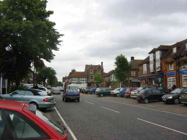
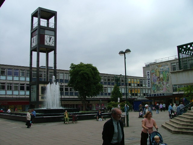
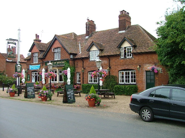
Old Town also offers a range of amenities, with a mix of independent shops, boutiques, and traditional pubs. Visitors can explore these local establishments and sample the region's culinary delights, including traditional British fare and international cuisines.

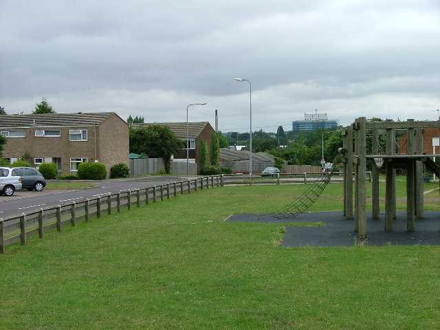
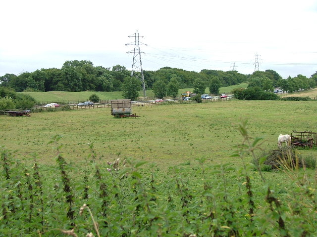
The district's proximity to the River Lea adds to its natural appeal, providing opportunities for leisurely walks along the riverbanks or picnics in the nearby Hartham Common. The Common itself features a playground, sports fields, and a lake, making it a popular spot for outdoor activities and family outings.

Old Town is well-connected to other parts of Hertfordshire, with regular bus services and easy access to major roads. The area also benefits from its close proximity to Hertford North railway station, connecting it to London and other nearby towns.

Overall, Old Town, Hertfordshire, is a delightful destination for history enthusiasts, nature lovers, and those seeking a quintessentially English experience.

If you have any feedback on the listing, please let us know in the comments section below.

Old Town Images

Images are sourced within 2km of 51.915596/-0.2088528 or Grid Reference TL2325. Thanks to Geograph Open Source API. All images are credited.

Edge of Stevenage Taken from TL 237 268 looking towards Lister Hospital in the distance
Edge of Stevenage
Taken from TL 237 268 looking towards Lister Hospital in the distance
Graveley Pylons Taken from TL 239 270 between Graveley and Stevenage, this line of pylons is running towards Hitchin, although the one in the foreground seems to morphing into a tree!
Graveley Pylons
Taken from TL 239 270 between Graveley and Stevenage, this line of pylons is running towards Hitchin, although the one in the foreground seems to morphing into a tree!
Stevenage  Old Town Old towns suffer from the motor car especially when nose in parking is the rule
Stevenage Old Town
Old towns suffer from the motor car especially when nose in parking is the rule
Stevenage Town Centre The clock tower features a memorial to Lewis Silkin, the Minister for Town and Country Planning.
Stevenage Town Centre
The clock tower features a memorial to Lewis Silkin, the Minister for Town and Country Planning.
Silam Rd. To the right are houses not untypical of Stevenage new town.  Looming over Silam Rd is one of a pair of high rise flats close to the town centre.
Silam Rd.
To the right are houses not untypical of Stevenage new town. Looming over Silam Rd is one of a pair of high rise flats close to the town centre.
Hampson Park / Pin Green Water Tower. Although this water tower is right on the edge of this square I have used it because it dominates the locality.  The large flat construction on the left, behind the fence, is a covered reservoir.  The tower is now bristling with aerials of all sorts.
Hampson Park / Pin Green Water Tower.
Although this water tower is right on the edge of this square I have used it because it dominates the locality. The large flat construction on the left, behind the fence, is a covered reservoir. The tower is now bristling with aerials of all sorts.
Weston Rd Cemetery Although Weston Rd Cemetery takes up a relatively small portion of this square, Stevenage has lots and lots of houses but only two cemeteries.
Weston Rd Cemetery
Although Weston Rd Cemetery takes up a relatively small portion of this square, Stevenage has lots and lots of houses but only two cemeteries.
Scarborough Avenue playground. Taken from Scarborough Avenue playground, in the distance, past the houses, the Lister Hospital (TL2226) can be seen.
Scarborough Avenue playground.
Taken from Scarborough Avenue playground, in the distance, past the houses, the Lister Hospital (TL2226) can be seen.
A1(M) from Shangri  La Shangri La is actually the name of the Turkey farm just to the left of the place that the photograph was taken from.  Within a moment or two the horse to the left  spotted me and decided that I might be a good source of mints.
A1(M) from Shangri La
Shangri La is actually the name of the Turkey farm just to the left of the place that the photograph was taken from. Within a moment or two the horse to the left spotted me and decided that I might be a good source of mints.
Hermit of Redcoats at Titmore Green A well thought of local hostelry and restaurant.  I had considered submitting the duck pond the other side of the road but The Hermit is better known.
Hermit of Redcoats at Titmore Green
A well thought of local hostelry and restaurant. I had considered submitting the duck pond the other side of the road but The Hermit is better known.
Warehouse on Crompton Rd This industrial estate consists of small units and this one could be any of them.  A hundred yards behind me when I took this photograph is the A1(M), but you wouldn't know it from here and a couple of hundred yards further than that is an old Roman road.
Warehouse on Crompton Rd
This industrial estate consists of small units and this one could be any of them. A hundred yards behind me when I took this photograph is the A1(M), but you wouldn't know it from here and a couple of hundred yards further than that is an old Roman road.
Trig point at Lonsdale School I swear that tree was not there when I took the photo.

This Trig point is in the playing field of a special needs school caring for 75 children between the ages of 2 and 19 from London, Bedfordshire and Hertfordshire.
Trig point at Lonsdale School
I swear that tree was not there when I took the photo. This Trig point is in the playing field of a special needs school caring for 75 children between the ages of 2 and 19 from London, Bedfordshire and Hertfordshire.
Stevenage Library Charactaristic of many of the buildings in this area.  Most of this end of the town is due for demolition.
Stevenage Library
Charactaristic of many of the buildings in this area. Most of this end of the town is due for demolition.
Stevenage Bus Station. Taken from the Matalan car park.
Stevenage Bus Station.
Taken from the Matalan car park.
Stevenage Swimming Pool The bus to the right is dropping children off for a drowning lesson.
Stevenage Swimming Pool
The bus to the right is dropping children off for a drowning lesson.
Religious Society of Friends meeting house Unprepossessing and in the shadow (almost literally) of the larger, church next door (St Andrew and St George)
Religious Society of Friends meeting house
Unprepossessing and in the shadow (almost literally) of the larger, church next door (St Andrew and St George)
Parish Church of St Andrew and St George - Stevenage. Below the church is Stevenage museum.
Parish Church of St Andrew and St George - Stevenage.
Below the church is Stevenage museum.
Town Park The 1940's map shows a stream running through this square and park.  All that remains visible is this long duck pond
Town Park
The 1940's map shows a stream running through this square and park. All that remains visible is this long duck pond
Show me another place!

Old Town is located at Grid Ref: TL2325 (Lat: 51.915596, Lng: -0.2088528)

Administrative County: Hertfordshire

District: Stevenage

Police Authority: Hertfordshire

What 3 Words

///issued.noisy.owner. Near Stevenage, Hertfordshire

Nearby Locations

Old Town Town, Old

Related Wikis

The Thomas Alleyne Academy

The Thomas Alleyne Academy is an Academy in Stevenage, Hertfordshire, England. It was founded in 2013, but can trace its roots back to 1558, when the...

Barclay Academy

Barclay Academy is a secondary school and sixth form located in Stevenage, Hertfordshire, England. The current head teacher is Dr. Matthew Laban. Opening...

The Saint John Henry Newman Catholic School

The Saint John Henry Newman School is a Roman Catholic secondary school with academy status in Stevenage, Hertfordshire, England. In its most recent Ofsted...

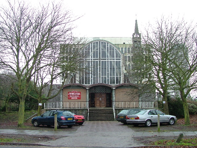
St Nicholas' Church, Stevenage

St Nicholas' Church is an Anglican parish church in Stevenage, a town in Hertfordshire, England. It occupies a hilltop site above Old Stevenage. It is...

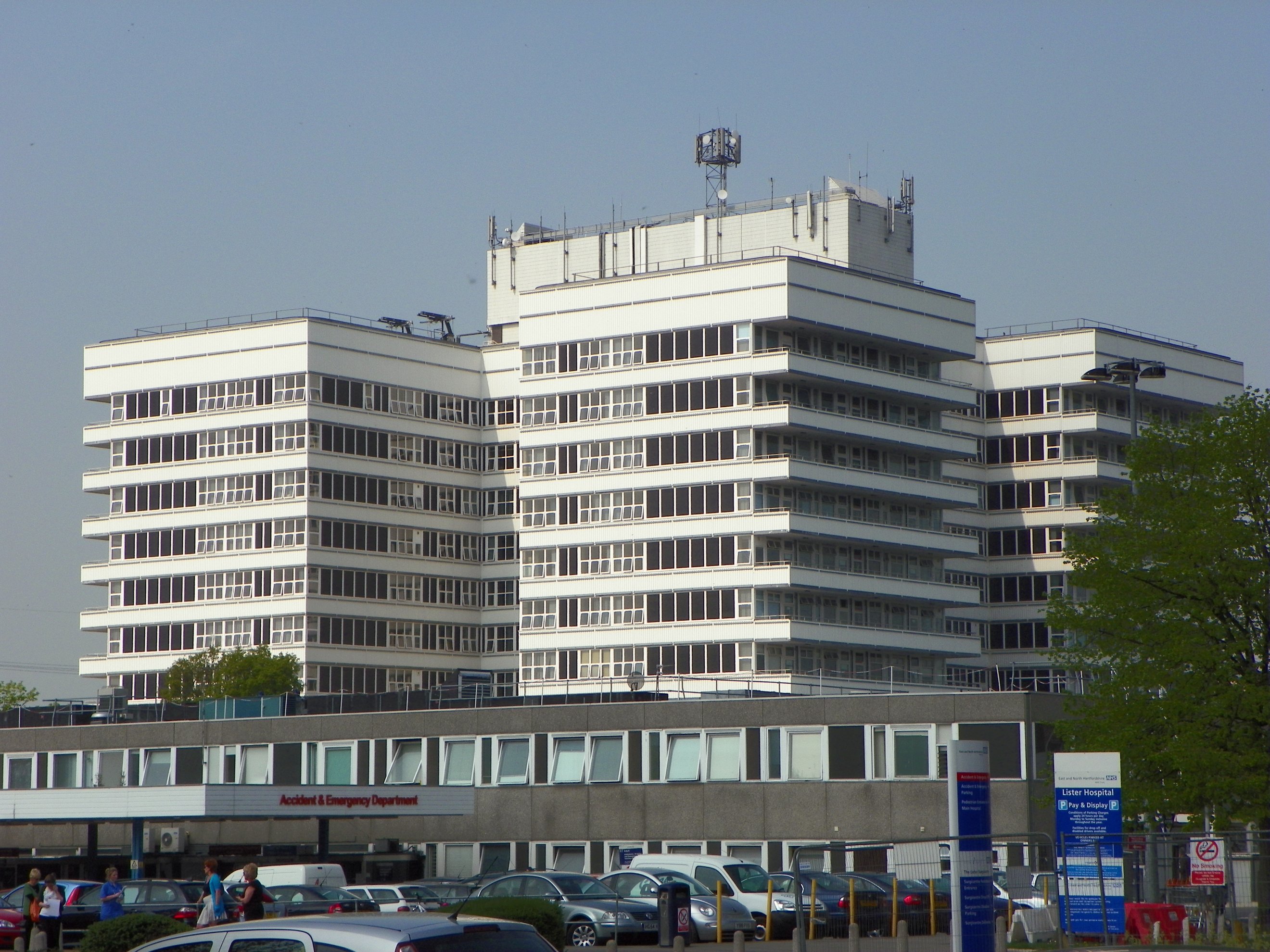
Lister Hospital, Stevenage

The Lister Hospital is an NHS hospital based on the outskirts of Stevenage in Hertfordshire. It is operated by the East and North Hertfordshire NHS Trust...

Ditchmore Lane

Ditchmore Lane is a cricket ground in Stevenage, Hertfordshire. The first recorded match on the ground was in 1921, when Hertfordshire played their first...
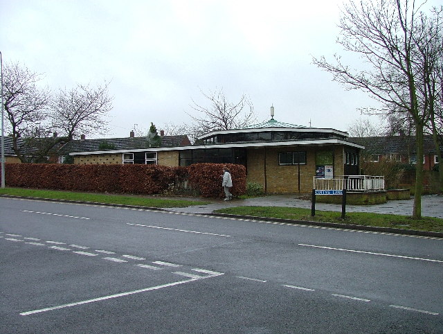
Symonds Green

Symonds Green is a neighbourhood within the English new town of Stevenage in Hertfordshire. Although predominantly a residential area with a mixture of...

Stevenage railway station

Stevenage railway station serves the town of Stevenage in Hertfordshire, England. The station is around 44.4 kilometres (27.6 miles) north of London King...

Nearby Amenities

Located within 500m of 51.915596,-0.2088528
Crossing
Crossing: unmarked
Crossing Island: yes
Crossing Markings: no
Kerb: lowered
Tactile Paving: yes
Lat/Long: 51.9180755/-0.2084445
Mini Roundabout
Direction: clockwise
Lat/Long: 51.9155775/-0.2154992
Traffic Signals
Lat/Long: 51.9177585/-0.2111113
Mini Roundabout
Direction: clockwise
Lat/Long: 51.9130413/-0.2068002
Parking
Access: yes
Fee: no
Parking: surface
Lat/Long: 51.9125517/-0.2087045
Crossing
Crossing: unmarked
Crossing Island: yes
Kerb: lowered
Tactile Paving: yes
Lat/Long: 51.9170757/-0.2084424
Crossing
Lat/Long: 51.9113279/-0.2081306
Note: most likely place for access to change
Lat/Long: 51.9155477/-0.2041548
Barrier: bollard
Bicycle: no
Foot: yes
Lat/Long: 51.9112811/-0.2079955
Barrier: bollard
Bicycle: no
Foot: yes
Lat/Long: 51.9113275/-0.2073598
Barrier: bollard
Foot: yes
Lat/Long: 51.9115822/-0.2084141
Bus Stop
Mulberry Tree Bus Shelter
Bench: yes
Bus: yes
Naptan AtcoCode: 210021200135
Naptan Bearing: N
Naptan CommonName: The White Lion PH
Naptan Crossing: Bell Lane
Naptan Indicator: o/s
Naptan Landmark: Bell Lane
Naptan NaptanCode: hrtgagwa
Naptan PlusbusZoneRef: STEVNGE
Naptan ShortCommonName: NA
Naptan Street: High Street
Naptan Verified: no
Public Transport: platform
Shelter: yes
Source: naptan_import
Lat/Long: 51.9121232/-0.2085006
Bus Stop
Franklin's Road
Bench: no
Bin: yes
Lit: yes
Naptan AtcoCode: 210021200140
Naptan Bearing: N
Naptan CommonName: Franklin's Road
Naptan Crossing: Bury Mead Recreation Ground
Naptan Indicator: adj
Naptan Landmark: Bury Mead Recreation Ground
Naptan NaptanCode: hrtgagwd
Naptan PlusbusZoneRef: STEVNGE
Naptan ShortCommonName: NA
Naptan Street: North Road
Shelter: no
Source: naptan_import;survey
Tactile Paving: yes
Lat/Long: 51.9163642/-0.2087279
Bus Stop
Bury Mead
Bench: no
Bin: no
Check Date Shelter: 2021-01-02
Lit: yes
Naptan AtcoCode: 210021200160
Naptan Bearing: N
Naptan CommonName: Bury Mead
Naptan Crossing: Whitney Drive
Naptan Indicator: opp
Naptan Landmark: Whitney Drive
Naptan NaptanCode: hrtgagwg
Naptan PlusbusZoneRef: STEVNGE
Naptan ShortCommonName: NA
Naptan Street: North Road
Shelter: no
Source: naptan_import;survey
Lat/Long: 51.9187669/-0.20865
Bus Stop
The Archways Hotel
Local Ref: NR
Naptan AtcoCode: 210021200180
Naptan Bearing: NW
Naptan CommonName: The Archways Hotel
Naptan Crossing: The Archways Hotel
Naptan Indicator: nr
Naptan Landmark: The Archways Hotel
Naptan NaptanCode: hrtgagwj
Naptan PlusbusZoneRef: STEVNGE
Naptan ShortCommonName: NA
Naptan Street: Hitchin Road
Naptan Verified: no
Source: naptan_import
Lat/Long: 51.9165318/-0.2112691
Bus Stop
Fleetwood Crescent
Bench: no
Bin: no
Lit: yes
Naptan AtcoCode: 210021200320
Naptan Bearing: S
Naptan CommonName: Fleetwood Crescent
Naptan Crossing: Julians Road
Naptan Indicator: opp
Naptan Landmark: Julians Road
Naptan NaptanCode: hrtgagtg
Naptan PlusbusZoneRef: STEVNGE
Naptan ShortCommonName: NA
Naptan Street: Fairview Road
Naptan Verified: no
Shelter: no
Source: naptan_import
Tactile Paving: no
Lat/Long: 51.9142855/-0.2149353
Bus Stop
Essex Road
Naptan AtcoCode: 210021200740
Naptan Bearing: SE
Naptan CommonName: Essex Road
Naptan Crossing: Essex Road
Naptan Indicator: adj
Naptan Landmark: Essex Road
Naptan NaptanCode: hrtgagjp
Naptan PlusbusZoneRef: STEVNGE
Naptan ShortCommonName: NA
Naptan Street: Julians Road
Naptan Verified: no
Source: naptan_import
Lat/Long: 51.9154363/-0.213741
Barclay School
Local Ref: NR
Naptan AtcoCode: 210021202155
Naptan Bearing: SW
Naptan BusStopType: CUS
Naptan CommonName: Barclay School
Naptan Crossing: Barclay School
Naptan Indicator: nr
Naptan Landmark: Barclay School
Naptan NaptanCode: hrtdwtdj
Naptan PlusbusZoneRef: STEVNGE
Naptan ShortCommonName: NA
Naptan Street: Walkern Road
Naptan Verified: no
Source: naptan_import
Lat/Long: 51.9141942/-0.2030304
Bus Stop
Royal Oak PH
Naptan AtcoCode: 210021202165
Naptan Bearing: SW
Naptan CommonName: Royal Oak PH
Naptan Crossing: Church Lane
Naptan Indicator: o/s
Naptan Landmark: Church Lane
Naptan NaptanCode: hrtgpwtw
Naptan PlusbusZoneRef: STEVNGE
Naptan ShortCommonName: NA
Naptan Street: Walkern Road
Naptan Verified: no
Source: naptan_import
Lat/Long: 51.9137108/-0.2049399
Bus Stop
Fleetwood Crescent
Bench: no
Bin: no
Lit: yes
Local Ref: NR
Naptan AtcoCode: 210021203700
Naptan Bearing: N
Naptan CommonName: Fleetwood Crescent
Naptan Crossing: Fleetwood Crescent
Naptan Indicator: nr
Naptan Landmark: Fleetwood Crescent
Naptan NaptanCode: hrtdwjgm
Naptan PlusbusZoneRef: STEVNGE
Naptan ShortCommonName: NA
Naptan Street: Fairview Road
Naptan Verified: no
Shelter: no
Source: naptan_import
Tactile Paving: no
Lat/Long: 51.9140165/-0.2149896
Bus Stop
Essex Road
Naptan AtcoCode: 210021203710
Naptan Bearing: NW
Naptan CommonName: Essex Road
Naptan Crossing: Orchard Road
Naptan Indicator: opp
Naptan Landmark: Orchard Road
Naptan NaptanCode: hrtdwjgp
Naptan PlusbusZoneRef: STEVNGE
Naptan ShortCommonName: NA
Naptan Street: Julians Road
Naptan Verified: no
Source: naptan_import
Lat/Long: 51.9150801/-0.213377
Bus Stop
Julians Road
Bench: no
Bin: no
Lit: yes
Naptan AtcoCode: 210021203720
Naptan Bearing: N
Naptan CommonName: Julians Road
Naptan Crossing: Gunnels Wood Road
Naptan Indicator: N-bound
Naptan Landmark: Gunnels Wood Road
Naptan NaptanCode: hrtdwjgt
Naptan PlusbusZoneRef: STEVNGE
Naptan ShortCommonName: NA
Naptan Street: Fairview Road
Naptan Verified: no
Shelter: no
Source: naptan_import
Tactile Paving: no
Lat/Long: 51.915945/-0.2158583
Bus Stop
The White Lion PH
Bench: yes
Naptan AtcoCode: 210021203880
Naptan Bearing: S
Naptan CommonName: The White Lion PH
Naptan Crossing: Basils Road
Naptan Indicator: opp
Naptan Landmark: Basils Road
Naptan NaptanCode: hrtdwjdg
Naptan PlusbusZoneRef: STEVNGE
Naptan ShortCommonName: NA
Naptan Street: High Street
Naptan Verified: no
Shelter: yes
Source: naptan_import
Lat/Long: 51.9120269/-0.2083221
Bus Stop
The Archways Hotel
Naptan AtcoCode: 210021203960
Naptan Bearing: SE
Naptan CommonName: The Archways Hotel
Naptan Crossing: Dewpond Close
Naptan Indicator: opp
Naptan Landmark: Dewpond Close
Naptan NaptanCode: hrtdwjdt
Naptan PlusbusZoneRef: STEVNGE
Naptan ShortCommonName: NA
Naptan Street: Hitchin Road
Naptan Verified: no
Source: naptan_import
Lat/Long: 51.9157286/-0.2104867
Bus Stop
Bury Mead
Bench: yes
Bin: yes
Check Date Shelter: 2021-01-02
Lit: yes
Local Ref: NR
Naptan AtcoCode: 210021204020
Naptan Bearing: S
Naptan CommonName: Bury Mead
Naptan Crossing: Whitney Drive
Naptan Indicator: nr
Naptan Landmark: Whitney Drive
Naptan NaptanCode: hrtdwgtp
Naptan PlusbusZoneRef: STEVNGE
Naptan ShortCommonName: NA
Naptan Street: North Road
Shelter: yes
Source: naptan_import;survey
Lat/Long: 51.9192005/-0.2084387
Bus Stop
Franklin's Road
Bench: no
Bin: yes
Lit: yes
Naptan AtcoCode: 210021204040
Naptan Bearing: S
Naptan CommonName: Franklin's Road
Naptan Crossing: Bury Mead Recreation Ground
Naptan Indicator: opp
Naptan Landmark: Bury Mead Recreation Ground
Naptan NaptanCode: hrtdwgtw
Naptan PlusbusZoneRef: STEVNGE
Naptan ShortCommonName: NA
Naptan Street: North Road
Shelter: no
Source: naptan_import;survey
Tactile Paving: yes
Lat/Long: 51.9160692/-0.208641
Doctors
Lat/Long: 51.9129501/-0.2061914
Library
Stevenage Old Town Library
Wikidata: Q55111285
Lat/Long: 51.9129952/-0.2092279
Fast Food
Subway
Addr City: Stevenage
Addr Housenumber: 39
Addr Postcode: SG1 3AH
Addr Street: High Street
Brand: Subway
Brand Wikidata: Q244457
Contact Website: https://restaurants.subway.com/united-kingdom/en/stevenage/39-high-st-old-town
Cuisine: sandwich
Fhrs Id: 349217
Source Addr: FHRS Open Data
Lat/Long: 51.9117559/-0.2081546
Disused Amenity: post_office
Note: Former PO within the now-closed Waitrose store.
Lat/Long: 51.9112335/-0.2085858
Bank
NatWest
Alt Name: National Westminster Bank
Lat/Long: 51.9118618/-0.2080447
Bar
cinnabar
Addr City: Stevenage
Addr Housenumber: 56-59
Addr Postcode: SG1 3EF
Addr Street: High Street
Addr Suburb: Old Town
Fhrs Id: 606580
Source Addr: FHRS Open Data
Lat/Long: 51.9123222/-0.208861
Pub
The Mulberry Tree
Brand: Greene King
Brand Wikidata: Q5564162
Website: https://www.greeneking.co.uk/pubs/hertfordshire/mulberry-tree
Lat/Long: 51.9120788/-0.2087242
Traffic Signals
Lat/Long: 51.9181338/-0.2119888
Traffic Signals
Lat/Long: 51.918274/-0.2119649
Turning Circle
Lat/Long: 51.9123866/-0.2135119
Crossing
Crossing: unmarked
Crossing Island: yes
Lat/Long: 51.9148361/-0.2129701
Noexit: yes
Lat/Long: 51.9134816/-0.2098126
Noexit: yes
Lat/Long: 51.9134007/-0.2081578
Mini Roundabout
Direction: clockwise
Lat/Long: 51.9130144/-0.2087615
Barrier: bollard
Lat/Long: 51.9146108/-0.2050075
Post Box
Collection Times: Mo-Fr 17:30; Sa 12:15
Post Box Type: pillar
Ref: SG1 130
Lat/Long: 51.915264/-0.213469
Collection Times: Mo-Fr 17:30; Sa 12:30
Disused Amenity: post_box
Post Box Type: indoor_wall_box
Ref: SG1 12
Lat/Long: 51.911289/-0.208314
Post Box
Collection Times: Mo-Fr 18:45; Sa 12:00
Post Box Type: pillar
Ref: SG1 138
Lat/Long: 51.913708/-0.209
Traffic Signals
Lat/Long: 51.917785/-0.2112991
Crossing
Crossing Ref: zebra
Lat/Long: 51.9127571/-0.2086701
Noexit: yes
Lat/Long: 51.9135985/-0.2080884
Barrier: bollard
Bollard: fixed
Lat/Long: 51.9156264/-0.2089237
Traffic Calming: cushion
Lat/Long: 51.9146819/-0.2151489
Old Rail Station
Historic: archaeological_site
Lat/Long: 51.9144709/-0.2139864
Dentist
Bowling Green Dental Surgery
Lat/Long: 51.9136244/-0.2095999
Fast Food
Papa John's
Addr City: Stevenage
Addr Housenumber: 30
Addr Postcode: SG1 3HF
Addr Street: High Street
Addr Suburb: Old Town
Brand: Papa John's
Brand Wikidata: Q2759586
Brand Wikipedia: en:Papa John's Pizza
Cuisine: pizza
Fhrs Id: 996452
Not Addr Postcode: SG1 3AU
Source Addr: FHRS Open Data
Source Addr Postcode: code-point_open
Takeaway: yes
Website: https://www.papajohns.co.uk/stores/stevenage
Wikidata: Q26394268
Lat/Long: 51.9133482/-0.2094827
Hamilton Davies
Addr City: Stevenage
Addr Housenumber: 28
Addr Postcode: SG1 3HF
Addr Street: High Street
Addr Suburb: Old Town
Lawyer: solicitor
Office: lawyer
Source Addr: https://www.hamiltondavies.co.uk/
Website: https://www.hamiltondavies.co.uk/
Lat/Long: 51.9134844/-0.2095721
little willow
Lat/Long: 51.9130919/-0.2092724
head office hair
Shop: hairdresser
Lat/Long: 51.9129198/-0.2091838
Restaurant
Surma
Addr City: Stevenage
Addr Housenumber: 44
Addr Postcode: SG1 3EF
Addr Street: High Street
Addr Suburb: Old Town
Fhrs Id: 349430
Source Addr: FHRS Open Data
Lat/Long: 51.9127022/-0.2091199
Restaurant
Old Town Fish Bar
Addr City: Stevenage
Addr Housenumber: 46
Addr Postcode: SG1 3EF
Addr Street: High Street
Addr Suburb: Old Town
Fhrs Id: 1043618
Source Addr: FHRS Open Data
Lat/Long: 51.9126406/-0.2090754
Pharmacy
Stearns
Addr City: Stevenage
Addr Housenumber: 48
Addr Postcode: SG1 3EF
Addr Street: High Street
Addr Suburb: Old Town
Fhrs Id: 349432
Healthcare: pharmacy
Source Addr: FHRS Open Data
Lat/Long: 51.9125828/-0.2090316
Tesco Express
Addr City: Stevenage
Addr Housenumber: 50
Addr Postcode: SG1 3EF
Addr Street: High Street
Brand: Tesco Express
Brand Wikidata: Q98456772
Brand Wikipedia: en:Tesco
Contact Website: https://www.tesco.com/store-locator/stevenage/50-high-st
Designation: 6131
Fhrs Id: 349276
Operator: Tesco Stores Ltd
Phone: +44 3456746462
Shop: supermarket
Source Addr: FHRS Open Data
Lat/Long: 51.9125341/-0.2090067
Atm
Operator: rbs
Lat/Long: 51.9125017/-0.2089262
Addr City: Stevenage
Addr Housenumber: 54
Addr Postcode: SG1 3EF
Addr Street: High Street
Fixme: Boots closed in 2020. Needs a survey. https://www.thecomet.net/news/22350229.stevenage-boots-store-set-closure/
Shop: yes
Lat/Long: 51.9124239/-0.2089004
Dentist
smilecraft
Lat/Long: 51.9119509/-0.2086723
Bar
the bank
Lat/Long: 51.9116535/-0.2085046
Restaurant
Taj Mahal
Lat/Long: 51.9115106/-0.2084432
the hair club
Shop: hairdresser
Lat/Long: 51.9113678/-0.2080772
Restaurant
Golden Siam
Addr City: Stevenage
Addr Housenumber: 15
Addr Postcode: SG1 3BG
Addr Street: High Street
Addr Suburb: Old Town
Brand: Golden Siam
Cuisine: thai
Fhrs Id: 1408284
Source Addr: FHRS Open Data
Lat/Long: 51.9135593/-0.2088341
Pub
The Standing Order
Addr City: Stevenage
Addr County: Hertfordshire
Addr Housenumber: 33
Addr Postcode: SG1 3AU
Addr Street: High Street
Brand: Wetherspoon
Brand Wikidata: Q6109362
Brand Wikipedia: en:Wetherspoons
Brewery: various
Building: yes
Changing Table: yes
Contact Phone: +44 1438 316972
Diet Vegan: Yes
Diet Vegetarian: Yes
Fhrs Authority: Stevenage
Fhrs Confidence Management: 0
Fhrs Hygiene: 0
Fhrs Id: 349429
Fhrs Local Authority Id: 13230/0033/0/000
Fhrs Rating: 5
Fhrs Rating Date: 2023-06-15T00:00:00
Fhrs Structural: 0
Food: yes
Internet Access: wlan
Internet Access Fee: no
Note: Has TV screens
Opening Hours: Mo,Tu,We,Th,Su 08:00-24:00; Fr,Sa 08:00-25:00
Outdoor Seating: yes
Payment Debit Cards: Yes
Payment Mastercard: Yes
Payment Visa: Yes
Real Ale: yes
Source Fhrs: FHRS Open Data
Source Website: https://www.jdwetherspoon.com/pubs/all-pubs/england/hertfordshire/the-standing-order-stevenage
Toilets: yes
Toilets Access: customers
Toilets Wheelchair: Yes
Website: https://www.jdwetherspoon.com/pubs/all-pubs/england/hertfordshire/the-standing-order-stevenage
Website Menu: https://www.jdwetherspoon.com/food
Wheelchair: yes
Lat/Long: 51.9119251/-0.2079926
Nightclub
Venue
Lat/Long: 51.9114509/-0.2088588
Street Lamp
Lat/Long: 51.9133013/-0.2090121
Chiropractor
Stevenage Chiropractic Clinic
Addr City: Stevenage
Addr Housenumber: 17
Addr Postcode: SG1 3BG
Addr Street: High Street
Phone: +44 1438 722 255
Wikidata: Q26394282
Lat/Long: 51.9134096/-0.2087553
Office
GeoMares Publishing UK Ltd
Addr City: Stevenage
Addr Housename: Mindenhall Court
Addr Postcode: SG1 3BG
Addr Street: High Street
Addr Unit: Unit A2
Alt Name: GeoMares UK Ltd
Office: company
Phone: +44 1438 352 617
Website: https://geomares-marketing.com/
Lat/Long: 51.9134638/-0.2083177
Waste Basket
Lat/Long: 51.9163755/-0.2087248
Waste Basket
Lat/Long: 51.9160575/-0.2086423
Waste Basket
Lat/Long: 51.9192173/-0.2084412
Traffic Calming: cushion
Lat/Long: 51.9130108/-0.2145982
Traffic Calming: cushion
Lat/Long: 51.9137859/-0.2147993
Traffic Calming: cushion
Lat/Long: 51.9153414/-0.215416
Traffic Calming: cushion
Lat/Long: 51.9162415/-0.2159674
Bench
Backrest: yes
Lat/Long: 51.9164256/-0.2160184
Historic: memorial
Memorial: war_memorial
Lat/Long: 51.9145354/-0.209451
Waste Basket
Lat/Long: 51.9169976/-0.2083728
Bench
Backrest: yes
Lat/Long: 51.91701/-0.2083694
Bench
Backrest: yes
Lat/Long: 51.9198832/-0.2085042
Crossing
Crossing: unmarked
Crossing Island: yes
Lat/Long: 51.9198595/-0.2087538
Crossing
Crossing: unmarked
Crossing Island: yes
Lat/Long: 51.9155882/-0.2153894
Bicycle Parking
Access: yes
Bicycle Parking: stands
Capacity: 6
Covered: no
Fee: no
Lat/Long: 51.9128098/-0.2087913
Crossing
Crossing: zebra
Crossing Markings: yes
Lat/Long: 51.9200585/-0.208654
Crossing
Crossing: zebra
Crossing Markings: zebra
Lat/Long: 51.9186765/-0.2085161
Crossing
Crossing: zebra
Crossing Markings: zebra
Tactile Paving: yes
Lat/Long: 51.9168084/-0.2085129
Crossing
Crossing: traffic_signals
Crossing Markings: dots
Tactile Paving: yes
Lat/Long: 51.915617/-0.2088276
The data included in this document is from www.openstreetmap.org. The data is made available under ODbL.

Have you been to Old Town?

Leave your review of Old Town below (or comments, questions and feedback).