Heath, Old

Settlement in Essex Colchester

England

Heath, Old

The 1327 from Colchester arriving at Colchester Town station
The 1327 from Colchester arriving at Colchester Town station Credit: Roy Hughes

Heath, Old is a charming village located in the county of Essex, England. Situated in the Uttlesford district, it is nestled in the picturesque countryside, offering a peaceful and idyllic setting. With a population of around 1,000 residents, it maintains a close-knit community atmosphere.

The village is well-known for its rich history, dating back to the Roman times. Evidence of this can be seen in the remains of an ancient Roman villa discovered in the area. This historical significance makes Heath, Old a popular destination for history enthusiasts and archeologists.

The village boasts a range of architectural styles, including stunning thatched cottages and elegant Georgian houses. Its picturesque streets are lined with beautiful gardens and well-maintained green spaces. The surrounding countryside provides ample opportunities for outdoor activities, such as walking, cycling, and horseback riding.

Heath, Old offers a range of amenities to cater to its residents' needs. These include a village hall, a primary school, a post office, and a local pub. The community spirit is further nurtured through various events and activities organized throughout the year, such as village fairs and summer festivals.

For those seeking a peaceful and rural lifestyle, Heath, Old presents an ideal location. Its close proximity to larger towns, such as Bishop's Stortford and Saffron Walden, ensures that residents have easy access to a wider range of amenities and services. With its rich history, natural beauty, and strong sense of community, Heath, Old is truly a gem within the Essex countryside.

If you have any feedback on the listing, please let us know in the comments section below.
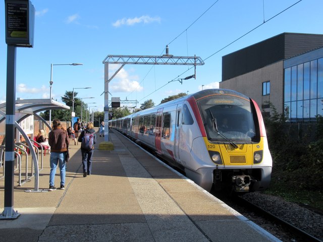
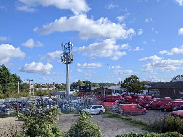
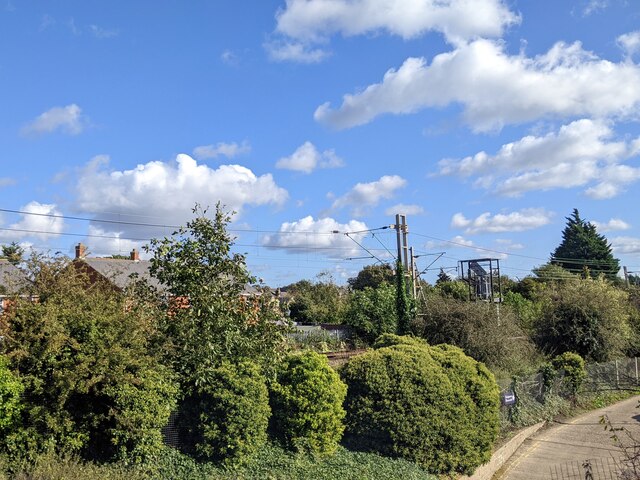
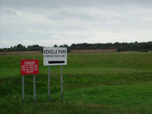
Heath, Old Images

Images are sourced within 2km of 51.872684/0.92473879 or Grid Reference TM0123. Thanks to Geograph Open Source API. All images are credited.

The 1327 from Colchester arriving at Colchester Town station
Lots of vans, Colchester
Joining the main line from the Colchester Town chord
The Odd One Out, Colchester This unusually-named establishment on Mersea Road has been a pub since 1935. It is notable for the number of internal period features.
The Odd One Out, Colchester
This unusually-named establishment on Mersea Road has been a pub since 1935. It is notable for the number of internal period features.
Hunger & Thirst After Righteousness? The Garrison Church Colchester was built in 1856 as a hospital. Florence Nightingale took one look and declared it as “unsuitable” for a Hospital so it was decided that souls should be healed there. The listed church will have to find a new use according to the Army when the Barracks move to Beerchurch Rd (See <a href="https://www.geograph.org.uk/photo/37809">TL9923 : Building a Barracks</a>). The British Grenadier is an honest un-mucked about good old British “Local” it would be a crying shame if the “theme pub” designers ever got their hands on it! Good beer and good company are what really matters. For an update on the Camp Church see 
<a href="https://www.geograph.org.uk/photo/1418933">TM0024 : Supreme Irony!</a>
Hunger & Thirst After Righteousness?
The Garrison Church Colchester was built in 1856 as a hospital. Florence Nightingale took one look and declared it as “unsuitable” for a Hospital so it was decided that souls should be healed there. The listed church will have to find a new use according to the Army when the Barracks move to Beerchurch Rd (See TL9923 : Building a Barracks). The British Grenadier is an honest un-mucked about good old British “Local” it would be a crying shame if the “theme pub” designers ever got their hands on it! Good beer and good company are what really matters. For an update on the Camp Church see TM0024 : Supreme Irony!
Middlewick Rifle Range The rifle range and butts date originally from around the time of the 1st world war. The danger area behind the butts has preserved countryside that would almost certainly been developed for housing
Middlewick Rifle Range
The rifle range and butts date originally from around the time of the 1st world war. The danger area behind the butts has preserved countryside that would almost certainly been developed for housing
Bourne Mill Bourne Mill built in 1591 by Flemish settlers as a fishing lodge, it was later converted into a mill. Owned by the National Trust the wheel and internal machinery have been restored.
Bourne Mill
Bourne Mill built in 1591 by Flemish settlers as a fishing lodge, it was later converted into a mill. Owned by the National Trust the wheel and internal machinery have been restored.
TS Colne Light Sea Cadets Training Ship has been moored at the Hythe Quay for many years. Commercial operations at the dock have now effectively ceased
TS Colne Light
Sea Cadets Training Ship has been moored at the Hythe Quay for many years. Commercial operations at the dock have now effectively ceased
Wivenhoe Park (University of Essex Buildings) The central block in the photo carries (I believe) the transmitting aerials for local station SGR Colchester. The block in the foreground carries transmitting aerials for a low power TV relay covering parts of Colchester (out of shot).
Wivenhoe Park (University of Essex Buildings)
The central block in the photo carries (I believe) the transmitting aerials for local station SGR Colchester. The block in the foreground carries transmitting aerials for a low power TV relay covering parts of Colchester (out of shot).
Hythe in 1975 This is a picture of Hythe Colchester taken in 1975 when it was still operating as an active dock. The grain was being loaded at Huslers Grain and Silage Company.
Hythe in 1975
This is a picture of Hythe Colchester taken in 1975 when it was still operating as an active dock. The grain was being loaded at Huslers Grain and Silage Company.
Coldock 1975 This is a picture of the Coldock (The Colchester Dock Transport Company) grain silo and cranes. The picture was taken in 1975 as part of a CSE project. The picture was taken looking downstream. You can see the view thirty-two years on at <a href="https://www.geograph.org.uk/photo/445163">TM0223 : Coldock Revisited</a>.
Coldock 1975
This is a picture of the Coldock (The Colchester Dock Transport Company) grain silo and cranes. The picture was taken in 1975 as part of a CSE project. The picture was taken looking downstream. You can see the view thirty-two years on at TM0223 : Coldock Revisited.
Cannock Mill, Old Heath There has been a mill on this site in Old Heath Colchester since the 14th century. The current mill is a nineteenth century structure,  now a tropical fish and aquatics shop. A fuller history may be found at <span class="nowrap"><a title="http://www.british-history.ac.uk/report.asp?compid=21998" rel="nofollow ugc noopener" href="http://www.british-history.ac.uk/report.asp?compid=21998">Link</a><img style="margin-left:2px;" alt="External link" title="External link - shift click to open in new window" src="https://s1.geograph.org.uk/img/external.png" width="10" height="10"/></span>
Cannock Mill, Old Heath
There has been a mill on this site in Old Heath Colchester since the 14th century. The current mill is a nineteenth century structure, now a tropical fish and aquatics shop. A fuller history may be found at LinkExternal link
Tin Tabernacle in Old Heath This corrugated iron chapel in Old Heath Colchester is a Congregational Church dating from 1869
Tin Tabernacle in Old Heath
This corrugated iron chapel in Old Heath Colchester is a Congregational Church dating from 1869
The Edge of Rowhedge This is the point on Rowhedge Rd where Old Heath becomes Rowhedge. The photo was taken looking towards the South-East.
The Edge of Rowhedge
This is the point on Rowhedge Rd where Old Heath becomes Rowhedge. The photo was taken looking towards the South-East.
St Johns Ambulance Station This is the St Johns Ambulance Station and Garage in Greensted Rd Colchester
St Johns Ambulance Station
This is the St Johns Ambulance Station and Garage in Greensted Rd Colchester
Brook Street, Colchester Derelict and boarded up houses, due for demolition soon.
Brook Street, Colchester
Derelict and boarded up houses, due for demolition soon.
St. Leonard's church, Hythe, Essex Hythe is no longer a village as Colchester has swallowed it up. It still has a few interesting old buildings, which includes this 14th century church.
St. Leonard's church, Hythe, Essex
Hythe is no longer a village as Colchester has swallowed it up. It still has a few interesting old buildings, which includes this 14th century church.
St. Andrew's church, Greenstead, Essex About fifty years ago, Greenstead still had a village feel about it, but now it has been swallowed up by the ever growing town of Colchester. The church is Norman with a 16th century tower and a 19th century south aisle. The Norman builders re-used Roman brick, which must have been in abundance in Colchester.
St. Andrew's church, Greenstead, Essex
About fifty years ago, Greenstead still had a village feel about it, but now it has been swallowed up by the ever growing town of Colchester. The church is Norman with a 16th century tower and a 19th century south aisle. The Norman builders re-used Roman brick, which must have been in abundance in Colchester.
Show me another place!

Heath, Old is located at Grid Ref: TM0123 (Lat: 51.872684, Lng: 0.92473879)

Administrative County: Essex

District: Colchester

Police Authority: Essex

What 3 Words

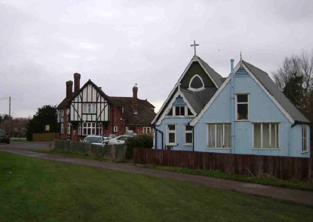
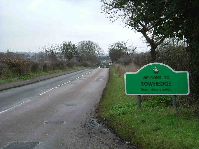
///flip.keys.seats. Near Rowhedge, Essex

Nearby Locations

Heath, Old Old Heath

Related Wikis

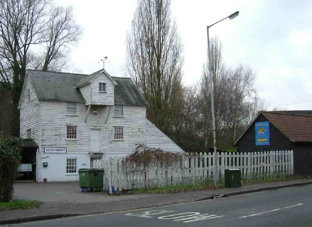
Bourne Mill, Colchester

Bourne Mill is a Grade I listed former fishing lodge and then in turn a fulling mill and cornmill in the city of Colchester in Essex and is owned by the...

The Hythe, Essex

The Hythe is an area in the southeastern part of Colchester in Essex, England, on the River Colne. Historically it was a hamlet. The Hythe is home to the...

Colchester power station

Colchester power station supplied electricity to the city of Colchester, Essex, England and the surrounding area from 1900 to 1960. It was owned and operated...

Donyland Lodge

Donyland Lodge was an independent school in Rowhedge, Colchester in the United Kingdom The school catered for children with complex behavioural, social...

Church of St Leonard at the Hythe, Colchester

The Church of St Leonard at the Hythe is a redundant Anglican church in Hythe, Colchester, Essex, England. It is recorded in the National Heritage List...

Magic Roundabout (Colchester)

The Greenstead roundabout is a large roundabout junction in Colchester, Essex, England.It is a "magic roundabout", where traffic travels both directions...

University of Essex

The University of Essex is a public research university in Essex, England. Established by royal charter in 1965, it is one of the original plate glass...

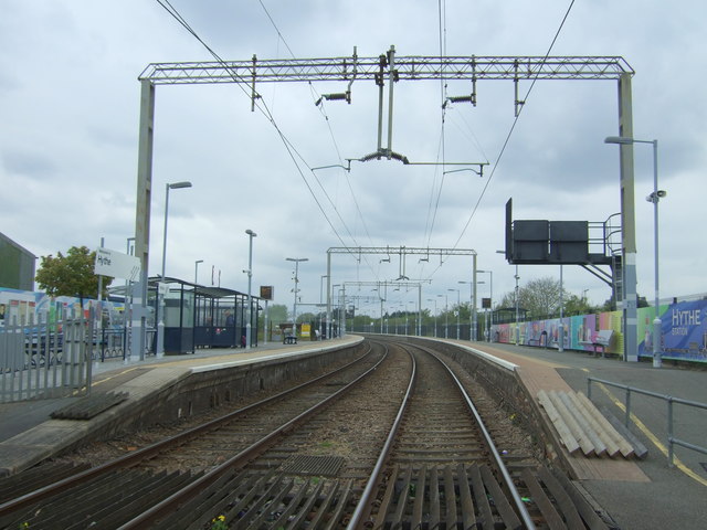
Hythe railway station (Essex)

Hythe railway station in Essex is on the Sunshine Coast Line, a branch of the Great Eastern Main Line in the East of England, serving Hythe and other eastern...

Nearby Amenities

Located within 500m of 51.872684,0.92473879
Mini Roundabout
Direction: clockwise
Lat/Long: 51.8734214/0.9245264
Mini Roundabout
Direction: clockwise
Lat/Long: 51.8710536/0.9262429
Power: tower
Ref: PUD 8
Source: GPS
Lat/Long: 51.8726725/0.9195739
Barrier: bollard
Foot: yes
Lat/Long: 51.8748292/0.9271301
Barrier: bollard
Foot: yes
Lat/Long: 51.8751403/0.9276394
Barrier: stile
Lat/Long: 51.8704507/0.9231004
Old Heath
Is In: Colchester
Place: suburb
Lat/Long: 51.8743479/0.9243368
Line Management: transition
Power: tower
Ref: PYF5
Lat/Long: 51.8735921/0.9248628
Power: tower
Ref: PUD 5
Lat/Long: 51.8726475/0.9283891
Power: tower
Ref: PUD 3
Source Ref: interpolation
Lat/Long: 51.8745641/0.9301578
Power: tower
Ref: PUD 4
Lat/Long: 51.8730261/0.9298237
Power: tower
Ref: PUD 7
Source Ref: interpolation
Lat/Long: 51.8727603/0.9221099
Post Box
Operator: Royal Mail
Ref: CO2 295
Lat/Long: 51.8740598/0.9243032
Power: tower
Ref: PUD 6
Lat/Long: 51.8726903/0.9257785
Power: tower
Ref: PYF4
Lat/Long: 51.8746029/0.9271954
Power: tower
Ref: PYF3
Lat/Long: 51.8753778/0.9290815
Turning Circle
Lat/Long: 51.8694527/0.9249568
Barrier: bollard
Lat/Long: 51.8767157/0.9266333
Bus Stop
Barn Hall Avenue
Bus: yes
Naptan AtcoCode: 150033043013
Naptan Bearing: NW
Naptan CommonName: Barn Hall Avenue
Naptan Crossing: Barn Hall Avenue
Naptan Indicator: Adj
Naptan Landmark: Barn Hall Avenue
Naptan NaptanCode: esxampdt
Naptan PlusbusZoneRef: CLCHSTR
Naptan Street: Old Heath Road
Naptan Verified: no
Public Transport: platform
Source: naptan_import
Lat/Long: 51.8762969/0.9214819
Bus Stop
Barn Hall Avenue
Bus: yes
Naptan AtcoCode: 150033044001
Naptan Bearing: SE
Naptan CommonName: Barn Hall Avenue
Naptan Crossing: Barn Hall Avenue
Naptan Indicator: Opp
Naptan Landmark: Barn Hall Avenue
Naptan NaptanCode: esxampdw
Naptan PlusbusZoneRef: CLCHSTR
Naptan Street: Old Heath Road
Naptan Verified: no
Public Transport: platform
Source: naptan_import
Lat/Long: 51.8759317/0.9224134
Abbots Road
Naptan AtcoCode: 150033044003
Naptan Bearing: NW
Naptan BusStopType: CUS
Naptan CommonName: Abbots Road
Naptan Crossing: Abbots Road
Naptan Indicator: Adj
Naptan Landmark: Abbots Road
Naptan NaptanCode: esxampgd
Naptan PlusbusZoneRef: CLCHSTR
Naptan Street: Old Heath Road
Naptan Verified: no
Public Transport: platform
Source: naptan_import
Lat/Long: 51.8717785/0.9255875
Bus Stop
Abbots Road
Bus: yes
Naptan AtcoCode: 150033044004
Naptan Bearing: SE
Naptan CommonName: Abbots Road
Naptan Crossing: Abbots Road
Naptan Indicator: Opp
Naptan Landmark: Abbots Road
Naptan NaptanCode: esxampgj
Naptan PlusbusZoneRef: CLCHSTR
Naptan Street: Old Heath Road
Naptan Verified: no
Public Transport: platform
Source: naptan_import
Lat/Long: 51.8714635/0.9259593
Bus Stop
School
Bus: yes
Naptan AtcoCode: 150033048001
Naptan Bearing: SW
Naptan CommonName: School
Naptan Indicator: o/s
Naptan Landmark: School
Naptan NaptanCode: esxamtpm
Naptan PlusbusZoneRef: CLCHSTR
Naptan Street: Abbot's Road
Naptan Verified: no
Public Transport: platform
Source: naptan_import
Lat/Long: 51.8707994/0.9255384
Bus Stop
Abbot's Road
Bus: yes
Naptan AtcoCode: 150033048002
Naptan Bearing: W
Naptan CommonName: Abbot's Road
Naptan Crossing: Mountbatten Drive
Naptan Indicator: W-bound
Naptan Landmark: Abbot's Road
Naptan NaptanCode: esxamtpt
Naptan PlusbusZoneRef: CLCHSTR
Naptan Street: Abbot's Road
Naptan Verified: no
Public Transport: platform
Source: naptan_import
Lat/Long: 51.8707039/0.9217837
Bus Stop
Abbot's Road
Bus: yes
Naptan AtcoCode: 150033048003
Naptan Bearing: E
Naptan CommonName: Abbot's Road
Naptan Crossing: Mountbatten Drive
Naptan Indicator: E-bound
Naptan Landmark: Abbot's Road
Naptan NaptanCode: esxamtpw
Naptan PlusbusZoneRef: CLCHSTR
Naptan Street: Abbot's Road
Naptan Verified: no
Public Transport: platform
Source: naptan_import
Lat/Long: 51.8708677/0.9213439
School
Naptan AtcoCode: 1500330480Y1
Naptan Bearing: NE
Naptan BusStopType: CUS
Naptan CommonName: School
Naptan Indicator: Opp
Naptan Landmark: School
Naptan NaptanCode: esxgwjwj
Naptan PlusbusZoneRef: CLCHSTR
Naptan Street: Abbot's Road
Naptan Verified: no
Public Transport: platform
Source: naptan_import
Lat/Long: 51.8708536/0.9255274
Bus Stop
Grange Way
Bus: yes
Naptan AtcoCode: 150033102002
Naptan Bearing: NE
Naptan CommonName: Grange Way
Naptan Crossing: Grange Way
Naptan Indicator: Opp
Naptan Landmark: Grange Way
Naptan NaptanCode: esxjdagw
Naptan PlusbusZoneRef: CLCHSTR
Naptan Street: Whitehall Road
Naptan Verified: no
Public Transport: platform
Source: naptan_import
Lat/Long: 51.8747886/0.9271488
Bus Stop
Grange Way
Bus: yes
Naptan AtcoCode: 150033102003
Naptan Bearing: SW
Naptan CommonName: Grange Way
Naptan Crossing: Grange Way
Naptan Indicator: Adj
Naptan Landmark: Grange Way
Naptan NaptanCode: esxjdagt
Naptan PlusbusZoneRef: CLCHSTR
Naptan Street: Whitehall Road
Naptan Verified: no
Public Transport: platform
Source: naptan_import
Lat/Long: 51.8741605/0.926367
Bus Stop
Network Colchester Depot
Bus: yes
Naptan AtcoCode: 1500331021Y
Naptan CommonName: Network Colchester Depot
Naptan Indicator: Arrival Stop
Naptan Landmark: Network Colchester Depot
Naptan NaptanCode: esxjgdpt
Naptan Street: Grange Way
Naptan Verified: no
Public Transport: platform
Source: naptan_import
Lat/Long: 51.8729186/0.927841
Bus Stop
Old Heath Post Office
Bus: yes
Naptan AtcoCode: 1500IM138
Naptan Bearing: NW
Naptan CommonName: Post Office
Naptan Crossing: Whitehall Close
Naptan Indicator: Opp
Naptan Landmark: Post Office
Naptan NaptanCode: esxampga
Naptan PlusbusZoneRef: CLCHSTR
Naptan Street: Old Heath Road
Naptan Verified: no
Public Transport: platform
Source: naptan_import
Lat/Long: 51.874714/0.9236421
Old Heath Post Office
Naptan AtcoCode: 1500IM138B
Naptan Bearing: S
Naptan BusStopType: CUS
Naptan CommonName: Post Office
Naptan Crossing: Cavendish Avenue
Naptan Indicator: o/s
Naptan Landmark: Post Office
Naptan NaptanCode: esxgjdmt
Naptan PlusbusZoneRef: CLCHSTR
Naptan Street: Old Heath Road
Naptan Verified: no
Public Transport: platform
Source: naptan_import
Lat/Long: 51.873951/0.9243099
Bus Stop
Canwick Grove
Bus: yes
Naptan AtcoCode: 1500IM1870
Naptan Bearing: W
Naptan CommonName: Canwick Grove
Naptan Indicator: Adj
Naptan Landmark: Canwick Grove
Naptan NaptanCode: esxamtwd
Naptan PlusbusZoneRef: CLCHSTR
Naptan Street: Barn Hall Avenue
Naptan Verified: no
Public Transport: platform
Source: naptan_import
Lat/Long: 51.8755611/0.9207886
Canwick Grove
Naptan AtcoCode: 1500IM1870Y
Naptan Bearing: E
Naptan BusStopType: CUS
Naptan CommonName: Canwick Grove
Naptan Indicator: Opp
Naptan Landmark: Canwick Grove
Naptan NaptanCode: esxgwjwm
Naptan PlusbusZoneRef: CLCHSTR
Naptan Street: Barn Hall Avenue
Naptan Verified: no
Public Transport: platform
Source: naptan_import
Lat/Long: 51.8756219/0.9207659
Bus Stop
The Bell
Naptan AtcoCode: 1500IM1898
Naptan Bearing: S
Naptan CommonName: The Bell
Naptan Indicator: o/s
Naptan Landmark: The Bell
Naptan NaptanCode: esxampgm
Naptan PlusbusZoneRef: CLCHSTR
Naptan Street: Old Heath Road
Naptan Verified: no
Public Transport: platform
Source: naptan_import
Lat/Long: 51.8694799/0.9272398
Crossing
Crossing: uncontrolled
Crossing Ref: zebra
Lat/Long: 51.8741538/0.9241264
Post Box
Addr Postcode: CO2 8AZ
Ref: CO2 468
Lat/Long: 51.8714618/0.918138
Leisure: playground
Source: Local knowledge
Lat/Long: 51.8766149/0.9266805
Designation: 91626
Man Made: mast
Operator: EE
Ref: 91626
Source: Bing/Knowledge
Lat/Long: 51.8731078/0.9265046
Addr City: Colchester
Addr Housenumber: 2-18
Addr Interpolation: even
Addr Postcode: CO2 8HZ
Addr Street: Waterside Lane
Entrance: main
Lat/Long: 51.8768626/0.9270075
Addr City: Colchester
Addr Housename: Mallard House
Addr Housenumber: 120-126
Addr Interpolation: even
Addr Postcode: CO2 8HU
Addr Street: Albany Gardens
Entrance: main
Lat/Long: 51.8767375/0.9263224
Addr City: Colchester
Addr Housename: Grebe House
Addr Housenumber: 163-197
Addr Interpolation: odd
Addr Postcode: CO2 8HQ
Addr Street: Albany Gardens
Entrance: main
Lat/Long: 51.8764539/0.9262583
Addr City: Colchester
Addr Housename: Heron House
Addr Housenumber: 96-118
Addr Interpolation: even
Addr Postcode: CO2 8HU
Addr Street: Albany Gardens
Entrance: main
Lat/Long: 51.8767605/0.926618
Addr City: Colchester
Addr Housename: Swan House
Addr Housenumber: 1-23
Addr Interpolation: odd
Addr Postcode: CO2 8HW
Addr Street: Waterside Lane
Entrance: yes
Lat/Long: 51.8770271/0.9265921
Barrier: bollard
Lat/Long: 51.8766479/0.9259148
Crossing Island: yes
Lat/Long: 51.8709621/0.9263129
Crossing Island: yes
Lat/Long: 51.8710228/0.9261567
Crossing
Crossing: unmarked
Crossing Island: yes
Lat/Long: 51.8711203/0.9261971
Crossing
Crossing: unmarked
Crossing Island: yes
Lat/Long: 51.873333/0.924517
Crossing
Crossing: unmarked
Crossing Island: yes
Lat/Long: 51.8734349/0.9246546
Crossing
Crossing: unmarked
Crossing Island: yes
Lat/Long: 51.8734932/0.924451
Crossing
Crossing: unmarked
Crossing Island: yes
Lat/Long: 51.8743698/0.9268513
Crossing Island: yes
Lat/Long: 51.8749969/0.9275428
Historic: boundary_stone
Ref: WD B.S. 10
Lat/Long: 51.870449/0.9230884
Post Office
Old Heath Post Office
Addr City: Colchester
Addr Housenumber: 218A
Addr Postcode: CO2 8AU
Addr Street: Old Heath Road
Brand: Post Office
Brand Wikidata: Q1783168
Fixme: verify by survey
Opening Hours: Mo-Su off
Ref Pol Id: 1220
Source: pol_branch_list_2018-02
Url: http://www.gazette-news.co.uk/news/14620179.Suspicions_raised_after_mysterious_closure_of_Old_Heath_Post_Office/
Lat/Long: 51.874056/0.9244404
Generator Method: photovoltaic
Generator Output Electricity: yes
Generator Source: solar
Generator Type: solar_photovoltaic_panel
Location: roof
Power: generator
Lat/Long: 51.8681951/0.9245811
Generator Method: photovoltaic
Generator Output Electricity: yes
Generator Source: solar
Generator Type: solar_photovoltaic_panel
Location: roof
Power: generator
Lat/Long: 51.8682381/0.9244416
Generator Method: photovoltaic
Generator Output Electricity: yes
Generator Source: solar
Generator Type: solar_photovoltaic_panel
Location: roof
Power: generator
Lat/Long: 51.8685263/0.9245462
Generator Method: photovoltaic
Generator Output Electricity: yes
Generator Source: solar
Generator Type: solar_photovoltaic_panel
Location: roof
Power: generator
Lat/Long: 51.8685147/0.9245945
Generator Method: photovoltaic
Generator Output Electricity: yes
Generator Source: solar
Generator Type: solar_photovoltaic_panel
Location: roof
Power: generator
Lat/Long: 51.8683822/0.9250022
Generator Method: photovoltaic
Generator Output Electricity: yes
Generator Source: solar
Generator Type: solar_photovoltaic_panel
Location: roof
Power: generator
Lat/Long: 51.8684611/0.9247729
Generator Method: photovoltaic
Generator Output Electricity: yes
Generator Source: solar
Generator Type: solar_photovoltaic_panel
Location: roof
Power: generator
Lat/Long: 51.8684793/0.924719
Generator Method: photovoltaic
Generator Output Electricity: yes
Generator Source: solar
Generator Type: solar_photovoltaic_panel
Location: roof
Power: generator
Lat/Long: 51.8684643/0.9253252
Generator Method: photovoltaic
Generator Output Electricity: yes
Generator Source: solar
Generator Type: solar_photovoltaic_panel
Location: roof
Power: generator
Lat/Long: 51.8684596/0.9253854
Generator Method: photovoltaic
Generator Output Electricity: yes
Generator Source: solar
Generator Type: solar_photovoltaic_panel
Location: roof
Power: generator
Lat/Long: 51.8684706/0.925684
Generator Method: photovoltaic
Generator Output Electricity: yes
Generator Source: solar
Generator Type: solar_photovoltaic_panel
Location: roof
Power: generator
Lat/Long: 51.8684881/0.9259185
Generator Method: photovoltaic
Generator Output Electricity: yes
Generator Source: solar
Generator Type: solar_photovoltaic_panel
Location: roof
Power: generator
Lat/Long: 51.8684928/0.925971
Generator Method: photovoltaic
Generator Output Electricity: yes
Generator Source: solar
Generator Type: solar_photovoltaic_panel
Location: roof
Power: generator
Lat/Long: 51.8685039/0.9260389
Generator Method: photovoltaic
Generator Output Electricity: yes
Generator Source: solar
Generator Type: solar_photovoltaic_panel
Location: roof
Power: generator
Lat/Long: 51.8685745/0.9263156
Generator Method: photovoltaic
Generator Output Electricity: yes
Generator Source: solar
Generator Type: solar_photovoltaic_panel
Location: roof
Power: generator
Lat/Long: 51.868543/0.9262512
Generator Method: photovoltaic
Generator Output Electricity: yes
Generator Source: solar
Generator Type: solar_photovoltaic_panel
Location: roof
Power: generator
Lat/Long: 51.8687087/0.9265624
Generator Method: photovoltaic
Generator Output Electricity: yes
Generator Source: solar
Generator Type: solar_photovoltaic_panel
Location: roof
Power: generator
Lat/Long: 51.8687352/0.9265945
Generator Method: photovoltaic
Generator Output Electricity: yes
Generator Source: solar
Generator Type: solar_photovoltaic_panel
Location: roof
Power: generator
Lat/Long: 51.8685198/0.9243764
Generator Method: photovoltaic
Generator Output Electricity: yes
Generator Source: solar
Generator Type: solar_photovoltaic_panel
Location: roof
Power: generator
Lat/Long: 51.8684787/0.9268787
Generator Method: photovoltaic
Generator Output Electricity: yes
Generator Source: solar
Generator Type: solar_photovoltaic_panel
Location: roof
Power: generator
Lat/Long: 51.8685276/0.9269122
Generator Method: photovoltaic
Generator Output Electricity: yes
Generator Source: solar
Generator Type: solar_photovoltaic_panel
Location: roof
Power: generator
Lat/Long: 51.8685789/0.9269632
Generator Method: photovoltaic
Generator Output Electricity: yes
Generator Source: solar
Generator Type: solar_photovoltaic_panel
Location: roof
Power: generator
Lat/Long: 51.8697136/0.9261239
Generator Method: photovoltaic
Generator Output Electricity: yes
Generator Source: solar
Generator Type: solar_photovoltaic_panel
Location: roof
Power: generator
Lat/Long: 51.8697384/0.9261642
Generator Method: photovoltaic
Generator Output Electricity: yes
Generator Source: solar
Generator Type: solar_photovoltaic_panel
Location: roof
Power: generator
Lat/Long: 51.8712127/0.9245212
Generator Method: photovoltaic
Generator Output Electricity: yes
Generator Source: solar
Generator Type: solar_photovoltaic_panel
Location: roof
Power: generator
Lat/Long: 51.8709345/0.9243147
Generator Method: photovoltaic
Generator Output Electricity: yes
Generator Source: solar
Generator Type: solar_photovoltaic_panel
Location: roof
Power: generator
Lat/Long: 51.8717311/0.9197871
Generator Method: photovoltaic
Generator Output Electricity: yes
Generator Source: solar
Generator Type: solar_photovoltaic_panel
Location: roof
Power: generator
Lat/Long: 51.8716102/0.9194009
Generator Method: photovoltaic
Generator Output Electricity: yes
Generator Source: solar
Generator Type: solar_photovoltaic_panel
Location: roof
Power: generator
Lat/Long: 51.8725127/0.9179498
Generator Method: photovoltaic
Generator Output Electricity: yes
Generator Source: solar
Generator Type: solar_photovoltaic_panel
Location: roof
Power: generator
Lat/Long: 51.8725097/0.9178088
Generator Method: photovoltaic
Generator Output Electricity: yes
Generator Source: solar
Generator Type: solar_photovoltaic_panel
Location: roof
Power: generator
Lat/Long: 51.8733242/0.9187638
Generator Method: photovoltaic
Generator Output Electricity: yes
Generator Source: solar
Generator Type: solar_photovoltaic_panel
Location: roof
Power: generator
Lat/Long: 51.8733324/0.9188175
Generator Method: photovoltaic
Generator Output Electricity: yes
Generator Source: solar
Generator Type: solar_photovoltaic_panel
Location: roof
Power: generator
Lat/Long: 51.8704787/0.9269965
Addr City: Colchester
Addr Housenumber: 135-161
Addr Interpolation: odd
Addr Postcode: CO2 8HQ
Addr Street: Albany Gardens
Building: residential
Building Levels: 4
Entrance: main
Lat/Long: 51.8765331/0.9269324
Defibrillator
Defibrillator Location: front left wall of building when viewed from road
Emergency: defibrillator
Ref GB The Circuit: AFE01617-082A-422C-9B5D-AF6B00CC31B2
Lat/Long: 51.8726697/0.9238807
The data included in this document is from www.openstreetmap.org. The data is made available under ODbL.

Have you been to Heath, Old?

Leave your review of Heath, Old below (or comments, questions and feedback).