Ditch, Old

Settlement in Somerset Mendip

England

Ditch, Old

Broad Road near Rodney Stoke A view down Broad Road at the top of the descent into Rodney Stoke.
The view west goes over the Somerset Levels to the Bristol Channel.
Broad Road near Rodney Stoke Credit: Kevin Pearson

Ditch, Old, Somerset is a small village located in the county of Somerset, England. Situated approximately 8 miles southwest of the town of Glastonbury, this rural community is nestled within the picturesque Somerset Levels.

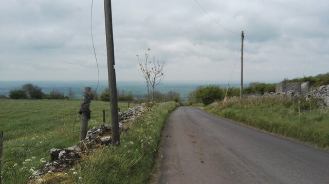
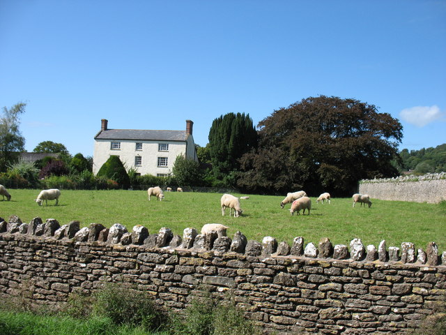
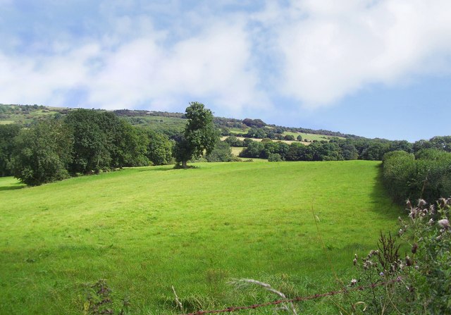
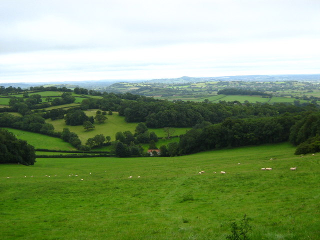
The village is characterized by its quaint and charming atmosphere, with traditional stone cottages lining narrow lanes. Ditch is surrounded by verdant countryside, offering beautiful views of rolling hills and farmland. The area is renowned for its natural beauty and is popular among nature enthusiasts and hikers.

Despite its small size, Ditch boasts a rich history that can be traced back to medieval times. The village is home to several historical landmarks, including St. Mary's Church, a Grade II listed building dating back to the 15th century. The church features stunning architectural details and is a focal point of the community.

In terms of amenities, Ditch offers limited but essential facilities. There is a small local shop for everyday necessities, and a pub where residents and visitors can enjoy a drink and a traditional meal. However, for more extensive services and amenities, residents often rely on nearby towns and villages.

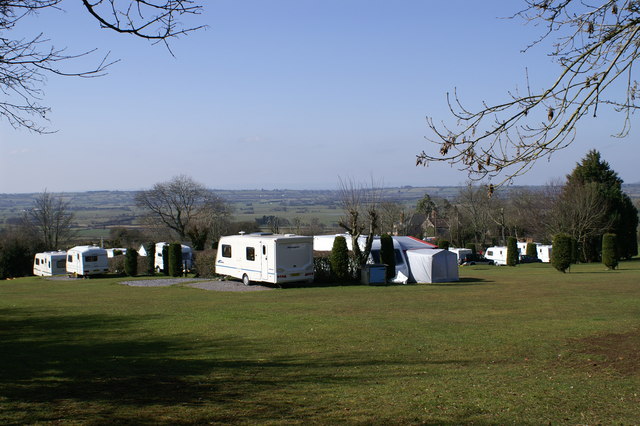
Ditch, Old, Somerset is a peaceful and idyllic village, ideal for those seeking a tranquil rural lifestyle. Surrounded by natural beauty and steeped in history, it provides a charming retreat from the hustle and bustle of modern life.

If you have any feedback on the listing, please let us know in the comments section below.

Ditch, Old Images

Images are sourced within 2km of 51.242079/-2.71454 or Grid Reference ST5049. Thanks to Geograph Open Source API. All images are credited.

Broad Road near Rodney Stoke A view down Broad Road at the top of the descent into Rodney Stoke.
The view west goes over the Somerset Levels to the Bristol Channel.
Broad Road near Rodney Stoke
A view down Broad Road at the top of the descent into Rodney Stoke. The view west goes over the Somerset Levels to the Bristol Channel.
In Rodney Stoke
In Rodney Stoke
Westbury-Sub Mendip Church Saint Lawrence, with parts dating back to the 12th century.
Westbury-Sub Mendip Church
Saint Lawrence, with parts dating back to the 12th century.
Mendip Edge Scenery On the south west slope of the Mendip Hills near Rodney Stoke.
Mendip Edge Scenery
On the south west slope of the Mendip Hills near Rodney Stoke.
Caravan Park On Westclose Hill
Caravan Park
On Westclose Hill
Looking South from Lodge Hill
St Lawrence's church, Westbury Originally C12; a little Norman work remains, but the tower was rebuilt in 1887, possibly reusing the former pinnacles <span class="nowrap"><a title="http://webapp1.somerset.gov.uk/her/details.asp?prn=22003" rel="nofollow ugc noopener" href="http://webapp1.somerset.gov.uk/her/details.asp?prn=22003">Link</a><img style="margin-left:2px;" alt="External link" title="External link - shift click to open in new window" src="https://s1.geograph.org.uk/img/external.png" width="10" height="10"/></span> .
St Lawrence's church, Westbury
Originally C12; a little Norman work remains, but the tower was rebuilt in 1887, possibly reusing the former pinnacles LinkExternal link .
Churchyard, Westbury-Sub-Mendip The churchyard on the north side of <a href="https://www.geograph.org.uk/photo/1878790">ST4948 : St Lawrence's church, Westbury</a>. In the background are barns at Court House Farm.
Churchyard, Westbury-Sub-Mendip
The churchyard on the north side of ST4948 : St Lawrence's church, Westbury. In the background are barns at Court House Farm.
St Lawrence's church, Westbury A view of <a href="https://www.geograph.org.uk/photo/1878790">ST4948 : St Lawrence's church, Westbury</a> from the south, showing the two-storey porch with its pierced parapet and empty niche. In a few minutes the sun would have illuminated more of the stonework, but breakfast called.
St Lawrence's church, Westbury
A view of ST4948 : St Lawrence's church, Westbury from the south, showing the two-storey porch with its pierced parapet and empty niche. In a few minutes the sun would have illuminated more of the stonework, but breakfast called.
Hollow Farm The lane is The Hollow, running from the centre of Westbury-Sub-Mendip to meet the A371 turnpike. Hollow Farm lies below Broadway Hill on the right.
Hollow Farm
The lane is The Hollow, running from the centre of Westbury-Sub-Mendip to meet the A371 turnpike. Hollow Farm lies below Broadway Hill on the right.
Towards Stoneleigh from The Hollow Looking across a couple of fields down the hill to the houses at Stoneleigh, which are along the A371 Stoke Road. The partly wooded Lodge Hill rises in the background.
Towards Stoneleigh from The Hollow
Looking across a couple of fields down the hill to the houses at Stoneleigh, which are along the A371 Stoke Road. The partly wooded Lodge Hill rises in the background.
Footpath up Broadway Hill The sign indicates the start of footpath WS 13/59 from The Hollow, but according to the maps it should leave the lane 100 metres further east. Two more footpaths cross the field.
Footpath up Broadway Hill
The sign indicates the start of footpath WS 13/59 from The Hollow, but according to the maps it should leave the lane 100 metres further east. Two more footpaths cross the field.
On Broadway Hill The line of yellow hawkweed roughly shows the line of footpath WS 13/17 down to meet The Hollow at the gate near the farm buildings. This is taken from footpath WS 13/59; the two paths cross just to the right of the camera. The two trees on a more steeply sloping bank suggest the line of a vanished field boundary.
On Broadway Hill
The line of yellow hawkweed roughly shows the line of footpath WS 13/17 down to meet The Hollow at the gate near the farm buildings. This is taken from footpath WS 13/59; the two paths cross just to the right of the camera. The two trees on a more steeply sloping bank suggest the line of a vanished field boundary.
Footpath down Broadway Hill The reverse view of <a href="https://www.geograph.org.uk/photo/1878942">ST4949 : Footpath up Broadway Hill</a>, with footpath WS 13/59 dropping to meet The Hollow. The nearest houses are at Stoneleigh on the A371, with Windmill Hill and Lodge Hill in the background.
Footpath down Broadway Hill
The reverse view of ST4949 : Footpath up Broadway Hill, with footpath WS 13/59 dropping to meet The Hollow. The nearest houses are at Stoneleigh on the A371, with Windmill Hill and Lodge Hill in the background.
On Broadway Hill Looking along the line of footpath WS 13/17 as it drops diagonally across the hillside towards The Hollow; see also <a href="https://www.geograph.org.uk/photo/1879003">ST4949 : On Broadway Hill</a>. The yellow flowers are Hawkweed.
On Broadway Hill
Looking along the line of footpath WS 13/17 as it drops diagonally across the hillside towards The Hollow; see also ST4949 : On Broadway Hill. The yellow flowers are Hawkweed.
Gunge tank, Broadway Hill Taken from close to the same spot as <a href="https://www.geograph.org.uk/photo/1879227">ST4949 : On Broadway Hill</a>, this is reminiscent of the "Poets Cornered" tub of gunk that Peter Cook, Dudley Moore and guest inevitably ended up in, in "Not Only ... But Also". Nevertheless, an important source of liquid for livestock on what is going to be a very hot weekend, and positioned so that animals in adjoining fields can enjoy a chat with their bevvy. Below is The Hollow, leading into Westbury-Sub-Mendip.
Gunge tank, Broadway Hill
Taken from close to the same spot as ST4949 : On Broadway Hill, this is reminiscent of the "Poets Cornered" tub of gunk that Peter Cook, Dudley Moore and guest inevitably ended up in, in "Not Only ... But Also". Nevertheless, an important source of liquid for livestock on what is going to be a very hot weekend, and positioned so that animals in adjoining fields can enjoy a chat with their bevvy. Below is The Hollow, leading into Westbury-Sub-Mendip.
On Broadway Hill Footpath WS 13/17 descends along a track, crossing into <a href="https://www.geograph.org.uk/gridref/ST5049">ST5049</a> on its way to Old Ditch.
On Broadway Hill
Footpath WS 13/17 descends along a track, crossing into ST5049 on its way to Old Ditch.
Show me another place!

Ditch, Old is located at Grid Ref: ST5049 (Lat: 51.242079, Lng: -2.71454)

Administrative County: Somerset

District: Mendip

Police Authority: Avon and Somerset

What 3 Words

///return.scrapped.loaders. Near Draycott, Somerset

Related Wikis

Westbury-sub-Mendip

Westbury-sub-Mendip is a village and civil parish in Somerset, England. The village is on the southern slopes of the Mendip Hills, 4 miles (6.4 km) from...

Church of St Lawrence, Westbury-sub-Mendip

The Church of St Lawrence in Westbury-sub-Mendip, Somerset, England was built in the 12th century. It is a Grade II* listed building. == History == The...

Lodge Hill railway station

Lodge Hill railway station was a station on the Bristol and Exeter Railway's Cheddar Valley line in Somerset, England from 1870 until 1963. The station...

Brimble Pit and Cross Swallet Basins

Brimble Pit and Cross Swallet Basins (grid reference ST512505) is a 154.3 hectare (381.3 acre) geological Site of Special Scientific Interest between Wookey...

Rodney Stoke

Rodney Stoke is a small village and civil parish, located at grid reference ST486501, 5 miles north-west of Wells, in the English county of Somerset. The...

Rodney Stoke SSSI

Rodney Stoke (grid reference ST492507) is a 69.6 hectare (172.0 acre) biological Site of Special Scientific Interest, just north of the village of Rodney...

Westbury Camp

Westbury Camp is a univallate Iron Age hill fort in the Mendip Hills in Somerset, England. The hill fort is situated in the parish of Rodney Stoke, approximately...

St Paul's Church, Easton

St Paul's Church is a Church of England church in Easton, Somerset, England. The church, which was designed by Richard Carver and built in 1843, has been...

Nearby Amenities

Located within 500m of 51.242079,-2.71454
Old Ditch
Place: hamlet
Source: NPE
Lat/Long: 51.2408827/-2.7176409
Broadway Hill
Natural: peak
Source: OS OpenData StreetView
Lat/Long: 51.2396868/-2.7190284
Barrier: stile
Source: survey;gps
Stile: stepover
Lat/Long: 51.2405691/-2.7193061
Bench
Source: survey;gps
Lat/Long: 51.2395108/-2.718329
Barrier: stile
Material: stone
Source: survey;gps
Stile: stepover
Lat/Long: 51.2404889/-2.7115997
The data included in this document is from www.openstreetmap.org. The data is made available under ODbL.

Have you been to Ditch, Old?

Leave your review of Ditch, Old below (or comments, questions and feedback).