Belses, Old

Settlement in Roxburghshire

Scotland

Belses, Old

Minto Kames Farm seen from the Minto Hills.
Minto Kames Credit: Richard Webb

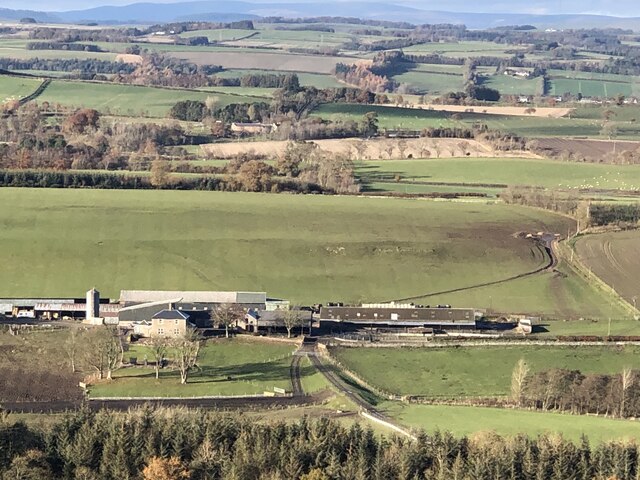
Belses is a small village located in the historic county of Roxburghshire in the Scottish Borders region of Scotland. Situated near the town of Ancrum, Belses is known for its picturesque countryside and rural charm.

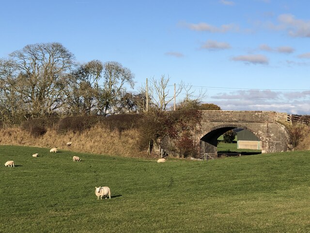
The village of Belses is steeped in history, with roots dating back to the medieval period. The area is dotted with ancient ruins and historic sites, including the remains of a 13th-century castle and a nearby Roman fort.

Belses is a close-knit community with a population of around 100 residents. The village is home to a mix of traditional stone cottages, farmhouses, and newer residential properties. The local economy is primarily based on agriculture, with many residents working in farming and livestock production.

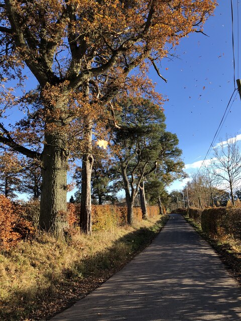
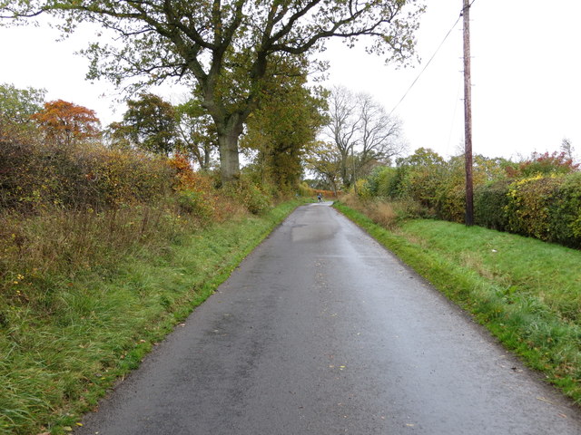
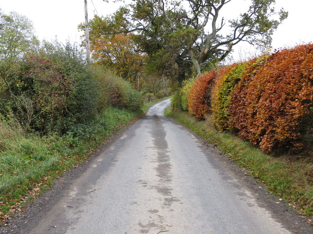
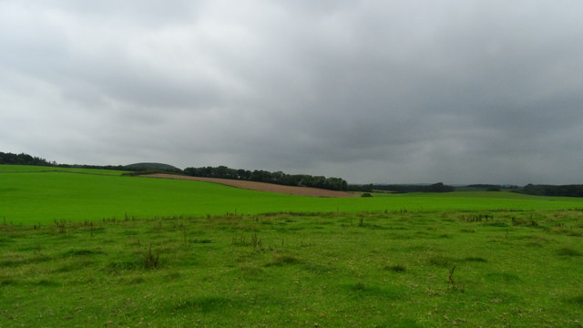
Belses is surrounded by rolling hills and lush green fields, making it an ideal destination for outdoor enthusiasts. The village is located near several walking and cycling trails, as well as fishing spots along the River Teviot.

Overall, Belses is a peaceful and charming village that offers a glimpse into Scotland's rich history and natural beauty.

If you have any feedback on the listing, please let us know in the comments section below.

Belses, Old Images

Images are sourced within 2km of 55.507776/-2.6982052 or Grid Reference NT5624. Thanks to Geograph Open Source API. All images are credited.

Minto Kames Farm seen from the Minto Hills.
Minto Kames
Farm seen from the Minto Hills.
Waverley Line route, Standhill I had hoped it would have reopened by now.  One day!
Waverley Line route, Standhill
I had hoped it would have reopened by now. One day!
Minor road near Netherraw
Minor road near Netherraw It got a bit muddy further on where the Christmas tree traffic was moving.
Minor road near Netherraw
It got a bit muddy further on where the Christmas tree traffic was moving.
Christmas trees, Netherraw
Muddy road, Netherraw Christmas tree harvest season.
Muddy road, Netherraw
Christmas tree harvest season.
Lumber awaiting transportation from Kipps Plantation Looking north-eastward from the road.
Lumber awaiting transportation from Kipps Plantation
Looking north-eastward from the road.
Rolling farmland on the B6400
Minor road with a blind summit near Hillhead Looking northward.
Minor road with a blind summit near Hillhead
Looking northward.
Minor road with a passing place crossing Mire Burn Looking south-eastward.
Minor road with a passing place crossing Mire Burn
Looking south-eastward.
Minor road at Netherraw Looking north-westward.
Minor road at Netherraw
Looking north-westward.
Minor road near Netherraw Looking south-eastward.
Minor road near Netherraw
Looking south-eastward.
Minor road approaching Standhill Looking south-eastward.
Minor road approaching Standhill
Looking south-eastward.
View SW from Standhill Ave, Standhill near Lilliesleaf
Belses Muir from the air Belses Muir  is in the foreground. Rawflat is up on the left, Bloomfield on the right. Ale Water can also be seen.
Belses Muir from the air
Belses Muir is in the foreground. Rawflat is up on the left, Bloomfield on the right. Ale Water can also be seen.
Kipps Plantation
Kipps Plantation
Path end, Troneyhill/Kipps/Lambslair Plantations The mapped track is very rough east of here, crossing the gate to the south and walking through the birchwood is a much easier option.
Path end, Troneyhill/Kipps/Lambslair Plantations
The mapped track is very rough east of here, crossing the gate to the south and walking through the birchwood is a much easier option.
Troneyhill Plantation
Show me another place!

Belses, Old is located at Grid Ref: NT5624 (Lat: 55.507776, Lng: -2.6982052)

Unitary Authority: The Scottish Borders

Police Authority: The Lothians and Scottish Borders

What 3 Words

///obstruct.suppers.crash. Near Saint Boswells, Scottish Borders

Related Wikis

Old Belses

Old Belses is a village by the Ale Water, in the Parish of Ancrum, in the Scottish Borders of Scotland, in the historic county of Roxburghshire. Other...

Belses

Belses is a village on the Ale Water, in the Scottish Borders area of Scotland the former Selkirkshire. It is situated close to Old Belses, and lies south...

Belses railway station

Belses railway station served the village of Belses, Scottish Borders, Scotland from 1849 to 1969 on the Waverley Route. == History == The station opened...

Lilliesleaf

Lilliesleaf is a small village and civil parish 7 miles (11 km) south east of Selkirk in the Roxburghshire area of Scottish Borders of Scotland. Other...

Nearby Amenities

Located within 500m of 55.507776,-2.6982052
Greenhouse
Naptan AtcoCode: 69001542
Naptan Bearing: SE
Naptan BusStopType: CUS
Naptan CommonName: Greenhouse
Naptan Indicator: at Entrance
Naptan Landmark: Farm Entrance
Naptan NaptanCode: 72732793
Naptan Street: Greenhouse
Naptan Verified: no
Source: naptan_import
Lat/Long: 55.5045471/-2.7033249
Greenhouse
Naptan AtcoCode: 69001543
Naptan Bearing: NW
Naptan BusStopType: CUS
Naptan CommonName: Greenhouse
Naptan Indicator: Road Junction
Naptan Landmark: Road Junction
Naptan NaptanCode: 72732868
Naptan Street: Greenhouse
Naptan Verified: no
Source: naptan_import
Lat/Long: 55.5043761/-2.7033852
Natural: peak
Lat/Long: 55.5076201/-2.702617
Greenhouse
Place: hamlet
Lat/Long: 55.5046817/-2.7027953
Power: pole
Lat/Long: 55.5050546/-2.7034737
Power: pole
Lat/Long: 55.5052896/-2.7028043
Power: pole
Lat/Long: 55.5054395/-2.7016743
Power: pole
Lat/Long: 55.5055735/-2.7005748
Power: pole
Lat/Long: 55.5051181/-2.6997044
Power: pole
Lat/Long: 55.5046712/-2.6988671
Power: pole
Lat/Long: 55.5042186/-2.6979992
Power: pole
Lat/Long: 55.5037603/-2.6971568
The data included in this document is from www.openstreetmap.org. The data is made available under ODbL.

Have you been to Belses, Old?

Leave your review of Belses, Old below (or comments, questions and feedback).