Arley, Old

Settlement in Warwickshire North Warwickshire

England

Arley, Old

St Michael's Church, New Arley The Arley Colliery Company began mining coal locally in 1905. In the 1920s it built a company village of six hundred houses, called New Arley, and, in 1928, a company church to serve it, the Church of England parish church of St Michael. The style could perhaps be called colliers' baroque. See the Victoria County History of Warwickshire, Vol. 6 pp8-12, which doesn't give the name of the architect <span class="nowrap"><a title="https://www.british-history.ac.uk/vch/warks/vol6/pp8-12" rel="nofollow ugc noopener" href="https://www.british-history.ac.uk/vch/warks/vol6/pp8-12">Link</a><img style="margin-left:2px;" alt="External link" title="External link - shift click to open in new window" src="https://s1.geograph.org.uk/img/external.png" width="10" height="10"/></span> .
St Michael's Church, New Arley Credit: A J Paxton

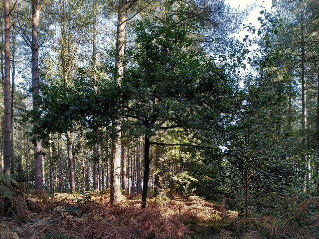
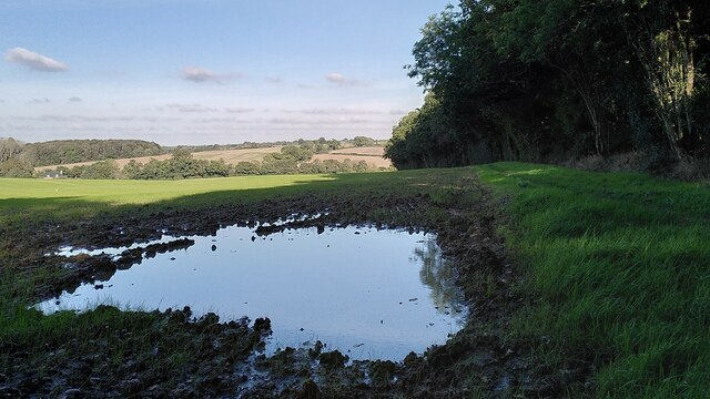
Arley is a small village located in the historic county of Warwickshire, England. Situated in the heart of the Forest of Arden, it is surrounded by picturesque countryside and lush green landscapes. The village is part of the civil parish of Old Arley, which also includes the neighboring village of New Arley.

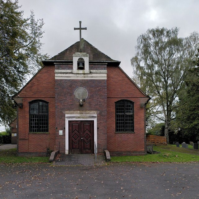
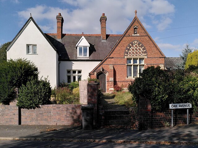
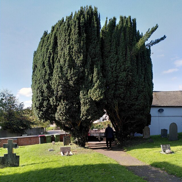
With a population of around 2,000 people, Arley is a close-knit community known for its tranquility and charm. The village is characterized by its traditional English architecture, with timber-framed houses and thatched roofs adding to its rustic appeal. The centerpiece of Arley is St. Wilfrid's Church, a beautiful medieval structure that dates back to the 12th century.

Arley offers a range of amenities to its residents, including a primary school, a village hall, and a handful of local shops and pubs. The village is well-connected to larger towns and cities in the region, with easy access to the nearby towns of Nuneaton and Coventry.

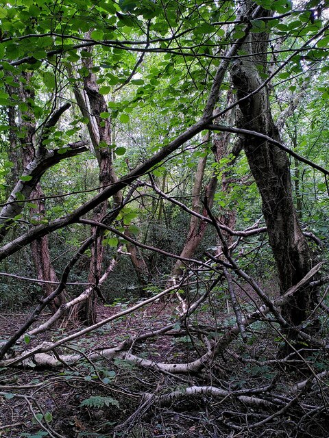
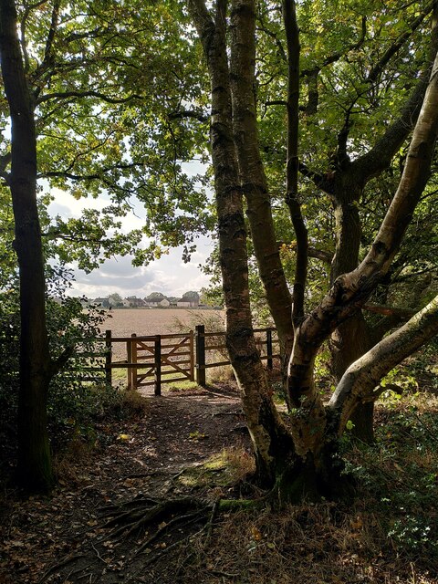
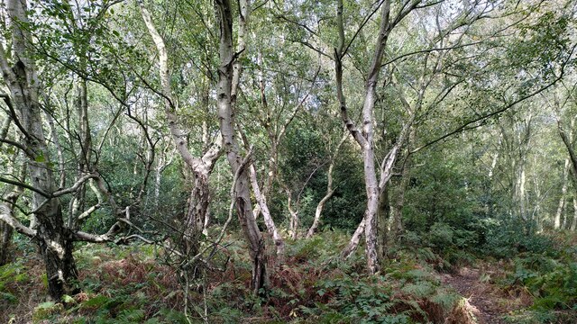
Nature lovers and outdoor enthusiasts are drawn to Arley for its idyllic surroundings. The village is located near the Coventry Canal, offering opportunities for scenic walks and boating. Additionally, the nearby Arley Arboretum and Gardens provide a peaceful retreat for visitors, showcasing a variety of plant species and vibrant flower displays.

In conclusion, Arley, Old, Warwickshire is a charming village nestled in the heart of the Forest of Arden. With its rich history, beautiful architecture, and stunning natural surroundings, it is a delightful place to visit or call home.

If you have any feedback on the listing, please let us know in the comments section below.
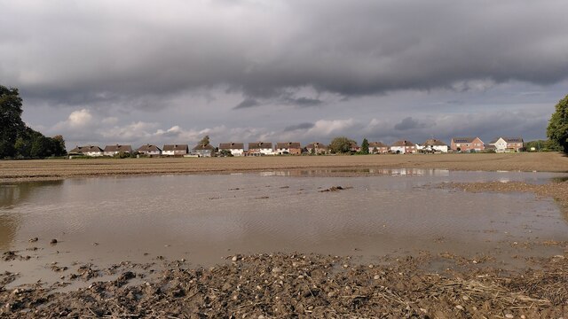
Arley, Old Images

Images are sourced within 2km of 52.513358/-1.5839647 or Grid Reference SP2890. Thanks to Geograph Open Source API. All images are credited.

St Michael's Church, New Arley The Arley Colliery Company began mining coal locally in 1905. In the 1920s it built a company village of six hundred houses, called New Arley, and, in 1928, a company church to serve it, the Church of England parish church of St Michael. The style could perhaps be called colliers' baroque. See the Victoria County History of Warwickshire, Vol. 6 pp8-12, which doesn't give the name of the architect <span class="nowrap"><a title="https://www.british-history.ac.uk/vch/warks/vol6/pp8-12" rel="nofollow ugc noopener" href="https://www.british-history.ac.uk/vch/warks/vol6/pp8-12">Link</a><img style="margin-left:2px;" alt="External link" title="External link - shift click to open in new window" src="https://s1.geograph.org.uk/img/external.png" width="10" height="10"/></span> .
St Michael's Church, New Arley
The Arley Colliery Company began mining coal locally in 1905. In the 1920s it built a company village of six hundred houses, called New Arley, and, in 1928, a company church to serve it, the Church of England parish church of St Michael. The style could perhaps be called colliers' baroque. See the Victoria County History of Warwickshire, Vol. 6 pp8-12, which doesn't give the name of the architect LinkExternal link .
Catholic church of St Joseph, New Arley The church stands at the western end of the former mining village, an area known as Gun Hill or Spring Hill. It was built in 1996 to designs by John D Holmes. It replaced a nearby timber church of the 1920s. See the Taking Stock site, which describes the new church as 'flexible in character and modest in architectural aspiration.' <span class="nowrap"><a title="https://taking-stock.org.uk/building/arley-st-joseph/" rel="nofollow ugc noopener" href="https://taking-stock.org.uk/building/arley-st-joseph/">Link</a><img style="margin-left:2px;" alt="External link" title="External link - shift click to open in new window" src="https://s1.geograph.org.uk/img/external.png" width="10" height="10"/></span>
Catholic church of St Joseph, New Arley
The church stands at the western end of the former mining village, an area known as Gun Hill or Spring Hill. It was built in 1996 to designs by John D Holmes. It replaced a nearby timber church of the 1920s. See the Taking Stock site, which describes the new church as 'flexible in character and modest in architectural aspiration.' LinkExternal link
Arley industrial estate and Arley Wood The industrial units are viewed from the path from Spring Hill to Daffern's Wood; they occupy the site of Arley Colliery, which closed in 1968. Arley Wood blankets the horizon. This ancient woodland was replanted with conifers in the 1960s, apparently to provide pit props for the mine; see <a href="https://www.geograph.org.uk/photo/7630660">SP2891 : A young oak tree among the conifers, Arley Wood</a>.
Arley industrial estate and Arley Wood
The industrial units are viewed from the path from Spring Hill to Daffern's Wood; they occupy the site of Arley Colliery, which closed in 1968. Arley Wood blankets the horizon. This ancient woodland was replanted with conifers in the 1960s, apparently to provide pit props for the mine; see SP2891 : A young oak tree among the conifers, Arley Wood.
Daffern's Wood, New Arley Situated on the western edge of New Arley, Daffern's Wood is roughly triangular in shape and about three hectares in extent. According to the Warwickshire Wildlife Trust it is an ancient semi-natural wood which has been documented back to around 1600. It is a Local Nature Reserve. <span class="nowrap"><a title="https://www.warwickshirewildlifetrust.org.uk/DaffernsWood" rel="nofollow ugc noopener" href="https://www.warwickshirewildlifetrust.org.uk/DaffernsWood">Link</a><img style="margin-left:2px;" alt="External link" title="External link - shift click to open in new window" src="https://s1.geograph.org.uk/img/external.png" width="10" height="10"/></span>. A public footpath passes below the wood, which can be entered from the stile visible at the left of the picture.
Daffern's Wood, New Arley
Situated on the western edge of New Arley, Daffern's Wood is roughly triangular in shape and about three hectares in extent. According to the Warwickshire Wildlife Trust it is an ancient semi-natural wood which has been documented back to around 1600. It is a Local Nature Reserve. LinkExternal link. A public footpath passes below the wood, which can be entered from the stile visible at the left of the picture.
Birch and hazel in Daffern's Wood For more information on this Local Nature Reserve see <a href="https://www.geograph.org.uk/photo/7635597">SP2889 : Daffern's Wood, New Arley</a>.
Birch and hazel in Daffern's Wood
For more information on this Local Nature Reserve see SP2889 : Daffern's Wood, New Arley.
New Arley seen from Gorsy Spinney From the birch trees of the spinney a footpath runs southwards to Wood End, following the edges of fields and passing the eastern tip of New Arley village.
New Arley seen from Gorsy Spinney
From the birch trees of the spinney a footpath runs southwards to Wood End, following the edges of fields and passing the eastern tip of New Arley village.
Birch trees at Gorsy Spinney, Arley A path runs through the wood on the edge of the football ground at Hill Top. public footpaths lead from here to Astley and Wood End.
Birch trees at Gorsy Spinney, Arley
A path runs through the wood on the edge of the football ground at Hill Top. public footpaths lead from here to Astley and Wood End.
New Arley reflections The path from New Arley to Wood End runs along the edge of a large field, which was very wet after heavy autumn rain.
New Arley reflections
The path from New Arley to Wood End runs along the edge of a large field, which was very wet after heavy autumn rain.
Birmingham Road, Ansley The 'Slow down think!' sign is labelled 'Warwickshire Police' and 'Warwickshire County Council'. The speed limit here is 30mph.
Birmingham Road, Ansley
The 'Slow down think!' sign is labelled 'Warwickshire Police' and 'Warwickshire County Council'. The speed limit here is 30mph.
Old Arley with church tower So named to distinguish it from the neighbouring mining village of New Arley, Old Arley predates the modern coal industry by centuries. St Wilfrid's church was built in the 14th century and was restored in 1873; see the listing at the Historic England site <span class="nowrap"><a title="https://historicengland.org.uk/listing/the-list/list-entry/1034773?section=official-list-entry" rel="nofollow ugc noopener" href="https://historicengland.org.uk/listing/the-list/list-entry/1034773?section=official-list-entry">Link</a><img style="margin-left:2px;" alt="External link" title="External link - shift click to open in new window" src="https://s1.geograph.org.uk/img/external.png" width="10" height="10"/></span> .
Old Arley with church tower
So named to distinguish it from the neighbouring mining village of New Arley, Old Arley predates the modern coal industry by centuries. St Wilfrid's church was built in the 14th century and was restored in 1873; see the listing at the Historic England site LinkExternal link .
Former village school, Old Arley Arley acquired a free school in 1875, according to Wikipedia <span class="nowrap"><a title="https://en.m.wikipedia.org/wiki/Old_Arley" rel="nofollow ugc noopener" href="https://en.m.wikipedia.org/wiki/Old_Arley">Link</a><img style="margin-left:2px;" alt="External link" title="External link - shift click to open in new window" src="https://s1.geograph.org.uk/img/external.png" width="10" height="10"/></span> ; this was presumably the building, now converted into housing.
Former village school, Old Arley
Arley acquired a free school in 1875, according to Wikipedia LinkExternal link ; this was presumably the building, now converted into housing.
Yew arch, Arley churchyard Two yew trees growing to either side of the gates to St Wilfrid's churchyard form a pointed arch. The tree to the right seems to be having a bad hair day (or perhaps a bad hair epoch, since these are yews and very long-lived).
Yew arch, Arley churchyard
Two yew trees growing to either side of the gates to St Wilfrid's churchyard form a pointed arch. The tree to the right seems to be having a bad hair day (or perhaps a bad hair epoch, since these are yews and very long-lived).
A young oak tree among the conifers, Arley Wood Arley Wood belongs to the Forestry Commission and is a PAWS or Planted Ancient Woodland Site, an ancient woodland that was largely destroyed and turned into a conifer plantation some time in the mid to late twentieth century. 

According to Arley Parish Council the replanting was carried out in the 1960s to provide pit props for Arley Colliery. The mine was closed in 1968, owing to falling demand for coal as a household fuel, so the destruction was for nothing (though the nearby colliery at Daw Mill continued in production until 2012). 

The wood is slowly being returned to a more mixed and quasi-natural state, with oaks and other broadleaved trees planted in clearings. See <a href="https://www.geograph.org.uk/photo/7630689">SP2891 : Oak tree in Arley Wood</a>, also the sites of the Woodland Trust <span class="nowrap"><a title="https://www.woodlandtrust.org.uk/visiting-woods/woods/arley-wood/" rel="nofollow ugc noopener" href="https://www.woodlandtrust.org.uk/visiting-woods/woods/arley-wood/">Link</a><img style="margin-left:2px;" alt="External link" title="External link - shift click to open in new window" src="https://s1.geograph.org.uk/img/external.png" width="10" height="10"/></span> and Arley Parish Council <span class="nowrap"><a title="https://www.arleyparishcouncil.co.uk/about-arley/neighbourhood-plan" rel="nofollow ugc noopener" href="https://www.arleyparishcouncil.co.uk/about-arley/neighbourhood-plan">Link</a><img style="margin-left:2px;" alt="External link" title="External link - shift click to open in new window" src="https://s1.geograph.org.uk/img/external.png" width="10" height="10"/></span> .
A young oak tree among the conifers, Arley Wood
Arley Wood belongs to the Forestry Commission and is a PAWS or Planted Ancient Woodland Site, an ancient woodland that was largely destroyed and turned into a conifer plantation some time in the mid to late twentieth century. According to Arley Parish Council the replanting was carried out in the 1960s to provide pit props for Arley Colliery. The mine was closed in 1968, owing to falling demand for coal as a household fuel, so the destruction was for nothing (though the nearby colliery at Daw Mill continued in production until 2012). The wood is slowly being returned to a more mixed and quasi-natural state, with oaks and other broadleaved trees planted in clearings. See SP2891 : Oak tree in Arley Wood, also the sites of the Woodland Trust LinkExternal link and Arley Parish Council LinkExternal link .
Oak tree in Arley Wood Arley Wood, an ancient broadleaved wood, was turned into a conifer plantation in the 1960s by the Forestry Commission, with great loss of wildlife habitat for little commercial gain. The Commission now recognises this and is gradually planting broadleaved trees. A young oak is growing among the ranks of conifers, with a birch off to the right.

"For its first twenty-five years, the Forestry Commission had little direct impact on woodland; but after 1945 foresters acquired woods and treated them as if they were moorland, trying to poison or otherwise destroy the existing vegetation and to replace it by plantations, usually of conifers. This was justified by a crude kind of cost-benefit analysis... a third of our ancient woods have been the victims of this habit of thought. Successful replanting destroys not only the trees of a wood but the herbaceous plants as well, which succumb to evergreen shade or are buried by heavy leaf-litter." (Oliver Rackham, The History of the Countryside, Phoenix Press, 2000, pp95-96). See also <a href="https://www.geograph.org.uk/photo/7630660">SP2891 : A young oak tree among the conifers, Arley Wood</a>.
Oak tree in Arley Wood
Arley Wood, an ancient broadleaved wood, was turned into a conifer plantation in the 1960s by the Forestry Commission, with great loss of wildlife habitat for little commercial gain. The Commission now recognises this and is gradually planting broadleaved trees. A young oak is growing among the ranks of conifers, with a birch off to the right. "For its first twenty-five years, the Forestry Commission had little direct impact on woodland; but after 1945 foresters acquired woods and treated them as if they were moorland, trying to poison or otherwise destroy the existing vegetation and to replace it by plantations, usually of conifers. This was justified by a crude kind of cost-benefit analysis... a third of our ancient woods have been the victims of this habit of thought. Successful replanting destroys not only the trees of a wood but the herbaceous plants as well, which succumb to evergreen shade or are buried by heavy leaf-litter." (Oliver Rackham, The History of the Countryside, Phoenix Press, 2000, pp95-96). See also SP2891 : A young oak tree among the conifers, Arley Wood.
Path through Arley Wood The ancient Arley Wood was turned into a conifer plantation in the 1960s, with a great loss of wildlife; note the ranks of trees of a single species and the dense undergrowth of bracken. It is now slowly being replanted with native broadleaved species such as oak. See <a href="https://www.geograph.org.uk/photo/7630660">SP2891 : A young oak tree among the conifers, Arley Wood</a> and <a href="https://www.geograph.org.uk/photo/7630689">SP2891 : Oak tree in Arley Wood</a>.

Though the loss is greatly to be regretted, it remains a peaceful place, beautiful in its way, the rustling of the trees blotting out human noise, apart from the occasional passing of aircraft overhead or the hooting of a train on the nearby railway.
Path through Arley Wood
The ancient Arley Wood was turned into a conifer plantation in the 1960s, with a great loss of wildlife; note the ranks of trees of a single species and the dense undergrowth of bracken. It is now slowly being replanted with native broadleaved species such as oak. See SP2891 : A young oak tree among the conifers, Arley Wood and SP2891 : Oak tree in Arley Wood. Though the loss is greatly to be regretted, it remains a peaceful place, beautiful in its way, the rustling of the trees blotting out human noise, apart from the occasional passing of aircraft overhead or the hooting of a train on the nearby railway.
The northern edge of Arley Wood Though Arley Wood was turned into a conifer plantation in the 1960s, its edges remain those of an ancient wood: sinuous, curving or zigzag, as described by Oliver Rackham, with broadleaved trees and a woodbank and ditch. The slight rise of the land outside the wood to the ditch along the edge can be seen very clearly here. The field beyond the wood is very muddy and has been reseeded by the farmer; a large puddle has formed after heavy rain. The land falls away to the Bourne Brook, with more fields and woodland beyond, as the land rises again towards Ansley. See also <a href="https://www.geograph.org.uk/photo/7630660">SP2891 : A young oak tree among the conifers, Arley Wood</a> and <a href="https://www.geograph.org.uk/photo/7630689">SP2891 : Oak tree in Arley Wood</a>.
The northern edge of Arley Wood
Though Arley Wood was turned into a conifer plantation in the 1960s, its edges remain those of an ancient wood: sinuous, curving or zigzag, as described by Oliver Rackham, with broadleaved trees and a woodbank and ditch. The slight rise of the land outside the wood to the ditch along the edge can be seen very clearly here. The field beyond the wood is very muddy and has been reseeded by the farmer; a large puddle has formed after heavy rain. The land falls away to the Bourne Brook, with more fields and woodland beyond, as the land rises again towards Ansley. See also SP2891 : A young oak tree among the conifers, Arley Wood and SP2891 : Oak tree in Arley Wood.
North Eastern edge of Arley Wood The edge of the wood looks well-trimmed here, and the boundary ditch is clearly visible, crossed by a plank footbridge. See <a href="https://www.geograph.org.uk/photo/7630845">SP2791 : The northern edge of Arley Wood</a>, also <a href="https://www.geograph.org.uk/photo/7630660">SP2891 : A young oak tree among the conifers, Arley Wood</a> and <a href="https://www.geograph.org.uk/photo/7630689">SP2891 : Oak tree in Arley Wood</a>.
North Eastern edge of Arley Wood
The edge of the wood looks well-trimmed here, and the boundary ditch is clearly visible, crossed by a plank footbridge. See SP2791 : The northern edge of Arley Wood, also SP2891 : A young oak tree among the conifers, Arley Wood and SP2891 : Oak tree in Arley Wood.
South Eastern gate to Arley Wood, with snail bench The bench was installed on the route of an Arley parish walk, an offshoot of a longer North Warwickshire Heritage Trail. It carries a couplet from the poem 'Leisure', by the Welsh poet and tramp W H Davies. The whole poem can be seen at his Wikipedia entry <span class="nowrap"><a title="https://en.m.wikipedia.org/wiki/W._H._Davies" rel="nofollow ugc noopener" href="https://en.m.wikipedia.org/wiki/W._H._Davies">Link</a><img style="margin-left:2px;" alt="External link" title="External link - shift click to open in new window" src="https://s1.geograph.org.uk/img/external.png" width="10" height="10"/></span> ; for the footpaths, see the North Warwickshire council site <span class="nowrap"><a title="https://www.northwarks.gov.uk/download/downloads/id/8388/arley_parish_walk.pdf" rel="nofollow ugc noopener" href="https://www.northwarks.gov.uk/download/downloads/id/8388/arley_parish_walk.pdf">Link</a><img style="margin-left:2px;" alt="External link" title="External link - shift click to open in new window" src="https://s1.geograph.org.uk/img/external.png" width="10" height="10"/></span> .
South Eastern gate to Arley Wood, with snail bench
The bench was installed on the route of an Arley parish walk, an offshoot of a longer North Warwickshire Heritage Trail. It carries a couplet from the poem 'Leisure', by the Welsh poet and tramp W H Davies. The whole poem can be seen at his Wikipedia entry LinkExternal link ; for the footpaths, see the North Warwickshire council site LinkExternal link .
Show me another place!

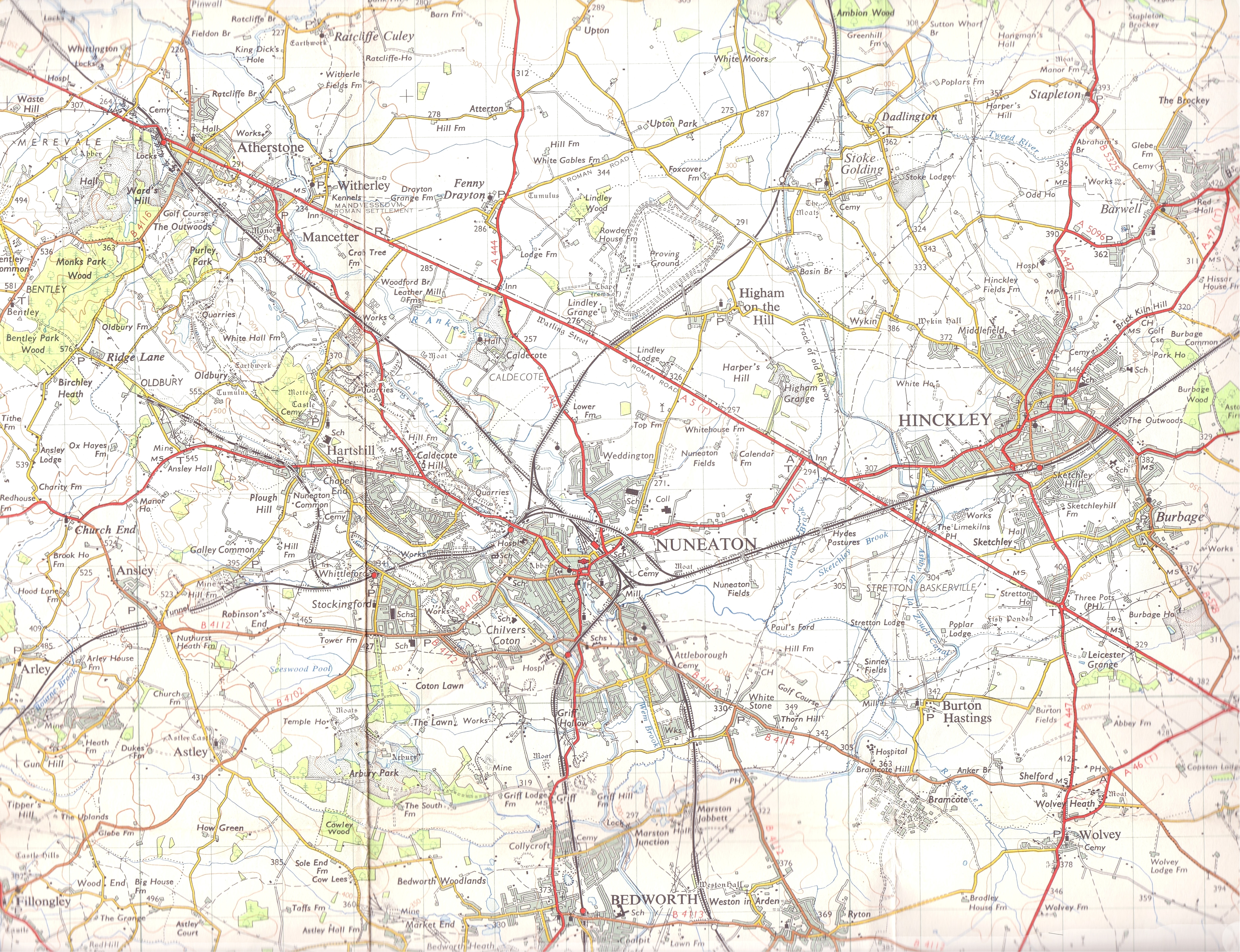
Arley, Old is located at Grid Ref: SP2890 (Lat: 52.513358, Lng: -1.5839647)

Administrative County: Warwickshire

District: North Warwickshire

Police Authority: Warwickshire

What 3 Words

///factor.safety.chucked. Near Hartshill, Warwickshire

Nearby Locations

Old Arley Arley, Old

Related Wikis

Old Arley

Old Arley is a village in the civil parish of Arley, in the north of Warwickshire, England, 5.5 miles (8.9 km) west of Nuneaton and 10 miles (16 km) north...

Arley, Warwickshire

Arley is a civil parish in the North Warwickshire district of Warwickshire, England. The parish includes two settlements, New Arley and Old Arley. Old...

Ballard's Green

Ballard's Green is a village in Warwickshire, England. Population details may be found under Over Whitacre.

Ansley, Warwickshire

Ansley is a parish in Warwickshire consisting of Ansley, Ansley Common, Church End, Birchley Heath and, previously, Ansley Hall Colliery. Ansley is on...

Arley and Fillongley railway station

Arley and Fillongley railway station was a station on the Midland Railway, which operated in the Midland county of Warwickshire, in England. == History... ==
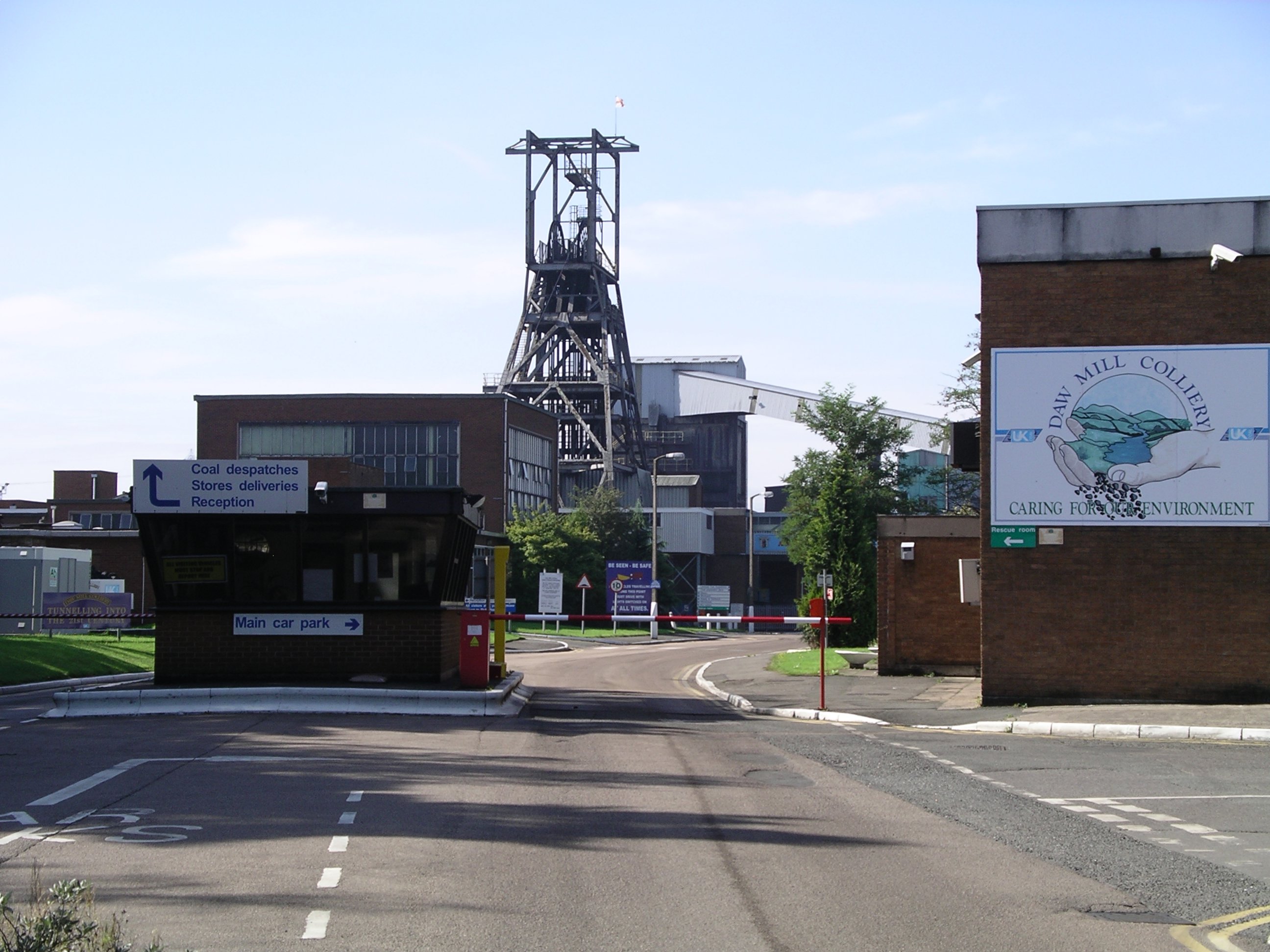
Daw Mill

Daw Mill was a coal mine located near the village of Arley, near Nuneaton, in the English county of Warwickshire. The mine was Britain's biggest coal producer...

Over Whitacre

Over Whitacre is a village containing the hamlets of Botts Green, Furnace End and Monwode Lea in North Warwickshire, Warwickshire, England. The population...

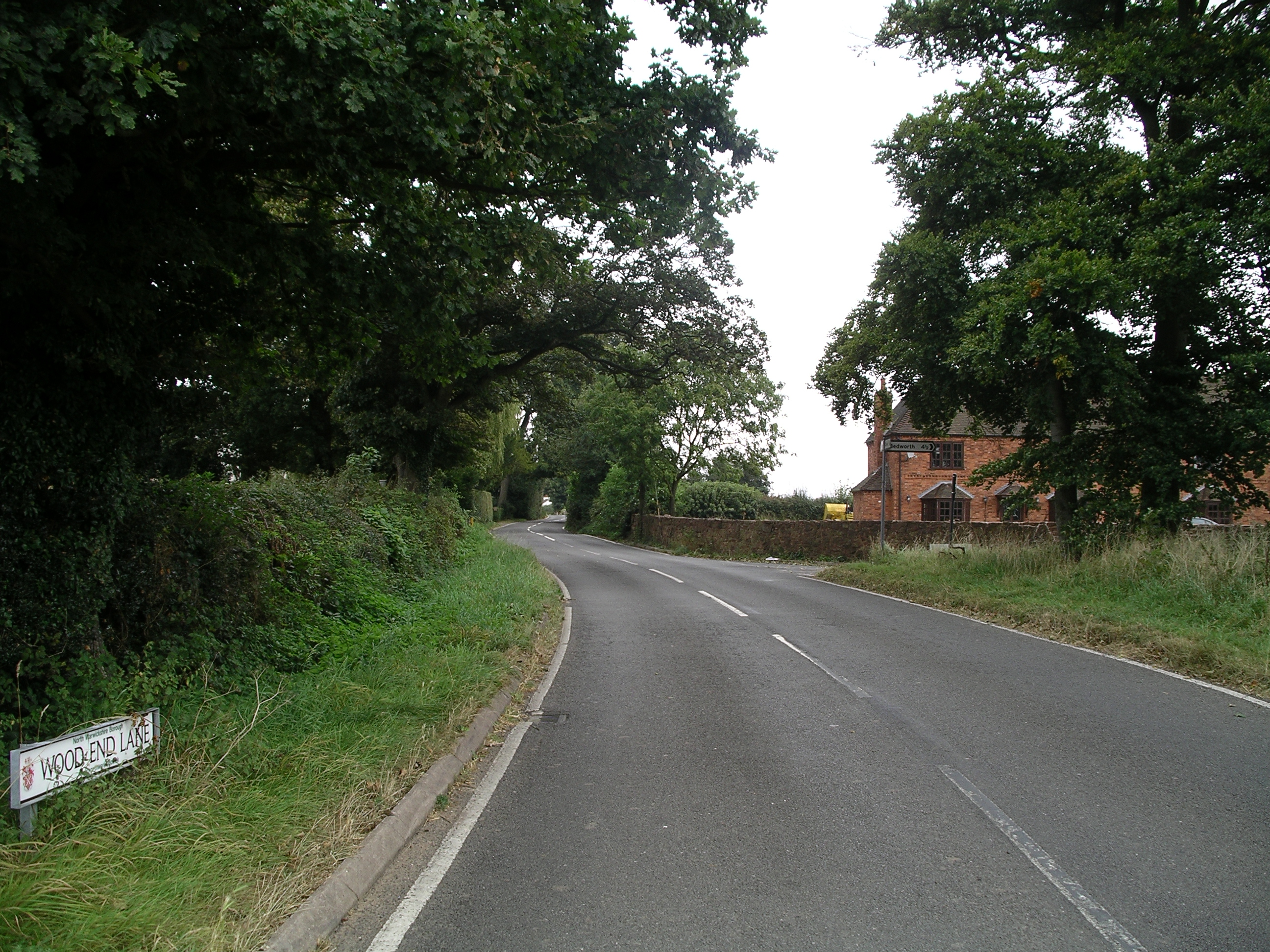
Wood End, Fillongley

Wood End, is a small village in Warwickshire, England. It is situated north of Coventry. The village is part of the civil parish of Fillongley. There is...

Related Videos

Hoar Park Childrenā€™s Farm - August 2021

Welcome to Hoar Park Children's Farm. Not only can you see a wide variety of Children's Pets such as Rabbits and Guinea Pigs, ...

Hoar Park Farm (Nuneaton) West Midlands 04/03/2023

Hoar Park Farm Nuneaton - Walk About.

Nearby Amenities

Located within 500m of 52.513358,-1.5839647
Old Arley
Place: village
Lat/Long: 52.5131924/-1.5847807
Post Box
Postal Code: CV7
Ref: CV7 160
Lat/Long: 52.5143734/-1.581965
Bus Stop
War Memorial
Bus: yes
Naptan AtcoCode: 4200F002300
Naptan Bearing: NE
Naptan CommonName: War Memorial
Naptan Indicator: War Memorial
Naptan NaptanCode: waratgdj
Naptan Street: Oak Avenue
Naptan Verified: no
Public Transport: platform
Source: naptan_import
Lat/Long: 52.5127684/-1.5847977
Bus Stop
War Memorial
Bus: yes
Naptan AtcoCode: 4200F002301
Naptan Bearing: SW
Naptan CommonName: War Memorial
Naptan Indicator: Adj
Naptan NaptanCode: waratgdm
Naptan Street: Oak Avenue
Naptan Verified: no
Public Transport: platform
Source: naptan_import
Lat/Long: 52.5124632/-1.5863993
Bus Stop
Oak Avenue
Bus: yes
Naptan AtcoCode: 4200F051600
Naptan Bearing: NE
Naptan CommonName: Oak Avenue
Naptan Indicator: Nr
Naptan NaptanCode: wardadag
Naptan Street: Rectory Road
Naptan Verified: no
Public Transport: platform
Source: naptan_import
Lat/Long: 52.5123513/-1.5849477
Bus Stop
Bournebrook View
Bus: yes
Naptan AtcoCode: 4200F130610
Naptan Bearing: S
Naptan CommonName: Bournebrook View
Naptan Indicator: Adj
Naptan NaptanCode: warawtja
Naptan Street: Rectory Road
Naptan Verified: no
Public Transport: platform
Source: naptan_import
Lat/Long: 52.5103441/-1.5855915
Bus Stop
Bournebrook View
Bus: yes
Naptan AtcoCode: 4200F173101
Naptan Bearing: N
Naptan CommonName: Bournebrook View
Naptan Indicator: Opp
Naptan NaptanCode: wardawma
Naptan Street: Rectory Road
Naptan Verified: no
Public Transport: platform
Source: naptan_import
Lat/Long: 52.5106412/-1.5856136
Bus Stop
Meadow Croft
Bus: yes
Naptan AtcoCode: 4200F173102
Naptan Bearing: S
Naptan CommonName: Meadow Croft
Naptan Indicator: Adj
Naptan NaptanCode: wardawmd
Naptan Street: Rectory Road
Naptan Verified: no
Public Transport: platform
Source: naptan_import
Lat/Long: 52.5118809/-1.5849389
Bus Stop
Post Office
Bus: yes
Naptan AtcoCode: 4200F173801
Naptan Bearing: SW
Naptan CommonName: OPost Office
Naptan Indicator: Nr
Naptan Landmark: Post Office
Naptan NaptanCode: wardadgj
Naptan Street: Arley Road
Naptan Verified: no
Public Transport: platform
Source: naptan_import
Lat/Long: 52.5145071/-1.5809433
Bus Stop
Post Office
Bus: yes
Naptan AtcoCode: 4200F173802
Naptan Bearing: NE
Naptan CommonName: Post Office
Naptan Indicator: Nr
Naptan Landmark: Post Office
Naptan NaptanCode: wardadgm
Naptan Street: Arley Road
Naptan Verified: no
Public Transport: platform
Source: naptan_import
Lat/Long: 52.5145744/-1.5810309
Bus Stop
Wagon Load of Lime
Bus: yes
Naptan AtcoCode: 4200F173901
Naptan Bearing: NE
Naptan CommonName: Wagon Load of Lime
Naptan Indicator: Adj
Naptan Landmark: Wagon Load of Lime
Naptan NaptanCode: wardadgp
Naptan Street: Rectory Road
Naptan Verified: no
Public Transport: platform
Source: naptan_import
Lat/Long: 52.5139678/-1.5835716
Bus Stop
Wagon Load of Lime
Bus: yes
Naptan AtcoCode: 4200F173902
Naptan Bearing: S
Naptan CommonName: Wagon Load of Lime
Naptan Indicator: Opp
Naptan Landmark: Wagon Load of Lime
Naptan NaptanCode: wardadgt
Naptan Street: Spring Hill
Naptan Verified: no
Public Transport: platform
Source: naptan_import
Lat/Long: 52.5138321/-1.5834813
Give Way
Source: Warwicks Aerial Imagery OGLv2
Lat/Long: 52.512656/-1.5848637
Give Way
Source: Warwicks CC Aerial Imagery 2013
Lat/Long: 52.5133632/-1.5839061
Barrier: kissing_gate
Source: survey
Lat/Long: 52.5166854/-1.5845973
Barrier: kissing_gate
Source: survey
Lat/Long: 52.5156577/-1.5876379
Barrier: kissing_gate
Source: survey
Lat/Long: 52.51593/-1.587764
Barrier: kissing_gate
Source: survey
Lat/Long: 52.5173913/-1.5842681
Barrier: kissing_gate
Lat/Long: 52.5133445/-1.586619
War Memorial
Historic: memorial
Memorial: war_memorial
Lat/Long: 52.5125104/-1.5847482
Generator Method: photovoltaic
Generator Output Electricity: yes
Generator Source: solar
Generator Type: solar_photovoltaic_panel
Power: generator
Lat/Long: 52.5141618/-1.5800974
Generator Method: photovoltaic
Generator Output Electricity: yes
Generator Source: solar
Generator Type: solar_photovoltaic_panel
Power: generator
Lat/Long: 52.5144621/-1.5800826
Generator Method: photovoltaic
Generator Output Electricity: yes
Generator Source: solar
Generator Type: solar_photovoltaic_panel
Location: roof
Power: generator
Lat/Long: 52.5127604/-1.5835547
Power: pole
Source: Warwicks CC Aerial Imagery 2013
Lat/Long: 52.5123132/-1.5776217
Generator Method: photovoltaic
Generator Output Electricity: yes
Generator Source: solar
Generator Type: solar_photovoltaic_panel
Location: roof
Power: generator
Lat/Long: 52.5126886/-1.5833281
The data included in this document is from www.openstreetmap.org. The data is made available under ODbL.

Have you been to Arley, Old?

Leave your review of Arley, Old below (or comments, questions and feedback).