Bicknacre

Settlement in Essex Chelmsford

England

Bicknacre

The Grove, Bicknacre Here it is again. <a title="https://www.geograph.org.uk/photo/6338669" href="https://www.geograph.org.uk/photo/6338669">Link</a>
The Grove, Bicknacre Credit: David Howard

Bicknacre is a village located in the county of Essex, in the eastern part of England. Situated approximately 3 miles southeast of the town of Danbury, Bicknacre is a rural settlement with a population of around 1,500 people. The village is part of the Chelmsford district and falls within the parliamentary constituency of Maldon.

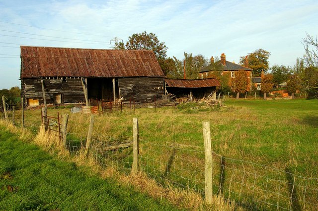
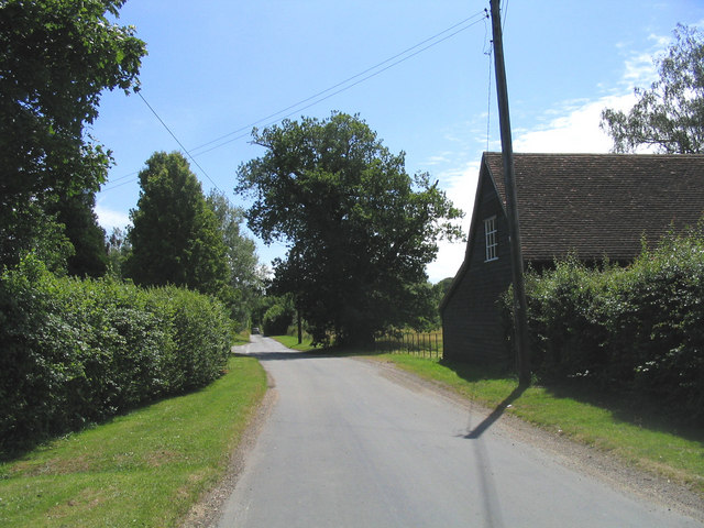
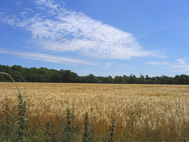
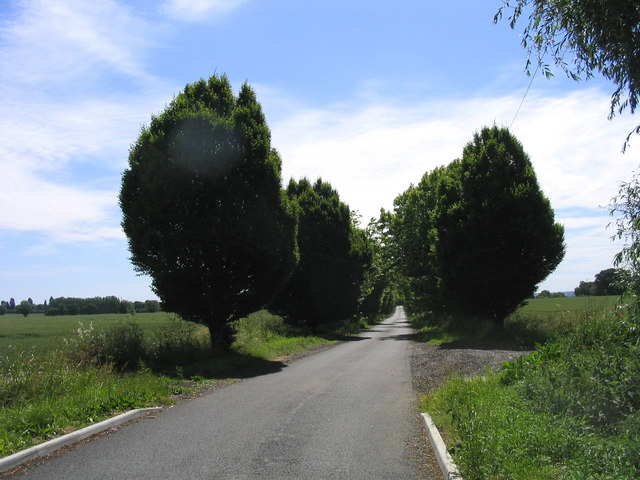
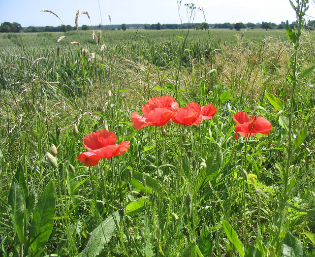
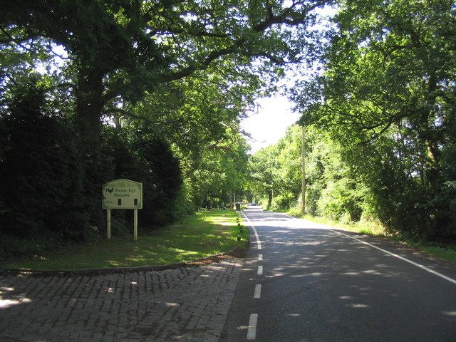
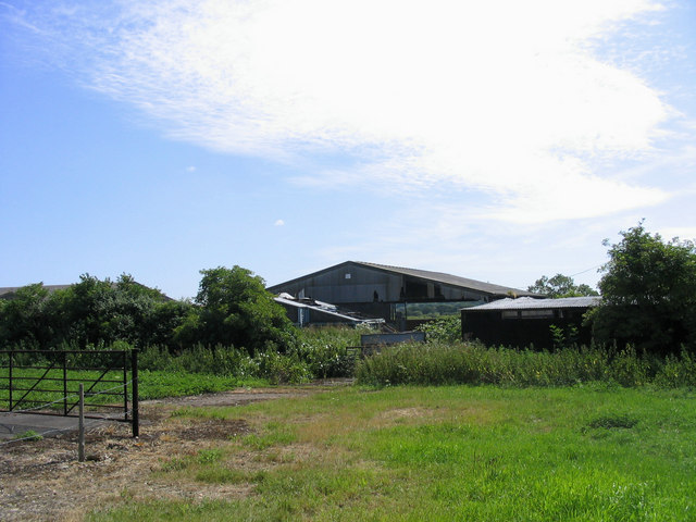
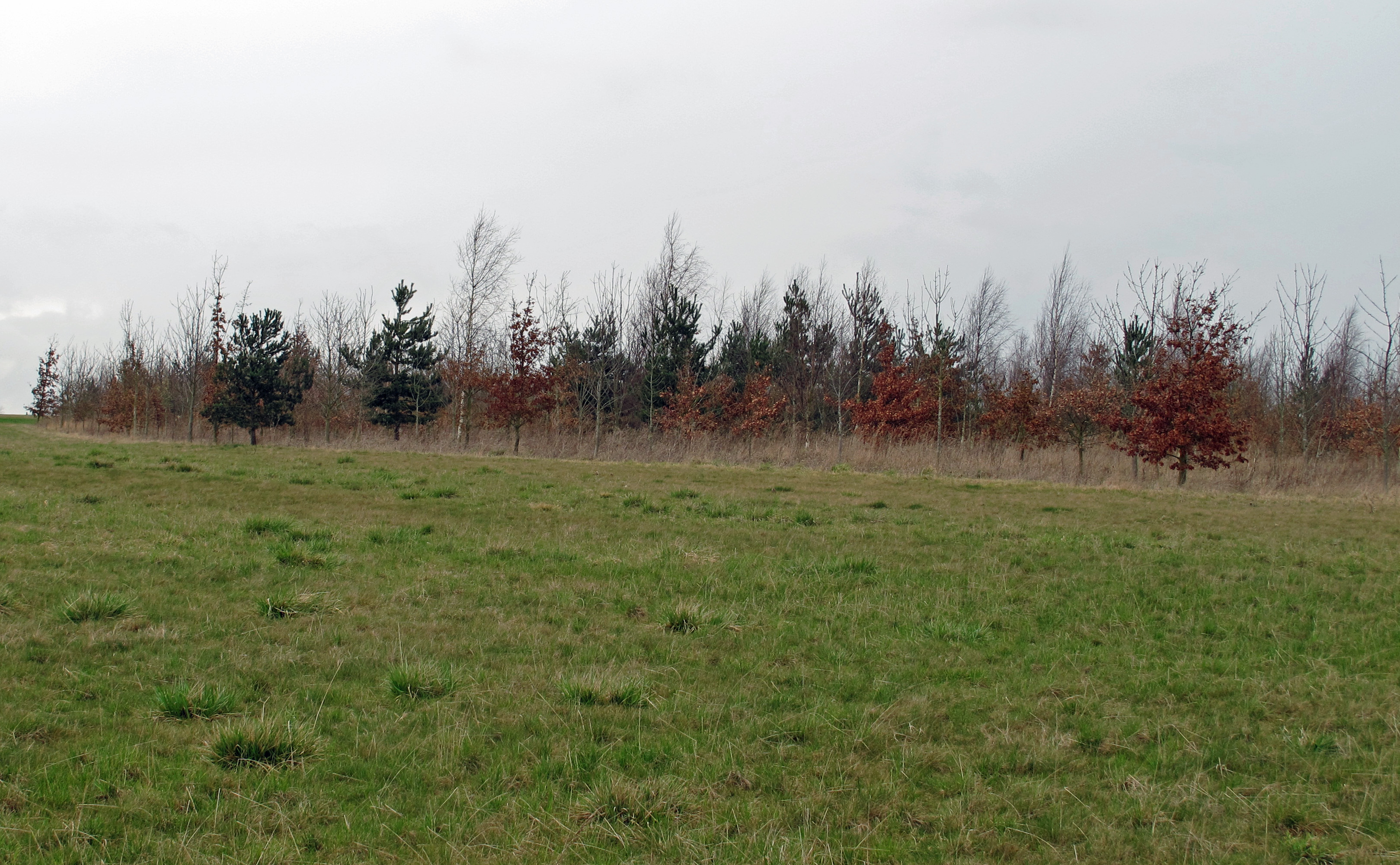
Known for its picturesque countryside and charming atmosphere, Bicknacre is surrounded by fields and farmland, offering residents and visitors a tranquil and idyllic setting. The village itself is characterized by a mix of traditional thatched cottages and more modern residential properties, creating a diverse architectural landscape.

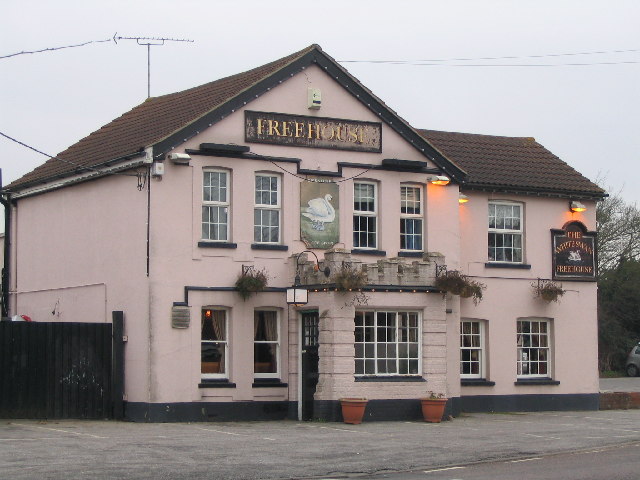
Bicknacre is well-served by a range of amenities, including a primary school, a village hall, a church, and a pub. The village also benefits from several shops, including a convenience store, which caters to the everyday needs of its residents.

The surrounding area of Bicknacre offers numerous opportunities for outdoor activities. The nearby Danbury Country Park is a popular destination for walkers, cyclists, and nature enthusiasts, boasting stunning woodlands, lakes, and historic sites. Additionally, the village is conveniently located close to the A12 and A130 roads, providing easy access to larger towns and cities in the region.

Overall, Bicknacre is a charming and peaceful village that offers a high quality of life, surrounded by beautiful countryside and offering a strong sense of community.

If you have any feedback on the listing, please let us know in the comments section below.

Bicknacre Images

Images are sourced within 2km of 51.692674/0.587754 or Grid Reference TL7802. Thanks to Geograph Open Source API. All images are credited.

The Grove, Bicknacre Here it is again. <a title="https://www.geograph.org.uk/photo/6338669" href="https://www.geograph.org.uk/photo/6338669">Link</a>
The Grove, Bicknacre
Here it is again. Link
Bridleway junction with Gay Bowers Road
Pond in Backwarden Nature Reserve It's a bit wet in the south and  east of the reserve with a number of small ponds
Pond in Backwarden Nature Reserve
It's a bit wet in the south and east of the reserve with a number of small ponds
Fields on Main Road, B1418 Westview Nursery sign
Fields on Main Road, B1418
Westview Nursery sign
Wickham's Farm This is Wickham’s Farm, the photo was taken from St Peters Way long distance footpath which runs along the fence.
Wickham's Farm
This is Wickham’s Farm, the photo was taken from St Peters Way long distance footpath which runs along the fence.
The White Swan Public House, one of two in Bicknacre
The White Swan
Public House, one of two in Bicknacre
Gay Bowers, Essex Gay Bowers is a tiny hamlet south of Danbury Essex
Gay Bowers, Essex
Gay Bowers is a tiny hamlet south of Danbury Essex
Ripening Wheat Wheat field on the east side of Hyde Lane, Gay Bowers.
Ripening Wheat
Wheat field on the east side of Hyde Lane, Gay Bowers.
Public Footpath, Bicknacre Footpath on east side of Hyde's Lane
Public Footpath, Bicknacre
Footpath on east side of Hyde's Lane
Backwarden Nature Reserve, Danbury Common National Trust nature reserve on west side of Danbury Common
Backwarden Nature Reserve, Danbury Common
National Trust nature reserve on west side of Danbury Common
Horseshoe Nurseries, Bicknacre Located on the east side of Bicknacre in White Elm Road.
Horseshoe Nurseries, Bicknacre
Located on the east side of Bicknacre in White Elm Road.
Farm Buildings, Woodham Hall, Bicknacre
Tree lined road, Woodham Ferrers Looking south-east in Lodge Road
Tree lined road, Woodham Ferrers
Looking south-east in Lodge Road
Poppies lining a wheatfield Verges on either side of Lodge Road are full of poppies.
Poppies lining a wheatfield
Verges on either side of Lodge Road are full of poppies.
Oak Lodge Farm, Bicknacre On east side of Leigham's Road between Bicknacre an Woodham Ferrers.
Oak Lodge Farm, Bicknacre
On east side of Leigham's Road between Bicknacre an Woodham Ferrers.
Farm Buildings, Salesfrith Farm Semi-derelict buildings on south side of Bicknacre Road, East Hanningfield
Farm Buildings, Salesfrith Farm
Semi-derelict buildings on south side of Bicknacre Road, East Hanningfield
Fishing Lake - Gay Bowers Lies on south side of Gay Bowers Road and the OS map shows this as a reservoir
Fishing Lake - Gay Bowers
Lies on south side of Gay Bowers Road and the OS map shows this as a reservoir
Gay Bowers Farm - Danbury Gay Bowers Farm is at the end of a private road running north off Gay Bowers Road.
Gay Bowers Farm - Danbury
Gay Bowers Farm is at the end of a private road running north off Gay Bowers Road.
Show me another place!

Bicknacre is located at Grid Ref: TL7802 (Lat: 51.692674, Lng: 0.587754)

Administrative County: Essex

District: Chelmsford

Police Authority: Essex

What 3 Words

///proves.beanbag.condiment. Near Bicknacre, Essex

Nearby Locations

Bicknacre

Related Wikis

Bicknacre

Bicknacre is a village in the civil parish of Woodham Ferrers and Bicknacre, in the county of Essex, England. It is approximately 4.0 mi (6.5 km) north...

Woodham Ferrers and Bicknacre

Woodham Ferrers and Bicknacre is a civil parish in the Chelmsford district in Essex, England. The parish includes the villages of Bicknacre and Woodham...

East Hanningfield

East Hanningfield is a small village in south Essex, England. It is situated to the southeast of Chelmsford and to the northwest of South Woodham Ferrers...

Danbury Common

Danbury Common is a 70.2-hectare (173-acre) biological Site of Special Scientific Interest in Danbury in Essex, England. Most of it is common land owned...

Danbury, Essex

Danbury is a village in the City of Chelmsford district, in the county of Essex, England. It is located 33.5 miles (53.9 km) northeast of Charing Cross...

Woodham Ferrers

Woodham Ferrers is a small village and former civil parish about 8 miles (13 km) southeast of Chelmsford, located between South Woodham Ferrers and Bicknacre...

Chelmsford Radio

Chelmsford Radio 107.7 was an Independent Local Radio station for Chelmsford and mid Essex, broadcasting from studios in Southend, and owned by the Adventure...

RHS Garden Hyde Hall

RHS Garden Hyde Hall is a public display garden run by the Royal Horticultural Society in the English county of Essex. It is one of five public gardens...

Nearby Amenities

Located within 500m of 51.692674,0.587754
Bicknacre
Is In: Essex, England, UK
Is In Country: UK
Is In County: Essex
Place: village
Source: NPE
Wikidata: Q4903690
Lat/Long: 51.6934817/0.5845549
Mini Roundabout
Direction: clockwise
Lat/Long: 51.6951192/0.5859509
Mini Roundabout
Direction: clockwise
Lat/Long: 51.6940784/0.5851103
Bus Stop
Brewers Arms
Naptan AtcoCode: 150008006007
Naptan Bearing: S
Naptan CommonName: Brewers Arms
Naptan Indicator: Opp
Naptan Landmark: Brewers Arms
Naptan NaptanCode: esxawjmg
Naptan Street: Main Road
Naptan Verified: no
Public Transport: platform
Source: naptan_import
Lat/Long: 51.6894725/0.5856054
Bus Stop
Brewers Arms
Naptan AtcoCode: 1500BICKBREW
Naptan Bearing: N
Naptan CommonName: Brewers Arms
Naptan Indicator: o/s
Naptan Landmark: Brewers Arms
Naptan NaptanCode: esxawjmd
Naptan Street: Main Road
Naptan Verified: no
Public Transport: platform
Source: naptan_import
Lat/Long: 51.6895459/0.5855372
Bus Stop
The White Swan
Bus: yes
Naptan AtcoCode: 1500IM868
Naptan Bearing: N
Naptan CommonName: The White Swan
Naptan Indicator: From
Naptan Landmark: The White Swan
Naptan NaptanCode: esxawjma
Naptan Street: Bicknacre Road
Naptan Verified: no
Public Transport: platform
Source: naptan_import
Lat/Long: 51.6955396/0.5857632
Bus Stop
The White Swan
Bus: yes
Naptan AtcoCode: 1500IM868B
Naptan Bearing: SE
Naptan CommonName: The White Swan
Naptan Indicator: Towards
Naptan Landmark: The White Swan
Naptan NaptanCode: esxawjgw
Naptan Street: Bicknacre Road
Naptan Verified: no
Public Transport: platform
Source: naptan_import
Lat/Long: 51.6956378/0.5857977
Bicknacre Priory
Heritage: yes
Historic: ruins
Wikidata: Q4903689
Wikipedia: en:Bicknacre Priory
Lat/Long: 51.6945305/0.5823482
White Elm Garden Centre
Addr City: Bicknacre
Addr Postcode: CM3 4LR
Addr Street: White Elm Road
Phone: +44 1245 227829
Shop: garden_centre
Url: www.whiteelmgardencentre.co.uk
Lat/Long: 51.6959572/0.5915912
Post Box
Lat/Long: 51.6945517/0.5853386
Bicknacre village sign
Tourism: artwork
Lat/Long: 51.6947193/0.5856223
Generator Method: photovoltaic
Generator Output Electricity: yes
Generator Source: solar
Generator Type: solar_photovoltaic_panel
Location: roof
Power: generator
Lat/Long: 51.6964849/0.5873957
Generator Method: photovoltaic
Generator Output Electricity: yes
Generator Source: solar
Generator Type: solar_photovoltaic_panel
Location: roof
Power: generator
Lat/Long: 51.6924581/0.5852875
Generator Method: photovoltaic
Generator Output Electricity: yes
Generator Source: solar
Generator Type: solar_photovoltaic_panel
Location: roof
Power: generator
Lat/Long: 51.6916601/0.5833966
Generator Method: photovoltaic
Generator Output Electricity: yes
Generator Source: solar
Generator Type: solar_photovoltaic_panel
Location: roof
Power: generator
Lat/Long: 51.6906492/0.5821601
Generator Method: photovoltaic
Generator Output Electricity: yes
Generator Source: solar
Generator Type: solar_photovoltaic_panel
Location: roof
Power: generator
Lat/Long: 51.6940892/0.5842173
Generator Method: photovoltaic
Generator Output Electricity: yes
Generator Source: solar
Generator Type: solar_photovoltaic_panel
Location: roof
Power: generator
Lat/Long: 51.6913857/0.5834824
Generator Method: photovoltaic
Generator Output Electricity: yes
Generator Source: solar
Generator Type: solar_photovoltaic_panel
Location: roof
Power: generator
Lat/Long: 51.6908088/0.583654
Generator Method: photovoltaic
Generator Output Electricity: yes
Generator Source: solar
Generator Type: solar_photovoltaic_panel
Location: roof
Power: generator
Lat/Long: 51.6905694/0.5838928
Generator Method: photovoltaic
Generator Output Electricity: yes
Generator Source: solar
Generator Type: solar_photovoltaic_panel
Location: roof
Power: generator
Lat/Long: 51.6909584/0.5856469
Generator Method: photovoltaic
Generator Output Electricity: yes
Generator Source: solar
Generator Type: solar_photovoltaic_panel
Location: roof
Power: generator
Lat/Long: 51.6922636/0.5858776
Generator Method: photovoltaic
Generator Output Electricity: yes
Generator Source: solar
Generator Type: solar_photovoltaic_panel
Location: roof
Power: generator
Lat/Long: 51.6922503/0.5859715
Generator Method: photovoltaic
Generator Output Electricity: yes
Generator Source: solar
Generator Type: solar_photovoltaic_panel
Location: roof
Power: generator
Lat/Long: 51.692405/0.5859366
Generator Method: photovoltaic
Generator Output Electricity: yes
Generator Source: solar
Generator Type: solar_photovoltaic_panel
Location: roof
Power: generator
Lat/Long: 51.6928805/0.5838713
Generator Method: photovoltaic
Generator Output Electricity: yes
Generator Source: solar
Generator Type: solar_photovoltaic_panel
Location: roof
Power: generator
Lat/Long: 51.6941208/0.5843675
Generator Method: photovoltaic
Generator Output Electricity: yes
Generator Source: solar
Generator Type: solar_photovoltaic_panel
Location: roof
Power: generator
Lat/Long: 51.6946395/0.5843514
Generator Method: photovoltaic
Generator Output Electricity: yes
Generator Source: solar
Generator Type: solar_photovoltaic_panel
Location: roof
Power: generator
Lat/Long: 51.6961674/0.5864006
Generator Method: photovoltaic
Generator Output Electricity: yes
Generator Source: solar
Generator Type: solar_photovoltaic_panel
Location: roof
Power: generator
Lat/Long: 51.6970036/0.5895361
Post Office
Bicknacre Post Office
Addr City: Bicknacre
Addr Housenumber: 18
Addr Postcode: CM3 4EU
Addr Street: Monks Mead
Lat/Long: 51.6949189/0.5850085
Board Type: history
Information: board
Subject Wikidata: Q26530231
Tourism: information
Lat/Long: 51.6946036/0.5825943
Bicknacre Priory
Board Type: history
Information: board
Subject Wikidata: Q4903689
Subject Wikipedia: en:Bicknacre Priory
Tourism: information
Lat/Long: 51.6945606/0.5824409
The data included in this document is from www.openstreetmap.org. The data is made available under ODbL.

Have you been to Bicknacre?

Leave your review of Bicknacre below (or comments, questions and feedback).