Bickley

Settlement in Worcestershire Malvern Hills

England

Bickley

Lane by Knighton on Teme Parish Room This country lane goes into a car park by the parish room at Knighton on Teme.
Lane by Knighton on Teme Parish Room Credit: Fabian Musto

Bickley is a small village located in the county of Worcestershire, England. Situated in the north-western part of the county, it is nestled within the picturesque landscape of the Malvern Hills Area of Outstanding Natural Beauty.

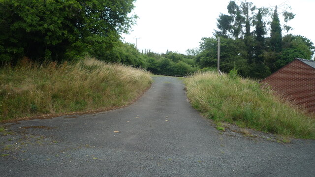
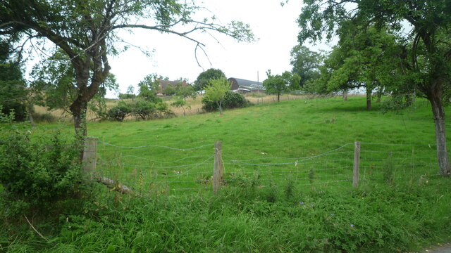
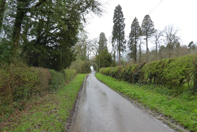
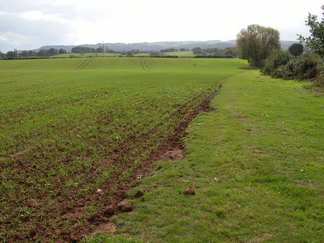
With a population of around 500 residents, Bickley retains its quaint and traditional charm. The village is characterized by its idyllic rural setting, surrounded by rolling hills, meandering streams, and lush green fields. The nearby Wychavon Way, a long-distance footpath, offers stunning views of the countryside and attracts hikers and nature enthusiasts.

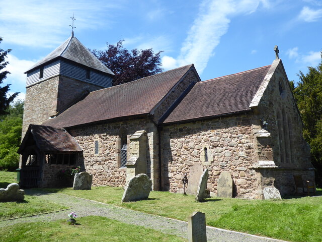
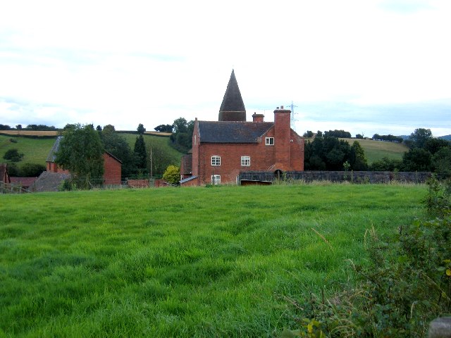
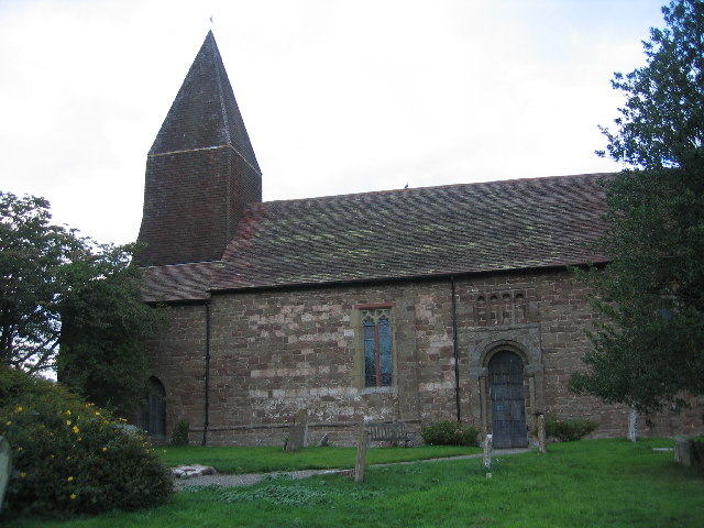
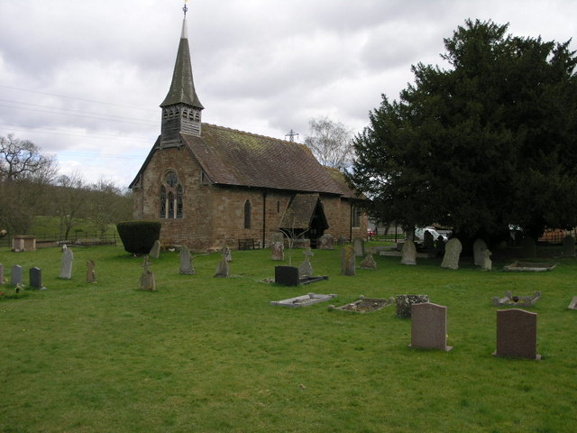
Bickley is known for its historic buildings, including the Grade II listed St. Leonard's Church, which dates back to the 12th century. The church's architecture is a testament to the village's rich heritage. The village also features a few traditional cottages and farmhouses, adding to its rustic appeal.

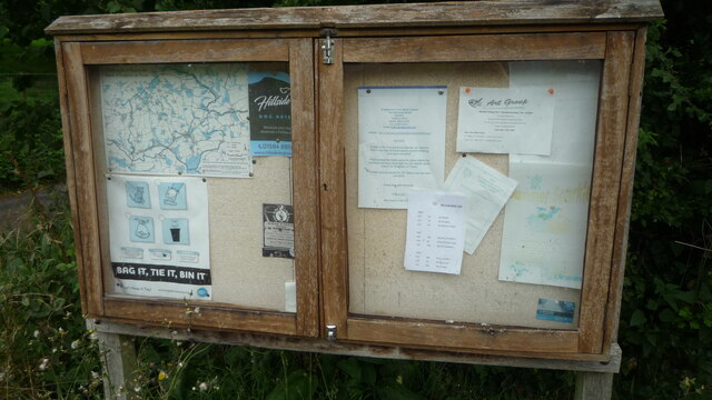
Despite its small size, Bickley has a strong sense of community. The village hosts various events throughout the year, such as summer fairs and Christmas markets, bringing residents together and fostering a friendly atmosphere.

For amenities, Bickley is equipped with a village hall that serves as a hub for community gatherings and activities. Nearby towns provide additional facilities, including shops, schools, and healthcare services.

In summary, Bickley offers a peaceful and scenic escape from the hustle and bustle of city life. With its charming countryside setting, rich history, and close-knit community, it is an ideal destination for those seeking a tranquil and authentic English village experience.

If you have any feedback on the listing, please let us know in the comments section below.
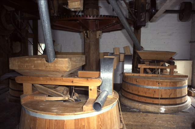
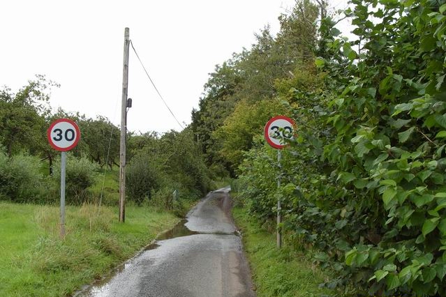
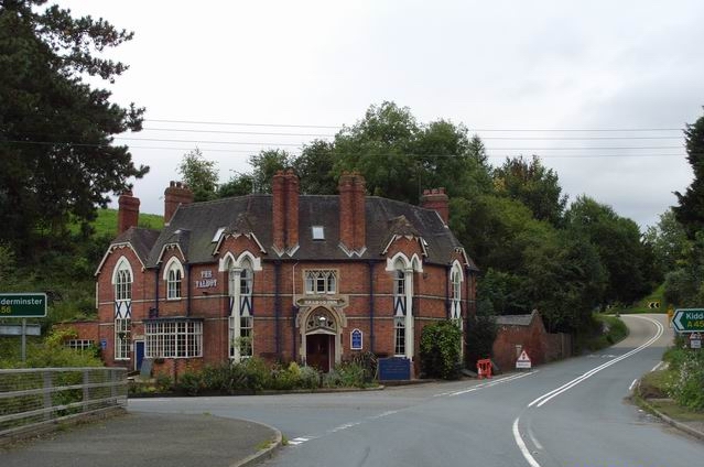
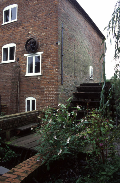
Bickley Images

Images are sourced within 2km of 52.335377/-2.537857 or Grid Reference SO6370. Thanks to Geograph Open Source API. All images are credited.

Lane by Knighton on Teme Parish Room This country lane goes into a car park by the parish room at Knighton on Teme.
Lane by Knighton on Teme Parish Room
This country lane goes into a car park by the parish room at Knighton on Teme.
Information board at Knighton on Teme This information board is placed by the parish room at Knighton on Teme.
Information board at Knighton on Teme
This information board is placed by the parish room at Knighton on Teme.
Hilltop Farm (Knighton on Teme) Taken from a country lane by the parish room.
Hilltop Farm (Knighton on Teme)
Taken from a country lane by the parish room.
Milson, St George
Milson, St George
No through road at Bickley No through road giving access to Bickley House.
No through road at Bickley
No through road giving access to Bickley House.
Church Farm, Knighton on Teme The main farmhouse in the centre with the tower of St Michael's Church visible over the roof.
Church Farm, Knighton on Teme
The main farmhouse in the centre with the tower of St Michael's Church visible over the roof.
St Michael's Church, Knighton on Teme The venerable old church dates back to Norman times and is mentioned in the Domesday Book.
St Michael's Church, Knighton on Teme
The venerable old church dates back to Norman times and is mentioned in the Domesday Book.
Newnham Bridge exchange & course of Leominster Canal The depression to the left of the farm track marks the course of the never completed and long since abandoned Leominster Canal.  The wooden shed is Newnham Bridge telephone exchange.
Newnham Bridge exchange & course of Leominster Canal
The depression to the left of the farm track marks the course of the never completed and long since abandoned Leominster Canal. The wooden shed is Newnham Bridge telephone exchange.
Newnham Bridge Watermill This was a beautifully restored and workable mill but the miller had just left and I'm not sure whether the mill is currently milling. Note the dust extraction kit that is in keeping with the original style of the mill furniture.
Newnham Bridge Watermill
This was a beautifully restored and workable mill but the miller had just left and I'm not sure whether the mill is currently milling. Note the dust extraction kit that is in keeping with the original style of the mill furniture.
A 30mph Back Lane
A 30mph Back Lane
The Talbot
The Talbot
Newnham Bridge watermill A very tight location this. Note the external pulley that could be connected up to an external power source if necessary.
Newnham Bridge watermill
A very tight location this. Note the external pulley that could be connected up to an external power source if necessary.
Newnham Bridge watermill
Fields near to Newnham Bridge
Newnham Bridge
Newnham Bridge
Former Leominster and Stourport Canal near to Newnham Bridge The Leominster and Stourport Canal was built in the late 1700s and was never completed due to a multiplicity of problems. Eventually it was sold to a railway company in 1858 which used some of the land for the Woofferton to Bewdley railway and sold the rest.
Former Leominster and Stourport Canal near to Newnham Bridge
The Leominster and Stourport Canal was built in the late 1700s and was never completed due to a multiplicity of problems. Eventually it was sold to a railway company in 1858 which used some of the land for the Woofferton to Bewdley railway and sold the rest.
Site of a tunnel on the Leominster and Stourport Canal near to Newnham Bridge The Leominster and Stourport Canal was built in the late 1700s and was never completed due to a multiplicity of problems. Eventually it was sold to a railway company in 1858 which used some of the land for the Woofferton to Bewdley railway and sold the rest.
Site of a tunnel on the Leominster and Stourport Canal near to Newnham Bridge
The Leominster and Stourport Canal was built in the late 1700s and was never completed due to a multiplicity of problems. Eventually it was sold to a railway company in 1858 which used some of the land for the Woofferton to Bewdley railway and sold the rest.
Above the former Leominster and Stourport Canal Oxnall Farm in the distance.
The canal would have been in a tunnel beneath.
Above the former Leominster and Stourport Canal
Oxnall Farm in the distance. The canal would have been in a tunnel beneath.
Show me another place!

Bickley is located at Grid Ref: SO6370 (Lat: 52.335377, Lng: -2.537857)

Administrative County: Worcestershire

District: Malvern Hills

Police Authority: West Mercia

What 3 Words

///nicknames.impaled.prospers. Near Tenbury Wells, Worcestershire

Related Wikis

Knighton on Teme

Knighton on Teme is a village and civil parish once in the hundred of Doddingtree and now in the Malvern Hills District of the county of Worcestershire...

Newnham Bridge

Newnham Bridge is a village in the parish of Knighton on Teme, near Tenbury Wells, Worcestershire, England, United Kingdom. The village derives part of...

Newnham Bridge railway station

Newnham Bridge railway station was a station on the Tenbury and Bewdley Railway in Newnham Bridge, Worcestershire, England. The station was named 'Newnham...

Milson, Shropshire

Milson is a small village and civil parish in Shropshire, England. The Church of England parish church is dedicated to Saint George and is in the Diocese...

Boraston

Boraston is a small village and civil parish in Shropshire, England. It is situated in the West Midlands, approximately 0.8 mi (1.3 km) north of Worcestershire...

Rochford, Worcestershire

Rochford consists of two hamlets, Lower and Upper Rochford. A civil parish in the Malvern Hills District near Tenbury Wells, in the county of Worcestershire...

Marlbrook, Shropshire

Marlbrook is a hamlet in Shropshire, England, right on the border with Worcestershire. == References == The geographic coordinates are from the Ordnance...

Neen Sollars railway station

Neen Sollars railway station was a station on the Tenbury & Bewdley railway in Neen Sollars, Shropshire, England. The station opened on 13 August 1864...

Nearby Amenities

Located within 500m of 52.335377,-2.537857
Bickley
Place: village
Source: OS 1:25k
Lat/Long: 52.3360066/-2.5358366
Bus Stop
Woodgates Green Farm
Bus: yes
Naptan AtcoCode: 2000G171200
Naptan Bearing: N
Naptan CommonName: Woodgates Green Farm
Naptan Indicator: Adj
Naptan Landmark: Woodgates Green Farm
Naptan NaptanCode: wocgjgaj
Naptan Street: Woodgates Green Road
Naptan Verified: no
Public Transport: platform
Source: naptan_import
Lat/Long: 52.3322766/-2.5429673
Bus Stop
Little London junction
Bus: yes
Naptan AtcoCode: 2000G500162
Naptan Bearing: NE
Naptan CommonName: Little London junction
Naptan Indicator: Adj
Naptan Landmark: Bickley Cottages
Naptan NaptanCode: wocdpadw
Naptan Street: Woodgates Green Road
Naptan Verified: no
Public Transport: platform
Source: naptan_import
Lat/Long: 52.3357864/-2.539013
The data included in this document is from www.openstreetmap.org. The data is made available under ODbL.

Have you been to Bickley?

Leave your review of Bickley below (or comments, questions and feedback).