Oakamoor

Settlement in Staffordshire Staffordshire Moorlands

England

Oakamoor

Closed railway tunnel and former crossing keeper's cottage On the former Churnet Valley line in North Staffordshire.
Closed railway tunnel and former crossing keeper's cottage Credit: John H Darch

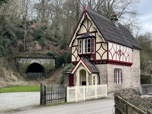
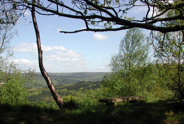
Oakamoor is a picturesque village located in the Staffordshire Moorlands district of Staffordshire, England. Situated on the eastern bank of the River Churnet, it is surrounded by stunning natural beauty, making it a popular destination for nature lovers and outdoor enthusiasts.

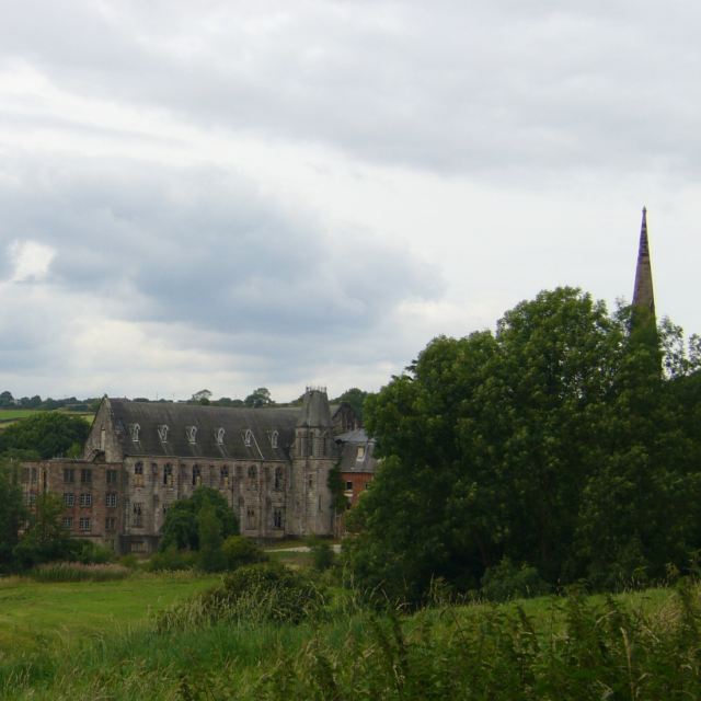
The village is known for its rich history, with evidence of human settlement dating back to the Roman era. Oakamoor is particularly famous for its connections to the industrial revolution, as it was once home to numerous coal mines and ironworks. The remnants of these industries can still be seen in the village, adding to its historical charm.

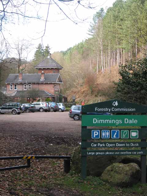
One of the main attractions in Oakamoor is the Churnet Valley Railway, a preserved steam railway that runs along the picturesque Churnet Valley. Visitors can enjoy a nostalgic train ride through the beautiful countryside and take in the breathtaking views.

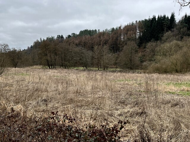
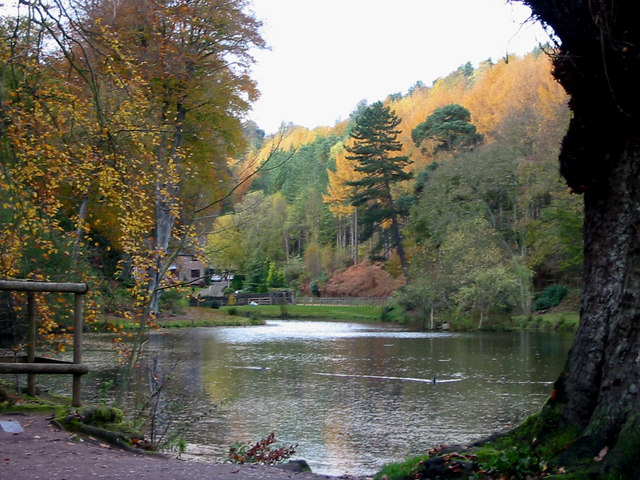
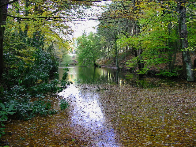
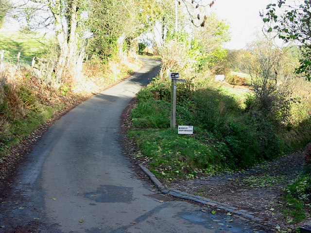
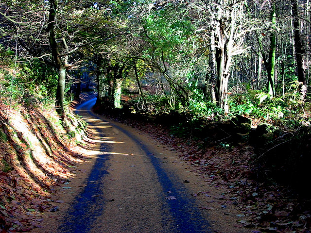
Nature lovers can explore the nearby woodland and enjoy walks along the riverbank, where they may spot a variety of wildlife. The village is also a great starting point for hiking and cycling adventures, with several trails and routes passing through the area.

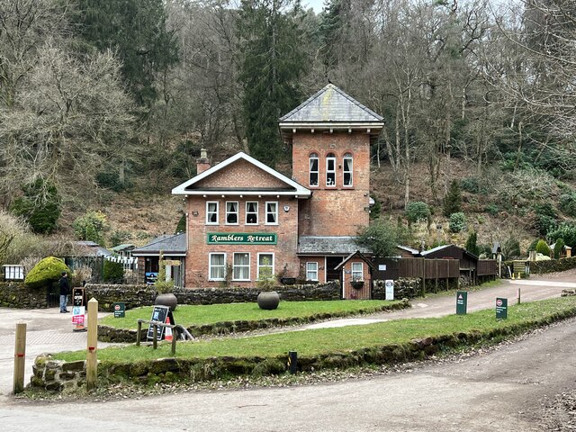
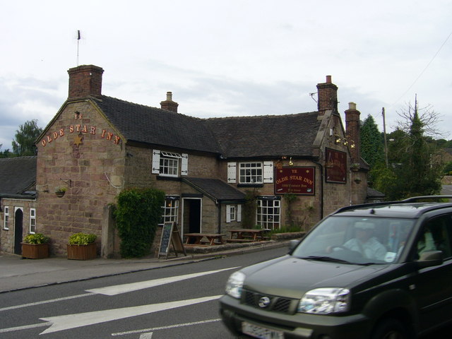
In terms of amenities, Oakamoor has a local pub that serves traditional food and drinks, providing a cozy spot to relax after a day of exploring. The village offers a peaceful and idyllic setting, making it a perfect destination for those seeking a retreat from the hustle and bustle of city life.

If you have any feedback on the listing, please let us know in the comments section below.
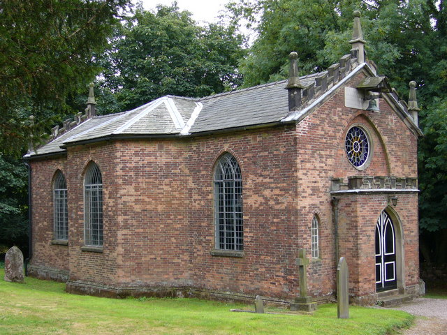
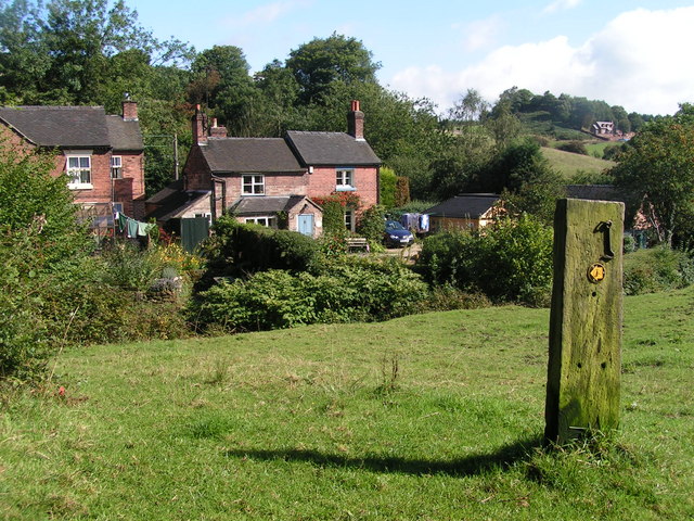
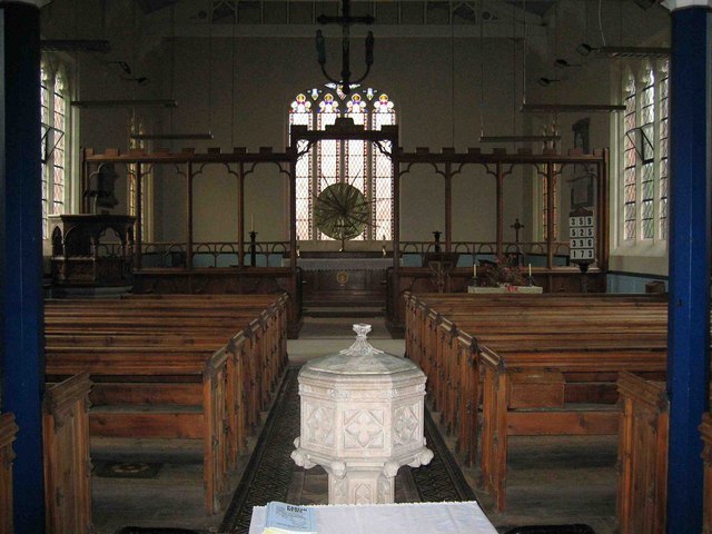
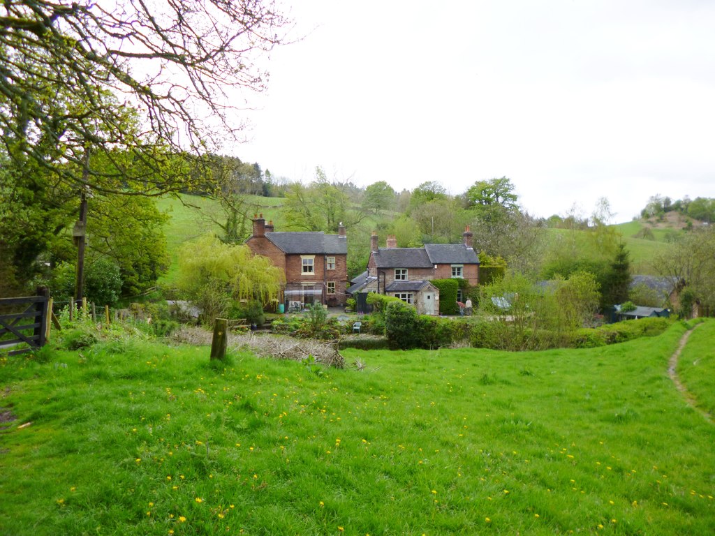
Oakamoor Images

Images are sourced within 2km of 53.001294/-1.920291 or Grid Reference SK0544. Thanks to Geograph Open Source API. All images are credited.

Closed railway tunnel and former crossing keeper's cottage On the former Churnet Valley line in North Staffordshire.
Closed railway tunnel and former crossing keeper's cottage
On the former Churnet Valley line in North Staffordshire.
Churnet Valley flood plain
The Ramblers' Retreat A deservedly popular cafe and tea room in Dimmingsdale.
The Ramblers' Retreat
A deservedly popular cafe and tea room in Dimmingsdale.
Car parking for Hawksmoor NT 'Limited parking for approx. 6 cars' states the National Trust website, and this is it. However even more limited off-road parking is possible at Highshutt further west outside the entrance shown here <a title="https://www.geograph.org.uk/photo/7667028" href="https://www.geograph.org.uk/photo/7667028">Link</a>
Car parking for Hawksmoor NT
'Limited parking for approx. 6 cars' states the National Trust website, and this is it. However even more limited off-road parking is possible at Highshutt further west outside the entrance shown here Link
View from Hawksmoor Reserve (NT)
Ramblers' Retreat Dimmings Dale The Ramblers' Retreat, now a popular restaurant and tea room deep in the Churnet Valley, was once a lodge for the 16th Earl of Shrewsbury's Alton Towers estate.
Ramblers' Retreat Dimmings Dale
The Ramblers' Retreat, now a popular restaurant and tea room deep in the Churnet Valley, was once a lodge for the 16th Earl of Shrewsbury's Alton Towers estate.
Dimmingsdale Dimmingsdale in all its autumnal glory showing one of the holding ponds built to hold water used in the adjacent smelting mill, now a private residence.
Dimmingsdale
Dimmingsdale in all its autumnal glory showing one of the holding ponds built to hold water used in the adjacent smelting mill, now a private residence.
Dimmingsdale in Autumn Autumnal leaves cover one of several ponds in Dimmingsdale in the Staffordshire Moorlands.
Dimmingsdale in Autumn
Autumnal leaves cover one of several ponds in Dimmingsdale in the Staffordshire Moorlands.
Country Lane The Threapwood to Oakamoor road showing the western entrance to Dimmingsdale
Country Lane
The Threapwood to Oakamoor road showing the western entrance to Dimmingsdale
Autumn Lane A country lane near Oakamoor in the Staffordshire Moorlands covered in pine needles.
Autumn Lane
A country lane near Oakamoor in the Staffordshire Moorlands covered in pine needles.
Ye Olde Star Inn a 16th century inn in Star Bank, Cotton, Staffordshire
Ye Olde Star Inn
a 16th century inn in Star Bank, Cotton, Staffordshire
Cotton College Cotton Lane, Cotton, Staffordshire. This Roman Catholic boarding school <span class="nowrap"><a title="http://www.cottoncollege.co.uk/" rel="nofollow ugc noopener" href="http://www.cottoncollege.co.uk/">Link</a><img style="margin-left:2px;" alt="External link" title="External link - shift click to open in new window" src="https://s1.geograph.org.uk/img/external.png" width="10" height="10"/></span> closed in 1987. The buildings are derelict. The spire on the right is St Wilfred's Roman Catholic Church which is still in use.
Cotton College
Cotton Lane, Cotton, Staffordshire. This Roman Catholic boarding school LinkExternal link closed in 1987. The buildings are derelict. The spire on the right is St Wilfred's Roman Catholic Church which is still in use.
Church of St John the Baptist Cotton Lane, Cotton, Staffordshire. <span class="nowrap"><a title="http://www.genuki.org.uk/big/eng/STS/Cotton/index.html" rel="nofollow ugc noopener" href="http://www.genuki.org.uk/big/eng/STS/Cotton/index.html">Link</a><img style="margin-left:2px;" alt="External link" title="External link - shift click to open in new window" src="https://s1.geograph.org.uk/img/external.png" width="10" height="10"/></span> This charming little church built in 1795 is tucked into a corner and virtually surrounded by St Wilfred's Roman Catholic Church and <a href="https://www.geograph.org.uk/photo/224492">SK0646 : Cotton College</a>.
Church of St John the Baptist
Cotton Lane, Cotton, Staffordshire. LinkExternal link This charming little church built in 1795 is tucked into a corner and virtually surrounded by St Wilfred's Roman Catholic Church and SK0646 : Cotton College.
Oldfurnace Cottages at Oldfurnace from the footpath to Newton.
Oldfurnace
Cottages at Oldfurnace from the footpath to Newton.
Oldfurnace Ford on the track to Dimmingsdale, with the chimneys of Oldfurnace beyond the hedge.
Oldfurnace
Ford on the track to Dimmingsdale, with the chimneys of Oldfurnace beyond the hedge.
Greendale Cottages Right on the eastern edge of the square (in fact the far end of the terrace is in <a href="https://www.geograph.org.uk/gridref/SK0443">SK0443</a>). A plaque on the end wall reads "These cottages built for brass and copper workers were given to the National Trust in 1987 by the late Mrs. M. C. Aldridge who loved Hawksmoor and the surrounding countryside". There is also a Victorian postbox in the wall.
Greendale Cottages
Right on the eastern edge of the square (in fact the far end of the terrace is in SK0443). A plaque on the end wall reads "These cottages built for brass and copper workers were given to the National Trust in 1987 by the late Mrs. M. C. Aldridge who loved Hawksmoor and the surrounding countryside". There is also a Victorian postbox in the wall.
Barn at Greendale Farm From Greendale Lane, on the very eastern edge of the square.
Barn at Greendale Farm
From Greendale Lane, on the very eastern edge of the square.
Interior of Oakamoor Church
Show me another place!

Oakamoor is located at Grid Ref: SK0544 (Lat: 53.001294, Lng: -1.920291)

Administrative County: Staffordshire

District: Staffordshire Moorlands

Police Authority: Staffordshire

What 3 Words

///flatten.mailbox.marinated. Near Cheadle, Staffordshire

Nearby Locations

Oakamoor Coppy Wood

Related Wikis

Oakamoor

Oakamoor is a small village in north Staffordshire, England. Although it is now a rural area, it has an industrial past which drew on the natural resources...

Oakamoor Tunnel

Oakamoor Tunnel is a disused 497-yard (454 m) long tunnel located north of Oakamoor railway station on the former Uttoxeter to North Rode section of the...

Oakamoor railway station

Oakamoor railway station is a closed railway station in the Churnet Valley, Staffordshire. The station was opened in 1849 as part of the Churnet Valley...

Cotton Dell

Cotton Dell is a nature reserve of the Staffordshire Wildlife Trust. It is a wooded valley area near the village of Cotton and about 0.5 miles (0.8 km...

Submission (Alton Towers)

Submission was a theme park ride at Alton Towers in Staffordshire, England from 2001 until 2013. It was a Chance Rides double swinging inverter. ��2...

The Old Furnace

The Old Furnace is a colloquial name given to an historic site in Oakamoor, Staffordshire, England, that supported the development of medieval and post...

Cotton, Staffordshire

Cotton is a village and civil parish in Staffordshire, England. It is about 5 miles (8.0 km) north-east of Cheadle. Cotton Hall, originally built in the...

Cotton College

Cotton College was a Roman Catholic boarding school in Cotton, Staffordshire, United Kingdom. It was also known as Saint Wilfrid's College. The school...

Nearby Amenities

Located within 500m of 53.001294,-1.920291
Oakamoor
Is In Country: UK
Is In County: Staffordshire
Place: village
Lat/Long: 53.0005429/-1.922878
Created By: Potlatch 0.10e
Postal Code: ST10
Lat/Long: 53.0022075/-1.9193151
Post Office
Oakamoor Post Office
Addr Postcode: ST10 3AA
Brand: Post Office
Brand Wikidata: Q1783168
Ref Pol Id: 133524
Website: https://www.postoffice.co.uk/branch-finder/3704718/oakamoor
Lat/Long: 53.0021209/-1.9201133
Bus Stop
Churnet Bridge
Naptan AtcoCode: 3800C810900
Naptan Bearing: NE
Naptan CommonName: Churnet Bridge
Naptan Indicator: Adj
Naptan Landmark: Churnet Bridge
Naptan Street: Mill Rd
Naptan Verified: no
Source: naptan_import
Lat/Long: 53.001257/-1.920785
Bus Stop
Carr Bank
Naptan AtcoCode: 3800C810901
Naptan Bearing: W
Naptan CommonName: Carr Bank
Naptan Indicator: Adj
Naptan Landmark: Carr Bank
Naptan Street: Star Bank
Naptan Verified: no
Source: naptan_import
Lat/Long: 53.0012565/-1.9201293
Addr Street: Woodside Cottages
Lat/Long: 53.0030784/-1.927086
Addr Housenumber: Alcove Cottage
Lat/Long: 53.0048022/-1.9188677
Historic Railway: level_crossing
Lat/Long: 52.9986289/-1.9234139
Barrier: kissing_gate
Lat/Long: 53.0033687/-1.9181187
Barrier: stile
Lat/Long: 53.0042831/-1.9204198
Grit Bin
Source: survey
Lat/Long: 53.0000718/-1.92332
Grit Bin
Source: survey
Lat/Long: 53.003665/-1.9197342
Oakamoor
Disused Railway: station
Railway: site
Lat/Long: 52.9972404/-1.9219188
The Froghall to Uttoxeter Canal
Board Type: history
Information: board
Tourism: information
Lat/Long: 53.0013138/-1.9207777
The North Staffordshire Railway
Board Type: history
Information: board
Tourism: information
Lat/Long: 52.99733/-1.9221026
Shelter
Bench: yes
Shelter: yes
Shelter Type: public_transport
Lat/Long: 53.0012747/-1.9206936
Bench
Backrest: yes
Material: wood
Lat/Long: 53.0013119/-1.9210157
Barrier: stile
Material: wood
Source: survey
Stile: stepover
Lat/Long: 53.0031092/-1.9140158
Barrier: stile
Lat/Long: 53.0057555/-1.9212435
Barrier: stile
Lat/Long: 53.0048256/-1.9204811
Barrier: stile
Lat/Long: 53.0055737/-1.9206196
Tourism: picnic_site
Lat/Long: 52.9991249/-1.9225131
Historic: memorial
Memorial: war_memorial
Lat/Long: 53.0018254/-1.9203564
Barrier: stile
Material: wood
Stile: ladder
Lat/Long: 53.002124/-1.9153681
Waste Basket
Waste: dog_excrement
Lat/Long: 53.0011659/-1.9207245
Barrier: bollard
Lat/Long: 53.0012003/-1.9206996
Barrier: height_restrictor
Lat/Long: 52.9992195/-1.9230986
Turning Circle
Lat/Long: 53.0008197/-1.9244688
Generator Method: photovoltaic
Generator Output Electricity: yes
Generator Source: solar
Location: roof
Power: generator
Source: visual survey; bing
Lat/Long: 53.0033701/-1.9202659
The Beehive Guest House
Operator: The Beehive Guest House
Tourism: guest_house
Lat/Long: 53.0020368/-1.9216903
Bolton Copper Mill
Board Type: history
Description: In 1790 Thomas Patten, owner of the Cheadle copper and Brass Company, bought the tin palte works as Oakamoor.
Information: board
Tourism: information
Lat/Long: 52.9998335/-1.9206239
Oakamoor Heritage Trail 1
Board Type: history
Description: Oakamoore has been an industrial centre for over 800 years.
Information: board
Tourism: information
Lat/Long: 52.9991099/-1.9227952
Generator Source: solar
Power: generator
Lat/Long: 53.0024048/-1.9189804
Bench
Backrest: yes
Lat/Long: 53.0038384/-1.9177056
Bench
Backrest: yes
Lat/Long: 53.0006917/-1.920563
Barrier: stile
Stile: stepover
Lat/Long: 53.0034031/-1.9179341
Board Type: map
Information: board
Tourism: information
Lat/Long: 53.003781/-1.9177473
Leisure: picnic_table
Lat/Long: 53.0000372/-1.921056
Bench
Backrest: yes
Lat/Long: 53.0018034/-1.920407
Post Box
Post Box Type: lamp
Ref: ST10 267
Royal Cypher: EIIR
Royal Cypher Wikidata: Q33102113
Lat/Long: 53.0021463/-1.9201742
Defibrillator
Access: yes
Check Date: 2023-03-10
Defibrillator Location: On outside wall of Oakamoor Village Hall
Emergency: defibrillator
Indoor: no
Opening Hours: 24/7
Lat/Long: 53.0021587/-1.9200943
Bench
Backrest: yes
Lat/Long: 53.0019268/-1.9203409
Bench
Backrest: yes
Lat/Long: 53.0019033/-1.9204129
Historic: yes
Man Made: kiln
Product: lime
Lat/Long: 53.0010949/-1.9198962
Entrance: yes
Lat/Long: 53.0021516/-1.9201172
The data included in this document is from www.openstreetmap.org. The data is made available under ODbL.

Have you been to Oakamoor?

Leave your review of Oakamoor below (or comments, questions and feedback).