Nunthorpe

Settlement in Yorkshire

England

Nunthorpe

Gypsy Lane Railway Station Served by services on the Middlesbrough - Whitby line, and by some Durham Coast Line services that are extended beyond Middlesbrough to Nunthorpe or Battersby.
Gypsy Lane Railway Station Credit: David Robinson

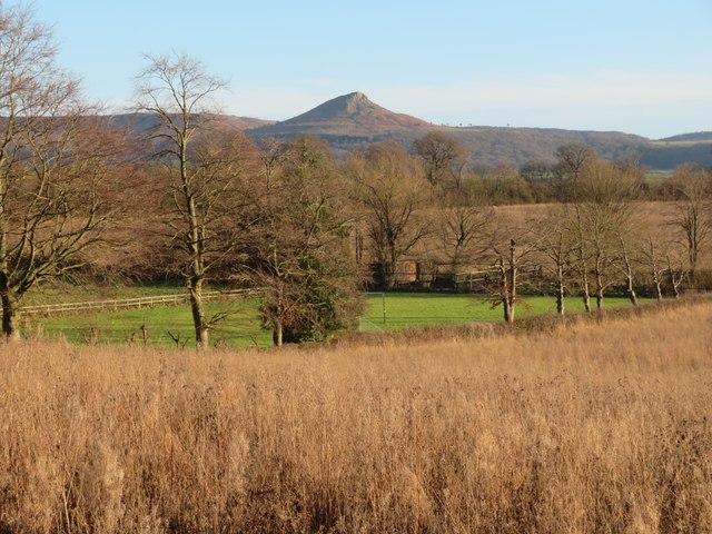
Nunthorpe is a small village located in the borough of Middlesbrough, within the county of North Yorkshire, England. It lies on the southern edge of the North York Moors National Park, approximately 4 miles south of Middlesbrough town center.

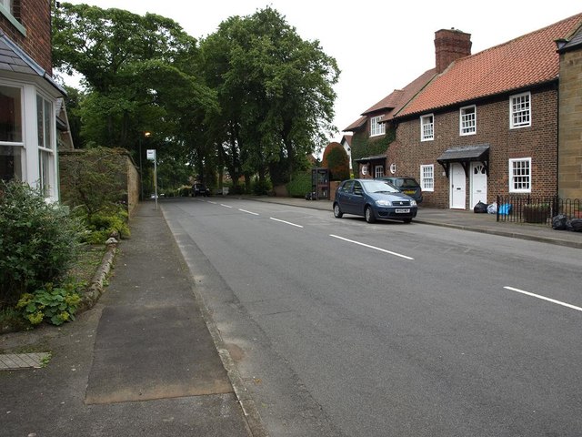
Nunthorpe is known for its picturesque setting, surrounded by stunning countryside and woodland areas. The village itself is characterized by a mix of modern houses and traditional cottages, giving it a charming and welcoming atmosphere. It is a popular residential area, offering a peaceful and tranquil environment for its residents.

The village is well-served by amenities, including a range of local shops, a post office, and a community center. There are also several pubs and restaurants, providing options for dining and socializing. Nunthorpe Primary School and Nunthorpe Academy cater to the educational needs of the local community.

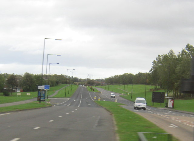
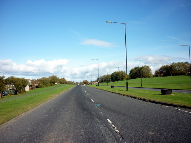
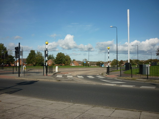
Nunthorpe benefits from excellent transport links, with a railway station providing easy access to Middlesbrough, Darlington, and Whitby. There are also regular bus services connecting the village to neighboring areas.

The surrounding countryside offers numerous opportunities for outdoor activities, such as walking, cycling, and horse riding. The nearby North York Moors National Park is a popular destination for nature lovers and hikers, with its rolling hills, heather-covered moorland, and diverse wildlife.

Overall, Nunthorpe offers a peaceful and idyllic lifestyle, combining the tranquility of rural living with the convenience of nearby urban amenities.

If you have any feedback on the listing, please let us know in the comments section below.
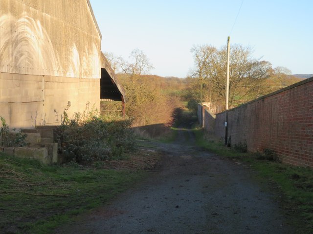
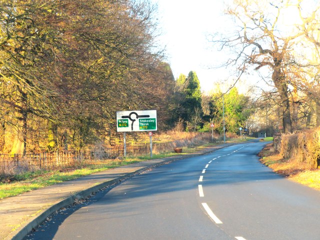
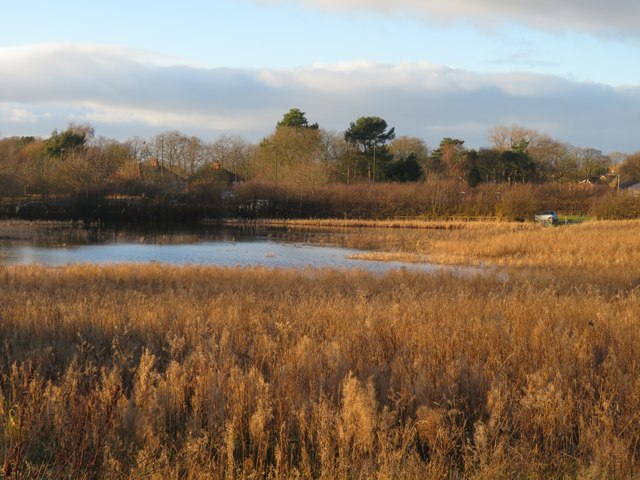
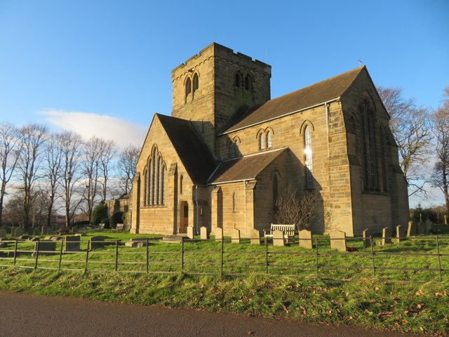
Nunthorpe Images

Images are sourced within 2km of 54.521847/-1.1744224 or Grid Reference NZ5314. Thanks to Geograph Open Source API. All images are credited.

Gypsy Lane Railway Station Served by services on the Middlesbrough - Whitby line, and by some Durham Coast Line services that are extended beyond Middlesbrough to Nunthorpe or Battersby.
Gypsy Lane Railway Station
Served by services on the Middlesbrough - Whitby line, and by some Durham Coast Line services that are extended beyond Middlesbrough to Nunthorpe or Battersby.
A1043 near its terminus with the A171
Old milepost A view of the milepost, from its style cast at Mattison's Foundry, Bedale, outside Milestone House on Gypsy Lane in Nunthorpe.  It is on the 1912 OS 6" map on what is now A172 Stokesley Road.   The right face has  a hand pointing left/STOKESLEY/6/MILES.
Old milepost
A view of the milepost, from its style cast at Mattison's Foundry, Bedale, outside Milestone House on Gypsy Lane in Nunthorpe. It is on the 1912 OS 6" map on what is now A172 Stokesley Road. The right face has a hand pointing left/STOKESLEY/6/MILES.
Footpath at Nunthorpe The path, which is a good track, leads between what appear to be abandoned farm buildings close to Nunthorpe Hall, the wall on the right being the boundary of the hall grounds.
Footpath at Nunthorpe
The path, which is a good track, leads between what appear to be abandoned farm buildings close to Nunthorpe Hall, the wall on the right being the boundary of the hall grounds.
Old road north of Nunthorpe village This is the line of the original A172 approaching a roundabout where it meets the current A172 which has by-passed Nunthorpe village.
Old road north of Nunthorpe village
This is the line of the original A172 approaching a roundabout where it meets the current A172 which has by-passed Nunthorpe village.
Wetland on the edge of urban sprawl This could be a rural scene with a rush & sedge fringed pond, but it is close to busy 'A' roads on the southern edge of Middlesbrough where houses and traffic can just be glimpsed in the background. Taken from a newly enclosed garden area to the west of Nunthorpe church.
Wetland on the edge of urban sprawl
This could be a rural scene with a rush & sedge fringed pond, but it is close to busy 'A' roads on the southern edge of Middlesbrough where houses and traffic can just be glimpsed in the background. Taken from a newly enclosed garden area to the west of Nunthorpe church.
Church of St Mary the Virgin Nunthorpe church stands between the old estate village of Nunthorpe to the south and the sprawling suburb of Middlesbrough that carries the same name to the north. This is a muscular looking building by Temple Moore, built between 1914 & 1926.
Church of St Mary the Virgin
Nunthorpe church stands between the old estate village of Nunthorpe to the south and the sprawling suburb of Middlesbrough that carries the same name to the north. This is a muscular looking building by Temple Moore, built between 1914 & 1926.
Rural view from near Nunthorpe church A view across countryside towards Roseberry Topping.
Rural view from near Nunthorpe church
A view across countryside towards Roseberry Topping.
Road through Old Nunthorpe
Stainton Way north east of the A172 at Dixons Bank
Guisborough Road, Nunthorpe at junction with the A171 and A1043 at Swan's Corner
The Brunton Arms A Sam Smith's public house.
The Brunton Arms
A Sam Smith's public house.
The beer garden at the Brunton Arms A Sam Smith's public house.
The beer garden at the Brunton Arms
A Sam Smith's public house.
The Brunton Arms A Sam Smith's public house
The Brunton Arms
A Sam Smith's public house
The shops on Dixons Bank
Stainton Way, Nunthorpe
Stainton Way from Dixon's Bank, Nunthorpe
Nunthorpe train station
Show me another place!

Nunthorpe is located at Grid Ref: NZ5314 (Lat: 54.521847, Lng: -1.1744224)

Division: North Riding

Unitary Authority: Middlesbrough

Police Authority: Cleveland

What 3 Words

///remove.comet.maple. Near Nunthorpe, North Yorkshire

Related Wikis

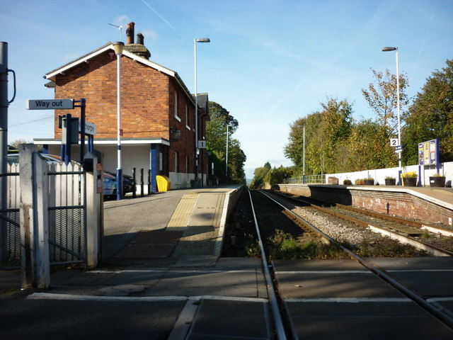
Nunthorpe railway station

Nunthorpe is a railway station on the Esk Valley Line, which runs between Middlesbrough and Whitby via Nunthorpe. The station, situated 4 miles 48 chains...

Nunthorpe

Nunthorpe is a village and civil parish in the Borough of Middlesbrough in North Yorkshire, England. It is part of the historic county of Yorkshire, North...

St Bernadette's, Nunthorpe

The parish church of St Bernadette is a Roman Catholic Church in Nunthorpe in the Diocese of Middlesbrough. The parish priest is Canon John Lumley. �...

Nunthorpe Academy

Nunthorpe Academy is an 11-18 Specialist Science, Business and Enterprise Academy in Nunthorpe, Middlesbrough, North Yorkshire, England. Houses are Endeavour...

Nearby Amenities

Located within 500m of 54.521847,-1.1744224
Traffic Signals
Source: survey
Lat/Long: 54.5215298/-1.1818733
Man Made: serving_area_interface
Operator: BT Openreach
Source: survey
Type: dslam
Lat/Long: 54.524754/-1.1720988
Crossing
Bicycle: no
Crossing: traffic_signals
Crossing Ref: pelican
Lat/Long: 54.5216377/-1.1820799
Pipeline: marker
Source: survey; Bing
Type: gas
Lat/Long: 54.5220751/-1.1797959
Generator Method: photovoltaic
Generator Output Electricity: yes
Generator Source: solar
Generator Type: solar_photovoltaic_panel
Location: roof
Power: generator
Lat/Long: 54.5200851/-1.1783084
Generator Method: photovoltaic
Generator Output Electricity: yes
Generator Source: solar
Generator Type: solar_photovoltaic_panel
Location: roof
Power: generator
Lat/Long: 54.5200174/-1.1753472
Generator Method: photovoltaic
Generator Output Electricity: yes
Generator Source: solar
Generator Type: solar_photovoltaic_panel
Location: roof
Power: generator
Lat/Long: 54.5199901/-1.1768225
Generator Method: photovoltaic
Generator Output Electricity: yes
Generator Source: solar
Generator Type: solar_photovoltaic_panel
Location: roof
Power: generator
Lat/Long: 54.5208854/-1.1762197
Generator Method: photovoltaic
Generator Output Electricity: yes
Generator Source: solar
Generator Type: solar_photovoltaic_panel
Location: roof
Power: generator
Lat/Long: 54.5227316/-1.1813755
Generator Method: photovoltaic
Generator Output Electricity: yes
Generator Source: solar
Generator Type: solar_photovoltaic_panel
Location: roof
Power: generator
Lat/Long: 54.522825/-1.1816276
Generator Method: photovoltaic
Generator Output Electricity: yes
Generator Source: solar
Generator Type: solar_photovoltaic_panel
Location: roof
Power: generator
Lat/Long: 54.5240944/-1.1808847
Generator Method: photovoltaic
Generator Output Electricity: yes
Generator Source: solar
Generator Type: solar_photovoltaic_panel
Location: roof
Power: generator
Lat/Long: 54.5237364/-1.1802543
Generator Method: photovoltaic
Generator Output Electricity: yes
Generator Source: solar
Generator Type: solar_photovoltaic_panel
Location: roof
Power: generator
Lat/Long: 54.5234157/-1.1797689
Generator Method: photovoltaic
Generator Output Electricity: yes
Generator Source: solar
Generator Type: solar_photovoltaic_panel
Location: roof
Power: generator
Lat/Long: 54.523513/-1.1796482
Generator Method: photovoltaic
Generator Output Electricity: yes
Generator Source: solar
Generator Type: solar_photovoltaic_panel
Location: roof
Power: generator
Lat/Long: 54.5235099/-1.1797286
Generator Method: photovoltaic
Generator Output Electricity: yes
Generator Source: solar
Generator Type: solar_photovoltaic_panel
Location: roof
Power: generator
Lat/Long: 54.5232608/-1.1800022
Generator Method: photovoltaic
Generator Output Electricity: yes
Generator Source: solar
Generator Type: solar_photovoltaic_panel
Location: roof
Power: generator
Lat/Long: 54.5246229/-1.1762981
Generator Method: photovoltaic
Generator Output Electricity: yes
Generator Source: solar
Generator Type: solar_photovoltaic_panel
Location: roof
Power: generator
Lat/Long: 54.5240758/-1.1767541
Generator Method: photovoltaic
Generator Output Electricity: yes
Generator Source: solar
Generator Type: solar_photovoltaic_panel
Location: roof
Power: generator
Lat/Long: 54.5240104/-1.179974
Generator Method: photovoltaic
Generator Output Electricity: yes
Generator Source: solar
Generator Type: solar_photovoltaic_panel
Location: roof
Power: generator
Lat/Long: 54.5242999/-1.1805293
Generator Method: photovoltaic
Generator Output Electricity: yes
Generator Source: solar
Generator Type: solar_photovoltaic_panel
Location: roof
Power: generator
Lat/Long: 54.5243186/-1.1805534
Generator Method: photovoltaic
Generator Output Electricity: yes
Generator Source: solar
Generator Type: solar_photovoltaic_panel
Location: roof
Power: generator
Lat/Long: 54.5259772/-1.1742489
Generator Method: photovoltaic
Generator Output Electricity: yes
Generator Source: solar
Generator Type: solar_photovoltaic_panel
Location: roof
Power: generator
Lat/Long: 54.52596/-1.1741684
The data included in this document is from www.openstreetmap.org. The data is made available under ODbL.

Have you been to Nunthorpe?

Leave your review of Nunthorpe below (or comments, questions and feedback).