Norton Lees

Settlement in Derbyshire

England

Norton Lees

A row of shops On the brow of East Bank Road
A row of shops Credit: David Lally

Norton Lees is a small village located in Derbyshire, England. It is situated near the city of Sheffield and is part of the civil parish of Norton. The village is characterized by its picturesque countryside surroundings, with rolling hills and lush greenery.

Norton Lees is home to a close-knit community of residents who take pride in their village and its heritage. The village has a mix of traditional stone cottages and more modern housing developments, providing a range of accommodation options for its residents.

In terms of amenities, Norton Lees has a number of local shops, pubs, and restaurants, providing residents with convenient access to everyday essentials and leisure activities. The village also has a primary school, making it an attractive location for families with young children.

Norton Lees is well-connected to nearby towns and cities, with good transport links making it easy for residents to access surrounding areas. Overall, Norton Lees offers a peaceful and idyllic setting for those looking to escape the hustle and bustle of urban life.

If you have any feedback on the listing, please let us know in the comments section below.
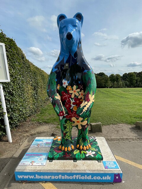
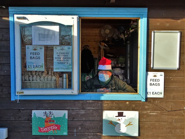
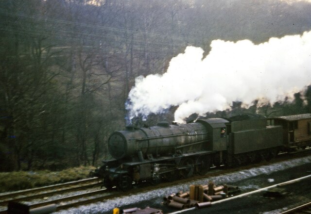
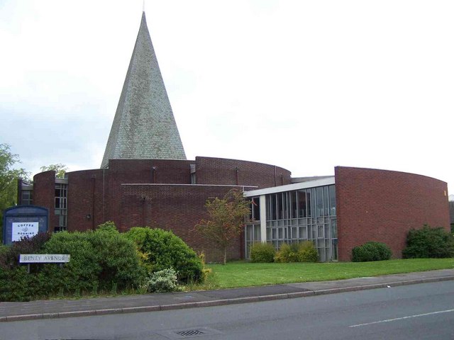
Norton Lees Images

Images are sourced within 2km of 53.350354/-1.47117 or Grid Reference SK3583. Thanks to Geograph Open Source API. All images are credited.

A row of shops On the brow of East Bank Road
A row of shops
On the brow of East Bank Road
Bears of Sheffield: #57 Beartanical #57 of 61 big bear sculptures, this one was decorated by Vanessa Scott and is located in Graves Park.

Beartantical was inspired by the artist's many adventures and relaxing days spent exploring the hills and woodland surrounding the city, and the afternoons she has spent gazing at the beautiful star shaped plants at the botanical gardens.
Bears of Sheffield: #57 Beartanical
#57 of 61 big bear sculptures, this one was decorated by Vanessa Scott and is located in Graves Park. Beartantical was inspired by the artist's many adventures and relaxing days spent exploring the hills and woodland surrounding the city, and the afternoons she has spent gazing at the beautiful star shaped plants at the botanical gardens.
Sycamore tree in Graves Park One of my favourite trees and I can't resist a photo when I pass by!
Sycamore tree in Graves Park
One of my favourite trees and I can't resist a photo when I pass by!
Graves parkrunners Participants in the 405th Graves parkrun on a downhill section which comes as something of a relief from the hills that precede it.
Graves parkrunners
Participants in the 405th Graves parkrun on a downhill section which comes as something of a relief from the hills that precede it.
Gleadless Road, looking towards Heeley, Sheffield View of Gleadless Road at the corner with Abney Road and looking west towards Heeley.
Gleadless Road, looking towards Heeley, Sheffield
View of Gleadless Road at the corner with Abney Road and looking west towards Heeley.
Archer Road, Sheffield
Hutcliffe Road, Sheffield
Brexit Bonus, Sainsbury's, Archer Road, Sheffield Sainsbury's are doing their best to make it look as though the shelves aren't empty, but crisps and other potato products have been especially badly hit by supply chain problems in 2021. Apparently, a lot of our crisps come from Ireland. Yes, really, we can't even get crisps from Ireland when we were promised that everything would be better after Brexit.
Brexit Bonus, Sainsbury's, Archer Road, Sheffield
Sainsbury's are doing their best to make it look as though the shelves aren't empty, but crisps and other potato products have been especially badly hit by supply chain problems in 2021. Apparently, a lot of our crisps come from Ireland. Yes, really, we can't even get crisps from Ireland when we were promised that everything would be better after Brexit.
Fox & flower mural by Faunagraphic This mural on the Meersbrook Park Pavilion by artist Sarah Yates (aka Faunagraphic) was financed through crowdfunding by the local community with matched funding from the City Council.
Fox & flower mural by Faunagraphic
This mural on the Meersbrook Park Pavilion by artist Sarah Yates (aka Faunagraphic) was financed through crowdfunding by the local community with matched funding from the City Council.
Lottie the Shire Horse At Graves Park Animal Farm, Sheffield.
Lottie the Shire Horse
At Graves Park Animal Farm, Sheffield.
Eye of a shire horse at Graves Park Animal Centre This is Lottie the Shire Horse's right eye. She is the biggest animal on the show farm which is popular with Sheffield families.
Eye of a shire horse at Graves Park Animal Centre
This is Lottie the Shire Horse's right eye. She is the biggest animal on the show farm which is popular with Sheffield families.
Christmas llama and sheep at Graves Park Animal Farm Graves Park is a large public park in southern Sheffield. It was given to the city by wealthy local businessman J.G.Graves in 1925.
Christmas llama and sheep at Graves Park Animal Farm
Graves Park is a large public park in southern Sheffield. It was given to the city by wealthy local businessman J.G.Graves in 1925.
Sycamore tree to the north of Graves Park With a distant view of The Peak District. The same tree was snapped by another Geograph member in August 2021: <a title="https://www.geograph.org.uk/photo/6949291" href="https://www.geograph.org.uk/photo/6949291">Link</a>
Sycamore tree to the north of Graves Park
With a distant view of The Peak District. The same tree was snapped by another Geograph member in August 2021: Link
Man in the kiosk at Graves Park Animal Farm He looked rather bored despite his santa hat. Midweek business was sparse. I asked him if I could take his photo and he kindly agreed.
Man in the kiosk at Graves Park Animal Farm
He looked rather bored despite his santa hat. Midweek business was sparse. I asked him if I could take his photo and he kindly agreed.
Goods train approaching Millhouses Station 1962 Heavy goods 2-8-0 loco approaching Millhouses station in February 1962. The streaked and stained boiler well shows these work horse locos were not the pride of the maintenance department! (From an old Kodachrome transparency in poor light.)
Goods train approaching Millhouses Station 1962
Heavy goods 2-8-0 loco approaching Millhouses station in February 1962. The streaked and stained boiler well shows these work horse locos were not the pride of the maintenance department! (From an old Kodachrome transparency in poor light.)
Solitary sycamore tree in Graves Park On a grey and misty morning
Solitary sycamore tree in Graves Park
On a grey and misty morning
Holy Trinity Church, Grove Road, Millhouses, Sheffield View down Grove Road showing Holy Trinity church, built in 1937 in the "Arts and Crafts" style. Although taken in 1963, the scene has changed little apart from the demise of the gas lamps.
Holy Trinity Church, Grove Road, Millhouses, Sheffield
View down Grove Road showing Holy Trinity church, built in 1937 in the "Arts and Crafts" style. Although taken in 1963, the scene has changed little apart from the demise of the gas lamps.
Abbeydale "Tesco" superstore
Show me another place!

Norton Lees is located at Grid Ref: SK3583 (Lat: 53.350354, Lng: -1.47117)

Unitary Authority: Sheffield

Police Authority: South Yorkshire

What 3 Words

///trace.twig.glee. Near Sheffield, South Yorkshire

Related Wikis

St Peter, Greenhill

St Peter's Greenhill is a Parish Church in the Church of England Diocese of Sheffield located in the Greenhill area of the city.The church was built between...

St Paul's Church and Centre, Norton Lees, Sheffield

St Paul's Church and Centre is a Parish Church in the Church of England Diocese of Sheffield located at the junction of Norton Lees Lane and Angerford...
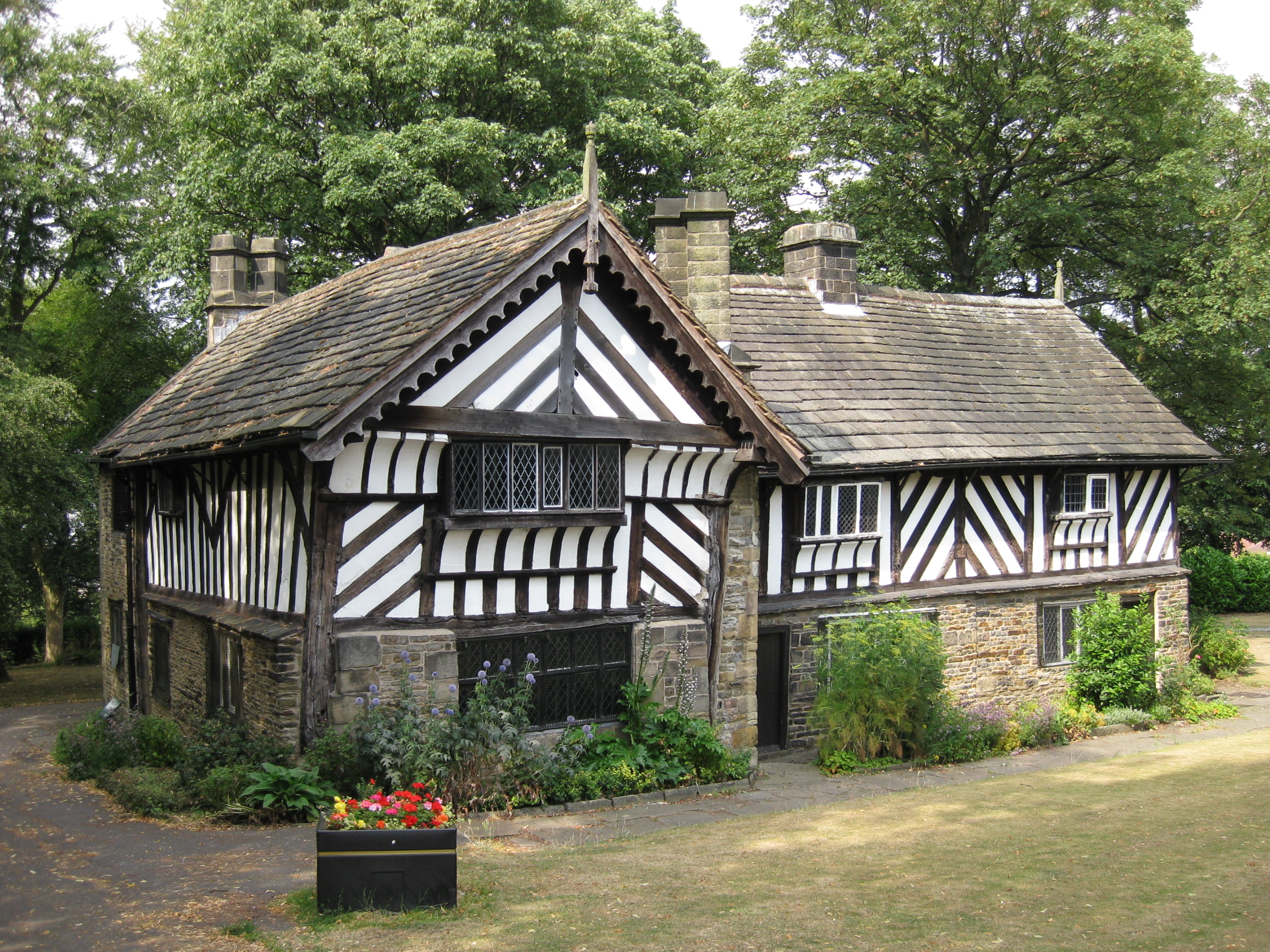
Bishops' House

Bishops' House is a half-timbered house in the Norton Lees district of the City of Sheffield, England. It was built c. 1500 and is located on the southern...

Norton Lees

Norton Lees (grid reference SK353839) is a residential suburb in the Graves Park ward of the City of Sheffield, England located to the east of Woodseats...

Nearby Amenities

Located within 500m of 53.350354,-1.47117
Meersbrook
Place: suburb
Wikidata: Q3304138
Wikipedia: en:Meersbrook
Lat/Long: 53.3547296/-1.4699018
Warminster Road/Brindley Close
Bus: yes
Public Transport: stop_position
Lat/Long: 53.3480366/-1.4684908
Norton Lees Road/Cliffefield Road
Bus: yes
Public Transport: stop_position
Lat/Long: 53.3514311/-1.4745526
Turning Circle
Lat/Long: 53.3466156/-1.4679218
Turning Circle
Source: Bing
Lat/Long: 53.3526424/-1.4677815
Turning Circle
Lat/Long: 53.3489007/-1.4734569
Turning Circle
Source: Bing
Lat/Long: 53.348113/-1.4711801
Turning Circle
Source: Bing
Lat/Long: 53.3475005/-1.4704708
Power: substation
Ref GB Uprn: 10013645020
Lat/Long: 53.3540928/-1.4704319
Telephone
Booth: KXPlus
Check Date: 2021-02-11
Covered: booth
Lat/Long: 53.3516581/-1.4684031
Post Box
Collection Times: Mo-Fr 16:00, Sa 11:45
Post Box Type: pillar
Ref: S8 628
Royal Cypher: GR
Royal Cypher Wikidata: Q33102273
Lat/Long: 53.3517913/-1.4671244
Power: substation
Ref GB Uprn: 10013644284
Lat/Long: 53.3520472/-1.4649811
Post Box
Collection Times: Mo-Fr 09:00, Sa 07:00
Ref: S8 640
Royal Cypher: GR
Royal Cypher Wikidata: Q33102273
Lat/Long: 53.3492254/-1.4645835
Norton Warminster Road
Man Made: pumping_station
Pumping Station: water
Lat/Long: 53.3487226/-1.4691831
Community Centre
Brindley Meeting Rooms
Lat/Long: 53.3479988/-1.4698507
Post Box
Collection Times: Mo-Fr 09:00, Sa 07:00
Ref: S8 483
Royal Cypher: GR
Royal Cypher Wikidata: Q33102273
Lat/Long: 53.3485021/-1.4760982
Bus Stop
Norton Lees/Hollythorpe Rise
Alt Name: Norton Lees/Hollythorpe Rise
Bench: no
Bin: no
Bus: yes
Lit: no
Naptan AltCommonName: Norton Lees/Hollythorpe Rise
Naptan AtcoCode: 370022248
Naptan Bearing: N
Naptan CommonName: Norton Lees/Hollythorpe Rise
Naptan Indicator: 22248
Naptan Landmark: Opposite 27
Naptan PlusbusZoneRef: ROTHCEN
Naptan Street: Thorpe House Road
Naptan Verified: no
Public Transport: platform
Shelter: no
Source: naptan_import
Tactile Paving: no
Lat/Long: 53.3501205/-1.4666949
Bus Stop
Norton Lees/Lees Hall Road
Alt Name: Norton Lees/Lees Hall Road
Bench: yes
Bin: no
Bus: yes
Lit: no
Naptan AltCommonName: Norton Lees/Lees Hall Road
Naptan AtcoCode: 370022249
Naptan Bearing: E
Naptan CommonName: Norton Lees/Lees Hall Road
Naptan Indicator: 22249
Naptan Landmark: Road Junctions
Naptan PlusbusZoneRef: ROTHCEN
Naptan Street: Thorpe House Avenue
Naptan Verified: no
Public Transport: platform
Shelter: yes
Source: naptan_import
Tactile Paving: no
Lat/Long: 53.3492058/-1.4651891
Bus Stop
Hollythorpe Rise/Thorpe House Road
Alt Name: Hollythorpe Rise/Thorpe House Road
Bench: no
Bin: no
Bus: yes
Lit: no
Naptan AltCommonName: Hollythorpe Rise/Thorpe House Road
Naptan AtcoCode: 370022250
Naptan Bearing: S
Naptan CommonName: Hollythorpe Rise/Thorpe House Road
Naptan Indicator: 22250
Naptan Landmark: Opposite Number 38
Naptan PlusbusZoneRef: ROTHCEN
Naptan Street: Hollythorpe Rise
Naptan Verified: no
Public Transport: platform
Shelter: no
Source: naptan_import
Tactile Paving: no
Lat/Long: 53.3496008/-1.467077
Bus Stop
Upper Albert Road/Hollythorpe Rise
Alt Name: Upper Albert Road/Hollythorpe Rise
Bench: no
Bin: no
Bus: yes
Lit: no
Naptan AltCommonName: Upper Albert Road/Hollythorpe Rise
Naptan AtcoCode: 370022252
Naptan Bearing: NE
Naptan CommonName: Upper Albert Road/Hollythorpe Rise
Naptan Indicator: 22252
Naptan Landmark: ROAD JUNCTIONS
Naptan PlusbusZoneRef: ROTHCEN
Naptan Street: Upper Albert Road
Naptan Verified: no
Operator: SYPTE
Public Transport: platform
Shelter: yes
Source: naptan_import
Tactile Paving: no
Lat/Long: 53.3519302/-1.4676201
Bus Stop
Upper Albert Road/Bishopscourt Road
Alt Name: Upper Albert Road/Bishopscourt Road
Bench: no
Bin: no
Bus: yes
Lit: no
Naptan AltCommonName: Upper Albert Road/Bishopscourt Road
Naptan AtcoCode: 370022253
Naptan Bearing: SW
Naptan CommonName: Upper Albert Road/Bishopscourt Road
Naptan Indicator: 22253
Naptan Landmark: Road Junction
Naptan PlusbusZoneRef: ROTHCEN
Naptan Street: Upper Albert Road
Naptan Verified: no
Public Transport: platform
Shelter: no
Source: naptan_import
Tactile Paving: no
Lat/Long: 53.351336/-1.4691586
Bus Stop
Derbyshire Lane/Cemetery
Bench: no
Bin: no
Bus: yes
Lit: no
Naptan AtcoCode: 370022254
Naptan Bearing: NW
Naptan CommonName: Derbyshire Lane/Cemetery
Naptan Indicator: 22254
Naptan Landmark: CEMETERY
Naptan PlusbusZoneRef: ROTHCEN
Naptan Street: Derbyshire Lane
Naptan Verified: no
Public Transport: platform
Shelter: yes
Source: naptan_import
Tactile Paving: no
Lat/Long: 53.3461945/-1.4732783
Bus Stop
Derbyshire Lane/Cemetery
Bench: no
Bin: no
Bus: yes
Lit: no
Naptan AtcoCode: 370022255
Naptan Bearing: SE
Naptan CommonName: Derbyshire Lane/Cemetery
Naptan Indicator: 22255
Naptan Landmark: PRINCE OF WALES PUB
Naptan PlusbusZoneRef: ROTHCEN
Naptan Street: Derbyshire Lane
Naptan Verified: no
Public Transport: platform
Shelter: yes
Source: naptan_import
Tactile Paving: no
Lat/Long: 53.3460117/-1.4725745
Bus Stop
Norton Lees Lane/Angerford Avenue
Bench: no
Bin: no
Bus: yes
Lit: no
Naptan AtcoCode: 370022256
Naptan Bearing: N
Naptan CommonName: Norton Lees Lane/Angerford Avenue
Naptan Indicator: 22256
Naptan Landmark: ST PAULS CHURCH
Naptan PlusbusZoneRef: ROTHCEN
Naptan Street: Norton Lees Lane
Naptan Verified: no
Public Transport: platform
Shelter: no
Source: naptan_import
Tactile Paving: no
Lat/Long: 53.35006/-1.4733207
Bus Stop
Norton Lees Lane/Norton Lees Road
Alt Name: Norton Lees Lane/Norton Lees Road
Bench: no
Bin: no
Bus: yes
Lit: no
Naptan AltCommonName: Norton Lees Lane/Norton Lees Road
Naptan AtcoCode: 370022257
Naptan Bearing: NE
Naptan CommonName: Norton Lees Lane/Norton Lees Road
Naptan Indicator: 22257
Naptan Landmark: Uk Garage
Naptan PlusbusZoneRef: ROTHCEN
Naptan Street: Norton Lees Lane
Naptan Verified: no
Public Transport: platform
Shelter: no
Source: naptan_import
Tactile Paving: no
Lat/Long: 53.3507644/-1.4720201
Bus Stop
Norton Lees Lane/Warminster Road
Bench: no
Bin: no
Bus: yes
Lit: no
Naptan AtcoCode: 370022258
Naptan Bearing: SW
Naptan CommonName: Norton Lees Lane/Warminster Road
Naptan Indicator: 22258
Naptan Landmark: Road Junction
Naptan PlusbusZoneRef: ROTHCEN
Naptan Street: Norton Lees Lane
Naptan Verified: no
Public Transport: platform
Shelter: no
Source: naptan_import
Tactile Paving: no
Lat/Long: 53.3507806/-1.4716293
Bus Stop
Norton Lees Road/Cliffefield Road
Bench: yes
Bin: no
Bus: yes
Lit: no
Naptan AtcoCode: 370022259
Naptan Bearing: NW
Naptan CommonName: Norton Lees Road/Cliffe Field Road
Naptan Indicator: 22259
Naptan Landmark: PARISH HALL
Naptan PlusbusZoneRef: ROTHCEN
Naptan Street: Norton Lees Road
Naptan Verified: no
Public Transport: platform
Shelter: yes
Source: naptan_import
Tactile Paving: no
Lat/Long: 53.3515532/-1.4755859
Bus Stop
Norton Lees Road/Cliffefield Road
Bench: no
Bin: no
Bus: yes
Lit: no
Naptan AtcoCode: 370022260
Naptan Bearing: E
Naptan CommonName: Norton Lees Road/Cliffe Field Road
Naptan Indicator: 22260
Naptan Landmark: Open Area View
Naptan PlusbusZoneRef: ROTHCEN
Naptan Street: Norton Lees Road
Naptan Verified: no
Public Transport: platform
Shelter: no
Source: naptan_import
Tactile Paving: no
Lat/Long: 53.3514078/-1.4744011
Bus Stop
Norton Lees Road/Beverleys Road
Alt Name: Norton Lees Road/Beverleys Road
Bench: no
Bin: no
Bus: yes
Lit: no
Naptan AltCommonName: Norton Lees Road/Beverleys Road
Naptan AtcoCode: 370022261
Naptan Bearing: W
Naptan CommonName: Norton Lees Road/Beverleys Road
Naptan Indicator: 22261
Naptan Landmark: OPPOSITE ALLOTMENTS
Naptan PlusbusZoneRef: ROTHCEN
Naptan Street: Norton Lees Road
Naptan Verified: no
Public Transport: platform
Shelter: no
Source: naptan_import
Tactile Paving: no
Lat/Long: 53.3511114/-1.4732477
Bus Stop
Norton Lees Road/Norton Lees Lane
Alt Name: Norton Lees Road/Norton Lees Lane
Bench: no
Bin: yes
Bus: yes
Lit: no
Naptan AltCommonName: Norton Lees Road/Norton Lees Lane
Naptan AtcoCode: 370022262
Naptan Bearing: SE
Naptan CommonName: Norton Lees Road/Norton Lees Lane
Naptan Indicator: 22262
Naptan Landmark: Allotments
Naptan PlusbusZoneRef: ROTHCEN
Naptan Street: Norton Lees Road
Naptan Verified: no
Public Transport: platform
Shelter: no
Source: naptan_import
Tactile Paving: no
Lat/Long: 53.3512036/-1.4717442
Bus Stop
Warminster Road/Norton Lees Lane
Bench: no
Bin: no
Bus: yes
Lit: no
Naptan AtcoCode: 370022263
Naptan Bearing: N
Naptan CommonName: Warminster Road/Norton Lees Lane
Naptan Indicator: 22263
Naptan Landmark: Road Junction
Naptan PlusbusZoneRef: ROTHCEN
Naptan Street: Warminster Road
Naptan Verified: no
Public Transport: platform
Shelter: no
Source: naptan_import
Tactile Paving: no
Lat/Long: 53.3504634/-1.4710473
Bus Stop
Warminster Road/Warminster Close
Bench: no
Bin: no
Bus: yes
Lit: no
Naptan AtcoCode: 370022264
Naptan Bearing: SE
Naptan CommonName: Warminster Road/Warminster Close
Naptan Indicator: 22264
Naptan Landmark: Outside Electricity Sub Statio
Naptan PlusbusZoneRef: ROTHCEN
Naptan Street: Warminster Road
Naptan Verified: no
Public Transport: platform
Shelter: no
Source: naptan_import
Tactile Paving: no
Lat/Long: 53.3495496/-1.4697066
Bus Stop
Warminster Road/Holmwood Nursing Home
Alt Name: Warminster Road/Holmwood Nursing Home
Bench: yes
Bin: no
Bus: yes
Lit: yes
Naptan AltCommonName: Warminster Road/Holmwood Nursing Home
Naptan AtcoCode: 370022265
Naptan Bearing: NW
Naptan CommonName: Warminster Road/Holmwood Nursing Home
Naptan Indicator: 22265
Naptan Landmark: Holmwood Nursing Home/Recreati
Naptan PlusbusZoneRef: ROTHCEN
Naptan Street: Warminster Road
Naptan Verified: no
Public Transport: platform
Shelter: yes
Source: naptan_import
Tactile Paving: no
Lat/Long: 53.3494602/-1.4698129
Bus Stop
Warminster Road/Thorpe House Avenue
Bench: no
Bin: no
Bus: yes
Lit: no
Naptan AtcoCode: 370022266
Naptan Bearing: SE
Naptan CommonName: Warminster Road/Thorpe House Avenue
Naptan Indicator: 22266
Naptan Landmark: Recreation Department
Naptan PlusbusZoneRef: ROTHCEN
Naptan Street: Warminster Road
Naptan Verified: no
Public Transport: platform
Shelter: no
Source: naptan_import
Tactile Paving: no
Lat/Long: 53.3486286/-1.4687866
Bus Stop
Warminster Road/Ketton Avenue
Bench: no
Bin: yes
Bus: yes
Lit: no
Naptan AtcoCode: 370022268
Naptan Bearing: N
Naptan CommonName: Warminster Road/Ketton Avenue
Naptan Indicator: 22268
Naptan Landmark: Road Junction
Naptan PlusbusZoneRef: ROTHCEN
Naptan Street: Warminster Road
Naptan Verified: no
Public Transport: platform
Shelter: yes
Source: naptan_import
Tactile Paving: no
Lat/Long: 53.3462647/-1.468816
Bus Stop
Warminster Road/Brindley Close
Alt Name: Warminster Road/Brindley Close
Bench: yes
Bin: no
Bus: yes
Lit: yes
Naptan AltCommonName: Warminster Road/Brindley Close
Naptan AtcoCode: 370023760
Naptan Bearing: NW
Naptan CommonName: Warminster Road/Brindley Close
Naptan Indicator: 23760
Naptan Landmark: Hostel
Naptan PlusbusZoneRef: ROTHCEN
Naptan Street: Warminster Road
Naptan Verified: no
Public Transport: platform
Shelter: yes
Source: naptan_import
Tactile Paving: no
Lat/Long: 53.3480165/-1.4685839
Bus Stop
Norton Lees Road/Derbyshire Lane
Alt Name: Norton Lees Road/Derbyshire Lane
Bench: no
Bin: no
Bus: yes
Lit: no
Naptan AltCommonName: Norton Lees Road/Derbyshire Lane
Naptan AtcoCode: 370023821
Naptan Bearing: NW
Naptan CommonName: Norton Lees Road/Derbyshire Lane
Naptan Indicator: 23821
Naptan Landmark: 23821
Naptan PlusbusZoneRef: ROTHCEN
Naptan Street: Norton Lees Road
Naptan Verified: no
Public Transport: platform
Shelter: no
Source: naptan_import
Tactile Paving: no
Lat/Long: 53.3518699/-1.4781209
Bus Stop
Norton Lees Road/Cockayne Place
Bench: no
Bin: no
Bus: yes
Lit: no
Naptan AtcoCode: 370023822
Naptan Bearing: SE
Naptan CommonName: Norton Lees Road/Cockayne Place
Naptan Indicator: 23822
Naptan Landmark: 23822
Naptan PlusbusZoneRef: ROTHCEN
Naptan Street: Norton Lees Road
Naptan Verified: no
Public Transport: platform
Shelter: no
Source: naptan_import
Tactile Paving: no
Lat/Long: 53.3518578/-1.4773661
Bus Stop
Upper Albert Road/Lees Hall Avenue
Bench: no
Bin: no
Bus: yes
Lit: no
Naptan AtcoCode: 370026714
Naptan Bearing: SW
Naptan CommonName: Upper Albert Road/Lees Hall Avenue
Naptan Indicator: 26714
Naptan Landmark: 26714
Naptan PlusbusZoneRef: ROTHCEN
Naptan Street: Upper Albert Road
Naptan Verified: no
Public Transport: platform
Shelter: no
Source: naptan_import
Tactile Paving: no
Lat/Long: 53.3519304/-1.4674085
Hollythorpe Rise/Thorpe House Avenue
Naptan AtcoCode: 370026989
Naptan Bearing: N
Naptan BusStopType: CUS
Naptan CommonName: Hollythorpe Rise/Thorpe House Avenue
Naptan Indicator: 26989
Naptan Landmark: 26989
Naptan PlusbusZoneRef: ROTHCEN
Naptan Street: Hollythorpe Rise
Naptan Verified: no
Source: naptan_import
Lat/Long: 53.3495924/-1.4671973
Bus Stop
Derbyshire Lane/Scarsdale Road
Bench: no
Bin: no
Bus: yes
Lit: no
Naptan AtcoCode: 370021818
Naptan Bearing: NW
Naptan CommonName: Derbyshire Lane/Scarsdale Road
Naptan Indicator: 21818
Naptan Landmark: CEMETERY
Naptan PlusbusZoneRef: ROTHCEN
Naptan Street: Derbyshire Lane
Naptan Verified: no
Public Transport: platform
Shelter: no
Source: naptan_import
Tactile Paving: no
Lat/Long: 53.3481653/-1.4765102
Bus Stop
Norton Lees Lane/Derbyshire Lane
Bench: no
Bin: no
Bus: yes
Lit: no
Naptan AtcoCode: 370021819
Naptan Bearing: W
Naptan CommonName: Norton Lees Lane/Derbyshire Lane
Naptan Indicator: 21819
Naptan Landmark: 21819
Naptan PlusbusZoneRef: ROTHCEN
Naptan Street: Norton Lees Lane
Naptan Verified: no
Public Transport: platform
Shelter: no
Source: naptan_import
Tactile Paving: no
Lat/Long: 53.3484787/-1.4761163
Bus Stop
Norton Lees Lane/Derbyshire Lane
Bench: no
Bin: no
Bus: yes
Lit: no
Naptan AtcoCode: 370021820
Naptan Bearing: NE
Naptan CommonName: Norton Lees Lane/Derbyshire Lane
Naptan Indicator: 21820
Naptan Landmark: OPPOSITE NO. 8
Naptan PlusbusZoneRef: ROTHCEN
Naptan Street: Norton Lees Lane
Naptan Verified: no
Public Transport: platform
Shelter: no
Source: naptan_import
Tactile Paving: no
Lat/Long: 53.3486505/-1.4757717
Bus Stop
Derbyshire Lane/Norton Lees Lane
Alt Name: Derbyshire Lane/Norton Lees Lane
Bench: no
Bin: yes
Bus: yes
Lit: no
Naptan AltCommonName: Derbyshire Lane/Norton Lees Lane
Naptan AtcoCode: 370021821
Naptan Bearing: SE
Naptan CommonName: Derbyshire Lane/Norton Lees Lane
Naptan Indicator: 21821
Naptan Landmark: 21821
Naptan PlusbusZoneRef: ROTHCEN
Naptan Street: Derbyshire Lane
Naptan Verified: no
Public Transport: platform
Shelter: yes
Source: naptan_import
Tactile Paving: no
Lat/Long: 53.3481275/-1.4762493
Addr City: Sheffield
Addr Postcode: S8 9NE
Addr Street: Hollythorpe Road
Building: semidetached_house
Building Levels: 2
Roof Levels: 0
Roof Shape: hipped
Lat/Long: 53.3508433/-1.4662046
Addr City: Sheffield
Addr Postcode: S8 9NE
Addr Street: Hollythorpe Road
Building: semidetached_house
Building Levels: 2
Roof Levels: 0
Roof Shape: hipped
Lat/Long: 53.3508981/-1.4666967
Addr City: Sheffield
Addr Postcode: S8 9NE
Addr Street: Hollythorpe Road
Building: semidetached_house
Building Levels: 2
Roof Levels: 0
Roof Shape: hipped
Lat/Long: 53.3509277/-1.4655244
Addr City: Sheffield
Addr Postcode: S8 9NW
Lat/Long: 53.3475208/-1.4662548
Addr City: Sheffield
Addr Postcode: S8 9NW
Lat/Long: 53.3474746/-1.4674507
Bench
Backrest: yes
Colour: black
Lat/Long: 53.3547954/-1.4719021
Street Lamp
Sewer Gas Destructor Lamp
Historic: yes
Lamp Type: sewer_gas_destructor_lamp
Listed Status: Grade II
Source: Historic England
Source Website: https://historicengland.org.uk/listing/the-list/list-entry/1246769
Wikidata: Q7458240
Wikipedia: en:Sewer gas destructor lamp
Lat/Long: 53.3535615/-1.468843
Norton Lees Road/Derbyshire Lane
Bus: yes
Public Transport: stop_position
Lat/Long: 53.351937/-1.4781216
Norton Lees Road/Cockayne Place
Bus: yes
Public Transport: stop_position
Lat/Long: 53.3518356/-1.4773786
Norton Lees Road/Cliffefield Road
Bus: yes
Public Transport: stop_position
Lat/Long: 53.3516048/-1.4755785
Norton Lees Road/Beverleys Road
Bus: yes
Public Transport: stop_position
Lat/Long: 53.3511683/-1.4732581
Norton Lees Road/Norton Lees Lane
Bus: yes
Public Transport: stop_position
Lat/Long: 53.3511449/-1.4717685
Norton Lees Lane/Norton Lees Road
Bus: yes
Public Transport: stop_position
Lat/Long: 53.3507213/-1.4719787
Norton Lees Lane/Warminster Road
Bus: yes
Public Transport: stop_position
Lat/Long: 53.3508431/-1.471669
Warminster Road/Norton Lees Lane
Bus: yes
Public Transport: stop_position
Lat/Long: 53.3504961/-1.4709643
Warminster Road/Holmwood Nursing Home
Bus: yes
Public Transport: stop_position
Lat/Long: 53.3495011/-1.4697424
Warminster Road/Warminster Close
Bus: yes
Public Transport: stop_position
Lat/Long: 53.3495163/-1.4697694
Warminster Road/Thorpe House Avenue
Bus: yes
Public Transport: stop_position
Lat/Long: 53.3486125/-1.4688839
Warminster Road/Ketton Avenue
Bus: yes
Public Transport: stop_position
Lat/Long: 53.3462616/-1.4687469
Street Lamp
Lamp Mount: straight_mast
Lamp Type: gaslight
Wikidata: Q26539146
Lat/Long: 53.3520765/-1.468599
Artwork Type: statue
Material: wood
Tourism: artwork
Lat/Long: 53.3529154/-1.4739936
Artwork Type: statue
Material: wood
Tourism: artwork
Lat/Long: 53.3522672/-1.4718511
Power: transformer
Lat/Long: 53.3485542/-1.4717122
Power: transformer
Lat/Long: 53.3486344/-1.4714536
Power: switch
Lat/Long: 53.348372/-1.4715537
Power: switch
Lat/Long: 53.3483885/-1.4717301
Power: switch
Lat/Long: 53.3484994/-1.4716666
Power: switch
Lat/Long: 53.3485728/-1.4713975
Power: switch
Lat/Long: 53.34845/-1.4712841
Power: switch
Lat/Long: 53.3485457/-1.4712193
Grit Bin
Operator: Sheffield City Council
Operator Type: government
Operator Wikidata: Q7492609
Seasonal: no
Lat/Long: 53.3499184/-1.4734625
Grit Bin
Operator: Sheffield City Council
Operator Type: government
Operator Wikidata: Q7492609
Seasonal: no
Lat/Long: 53.3489109/-1.4692238
Grit Bin
Operator: Sheffield City Council
Operator Type: government
Operator Wikidata: Q7492609
Seasonal: no
Lat/Long: 53.3473085/-1.4666599
Grit Bin
Operator: Sheffield City Council
Operator Type: government
Operator Wikidata: Q7492609
Seasonal: no
Lat/Long: 53.3541782/-1.4691884
Grit Bin
Operator: Sheffield City Council
Operator Type: government
Operator Wikidata: Q7492609
Seasonal: no
Lat/Long: 53.353957/-1.4699874
Grit Bin
Operator: Sheffield City Council
Operator Type: government
Operator Wikidata: Q7492609
Seasonal: no
Lat/Long: 53.3477164/-1.4755626
Grit Bin
Operator: Sheffield City Council
Operator Type: government
Operator Wikidata: Q7492609
Seasonal: no
Lat/Long: 53.3536285/-1.4668665
Grit Bin
Operator: Sheffield City Council
Operator Type: government
Operator Wikidata: Q7492609
Seasonal: no
Lat/Long: 53.3473707/-1.4705347
Grit Bin
Operator: Sheffield City Council
Operator Type: government
Operator Wikidata: Q7492609
Seasonal: no
Lat/Long: 53.3480563/-1.471082
Grit Bin
Operator: Sheffield City Council
Operator Type: government
Operator Wikidata: Q7492609
Seasonal: no
Lat/Long: 53.348203/-1.4677003
Grit Bin
Operator: Sheffield City Council
Operator Type: government
Operator Wikidata: Q7492609
Seasonal: no
Lat/Long: 53.3516685/-1.4687689
Grit Bin
Operator: Sheffield City Council
Operator Type: government
Operator Wikidata: Q7492609
Seasonal: no
Lat/Long: 53.3510009/-1.4702494
Grit Bin
Operator: Sheffield City Council
Operator Type: government
Operator Wikidata: Q7492609
Seasonal: no
Lat/Long: 53.3484132/-1.4766206
Grit Bin
Operator: Sheffield City Council
Operator Type: government
Operator Wikidata: Q7492609
Seasonal: no
Lat/Long: 53.3532231/-1.4686744
Grit Bin
Operator: Sheffield City Council
Operator Type: government
Operator Wikidata: Q7492609
Seasonal: no
Lat/Long: 53.3533644/-1.470145
Grit Bin
Operator: Sheffield City Council
Operator Type: government
Operator Wikidata: Q7492609
Seasonal: no
Lat/Long: 53.3476357/-1.4694799
Grit Bin
Operator: Sheffield City Council
Operator Type: government
Operator Wikidata: Q7492609
Seasonal: no
Lat/Long: 53.3491691/-1.4747637
Grit Bin
Operator: Sheffield City Council
Operator Type: government
Operator Wikidata: Q7492609
Seasonal: no
Lat/Long: 53.3528449/-1.4685289
Grit Bin
Operator: Sheffield City Council
Operator Type: government
Operator Wikidata: Q7492609
Seasonal: no
Lat/Long: 53.3512558/-1.4750535
Grit Bin
Operator: Sheffield City Council
Operator Type: government
Operator Wikidata: Q7492609
Seasonal: no
Lat/Long: 53.3506617/-1.4769236
Grit Bin
Operator: Sheffield City Council
Operator Type: government
Operator Wikidata: Q7492609
Seasonal: no
Lat/Long: 53.3503048/-1.4734277
Grit Bin
Operator: Sheffield City Council
Operator Type: government
Operator Wikidata: Q7492609
Seasonal: no
Lat/Long: 53.3514625/-1.475051
Grit Bin
Operator: Sheffield City Council
Operator Type: government
Operator Wikidata: Q7492609
Seasonal: no
Lat/Long: 53.3492101/-1.4779629
Grit Bin
Operator: Sheffield City Council
Operator Type: government
Operator Wikidata: Q7492609
Seasonal: no
Lat/Long: 53.3477656/-1.4724225
Grit Bin
Operator: Sheffield City Council
Operator Type: government
Operator Wikidata: Q7492609
Seasonal: no
Lat/Long: 53.3505041/-1.4778719
Grit Bin
Operator: Sheffield City Council
Operator Type: government
Operator Wikidata: Q7492609
Seasonal: no
Lat/Long: 53.350059/-1.4646276
Grit Bin
Operator: Sheffield City Council
Operator Type: government
Operator Wikidata: Q7492609
Seasonal: no
Lat/Long: 53.3536643/-1.4688492
The data included in this document is from www.openstreetmap.org. The data is made available under ODbL.

Have you been to Norton Lees?

Leave your review of Norton Lees below (or comments, questions and feedback).