Northgate

Settlement in Lincolnshire South Holland

England

Northgate

Glenside Mill, Pinchbeck West, Lincs built 1812, worked with wind until 1931 and by modern machinery until the late 1970s; has acquired a distinct lean <span class="nowrap"><a title="http://www.lincolnshire.gov.uk/windmills/section.asp?catId=3416" rel="nofollow ugc noopener" href="http://www.lincolnshire.gov.uk/windmills/section.asp?catId=3416">Link</a><img style="margin-left:2px;" alt="External link" title="External link - shift click to open in new window" src="https://s1.geograph.org.uk/img/external.png" width="10" height="10"/></span> .
Glenside Mill, Pinchbeck West, Lincs Credit: Rodney Burton

Northgate is a small village located in Lincolnshire, England. Situated near the larger town of Sleaford, Northgate is a quiet and charming rural community known for its picturesque countryside and historic buildings. The village is surrounded by rolling fields and farmland, making it an ideal destination for those seeking a peaceful retreat away from the hustle and bustle of city life.

Northgate is home to a mix of traditional cottages and modern homes, as well as a small number of local businesses including a village pub and a convenience store. The village also has a primary school, making it an attractive location for families with young children.

In terms of amenities, Northgate benefits from its close proximity to Sleaford, where residents can access a wider range of shops, restaurants, and services. The village is also well-connected by road, with easy access to the A17 and A15 providing links to nearby towns and cities.

Overall, Northgate offers a peaceful and idyllic setting for those looking to enjoy the beauty of the Lincolnshire countryside.

If you have any feedback on the listing, please let us know in the comments section below.
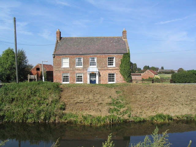
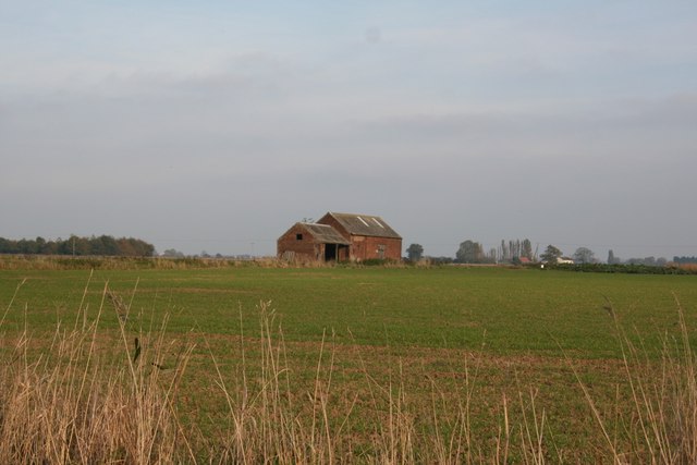
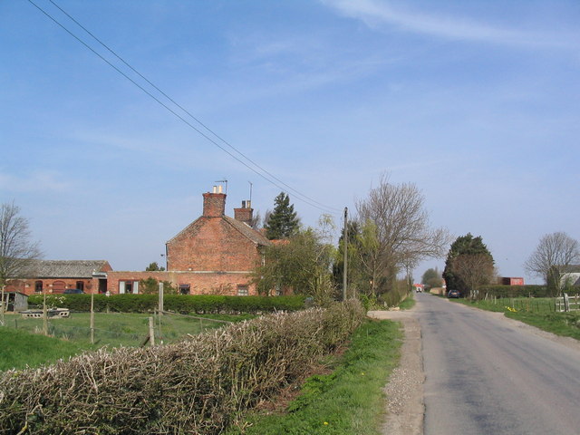
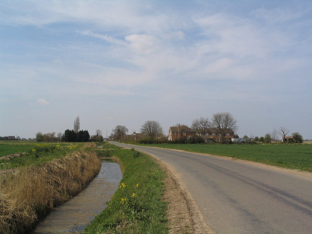
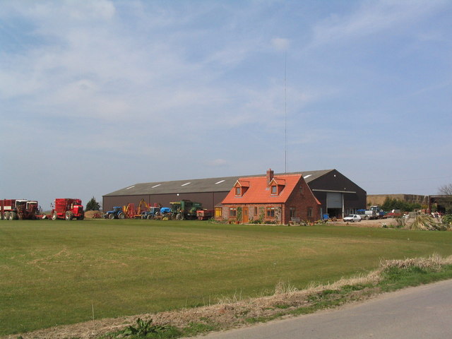
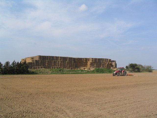
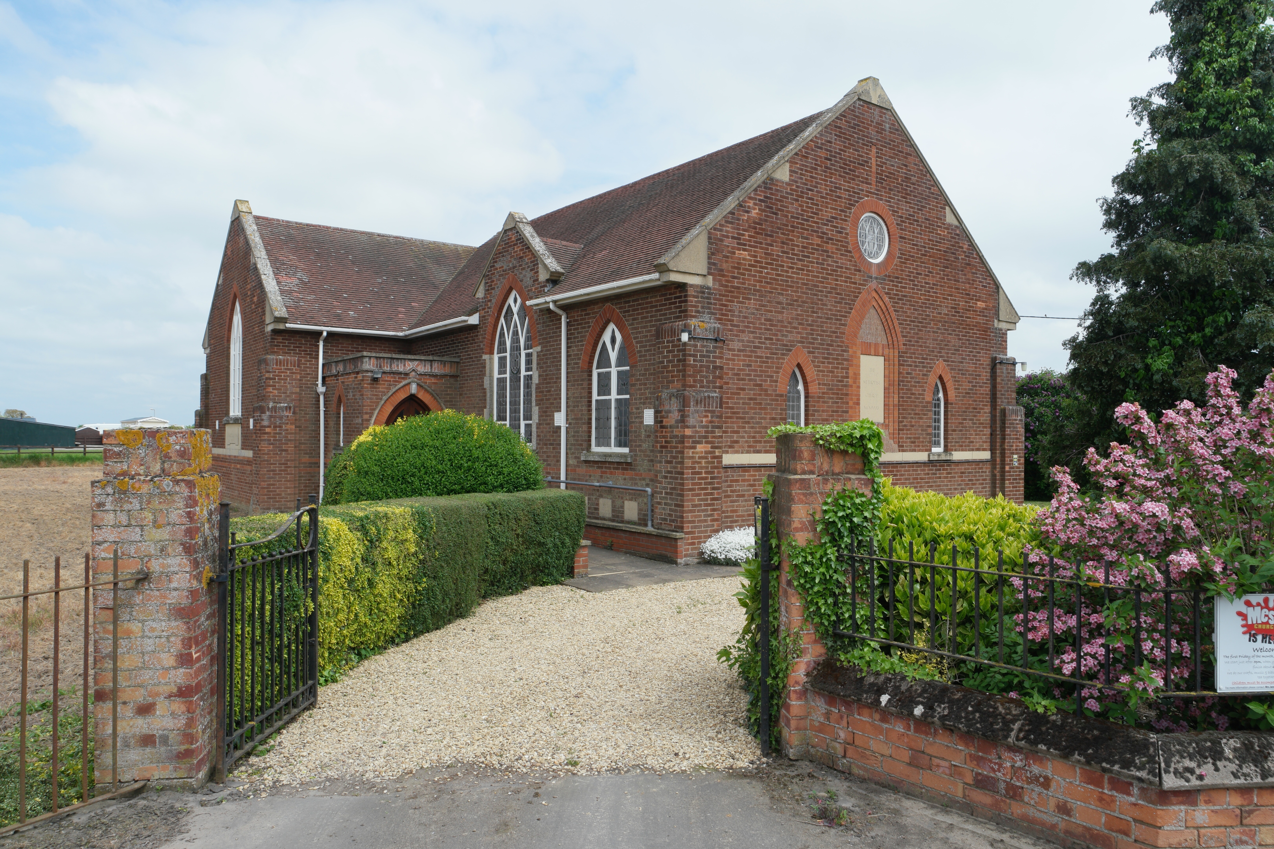
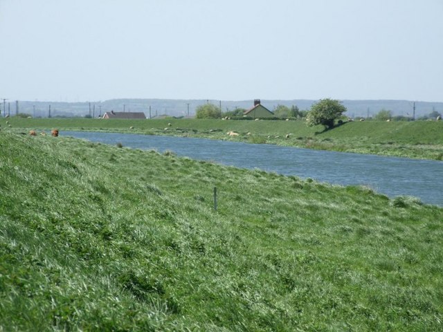
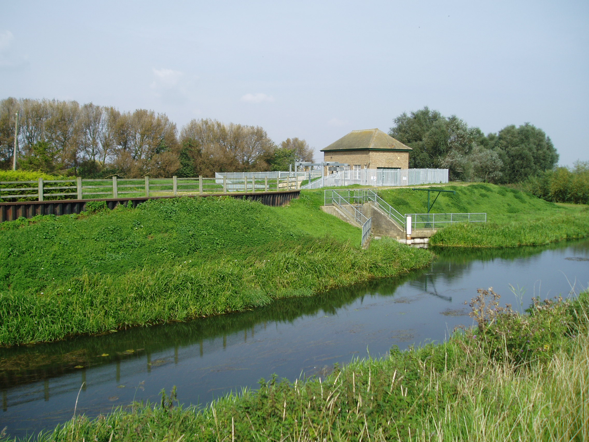
Northgate Images

Images are sourced within 2km of 52.819619/-0.22671155 or Grid Reference TF1926. Thanks to Geograph Open Source API. All images are credited.

Glenside Mill, Pinchbeck West, Lincs built 1812, worked with wind until 1931 and by modern machinery until the late 1970s; has acquired a distinct lean <span class="nowrap"><a title="http://www.lincolnshire.gov.uk/windmills/section.asp?catId=3416" rel="nofollow ugc noopener" href="http://www.lincolnshire.gov.uk/windmills/section.asp?catId=3416">Link</a><img style="margin-left:2px;" alt="External link" title="External link - shift click to open in new window" src="https://s1.geograph.org.uk/img/external.png" width="10" height="10"/></span> .
Glenside Mill, Pinchbeck West, Lincs
built 1812, worked with wind until 1931 and by modern machinery until the late 1970s; has acquired a distinct lean LinkExternal link .
Field of cabbages View north from Leaves Lake Drove
Field of cabbages
View north from Leaves Lake Drove
Leaves Lake Drove, view north-east
Stop that horse! Playground next to school off Leaves Lake Drove. Sign reads "No animals on this field"
Stop that horse!
Playground next to school off Leaves Lake Drove. Sign reads "No animals on this field"
Church of St Bartholomew, Pinchbeck West Built in the mid 19th century, in response to the Pinchbeck parish becoming too large.
Church of St Bartholomew, Pinchbeck West
Built in the mid 19th century, in response to the Pinchbeck parish becoming too large.
River Glen from bridge at Pinchbeck West View north-east. Roads run along both the north (left) and south banks. The former is much quieter.
River Glen from bridge at Pinchbeck West
View north-east. Roads run along both the north (left) and south banks. The former is much quieter.
The "Old Five Bells", Money Bridge, Pinchbeck West A fine Georgian? building, formerly an Inn
The "Old Five Bells", Money Bridge, Pinchbeck West
A fine Georgian? building, formerly an Inn
Rigbolt House, West Pinchbeck
Primitive Methodist Church, Northgate
Guthram Tofts Isolated farm building near Guthram Tofts off Cross Lane
Guthram Tofts
Isolated farm building near Guthram Tofts off Cross Lane
Peartree House, Money Bridge Lane
Northgate road and  Graft Drain Barrowby house on the right
Northgate road and Graft Drain
Barrowby house on the right
Little house at Cross Lane Farm Looking like a Doll's House next to the large barn and machinery.
Little house at Cross Lane Farm
Looking like a Doll's House next to the large barn and machinery.
Straw mountain
Straw mountain
Lane into the fens Looking like hundreds of other field lanes in this area.
Lane into the fens
Looking like hundreds of other field lanes in this area.
Parson Drove leading from Beck Bank
Daffodils on Parson Drove
Bridge to Cowbit Farm The farmhouse of Cowbit Farm, served by this dainty bridge, is dated 1825. But the bridge is older, built in 1811 for £21.13s 0d. Half the cost was paid by the landlord (Emmanuel College Cambridge), and half by the then tenant Henry Bennett Dandy. (Thanks to Leslie Chamberlain for providing this information)
Bridge to Cowbit Farm
The farmhouse of Cowbit Farm, served by this dainty bridge, is dated 1825. But the bridge is older, built in 1811 for £21.13s 0d. Half the cost was paid by the landlord (Emmanuel College Cambridge), and half by the then tenant Henry Bennett Dandy. (Thanks to Leslie Chamberlain for providing this information)
Show me another place!

Northgate is located at Grid Ref: TF1926 (Lat: 52.819619, Lng: -0.22671155)

Division: Parts of Holland

Administrative County: Lincolnshire

District: South Holland

Police Authority: Lincolnshire

What 3 Words

///dummy.shredding.magnitude. Near Pinchbeck, Lincolnshire

Nearby Locations

Northgate

Related Wikis

Gosberton Clough

Gosberton Clough is a village in the civil parish of Gosberton and the South Holland district of Lincolnshire, England. It is 30 miles (50 km) south-east...

Pinchbeck railway station

Pinchbeck railway station was a station in Pinchbeck, Lincolnshire, England on the line between Spalding and Sleaford. The station opened in 1882, closed...

Guthram Gowt

Guthram Gowt is a small settlement in the South Holland district of Lincolnshire, England. It is situated 5 miles (8 km) both east from Bourne and west...

River Glen, Lincolnshire

The River Glen is a river in Lincolnshire, England with a short stretch passing through Rutland near Essendine. The river's name appears to derive from...

Nearby Amenities

Located within 500m of 52.819619,-0.22671155
Bus Stop
Horse & Jockey PH
Naptan AtcoCode: 2700LNC06534
Naptan Bearing: NW
Naptan CommonName: Horse & Jockey PH
Naptan Indicator: opp
Naptan Landmark: Horse & Jockey PH
Naptan NaptanCode: lingdmja
Naptan Street: Six House Bank
Naptan Verified: no
Source: naptan_import
Lat/Long: 52.8203687/-0.2270291
Bus Stop
Horse & Jockey PH
Naptan AtcoCode: 2700LNHJ6284
Naptan Bearing: SE
Naptan CommonName: Horse & Jockey PH
Naptan Indicator: adj
Naptan Landmark: Horse & Jockey PH
Naptan NaptanCode: lingawdp
Naptan Street: Six House Bank
Naptan Verified: no
Source: naptan_import
Lat/Long: 52.8204031/-0.2269238
Northgate
Place: village
Wikidata: Q43655965
Lat/Long: 52.8207904/-0.2265551
Greenacres Farm
Place: farm
Source: Bing
Lat/Long: 52.8225363/-0.2273166
Proctors Farm
Alt Name: Brewery Farm
Place: farm
Source: Bing
Lat/Long: 52.8211478/-0.2325328
Hawthorn Barn
Place: isolated_dwelling
Source: Bing
Lat/Long: 52.8154524/-0.2285757
Perfect Move
Addr City: Spalding
Addr Country: GB
Addr Postcode: PE11 3QQ
Addr Suburb: West Pinchbeck
Email: perfectmove1@aol.com
Office: moving_company
Opening Hours: Mo-Fr 08:00-18:00
Phone: +44 7916 124 485
Website: https://www.perfectmove1.co.uk/
Lat/Long: 52.8193989/-0.2262811
The data included in this document is from www.openstreetmap.org. The data is made available under ODbL.

Have you been to Northgate?

Leave your review of Northgate below (or comments, questions and feedback).