Roe, North

Settlement in Shetland

Scotland

Roe, North

Sand Voe Sand Voe is an inlet at the north of the Northmavine area of Mainland, Shetland.
This view is of the sandy / shingly beach at the southern end of the voe near to the eponymously named settlement of Sandvoe (see <a href="https://www.geograph.org.uk/photo/2713084">HU3690 : Sandvoe settlement</a>)
Sand Voe Credit: Rob Farrow

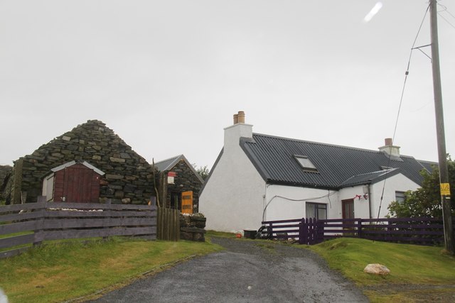
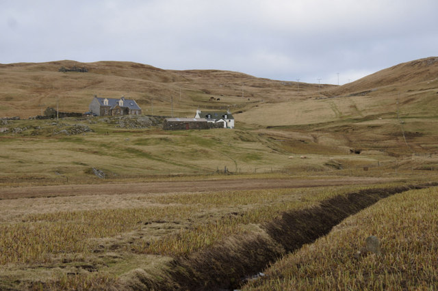
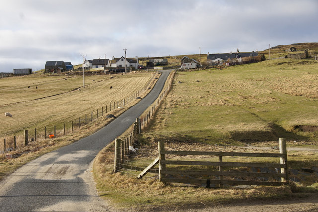
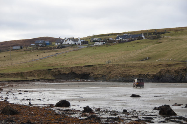
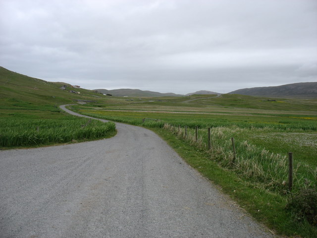
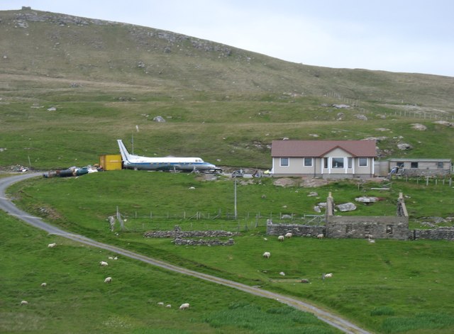
Roe is a small township located in the North Mainland of the Shetland Islands, Scotland. Situated on the A970 road, it lies approximately 20 miles north of Lerwick, the capital of Shetland. Roe is part of the wider community of Northmavine, which encompasses several other villages and hamlets in the area.

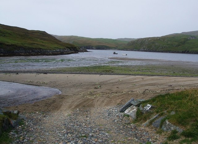
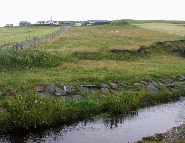
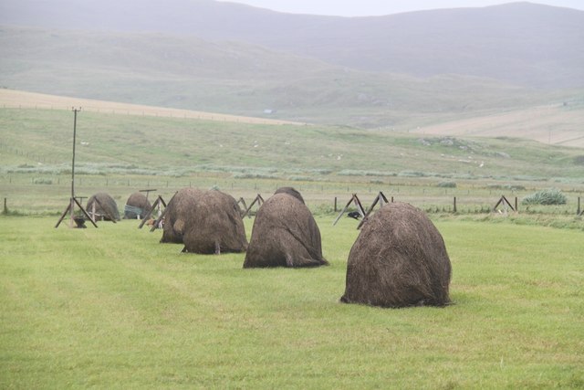
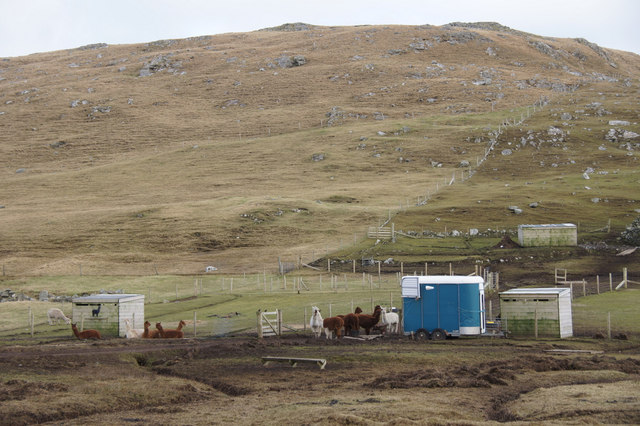
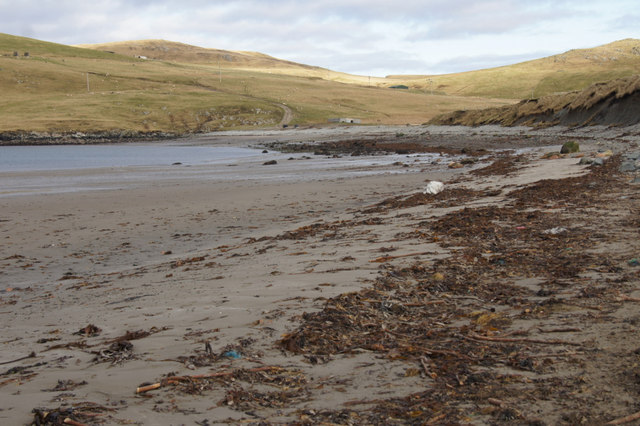
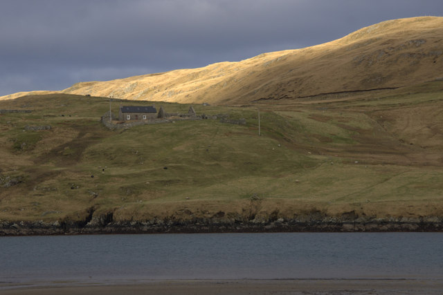
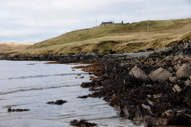
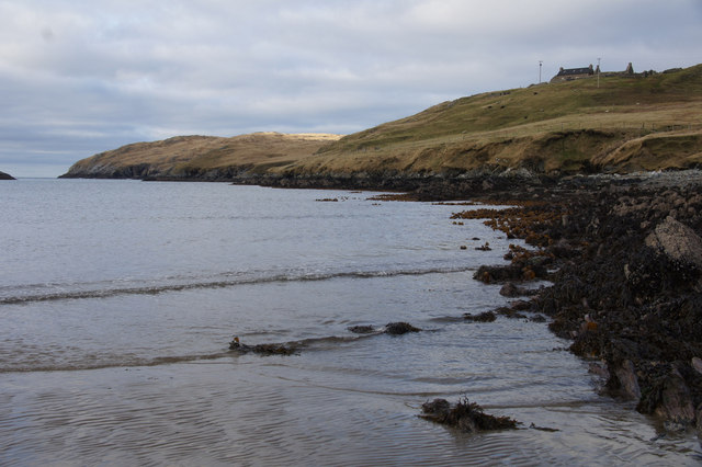
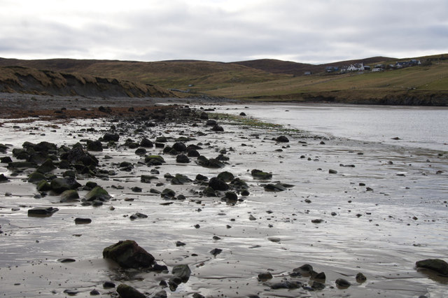
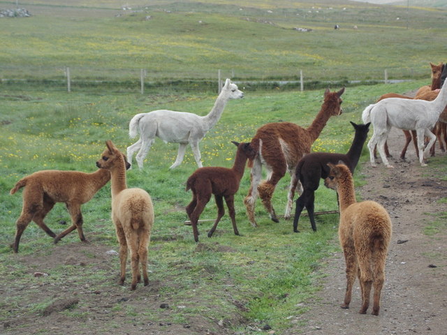
The township of Roe is known for its stunning natural beauty and is surrounded by picturesque landscapes. It is nestled between rolling hills and rugged cliffs, offering breathtaking views of the North Atlantic Ocean. The area is home to an abundance of wildlife, including seabirds, otters, and seals, making it a popular destination for nature lovers and birdwatchers.

Although Roe is a small community, it has a strong sense of community spirit. The local residents are known for being friendly and welcoming, often organizing events and gatherings to bring people together. The township has a primary school, providing education for the local children, and a community hall that hosts various activities and events throughout the year.

For outdoor enthusiasts, Roe offers plenty of opportunities for exploring the surrounding countryside. There are several walking trails that take visitors through the beautiful landscapes, including hikes along the coastline and treks up the nearby hills. Additionally, Roe is within close proximity to the Eshaness cliffs, a popular attraction known for its dramatic scenery and stunning rock formations.

Overall, Roe, North, Shetland is a peaceful and picturesque township that offers visitors a chance to immerse themselves in the natural beauty of the Shetland Islands.

If you have any feedback on the listing, please let us know in the comments section below.

Roe, North Images

Images are sourced within 2km of 60.585851/-1.3306466 or Grid Reference HU3689. Thanks to Geograph Open Source API. All images are credited.

Sand Voe Sand Voe is an inlet at the north of the Northmavine area of Mainland, Shetland.
This view is of the sandy / shingly beach at the southern end of the voe near to the eponymously named settlement of Sandvoe (see <a href="https://www.geograph.org.uk/photo/2713084">HU3690 : Sandvoe settlement</a>)
Sand Voe
Sand Voe is an inlet at the north of the Northmavine area of Mainland, Shetland. This view is of the sandy / shingly beach at the southern end of the voe near to the eponymously named settlement of Sandvoe (see HU3690 : Sandvoe settlement)
Sandvoe settlement The few houses that make up the settlement of Sandvoe at the north of the Northmavine area of Mainland, Shetland as seen from its little beach on the voe (see <a href="https://www.geograph.org.uk/photo/2713080">HU3690 : Sand Voe</a>), with the burn seen nearest the camera about to flow into the sea.
Sandvoe settlement
The few houses that make up the settlement of Sandvoe at the north of the Northmavine area of Mainland, Shetland as seen from its little beach on the voe (see HU3690 : Sand Voe), with the burn seen nearest the camera about to flow into the sea.
A lost plane There was an explanation of how this plane got half way up the hill but it was so wet that I didn't read it.
A lost plane
There was an explanation of how this plane got half way up the hill but it was so wet that I didn't read it.
Traditional Haystacks Some good old fashioned haystacks at Isbister
Traditional Haystacks
Some good old fashioned haystacks at Isbister
The end of the road The end of the road at Sandvoe
The end of the road
The end of the road at Sandvoe
Alpacas, Isbister, North Roe
Irisbeds, Isbister, North Roe
Sandvoe, North Roe
Sandvoe, North Roe
Beach at the head of Sand Voe, North Roe
Benigarth, beside Sand Voe, North Roe The slopes of the hill of Lanchestoo beyond. The house gained some fame as the residence of Simon King during the filming of Simon King's Shetland. It is only accessible by vehicle by driving along the beach.
Benigarth, beside Sand Voe, North Roe
The slopes of the hill of Lanchestoo beyond. The house gained some fame as the residence of Simon King during the filming of Simon King's Shetland. It is only accessible by vehicle by driving along the beach.
Benigarth, beside Sand Voe, North Roe From the beach on a low tide.
Benigarth, beside Sand Voe, North Roe
From the beach on a low tide.
East shore of Sand Voe, North Roe Looking towards Orrwick Taing.
East shore of Sand Voe, North Roe
Looking towards Orrwick Taing.
Beach at the head of Sand Voe, North Roe Not it's sandiest aspect.
Beach at the head of Sand Voe, North Roe
Not it's sandiest aspect.
Land Rover on the beach at Sand Voe, North Roe The crofter has just been to feed sheep on the far end of the beach.
Land Rover on the beach at Sand Voe, North Roe
The crofter has just been to feed sheep on the far end of the beach.
End Of The A970 Isbister is the end of the A970 and where we parked for our walk to Lanchestoo trig point.
End Of The A970
Isbister is the end of the A970 and where we parked for our walk to Lanchestoo trig point.
North Roe: alpacas The food tub has just been rattled and the alpacas respond as expected, making a bee-line for their owner. This is the only group of alpacas in Shetland; they have been here for four years, having been born in Hazelbury Bryan in Dorset. Some of the youngest in the picture are only a fortnight old.
North Roe: alpacas
The food tub has just been rattled and the alpacas respond as expected, making a bee-line for their owner. This is the only group of alpacas in Shetland; they have been here for four years, having been born in Hazelbury Bryan in Dorset. Some of the youngest in the picture are only a fortnight old.
The end of the road The A970 just comes to a dead stop here at Isbister. Looking south, for the first ten or a dozen miles it is "single track with passing places", but there is so little traffic that it is hardly a problem. After that, and all the way to Sumburgh <a href="https://www.geograph.org.uk/gridref/HU4009">HU4009</a>, 80km away, it is a splendid road, upgraded (like other main routes in the Shetland Islands) when the oil money was at its peak.

It is, of course, possible to walk further north for nearly 5 kilometres, to the Point of Fethaland (though I did not have time to do this). Only two inhabited islands, Yell and Unst, get even further north and into Myriad HP.
The end of the road
The A970 just comes to a dead stop here at Isbister. Looking south, for the first ten or a dozen miles it is "single track with passing places", but there is so little traffic that it is hardly a problem. After that, and all the way to Sumburgh HU4009, 80km away, it is a splendid road, upgraded (like other main routes in the Shetland Islands) when the oil money was at its peak. It is, of course, possible to walk further north for nearly 5 kilometres, to the Point of Fethaland (though I did not have time to do this). Only two inhabited islands, Yell and Unst, get even further north and into Myriad HP.
Shetland Potez This French 'Potez' plane crash-landed at Sumburgh in 1981, and was brought here, 80km north, to its final resting place. One has to wonder why anyone would wish to do this, but also admire the tenacity that he must have shown.

There is a descriptive plaque, which is just in the next square west. I have submitted a photo - see <a href="https://www.geograph.org.uk/photo/5023488">HU3690 : The "Shetland Potez" plaque</a>. It is of poor quality (the moderator must have been feeling generous), partly but not entirely because the plaque itself is in bad condition. However I submitted it because there was no other image on site, the plaque will continue to deteriorate, and with judicious zooming you can make out most of the story behind this extraordinary scene.
Shetland Potez
This French 'Potez' plane crash-landed at Sumburgh in 1981, and was brought here, 80km north, to its final resting place. One has to wonder why anyone would wish to do this, but also admire the tenacity that he must have shown. There is a descriptive plaque, which is just in the next square west. I have submitted a photo - see HU3690 : The "Shetland Potez" plaque. It is of poor quality (the moderator must have been feeling generous), partly but not entirely because the plaque itself is in bad condition. However I submitted it because there was no other image on site, the plaque will continue to deteriorate, and with judicious zooming you can make out most of the story behind this extraordinary scene.
Show me another place!

Roe, North is located at Grid Ref: HU3689 (Lat: 60.585851, Lng: -1.3306466)

Unitary Authority: Shetland Islands

Police Authority: Highlands and Islands

What 3 Words

///boss.hydration.passage. Near Ulsta, Shetland Islands

Related Wikis

North Roe

North Roe is a village, and protected area at the northern tip in the large Northmavine peninsula of the Mainland of Shetland, Scotland. It is a small...

Muckle Holm, Yell Sound

Muckle Holm is a small island in Shetland. It is in Yell Sound, near the Northmavine. It is 23 metres (75 ft) at its highest point. There is a lighthouse...

Yell Sound

Yell Sound is the strait running between Yell and Mainland, Shetland, Scotland. It is the boundary between the Mainland and the North Isles and it contains...

Little Holm, Yell Sound

Little Holm is a small island in Yell Sound, in Shetland, Scotland. It lies between Northmavine and the island of Yell. There is a lighthouse here. In...

Fethaland

Fethaland or Fedeland (pronounced [ˈfeɪdələnd]) is an abandoned settlement at the extreme north end of Mainland, Shetland. It was the site of the largest...

Uyea, Northmavine

Uyea (Scots: Öya in Shetland dialect spelling) is an uninhabited tidal island located to the northwest of Mainland, Shetland. Uyea lies off the Northmavine...

Gruney

Gruney is a small, uninhabited island in Shetland, Scotland. It lies north of the Northmavine peninsula of the Shetland Mainland, from which it is separated...

Lamba, Shetland

Lamba is an uninhabited island in Yell Sound in Shetland. It lies 1.5 km (0.93 mi) north of the entrance to the Sullom Voe inlet and 1.4 kilometres (0...

Nearby Amenities

Located within 500m of 60.585851,-1.3306466
Passing Place
Lat/Long: 60.5830955/-1.3358824
Passing Place
Lat/Long: 60.5821711/-1.3347025
Passing Place
Lat/Long: 60.587434/-1.3355923
Passing Place
Lat/Long: 60.5865288/-1.336569
Passing Place
Lat/Long: 60.5861952/-1.3371978
North Roe
Name Sco: North Ro
Place: village
Lat/Long: 60.5881569/-1.3352233
Post Office
North Roe Post Office
Addr City: Shetland
Addr Postcode: ZE2 9RY
Opening Hours: Mo-Sa 10:00-12:00
Ref Pol Id: 17022
Lat/Long: 60.5872146/-1.3317544
Passing Place
Lat/Long: 60.5851672/-1.3372067
Turning Circle
Lat/Long: 60.5872373/-1.3376963
Noexit: yes
Lat/Long: 60.5872558/-1.3377051
Barrier: cattle_grid
Lat/Long: 60.5874105/-1.3363663
Barrier: cattle_grid
Lat/Long: 60.5890818/-1.3345475
Barrier: cattle_grid
Lat/Long: 60.5874696/-1.3357219
Power: pole
Lat/Long: 60.5858055/-1.3389936
Power: pole
Lat/Long: 60.5839916/-1.3388595
Power: pole
Lat/Long: 60.5845857/-1.3385108
Power: pole
Lat/Long: 60.58511/-1.3382211
Power: pole
Lat/Long: 60.5856474/-1.3379261
Power: pole
Lat/Long: 60.5862402/-1.3382077
Power: pole
Lat/Long: 60.5872974/-1.3362631
Power: pole
Lat/Long: 60.5870806/-1.3356677
Power: pole
Lat/Long: 60.5867065/-1.3347557
Power: pole
Lat/Long: 60.5863285/-1.3337714
Power: pole
Lat/Long: 60.5859293/-1.3328084
Power: pole
Lat/Long: 60.5875864/-1.3289943
Power: pole
Lat/Long: 60.587705/-1.3297695
Power: pole
Lat/Long: 60.5878591/-1.3305581
Power: pole
Lat/Long: 60.5879526/-1.3311803
Power: pole
Lat/Long: 60.5882292/-1.3318375
Power: pole
Lat/Long: 60.5884834/-1.3324088
Power: pole
Lat/Long: 60.5886817/-1.3328822
Power: pole
Lat/Long: 60.5889076/-1.3334039
Power: pole
Lat/Long: 60.5889642/-1.3338599
Power: pole
Lat/Long: 60.5887284/-1.3349569
Power: pole
Lat/Long: 60.5867105/-1.3373038
Power: pole
Lat/Long: 60.5872887/-1.3369993
Power: pole
Lat/Long: 60.5879065/-1.3366601
Power: pole
Lat/Long: 60.5885361/-1.3360888
Power: pole
Lat/Long: 60.5891486/-1.3355108
Power: pole
Lat/Long: 60.5902006/-1.3323848
Power: pole
Lat/Long: 60.5891781/-1.3331749
Power: pole
Lat/Long: 60.5898239/-1.3326693
Power: pole
Lat/Long: 60.5894485/-1.3329724
Power: pole
Lat/Long: 60.5881432/-1.3335142
Power: pole
Lat/Long: 60.5883968/-1.3332192
Power: pole
Lat/Long: 60.5880945/-1.3322375
The data included in this document is from www.openstreetmap.org. The data is made available under ODbL.

Have you been to Roe, North?

Leave your review of Roe, North below (or comments, questions and feedback).